Brackenbreast Plantation

Wood, Forest in Westmorland South Lakeland

England

Brackenbreast Plantation

Old oak in a field This is the further tree beyond the pair seen in the foreground of <a href="https://www.geograph.org.uk/photo/6816077">SD6083 : Minor road towards Rigmaden</a> taken in the spring of the same year.
Old oak in a field Credit: Stephen Craven

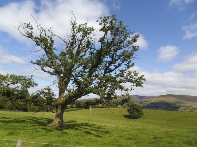
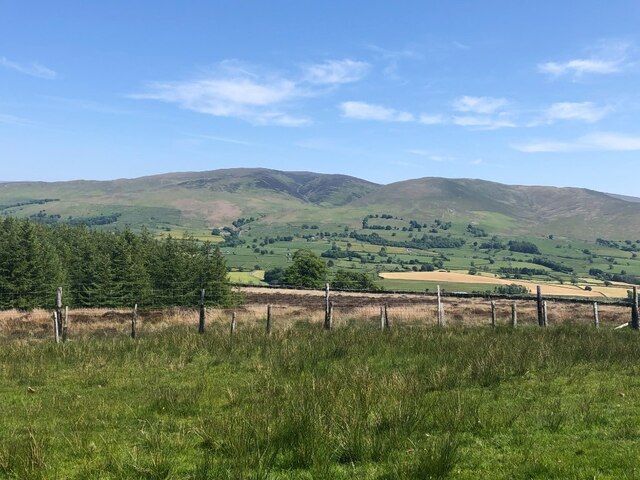
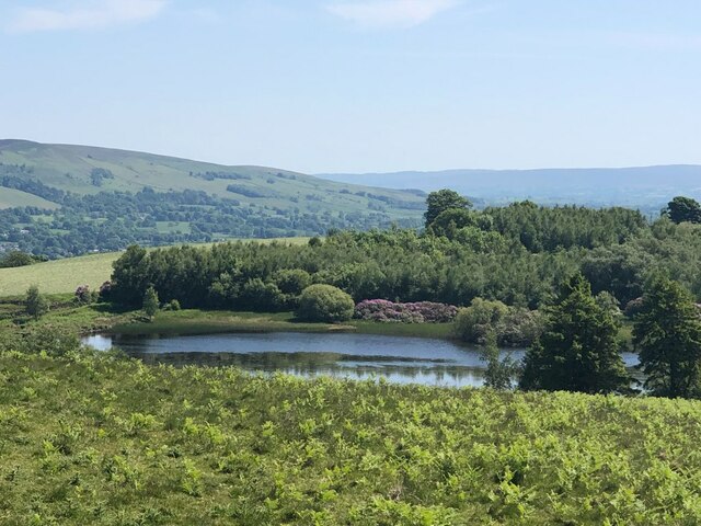
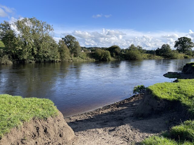
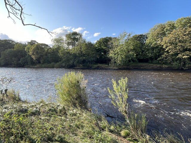
Brackenbreast Plantation is a picturesque woodland located in the region of Westmorland, known for its natural beauty and rich biodiversity. Situated in the heart of the county, the plantation covers a vast area of dense forest and is a haven for nature enthusiasts and outdoor adventurers alike.

The woodland is predominantly composed of a variety of tree species, including oak, beech, and birch, which create a stunning tapestry of colors throughout the year. The canopy of the trees provides shelter for an array of wildlife, making it a great spot for birdwatching and animal spotting. Species such as red squirrels, woodpeckers, and various songbirds can often be seen and heard within the woodland.

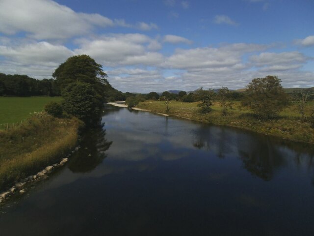
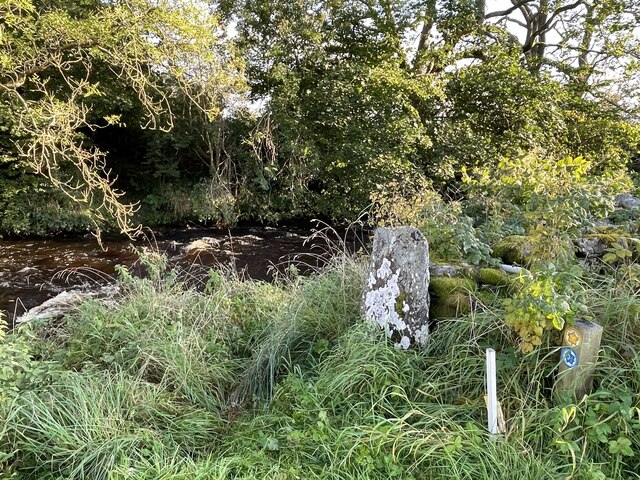
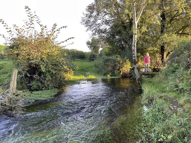
Tranquil walking trails wind their way through the plantation, offering visitors the opportunity to immerse themselves in the natural surroundings. These trails vary in difficulty, catering to both casual strollers and avid hikers. Along the paths, visitors may encounter babbling brooks, small waterfalls, and wildflower meadows, adding to the charm of the plantation.

Brackenbreast Plantation is also home to a diverse range of plant life, with an abundance of ferns, mosses, and wildflowers carpeting the forest floor. This creates a visually stunning and ecologically important environment, supporting a wide range of insect species.

Overall, Brackenbreast Plantation in Westmorland is a true natural gem, offering visitors the chance to connect with nature, explore its diverse landscapes, and appreciate the beauty of the woodland ecosystem.

If you have any feedback on the listing, please let us know in the comments section below.

Brackenbreast Plantation Images

Images are sourced within 2km of 54.251715/-2.5888993 or Grid Reference SD6184. Thanks to Geograph Open Source API. All images are credited.

Old oak in a field This is the further tree beyond the pair seen in the foreground of <a href="https://www.geograph.org.uk/photo/6816077">SD6083 : Minor road towards Rigmaden</a> taken in the spring of the same year.
Old oak in a field
This is the further tree beyond the pair seen in the foreground of SD6083 : Minor road towards Rigmaden taken in the spring of the same year.
Carrfoot Lodge The lodge was that of Rigmaden Park that stretches about 1.2km south from this junction. See <a href="https://www.geograph.org.uk/photo/6816094">SD6185 : Carrfoot Lodge</a> for a closer view taken earlier the same year.
Carrfoot Lodge
The lodge was that of Rigmaden Park that stretches about 1.2km south from this junction. See SD6185 : Carrfoot Lodge for a closer view taken earlier the same year.
Sheep at Rigmaden Farm Grazing on a level field part way up the west slope of Lonsdale.
Sheep at Rigmaden Farm
Grazing on a level field part way up the west slope of Lonsdale.
Rigmaden bridge The grade II listed bridge (list entry 1086894) has an unusual curved girder construction and dates from the 1880s. <a href="https://www.geograph.org.uk/photo/1213202">SD6184 : Rigmaden Bridge</a> shows a side view quite clearly.
Rigmaden bridge
The grade II listed bridge (list entry 1086894) has an unusual curved girder construction and dates from the 1880s. SD6184 : Rigmaden Bridge shows a side view quite clearly.
River Lune north from Rigmaden bridge Photographed towards the end of a fairly dry summer.  <a href="https://www.geograph.org.uk/photo/4395485">SD6184 : River Lune at Rigmaden</a> shows it in late winter with a greater depth of flow.
River Lune north from Rigmaden bridge
Photographed towards the end of a fairly dry summer. SD6184 : River Lune at Rigmaden shows it in late winter with a greater depth of flow.
Minor Road in Rigmaden Park The road seen here rising towards the woodland of High Rigg Brown and Low Rigg Brown
Minor Road in Rigmaden Park
The road seen here rising towards the woodland of High Rigg Brown and Low Rigg Brown
View over Rigmaden and the Lune Valley View taking in a sweep of landscape over the Lune Valley towards Middleton Fell
View over Rigmaden and the Lune Valley
View taking in a sweep of landscape over the Lune Valley towards Middleton Fell
View towards the Howgill Fells
View across Lunedale From Shawrigg towards Calf.
View across Lunedale
From Shawrigg towards Calf.
Kittmere View from Talebrigg Hill
Kittmere
View from Talebrigg Hill
A683 towards Sedbergh
A683 towards Kirkby Lonsdale
River Lune Ford This is another old impassable ford on the River Lune near Nether Hall.
River Lune Ford
This is another old impassable ford on the River Lune near Nether Hall.
River Lune Ford This is another old impassable ford on the River Lune at Hawkin Hall. The lady at the farm advised us that people on both horseback and on motorcycles have attempted crossings but the base has long since been washed away and they have found it very difficult.
River Lune Ford
This is another old impassable ford on the River Lune at Hawkin Hall. The lady at the farm advised us that people on both horseback and on motorcycles have attempted crossings but the base has long since been washed away and they have found it very difficult.
Ford on Barbon Beck This ford on the Barbon Beck is found beside Kirkby Lonsdale Golf Club.
Ford on Barbon Beck
This ford on the Barbon Beck is found beside Kirkby Lonsdale Golf Club.
Treasonfield Ford This ford is found on High Beckfoot Lane, a track leading down from Treasonfield Farm.
Treasonfield Ford
This ford is found on High Beckfoot Lane, a track leading down from Treasonfield Farm.
Betweengates Lane At its junction with the A683.
Betweengates Lane
At its junction with the A683.
Pasture off Betweengates Lane
Show me another place!

Brackenbreast Plantation is located at Grid Ref: SD6184 (Lat: 54.251715, Lng: -2.5888993)

Administrative County: Cumbria

District: South Lakeland

Police Authority: Cumbria

What 3 Words

///sorry.splashes.appoints. Near Kirkby Lonsdale, Cumbria

Related Wikis

Middleton, Cumbria

Middleton is a village and a civil parish on the A683 road, in the South Lakeland district, in the county of Cumbria, England. Middleton has a church called...

St Peter's Church, Mansergh

St Peter's Church is in the village of Mansergh, Cumbria, England. It is an active Anglican parish church in the deanery of Kendal, the archdeaconry of...

Barbon railway station

Barbon railway station was located in Westmorland (now part of Cumbria), England, serving the town and locale of Barbon on the Ingleton Branch Line....

Mansergh, Cumbria

Mansergh is a village and civil parish in the South Lakeland district of the English county of Cumbria. It includes the village of Mansergh and the hamlet...

St Bartholomew's Church, Barbon

St Bartholomew's Church is in the village of Barbon, Cumbria, England. It is an active Anglican parish church in the deanery of Kendal, the archdeaconry...

Barbon Beck

Barbon Beck is a small river in Barbondale, Cumbria. It is a tributary of the River Lune. Rising at Weather Ling Hill, where it is known as Barkin Beck...

Beckside

Beckside is a village in Cumbria, England.

Underley Hall

Underley Hall is a large country house near Kirkby Lonsdale in Cumbria. It was designed in a Jacobean Revival style by the architect George Webster for...

Have you been to Brackenbreast Plantation?

Leave your review of Brackenbreast Plantation below (or comments, questions and feedback).