Hengrove Wood
Wood, Forest in Somerset Mendip
England
Hengrove Wood

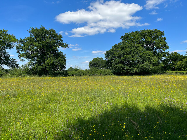
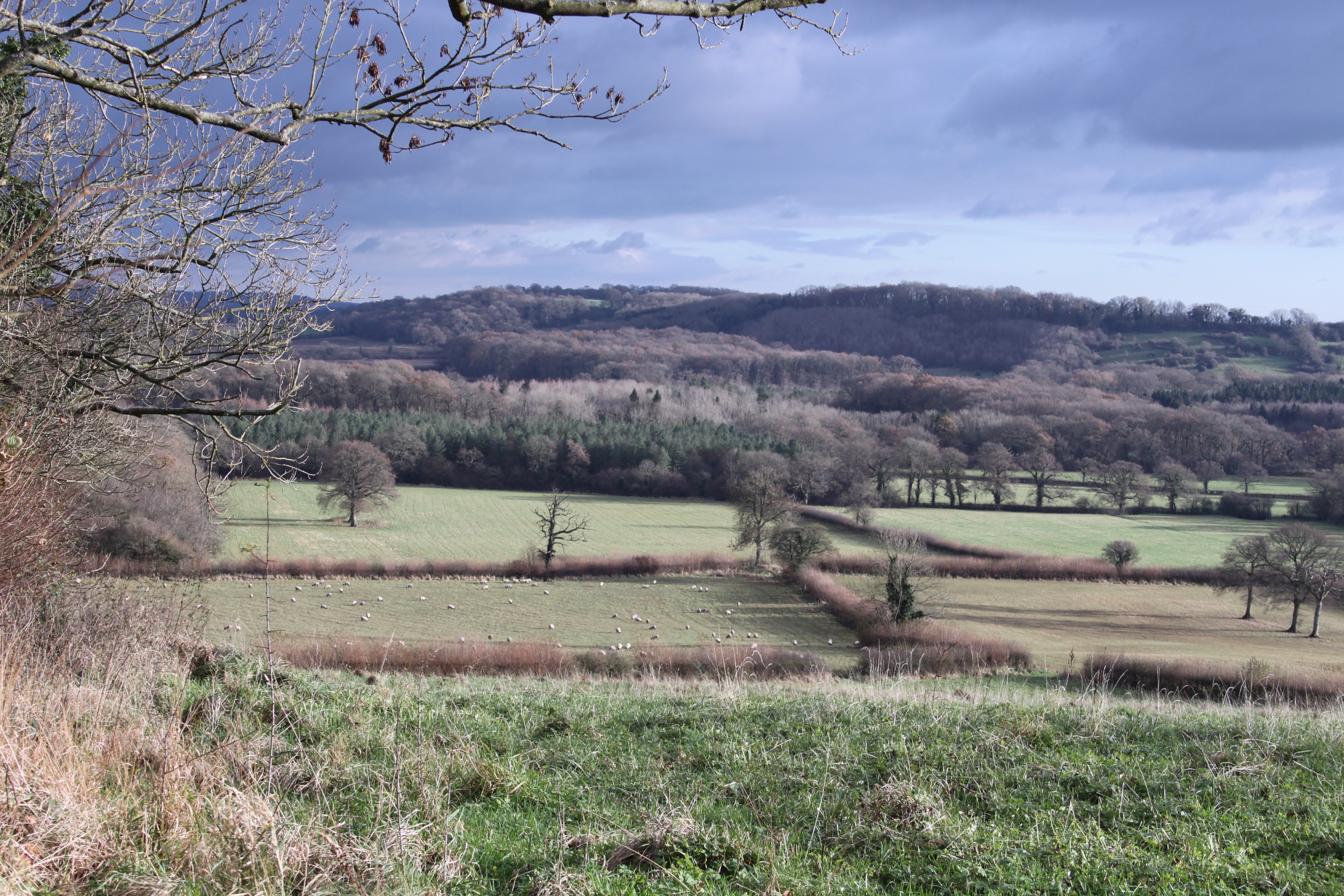
Hengrove Wood is a beautiful woodland located in Somerset, England. Nestled in the rolling hills of the region, this forest is a haven for nature lovers and outdoor enthusiasts. Covering an area of approximately 300 acres, Hengrove Wood is a diverse and thriving ecosystem, teeming with a variety of flora and fauna.
The woodland is primarily composed of deciduous trees, such as oak, beech, and birch, which provide a stunning display of colors during the autumn months. These majestic trees create a dense canopy that shades the forest floor, fostering the growth of an array of plants and wildflowers. Bluebells, primroses, and wild garlic are just a few examples of the vibrant plant life that can be found here.
In terms of wildlife, Hengrove Wood is home to a diverse range of species. Birdwatchers will delight in spotting woodpeckers, owls, and various songbirds flitting through the trees. The forest is also inhabited by mammals such as foxes, badgers, and deer, which can occasionally be spotted grazing in the clearings.
The woodland offers a network of well-maintained trails and footpaths, making it a popular destination for hikers and walkers. These paths wind their way through the forest, offering visitors the opportunity to explore the wood at their leisure. There are also picnic areas and benches scattered throughout the woodland, providing the perfect spots to rest and soak in the tranquil surroundings.
Overall, Hengrove Wood is a picturesque and enchanting woodland, offering visitors a peaceful retreat and an opportunity to connect with nature in the heart of Somerset.
If you have any feedback on the listing, please let us know in the comments section below.
Hengrove Wood Images
Images are sourced within 2km of 51.294748/-2.5490148 or Grid Reference ST6155. Thanks to Geograph Open Source API. All images are credited.


Hengrove Wood is located at Grid Ref: ST6155 (Lat: 51.294748, Lng: -2.5490148)
Administrative County: Somerset
District: Mendip
Police Authority: Avon and Somerset
What 3 Words
///according.emulating.fictional. Near Cameley, Somerset
Nearby Locations
Related Wikis
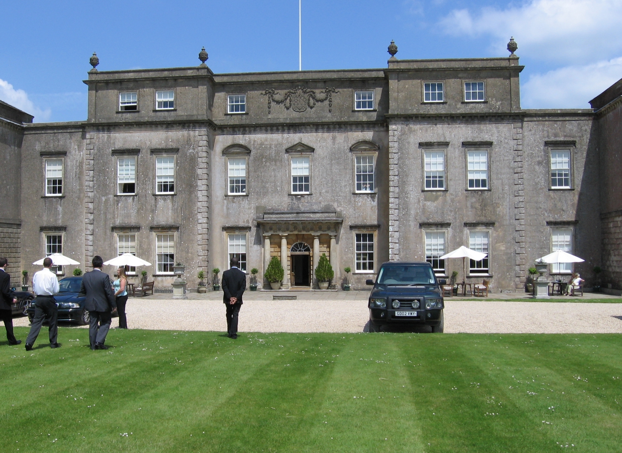
Ston Easton Park
Ston Easton Park is an English country house built in the 18th century. It lies near the village of Ston Easton, Somerset. It is a Grade I listed building...
Farrington Gurney
Farrington Gurney is a village and civil parish in Somerset, England located at the foot of the Mendip Hills on the junction of the A37 and A362. It has...
Long Dole Wood and Meadows SSSI
Long Dole Wood and Meadows SSSI (grid reference ST610562) is a 9.8 hectares (24 acres) biological Site of Special Scientific Interest (SSSI) between the...
Ston Easton
Ston Easton is a linear village and civil parish in the English county of Somerset. It is 14 miles (23 km) southwest of Bath and 7 miles (11 km) north...
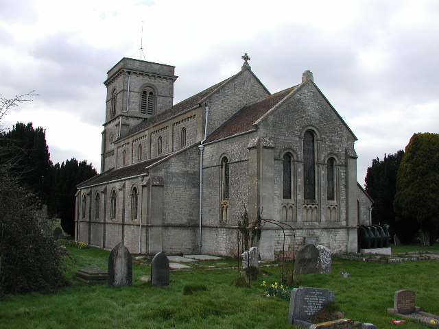
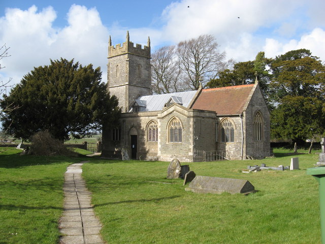
Church of St Mary the Virgin, Ston Easton
The Anglican Church of St Mary the Virgin in Ston Easton, Somerset, England, is a Grade II* listed building dating from the 11th century, with a 15th-century...
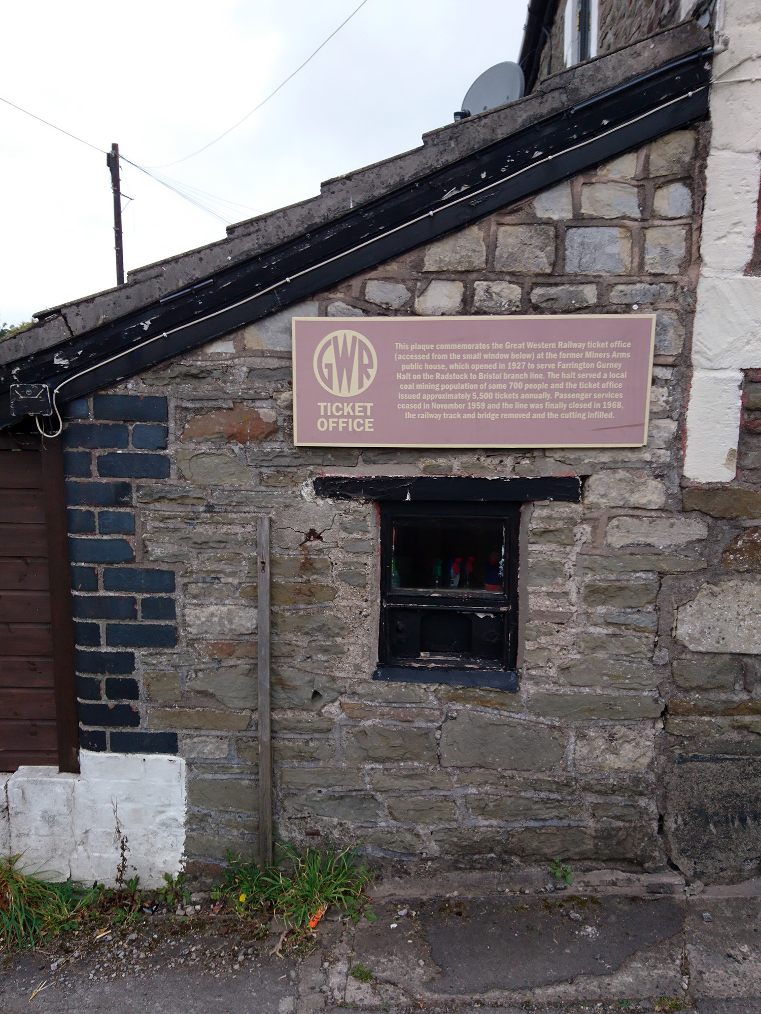
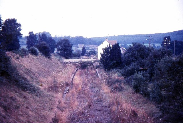
Farrington Gurney Halt railway station
Farrington Gurney Halt railway station served the village of Farrington Gurney, Somerset, England from 1927 to 1959 on the Bristol and North Somerset Railway...
Hallatrow railway station
Hallatrow railway station served the village of High Littleton, Somerset, England from 1873 to 1959 on the Bristol and North Somerset Railway. == History... ==

Cameley
Cameley is a village in the civil parish of Temple Cloud with Cameley, within the Chew Valley in Somerset, and on the northern slopes of the Mendip Hills...
Have you been to Hengrove Wood?
Leave your review of Hengrove Wood below (or comments, questions and feedback).