Chewton Wood

Wood, Forest in Somerset Mendip

England

Chewton Wood

The Old Parsonage, Farrington Gurney Listed Grade II* and dating from the late C17. Parsons lived well in those days! It is now a hotel and restaurant.
The Old Parsonage, Farrington Gurney Credit: Eirian Evans

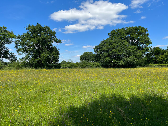
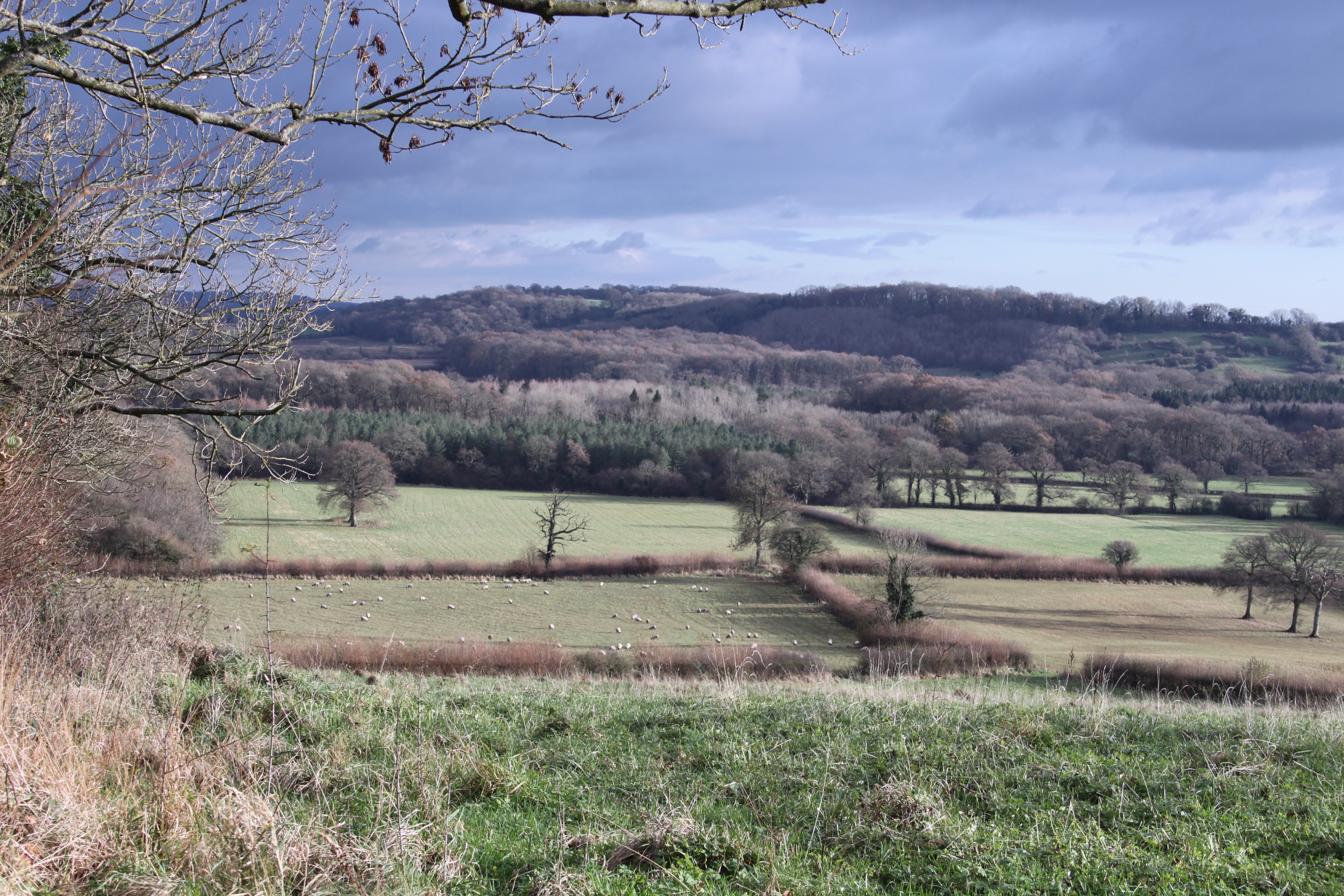
Chewton Wood, located in Somerset, is a picturesque woodland area that covers approximately 100 hectares. It is situated on the southern slopes of the Mendip Hills, offering stunning views of the surrounding countryside. The wood is managed by the Forestry Commission and is open to the public year-round.

The woodland is predominantly composed of broadleaf trees, including oak, beech, and ash, which create a diverse and vibrant ecosystem. The forest floor is carpeted with bluebells in the spring, creating a breathtaking display of color. Wildlife thrives in Chewton Wood, with various species of birds, mammals, and insects calling it home.

Visitors to Chewton Wood can explore the network of well-maintained footpaths that wind through the forest, providing opportunities for leisurely walks and nature hikes. The wood is also popular among birdwatchers, as it attracts a wide variety of bird species, including woodpeckers, nuthatches, and tawny owls.

For those interested in history, Chewton Wood holds significance as an ancient woodland that has been documented since the Domesday Book in 1086. It has likely been continuously wooded for over a millennium, making it an important cultural and ecological landmark.

Chewton Wood offers a peaceful and tranquil escape from the hustle and bustle of everyday life. It provides an opportunity to connect with nature and enjoy the beauty of the Somerset countryside.

If you have any feedback on the listing, please let us know in the comments section below.

Chewton Wood Images

Images are sourced within 2km of 51.296208/-2.5578098 or Grid Reference ST6155. Thanks to Geograph Open Source API. All images are credited.

The Old Parsonage, Farrington Gurney Listed Grade II* and dating from the late C17. Parsons lived well in those days! It is now a hotel and restaurant.
The Old Parsonage, Farrington Gurney
Listed Grade II* and dating from the late C17. Parsons lived well in those days! It is now a hotel and restaurant.
Meadow in the sun This image in the Hollow Marsh Nature Reserve was taken 15 years after, but one month earlier than, the image in <a href="https://www.geograph.org.uk/photo/501821">ST6156 : A summer meadow</a>. The sun is shining, but the obvious flowers here are spotted orchids and buttercups.
Meadow in the sun
This image in the Hollow Marsh Nature Reserve was taken 15 years after, but one month earlier than, the image in ST6156 : A summer meadow. The sun is shining, but the obvious flowers here are spotted orchids and buttercups.
The obstacle remains The fallen tree that was across the path through Chewton Wood in 2007 <a href="https://www.geograph.org.uk/photo/501830">ST6155 : An obstacle</a> is still there.
The obstacle remains
The fallen tree that was across the path through Chewton Wood in 2007 ST6155 : An obstacle is still there.
Farrington Gurney : Church Lane Church Lane off Bush Hill.
Farrington Gurney : Church Lane
Church Lane off Bush Hill.
Petrol Station  This Murco station is on the A37 Bristol Road in Farrington Gurney close to its junction with Ham lane and Church lane.
Petrol Station
This Murco station is on the A37 Bristol Road in Farrington Gurney close to its junction with Ham lane and Church lane.
Sheep Pasture near Ston Easton These pasture fields with grazing sheep are just to the east of the A37 north of Ston Easton and just south west of Farrington Gurney
Sheep Pasture near Ston Easton
These pasture fields with grazing sheep are just to the east of the A37 north of Ston Easton and just south west of Farrington Gurney
Houses in Ston Easton These houses are on the west side of High St in the middle of the village. The A37 goes right through the middle of the village.
Houses in Ston Easton
These houses are on the west side of High St in the middle of the village. The A37 goes right through the middle of the village.
Track by Field Farm Cottage The cottages sits close to the A37 on the southern edge of the square. The track next to it leads to Field Farm which is located on the unclassified ham Lane. The track also carries a footpath leading west to Ham Lane and the fields beyond.
Track by Field Farm Cottage
The cottages sits close to the A37 on the southern edge of the square. The track next to it leads to Field Farm which is located on the unclassified ham Lane. The track also carries a footpath leading west to Ham Lane and the fields beyond.
A37 northbound
A37 northbound
Entrance to Farrington Gurney
Gate at west end of Pitway Lane No public access for vehicles beyond here; public footpath only according to the Ordnance Survey, despite the presence of a bridleway gate.
Gate at west end of Pitway Lane
No public access for vehicles beyond here; public footpath only according to the Ordnance Survey, despite the presence of a bridleway gate.
Ston Easton Park, Ston Easton An eleven-bay facade broken up in the rhythm 1-1-2-3-2-1-1 dating from c1755 and concealing an early-C17th house. The two bays at either end were added around ten or twenty years later. Decoration is sparing - urns above the attic, central festoon and Doric doorcase. The later contributions have been attributed on stylistic grounds to Thomas and William Paty, prolific masons and architects from Bristol. Grade I listed.
The house is now a hotel.
Ston Easton Park, Ston Easton
An eleven-bay facade broken up in the rhythm 1-1-2-3-2-1-1 dating from c1755 and concealing an early-C17th house. The two bays at either end were added around ten or twenty years later. Decoration is sparing - urns above the attic, central festoon and Doric doorcase. The later contributions have been attributed on stylistic grounds to Thomas and William Paty, prolific masons and architects from Bristol. Grade I listed. The house is now a hotel.
The road in Chewton Wood After the tarmac ends, the road continues for a few hundred metres northwards but is unsurfaced.  This view is from the crossroads where the public bridleway, public footpath/permissive bridleway and road meet.
The road in Chewton Wood
After the tarmac ends, the road continues for a few hundred metres northwards but is unsurfaced. This view is from the crossroads where the public bridleway, public footpath/permissive bridleway and road meet.
Bridleway in Chewton Wood Looking uphill in a southerly direction - the public bridleway that descends from the A39, just north of Turnpike Corner, has a rocky surface.
Bridleway in Chewton Wood
Looking uphill in a southerly direction - the public bridleway that descends from the A39, just north of Turnpike Corner, has a rocky surface.
Permissive Bridleway in Chewton Wood The route beyond the gate is a public footpath and is signed as a permissive bridleway.  The vehicle gate is locked and the sign confirms no motorised vehicles beyond this point.
Permissive Bridleway in Chewton Wood
The route beyond the gate is a public footpath and is signed as a permissive bridleway. The vehicle gate is locked and the sign confirms no motorised vehicles beyond this point.
The road enters Chewton Wood The surface is old tarmac up to this point.
The road enters Chewton Wood
The surface is old tarmac up to this point.
The end of the road The road into Chewton Wood ends at this field gate.  Although on the map the track continues to the right of the gate, there is a barrier preventing any further progress except on foot.
The end of the road
The road into Chewton Wood ends at this field gate. Although on the map the track continues to the right of the gate, there is a barrier preventing any further progress except on foot.
A39 towards Chewton Mendip
Show me another place!

Chewton Wood is located at Grid Ref: ST6155 (Lat: 51.296208, Lng: -2.5578098)

Administrative County: Somerset

District: Mendip

Police Authority: Avon and Somerset

What 3 Words

///adverbs.lance.zoom. Near Cameley, Somerset

Nearby Locations

Hengrove Wood Chewton Wood

Related Wikis

Long Dole Wood and Meadows SSSI

Long Dole Wood and Meadows SSSI (grid reference ST610562) is a 9.8 hectares (24 acres) biological Site of Special Scientific Interest (SSSI) between the...

Ston Easton Park

Ston Easton Park is an English country house built in the 18th century. It lies near the village of Ston Easton, Somerset. It is a Grade I listed building...

Farrington Gurney

Farrington Gurney is a village and civil parish in Somerset, England located at the foot of the Mendip Hills on the junction of the A37 and A362. It has...

Litton, Somerset

Litton (grid reference ST593546) is a small village and civil parish between Chewton Mendip and West Harptree in the Mendip Hills, Somerset, England. The...

Ston Easton

Ston Easton is a linear village and civil parish in the English county of Somerset. It is 14 miles (23 km) southwest of Bath and 7 miles (11 km) north...

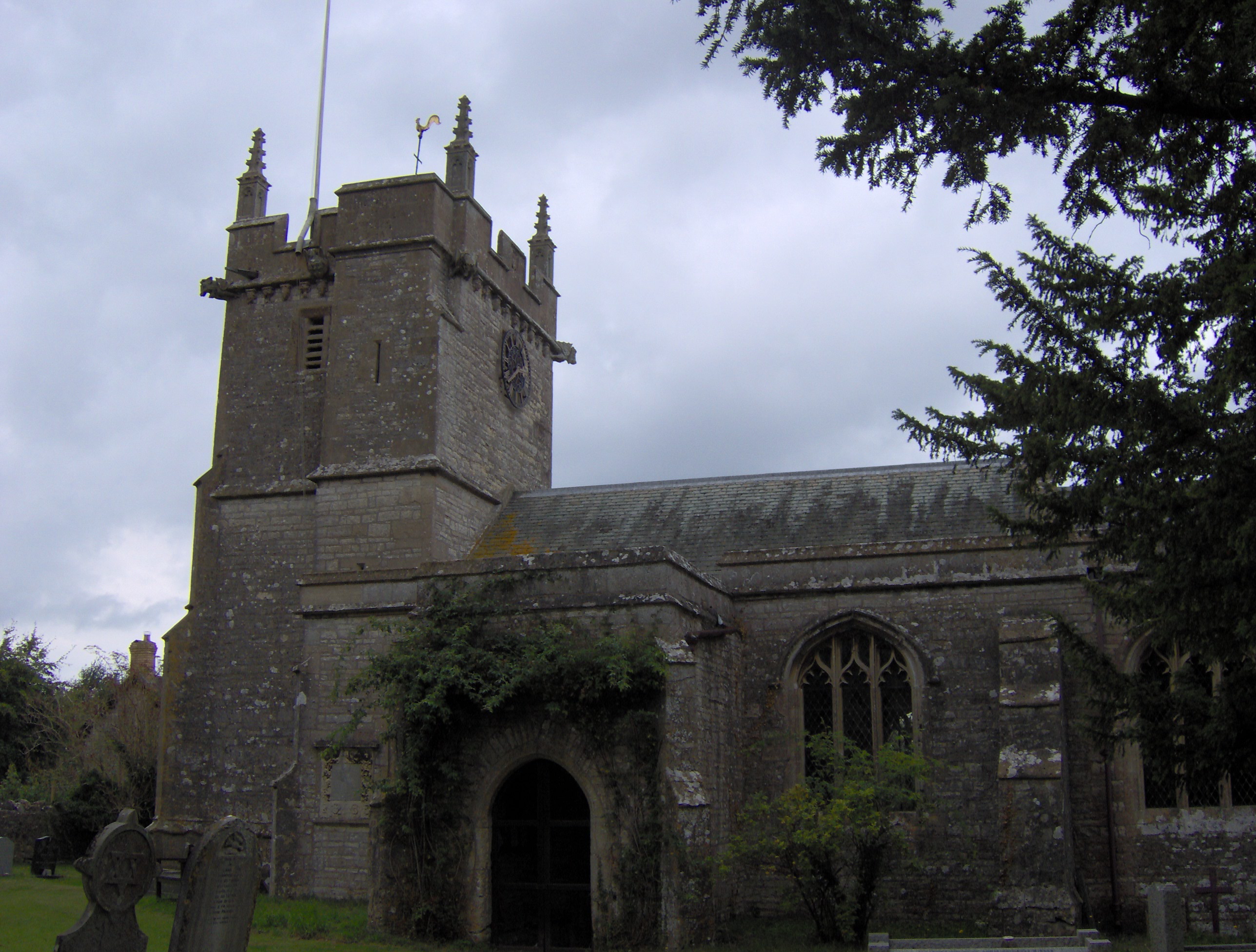
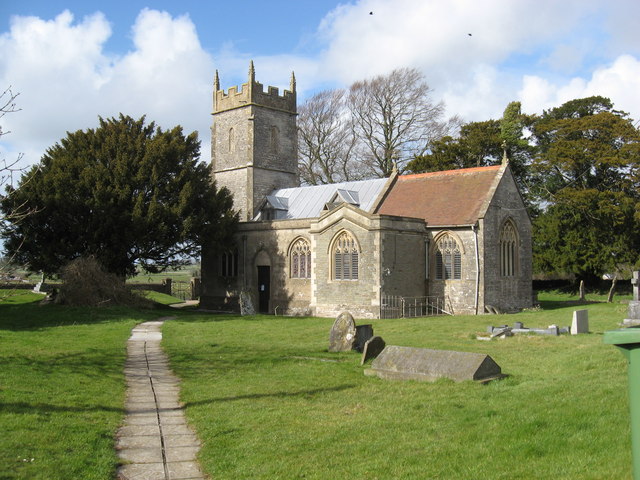
Church of St James, Cameley

The Church of St James is a redundant church in Cameley, Somerset, England, dating from the late 12th century. It is recorded in the National Heritage...
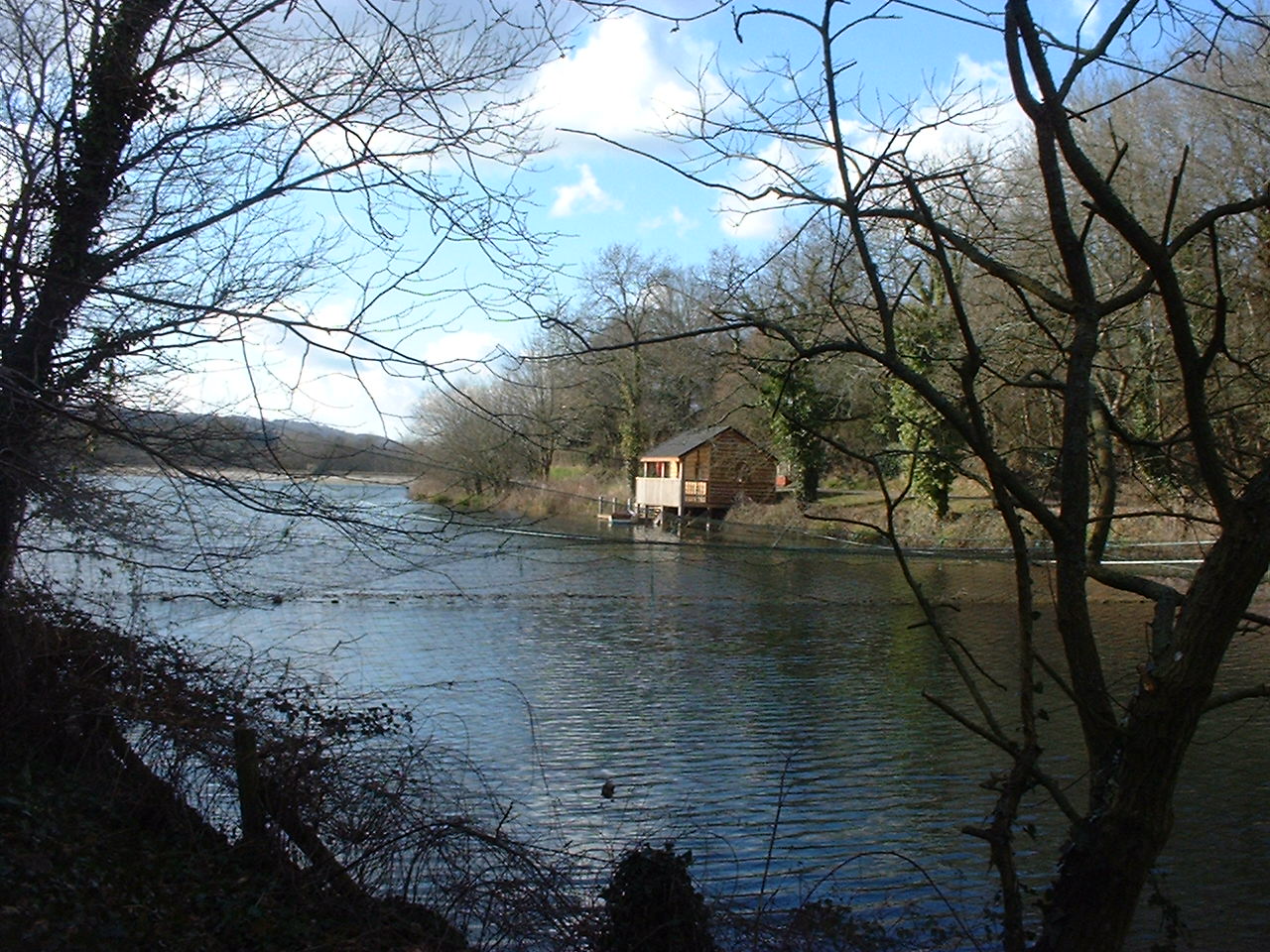
Litton Reservoirs

Litton Reservoirs (also known as Coley Reservoirs) (grid reference ST590553) are two reservoirs near the village of Litton, Somerset, England. They are...

Cameley

Cameley is a village in the civil parish of Temple Cloud with Cameley, within the Chew Valley in Somerset, and on the northern slopes of the Mendip Hills...

Nearby Amenities

Located within 500m of 51.296208,-2.5578098
The data included in this document is from www.openstreetmap.org. The data is made available under ODbL.

Have you been to Chewton Wood?

Leave your review of Chewton Wood below (or comments, questions and feedback).