Beeches Green

Settlement in Gloucestershire Stroud

England

Beeches Green

Finger Post, Walkley Hill, Stroud In the parish of Rodborough opposite the "Prince Albert" pub. To the right is Dudbridge (board read Gloucester 13in 2011), to the left is Minchinhampton and towards the camera (North) is down Rodborough Hill to Stroud.
View prior to 2015 is <a href="https://www.geograph.org.uk/photo/7676215">SO8404 : Finger Post, Walkley Hill, Stroud</a>.

Inscription (was): [Minchinhampton / Cirencester] // [Stroud] // Cainscross 1 / Gloucester 13

Milestone Society National ID: tbc
Finger Post, Walkley Hill, Stroud Credit: Ian Kenny Roberts

Beeches Green is a residential area located in the town of Stroud, Gloucestershire, England. Situated on the eastern edge of the town, Beeches Green is a predominantly residential neighborhood with a mix of housing types, including detached houses, semi-detached houses, and bungalows.

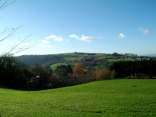
The area is known for its leafy streets and abundance of mature beech trees, which lend the neighborhood its name and contribute to its natural beauty. Beeches Green is surrounded by picturesque countryside, offering residents easy access to scenic walks and outdoor activities.

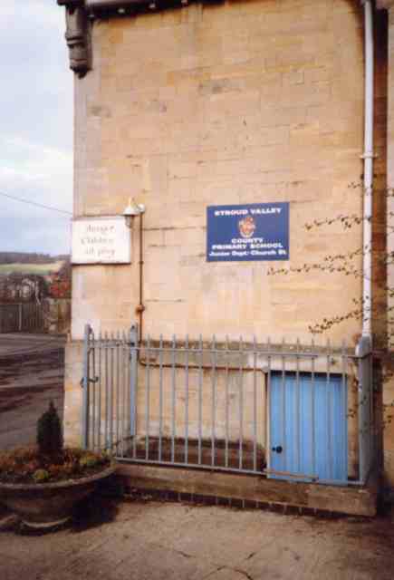
Within the neighborhood, there are several amenities and facilities that cater to the needs of the local community. These include a primary school, a community center, and a small shopping precinct with a variety of shops and services. Additionally, there is a public house where residents can socialize and enjoy a meal or drink.

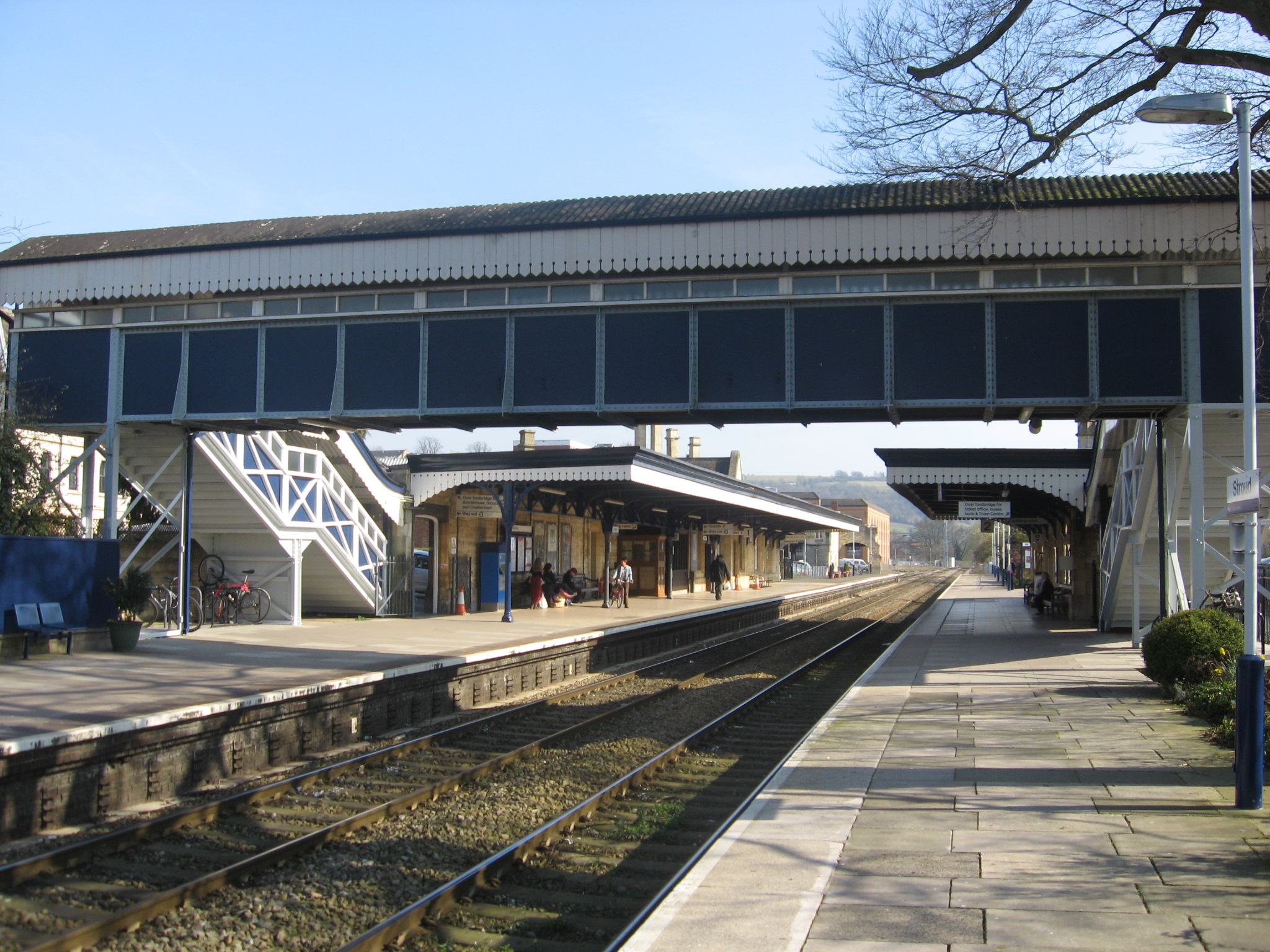
Transport links in Beeches Green are well-developed, with regular bus services connecting the neighborhood to the town center and surrounding areas. The nearby Stroud railway station provides further transport options for residents, with regular train services to Gloucester, Cheltenham, and London.

Overall, Beeches Green offers a peaceful and family-friendly environment, with its combination of natural surroundings, amenities, and convenient transport links making it an attractive place to live in Gloucestershire.

If you have any feedback on the listing, please let us know in the comments section below.

Beeches Green Images

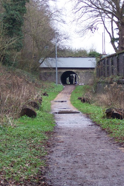
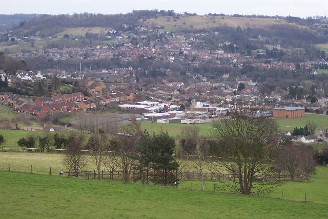
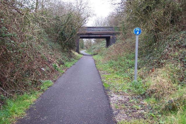
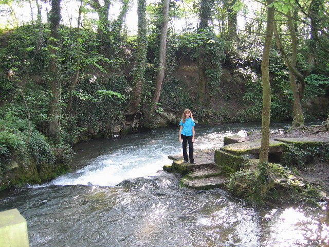
Images are sourced within 2km of 51.747576/-2.2204254 or Grid Reference SO8405. Thanks to Geograph Open Source API. All images are credited.

Finger Post, Walkley Hill, Stroud In the parish of Rodborough opposite the "Prince Albert" pub. To the right is Dudbridge (board read Gloucester 13in 2011), to the left is Minchinhampton and towards the camera (North) is down Rodborough Hill to Stroud.
View prior to 2015 is <a href="https://www.geograph.org.uk/photo/7676215">SO8404 : Finger Post, Walkley Hill, Stroud</a>.

Inscription (was): [Minchinhampton / Cirencester] // [Stroud] // Cainscross 1 / Gloucester 13

Milestone Society National ID: tbc
Finger Post, Walkley Hill, Stroud
In the parish of Rodborough opposite the "Prince Albert" pub. To the right is Dudbridge (board read Gloucester 13in 2011), to the left is Minchinhampton and towards the camera (North) is down Rodborough Hill to Stroud. View prior to 2015 is SO8404 : Finger Post, Walkley Hill, Stroud. Inscription (was): [Minchinhampton / Cirencester] // [Stroud] // Cainscross 1 / Gloucester 13 Milestone Society National ID: tbc
Finger Post, Walkley Hill, Stroud From 2011, in the parish of Rodborough opposite the "Prince Albert" pub. To the right is Dudbridge and Gloucester, to the left is Minchinhampton and towards the camera (North) is down Rodborough Hill to Stroud.
2023 view is <a href="https://www.geograph.org.uk/photo/7674397">SO8404 : Finger Post, Walkley Hill, Stroud</a>.

Inscription (was): [Minchinhampton / Cirencester] // [Stroud] // Cainscross 1 / Gloucester 13

Milestone Society National ID: tbc
Finger Post, Walkley Hill, Stroud
From 2011, in the parish of Rodborough opposite the "Prince Albert" pub. To the right is Dudbridge and Gloucester, to the left is Minchinhampton and towards the camera (North) is down Rodborough Hill to Stroud. 2023 view is SO8404 : Finger Post, Walkley Hill, Stroud. Inscription (was): [Minchinhampton / Cirencester] // [Stroud] // Cainscross 1 / Gloucester 13 Milestone Society National ID: tbc
Stroud junior School This sign saying  "Danger children at Play" struck me a rather amusing and beyond the wall can be seen a snippet of Stroud.
Stroud junior School
This sign saying "Danger children at Play" struck me a rather amusing and beyond the wall can be seen a snippet of Stroud.
Selsley Common from Rodborough Taken from somewhat undulating Gastrells School playing fields looking due west. This ridge is very popular with paragliders, hang-gliders, gliders and model gliders, can get a bit busy up there!
Selsley Common from Rodborough
Taken from somewhat undulating Gastrells School playing fields looking due west. This ridge is very popular with paragliders, hang-gliders, gliders and model gliders, can get a bit busy up there!
Rodborough Fort
Rodborough Fort
Performance outside Stroud Subscription Rooms Skate Naked perform outside the 'Sub Rooms'
Performance outside Stroud Subscription Rooms
Skate Naked perform outside the 'Sub Rooms'
Stroud Town Cemetery Chapel, Bisley Road, Stroud Taken after an unseasonal snowfall in March
Stroud Town Cemetery Chapel, Bisley Road, Stroud
Taken after an unseasonal snowfall in March
Stratford Park Lido View through turnstiles of 1930's open air lido with cast concrete diving boards and the modern leisure centre next door in Stratford Park, Stroud, Gloucestershire.
Stratford Park Lido
View through turnstiles of 1930's open air lido with cast concrete diving boards and the modern leisure centre next door in Stratford Park, Stroud, Gloucestershire.
Rodborough Hill View from Rodborough Hill looking north over Beeches Green with Whiteshill in the distance.
Rodborough Hill
View from Rodborough Hill looking north over Beeches Green with Whiteshill in the distance.
St Laurence Church Stroud parish church, St Laurence through the early morning mist shortly before 9am. The foreground wall is alongside Landsdown road and past that is Bank Gardens.
St Laurence Church
Stroud parish church, St Laurence through the early morning mist shortly before 9am. The foreground wall is alongside Landsdown road and past that is Bank Gardens.
Dudbridge Cycle Track Former Midland Railway line linking Nailsworth and Stonehouse now a cycle track. The bridge is where the B4066 climbs towards Selsley.
Dudbridge Cycle Track
Former Midland Railway line linking Nailsworth and Stonehouse now a cycle track. The bridge is where the B4066 climbs towards Selsley.
Stroud view General view of Stroud. The clump of buildings in the centre of the picture belong to Archway School. The pair of white lines looking like a giant rugby goal are chimney stacks belonging to the Millikan factory, a wool cloth mill. The hill in the background is Rodborough Hill.
Stroud view
General view of Stroud. The clump of buildings in the centre of the picture belong to Archway School. The pair of white lines looking like a giant rugby goal are chimney stacks belonging to the Millikan factory, a wool cloth mill. The hill in the background is Rodborough Hill.
Dudbridge Cycle Track The railway line ran between Dudbridge and Stroud and is viewed from the Dudbridge End. Nowadays it's the best made bit of cycle track in Stroud, it's a pity the access is by a flight of stairs. The road bridge carries traffic between Dudbridge Hill and Dudbridge.
Dudbridge Cycle Track
The railway line ran between Dudbridge and Stroud and is viewed from the Dudbridge End. Nowadays it's the best made bit of cycle track in Stroud, it's a pity the access is by a flight of stairs. The road bridge carries traffic between Dudbridge Hill and Dudbridge.
River Frome in Stroud Bend in the River Frome showing the remains of an old water mill. It's in the shadow of a railway viaduct, and just over the road from Waitrose.
River Frome in Stroud
Bend in the River Frome showing the remains of an old water mill. It's in the shadow of a railway viaduct, and just over the road from Waitrose.
Whiteshill Church Whiteshill church is situated at the southern end of Whiteshill and just north of Stroud. The church was opened in 1840.
Whiteshill Church
Whiteshill church is situated at the southern end of Whiteshill and just north of Stroud. The church was opened in 1840.
Whiteshill village Whiteshill village is 2Km north of Stroud. The Cotswold Way path is 1Km to the west in Standish woods.
Whiteshill village
Whiteshill village is 2Km north of Stroud. The Cotswold Way path is 1Km to the west in Standish woods.
Stroud Fire Station Stroud Fire Station, Paganhill Lane, Stroud, Gloucestershire is station number W07 of the Gloucestershire Fire & Rescue Service.
Stroud Fire Station
Stroud Fire Station, Paganhill Lane, Stroud, Gloucestershire is station number W07 of the Gloucestershire Fire & Rescue Service.
Cottages in Cashes Green Cottages at the corner of Westrip Lane and Cashes Green Road, in an area where the majority of houses are modern.
Cottages in Cashes Green
Cottages at the corner of Westrip Lane and Cashes Green Road, in an area where the majority of houses are modern.
Show me another place!

Beeches Green is located at Grid Ref: SO8405 (Lat: 51.747576, Lng: -2.2204254)

Administrative County: Gloucestershire

District: Stroud

Police Authority: Gloucestershire

What 3 Words

///vampire.awestruck.twins. Near Stroud, Gloucestershire

Nearby Locations

Paganhill Beeches Green

Related Wikis

Nearby Amenities

Located within 500m of 51.747576,-2.2204254
Crossing
Crossing: traffic_signals
Crossing Island: no
Crossing Ref: pelican
Kerb: lowered
Tactile Paving: yes
Lat/Long: 51.7458399/-2.2204851
Crossing
Button Operated: yes
Crossing: traffic_signals
Crossing Island: no
Crossing Ref: puffin
Tactile Paving: yes
Traffic Signals Sound: yes
Traffic Signals Vibration: yes
Lat/Long: 51.746627/-2.219214
Crossing
Crossing: traffic_signals
Crossing Island: no
Crossing Ref: pelican
Kerb: lowered
Tactile Paving: yes
Lat/Long: 51.7479022/-2.2188066
Stroud
Is In: Gloucestershire, England, UK
Place: town
Postal Code: GL5
Wikidata: Q281749
Wikipedia: en:Stroud
Lat/Long: 51.745424/-2.2198605
Stroud
Naptan AtcoCode: 9100STRUD
Network: National Rail
Network Website: https://www.nationalrail.co.uk/stations/std/
Network Wikidata: Q26334
Operator: Great Western Railway
Operator Website: https://www.gwr.com/stations-and-destinations/stations/stroud-gloucs
Operator Wikidata: Q1419438
Postal Code: GL5 3AP
Public Transport: station
Railway: station
Ref Crs: STD
Source: NPE
Train: yes
Wheelchair: yes
Wikidata: Q3079073
Wikipedia: en:Stroud railway station
Lat/Long: 51.7444813/-2.2191762
Mini Roundabout
Direction: clockwise
Lat/Long: 51.7481955/-2.2269458
Mini Roundabout
Direction: clockwise
Lat/Long: 51.7481574/-2.2236745
Crossing
Button Operated: yes
Crossing: traffic_signals
Crossing Island: no
Crossing Ref: toucan
Kerb: lowered
Tactile Paving: yes
Traffic Signals Sound: yes
Traffic Signals Vibration: yes
Lat/Long: 51.748556/-2.2221686
Mini Roundabout
Direction: clockwise
Lat/Long: 51.7488549/-2.2213412
Traffic Signals
Lat/Long: 51.7449704/-2.2249955
Crossing
Crossing: uncontrolled
Crossing Island: no
Crossing Ref: zebra
Lat/Long: 51.7446666/-2.2209024
Mini Roundabout
Direction: clockwise
Lat/Long: 51.7447857/-2.2190839
Mini Roundabout
Direction: clockwise
Lat/Long: 51.7446354/-2.2204687
Mini Roundabout
Direction: clockwise
Lat/Long: 51.7484535/-2.2254966
Traffic Signals
Crossing: traffic_signals
Crossing Ref: pelican
Tactile Paving: yes
Lat/Long: 51.7448168/-2.2180716
Mini Roundabout
Direction: clockwise
Lat/Long: 51.7449676/-2.2147102
Crossing
Crossing: traffic_signals
Crossing Island: no
Crossing Ref: pelican
Lat/Long: 51.7471296/-2.216969
Telephone
Booth: K6
Covered: booth
Listed Status: Grade II
Operator: BT
Operator Wikidata: Q593786
Phone: +44 1453 763092
Lat/Long: 51.7460435/-2.217074
Crossing
Crossing: uncontrolled
Crossing Island: yes
Crossing Ref: zebra
Tactile Paving: yes
Lat/Long: 51.7448881/-2.2148604
Bus Stop
Tesco
Bench: no
Bin: yes
Bus: yes
Naptan AtcoCode: 1600GL4523
Naptan Bearing: NE
Naptan CommonName: Tesco
Naptan Indicator: Opp
Naptan NaptanCode: glodgajg
Naptan PlusbusZoneRef: STRUD
Naptan Street: Stratford Rd
Naptan Verified: no
Public Transport: platform
Shelter: no
Source: naptan_import
Lat/Long: 51.7484524/-2.222743
Bus Stop
Tesco
Bench: yes
Bin: yes
Bus: yes
Lit: yes
Naptan AtcoCode: 1600GL4524
Naptan Bearing: SW
Naptan CommonName: Tesco
Naptan NaptanCode: glodgagw
Naptan PlusbusZoneRef: STRUD
Naptan Street: Stratford Rd
Naptan Verified: no
Public Transport: platform
Shelter: yes
Source: naptan_import
Tactile Paving: no
Lat/Long: 51.7483263/-2.2228438
Bus Stop
Merrywalks
Bench: yes
Bus: yes
Local Ref: K
Naptan AtcoCode: 1600GL4566
Naptan Bearing: SW
Naptan CommonName: Merrywalks
Naptan Indicator: Stop K
Naptan NaptanCode: glodgdmw
Naptan PlusbusZoneRef: STRUD
Naptan Street: Merrywalks
Naptan Verified: no
Public Transport: platform
Shelter: yes
Source: naptan_import
Lat/Long: 51.7468782/-2.2183318
Bus Stop
Russell St
Bench: no
Bin: no
Bus: yes
Lit: no
Naptan AtcoCode: 1600GL4572
Naptan Bearing: NW
Naptan CommonName: Russell St
Naptan NaptanCode: glodgdtm
Naptan PlusbusZoneRef: STRUD
Naptan Street: Russell St
Naptan Verified: no
Public Transport: platform
Shelter: no
Source: naptan_import
Tactile Paving: no
Lat/Long: 51.7447059/-2.2178718
Bus Stop
Stroud & Swindon Bldg Soc
Bus: yes
Naptan AtcoCode: 1600GLA36669
Naptan Bearing: NE
Naptan CommonName: Stroud & Swindon Bldg Soc
Naptan NaptanCode: glogmjam
Naptan PlusbusZoneRef: STRUD
Naptan ShortCommonName: Night Link Only
Naptan Street: Rowcroft
Naptan Verified: no
Public Transport: platform
Source: naptan_import
Lat/Long: 51.7450141/-2.2198582
Bus Stop
King St
Bench: yes
Bin: no
Bus: yes
Lit: yes
Naptan AtcoCode: 1600GLA36781
Naptan Bearing: NE
Naptan CommonName: King St
Naptan NaptanCode: glogmpgp
Naptan PlusbusZoneRef: STRUD
Naptan Street: King St
Naptan Verified: no
Public Transport: platform
Shelter: no
Source: naptan_import
Tactile Paving: no
Lat/Long: 51.7453578/-2.218788
Bus Stop
Bench: no
Bin: no
Bus: yes
Naptan AtcoCode: 1600GLA36790
Naptan Bearing: N
Naptan Indicator: Opp
Naptan NaptanCode: glogmpjd
Naptan PlusbusZoneRef: STRUD
Naptan Street: Ryeleaze Rd
Naptan Verified: no
Public Transport: platform
Shelter: no
Source: naptan_import
Lat/Long: 51.7460493/-2.2143735
Bus Stop
Bus: yes
Naptan AtcoCode: 1600GLA36795
Naptan Bearing: SW
Naptan NaptanCode: glogmpjg
Naptan PlusbusZoneRef: STRUD
Naptan Street: Brickrow
Naptan Verified: no
Public Transport: platform
Shelter: no
Source: naptan_import
Lat/Long: 51.7464811/-2.2142452
Bus Stop
Merrywalks
Bus: yes
Local Ref: D
Naptan AtcoCode: 1600GLA90862
Naptan Bearing: NE
Naptan CommonName: Merrywalks
Naptan Indicator: Stop D
Naptan NaptanCode: glogpdgd
Naptan PlusbusZoneRef: STRUD
Naptan Street: Merrywalks
Naptan Verified: no
Public Transport: platform
Shelter: yes
Source: naptan_import
Lat/Long: 51.7470852/-2.218217
Bus Stop
Merrywalks
Bench: yes
Bin: no
Bus: yes
Local Ref: J
Naptan AtcoCode: 1600GLA90863
Naptan Bearing: SW
Naptan CommonName: Merrywalks
Naptan Indicator: Stop J
Naptan NaptanCode: glogpdgj
Naptan PlusbusZoneRef: STRUD
Naptan Street: Merrywalks
Naptan Verified: no
Public Transport: platform
Shelter: yes
Source: naptan_import
Tactile Paving: no
Lat/Long: 51.7469777/-2.2179992
Bus Stop
Merrywalks
Bench: yes
Bin: yes
Bus: yes
Lit: yes
Local Ref: C
Naptan AtcoCode: 1600GLA90864
Naptan Bearing: NE
Naptan CommonName: Merrywalks
Naptan Indicator: Stop C
Naptan NaptanCode: glogpdgm
Naptan PlusbusZoneRef: STRUD
Naptan Street: Merrywalks
Naptan Verified: no
Public Transport: platform
Shelter: yes
Source: naptan_import
Tactile Paving: yes
Lat/Long: 51.746964/-2.2185139
Bus Stop
Merrywalks
Bench: yes
Bin: no
Bus: yes
Check Date Shelter: 2021-07-18
Lit: yes
Local Ref: L
Naptan AtcoCode: 1600GLA90865
Naptan Bearing: SW
Naptan CommonName: Merrywalks
Naptan Indicator: Stop L
Naptan NaptanCode: glogpdgp
Naptan PlusbusZoneRef: STRUD
Naptan Street: Merrywalks
Naptan Verified: no
Public Transport: platform
Shelter: yes
Source: naptan_import
Tactile Paving: no
Lat/Long: 51.7467968/-2.2185922
Bus Stop
Merrywalks
Bench: yes
Bin: no
Bus: yes
Check Date Shelter: 2021-07-18
Lit: yes
Local Ref: B
Naptan AtcoCode: 1600GLA90866
Naptan Bearing: NE
Naptan CommonName: Merrywalks
Naptan Indicator: Stop B
Naptan NaptanCode: glogpdgt
Naptan PlusbusZoneRef: STRUD
Naptan Street: Merrywalks
Naptan Verified: no
Public Transport: platform
Shelter: yes
Source: naptan_import
Tactile Paving: no
Lat/Long: 51.7468761/-2.2187293
Bus Stop
Merrywalks
Bench: yes
Bin: no
Bus: yes
Check Date Shelter: 2021-07-18
Lit: yes
Local Ref: M
Naptan AtcoCode: 1600GLA90867
Naptan Bearing: SW
Naptan CommonName: Merrywalks
Naptan Indicator: Stop M
Naptan NaptanCode: glogpdgw
Naptan PlusbusZoneRef: STRUD
Naptan Street: Merrywalks
Naptan Verified: no
Public Transport: platform
Shelter: yes
Source: naptan_import
Tactile Paving: no
Lat/Long: 51.7466916/-2.2188215
Bus Stop
Merrywalks
Bench: yes
Bin: no
Bus: yes
Check Date Shelter: 2021-07-18
Lit: yes
Local Ref: A
Naptan AtcoCode: 1600GLA90868
Naptan Bearing: NE
Naptan CommonName: Merrywalks
Naptan Indicator: Stop A
Naptan NaptanCode: glogpdjg
Naptan PlusbusZoneRef: STRUD
Naptan Street: Merrywalks
Naptan Verified: no
Public Transport: platform
Shelter: yes
Source: naptan_import
Tactile Paving: no
Lat/Long: 51.7467514/-2.2190734
Bus Stop
Merrywalks
Bench: yes
Bin: no
Bus: yes
Check Date Shelter: 2021-07-18
Lit: yes
Local Ref: N
Naptan AtcoCode: 1600GLA90869
Naptan Bearing: SW
Naptan CommonName: Merrywalks
Naptan Indicator: Stop N
Naptan NaptanCode: glogpdja
Naptan PlusbusZoneRef: STRUD
Naptan Street: Merrywalks
Naptan Verified: no
Public Transport: platform
Shelter: yes
Source: naptan_import
Tactile Paving: no
Lat/Long: 51.7466102/-2.2190186
Bus Stop
Stratford Park
Bench: no
Bin: no
Bus: yes
Lit: yes
Naptan AtcoCode: 1600GLS125
Naptan Bearing: S
Naptan CommonName: Stratford Park
Naptan Indicator: Opp
Naptan NaptanCode: glodgamt
Naptan PlusbusZoneRef: STRUD
Naptan Street: Painswick Rd A46
Naptan Verified: no
Public Transport: platform
Shelter: no
Source: naptan_import
Tactile Paving: no
Lat/Long: 51.7516005/-2.2221356
Bus Stop
Stratford Park
Bench: no
Bin: no
Bus: yes
Lit: no
Naptan AtcoCode: 1600GLS126
Naptan Bearing: N
Naptan CommonName: Stratford Park
Naptan NaptanCode: glodgamw
Naptan PlusbusZoneRef: STRUD
Naptan Street: Painswick Rd A46
Naptan Verified: no
Public Transport: platform
Shelter: no
Source: naptan_import
Tactile Paving: no
Lat/Long: 51.7511691/-2.2220465
Bus Stop
Homebase
Bus: yes
Naptan AtcoCode: 1600GLS127
Naptan Bearing: W
Naptan CommonName: Homebase
Naptan NaptanCode: glodawpm
Naptan PlusbusZoneRef: STRUD
Naptan Street: Cainscross Rd
Naptan Verified: no
Public Transport: platform
Shelter: no
Source: naptan_import
Lat/Long: 51.7450303/-2.2255651
Bus Stop
Homebase
Bus: yes
Naptan AtcoCode: 1600GLS128
Naptan Bearing: E
Naptan CommonName: Homebase
Naptan Indicator: Opp
Naptan NaptanCode: glodawpa
Naptan PlusbusZoneRef: STRUD
Naptan Street: Cainscross Rd
Naptan Verified: no
Public Transport: platform
Shelter: no
Source: naptan_import
Lat/Long: 51.7449243/-2.2245941
Bus Stop
Health Centre
Bench: no
Bin: no
Bus: yes
Naptan AtcoCode: 1600GLS221
Naptan Bearing: SE
Naptan CommonName: Health Centre
Naptan Indicator: Opp
Naptan NaptanCode: glodgdjd
Naptan PlusbusZoneRef: STRUD
Naptan Street: Beeches Green
Naptan Verified: no
Public Transport: platform
Shelter: no
Source: naptan_import
Tactile Paving: yes
Lat/Long: 51.7479025/-2.2186844
Bus Stop
Health Centre
Bench: yes
Bin: yes
Bus: yes
Lit: yes
Naptan AtcoCode: 1600GLS222
Naptan Bearing: NW
Naptan CommonName: Health Centre
Naptan NaptanCode: glodgdap
Naptan PlusbusZoneRef: STRUD
Naptan Street: Beeches Green
Naptan Verified: no
Public Transport: platform
Shelter: yes
Source: naptan_import
Tactile Paving: no
Lat/Long: 51.7481436/-2.2196271
Locking Hill
Naptan AtcoCode: 1600GLS283
Naptan Bearing: NE
Naptan BusStopType: CUS
Naptan CommonName: Locking Hill
Naptan Indicator: Opp
Naptan NaptanCode: glodgjat
Naptan PlusbusZoneRef: STRUD
Naptan Street: Slad Rd
Naptan Verified: no
Source: naptan_import
Lat/Long: 51.7472859/-2.2166535
Bus Stop
Locking Hill
Bus: yes
Naptan AtcoCode: 1600GLS284
Naptan Bearing: SW
Naptan CommonName: Locking Hill
Naptan NaptanCode: glodgjda
Naptan PlusbusZoneRef: STRUD
Naptan Street: Slad Rd
Naptan Verified: no
Public Transport: platform
Source: naptan_import
Lat/Long: 51.7472321/-2.2165519
Bus Stop
Springfield Rd
Bus: yes
Naptan AtcoCode: 1600GLS504
Naptan Bearing: SW
Naptan CommonName: Springfield Rd
Naptan NaptanCode: glodgjmw
Naptan PlusbusZoneRef: STRUD
Naptan Street: Folly Ln
Naptan Verified: no
Public Transport: platform
Source: naptan_import
Lat/Long: 51.749044/-2.21404
Bar
Bar Greyhound
Addr City: Stroud
Addr Housename: The Greyhound Inn
Addr Housenumber: 12
Addr Postcode: GL5 1QG
Addr Street: Gloucester Street
Air Conditioning: no
Indoor Seating: yes
Outdoor Seating: no
Source: survey
Wikidata: Q26532466
Lat/Long: 51.746193/-2.217164
Cinema
Vue
Addr City: Stroud
Addr Housenumber: 19
Addr Postcode: GL5 1RY
Addr Street: Merrywalks Shopping Centre
Brand: Vue
Brand Wikidata: Q2535134
Building: retail
Fhrs Id: 154664
Layer: 0
Note: Merrywalks level
Wikidata: Q41022196
Lat/Long: 51.7466611/-2.2184853
Cafe
Star Anise Arts Cafe
Wheelchair: yes
Lat/Long: 51.7469147/-2.2167694
Bicycle Parking
Capacity: 5
Lat/Long: 51.7467619/-2.2157886
Tesco Express
Addr City: Stroud
Addr Housename: Merrywalks Shopping Centre
Addr Postcode: GL5 1RR
Addr Street: Merrywalks
Addr Unit: 63
Brand: Tesco Express
Brand Wikidata: Q98456772
Opening Hours: Mo-Su 06:00-22:00
Shop: convenience
Website: https://www.tesco.com/store-locator/stroud/unit-63-five-valleys-shopping-centre
Lat/Long: 51.7463368/-2.2194639
Access: private
Barrier: bollard
Bollard: fixed
Lat/Long: 51.7450844/-2.2170078
Seamark Type: gate
Waterway: lock_gate
Lat/Long: 51.7443511/-2.2240212
Seamark Type: gate
Waterway: lock_gate
Lat/Long: 51.7440531/-2.2207479
Seamark Type: gate
Waterway: lock_gate
Lat/Long: 51.7442109/-2.2209858
Barrier: bollard
Bollard: fixed
Lat/Long: 51.7439755/-2.2218989
Traffic Calming: island
Lat/Long: 51.7450166/-2.2145717
Traffic Signals
Lat/Long: 51.7465118/-2.2176444
Traffic Signals
Lat/Long: 51.7468518/-2.2173868
Crazy Daisy
Addr City: Stroud
Addr Housenumber: 11
Addr Postcode: GL5 1QG
Addr Street: Gloucester Street
Shop: florist
Source: survey
Lat/Long: 51.746269/-2.2171859
Peter Hickman Hairdressing
Addr City: Stroud
Addr Housenumber: 9
Addr Postcode: GL5 1QG
Addr Street: Gloucester Street
Shop: hairdresser
Source: survey
Wikidata: Q26531290
Lat/Long: 51.7464152/-2.2171645
Strangeness and Charm Vintage
Addr City: Stroud
Addr Housenumber: 7
Addr Postcode: GL5 1QG
Addr Street: Gloucester Street
Shop: clothes
Source: survey
Lat/Long: 51.7465482/-2.2171392
Stroud Home Brew
Addr City: Stroud
Addr Housenumber: 8
Addr Postcode: GL5 1QG
Addr Street: Gloucester Street
Shop: brewing_supplies
Source: survey
Website: http://www.stroudhomebrew.co.uk/
Lat/Long: 51.7464821/-2.2171512
Pub
The Queen Victoria
Addr City: Stroud
Addr Housenumber: 5
Addr Postcode: GL5 1QG
Addr Street: Gloucester Street
Source: survey
Lat/Long: 51.7466325/-2.2170578
Vogue Haircare
Addr City: Stroud
Addr Housenumber: 10
Addr Street: Gloucester Street
Shop: hairdresser
Source: survey
Lat/Long: 51.7463285/-2.2171859
Dentist
Brockley House Dental Practice
Addr City: Stroud
Addr Housename: Brockley House
Addr Housenumber: 10
Addr Postcode: GL5 1BB
Addr Street: Lansdown
Healthcare: dentist
Healthcare Speciality: dentist
Source: survey
Lat/Long: 51.7467083/-2.216215
Cotswold Sewing Machines
Addr City: Stroud
Addr Housenumber: 7A
Addr Street: Lansdown
Shop: sewing
Source: survey
Lat/Long: 51.7465465/-2.2164792
Hi-Lite Windows
Addr City: Stroud
Addr Housenumber: 5
Addr Postcode: GL5 1BB
Addr Street: Lansdown
Fixme: may now be a gallery: check
Shop: windows
Source: survey
Lat/Long: 51.7464275/-2.2166848
Addr City: Stroud
Addr Housename: Chedworth House
Addr Housenumber: 8
Addr Postcode: GL5 1BD
Addr Street: Lansdown
Source: survey
Start Date: 1867
Lat/Long: 51.7465956/-2.2164065
Addr City: Stroud
Addr Housenumber: 7
Addr Street: Lansdown
Source: survey
Lat/Long: 51.7465185/-2.2165301
Stroud Labour Party
Addr City: Stroud
Addr Housenumber: 5A
Addr Postcode: GL5 1BB
Addr Street: Lansdown
Office: political_party
Source: survey
Lat/Long: 51.7464413/-2.216649
Stroud News & Journal
Addr City: Stroud
Addr Housenumber: 6
Addr Postcode: GL5 1BE
Addr Street: Lansdown
Check Date: 2024-02-12
Office: newspaper
Source: survey
Lat/Long: 51.7464811/-2.2166094
The Blanket Box
Addr City: Stroud
Addr Housenumber: 11-12
Addr Postcode: GL5 1BB
Addr Street: Lansdown
Shop: furniture
Source: survey
Lat/Long: 51.7467801/-2.2160957
The Lansdown Centre
Addr City: Stroud
Addr Housenumber: 9
Addr Street: Lansdown
Source: survey
Lat/Long: 51.7466475/-2.2163075
Post Box
Lansdown
Collection Times: Mo-Fr 17:15; Sa 12:15
Drive Through: no
Operator: Royal Mail
Operator Wikidata: Q638098
Post Box Type: wall
Ref: GL5 35
Royal Cypher: VR
Royal Cypher Wikidata: Q33102356
Source: survey
Lat/Long: 51.7463608/-2.2165839
Post Box
High Street
Check Date: 2021-07-09
Collection Times: Mo-Fr 16:30, Sa 12:00
Old Ref: STD 047
Operator: Royal Mail
Operator Wikidata: Q638098
Post Box Apertures: 2
Post Box Type: pillar
Ref: GL5 47;GL5 1047
Royal Cypher: EIIR
Royal Cypher Wikidata: Q33102113
Source: survey
Lat/Long: 51.7452653/-2.2158912
Duffle Vintage
Addr City: Stroud
Addr Housenumber: 1
Addr Postcode: GL5 2HA
Addr Street: John Street
Shop: clothes
Source: survey
Wheelchair: limited
Lat/Long: 51.7444643/-2.2169011
Four Seasons
Addr City: Stroud
Addr Housenumber: 5
Addr Postcode: GL5 1AF
Addr Street: Threadneedle Street
Shop: greengrocer
Source: survey
Lat/Long: 51.7448322/-2.2160966
Caer Sidi
Addr City: Stroud
Addr Housenumber: 10
Addr Postcode: GL5 2HE
Addr Street: Union Street
Check Date: 2023-07-17
Shop: gift
Lat/Long: 51.7448151/-2.2158684
Confection Affection
Addr City: Stroud
Addr Housenumber: 4
Addr Postcode: GL5 1AF
Addr Street: Threadneedle Street
Check Date: 2023-07-17
Fhrs Id: 154736
Shop: confectionery
Source: survey
Wheelchair: no
Lat/Long: 51.7447602/-2.2164523
Cornhill Pets & Country Crafts
Addr City: Stroud
Addr Housenumber: 7
Addr Postcode: GL5 1AF
Addr Street: Threadneedle Street
Check Date: 2023-07-17
Shop: pet
Source: survey
Lat/Long: 51.7448172/-2.2160012
K'n'G Convenience
Addr City: Stroud
Addr Housenumber: 2
Addr Postcode: GL5 1AF
Addr Street: Threadneedle Street
Check Date: 2023-07-17
Fhrs Id: 154805
Shop: convenience
Source: survey
Lat/Long: 51.7447782/-2.2165396
Disused Shop: yes
Source: survey
Lat/Long: 51.7443361/-2.2162041
The Old Clock and Gramophone Shop
Shop: antiques
Source: survey
Wheelchair: limited
Lat/Long: 51.7444393/-2.2167082
Walkers Cake Centre
Addr City: Stroud
Addr Housenumber: 1
Addr Postcode: GL5 1AF
Addr Street: Threadneedle Street
Fhrs Id: 154676
Source: survey
Lat/Long: 51.7448673/-2.2162486
Addr City: Stroud
Addr Housenumber: 9
Addr Postcode: GL5 3DX
Addr Street: George Street
Wikidata: Q26531287
Lat/Long: 51.7450803/-2.2176432
Waterway: weir
Lat/Long: 51.7486555/-2.2228543
Crossing
Bicycle: yes
Crossing: unmarked
Crossing Island: no
Lat/Long: 51.7482972/-2.2269527
Crossing
Crossing Island: no
Lat/Long: 51.7486555/-2.2254282
Vending Machine
Check Date: 2021-08-17
Indoor: yes
Note: Train tickets
Source: survey
Vending: public_transport_tickets
Lat/Long: 51.7446955/-2.2194263
Power: pole
Lat/Long: 51.7519404/-2.220889
Power: pole
Lat/Long: 51.751636/-2.2204404
Railway: turntable
Lat/Long: 51.750303/-2.2222814
Police
Lat/Long: 51.7454893/-2.2141514
Description: The Shambles
Information: guidepost
Ref: 2
Tourism: information
Lat/Long: 51.7453946/-2.2155847
Entrance: main
Lat/Long: 51.7463837/-2.2187111
Defibrillator
Access: yes
Check Date: 2023-04-29
Defibrillator Location: On front of Co-op
Emergency: defibrillator
Indoor: no
Lat/Long: 51.7476251/-2.2150734
Addr City: Stroud
Addr Housenumber: Unicorn House, 7
Addr Postcode: GL5 3AX
Addr Street: Russell Street
Lat/Long: 51.7443525/-2.2173764
Disused Shop: yes
Lat/Long: 51.7442412/-2.2208473
Arts Centre
SVA
Lat/Long: 51.7445037/-2.2167788
Restaurant
Eatalia
Addr City: Stroud
Addr Postcode: GL5 1QA
Addr Street: Merrywalks
Cuisine: italian
Fhrs Id: 622852
Lat/Long: 51.7455663/-2.2206389
Post Box
Collection Times: Mo-Fr 17:00; Sa 12:00
Operator: Royal Mail
Operator Wikidata: Q638098
Post Box Type: pillar
Ref: GL5 283
Royal Cypher: EIIR
Royal Cypher Wikidata: Q33102113
Survey Date: 2017-01-15
Lat/Long: 51.7472522/-2.2233902
Atm
Brand: RBS
Brand Wikidata: Q160126
Official Name: Royal Bank of Scotland
Operator: RBS
Operator Wikidata: Q160126
Lat/Long: 51.7472906/-2.2237291
Atm
Brand: RBS
Brand Wikidata: Q160126
Official Name: Royal Bank of Scotland
Operator: RBS
Operator Wikidata: Q160126
Lat/Long: 51.7472946/-2.223757
Mini Roundabout
Direction: clockwise
Lat/Long: 51.7447376/-2.2218118
Mini Roundabout
Direction: clockwise
Lat/Long: 51.7448578/-2.2214123
Crossing
Crossing: traffic_signals
Crossing Ref: pelican
Lat/Long: 51.74715/-2.2179032
Fast Food
Domino's
Addr Postcode: GL5 1RR
Brand: Domino's
Brand Wikidata: Q839466
Brand Wikipedia: en:Domino's Pizza
Contact Website: https://www.dominos.co.uk/pizza-near-me/stroud/unit-e-merrywalks-centre
Cuisine: pizza
Diet Vegan: yes
Diet Vegetarian: yes
Fhrs Id: 154914
Opening Hours: Su-Th 11:00-23:00; Fr,Sa 11:00-24:00
Takeaway: yes
Lat/Long: 51.7464973/-2.2189284
Tim Sysum
Shop: hairdresser
Survey Date: 2017-01-15
Lat/Long: 51.7466243/-2.2174874
Note: entrance to car park
Lat/Long: 51.7463499/-2.2189546
Anytime Fitness
Brand: Anytime Fitness
Brand Wikidata: Q4778364
Layer: 1
Leisure: fitness_centre
Website: https://www.anytimefitness.co.uk/gyms/uk-0119/stroud-south-west-gl5-1qa/
Lat/Long: 51.7465438/-2.2188339
Crossing
Crossing: traffic_signals
Crossing Ref: pelican
Lat/Long: 51.7470607/-2.2178683
Crossing
Crossing: traffic_signals
Crossing Ref: pelican
Lat/Long: 51.7470938/-2.217896
Crossing
Crossing: traffic_signals
Crossing Ref: pelican
Lat/Long: 51.7471018/-2.2178689
Elevator
Lat/Long: 51.7463221/-2.2188369
Waste Basket
Check Date: 2023-07-15
Lat/Long: 51.7467682/-2.2158027
Crossing
Crossing: pelican
Crossing Ref: puffin
Lat/Long: 51.747672/-2.215226
Addr Housename: Willow Cottage
Addr Housenumber: 4
Lat/Long: 51.7475337/-2.2154762
Waste Basket
Lat/Long: 51.7477234/-2.2154829
Post Box
Collection Times: Mo-Fr 16:45; Sa 12:15
Operator: Royal Mail
Operator Wikidata: Q638098
Post Box Type: lamp
Ref: GL5 36
Royal Cypher: EIIR
Royal Cypher Wikidata: Q33102113
Survey Date: 2017-01-15
Lat/Long: 51.7477355/-2.2155425
Traffic Calming: choker
Lat/Long: 51.7468149/-2.2136564
Addr Housenumber: 26
Addr Street: Church Street
Lat/Long: 51.7454607/-2.2152852
Check Date: 2023-07-16
Shop: vacant
Lat/Long: 51.7457755/-2.2168149
Telephone
Booth: KX100
Covered: booth
Operator: BT
Operator Wikidata: Q593786
Lat/Long: 51.7449876/-2.214825
Bench
Backrest: yes
Colour: brown
Material: wood
Seats: 3
Lat/Long: 51.745002/-2.2148033
Tourism: artwork
Lat/Long: 51.7450105/-2.2147841
Bench
Backrest: yes
Lat/Long: 51.7450248/-2.214768
Recycling
Recycling Glass Bottles: yes
Recycling Paper: yes
Recycling Plastic: yes
Recycling Type: container
Lat/Long: 51.745043/-2.2147783
Barrier: bollard
Bollard: removable
Foot: yes
Lat/Long: 51.7451762/-2.2155732
Waste Basket
Check Date: 2023-07-15
Lat/Long: 51.7452639/-2.2158096
Bench
Backrest: yes
Lat/Long: 51.745327/-2.2160556
Bench
Backrest: yes
Lat/Long: 51.7453357/-2.2160764
Waste Basket
Layer: 2
Note: King Street level
Lat/Long: 51.7463118/-2.2182866
Waste Basket
Layer: 2
Note: King Street level
Lat/Long: 51.7464417/-2.2185206
Man Made: street_cabinet
Ref: 37
Utility: telecom
Lat/Long: 51.7456849/-2.2183885
Historic: memorial
Lat/Long: 51.7457732/-2.2153779
Waste Basket
Lat/Long: 51.7459352/-2.2171426
Bicycle Parking
Bicycle Parking: stands
Capacity: 4
Covered: no
Lat/Long: 51.7450474/-2.2147977
Bench
Backrest: yes
Lat/Long: 51.744759/-2.2158513
Waste Basket
Check Date: 2023-07-15
Lat/Long: 51.744759/-2.215866
Waste Basket
Check Date: 2023-07-15
Lat/Long: 51.7449309/-2.214547
Restaurant
JRool Bistro
Addr City: Stroud
Addr Housenumber: 12
Addr Postcode: GL5 2HE
Addr Street: Union Street
Check Date Opening Hours: 2023-07-17
Fhrs Id: 154801
Note: FHRS has GL5 2JT, website has GL5 2HE
Opening Hours Signed: no
Website: https://www.jrool.co.uk/
Wheelchair: yes
Lat/Long: 51.744979/-2.2157755
Barrier: bollard
Bollard: removable
Foot: yes
Lat/Long: 51.7450982/-2.2156851
Waste Basket
Lat/Long: 51.7455738/-2.2182441
Bicycle Parking
Bicycle Parking: stands
Capacity: 2
Covered: no
Lat/Long: 51.7456369/-2.2181784
Bench
Backrest: no
Lat/Long: 51.7456485/-2.2181529
Bicycle Parking
Bicycle Parking: stands
Capacity: 2
Covered: no
Lat/Long: 51.745661/-2.2181248
Bench
Backrest: no
Lat/Long: 51.7456743/-2.218102
Atm
Cash In: no
Check Date: 2022-03-26
Operator: Nationwide Building Society
Lat/Long: 51.7457658/-2.2176538
Entrance: main
Lat/Long: 51.7457995/-2.2175899
Waste Basket
Lat/Long: 51.7458449/-2.2177553
Waste Basket
Lat/Long: 51.7454749/-2.2265909
Noexit: yes
Lat/Long: 51.7439988/-2.2185993
Fast Food
Simpsons
Addr City: Stroud
Addr Country: GB
Addr Housenumber: 13
Addr Postcode: GL5 1AY
Addr Street: Bedford Street
Air Conditioning: no
Cuisine: fish_and_chips
Diet Vegan: yes
Diet Vegetarian: yes
Drive Through: no
Fhrs Id: 990078
Indoor Seating: yes
Internet Access: no
Operator: Simpsons
Outdoor Seating: no
Takeaway: yes
Toilets Access: private
Lat/Long: 51.7452384/-2.2167408
Telephone
Booth: K6
Covered: booth
Listed Status: Grade II
Operator: BT
Operator Wikidata: Q593786
Phone: +44 1453 764050
Lat/Long: 51.7446802/-2.2175498
Telephone
Booth: K6
Covered: booth
Listed Status: Grade II
Operator: BT
Operator Wikidata: Q593786
Phone: +44 1453 764096
Lat/Long: 51.7446771/-2.2175613
Telephone
Booth: K6
Check Date: 2023-07-17
Covered: booth
Listed Status: Grade II
Operator: BT
Operator Wikidata: Q593786
Phone: +44 1453 764455
Lat/Long: 51.7446823/-2.2175837
Clock
Indoor: no
Lat/Long: 51.7445624/-2.2173739
Information: guidepost
Tourism: information
Lat/Long: 51.7452304/-2.2157481
Waste Basket
Check Date: 2024-02-09
Lat/Long: 51.7449626/-2.2166124
Information: guidepost
Tourism: information
Lat/Long: 51.7448974/-2.2174137
Clock
Indoor: no
Lat/Long: 51.7445906/-2.2173616
Clock
Indoor: no
Lat/Long: 51.7446052/-2.2174054
Clock
Indoor: no
Lat/Long: 51.7445735/-2.217425
Post Box
Stroud Post Office Russell St
Collection Times: Mo-Fr 17:00; Sa 12:30
Operator: Royal Mail
Operator Wikidata: Q638098
Post Box Type: wall
Ref: GL5 255
Royal Cypher: no
Source: survey
Lat/Long: 51.7447315/-2.2180376
Waste Basket
Lat/Long: 51.7446948/-2.2174157
Board Type: history
Check Date: 2023-07-17
Description: George's Square
Information: board
Ref: 6
Tourism: information
Lat/Long: 51.7446157/-2.2174242
Stroud
Board Type: history
Check Date: 2023-07-17
Information: board
Tourism: information
Lat/Long: 51.7446885/-2.2175056
Information: guidepost
Tourism: information
Lat/Long: 51.7446732/-2.2174989
Waste Basket
Lat/Long: 51.7446602/-2.217538
Waste Basket
Check Date: 2024-01-29
Lat/Long: 51.7445125/-2.217401
Waste Basket
Lat/Long: 51.7447757/-2.2173567
Barrier: bollard
Bicycle: yes
Bollard: fixed
Foot: yes
Lat/Long: 51.7454699/-2.2165111
Grit Bin
Lat/Long: 51.7449646/-2.2148576
Barrier: bollard
Bicycle: yes
Bollard: fixed
Foot: yes
Lat/Long: 51.7450086/-2.2150748
Caer Sidi
Shop: jewelry
Lat/Long: 51.7449422/-2.2157802
Board Type: history
Description: Middle High Street
Information: board
Ref: 4
Tourism: information
Lat/Long: 51.7451187/-2.2157025
Clock
Check Date: 2022-10-21
Lat/Long: 51.7453611/-2.2179274
George Holloway statue
Artist Name: TR Essex, 1894
Artwork Type: statue
Material: stone
Tourism: artwork
Lat/Long: 51.7451834/-2.2190464
Waste Basket
Lat/Long: 51.7454309/-2.2184543
Taxi
Capacity: 4
Lat/Long: 51.7455322/-2.2184014
Bicycle Parking
Bicycle Parking: stands
Capacity: 6
Covered: no
Lat/Long: 51.7455629/-2.2183625
King Street
Board Type: history
Check Date: 2022-03-26
Information: board
Tourism: information
Lat/Long: 51.7455766/-2.2182734
Information: guidepost
Tourism: information
Lat/Long: 51.7455695/-2.2181755
Waste Basket
Lat/Long: 51.7461209/-2.217228
Victorian Improvements
Board Type: history
Check Date: 2022-03-26
Information: board
Tourism: information
Lat/Long: 51.7460026/-2.2171046
Atm
Lloyds Bank
Brand: Lloyds Bank
Brand Wikidata: Q1152847
Brand Wikipedia: en:Lloyds Bank
Cash In: no
Indoor: no
Operator: Lloyds Bank
Operator Wikidata: Q1152847
Lat/Long: 51.7453804/-2.2189354
Addr Postcode: GL5 3AN
Shop: deli
Lat/Long: 51.7451012/-2.2189137
Clinic
Crossfields Institute
Healthcare: clinic
Lat/Long: 51.7451494/-2.2189996
Board Type: history
Check Date: 2022-11-17
Information: board
Tourism: information
Lat/Long: 51.7452723/-2.2187635
Information: guidepost
Tourism: information
Lat/Long: 51.7450406/-2.2184651
Dentist
Rowcroft Dental Centre
Healthcare: dentist
Lat/Long: 51.7453329/-2.2190934
Bicycle Parking
Bicycle Parking: stands
Capacity: 6
Covered: no
Lat/Long: 51.7448672/-2.2181818
Atm
Check Date: 2024-03-09
Lat/Long: 51.7447653/-2.2181097
Bench
Lat/Long: 51.7509027/-2.2250108
Bench
Lat/Long: 51.7511617/-2.2244784
Noexit: yes
Lat/Long: 51.7441765/-2.2207633
Barrier: lift_gate
Lat/Long: 51.7443997/-2.2205892
Cotswold Canals Trust
Addr City: Stroud
Addr Housename: Bell House
Addr Postcode: GL5 3JS
Addr Street: Wallbridge
Information: office
Office: charity
Opening Hours: Mo-Sa 10:00-13:00
Shop: gift
Tourism: information
Wheelchair: yes
Wikidata: Q5175474
Lat/Long: 51.7443316/-2.2208816
Noexit: yes
Lat/Long: 51.7483851/-2.2222665
Crossing
Crossing: uncontrolled
Crossing Island: no
Crossing Ref: zebra
Lat/Long: 51.7440292/-2.2210271
Crossing
Crossing: uncontrolled
Crossing Island: no
Crossing Ref: zebra
Lat/Long: 51.7435069/-2.2201574
Drinking Water
Bottle: yes
Fee: no
Fountain: bottle_refill
Wheelchair: yes
Lat/Long: 51.7461476/-2.2168137
First Base Employment
Addr City: Stroud
Addr Housenumber: 9-10
Addr Postcode: GL5 3AZ
Addr Street: Rowcroft
Email: jobs@first-base.co.uk
Office: employment_agency
Opening Hours: Mo-Fr 09:00-17:30
Phone: +44 1453 755 330
Website: https://first-base.co.uk
Lat/Long: 51.7452743/-2.2192074
Impressions
Addr City: Stroud
Addr Housenumber: 8
Addr Postcode: GL5 3AZ
Addr Street: Rowcroft
Phone: +44 1453 750051
Shop: hairdresser
Lat/Long: 51.7452497/-2.2192847
Pharmacy
Lloyds Pharmacy
Brand: Lloyds Pharmacy
Brand Wikidata: Q6662870
Healthcare: pharmacy
Opening Hours: Mo-Fr 09:00-18:30; Sa 09:00-13:00
Phone: +44 1453 764513
Lat/Long: 51.7456662/-2.2194473
Df Legal Solicitors
Addr City: Stroud
Addr Housenumber: 3
Addr Postcode: GL5 1BB
Addr Street: Lansdown
Office: solicitor
Source: survey
Lat/Long: 51.7463713/-2.2167992
Loose, plastic-free shop
Addr City: Stroud
Addr Housenumber: 4
Addr Postcode: GL5 1BB
Addr Street: Lansdown
Payment Cash: yes
Payment Credit Cards: yes
Shop: convenience
Lat/Long: 51.7464028/-2.2167314
Arts Centre
Centre for Science and Art
Addr City: Stroud
Addr Housenumber: 13
Addr Postcode: GL5 1BB
Addr Street: Lansdown
Website: https://www.roomhirestroud.co.uk/
Lat/Long: 51.7468964/-2.2159575
Office: coworking
Lat/Long: 51.7469298/-2.2159104
Craft: pottery
Lat/Long: 51.7469966/-2.2158902
Leisure: fitness_centre
Lat/Long: 51.746914/-2.2160209
The Exchange
Addr City: Stroud
Addr Postcode: GL5 1DF
Addr Street: Brickrow
Internet Access: yes
Office: coworking
Lat/Long: 51.7467039/-2.2141047
Critchley, Cole & Co.
Addr City: Stroud
Addr Housenumber: 20
Addr Postcode: GL5 1BG
Addr Street: Lansdown
Office: yes
Lat/Long: 51.7471516/-2.2150714
Events Venue
Lansdown Hall
Addr City: Stroud
Addr Postcode: GL5 1BB
Addr Street: Lansdown
Check Date: 2024-02-12
Internet Access: wlan
Internet Access Fee: no
Wheelchair: limited
Lat/Long: 51.7464084/-2.2163266
Lansdown Gallery
Addr City: Stroud
Addr Postcode: GL5 1BB
Addr Street: Lansdown
Tourism: gallery
Wheelchair: yes
Lat/Long: 51.7464439/-2.2162762
Cafe
Mills Cafe
Addr City: Stroud
Addr Country: GB
Addr Housename: Witheys Yard
Addr Housenumber: 55
Addr Postcode: GL5 1AS
Addr Street: High Street
Addr Unit: 8
Fhrs Id: 1212353
Outdoor Seating: yes
Lat/Long: 51.7456573/-2.2160671
Events Venue
Parish Church Hall
Lat/Long: 51.7456161/-2.2156948
Events Venue
Old Town Hall
Lat/Long: 51.7454717/-2.2154808
Access: yes
Leisure: playground
Max Age: 10
Operator: Stroud Town Council
Lat/Long: 51.7482334/-2.2136923
Crossing
Crossing: traffic_signals
Crossing Ref: toucan
Lat/Long: 51.7449875/-2.2250909
Parking
Merrywalks Multi-Storey Car Park
Access: yes
Fee: yes
Operator: Stroud District Council
Parking: multi-storey
Surface: asphalt
Lat/Long: 51.7462043/-2.2189385
Painswick Inn Housing Enterance
Operator: OPENhouse
Shop: doors
Lat/Long: 51.7468574/-2.2167508
Fast Food
Fat Toni's
Cuisine: pizza
Fhrs Id: 508094
Fixme: Fat Toni's Stroud has moved from Gloucester Street to the Five Valleys Shopping Centre. I don't have the exact location, but it's definitely on the northern side. Please resurvey :)
Phone: +441453 762503
Website: https://www.fattoni.co.uk/
Lat/Long: 51.746616/-2.2187473
Defibrillator
Access: yes
Check Date: 2023-04-29
Defibrillator Location: southern corner of Cotswold Canals Trust
Emergency: defibrillator
Indoor: no
Operator: Community Heartbeat
Ref: CHT-9920
Source: survey
Lat/Long: 51.7442987/-2.2208816
Generator Output Electricity: yes
Generator Solar Modules: 5
Generator Source: solar
Generator Type: solar_photovoltaic_panel
Location: roof
Power: generator
Lat/Long: 51.7484541/-2.2145109
Generator Output Electricity: yes
Generator Solar Modules: 7
Generator Source: solar
Generator Type: solar_photovoltaic_panel
Location: roof
Power: generator
Lat/Long: 51.7484408/-2.2144331
Generator Output Electricity: yes
Generator Solar Modules: 16
Generator Source: solar
Generator Type: solar_photovoltaic_panel
Location: roof
Power: generator
Lat/Long: 51.748518/-2.2142534
Generator Output Electricity: yes
Generator Source: solar
Generator Type: solar_photovoltaic_panel
Location: roof
Power: generator
Lat/Long: 51.7487837/-2.2137277
Generator Output Electricity: yes
Generator Solar Modules: 9
Generator Source: solar
Generator Type: solar_photovoltaic_panel
Location: roof
Power: generator
Lat/Long: 51.7492146/-2.2180058
Generator Output Electricity: yes
Generator Solar Modules: 12
Generator Source: solar
Generator Type: solar_photovoltaic_panel
Location: roof
Power: generator
Lat/Long: 51.7495526/-2.2166419
Generator Output Electricity: yes
Generator Solar Modules: 14
Generator Source: solar
Generator Type: solar_photovoltaic_panel
Location: roof
Power: generator
Lat/Long: 51.749301/-2.216025
Generator Output Electricity: yes
Generator Solar Modules: 18
Generator Source: solar
Generator Type: solar_photovoltaic_panel
Location: roof
Power: generator
Lat/Long: 51.7491092/-2.2156535
Generator Output Electricity: yes
Generator Solar Modules: 18
Generator Source: solar
Generator Type: solar_photovoltaic_panel
Location: roof
Power: generator
Lat/Long: 51.7491333/-2.2151466
Generator Output Electricity: yes
Generator Source: solar
Generator Type: solar_photovoltaic_panel
Location: roof
Power: generator
Lat/Long: 51.7478256/-2.2159901
Generator Output Electricity: yes
Generator Solar Modules: 12
Generator Source: solar
Generator Type: solar_photovoltaic_panel
Location: roof
Power: generator
Lat/Long: 51.7481153/-2.2161095
Generator Output Electricity: yes
Generator Solar Modules: 12
Generator Source: solar
Generator Type: solar_photovoltaic_panel
Location: roof
Power: generator
Lat/Long: 51.7483918/-2.2158064
Generator Output Electricity: yes
Generator Source: solar
Generator Type: solar_photovoltaic_panel
Location: roof
Power: generator
Lat/Long: 51.7503065/-2.2155114
Generator Output Electricity: yes
Generator Source: solar
Generator Type: solar_photovoltaic_panel
Location: roof
Power: generator
Lat/Long: 51.7506784/-2.2155073
Generator Output Electricity: yes
Generator Source: solar
Generator Type: solar_photovoltaic_panel
Location: roof
Power: generator
Lat/Long: 51.750162/-2.2147912
Generator Output Electricity: yes
Generator Solar Modules: 12
Generator Source: solar
Generator Type: solar_photovoltaic_panel
Location: roof
Power: generator
Lat/Long: 51.7500939/-2.2149172
Generator Output Electricity: yes
Generator Source: solar
Generator Type: solar_photovoltaic_panel
Location: roof
Power: generator
Lat/Long: 51.7460262/-2.2136472
Bicycle Parking
Bicycle Parking: stands
Capacity: 6
Covered: no
Lat/Long: 51.7460592/-2.2170459
Telephone
Booth: K6
Covered: booth
Operator: BT
Operator Wikidata: Q593786
Phone: +44 1453 764167
Lat/Long: 51.7446358/-2.2192621
Board Type: public_transport
Information: board
Tourism: information
Lat/Long: 51.744659/-2.2192286
Crossing
Crossing: marked
Crossing Markings: yes
Kerb: flush
Tactile Paving: no
Lat/Long: 51.7446614/-2.2191022
Defibrillator
Access: yes
Defibrillator Location: on shop wall at bottom of High Street, facing towards roundabout
Emergency: defibrillator
Indoor: no
Lat/Long: 51.7451166/-2.2149214
Bench
Backrest: yes
Lat/Long: 51.7451942/-2.2146219
Information: guidepost
Tourism: information
Lat/Long: 51.7449746/-2.2148318
Turning Circle
Lat/Long: 51.7444492/-2.221074
Seamark Type: gate
Waterway: lock_gate
Lat/Long: 51.7443534/-2.2236502
Kerb: lowered
Tactile Paving: yes
Lat/Long: 51.7485812/-2.2221861
Traffic Signals
Crossing: no
Traffic Signals Direction: backward
Lat/Long: 51.748573/-2.2221129
Traffic Signals
Crossing: no
Traffic Signals Direction: forward
Lat/Long: 51.7485393/-2.2222281
Crossing
Crossing: unmarked
Crossing Island: no
Crossing Markings: no
Kerb: lowered
Tactile Paving: yes
Lat/Long: 51.7484207/-2.2224537
Crossing
Crossing: unmarked
Crossing Island: no
Crossing Markings: no
Kerb: lowered
Tactile Paving: yes
Lat/Long: 51.7483932/-2.2225626
Give Way
Lat/Long: 51.7484016/-2.222584
Stroud Wallbridge
Alt Name: Stroud
Historic Railway: station
Railway: site
Wikidata: Q7624887
Wikipedia: en:Stroud (Midland) railway station
Lat/Long: 51.7432711/-2.2205564
Public Transport: stop_position
Railway: stop
Train: yes
Lat/Long: 51.7444764/-2.2192049
Public Transport: stop_position
Railway: stop
Train: yes
Lat/Long: 51.744481/-2.2191477
Rough Hands Coffee
Diet Vegan: yes
Opening Hours: Mo-Sa 08:00-16:00; Su 09:30-15:00
Payment Credit Cards: yes
Payment Debit Cards: yes
Shop: coffee
Wheelchair: limited
Lat/Long: 51.7460136/-2.2180327
Bicycle Parking
Access: yes
Bicycle Parking: stands
Capacity: 40
Covered: yes
Lit: yes
Lat/Long: 51.7446343/-2.2196949
Information: map
Tourism: information
Lat/Long: 51.7439273/-2.218695
Noexit: yes
Lat/Long: 51.7437162/-2.219209
We Have a Dream
Artist Name: Andy Pride
Artwork Subject: Two shaking hands, representing the meeting of the Stroudwater Navigation and the Thames & Severn Canal
Artwork Type: sculpture
Material: wood
Start Date: 2020
Tourism: artwork
Lat/Long: 51.7442774/-2.2239397
Board Type: history
Description: Site of Wallbridge Basin on the Stroudwater Navigation
Information: board
Operator: Cotswold Canals Trust
Tourism: information
Lat/Long: 51.7442826/-2.2230654
Restoration of the Stroudwater Navigation and Thames & Severn Canal
Historic: memorial
Memorial: plaque
Start Date: 2018
Lat/Long: 51.7442736/-2.2238137
Stroud Brewery Bridge
Historic: memorial
Memorial: plaque
Operator: Gloucestershire County Council
Start Date: 2011
Lat/Long: 51.7445035/-2.222079
Stroud Brewery Bridge
Historic: memorial
Memorial: plaque
Operator: Gloucestershire County Council
Start Date: 2011
Lat/Long: 51.7444877/-2.2217212
Noexit: yes
Lat/Long: 51.7443272/-2.2224764
Bicycle Parking
Bicycle Parking: stands
Capacity: 18
Covered: no
Lat/Long: 51.7444261/-2.2211383
Turning Circle
Lat/Long: 51.7439919/-2.2222633
Bicycle Parking
Access: yes
Bicycle Parking: floor
Capacity: 6
Covered: no
Lat/Long: 51.7454209/-2.2184941
Noexit: yes
Lat/Long: 51.743429/-2.2194306
Crossing
Crossing: uncontrolled
Crossing Island: no
Crossing Ref: zebra
Lat/Long: 51.7438495/-2.2210095
Crossing
Crossing: uncontrolled
Crossing Island: no
Crossing Ref: zebra
Lat/Long: 51.744192/-2.2212043
Crossing
Crossing: uncontrolled
Crossing Island: no
Crossing Ref: zebra
Lat/Long: 51.7439605/-2.2210584
Crossing
Crossing: uncontrolled
Crossing Island: no
Crossing Ref: zebra
Lat/Long: 51.7437479/-2.2205674
Crossing
Crossing: uncontrolled
Crossing Island: no
Crossing Ref: zebra
Lat/Long: 51.7433249/-2.2195188
Crossing
Crossing: uncontrolled
Crossing Island: no
Crossing Ref: zebra
Lat/Long: 51.7438281/-2.2209249
Crossing
Crossing: uncontrolled
Crossing Island: no
Crossing Ref: zebra
Lat/Long: 51.7438258/-2.220736
Crossing
Crossing: uncontrolled
Crossing Island: no
Crossing Ref: zebra
Lat/Long: 51.7434119/-2.2198842
Crossing
Crossing: uncontrolled
Crossing Island: no
Crossing Ref: zebra
Lat/Long: 51.7433078/-2.2195856
Crossing
Crossing: uncontrolled
Crossing Island: no
Crossing Ref: zebra
Lat/Long: 51.74369/-2.2204138
Barrier: kerb
Tactile Paving: no
Wheelchair: no
Lat/Long: 51.7442661/-2.2214293
Description: Hotel entrance
Entrance: yes
Lat/Long: 51.7479351/-2.2221813
Pub
Old Nelson
Addr City: Stroud
Addr Housename: Stratford Lodge
Addr Postcode: GL5 4AF
Addr Street: Stratford Road
Brand: Brewers Fayre
Brand Wikidata: Q4962678
Cuisine: british
Lat/Long: 51.7481634/-2.2220494
Description: Entrance to restaurant
Entrance: yes
Lat/Long: 51.7481487/-2.2221677
Noexit: yes
Lat/Long: 51.7483161/-2.2225719
Bodhi collective Ltd
Addr City: Stroud
Addr Housenumber: 17
Addr Postcode: GL5 3AQ
Addr Street: Russell Street
Check Date: 2023-03-22
Currency XBT: yes
Description: The Bodhi Collective is a beauty destination. Taking a holistic approach and rejecting unrealistic beauty standards, we focus on natural, healthy beauty, inside and out, using results based treatments and environmentally conscious products.
Email: info@thebodhi.co.uk
Opening Hours: Mo-Sa 10:00-17:00
Payment Lightning: yes
Payment Lightning Contactless: yes
Payment Onchain: yes
Phone: +44 7916 188454
Shop: beauty
Website: https://thebodhi.co.uk/
Lat/Long: 51.744855/-2.2183708
Defibrillator
Access: yes
Defibrillator Location: On outside wall
Emergency: defibrillator
Indoor: no
Not Ref GB The Circuit: 78B9027D-7E5C-44CF-891B-AD500090C000
Lat/Long: 51.7454693/-2.2183184
Entrance: yes
Lat/Long: 51.7445992/-2.2257668
Give Way
Direction: backward
Lat/Long: 51.7449611/-2.2214108
Give Way
Direction: forward
Lat/Long: 51.7449142/-2.2215659
Give Way
Direction: forward
Lat/Long: 51.7446952/-2.2216255
Barrier: entrance
Lat/Long: 51.7462326/-2.216375
Absolute Kitchens
Check Date Opening Hours: 2023-07-17
Opening Hours Signed: no
Shop: kitchen
Wheelchair: yes
Lat/Long: 51.7450066/-2.2153092
Salt Bakehouse
Indoor Seating: no
Opening Hours: We-Fr 09:00-13:00; Sa 09:00-14:00
Outdoor Seating: no
Shop: bakery
Takeaway: only
Wheelchair: yes
Lat/Long: 51.7443086/-2.2157798
Card Factory
Brand: Card Factory
Brand Wikidata: Q5038192
Brand Wikipedia: en:Card Factory
Check Date: 2023-07-08
Fhrs Id: 492606
Shop: gift
Source: survey
Wheelchair: yes
Wikidata: Q26517768
Lat/Long: 51.7458189/-2.2168675
Shoe Zone
Brand: Shoe Zone
Brand Wikidata: Q7500016
Brand Wikipedia: en:Shoe Zone
Check Date: 2023-07-08
Contact Website: https://www.shoezone.com/Stores/Stroud-1963
Shop: shoes
Wheelchair: yes
Lat/Long: 51.7456759/-2.2166956
CeX
Brand: CeX
Brand Wikidata: Q5055676
Opening Hours: Mo-Sa 09:00-18:00; Su 11:00-16:00
Shop: electronics
Source: survey
Wheelchair: yes
Lat/Long: 51.7457214/-2.2167568
Stratford Park Model Railway
Tourism: attraction
Wheelchair: no
Lat/Long: 51.7507273/-2.2224112
Capacity: 1
Man Made: charge_point
Operator: InstaVolt
Operator Wikidata: Q111173904
Ref EU EVSE: GB*CPI*E2777735
Socket Chademo: 1
Socket Chademo Output: 50kW
Socket Type2 Combo: 1
Socket Type2 Combo Output: 50kW
Lat/Long: 51.746203/-2.2191676
Capacity: 1
Man Made: charge_point
Operator: InstaVolt
Operator Wikidata: Q111173904
Ref EU EVSE: GB*CPI*E2865185
Socket Chademo: 1
Socket Chademo Output: 50kW
Socket Type2 Combo: 1
Socket Type2 Combo Output: 50kW
Lat/Long: 51.7461923/-2.2191866
Capacity: 1
Man Made: charge_point
Operator: InstaVolt
Operator Wikidata: Q111173904
Ref EU EVSE: GB*CPI*E2871695
Socket Chademo: 1
Socket Chademo Output: 50kW
Socket Type2 Combo: 1
Socket Type2 Combo Output: 50kW
Lat/Long: 51.7461789/-2.2192103
Capacity: 1
Man Made: charge_point
Operator: InstaVolt
Operator Wikidata: Q111173904
Ref EU EVSE: GB*CPI*E2248065
Socket Chademo: 1
Socket Chademo Output: 50kW
Socket Type2 Combo: 1
Socket Type2 Combo Output: 50kW
Lat/Long: 51.7461671/-2.2192314
Alma-Milo
Capacity: 2
Man Made: charge_point
Operator: Pod Point
Operator Wikidata: Q42888154
Ref: PG-70095
Socket Type2: 2
Socket Type2 Output: 7 kW
Lat/Long: 51.7475954/-2.2239743
Clay-Chip
Capacity: 2
Man Made: charge_point
Operator: Pod Point
Operator Wikidata: Q42888154
Ref: PG-83878
Socket Type2: 2
Socket Type2 Output: 7 kW
Lat/Long: 51.7476542/-2.2239528
Cafe
Costa
Brand: Costa
Brand Wikidata: Q608845
Cuisine: coffee_shop
Takeaway: yes
Lat/Long: 51.7470463/-2.2234447
Klang Tone Records
Contact Instagram: klang_tone_records
Shop: music
Website: https://www.discogs.com/seller/Klang-Tone-Records/profile
Lat/Long: 51.7465764/-2.2165061
Defibrillator
Defibrillator Location: Next to Tesco helpdesk
Emergency: defibrillator
Indoor: yes
Lat/Long: 51.7472235/-2.2236908
Bench
Lat/Long: 51.7462249/-2.2158118
Bench
Lat/Long: 51.7463165/-2.2157799
Bench
Lat/Long: 51.7461478/-2.2158352
Charging Station
Ecotricity
Access: permit
Bicycle: no
Bus: no
Capacity: 1
Fee: yes
Hgv: no
Maxstay: unlimited
Motorcar: yes
Not Operator Wikidata: Q89575318
Payment App: no
Payment Cards: yes
Payment Cash: no
Payment Membership Card: no
Payment Qr Code: no
Scooter: no
Socket Chademo: 1
Socket Type2 Combo: 1
Lat/Long: 51.7448361/-2.2205267
Man Made: survey_point
Operator: Ordnance Survey
Operator Wikidata: Q548721
Survey Point Structure: cut
Lat/Long: 51.743877/-2.2224396
Generator Method: photovoltaic
Generator Output Electricity: yes
Generator Source: solar
Generator Type: solar_photovoltaic_panel
Location: roof
Power: generator
Lat/Long: 51.7501836/-2.2252947
Generator Method: photovoltaic
Generator Output Electricity: yes
Generator Source: solar
Generator Type: solar_photovoltaic_panel
Location: roof
Power: generator
Lat/Long: 51.7497568/-2.2250453
Generator Method: photovoltaic
Generator Output Electricity: yes
Generator Source: solar
Generator Type: solar_photovoltaic_panel
Location: roof
Power: generator
Lat/Long: 51.7499478/-2.2248629
Generator Method: photovoltaic
Generator Output Electricity: yes
Generator Source: solar
Generator Type: solar_photovoltaic_panel
Location: roof
Power: generator
Lat/Long: 51.7483794/-2.2174251
Generator Method: photovoltaic
Generator Output Electricity: yes
Generator Source: solar
Generator Type: solar_photovoltaic_panel
Location: roof
Power: generator
Lat/Long: 51.7468923/-2.2149977
Generator Method: photovoltaic
Generator Output Electricity: yes
Generator Source: solar
Generator Type: solar_photovoltaic_panel
Location: roof
Power: generator
Lat/Long: 51.7468798/-2.2150567
Generator Method: photovoltaic
Generator Output Electricity: yes
Generator Source: solar
Generator Type: solar_photovoltaic_panel
Location: roof
Power: generator
Lat/Long: 51.7468757/-2.2151251
Generator Method: photovoltaic
Generator Output Electricity: yes
Generator Source: solar
Generator Type: solar_photovoltaic_panel
Location: roof
Power: generator
Lat/Long: 51.7468582/-2.2151949
Generator Method: photovoltaic
Generator Output Electricity: yes
Generator Source: solar
Generator Type: solar_photovoltaic_panel
Location: roof
Power: generator
Lat/Long: 51.7463559/-2.215443
Generator Method: photovoltaic
Generator Output Electricity: yes
Generator Source: solar
Generator Type: solar_photovoltaic_panel
Location: roof
Power: generator
Lat/Long: 51.7442925/-2.2173768
Generator Method: photovoltaic
Generator Output Electricity: yes
Generator Source: solar
Generator Type: solar_photovoltaic_panel
Location: roof
Power: generator
Lat/Long: 51.7433284/-2.2219124
Generator Method: photovoltaic
Generator Output Electricity: yes
Generator Source: solar
Generator Type: solar_photovoltaic_panel
Location: roof
Power: generator
Lat/Long: 51.7433965/-2.2221082
Generator Method: photovoltaic
Generator Output Electricity: yes
Generator Source: solar
Generator Type: solar_photovoltaic_panel
Location: roof
Power: generator
Lat/Long: 51.7453836/-2.2233662
Generator Method: photovoltaic
Generator Output Electricity: yes
Generator Source: solar
Generator Type: solar_photovoltaic_panel
Location: roof
Power: generator
Lat/Long: 51.7455438/-2.2238463
Generator Method: photovoltaic
Generator Output Electricity: yes
Generator Source: solar
Generator Type: solar_photovoltaic_panel
Location: roof
Power: generator
Lat/Long: 51.7458975/-2.2190478
Generator Method: photovoltaic
Generator Output Electricity: yes
Generator Source: solar
Generator Type: solar_photovoltaic_panel
Location: roof
Power: generator
Lat/Long: 51.74568/-2.2188011
Glazed Bakehouse
Diet Dairy Free: only
Diet Gluten Free: only
Diet Vegan: only
Diet Vegetarian: only
Opening Hours: Fr-Sa 10:00-14:00
Shop: coffee
Lat/Long: 51.7452823/-2.2167474
Coco Caravan
Addr City: Stroud
Addr Housenumber: 2
Addr Postcode: GL5 1AY
Addr Street: Bedford Street
Diet Dairy Free: only
Diet Gluten Free: only
Diet Vegan: only
Diet Vegetarian: only
Shop: chocolate
Website: https://www.cococaravan.co.uk/
Lat/Long: 51.7452965/-2.2168263
Sports Direct
Brand: Sports Direct
Brand Wikidata: Q7579661
Construction Shop: sports
Layer: 2
Note: King Street level
Lat/Long: 51.7467076/-2.2182535
Game
Brand: Game
Brand Wikidata: Q5519813
Construction Shop: video_games
Layer: 2
Note: King Street level. Within Sports Direct.
Lat/Long: 51.7467118/-2.2181696
Bench
Backrest: no
Material: wood
Lat/Long: 51.750371/-2.2221305
Bench
Backrest: no
Material: wood
Lat/Long: 51.7503255/-2.222193
Bench
Backrest: yes
Material: wood
Lat/Long: 51.7503403/-2.2221525
Bench
Backrest: no
Material: wood
Lat/Long: 51.7503739/-2.2222554
Bench
Backrest: yes
Material: wood
Lat/Long: 51.7496845/-2.2233326
Waste Basket
Waste: dog_excrement;trash
Lat/Long: 51.7500293/-2.2233126
Backrest: yes
Covered: no
Leisure: picnic_table
Material: metal
Lat/Long: 51.7500419/-2.2233044
Waste Basket
Waste: dog_excrement
Lat/Long: 51.7501569/-2.2231657
Backrest: yes
Covered: no
Leisure: picnic_table
Material: metal
Lat/Long: 51.7495042/-2.2230655
Waste Basket
Waste: dog_excrement
Lat/Long: 51.7499139/-2.2227626
Give Way
Direction: forward
Lat/Long: 51.7446463/-2.2218778
Give Way
Direction: forward
Lat/Long: 51.7447645/-2.22193
Give Way
Direction: forward
Lat/Long: 51.7447713/-2.221292
Traffic Calming: island
Lat/Long: 51.7447593/-2.2212608
Give Way
Direction: backward
Lat/Long: 51.7450241/-2.2215048
Pharmacy
Tesco Pharmacy
Addr City: Stroud
Addr Postcode: GL5 4AG
Addr Street: Stratford Road
Brand: Tesco
Brand Wikidata: Q487494
Dispensing: yes
Drive Through: no
Healthcare: pharmacy
Opening Hours: Mo-Sa 08:00-20:00; Su 10:00-16:00
Operator: Tesco
Operator Wikidata: Q487494
Phone: +44 1452 801026
Website: https://www.tesco.com/store-locator/stroud/stratford-rd/pharmacy
Lat/Long: 51.7469013/-2.2246297
Tesco Mobile
Addr City: Stroud
Addr Postcode: GL5 4AG
Addr Street: Stratford Road
Brand: Tesco Mobile
Brand Wikidata: Q12777405
Opening Hours: Mo-Fr 10:00-19:00; Sa 09:00-19:00; Su 10:00-16:00
Shop: mobile_phone
Website: https://www.tesco.com/store-locator/stroud/stratford-rd?preservedReferrer=https://www.google.com/
Lat/Long: 51.7468815/-2.2244598
Library
Stroud Library
Addr City: Stroud
Addr Housename: Five Valleys Shopping Centre
Addr Postcode: GL5 1RR
Addr Street: King Street
Operator: Gloucestershire County Council
Operator Type: local_authority
Lat/Long: 51.7458826/-2.2189479
The data included in this document is from www.openstreetmap.org. The data is made available under ODbL.

Have you been to Beeches Green?

Leave your review of Beeches Green below (or comments, questions and feedback).