Paganhill

Settlement in Gloucestershire Stroud

England

Paganhill

Finger Post, Walkley Hill, Stroud In the parish of Rodborough opposite the "Prince Albert" pub. To the right is Dudbridge (board read Gloucester 13in 2011), to the left is Minchinhampton and towards the camera (North) is down Rodborough Hill to Stroud.
View prior to 2015 is <a href="https://www.geograph.org.uk/photo/7676215">SO8404 : Finger Post, Walkley Hill, Stroud</a>.

Inscription (was): [Minchinhampton / Cirencester] // [Stroud] // Cainscross 1 / Gloucester 13

Milestone Society National ID: tbc
Finger Post, Walkley Hill, Stroud Credit: Ian Kenny Roberts

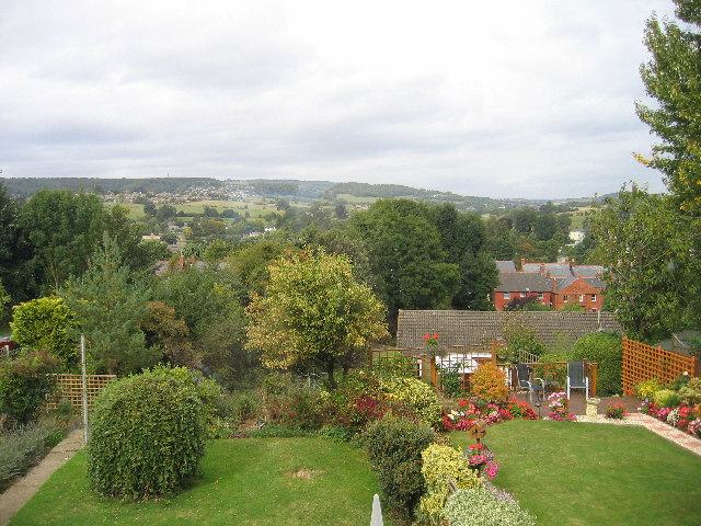
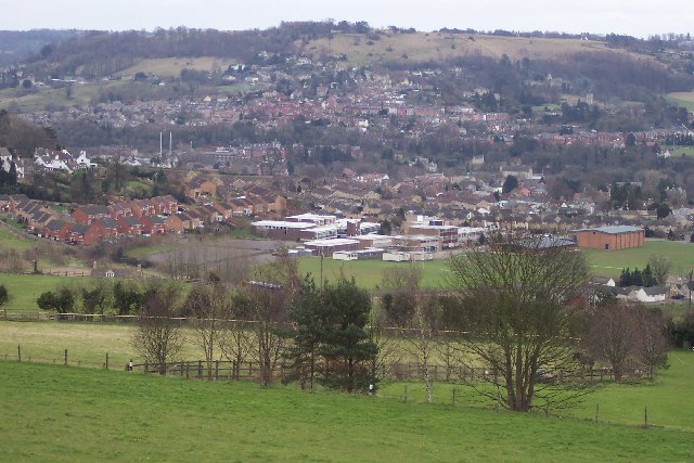
Paganhill is a residential area located in the county of Gloucestershire, England. It is situated on the outskirts of the town of Stroud and is part of the civil parish of Rodborough. Paganhill is nestled within the beautiful Cotswolds, a designated Area of Outstanding Natural Beauty.

The area is primarily residential, consisting of a mix of housing types, including detached and semi-detached houses, as well as some apartment complexes. Paganhill offers a range of housing options to cater to different needs and budgets.

The community of Paganhill benefits from various amenities and services. There are several local shops, including convenience stores and small businesses, providing essential goods and services to residents. Additionally, the area has a primary school, providing education for young children.

Paganhill is well-connected to the rest of Gloucestershire and beyond. The A46 road runs through the area, providing easy access to nearby towns and cities. The town of Stroud is just a short drive away and offers a wider range of amenities, including supermarkets, leisure facilities, and a train station with regular services to London and other major cities.

The surrounding countryside offers plenty of opportunities for outdoor activities, such as walking, hiking, and cycling. Paganhill benefits from its proximity to the Cotswolds, allowing residents to enjoy the stunning landscapes and picturesque villages that this area is renowned for.

Overall, Paganhill is a residential area with a close-knit community, offering a peaceful and picturesque setting within the beautiful Cotswolds.

If you have any feedback on the listing, please let us know in the comments section below.

Paganhill Images

Images are sourced within 2km of 51.748642/-2.232314 or Grid Reference SO8405. Thanks to Geograph Open Source API. All images are credited.

Finger Post, Walkley Hill, Stroud In the parish of Rodborough opposite the "Prince Albert" pub. To the right is Dudbridge (board read Gloucester 13in 2011), to the left is Minchinhampton and towards the camera (North) is down Rodborough Hill to Stroud.
View prior to 2015 is <a href="https://www.geograph.org.uk/photo/7676215">SO8404 : Finger Post, Walkley Hill, Stroud</a>.

Inscription (was): [Minchinhampton / Cirencester] // [Stroud] // Cainscross 1 / Gloucester 13

Milestone Society National ID: tbc
Finger Post, Walkley Hill, Stroud
In the parish of Rodborough opposite the "Prince Albert" pub. To the right is Dudbridge (board read Gloucester 13in 2011), to the left is Minchinhampton and towards the camera (North) is down Rodborough Hill to Stroud. View prior to 2015 is SO8404 : Finger Post, Walkley Hill, Stroud. Inscription (was): [Minchinhampton / Cirencester] // [Stroud] // Cainscross 1 / Gloucester 13 Milestone Society National ID: tbc
Finger Post, Walkley Hill, Stroud From 2011, in the parish of Rodborough opposite the "Prince Albert" pub. To the right is Dudbridge and Gloucester, to the left is Minchinhampton and towards the camera (North) is down Rodborough Hill to Stroud.
2023 view is <a href="https://www.geograph.org.uk/photo/7674397">SO8404 : Finger Post, Walkley Hill, Stroud</a>.

Inscription (was): [Minchinhampton / Cirencester] // [Stroud] // Cainscross 1 / Gloucester 13

Milestone Society National ID: tbc
Finger Post, Walkley Hill, Stroud
From 2011, in the parish of Rodborough opposite the "Prince Albert" pub. To the right is Dudbridge and Gloucester, to the left is Minchinhampton and towards the camera (North) is down Rodborough Hill to Stroud. 2023 view is SO8404 : Finger Post, Walkley Hill, Stroud. Inscription (was): [Minchinhampton / Cirencester] // [Stroud] // Cainscross 1 / Gloucester 13 Milestone Society National ID: tbc
Stroud junior School This sign saying  "Danger children at Play" struck me a rather amusing and beyond the wall can be seen a snippet of Stroud.
Stroud junior School
This sign saying "Danger children at Play" struck me a rather amusing and beyond the wall can be seen a snippet of Stroud.
Rodborough Fort
Rodborough Fort
Performance outside Stroud Subscription Rooms Skate Naked perform outside the 'Sub Rooms'
Performance outside Stroud Subscription Rooms
Skate Naked perform outside the 'Sub Rooms'
Stratford Park Lido View through turnstiles of 1930's open air lido with cast concrete diving boards and the modern leisure centre next door in Stratford Park, Stroud, Gloucestershire.
Stratford Park Lido
View through turnstiles of 1930's open air lido with cast concrete diving boards and the modern leisure centre next door in Stratford Park, Stroud, Gloucestershire.
Rodborough Hill View from Rodborough Hill looking north over Beeches Green with Whiteshill in the distance.
Rodborough Hill
View from Rodborough Hill looking north over Beeches Green with Whiteshill in the distance.
St Laurence Church Stroud parish church, St Laurence through the early morning mist shortly before 9am. The foreground wall is alongside Landsdown road and past that is Bank Gardens.
St Laurence Church
Stroud parish church, St Laurence through the early morning mist shortly before 9am. The foreground wall is alongside Landsdown road and past that is Bank Gardens.
Dudbridge Cycle Track Former Midland Railway line linking Nailsworth and Stonehouse now a cycle track. The bridge is where the B4066 climbs towards Selsley.
Dudbridge Cycle Track
Former Midland Railway line linking Nailsworth and Stonehouse now a cycle track. The bridge is where the B4066 climbs towards Selsley.
Stroud view General view of Stroud. The clump of buildings in the centre of the picture belong to Archway School. The pair of white lines looking like a giant rugby goal are chimney stacks belonging to the Millikan factory, a wool cloth mill. The hill in the background is Rodborough Hill.
Stroud view
General view of Stroud. The clump of buildings in the centre of the picture belong to Archway School. The pair of white lines looking like a giant rugby goal are chimney stacks belonging to the Millikan factory, a wool cloth mill. The hill in the background is Rodborough Hill.
Ebley Mill Ebley mill is next to the Stroudwater canal. This particular bit of the mill is now a fitness club. The canal is being restored and excavated and this viewpoint will soon only be possible from a boat.
Ebley Mill
Ebley mill is next to the Stroudwater canal. This particular bit of the mill is now a fitness club. The canal is being restored and excavated and this viewpoint will soon only be possible from a boat.
Selsley The B4066 road rises through Selsley a bit too steeply for this cyclist. Randwick rises across the other side of the valley.
Selsley
The B4066 road rises through Selsley a bit too steeply for this cyclist. Randwick rises across the other side of the valley.
Dudbridge Cycle Track The railway line ran between Dudbridge and Stroud and is viewed from the Dudbridge End. Nowadays it's the best made bit of cycle track in Stroud, it's a pity the access is by a flight of stairs. The road bridge carries traffic between Dudbridge Hill and Dudbridge.
Dudbridge Cycle Track
The railway line ran between Dudbridge and Stroud and is viewed from the Dudbridge End. Nowadays it's the best made bit of cycle track in Stroud, it's a pity the access is by a flight of stairs. The road bridge carries traffic between Dudbridge Hill and Dudbridge.
River Frome in Stroud Bend in the River Frome showing the remains of an old water mill. It's in the shadow of a railway viaduct, and just over the road from Waitrose.
River Frome in Stroud
Bend in the River Frome showing the remains of an old water mill. It's in the shadow of a railway viaduct, and just over the road from Waitrose.
Whiteshill Church Whiteshill church is situated at the southern end of Whiteshill and just north of Stroud. The church was opened in 1840.
Whiteshill Church
Whiteshill church is situated at the southern end of Whiteshill and just north of Stroud. The church was opened in 1840.
Whiteshill village Whiteshill village is 2Km north of Stroud. The Cotswold Way path is 1Km to the west in Standish woods.
Whiteshill village
Whiteshill village is 2Km north of Stroud. The Cotswold Way path is 1Km to the west in Standish woods.
Randwick church Randwick parish church lies just below Standish wood and is 1Km north of Stroud.
Randwick church
Randwick parish church lies just below Standish wood and is 1Km north of Stroud.
Cotswold Way path in Standish woods The Cotswold Way path as it runs south-west through Standish woods. Taken in late April with a late spring the floor of the wood was covered in Wild Garlic and Bluebells.
Cotswold Way path in Standish woods
The Cotswold Way path as it runs south-west through Standish woods. Taken in late April with a late spring the floor of the wood was covered in Wild Garlic and Bluebells.
Show me another place!

Paganhill is located at Grid Ref: SO8405 (Lat: 51.748642, Lng: -2.232314)

Administrative County: Gloucestershire

District: Stroud

Police Authority: Gloucestershire

What 3 Words

///crafts.fails.milk. Near Stroud, Gloucestershire

Nearby Locations

Beeches Green Paganhill

Related Wikis

Stroud High School

Stroud High School (SHS) is a grammar school with academy status for girls aged 11 to 18 located in Stroud, Gloucestershire, England == History == Stroud...

Downfield Crossing Halt railway station

Downfield Crossing Halt was on what is now the Golden Valley Line between Stroud and Stonehouse. == History == The line was opened in 1845 as the Cheltenham...

Marling School

Marling School is a grammar school with academy status for boys, with a co-educational Sixth Form located in Stroud, Gloucestershire, England. It is on...

Archway School

Archway School is a comprehensive co-educational school for pupils aged 11 to 18 in Stroud, Gloucestershire, England. The headteacher is Kieron Smith....

Stratford Park

Stratford Park is a green flag awarded area of Stroud in Gloucestershire, south west England. With a large park and lake, and a leisure centre complex...

Painswick Stream

Painswick Stream is a small river in Gloucestershire, England. It is a tributary of the River Frome, and flows generally southwards, passing around the...

Cotswold Canals Trust

The Cotswold Canals Trust is a British registered charity that aims to protect and restore the Stroudwater Navigation and the Thames and Severn Canal....

Stroud railway station

Stroud railway station serves the market town of Stroud in Gloucestershire, England. It is a stop on the Gloucester–Swindon Golden Valley Line and was...

Nearby Amenities

Located within 500m of 51.748642,-2.232314
Gannicox Crossing
Crossing Barrier: gate
Railway: crossing
Lat/Long: 51.7470678/-2.2285095
Mini Roundabout
Direction: clockwise
Lat/Long: 51.7488543/-2.2373098
Mini Roundabout
Direction: clockwise
Lat/Long: 51.7482238/-2.2290469
Mini Roundabout
Direction: clockwise
Lat/Long: 51.7481955/-2.2269458
Mini Roundabout
Direction: clockwise
Lat/Long: 51.7484535/-2.2254966
Crossing
Crossing: traffic_signals
Crossing Ref: pelican
Lat/Long: 51.7477461/-2.2317977
Crossing
Crossing: traffic_signals
Crossing Island: yes
Crossing Ref: pelican
Lat/Long: 51.7487926/-2.2368119
Post Box
Collection Times: Mo-Fr 09:00; Sa 07:00
Operator: Royal Mail
Operator Wikidata: Q638098
Post Box Type: lamp
Ref: GL5 286D
Royal Cypher: EIIR
Royal Cypher Wikidata: Q33102113
Survey Date: 2017-05-12
Lat/Long: 51.7458484/-2.2278857
Post Box
Operator: Royal Mail
Operator Wikidata: Q638098
Post Box Type: lamp
Postal Code: GL5
Ref: GL5 118
Royal Cypher: EIIR
Lat/Long: 51.7477086/-2.2322745
Post Box
Collection Times: Mo-Fr 09:00; Sa 07:00
Collection Times Checked: 2015-10-30
Operator: Royal Mail
Operator Wikidata: Q638098
Post Box Type: lamp
Ref: GL5 32D
Royal Cypher: EIIR
Royal Cypher Wikidata: Q33102113
Lat/Long: 51.7450324/-2.2314685
Bus Stop
Archway School Grounds
Bus: yes
Naptan AtcoCode: 1600GL132
Naptan Bearing: S
Naptan CommonName: Archway School Grounds
Naptan NaptanCode: glodagwt
Naptan PlusbusZoneRef: STRUD
Naptan Street: Off Park End
Naptan Verified: no
Public Transport: platform
Source: naptan_import
Lat/Long: 51.7497067/-2.2387416
Bus Stop
Upfield Prep School
Bus: yes
Naptan AtcoCode: 1600GL2514
Naptan Bearing: E
Naptan CommonName: Upfield Prep School
Naptan Indicator: Opp
Naptan NaptanCode: glodagwm
Naptan PlusbusZoneRef: STRUD
Naptan Street: Park End
Naptan Verified: no
Public Transport: platform
Source: naptan_import
Lat/Long: 51.7490591/-2.2388686
Bus Stop
Church of the Holy Spirit
Bus: yes
Naptan AtcoCode: 1600GL3683
Naptan Bearing: E
Naptan CommonName: Church of the Holy Spirit
Naptan NaptanCode: glodajgw
Naptan PlusbusZoneRef: STRUD
Naptan Street: Stratford Rd
Naptan Verified: no
Public Transport: platform
Source: naptan_import
Lat/Long: 51.7487316/-2.2363174
Bus Stop
Church of the Holy Spirit
Bus: yes
Naptan AtcoCode: 1600GL3684
Naptan Bearing: W
Naptan CommonName: Church of the Holy Spirit
Naptan Indicator: Opp
Naptan NaptanCode: glodajma
Naptan PlusbusZoneRef: STRUD
Naptan Street: Stratford Rd
Naptan Verified: no
Public Transport: platform
Source: naptan_import
Lat/Long: 51.7486148/-2.2362878
Bus Stop
Lodgemore Lane
Bench: yes
Bus: yes
Naptan AtcoCode: 1600GL857
Naptan Bearing: W
Naptan CommonName: Lodgemore Lane
Naptan NaptanCode: glodapjd
Naptan PlusbusZoneRef: STRUD
Naptan Street: Cainscross Rd
Naptan Verified: no
Public Transport: platform
Shelter: no
Source: naptan_import
Lat/Long: 51.7449499/-2.229939
Bus Stop
Beard's Lane
Bench: no
Bin: no
Bus: yes
Naptan AtcoCode: 1600GL858
Naptan Bearing: E
Naptan CommonName: Beard's Lane
Naptan NaptanCode: glodapda
Naptan PlusbusZoneRef: STRUD
Naptan ShortCommonName: Stop G
Naptan Street: Cainscross Rd
Naptan Verified: no
Public Transport: platform
Shelter: no
Source: naptan_import
Tactile Paving: no
Lat/Long: 51.7449726/-2.2321263
Bus Stop
Marling School School Stop
Bus: yes
Naptan AtcoCode: 1600GLA06108
Naptan CommonName: Marling School School Stop
Naptan NaptanCode: glogpgaj
Naptan PlusbusZoneRef: STRUD
Naptan ShortCommonName: Stop N
Naptan Street: Cainscross Rd
Naptan Verified: no
Public Transport: platform
Source: naptan_import
Lat/Long: 51.7450834/-2.235183
Bus Stop
Beard's Lane School Stop
Bus: yes
Naptan AtcoCode: 1600GLA06110
Naptan CommonName: Beard's Lane School Stop
Naptan NaptanCode: glogpgam
Naptan PlusbusZoneRef: STRUD
Naptan ShortCommonName: Stop E
Naptan Street: Cainscross Rd
Naptan Verified: no
Public Transport: platform
Source: naptan_import
Lat/Long: 51.7450814/-2.2316343
Bus Stop
Lodgemore Lane School Stop
Bus: yes
Naptan AtcoCode: 1600GLA06111
Naptan CommonName: Lodgemore Lane School Stop
Naptan NaptanCode: glogpgap
Naptan PlusbusZoneRef: STRUD
Naptan ShortCommonName: Stop B
Naptan Street: Cainscross Rd
Naptan Verified: no
Public Transport: platform
Shelter: no
Source: naptan_import
Lat/Long: 51.7449594/-2.2296783
Bus Stop
Beard's Lane School Stop
Bus: yes
Naptan AtcoCode: 1600GLA06112
Naptan Bearing: E
Naptan CommonName: Beard's Lane School Stop
Naptan NaptanCode: glogpgat
Naptan PlusbusZoneRef: STRUD
Naptan ShortCommonName: Stop F
Naptan Street: Cainscross Rd
Naptan Verified: no
Public Transport: platform
Source: naptan_import
Lat/Long: 51.7450809/-2.2318951
Bus Stop
Lodgemore Lane School Stop
Bus: yes
Naptan AtcoCode: 1600GLA06113
Naptan Bearing: W
Naptan CommonName: Lodgemore Lane School Stop
Naptan NaptanCode: glogpgaw
Naptan PlusbusZoneRef: STRUD
Naptan ShortCommonName: Stop A
Naptan Street: Cainscross Rd
Naptan Verified: no
Public Transport: platform
Shelter: no
Source: naptan_import
Lat/Long: 51.744969/-2.2293452
Bus Stop
Beard's Lane School Stop
Bus: yes
Naptan AtcoCode: 1600GLA06114
Naptan CommonName: Beard's Lane School Stop
Naptan NaptanCode: glogpgda
Naptan PlusbusZoneRef: STRUD
Naptan ShortCommonName: Stop H
Naptan Street: Cainscross Rd
Naptan Verified: no
Public Transport: platform
Source: naptan_import
Lat/Long: 51.7450711/-2.2323295
Bus Stop
Beard's Lane
Bus: yes
Naptan AtcoCode: 1600GLA06115
Naptan Bearing: W
Naptan CommonName: Beard's Lane
Naptan Indicator: Opp
Naptan NaptanCode: glogpgdg
Naptan PlusbusZoneRef: STRUD
Naptan ShortCommonName: Stop D
Naptan Street: Cainscross Rd
Naptan Verified: no
Public Transport: platform
Shelter: no
Source: naptan_import
Lat/Long: 51.7449022/-2.2313293
Bus Stop
Beard's Lane School Stop
Bus: yes
Naptan AtcoCode: 1600GLA06116
Naptan CommonName: Beard's Lane School Stop
Naptan NaptanCode: glogpgdj
Naptan PlusbusZoneRef: STRUD
Naptan ShortCommonName: Stop I
Naptan Street: Cainscross Rd
Naptan Verified: no
Public Transport: platform
Shelter: no
Source: naptan_import
Lat/Long: 51.7449918/-2.2326649
Bus Stop
Beard's Lane School Stop
Bus: yes
Naptan AtcoCode: 1600GLA06117
Naptan CommonName: Beard's Lane School Stop
Naptan NaptanCode: glogpgdm
Naptan PlusbusZoneRef: STRUD
Naptan ShortCommonName: Stop J
Naptan Street: Cainscross Rd
Naptan Verified: no
Public Transport: platform
Shelter: no
Source: naptan_import
Lat/Long: 51.7450028/-2.2328726
Bus Stop
Beard's Lane School Stop
Bus: yes
Naptan AtcoCode: 1600GLA06118
Naptan CommonName: Beard's Lane School Stop
Naptan NaptanCode: glogpgdp
Naptan PlusbusZoneRef: STRUD
Naptan ShortCommonName: Stop K
Naptan Street: Cainscross Rd
Naptan Verified: no
Public Transport: platform
Shelter: no
Source: naptan_import
Lat/Long: 51.7450082/-2.23312
Bus Stop
Downfield Hotel School Stop
Bus: yes
Naptan AtcoCode: 1600GLA06119
Naptan CommonName: Downfield Hotel School Stop
Naptan NaptanCode: glogpgdt
Naptan PlusbusZoneRef: STRUD
Naptan ShortCommonName: Stop L
Naptan Street: Cainscross Rd
Naptan Verified: no
Public Transport: platform
Shelter: no
Source: naptan_import
Lat/Long: 51.7450383/-2.2335927
Bus Stop
Downfield Rd School Stop
Bus: yes
Naptan AtcoCode: 1600GLA06121
Naptan CommonName: Downfield Rd School Stop
Naptan NaptanCode: glogpgja
Naptan PlusbusZoneRef: STRUD
Naptan ShortCommonName: Stop M
Naptan Street: Cainscross Rd
Naptan Verified: no
Public Transport: platform
Shelter: no
Source: naptan_import
Lat/Long: 51.7450438/-2.2340257
Bus Stop
SGS College
Bus: yes
Naptan AtcoCode: 1600GLA36689
Naptan Bearing: SW
Naptan CommonName: Stroud College
Naptan Indicator: Opp
Naptan NaptanCode: glogmgmw
Naptan PlusbusZoneRef: STRUD
Naptan Street: Stratford Rd
Naptan Verified: no
Public Transport: platform
Source: naptan_import
Lat/Long: 51.7481445/-2.2285791
Bus Stop
SGS College
Bus: yes
Naptan AtcoCode: 1600GLA36789
Naptan Bearing: E
Naptan CommonName: Stroud College
Naptan NaptanCode: glogmpja
Naptan PlusbusZoneRef: STRUD
Naptan Street: Stratford Rd
Naptan Verified: no
Public Transport: platform
Source: naptan_import
Lat/Long: 51.7482713/-2.2280728
Bus Stop
Stroud College
Bus: yes
Naptan AtcoCode: 1600GLA90860
Naptan Bearing: SE
Naptan CommonName: Stroud College
Naptan NaptanCode: glogpdaw
Naptan PlusbusZoneRef: STRUD
Naptan ShortCommonName: Kb Coaches Only
Naptan Street: Off Stratford Rd
Naptan Verified: no
Public Transport: platform
Source: naptan_import
Lat/Long: 51.7493331/-2.2276725
Bus Stop
Beard's Lane
Bus: yes
Naptan AtcoCode: 1600GLS223
Naptan Bearing: W
Naptan CommonName: Beard's Ln
Naptan NaptanCode: glodamwj
Naptan PlusbusZoneRef: STRUD
Naptan Street: Stratford Rd
Naptan Verified: no
Public Transport: platform
Source: naptan_import
Lat/Long: 51.7477499/-2.232604
Bus Stop
Beard's Lane
Bus: yes
Naptan AtcoCode: 1600GLS224
Naptan Bearing: E
Naptan CommonName: Beard's Ln
Naptan Indicator: Opp
Naptan NaptanCode: glodapgp
Naptan PlusbusZoneRef: STRUD
Naptan Street: Stratford Rd
Naptan Verified: no
Public Transport: platform
Source: naptan_import
Lat/Long: 51.7477963/-2.2318945
Bus Stop
Mill Farm Drive
Bus: yes
Naptan AtcoCode: 1600GLS225
Naptan Bearing: SW
Naptan CommonName: Mill Farm Drive
Naptan Indicator: Opp
Naptan NaptanCode: glodajat
Naptan PlusbusZoneRef: STRUD
Naptan Street: Paganhill Lane
Naptan Verified: no
Public Transport: platform
Source: naptan_import
Lat/Long: 51.7479195/-2.2377472
Bus Stop
Mill Farm Drive
Bus: yes
Naptan AtcoCode: 1600GLS226
Naptan Bearing: NE
Naptan CommonName: Mill Farm Drive
Naptan NaptanCode: glodajap
Naptan PlusbusZoneRef: STRUD
Naptan Street: Paganhill Lane
Naptan Verified: no
Public Transport: platform
Source: naptan_import
Lat/Long: 51.7477842/-2.2379493
Bus Stop
Farm Hill Crescent
Bus: yes
Naptan AtcoCode: 1600GLS405
Naptan Bearing: S
Naptan CommonName: Farmhill Crescent
Naptan NaptanCode: glodamjw
Naptan PlusbusZoneRef: STRUD
Naptan Street: Farmhill Lane
Naptan Verified: no
Public Transport: platform
Source: naptan_import
Lat/Long: 51.7522109/-2.2338112
Bus Stop
Farm Hill Crescent
Bus: yes
Naptan AtcoCode: 1600GLS406
Naptan Bearing: N
Naptan CommonName: Farmhill Crescent
Naptan NaptanCode: glodamjt
Naptan PlusbusZoneRef: STRUD
Naptan Street: Farmhill Lane
Naptan Verified: no
Public Transport: platform
Source: naptan_import
Lat/Long: 51.7530074/-2.2338479
Bus Stop
Memorial Arch
Bus: yes
Naptan AtcoCode: 1600GLS407
Naptan Bearing: SW
Naptan CommonName: Anti-slavery Memorial Arch
Naptan NaptanCode: glodajpj
Naptan PlusbusZoneRef: STRUD
Naptan Street: Farmhill Ln
Naptan Verified: no
Public Transport: platform
Source: naptan_import
Lat/Long: 51.7501799/-2.2359483
Bus Stop
Memorial Arch
Bus: yes
Naptan AtcoCode: 1600GLS408
Naptan Bearing: NE
Naptan CommonName: Anti-slavery Memorial Arch
Naptan NaptanCode: glodajmt
Naptan PlusbusZoneRef: STRUD
Naptan Street: Farmhill Lane
Naptan Verified: no
Public Transport: platform
Source: naptan_import
Lat/Long: 51.7505401/-2.2357039
Bus Stop
Upfield Prep School
Bus: yes
Naptan AtcoCode: 1600GLS546
Naptan Bearing: W
Naptan CommonName: Upfield Prep School
Naptan NaptanCode: glogamtw
Naptan PlusbusZoneRef: STRUD
Naptan Street: Park End
Naptan Verified: no
Public Transport: platform
Source: naptan_import
Lat/Long: 51.7489962/-2.2388682
Crossing
Crossing: traffic_signals
Crossing Ref: pelican
Lat/Long: 51.7449722/-2.2309307
Barrier: lift_gate
Lat/Long: 51.7503948/-2.2284693
Crossing
Bicycle: yes
Crossing: unmarked
Crossing Island: no
Lat/Long: 51.7482972/-2.2269527
Crossing
Crossing Island: no
Lat/Long: 51.7486555/-2.2254282
Power: pole
Lat/Long: 51.750623/-2.2296096
Power: pole
Lat/Long: 51.7501794/-2.2307745
Power: pole
Lat/Long: 51.7517887/-2.2301688
Power: pole
Lat/Long: 51.7512571/-2.2303668
Power: pole
Lat/Long: 51.751605/-2.2307852
Power: pole
Lat/Long: 51.7501307/-2.2290303
Crossing
Crossing: traffic_signals
Crossing Island: no
Crossing Ref: pelican
Lat/Long: 51.7450132/-2.2360607
Parking
Fee: no
Note: temporary? maths classrooms here 2014
Operator: Marling School
Operator Type: private
Parking: surface
Lat/Long: 51.746294/-2.2346028
Post Box
Collection Times: Mo-Fr 17:00; Sa 12:00
Collection Times Checked: 2015-10-11
Operator: Royal Mail
Operator Wikidata: Q638098
Post Box Type: pillar
Ref: GL5 284
Royal Cypher: EIIR
Royal Cypher Wikidata: Q33102113
Lat/Long: 51.7488291/-2.2367464
Atm
Brand: RBS
Brand Wikidata: Q160126
Official Name: Royal Bank of Scotland
Operator: RBS
Operator Wikidata: Q160126
Lat/Long: 51.7489867/-2.2367727
Man Made: flagpole
Lat/Long: 51.749147/-2.2376924
Post Box
Collection Times: Mo-Fr 17:15; Sa 12:00
Collection Times Checked: 2015-10-11
Operator: Royal Mail
Operator Wikidata: Q638098
Post Box Type: wall
Ref: GL5 134
Royal Cypher: GR
Royal Cypher Wikidata: Q33102273
Lat/Long: 51.7521069/-2.233997
Post Box
Collection Times: Mo-Fr 09:00; Sa 07:00
Collection Times Checked: 2015-10-11
Operator: Royal Mail
Operator Wikidata: Q638098
Post Box Type: wall
Ref: GL5 112D
Royal Cypher: GVIR
Royal Cypher Wikidata: Q33102169
Lat/Long: 51.7494001/-2.2353597
Telephone
Booth: KX300
Covered: booth
Lat/Long: 51.74966/-2.2366656
Gannicox Crossing
Crossing Barrier: gate
Railway: crossing
Lat/Long: 51.7470984/-2.2285058
Waste Basket
Waste: dog_excrement
Lat/Long: 51.7460642/-2.2280262
Waste Basket
Lat/Long: 51.7460595/-2.2279944
Power: substation
Lat/Long: 51.7459843/-2.2280272
Bench
Backrest: yes
Lat/Long: 51.7507424/-2.2278781
Bench
Backrest: no
Lat/Long: 51.7510007/-2.2276361
Crossing
Bicycle: yes
Lat/Long: 51.7483602/-2.22921
Post Office
Paganhill Post Office
Addr City: Stroud
Addr Housename: Maypole Hall
Addr Postcode: GL5 4AN
Addr Village: Paganhill
Brand: Post Office
Brand Wikidata: Q1783168
Brand Wikipedia: en:Post Office Ltd
Contact Website: https://www.postoffice.co.uk/branch-finder/3195236/paganhill
Note: Counter in Maypole Hall
Opening Hours: Mo-Fr 09:00-13:00,14:00-17:30; Sa 09:00-12:30; Su off
Operator: Post Office Ltd
Ref Pol Id: 12707
Source: local knowledge
Source Ref: pol_branch_list_2019‑10‑29
Lat/Long: 51.7490283/-2.2363632
Defibrillator
Access: yes
Defibrillator Location: On external wall to right of main entrance.
Emergency: defibrillator
Indoor: no
Not Ref GB The Circuit: 115B523B-35B0-4119-A1EB-B03000DA7708
Operator: Community Heartbeat
Ref: CHT-9848
Source: local knowledge
Lat/Long: 51.748831/-2.2365337
Anti-Slavery Memorial Arch
Historic: memorial
Memorial: archway
Lat/Long: 51.7503346/-2.2361993
Barrier: bollard
Lat/Long: 51.7479985/-2.230635
Speed Camera
Direction: 290
Maxspeed: 30 mph
Lat/Long: 51.7449612/-2.2350972
Speed Camera
Direction: 100
Maxspeed: 30 mph
Lat/Long: 51.7450174/-2.2308443
Kindergarten
Seasons Nursery
Lat/Long: 51.7488022/-2.2314618
Generator Method: photovoltaic
Generator Output Electricity: yes
Generator Source: solar
Generator Type: solar_photovoltaic_panel
Location: roof
Power: generator
Lat/Long: 51.7448571/-2.2294199
Generator Method: photovoltaic
Generator Output Electricity: yes
Generator Source: solar
Generator Type: solar_photovoltaic_panel
Location: roof
Power: generator
Lat/Long: 51.7448596/-2.2292966
Generator Method: photovoltaic
Generator Output Electricity: yes
Generator Source: solar
Generator Type: solar_photovoltaic_panel
Location: roof
Power: generator
Lat/Long: 51.7523323/-2.2325045
Generator Method: photovoltaic
Generator Output Electricity: yes
Generator Source: solar
Generator Type: solar_photovoltaic_panel
Location: roof
Power: generator
Lat/Long: 51.7523339/-2.2324401
Generator Method: photovoltaic
Generator Output Electricity: yes
Generator Source: solar
Generator Type: solar_photovoltaic_panel
Location: roof
Power: generator
Lat/Long: 51.7525033/-2.2334459
Generator Method: photovoltaic
Generator Output Electricity: yes
Generator Source: solar
Generator Type: solar_photovoltaic_panel
Location: roof
Power: generator
Lat/Long: 51.7525365/-2.2334459
Generator Method: photovoltaic
Generator Output Electricity: yes
Generator Source: solar
Generator Type: solar_photovoltaic_panel
Location: roof
Power: generator
Lat/Long: 51.750979/-2.2318152
Generator Method: photovoltaic
Generator Output Electricity: yes
Generator Source: solar
Generator Type: solar_photovoltaic_panel
Location: roof
Power: generator
Lat/Long: 51.7507996/-2.2316945
Generator Method: photovoltaic
Generator Output Electricity: yes
Generator Source: solar
Generator Type: solar_photovoltaic_panel
Location: roof
Power: generator
Lat/Long: 51.7507232/-2.2319707
Generator Method: photovoltaic
Generator Output Electricity: yes
Generator Source: solar
Generator Type: solar_photovoltaic_panel
Location: roof
Power: generator
Lat/Long: 51.7502699/-2.2328988
Generator Method: photovoltaic
Generator Output Electricity: yes
Generator Source: solar
Generator Type: solar_photovoltaic_panel
Location: roof
Power: generator
Lat/Long: 51.7497817/-2.2319707
Generator Method: photovoltaic
Generator Output Electricity: yes
Generator Source: solar
Generator Type: solar_photovoltaic_panel
Location: roof
Power: generator
Lat/Long: 51.7467478/-2.2281982
Generator Method: photovoltaic
Generator Output Electricity: yes
Generator Source: solar
Generator Type: solar_photovoltaic_panel
Location: roof
Power: generator
Lat/Long: 51.7478903/-2.22931
Generator Method: photovoltaic
Generator Output Electricity: yes
Generator Source: solar
Generator Type: solar_photovoltaic_panel
Location: roof
Power: generator
Lat/Long: 51.747349/-2.2308482
Generator Method: photovoltaic
Generator Output Electricity: yes
Generator Source: solar
Generator Type: solar_photovoltaic_panel
Location: roof
Power: generator
Lat/Long: 51.7473207/-2.2307865
Generator Method: photovoltaic
Generator Output Electricity: yes
Generator Source: solar
Generator Type: solar_photovoltaic_panel
Location: roof
Power: generator
Lat/Long: 51.747623/-2.2304097
Generator Method: photovoltaic
Generator Output Electricity: yes
Generator Source: solar
Generator Type: solar_photovoltaic_panel
Location: roof
Power: generator
Lat/Long: 51.7474976/-2.2317857
Generator Method: photovoltaic
Generator Output Electricity: yes
Generator Source: solar
Generator Type: solar_photovoltaic_panel
Location: roof
Power: generator
Lat/Long: 51.7474054/-2.232931
Generator Method: photovoltaic
Generator Output Electricity: yes
Generator Source: solar
Generator Type: solar_photovoltaic_panel
Location: roof
Power: generator
Lat/Long: 51.7481162/-2.2343498
Generator Method: photovoltaic
Generator Output Electricity: yes
Generator Source: solar
Generator Type: solar_photovoltaic_panel
Location: roof
Power: generator
Lat/Long: 51.7494961/-2.2327673
Generator Method: photovoltaic
Generator Output Electricity: yes
Generator Source: solar
Generator Type: solar_photovoltaic_panel
Location: roof
Power: generator
Lat/Long: 51.7491125/-2.2329766
Generator Method: photovoltaic
Generator Output Electricity: yes
Generator Source: solar
Generator Type: solar_photovoltaic_panel
Location: roof
Power: generator
Lat/Long: 51.7489083/-2.2344089
Generator Method: photovoltaic
Generator Output Electricity: yes
Generator Source: solar
Generator Type: solar_photovoltaic_panel
Location: roof
Power: generator
Lat/Long: 51.7505589/-2.2361335
Generator Method: photovoltaic
Generator Output Electricity: yes
Generator Source: solar
Generator Type: solar_photovoltaic_panel
Location: roof
Power: generator
Lat/Long: 51.7506037/-2.2362381
Generator Method: photovoltaic
Generator Output Electricity: yes
Generator Source: solar
Generator Type: solar_photovoltaic_panel
Location: roof
Power: generator
Lat/Long: 51.750876/-2.2367263
Generator Method: photovoltaic
Generator Output Electricity: yes
Generator Source: solar
Generator Type: solar_photovoltaic_panel
Location: roof
Power: generator
Lat/Long: 51.7511832/-2.23645
Generator Method: photovoltaic
Generator Output Electricity: yes
Generator Source: solar
Generator Type: solar_photovoltaic_panel
Location: roof
Power: generator
Lat/Long: 51.7518424/-2.2364017
Generator Method: photovoltaic
Generator Output Electricity: yes
Generator Source: solar
Generator Type: solar_photovoltaic_panel
Location: roof
Power: generator
Lat/Long: 51.7517295/-2.2349761
Generator Method: photovoltaic
Generator Output Electricity: yes
Generator Source: solar
Generator Type: solar_photovoltaic_panel
Location: roof
Power: generator
Lat/Long: 51.7475266/-2.2385046
Generator Method: photovoltaic
Generator Output Electricity: yes
Generator Source: solar
Generator Type: solar_photovoltaic_panel
Location: roof
Power: generator
Lat/Long: 51.7448164/-2.2342064
Generator Method: photovoltaic
Generator Output Electricity: yes
Generator Source: solar
Generator Type: solar_photovoltaic_panel
Location: roof
Power: generator
Lat/Long: 51.7468076/-2.2332233
Generator Method: photovoltaic
Generator Output Electricity: yes
Generator Source: solar
Generator Type: solar_photovoltaic_panel
Location: roof
Power: generator
Lat/Long: 51.7452067/-2.2344437
Generator Method: photovoltaic
Generator Output Electricity: yes
Generator Source: solar
Generator Type: solar_photovoltaic_panel
Location: roof
Power: generator
Lat/Long: 51.745225/-2.2289211
The data included in this document is from www.openstreetmap.org. The data is made available under ODbL.

Have you been to Paganhill?

Leave your review of Paganhill below (or comments, questions and feedback).