Sow Dale

Valley in Lincolnshire East Lindsey

England

Sow Dale

Bolingbroke Castle: aerial 2021 (1) See <span class="nowrap"><a title="https://www.english-heritage.org.uk/visit/places/bolingbroke-castle/history" rel="nofollow ugc noopener" href="https://www.english-heritage.org.uk/visit/places/bolingbroke-castle/history">Link</a><img style="margin-left:2px;" alt="External link" title="External link - shift click to open in new window" src="https://s1.geograph.org.uk/img/external.png" width="10" height="10"/></span>
Bolingbroke Castle: aerial 2021 (1) Credit: Simon Tomson

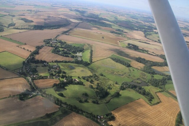
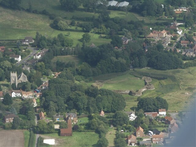
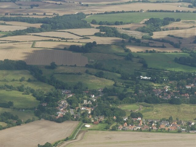
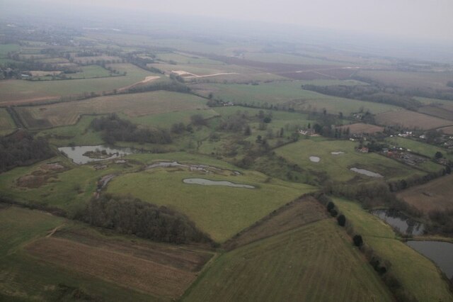
Sow Dale, also known as Sow Valley, is a picturesque area located in the county of Lincolnshire, England. Nestled in the Lincolnshire Wolds, it is surrounded by rolling hills and beautiful countryside. The valley is named after the small stream that runs through it, known as the Sow Beck.

Sow Dale is renowned for its natural beauty and tranquility. The lush green meadows and fields provide a stunning backdrop for nature lovers and photographers alike. The area is abundant in wildlife, with various species of birds, butterflies, and small mammals calling it home.

The valley is dotted with charming cottages and farmhouses, giving it a quaint and traditional feel. Many of these buildings date back to the 18th and 19th centuries, adding to the area's historical appeal. Sow Dale is a popular spot for walkers and hikers, with numerous footpaths and trails winding through the valley and surrounding hills.

The nearby village of Sowthorpe offers amenities such as a pub and a small convenience store, serving as a hub for locals and visitors alike. The village also hosts an annual summer fair, attracting people from the surrounding areas.

Overall, Sow Dale is a hidden gem in Lincolnshire, offering a peaceful and idyllic setting for those seeking a break from the hustle and bustle of everyday life. With its stunning landscapes, rich wildlife, and charming architecture, it is a must-visit destination for anyone exploring the Lincolnshire Wolds.

If you have any feedback on the listing, please let us know in the comments section below.
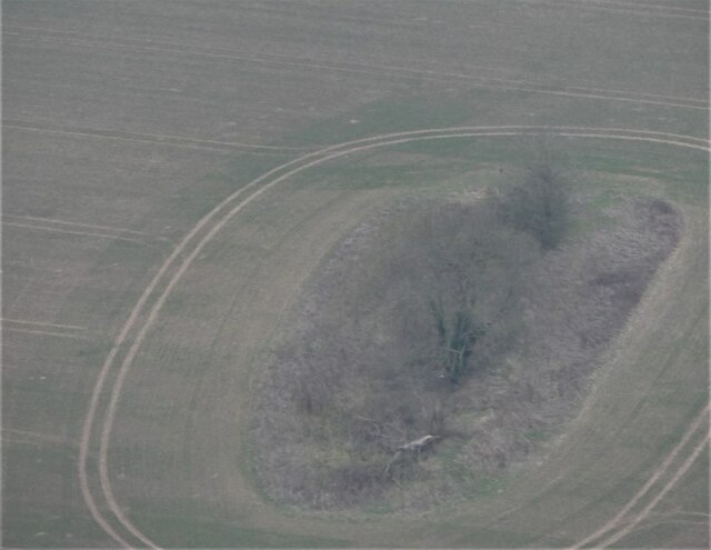
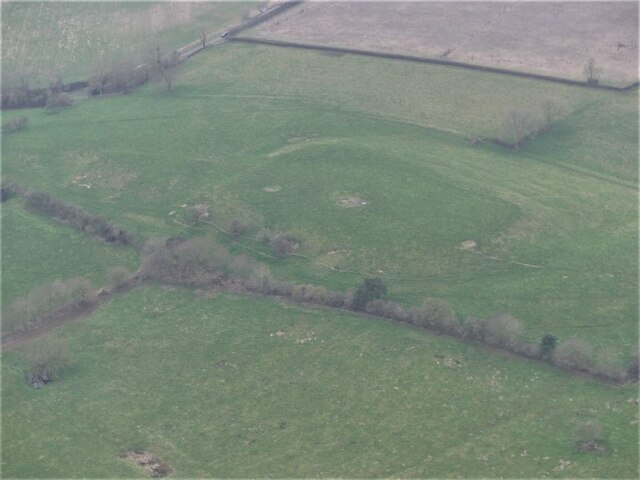
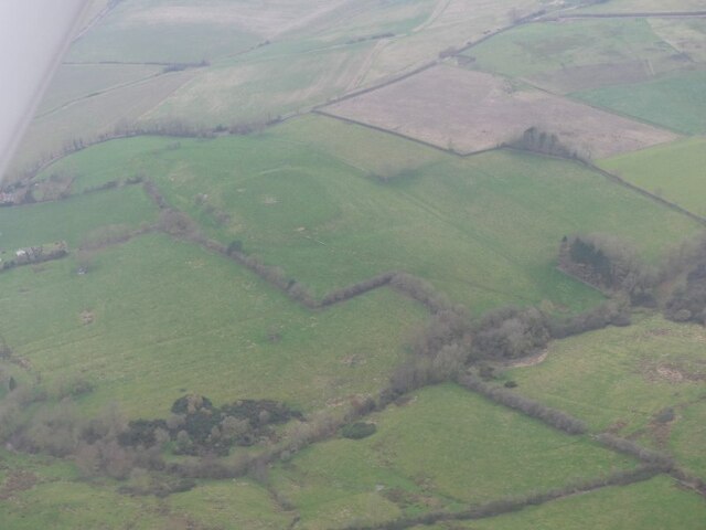
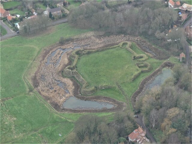
Sow Dale Images

Images are sourced within 2km of 53.177976/0.015670847 or Grid Reference TF3466. Thanks to Geograph Open Source API. All images are credited.

Bolingbroke Castle: aerial 2021 (1) See <span class="nowrap"><a title="https://www.english-heritage.org.uk/visit/places/bolingbroke-castle/history" rel="nofollow ugc noopener" href="https://www.english-heritage.org.uk/visit/places/bolingbroke-castle/history">Link</a><img style="margin-left:2px;" alt="External link" title="External link - shift click to open in new window" src="https://s1.geograph.org.uk/img/external.png" width="10" height="10"/></span>
Bolingbroke Castle: aerial 2021 (1)
See LinkExternal link
Bolingbroke Castle: aerial 2021 (2) See <span class="nowrap"><a title="https://www.english-heritage.org.uk/visit/places/bolingbroke-castle/history" rel="nofollow ugc noopener" href="https://www.english-heritage.org.uk/visit/places/bolingbroke-castle/history">Link</a><img style="margin-left:2px;" alt="External link" title="External link - shift click to open in new window" src="https://s1.geograph.org.uk/img/external.png" width="10" height="10"/></span>
Bolingbroke Castle: aerial 2021 (2)
See LinkExternal link
Bolingbroke Castle: aerial 2021 (3) Rout Yard See <span class="nowrap"><a title="https://www.english-heritage.org.uk/visit/places/bolingbroke-castle/history" rel="nofollow ugc noopener" href="https://www.english-heritage.org.uk/visit/places/bolingbroke-castle/history">Link</a><img style="margin-left:2px;" alt="External link" title="External link - shift click to open in new window" src="https://s1.geograph.org.uk/img/external.png" width="10" height="10"/></span>
Bolingbroke Castle: aerial 2021 (3) Rout Yard
See LinkExternal link
Mavis Enderby: aerial 2021
Bolingbroke Castle: aerial 2021 (1)
Bolingbroke Castle: aerial 2021 (2)
Bolingbroke Castle: aerial 2021 (3)
Bolingbroke Castle: aerial 2021 (4)
Bolingbroke Castle: aerial 2021 (5)
Bolingbroke Castle: aerial 2021 (6)
Direction Sign – Signpost at Hareby, Bolingbroke parish Located on the west side of a T junction at Hareby in Bolingbroke parish. 3 arms and no finial.

Milestone Society National ID: LI_TF3365
Direction Sign – Signpost at Hareby, Bolingbroke parish
Located on the west side of a T junction at Hareby in Bolingbroke parish. 3 arms and no finial. Milestone Society National ID: LI_TF3365
Direction Sign – Signpost on Horncastle Hill, Old Bolingbroke Located by the war memorial in Old Bolingbroke on a grass triangle in the centre of the junction of Hagnaby Road and Horncastle Hill, Bolingbroke parish. 3 arms and no finial. See also <a title="https://www.geograph.org.uk/photo/6047643" href="https://www.geograph.org.uk/photo/6047643">Link</a>.

Milestone Society National ID: LI_TF3465
Direction Sign – Signpost on Horncastle Hill, Old Bolingbroke
Located by the war memorial in Old Bolingbroke on a grass triangle in the centre of the junction of Hagnaby Road and Horncastle Hill, Bolingbroke parish. 3 arms and no finial. See also Link. Milestone Society National ID: LI_TF3465
Possible barrow near Northfield Farm, Mavis Enderby: aerial 2022
Even older Old Bolingbroke: Dewy Hill, aerial 2022 (1) Suggested site of an early medieval fortified settlement, later used for an 11/12th century fortified hall. Examined by M W Thompson in 1965 and identified as the remains of an 11th-12th century fortified hall, the forerunner of the hexagonal Bolingbroke Castle (see <a href="https://www.geograph.org.uk/photo/4058083">TF3464 : Bolingbroke village and castle site: aerial 2014</a>).

See: <span class="nowrap"><a title="https://www.heritagegateway.org.uk/Gateway/Results_Single.aspx?uid=e49416b6-5177-45c3-8a03-2547716fba09&resourceID=19191" rel="nofollow ugc noopener" href="https://www.heritagegateway.org.uk/Gateway/Results_Single.aspx?uid=e49416b6-5177-45c3-8a03-2547716fba09&resourceID=19191">Link</a><img style="margin-left:2px;" alt="External link" title="External link - shift click to open in new window" src="https://s1.geograph.org.uk/img/external.png" width="10" height="10"/></span>
Even older Old Bolingbroke: Dewy Hill, aerial 2022 (1)
Suggested site of an early medieval fortified settlement, later used for an 11/12th century fortified hall. Examined by M W Thompson in 1965 and identified as the remains of an 11th-12th century fortified hall, the forerunner of the hexagonal Bolingbroke Castle (see TF3464 : Bolingbroke village and castle site: aerial 2014). See: LinkExternal link
Even older Old Bolingbroke: Dewy Hill, aerial 2022 (2) Suggested site of an early medieval fortified settlement, later used for an 11/12th century fortified hall. Examined by M W Thompson in 1965 and identified as the remains of an 11th-12th century fortified hall, the forerunner of the hexagonal Bolingbroke Castle (see <a href="https://www.geograph.org.uk/photo/4058083">TF3464 : Bolingbroke village and castle site: aerial 2014</a>).

See: <span class="nowrap"><a title="https://www.heritagegateway.org.uk/Gateway/Results_Single.aspx?uid=e49416b6-5177-45c3-8a03-2547716fba09&resourceID=19191" rel="nofollow ugc noopener" href="https://www.heritagegateway.org.uk/Gateway/Results_Single.aspx?uid=e49416b6-5177-45c3-8a03-2547716fba09&resourceID=19191">Link</a><img style="margin-left:2px;" alt="External link" title="External link - shift click to open in new window" src="https://s1.geograph.org.uk/img/external.png" width="10" height="10"/></span>
Even older Old Bolingbroke: Dewy Hill, aerial 2022 (2)
Suggested site of an early medieval fortified settlement, later used for an 11/12th century fortified hall. Examined by M W Thompson in 1965 and identified as the remains of an 11th-12th century fortified hall, the forerunner of the hexagonal Bolingbroke Castle (see TF3464 : Bolingbroke village and castle site: aerial 2014). See: LinkExternal link
Old Bolingbroke Castle: aerial 2022 For details see <a href="https://www.geograph.org.uk/photo/4058083">TF3464 : Bolingbroke village and castle site: aerial 2014</a>.

For site of possible earlier fortification see <a href="https://www.geograph.org.uk/photo/7081384">TF3465 : Even older Old Bolingbroke: Dewy Hill, aerial 2022 (1)</a>.
Old Bolingbroke Castle: aerial 2022
Old Bolingbroke Castle and Rout Yard: aerial 2022 For details see <a href="https://www.geograph.org.uk/photo/4058083">TF3464 : Bolingbroke village and castle site: aerial 2014</a>.

For site of possible earlier fortification see <a href="https://www.geograph.org.uk/photo/7081384">TF3465 : Even older Old Bolingbroke: Dewy Hill, aerial 2022 (1)</a>.
Old Bolingbroke Castle and Rout Yard: aerial 2022
Fields NE of Mavis Enderby: aerial 2022
Show me another place!

Sow Dale is located at Grid Ref: TF3466 (Lat: 53.177976, Lng: 0.015670847)

Administrative County: Lincolnshire

District: East Lindsey

Police Authority: Lincolnshire

What 3 Words

///establish.northward.foot. Near Spilsby, Lincolnshire

Related Wikis

Hareby

Hareby is a small village and former civil parish, now in the parish of Bolingbroke, in the East Lindsey district of Lincolnshire, England. It is situated...

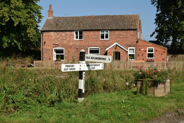
Bolingbroke, Lincolnshire

Bolingbroke, now called Old Bolingbroke, is a village and civil parish in the East Lindsey district of Lincolnshire, England. Its present boundaries were...

Mavis Enderby

Mavis Enderby is a hamlet and civil parish in the East Lindsey district of Lincolnshire, England. It lies in the Lincolnshire Wolds, 4.5 miles (7 km) east...
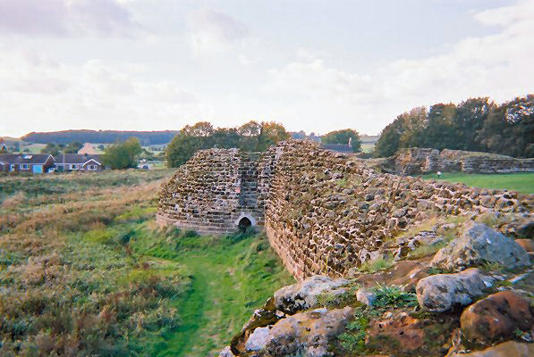
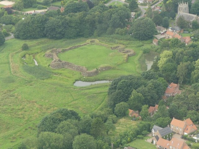
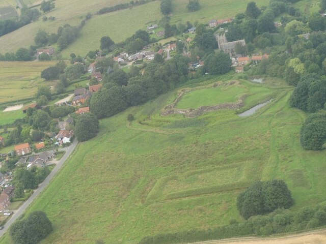
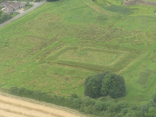
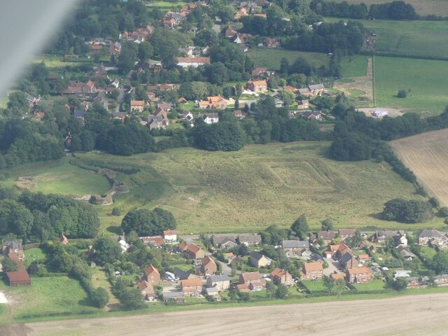
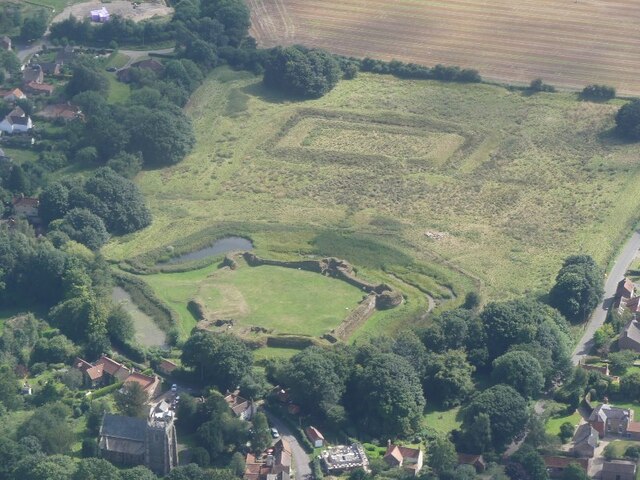
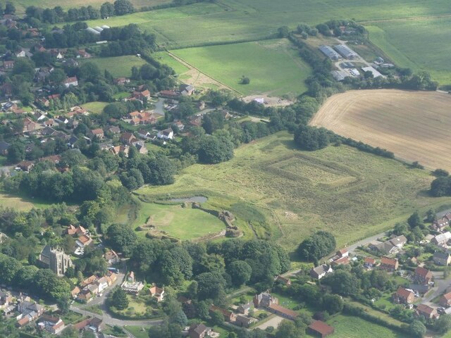
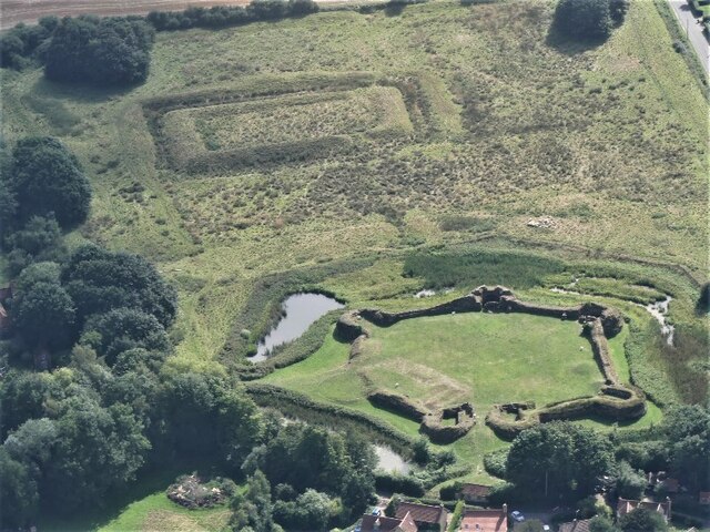
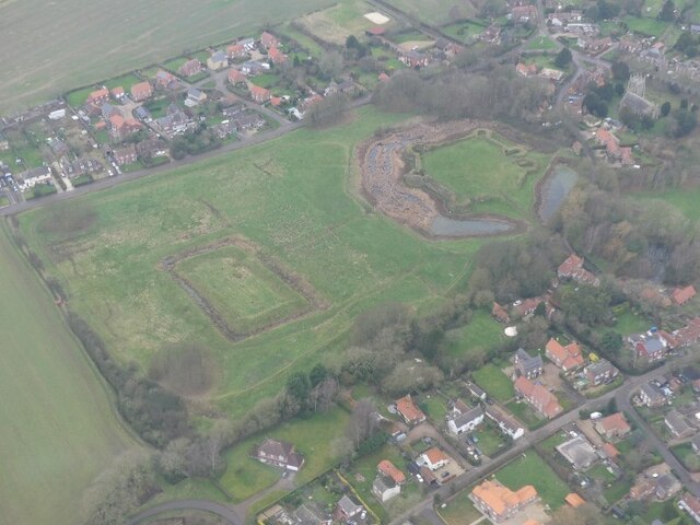
Bolingbroke Castle

Bolingbroke Castle is a ruined castle in Bolingbroke (now Old Bolingbroke) in Lincolnshire, England. == Construction == Most of the castle is built of...

Lusby, Lincolnshire

Lusby is a village and former civil parish, now in the parish of Lusby with Winceby, in the East Lindsey district of Lincolnshire, England. It is situated...

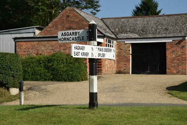
Asgarby, East Lindsey

Asgarby is a hamlet and former civil parish, now in the parish of Lusby with Winceby, in the East Lindsey district of Lincolnshire, England. It lies just...

Snipe Dales

Snipe Dales is a country park and nature reserve in the Lincolnshire Wolds near Hagworthingham in Lincolnshire, England. The reserve is one of the few...

Raithby by Spilsby

Raithby by Spilsby or Raithby is a village and civil parish in the East Lindsey district of Lincolnshire, England. It is situated about 2 miles (3.2 km...

Nearby Amenities

Located within 500m of 53.177976,0.015670847
Sow Dale
Place: locality
Source: Bing
Lat/Long: 53.1778032/0.0158146
The data included in this document is from www.openstreetmap.org. The data is made available under ODbL.

Have you been to Sow Dale?

Leave your review of Sow Dale below (or comments, questions and feedback).