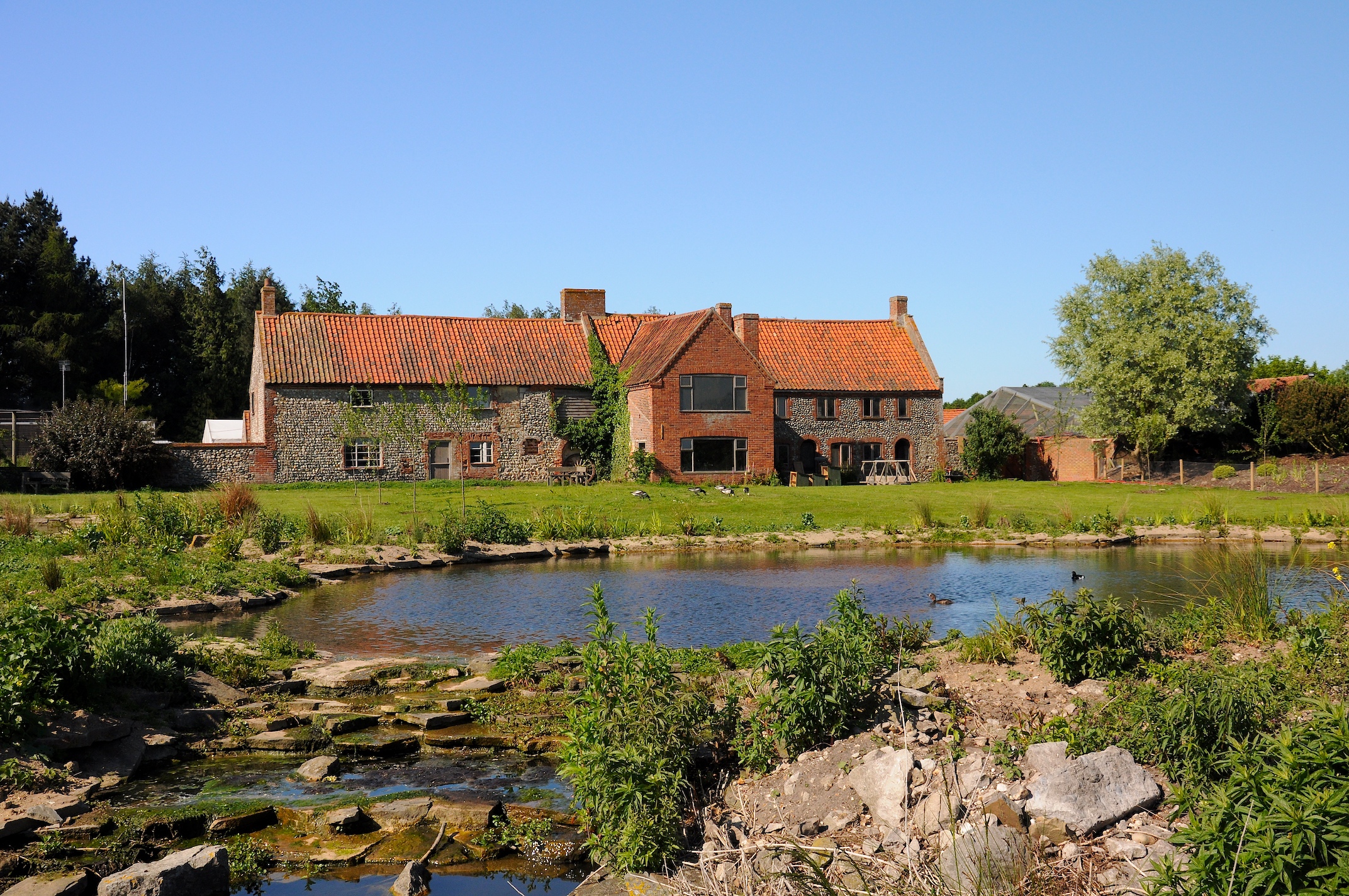
Barts Lake

Lake, Pool, Pond, Freshwater Marsh in Norfolk North Norfolk

England

Barts Lake

The Millennium Garden, Pensthorpe Natural Park
The Millennium Garden, Pensthorpe Natural Park Credit: Nigel Thompson

Barts Lake, located in Norfolk, is a freshwater marsh that serves as an important ecological feature in the region. Spanning across an area of approximately 50 acres, this natural wonder is characterized by its diverse plant and animal life, making it a haven for both wildlife enthusiasts and nature lovers.

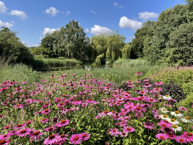
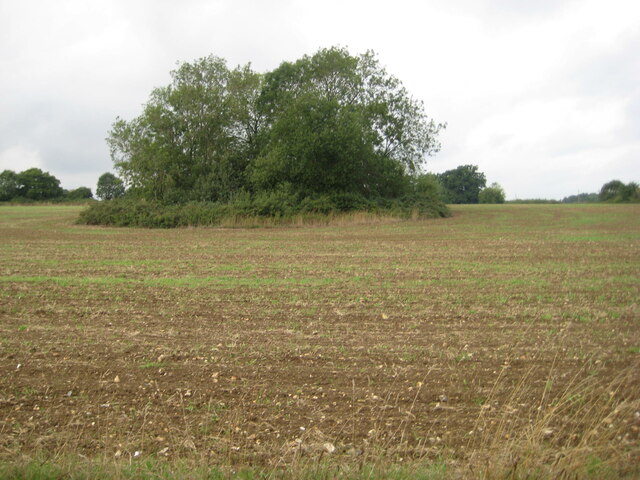
The lake is predominantly surrounded by dense vegetation, including cattails, reeds, and various types of grasses. These plants not only provide a picturesque backdrop but also play a crucial role in maintaining the ecological balance of the lake. They serve as habitats and breeding grounds for a wide range of animal species, including waterfowls, amphibians, and insects.

Barts Lake is known for its abundant birdlife, attracting numerous species throughout the year. Birdwatchers flock to the lake to catch a glimpse of various waterfowl, such as herons, egrets, and ducks. The lake's calm and serene environment also serves as a resting spot for migratory birds during their long journeys.

The lake itself is relatively shallow, with an average depth of around 5 feet. Its water is rich in nutrients, providing an ideal environment for fish, crustaceans, and other aquatic organisms. Anglers are often seen casting their rods in hopes of catching species like largemouth bass, bluegill, and catfish.

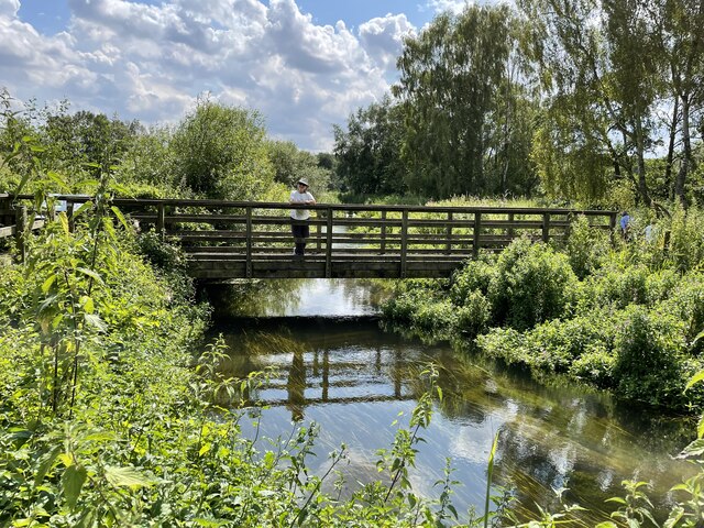
Barts Lake offers visitors the opportunity to explore its natural beauty through various recreational activities. Canoeing, kayaking, and paddleboarding are popular choices, allowing visitors to navigate through the calm waters while immersing themselves in the surrounding nature. Additionally, nature trails and observation platforms provide excellent vantage points for observing the lake's diverse wildlife.

Overall, Barts Lake is a remarkable freshwater marsh that showcases the beauty and importance of Norfolk's natural ecosystems. Its abundance of flora and fauna make it a truly captivating destination for those seeking to connect with nature and explore the wonders of the area.

If you have any feedback on the listing, please let us know in the comments section below.

Barts Lake Images

Images are sourced within 2km of 52.821745/0.89254555 or Grid Reference TF9428. Thanks to Geograph Open Source API. All images are credited.

The Millennium Garden, Pensthorpe Natural Park
The 'Kingfisher Bridge', Pensthorpe Natural Park
Ryburgh railway station (site), Norfolk Opened in 1849 by the Eastern Counties Railway, later part of the Great Eastern Railway, on the line from Wymondham to Wells, this station closed to passengers in 1964. Goods trains carried on until around 1980 after which the track was lifted.
View north west from the former level crossing towards the single platform, a short length of which survives to the left of the white van. The building to the left was the Station Master's house. As can be seen, the maltings in the background have extended across the track-bed.
Ryburgh railway station (site), Norfolk
Opened in 1849 by the Eastern Counties Railway, later part of the Great Eastern Railway, on the line from Wymondham to Wells, this station closed to passengers in 1964. Goods trains carried on until around 1980 after which the track was lifted. View north west from the former level crossing towards the single platform, a short length of which survives to the left of the white van. The building to the left was the Station Master's house. As can be seen, the maltings in the background have extended across the track-bed.
Abandoned field, Great Ryburgh
Old marl pit near Great Ryburgh A common sight in this part of Norfolk.
Old marl pit near Great Ryburgh
A common sight in this part of Norfolk.
Crisp Maltings, Great Ryburgh
Former chapel, Great Ryburgh
Former station house, Great Ryburgh The main buildings of Ryburgh station were bombed out in 1942.
Former station house, Great Ryburgh
The main buildings of Ryburgh station were bombed out in 1942.
War Memorial, Great Ryburgh Listed Grade II <span class="nowrap"><a title="https://historicengland.org.uk/listing/the-list/list-entry/1452673?section=official-list-entry" rel="nofollow ugc noopener" href="https://historicengland.org.uk/listing/the-list/list-entry/1452673?section=official-list-entry">Link</a><img style="margin-left:2px;" alt="External link" title="External link - shift click to open in new window" src="https://s1.geograph.org.uk/img/external.png" width="10" height="10"/></span>
War Memorial, Great Ryburgh
Listed Grade II LinkExternal link
Ryburgh Village Stores
The Old School, Great Ryburgh
The Blue Boar Inn, Great Ryburgh Eighteenth century inn <span class="nowrap"><a title="https://historicengland.org.uk/listing/the-list/list-entry/1049299?section=official-list-entry" rel="nofollow ugc noopener" href="https://historicengland.org.uk/listing/the-list/list-entry/1049299?section=official-list-entry">Link</a><img style="margin-left:2px;" alt="External link" title="External link - shift click to open in new window" src="https://s1.geograph.org.uk/img/external.png" width="10" height="10"/></span>
The Blue Boar Inn, Great Ryburgh
Eighteenth century inn LinkExternal link
Station Road, Great Ryburgh The Blue Boar Inn dates from the eighteenth century <span class="nowrap"><a title="https://historicengland.org.uk/listing/the-list/list-entry/1049299?section=official-list-entry" rel="nofollow ugc noopener" href="https://historicengland.org.uk/listing/the-list/list-entry/1049299?section=official-list-entry">Link</a><img style="margin-left:2px;" alt="External link" title="External link - shift click to open in new window" src="https://s1.geograph.org.uk/img/external.png" width="10" height="10"/></span> The house adjacent is a century or so older <span class="nowrap"><a title="https://historicengland.org.uk/listing/the-list/list-entry/1305345?section=official-list-entry" rel="nofollow ugc noopener" href="https://historicengland.org.uk/listing/the-list/list-entry/1305345?section=official-list-entry">Link</a><img style="margin-left:2px;" alt="External link" title="External link - shift click to open in new window" src="https://s1.geograph.org.uk/img/external.png" width="10" height="10"/></span>
Station Road, Great Ryburgh
The Blue Boar Inn dates from the eighteenth century LinkExternal link The house adjacent is a century or so older LinkExternal link
Round tower, St Andrew's church, Great Ryburgh The tower dates from about 1100 with the octagonal upper part of about 1300 <span class="nowrap"><a title="https://historicengland.org.uk/listing/the-list/list-entry/1305377?section=official-list-entry" rel="nofollow ugc noopener" href="https://historicengland.org.uk/listing/the-list/list-entry/1305377?section=official-list-entry">Link</a><img style="margin-left:2px;" alt="External link" title="External link - shift click to open in new window" src="https://s1.geograph.org.uk/img/external.png" width="10" height="10"/></span>
Round tower, St Andrew's church, Great Ryburgh
The tower dates from about 1100 with the octagonal upper part of about 1300 LinkExternal link
The churchyard, Great Ryburgh
Cottages, Great Ryburgh
Road Closed at Great Ryburgh Fakenham Road closed because of a burst water main. However no work seemed to be going on to repair the main and no vehicle took the slightest notice of the Road Closed sign.
Road Closed at Great Ryburgh
Fakenham Road closed because of a burst water main. However no work seemed to be going on to repair the main and no vehicle took the slightest notice of the Road Closed sign.
Memorial Hall, Great Ryburgh Note the flooded road in the foreground, the result of a burst water main.
Memorial Hall, Great Ryburgh
Note the flooded road in the foreground, the result of a burst water main.
Show me another place!

Barts Lake is located at Grid Ref: TF9428 (Lat: 52.821745, Lng: 0.89254555)

Administrative County: Norfolk

District: North Norfolk

Police Authority: Norfolk

What 3 Words

///darts.gradually.blazers. Near Fakenham, Norfolk

Related Wikis

Pensthorpe Natural Park

Pensthorpe Natural Park is located in Pensthorpe, Norfolk, England and is approximately one mile from Fakenham and close to the A1067 road. The park covers...

Great Ryburgh

Great Ryburgh is a village and former civil parish, now in the parish of Ryburgh, in the North Norfolk district, in the county of Norfolk, England. In...

Ryburgh railway station

Ryburgh railway station was a railway station in the village of Great Ryburgh in the English county of Norfolk. == History == The station opened in 1849...

Ryburgh

Ryburgh is a civil parish in the English county of Norfolk. The parish is 21.2 miles (34.1 km) south-west of Cromer, 23.1 miles (37.2 km) north-west of...

Testerton

Testerton is a small village and former civil parish, now in the parish of Pudding Norton, in the North Norfolk district, in the county of Norfolk, England...

Fakenham Town F.C.

Fakenham Town Football Club is a football club based in Fakenham, Norfolk, England. Affiliated to the Norfolk County Football Association, they are currently...

Fakenham East railway station

Fakenham East railway station was a railway station in the market town of Fakenham in the English county of Norfolk. The station was opened by the Norfolk...

Alethorpe

Alethorpe is a deserted medieval village site and former civil parish, now in the parish of Little Snoring, in the North Norfolk district, in the county...

Nearby Amenities

Located within 500m of 52.821745,0.89254555
Crossing
Lat/Long: 52.8246769/0.8887819
Parking
Wheelchair: yes
Lat/Long: 52.8250176/0.8883382
Toilets
Pensthorpe
Female: yes
Male: yes
Wheelchair: yes
Lat/Long: 52.824552/0.887471
Woodland Birds In The Wensum Way
Information: board
Tourism: information
Lat/Long: 52.8198769/0.8869287
Man Made: bug_hotel
Lat/Long: 52.8222043/0.8915281
Bench
Lat/Long: 52.8224118/0.8902126
Coppce Woodland In The Wensum Valley
Information: board
Tourism: information
Lat/Long: 52.8192543/0.8912551
Bench
Lat/Long: 52.8216827/0.8913223
Bench
Lat/Long: 52.8224784/0.8902016
Bench
Lat/Long: 52.8214182/0.8889258
Bench
Lat/Long: 52.8216294/0.8912004
Bench
Lat/Long: 52.821488/0.8888819
Bench
Lat/Long: 52.821896/0.8908014
Bench
Lat/Long: 52.8216177/0.8884531
Birds
Artist Name: Ros Newman
Artwork Type: sculpture
Tourism: artwork
Lat/Long: 52.8224082/0.8910703
Nest
Artist Name: Miles Halpin
Tourism: artwork
Lat/Long: 52.8224415/0.8915692
Organic Forms
Artist Name: Peter Clarke
Artwork Type: sculpture
Tourism: artwork
Lat/Long: 52.8222362/0.8911387
The data included in this document is from www.openstreetmap.org. The data is made available under ODbL.

Have you been to Barts Lake?

Leave your review of Barts Lake below (or comments, questions and feedback).