Morray Plantation

Wood, Forest in Yorkshire Craven

England

Morray Plantation

Fields in Ribblesdale, opposite Studfold Pen-y-Ghent can be seen in the distance.
Fields in Ribblesdale, opposite Studfold Credit: Stephen Craven

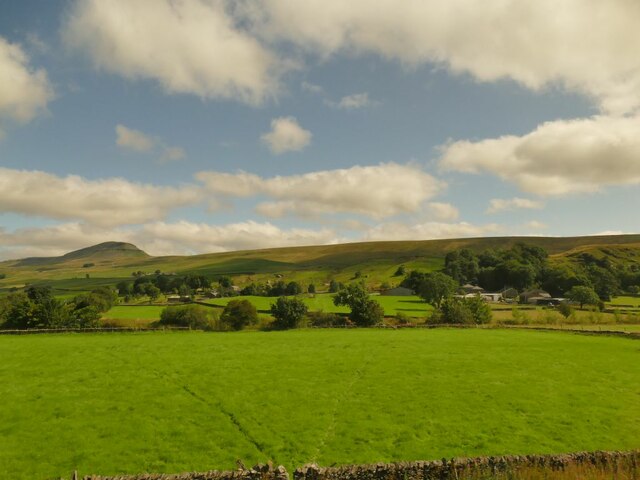
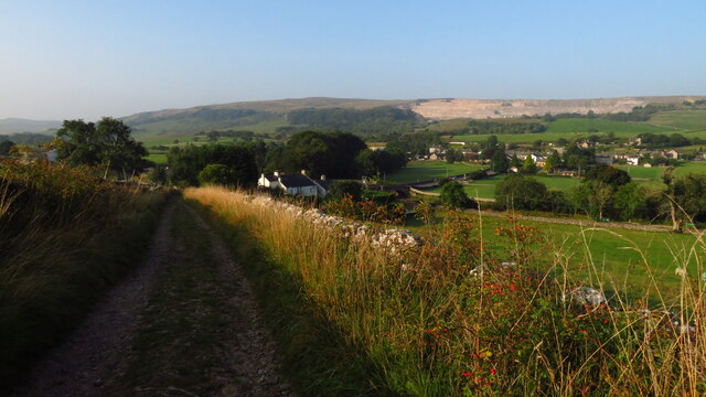
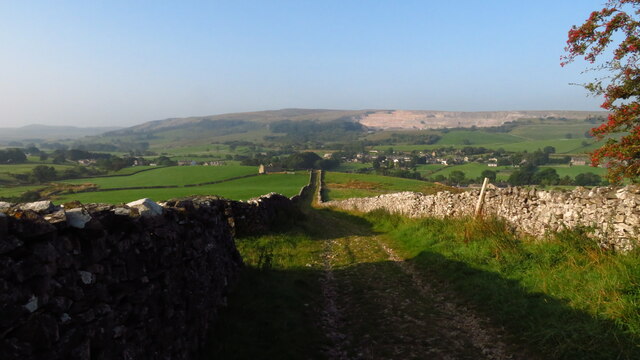
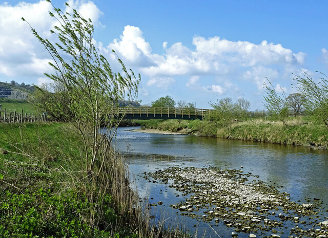
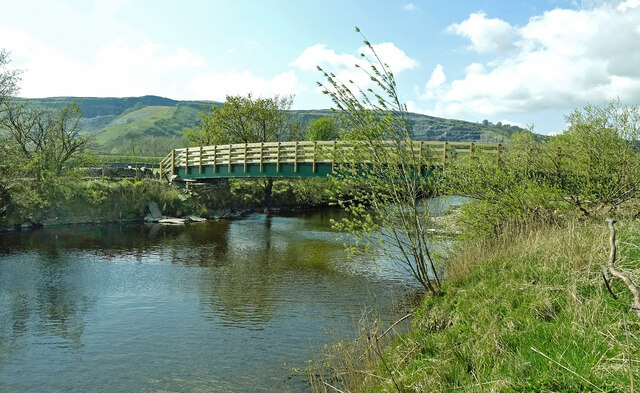
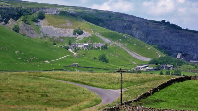
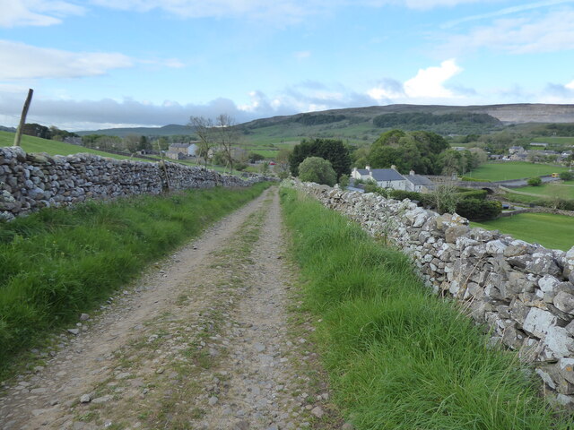
Morray Plantation, located in Yorkshire, is a picturesque woodland area encompassing acres of lush greenery and towering trees. Nestled within the region's diverse topography, this forested haven is renowned for its natural beauty and tranquil ambiance.

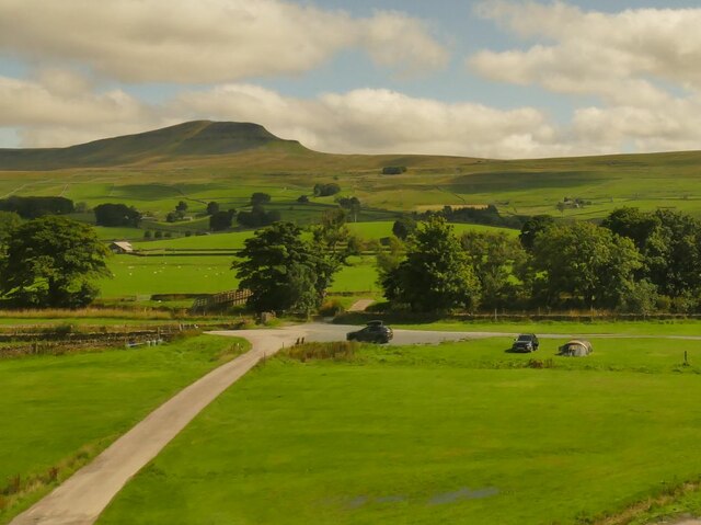
The plantation boasts a rich history dating back several centuries, originally serving as a hunting ground for local nobility. Today, it stands as a testament to the area's deep-rooted heritage, with remnants of old structures and pathways still visible throughout the forest.

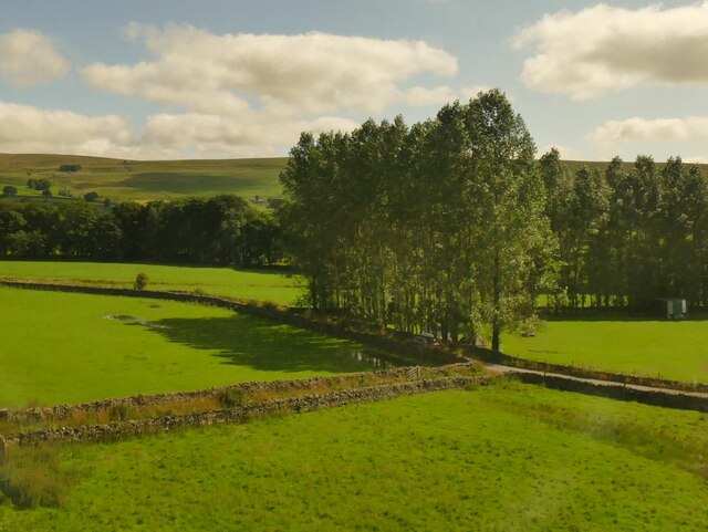
Morray Plantation is home to a wide array of tree species, including oak, birch, beech, and pine, creating a diverse and vibrant ecosystem. The verdant canopy provides a sanctuary for numerous bird species, making it a haven for birdwatchers and nature enthusiasts.

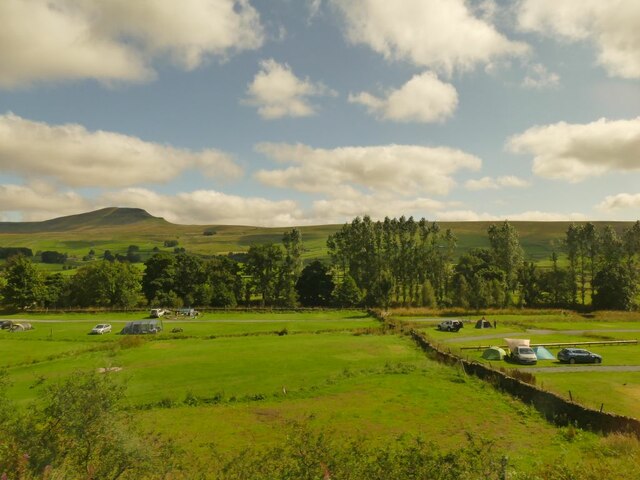
Visitors to Morray Plantation can enjoy a variety of recreational activities. The well-maintained network of trails offers opportunities for hiking, cycling, and horseback riding, allowing visitors to fully immerse themselves in the natural surroundings. There are also designated picnic areas that provide a perfect spot for a leisurely lunch amidst the serenity of the forest.

The plantation is open year-round, with each season offering its unique charm. In spring, the forest comes alive with colorful wildflowers, while autumn paints the landscape with a breathtaking tapestry of vibrant hues. Winter brings a sense of tranquility as the snow blankets the woodland, creating a serene and peaceful atmosphere.

Morray Plantation, with its captivating beauty and rich history, is a must-visit destination for nature enthusiasts and those seeking solace in Yorkshire's enchanting woodlands.

If you have any feedback on the listing, please let us know in the comments section below.

Morray Plantation Images

Images are sourced within 2km of 54.139638/-2.2889052 or Grid Reference SD8171. Thanks to Geograph Open Source API. All images are credited.

Fields in Ribblesdale, opposite Studfold Pen-y-Ghent can be seen in the distance.
Fields in Ribblesdale, opposite Studfold
Pen-y-Ghent can be seen in the distance.
Crag Hill Farm campsite (1) Pen-y-Ghent can be seen in the distance.
Crag Hill Farm campsite (1)
Pen-y-Ghent can be seen in the distance.
Crag Hill Farm campsite (2) Pen-y-Ghent can be seen in the distance.
Crag Hill Farm campsite (2)
Pen-y-Ghent can be seen in the distance.
Poplars alongside a country lane An unnamed lane heading south from Horton-in-Ribblesdale to serve a few farms and a campsite. The track front left leads to Garth House.
Poplars alongside a country lane
An unnamed lane heading south from Horton-in-Ribblesdale to serve a few farms and a campsite. The track front left leads to Garth House.
Ribble Way & Pennine Way leading south towards Horton in Ribblesddale
Horton-in-Ribblesdale Station A close-up of the line maintenance engines in the distance can be seen in <a href="https://www.geograph.org.uk/photo/7046846">SD8072 : Line maintenance near Horton-in-Ribblesdale Station</a>.
Horton-in-Ribblesdale Station
A close-up of the line maintenance engines in the distance can be seen in SD8072 : Line maintenance near Horton-in-Ribblesdale Station.
Horton-in-Ribblesdale Station A close-up of the freight train (which is involved in line maintenance) can be seen in <a href="https://www.geograph.org.uk/photo/7046840">SD8072 : Freight train near Horton-in-Ribblesdale Station</a>.
Horton-in-Ribblesdale Station
A close-up of the freight train (which is involved in line maintenance) can be seen in SD8072 : Freight train near Horton-in-Ribblesdale Station.
Freight train near Horton-in-Ribblesdale Station This train (involved in line maintenance) can be seen in context in <a href="https://www.geograph.org.uk/photo/7046835">SD8072 : Horton-in-Ribblesdale Station</a>.
Freight train near Horton-in-Ribblesdale Station
This train (involved in line maintenance) can be seen in context in SD8072 : Horton-in-Ribblesdale Station.
Line maintenance near Horton-in-Ribblesdale Station These can be seen in context in <a href="https://www.geograph.org.uk/photo/7046828">SD8072 : Horton-in-Ribblesdale Station</a>.
Line maintenance near Horton-in-Ribblesdale Station
These can be seen in context in SD8072 : Horton-in-Ribblesdale Station.
Beside the River Ribble This view wasn’t available on our previous visits as the footbridge had been washed away.
Beside the River Ribble
This view wasn’t available on our previous visits as the footbridge had been washed away.
Down the Ribble The downstream view taken from the new footbridge. The fishermen’s access path is on the right-hand bank. Fishing is private, controlled by the Manchester Anglers Association.
Down the Ribble
The downstream view taken from the new footbridge. The fishermen’s access path is on the right-hand bank. Fishing is private, controlled by the Manchester Anglers Association.
River Ribble viewed again Looking upstream from the new footbridge on a bright late-April afternoon. Arcow Quarry is shown in the background.
River Ribble viewed again
Looking upstream from the new footbridge on a bright late-April afternoon. Arcow Quarry is shown in the background.
New bridge across the Ribble Looking upstream towards this substantial new footbridge near Helwith Bridge.  <a href="https://www.geograph.org.uk/photo/5470938">SD8170 : Footbridge over the River Ribble</a> shows the previous bridge which was washed away.
New bridge across the Ribble
Looking upstream towards this substantial new footbridge near Helwith Bridge. SD8170 : Footbridge over the River Ribble shows the previous bridge which was washed away.
The new footbridge On our previous visits, we found that the old bridge had been washed away leaving no access to this side of the River Ribble. <a href="https://www.geograph.org.uk/photo/6862909">SD8170 : No footbridge over the River Ribble</a> shows what remained in June 2021. This lovely brand-new footbridge restores the footpath circuit around Helwith Bridge. Viewed looking upstream.
The new footbridge
On our previous visits, we found that the old bridge had been washed away leaving no access to this side of the River Ribble. SD8170 : No footbridge over the River Ribble shows what remained in June 2021. This lovely brand-new footbridge restores the footpath circuit around Helwith Bridge. Viewed looking upstream.
View to Foredale Cottages Cottages surrounded by quarries
View to Foredale Cottages
Cottages surrounded by quarries
The Pennine Way along the B6479 in Horton in Ribblesdale
The Pennine Way near Horton in Ribblesdale
Show me another place!

Morray Plantation is located at Grid Ref: SD8171 (Lat: 54.139638, Lng: -2.2889052)

Division: West Riding

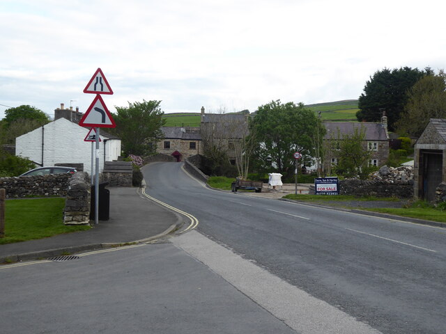
Administrative County: North Yorkshire

District: Craven

Police Authority: North Yorkshire

What 3 Words

///rumbles.remains.animates. Near Settle, North Yorkshire

Related Wikis

Ribblesdale

Ribblesdale is one of the Yorkshire Dales in England. It is the dale or upper valley of the River Ribble in North Yorkshire. Towns and villages in Ribblesdale...

Brackenbottom

Brackenbottom is a village in Ribblesdale, North Yorkshire, England. == External links == Media related to Brackenbottom at Wikimedia Commons

Horton in Ribblesdale

Horton in Ribblesdale is a small village and civil parish in the Craven district of North Yorkshire, England. It is situated in Ribblesdale on the Settle...

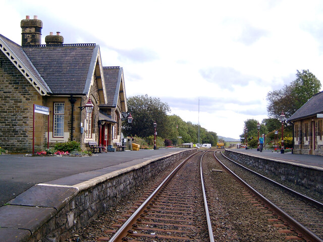
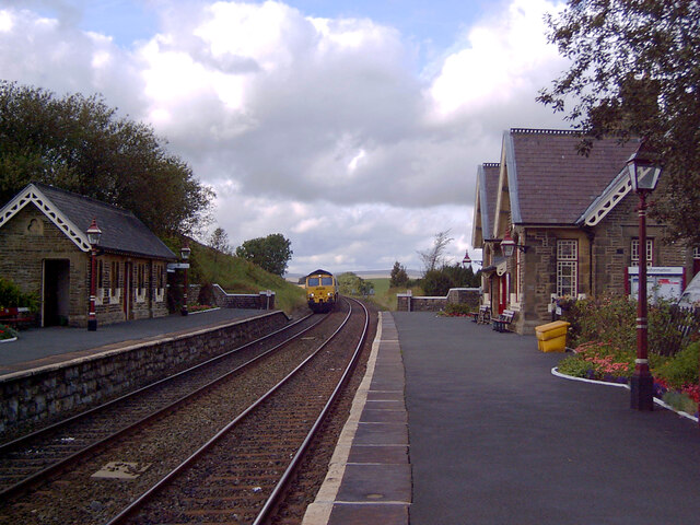
Horton-in-Ribblesdale railway station

Horton-in-Ribblesdale is a railway station on the Settle and Carlisle Line, which runs between Carlisle and Leeds via Settle. The station, situated 47...

Nearby Amenities

Located within 500m of 54.139638,-2.2889052
Natural: spring
Lat/Long: 54.1382639/-2.2844274
Barrier: cattle_grid
Lat/Long: 54.1415442/-2.2929895
Give Way
Direction: backward
Lat/Long: 54.1434651/-2.2896775
Power: pole
Lat/Long: 54.1425291/-2.2946638
Power: pole
Lat/Long: 54.1418048/-2.2945109
Power: pole
Lat/Long: 54.1409076/-2.2942749
Power: pole
Lat/Long: 54.1400592/-2.2940791
Power: pole
Lat/Long: 54.1392091/-2.2938458
Power: pole
Lat/Long: 54.1383072/-2.2936044
Power: pole
Lat/Long: 54.13741/-2.293363
Power: pole
Lat/Long: 54.1365771/-2.2930813
Power: pole
Lat/Long: 54.1357899/-2.2925476
Barrier: stile
Lat/Long: 54.1416122/-2.2931866
Barrier: stile
Lat/Long: 54.1419485/-2.2930695
Power: pole
Lat/Long: 54.1423513/-2.2844664
Power: pole
Lat/Long: 54.141969/-2.2851368
Power: pole
Lat/Long: 54.1414628/-2.2860571
Power: pole
Lat/Long: 54.1409252/-2.287008
Power: pole
Lat/Long: 54.1403443/-2.2863656
Power: pole
Lat/Long: 54.1398768/-2.2858506
Power: pole
Lat/Long: 54.1394796/-2.2848207
Power: pole
Lat/Long: 54.1387299/-2.2833906
Power: pole
Lat/Long: 54.1365867/-2.2839183
Power: pole
Lat/Long: 54.136412/-2.284808
Power: pole
Lat/Long: 54.1363373/-2.2855575
Power: pole
Lat/Long: 54.1362149/-2.2863732
Power: pole
Lat/Long: 54.1386112/-2.2819566
Power: pole
Lat/Long: 54.1408184/-2.2879105
Power: pole
Lat/Long: 54.1406422/-2.2892998
Power: pole
Lat/Long: 54.1405212/-2.2903399
Power: pole
Lat/Long: 54.140357/-2.291714
Power: pole
Lat/Long: 54.1401822/-2.293009
The data included in this document is from www.openstreetmap.org. The data is made available under ODbL.

Have you been to Morray Plantation?

Leave your review of Morray Plantation below (or comments, questions and feedback).