Mere Wood

Wood, Forest in Cheshire

England

Mere Wood

Church of St Martin On Blackcarr Road and apparently not in use with services transferred to the church hall
Church of St Martin Credit: Kevin Waterhouse

Mere Wood is a picturesque woodland located in the county of Cheshire, England. Situated near the village of Mere, the woodland covers an area of approximately 40 hectares and is a popular destination for nature enthusiasts and walkers alike.

The wood is predominantly composed of broadleaf trees, such as oak, beech, and birch, offering a diverse and vibrant canopy throughout the year. The forest floor is covered with an array of wildflowers, including bluebells and primroses, creating a stunning display during springtime.

Mere Wood is home to a variety of wildlife, making it a haven for nature lovers. Visitors may spot numerous bird species, including woodpeckers and owls, as well as mammals such as deer and foxes. The wood also boasts a rich insect population, with butterflies and dragonflies fluttering among the trees.

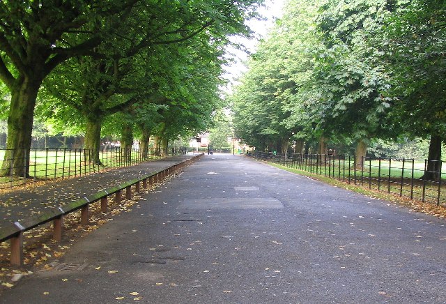
For those seeking tranquility and solitude, Mere Wood offers several walking trails that wind through the trees, providing a peaceful escape from the hustle and bustle of everyday life. The paths are well-maintained, making it accessible for all abilities, and there are benches and picnic areas scattered throughout the wood for visitors to relax and enjoy the surroundings.

Mere Wood is not only valued for its natural beauty but also for its historical significance. The wood is thought to have been in existence since medieval times and has witnessed centuries of change and development in the surrounding area.

Overall, Mere Wood is a cherished woodland in Cheshire, offering a captivating blend of nature, tranquility, and history to all who visit.

If you have any feedback on the listing, please let us know in the comments section below.

Mere Wood Images

Images are sourced within 2km of 53.404762/-2.2839134 or Grid Reference SJ8189. Thanks to Geograph Open Source API. All images are credited.

Church of St Martin On Blackcarr Road and apparently not in use with services transferred to the church hall
Church of St Martin
On Blackcarr Road and apparently not in use with services transferred to the church hall
Railway view towards Stockport From the bridge on Hall Lane across the Altrincham to Stockport line
Railway view towards Stockport
From the bridge on Hall Lane across the Altrincham to Stockport line
Fun bikes on running track The large fenced track in Wythenshawe Park
Fun bikes on running track
The large fenced track in Wythenshawe Park
Former bus garage, Bradnor Road, Manchester By G. Noel Hill, City Architect, 1938-42. A very innovative building. "A huge clear span of 296 by 185ft covers spaces for 100 buses". The concrete exterior employed the Chisarc system. "On completion it was handed over to Messrs. A.V. Roe for building Lancaster bombers." Grade II* listed.
It now sits in the Sharston Industrial Area and appears to be used for something.
Former bus garage, Bradnor Road, Manchester
By G. Noel Hill, City Architect, 1938-42. A very innovative building. "A huge clear span of 296 by 185ft covers spaces for 100 buses". The concrete exterior employed the Chisarc system. "On completion it was handed over to Messrs. A.V. Roe for building Lancaster bombers." Grade II* listed. It now sits in the Sharston Industrial Area and appears to be used for something.
Southmoor House, Southmoor Road, Manchester A 1930s block fronting Southmoor Industrial Estate. There is a further block to the right, Trafford House, and extensive sheds behind.
The tram runs in front.
Southmoor House, Southmoor Road, Manchester
A 1930s block fronting Southmoor Industrial Estate. There is a further block to the right, Trafford House, and extensive sheds behind. The tram runs in front.
Offices, Southmoor Road, Manchester Post-war, possibly counting as part of the Southmoor Industrial Estate.
Since pulled down and replaced by a Lidl supermarket.
Offices, Southmoor Road, Manchester
Post-war, possibly counting as part of the Southmoor Industrial Estate. Since pulled down and replaced by a Lidl supermarket.
Moorcot Court, Bideford Drive, Manchester A nine-storey slab containing 73 flats which was probably built in the late 1960s.
Moorcot Court, Bideford Drive, Manchester
A nine-storey slab containing 73 flats which was probably built in the late 1960s.
Brookway Court, Bideford Drive, Manchester A 17-storey point block containing 94 flats which was built c1967.
Brookway Court, Bideford Drive, Manchester
A 17-storey point block containing 94 flats which was built c1967.
Southmoor, Glebelands Road, Manchester A nine-storey slab containing 73 flats which was built c1960.
Southmoor, Glebelands Road, Manchester
A nine-storey slab containing 73 flats which was built c1960.
Footbridge across Fairywell Brook For a path connecting Roundthorn Industrial Estate with residential Redbrook Road
Footbridge across Fairywell Brook
For a path connecting Roundthorn Industrial Estate with residential Redbrook Road
Metrolink tracks near Roundthorn Station The tracks are making a sharp bend to turn from the station in Southmoor Road (behind the camera) into Hollyhedge Road
Metrolink tracks near Roundthorn Station
The tracks are making a sharp bend to turn from the station in Southmoor Road (behind the camera) into Hollyhedge Road
Green Lane at Baguley Pedestrian way and bridle path leading over the railway bridge at Brooks Drive. From the roundabout at the top of Brooklands Road.
Green Lane at Baguley
Pedestrian way and bridle path leading over the railway bridge at Brooks Drive. From the roundabout at the top of Brooklands Road.
Wendover Road, Wythenshawe
Baguley Station View from A5103 bridge eastward towards Stockport on former Cheshire Lines main line Glazebrook - Stockport (Tiviot Dale) - Godley Junction.  A heavy Peak Forest - Northwich (ICI Winnington) limestone train is passing, hauled by a Class 8F 2-8-0.  The station was closed in November 1964.
Baguley Station
View from A5103 bridge eastward towards Stockport on former Cheshire Lines main line Glazebrook - Stockport (Tiviot Dale) - Godley Junction. A heavy Peak Forest - Northwich (ICI Winnington) limestone train is passing, hauled by a Class 8F 2-8-0. The station was closed in November 1964.
Westbound freight train approaching Baguley Station As <a href="https://www.geograph.org.uk/photo/2771994">SJ7989 : Westbound coal train at Baguley, Cheshire Lines</a>, view eastward, towards Stockport (Tiviot Dale) and Godley Junction; Cheshire Lines (CLC) main line Glazebrook - Godley Junction. The Class H freight is headed by Hughes/Fowler 5P4F 2-6-0 No. 42924. Beyond is Timpson's Shoe Works.
Westbound freight train approaching Baguley Station
As SJ7989 : Westbound coal train at Baguley, Cheshire Lines, view eastward, towards Stockport (Tiviot Dale) and Godley Junction; Cheshire Lines (CLC) main line Glazebrook - Godley Junction. The Class H freight is headed by Hughes/Fowler 5P4F 2-6-0 No. 42924. Beyond is Timpson's Shoe Works.
Sale Moor Community Centre On Norris Road
Sale Moor Community Centre
On Norris Road
M56 joins the A560 in Wythenshawe Not sure what this building is, but I thought it looked great.
M56 joins the A560 in Wythenshawe
Not sure what this building is, but I thought it looked great.
Wythenshawe Hall This picture is of Wythenshawe hall at SJ816897. The Building unfortunately is not open to the public but is available for weddings and functions.
Wythenshawe Hall
This picture is of Wythenshawe hall at SJ816897. The Building unfortunately is not open to the public but is available for weddings and functions.
Show me another place!

Mere Wood is located at Grid Ref: SJ8189 (Lat: 53.404762, Lng: -2.2839134)

Unitary Authority: Manchester

Police Authority: Greater Manchester

What 3 Words

///onions.sake.blend. Near Timperley, Manchester

Related Wikis

Wythenshawe community farm

Wythenshawe Community Farm is an educational farm based in Wythenshawe Park, South Manchester. Although set in an urban environment, it operates as a working...

Wythenshawe Hall

Wythenshawe Hall is a 16th-century timber-framed historic house and former manor house in Wythenshawe, Manchester, England, five miles (8 km) south of...

Church of St Michael and All Angels, Northenden

The Church of St Michael and All Angels, Orton Road, Lawton Moor, Northenden, Manchester, is an Anglican church of 1935-7 by N. F.Cachemaille-Day. Pevsner...

Wythenshawe Park

Wythenshawe Park is located in Northern moor & borders into Baguley England, covers an area of 270 acres. Wythenshawe Hall lies at its centre. The park...

Manchester (Wythenshawe) Aerodrome

Manchester (Wythenshawe) Aerodrome was the first airfield built to serve Manchester, England. It is now occupied by Rack House Primary School. == History... ==
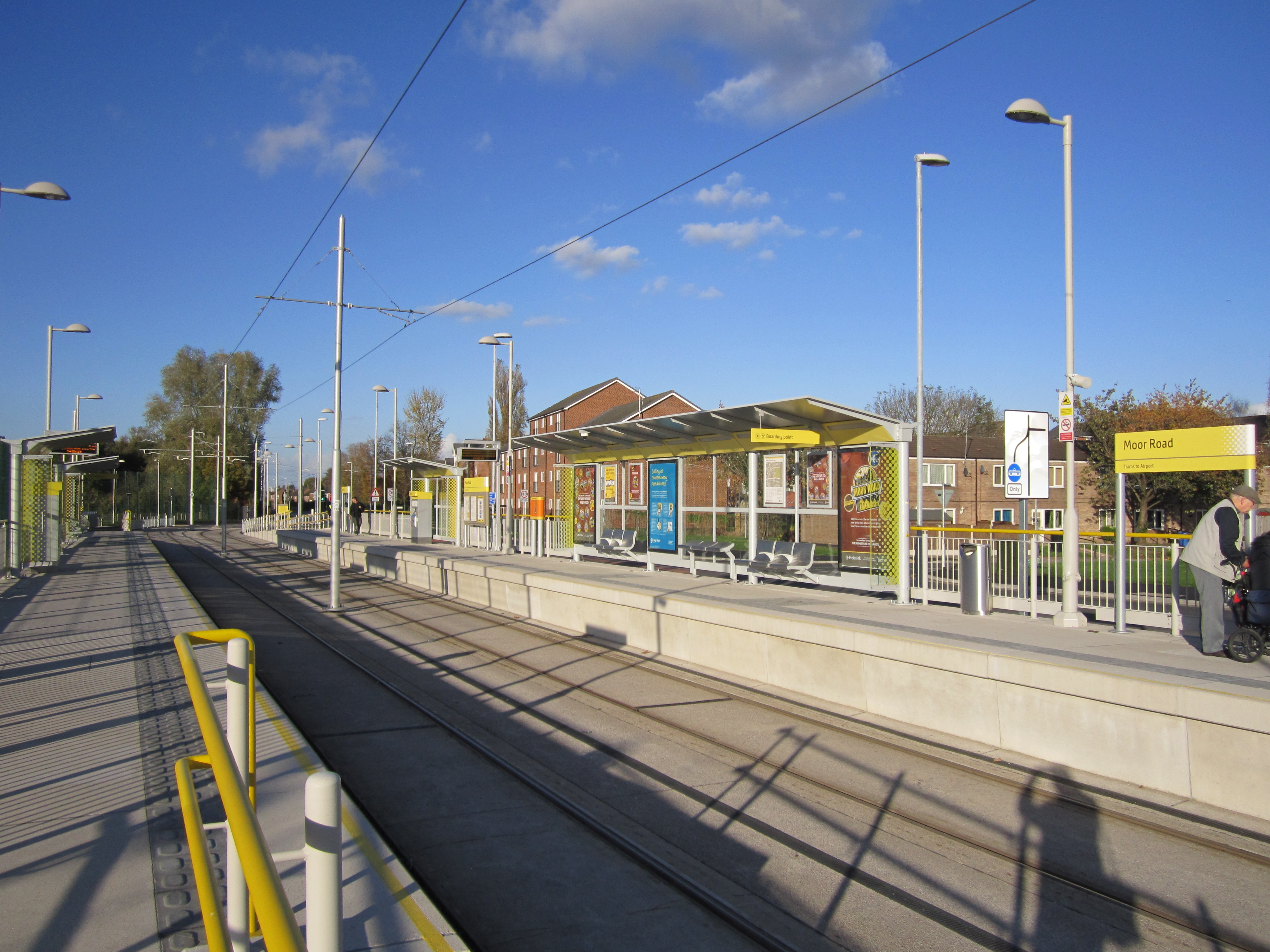
Moor Road tram stop

Moor Road is a tram stop for Phase 3b of the Manchester Metrolink. It opened on 3 November 2014. and is on the Airport Line on Moor Road at the junction...

Baguley

Baguley ( BAG-əl-ee) is an electoral ward of the city of Manchester in Wythenshawe, England. The population at the 2011 census was 14,794.The name Baguley...

Dixons Brooklands Academy

Dixons Brooklands Academy, also known as DBA or DBK, is a mixed-sex secondary school in Wythenshawe, Manchester, England. == History == In 1957, two separate...

Nearby Amenities

Located within 500m of 53.404762,-2.2839134
Bus Stop
Northern Moor, Wythenshawe Road / near Orton Road
Bus: yes
Naptan AtcoCode: 1800SB41511
Naptan Bearing: E
Naptan CommonName: Wythenshawe Road/Orton Road
Naptan Indicator: O/S House 200
Naptan Landmark: PARK
Naptan NaptanCode: mangwjtw
Naptan PlusbusZoneRef: MNCRPIC
Naptan ShortCommonName: Orton Road
Naptan Street: Wythenshawe Road
Naptan Verified: no
Network: TfGM
Public Transport: platform
Source: naptan_import
Lat/Long: 53.4077061/-2.2826262
Bus Stop
Northern Moor, Wythenshawe Road / opposite Orton Road
Bus: yes
Naptan AtcoCode: 1800SB41521
Naptan Bearing: W
Naptan CommonName: Wythenshawe Road/Orton Road
Naptan Indicator: Wyshawe Park
Naptan Landmark: PARK
Naptan NaptanCode: mangwjwa
Naptan PlusbusZoneRef: MNCRPIC
Naptan ShortCommonName: Orton Road
Naptan Street: Wythenshawe Road
Naptan Verified: no
Network: TfGM
Operator: TfGM
Public Transport: platform
Source: naptan_import
Lat/Long: 53.4076353/-2.282428
Bus Stop
Northern Moor, Wythenshawe Road / opposite Carloon Road
Bus: yes
Naptan AtcoCode: 1800SB41531
Naptan Bearing: W
Naptan CommonName: Wythenshawe Road/Carloon Road
Naptan Indicator: Op house 146
Naptan Landmark: PARK
Naptan NaptanCode: mangwjwd
Naptan Notes: INDICATOR AMENDED
Naptan PlusbusZoneRef: MNCRPIC
Naptan ShortCommonName: Carloon Road
Naptan Street: Wythenshawe Road.
Naptan Verified: no
Network: TfGM
Operator: TfGM
Public Transport: platform
Source: naptan_import
Lat/Long: 53.4073862/-2.2783127
Bus Stop
Northern Moor, Wythenshawe Road / near Northolt Road
Bus: yes
Naptan AtcoCode: 1800SB41721
Naptan Bearing: E
Naptan CommonName: Wythenshawe Road/Northolt Road
Naptan Indicator: Church
Naptan Landmark: CHURCH
Naptan NaptanCode: mangwmdj
Naptan PlusbusZoneRef: MNCRPIC
Naptan ShortCommonName: Northolt Road
Naptan Street: Wythenshawe Road
Naptan Verified: no
Network: TfGM
Public Transport: platform
Source: naptan_import
Lat/Long: 53.4080271/-2.2875174
Bus Stop
Baguley, Altrincham Road / near Wellfield Road
Bus: yes
Naptan AtcoCode: 1800SB41821
Naptan Bearing: W
Naptan CommonName: Altrincham Road/Wellfield Road
Naptan Indicator: House 449
Naptan Landmark: HOUSE 449
Naptan NaptanCode: mangwmgt
Naptan PlusbusZoneRef: MNCRPIC
Naptan ShortCommonName: Wellfield Road
Naptan Street: ALTRINCHAM ROAD
Naptan Verified: no
Network: TfGM
Operator: TfGM
Public Transport: platform
Source: naptan_import
Lat/Long: 53.4008342/-2.2807006
Bus Stop
Baguley, Altrincham Road / opposite Wellfield Road
Bus: yes
Naptan AtcoCode: 1800SB41831
Naptan Bearing: E
Naptan CommonName: Altrincham Road/Wellfield Road
Naptan Indicator: Wyshawe Park
Naptan Landmark: PARK
Naptan NaptanCode: mangwmgw
Naptan PlusbusZoneRef: MNCRPIC
Naptan ShortCommonName: Wellfield Road
Naptan Street: ALTRINCHAM ROAD
Naptan Verified: no
Network: TfGM
Operator: TfGM
Public Transport: platform
Source: naptan_import
Lat/Long: 53.4009574/-2.2818445
Bus Stop
Baguley, Altrincham Road / near Westage Gardens
Bus: yes
Naptan AtcoCode: 1800SB41841
Naptan Bearing: W
Naptan CommonName: Altrincham Road/Westage Gardens
Naptan Indicator: Westage Gardens
Naptan Landmark: HOUSE 611
Naptan NaptanCode: mangwmja
Naptan PlusbusZoneRef: MNCRPIC
Naptan ShortCommonName: Westage Gardens
Naptan Street: ALTRINCHAM ROAD
Naptan Verified: no
Network: TfGM
Operator: TfGM
Public Transport: platform
Source: naptan_import
Lat/Long: 53.4006877/-2.285633
Bus Stop
Baguley, Altrincham Road / opposite Westage Gardens
Bus: yes
Naptan AtcoCode: 1800SB41851
Naptan Bearing: E
Naptan CommonName: Altrincham Road/Westage Gardens
Naptan Indicator: Wythenshawe Pk
Naptan Landmark: PARK
Naptan NaptanCode: mangwmjd
Naptan PlusbusZoneRef: MNCRPIC
Naptan ShortCommonName: Westage Gardens
Naptan Street: ALTRINCHAM ROAD
Naptan Verified: no
Network: TfGM
Operator: TfGM
Public Transport: platform
Source: naptan_import
Lat/Long: 53.4007948/-2.2859646
Bus Stop
Northern Moor, Wythenshawe Road / opposite Northolt Road
Bus: yes
Naptan AtcoCode: 1800SB17421
Naptan Bearing: W
Naptan CommonName: Wythenshawe Road/Northolt Road
Naptan Indicator: Opp Church
Naptan Landmark: CHURCH
Naptan NaptanCode: mangtgwj
Naptan PlusbusZoneRef: MNCRPIC
Naptan ShortCommonName: Northolt Road
Naptan Street: Wythenshawe Road
Naptan Verified: no
Network: TfGM
Operator: TfGM
Public Transport: platform
Source: naptan_import
Lat/Long: 53.4079901/-2.2879383
Place Of Worship
St Aidan's Church
Node Id: 1104984198
Religion: christian
Source Name: OS Open Local Important Buildings Layer
Lat/Long: 53.4082301/-2.2872634
Traffic Calming: bump
Lat/Long: 53.4032991/-2.2824069
Toilets
Lat/Long: 53.4042033/-2.2837295
Oliver Cromwell Statue
Artist Name: Matthew Noble
Historic: memorial
Inscription: OLIVER CROMWELL BORN 1599 DIED 1658 The gift of Elizabeth Salisbury Heywood to to the citizens of Manchester 1875
Landmark: statue
Material: bronze
Memorial: statue
Wikidata: Q26546639
Lat/Long: 53.4047816/-2.2768537
Crossing
Crossing: unmarked
Crossing Island: yes
Tactile Paving: no
Lat/Long: 53.4008995/-2.2812685
Post Box
Brand: Royal Mail
Brand Wikidata: Q638098
Brand Wikipedia: en:Royal Mail
Operator: Royal Mail
Operator Wikidata: Q638098
Lat/Long: 53.404144/-2.2841704
Barrier: kissing_gate
Lat/Long: 53.4009781/-2.2834402
Leisure: garden
Lat/Long: 53.4037325/-2.2834909
Bench
Backrest: yes
Colour: #634626
Direction: 271
Material: wood
Survey Date: 2021-07-02
Lat/Long: 53.4048886/-2.277056
Give Way
Direction: forward
Lat/Long: 53.4009845/-2.2813044
Give Way
Direction: backward
Lat/Long: 53.400985/-2.2812284
Give Way
Direction: backward
Lat/Long: 53.4009478/-2.2833853
Give Way
Direction: forward
Lat/Long: 53.4009415/-2.2835387
Playground: teenshelter
Lat/Long: 53.403729/-2.2788733
Capacity: 10
Leisure: fitness_station
Start Date: 2022
Surface: artificial_turf
Lat/Long: 53.4038886/-2.2792866
Rose Garden
Information: board
Tourism: information
Lat/Long: 53.404967/-2.2799844
Crossing
Crossing: uncontrolled
Crossing Island: no
Crossing Markings: zebra
Tactile Paving: no
Lat/Long: 53.4044127/-2.2806152
Traffic Calming: hump
Lat/Long: 53.40463/-2.2805012
Traffic Calming: hump
Lat/Long: 53.404924/-2.280347
Traffic Calming: hump
Lat/Long: 53.4052105/-2.2801967
Traffic Calming: hump
Lat/Long: 53.4063512/-2.2795829
Traffic Calming: hump
Lat/Long: 53.4069057/-2.2792728
Traffic Calming: hump
Lat/Long: 53.406624/-2.2794303
Traffic Calming: hump
Lat/Long: 53.4035115/-2.2815801
Playground: slide
Lat/Long: 53.4036849/-2.2801968
Playground: roundabout
Lat/Long: 53.4039446/-2.2801866
Playground: roundabout
Lat/Long: 53.4040939/-2.280037
Baby: yes
Playground: swing
Lat/Long: 53.4041339/-2.2801979
Playground: structure
Lat/Long: 53.4039737/-2.2799348
Playground: climbingwall
Lat/Long: 53.4037751/-2.2797937
Baby: no
Playground: swing
Lat/Long: 53.4036388/-2.2799219
Playground: balancebeam
Lat/Long: 53.4038029/-2.2797518
Playground: structure
Lat/Long: 53.4037469/-2.2798237
Baby: no
Playground: swing
Lat/Long: 53.403715/-2.2796322
Playground: climbingframe
Lat/Long: 53.4037853/-2.2801539
Playground: slide
Lat/Long: 53.4037198/-2.2800176
Entrance: yes
Lat/Long: 53.4049026/-2.2794795
Public Bookcase
Lat/Long: 53.4047839/-2.279274
Information: board
Tourism: information
Lat/Long: 53.4068885/-2.2847035
Board Type: sport
Information: board
Tourism: information
Lat/Long: 53.4068869/-2.2846365
Board Type: sport
Information: board
Tourism: information
Lat/Long: 53.4066016/-2.2859109
Board Type: sport
Information: board
Tourism: information
Lat/Long: 53.4062759/-2.286009
Bicycle Parking
Bicycle Parking: stands
Capacity: 14
Covered: no
Fee: no
Lat/Long: 53.4058687/-2.284952
Bicycle Parking
Bicycle Parking: stands
Covered: no
Fee: no
Lat/Long: 53.4036955/-2.2808475
Crossing
Crossing: uncontrolled
Crossing Island: no
Crossing Markings: zebra
Tactile Paving: no
Lat/Long: 53.4036908/-2.281207
Waste Basket
Material: metal
Lat/Long: 53.4041764/-2.2802881
Give Way
Direction: backward
Lat/Long: 53.4088401/-2.2829679
Give Way
Direction: forward
Lat/Long: 53.4088498/-2.2830837
The data included in this document is from www.openstreetmap.org. The data is made available under ODbL.

Have you been to Mere Wood?

Leave your review of Mere Wood below (or comments, questions and feedback).