Woodhousefield Plantation

Wood, Forest in Shropshire

England

Woodhousefield Plantation

Sign for a footpath
Sign for a footpath Credit: Row17

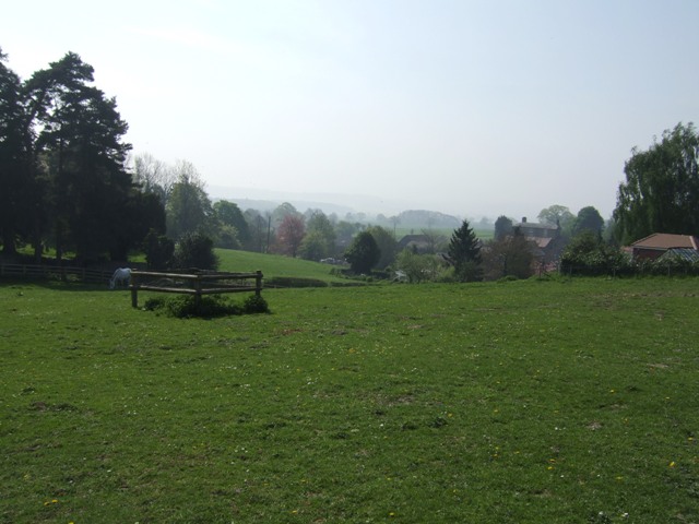
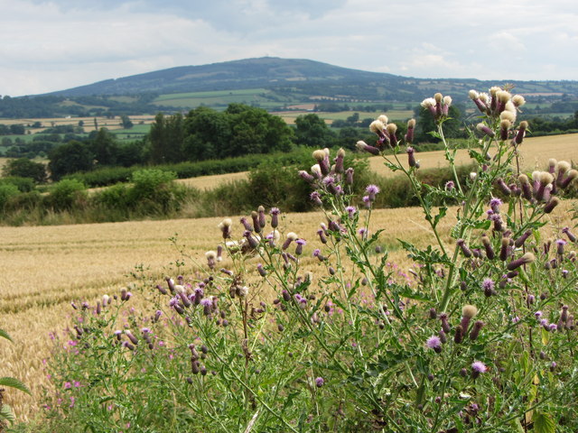
Woodhousefield Plantation is a picturesque woodland area located in Shropshire, England. Spanning over a vast area of land, the plantation is known for its dense and diverse forest, making it an ideal spot for nature enthusiasts and hiking enthusiasts alike. The plantation is situated near the town of Woodhousefield, which adds to its accessibility and popularity among locals and tourists.

The woodland is characterized by its towering trees, predominantly oak and beech, that create a lush canopy overhead. This creates a tranquil and serene atmosphere, providing a welcome escape from the hustle and bustle of everyday life. The forest floor is covered with a rich carpet of mosses, ferns, and wildflowers, adding to the beauty and biodiversity of the area.

Woodhousefield Plantation is home to a wide range of wildlife, including various species of birds, mammals, and insects. Birdwatchers can often spot woodpeckers, owls, and other woodland birds, while lucky visitors might come across deer, squirrels, or even a shy fox.

The plantation offers several well-maintained trails and paths, allowing visitors to explore the woodland at their own pace. These trails are suitable for all abilities and offer opportunities for leisurely walks or more challenging hikes. The plantation also provides picnic areas for visitors to relax and enjoy the peaceful surroundings.

Woodhousefield Plantation is a true gem in the heart of Shropshire, offering a wonderful opportunity to immerse oneself in nature and experience the beauty of a traditional English woodland.

If you have any feedback on the listing, please let us know in the comments section below.

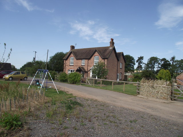
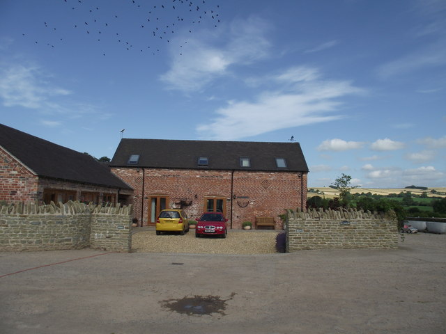
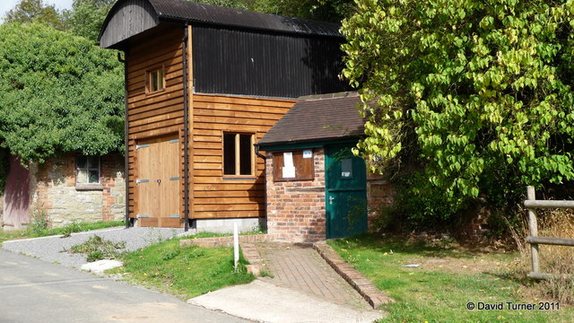
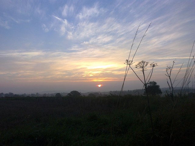
Woodhousefield Plantation Images

Images are sourced within 2km of 52.55078/-2.5897376 or Grid Reference SO6094. Thanks to Geograph Open Source API. All images are credited.

Sign for a footpath
Sign for a footpath
Standing strong against the skyline A single tree stands proud in a field of wheat.
Standing strong against the skyline
A single tree stands proud in a field of wheat.
Weird Weather The on screen photo fails to do justice to this funnel cloud taken over Cawleys Coppice.
Weird Weather
The on screen photo fails to do justice to this funnel cloud taken over Cawleys Coppice.
Pasture on the edge of the village
Beside a field of Oilseed Rape
Netchwood Junction A rather attractive Copper Beech tree stands close to the B4368.
The footpath behind links up to Corve Barn farm.
Netchwood Junction
A rather attractive Copper Beech tree stands close to the B4368. The footpath behind links up to Corve Barn farm.
Footpath in the corn Corve Barn Farm,Weston.
Footpath in the corn
Corve Barn Farm,Weston.
Corve Barn Farm No longer an active farm, having diversified into holiday accommodation.
Corve Barn Farm
No longer an active farm, having diversified into holiday accommodation.
Corve Barn Farm, barn conversion  Can be best described as a luxury holiday let.
Corve Barn Farm, barn conversion
Can be best described as a luxury holiday let.
Limestone pasture, Bourton On the Corvedale side of the double ridge behind Wenlock Edge. The Silurian limestones form land like chalk downs, a steep scarp with a long dip which carries seasonal watercourses. The stream here was not flowing above ground at this time. This was a dry year in these parts.
Limestone pasture, Bourton
On the Corvedale side of the double ridge behind Wenlock Edge. The Silurian limestones form land like chalk downs, a steep scarp with a long dip which carries seasonal watercourses. The stream here was not flowing above ground at this time. This was a dry year in these parts.
A Corve head.... One of the headwaters of the River Corve, only without water. 2011 was a dry year here and the Silurian limestone behaves just like chalk, with downland and seasonal watercourses.
A Corve head....
One of the headwaters of the River Corve, only without water. 2011 was a dry year here and the Silurian limestone behaves just like chalk, with downland and seasonal watercourses.
Bourton Post Office A little Post Office, open four hours per week
Bourton Post Office
A little Post Office, open four hours per week
Roadside thistle near Bourton
Fields near Bradeley Farm
Corvedale sun-rise September sun-rise from the B4378, South-West of Much Wenlock.
Corvedale sun-rise
September sun-rise from the B4378, South-West of Much Wenlock.
Corvedale sun-rise view The September sun rising, seen from the B4378 entrance to Black Barn Farm, South-West of Bourton near Much Wenlock.
Corvedale sun-rise view
The September sun rising, seen from the B4378 entrance to Black Barn Farm, South-West of Bourton near Much Wenlock.
Wheatfields by the B4368 near Weston, Shropshire The B4368 links Craven Arms with Morville, near Bridgnorth. It is a very attractive rural route which tempts drivers into faster speeds than are safe in some places.
Wheatfields by the B4368 near Weston, Shropshire
The B4368 links Craven Arms with Morville, near Bridgnorth. It is a very attractive rural route which tempts drivers into faster speeds than are safe in some places.
Arable land east of Monkhopton, Shropshire Extensive wheat fields are ready for harvest, and work is progressing in many fields in the region. This field is already stubble, awaiting preparation for the next crop.
Arable land east of Monkhopton, Shropshire
Extensive wheat fields are ready for harvest, and work is progressing in many fields in the region. This field is already stubble, awaiting preparation for the next crop.
Show me another place!

Woodhousefield Plantation is located at Grid Ref: SO6094 (Lat: 52.55078, Lng: -2.5897376)

Unitary Authority: Shropshire

Police Authority: West Mercia

What 3 Words

///cackling.rear.replenish. Near Much Wenlock, Shropshire

Related Wikis

Bourton, Shropshire

Bourton is a small village in Shropshire, England, 3 miles (5 km) southwest of Much Wenlock. It is part of the civil parish of Much Wenlock. Holy Trinity...

Patton, Shropshire

Patton is a hamlet in Shropshire, England. It is located in the civil parish of Stanton Long on the B4378 road between Bourton and Brockton. It lies on...

Patton (hundred)

Patton was a hundred of Shropshire, England. Formed during Anglo-Saxon England, it encompassed manors in eastern central Shropshire, and was amalgamated...

Monkhopton

Monkhopton is a village and civil parish in Shropshire, England. It is 6.5 miles south of Much Wenlock. There is an Anglican church: Its co-ordinates are...

Presthope railway station

Presthope railway station was a station to the east of Hughley, Shropshire, England. The station was opened in 1867 and closed in 1951. == References... ==

Easthope

Easthope is a small village and small civil parish in Shropshire, England. Wenlock Edge passes through the parish, to the northwest of the village, along...

Stretton Westwood

Stretton Westwood is a hamlet in Shropshire, England. It is located in the parish of Much Wenlock and is two miles southwest of the town, on the B4371...

Acton Round

Acton Round is a village and civil parish in the English county of Shropshire. Acton Round was recorded in the Domesday Book as Achetune. The civil parish...

Nearby Amenities

Located within 500m of 52.55078,-2.5897376
The data included in this document is from www.openstreetmap.org. The data is made available under ODbL.

Have you been to Woodhousefield Plantation?

Leave your review of Woodhousefield Plantation below (or comments, questions and feedback).