Kennel Wood

Wood, Forest in Cheshire

England

Kennel Wood

Shemmy Moss from the Whitegate Way As near to wilderness as you are likely to find in Cheshire, this is undeveloped wetland.
Shemmy Moss from the Whitegate Way Credit: Stephen Craven

Located in the county of Cheshire, England, Kennel Wood is a picturesque woodland area that offers a serene and tranquil escape from the bustling city life. Covering an area of approximately 50 acres, this forested region is a haven for nature lovers and outdoor enthusiasts.

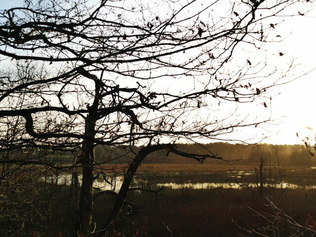
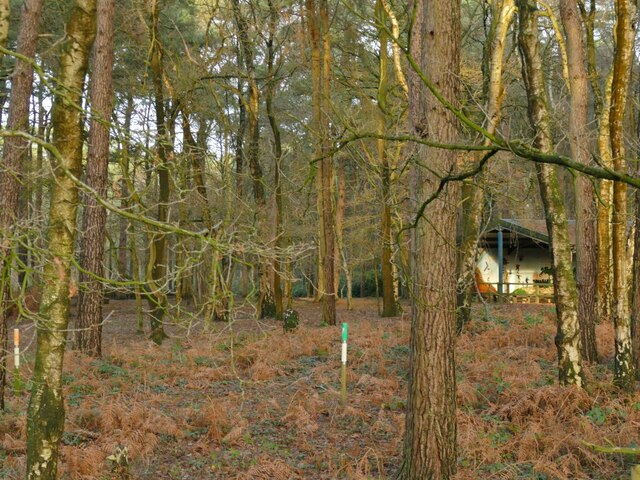
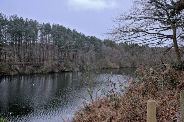
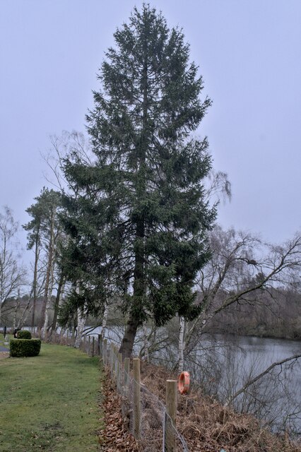
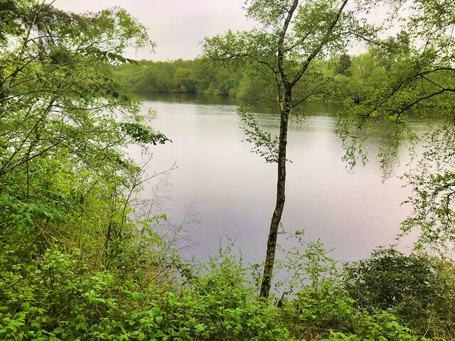
Kennel Wood is characterized by its dense, ancient woodland, featuring a variety of tree species such as oak, beech, and birch. The towering trees create a dense canopy, providing shade and shelter for the diverse wildlife that calls this forest home. Visitors can expect to encounter a range of bird species, including woodpeckers, owls, and various songbirds, as well as small mammals like squirrels and rabbits.

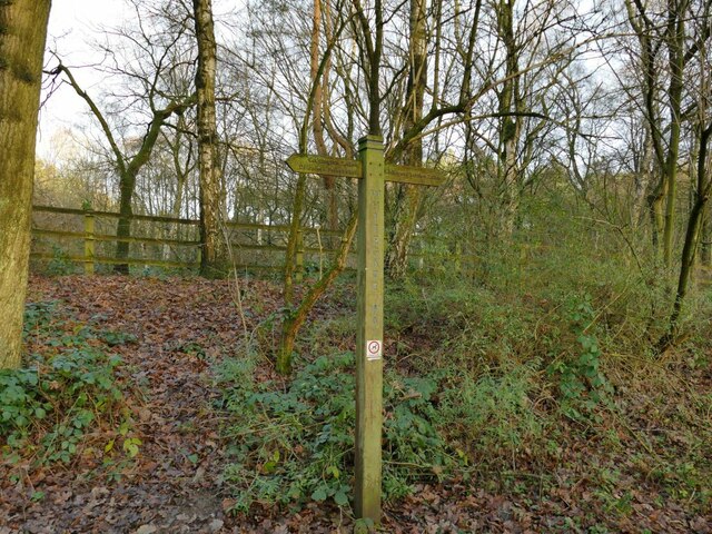
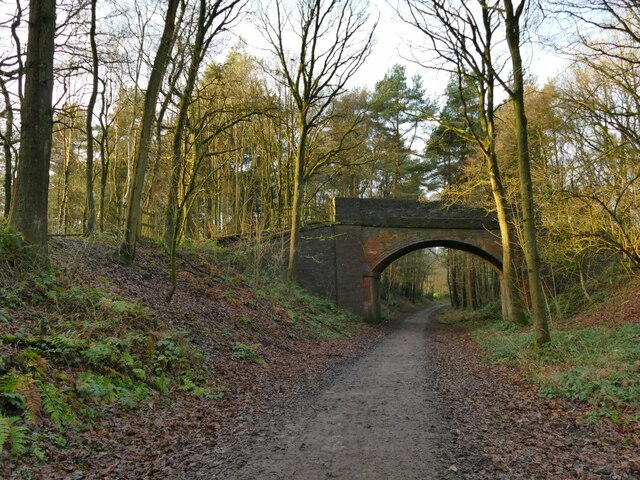
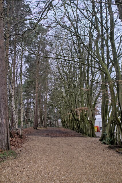
The wood offers a network of well-maintained footpaths and trails, allowing visitors to explore its natural beauty at their own pace. These paths wind through the forest, offering glimpses of beautiful wildflowers, ferns, and moss-covered rocks. Additionally, there are several picnic areas scattered throughout the wood, providing a perfect spot for a leisurely lunch amidst nature's embrace.

Kennel Wood is a popular destination for nature walks, jogging, and dog walking. The serene atmosphere and the absence of traffic noise make it an ideal location for a peaceful stroll or a moment of solitude. The forest is easily accessible, with a car park located nearby, and it is often frequented by locals and tourists alike.

In summary, Kennel Wood, Cheshire is a beautiful forested area that offers a peaceful retreat for those seeking solace in nature. With its diverse wildlife, well-maintained paths, and serene atmosphere, it is a must-visit destination for nature enthusiasts and those looking to escape the hustle and bustle of daily life.

If you have any feedback on the listing, please let us know in the comments section below.
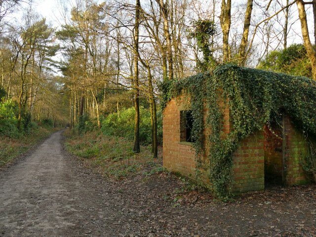
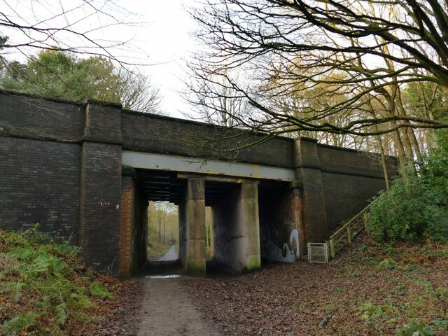
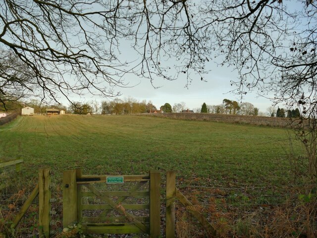
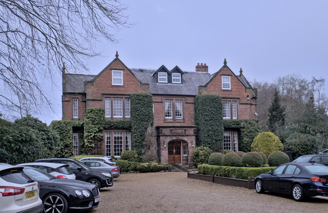
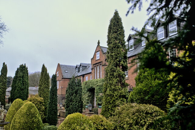
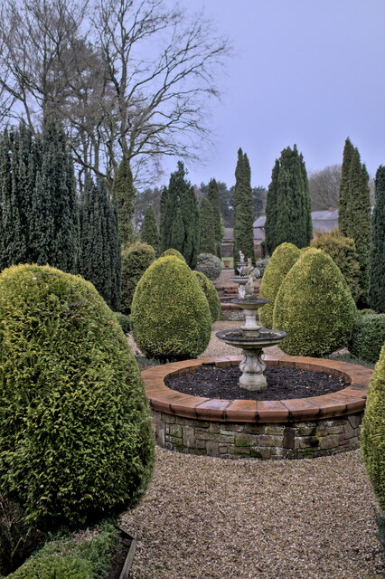
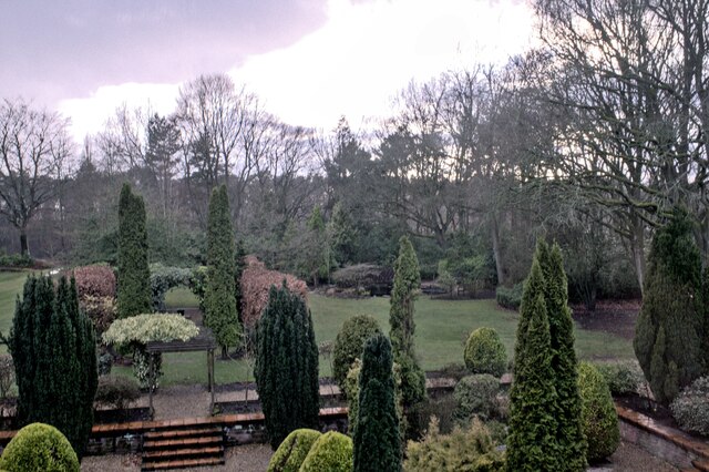
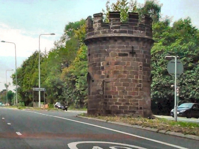
Kennel Wood Images

Images are sourced within 2km of 53.227578/-2.6006767 or Grid Reference SJ5970. Thanks to Geograph Open Source API. All images are credited.

Shemmy Moss from the Whitegate Way As near to wilderness as you are likely to find in Cheshire, this is undeveloped wetland.
Shemmy Moss from the Whitegate Way
As near to wilderness as you are likely to find in Cheshire, this is undeveloped wetland.
Forest Camp, from the Whitegate Way A view into the woodland scout camp, including one end of a building not shown on maps and hidden from aerial imagery by trees, so the location is approximate. The caption to a historic image <a href="https://www.geograph.org.uk/photo/6441476">SJ5969 : Crossing The Reeka</a> explains that this area has been used as a scout camp since 1947 or earlier.
Forest Camp, from the Whitegate Way
A view into the woodland scout camp, including one end of a building not shown on maps and hidden from aerial imagery by trees, so the location is approximate. The caption to a historic image SJ5969 : Crossing The Reeka explains that this area has been used as a scout camp since 1947 or earlier.
Signpost on the Whitegate Way A path links Kennel Lane to the railway trail at this point. The sign is to Cuddington (2.4km) and Delamere Forest (6km) to the left, and Whitegate car park (2.3km) to the right.
Signpost on the Whitegate Way
A path links Kennel Lane to the railway trail at this point. The sign is to Cuddington (2.4km) and Delamere Forest (6km) to the left, and Whitegate car park (2.3km) to the right.
Kennel Lane bridge over the Whitegate Way A substantial footbridge, maybe designed for horse-drawn vehicles originally.
Kennel Lane bridge over the Whitegate Way
A substantial footbridge, maybe designed for horse-drawn vehicles originally.
Hut beside the Whitegate Way The brick hut was probably for the use of railway maintenance workers. There certainly was never a station here.
Hut beside the Whitegate Way
The brick hut was probably for the use of railway maintenance workers. There certainly was never a station here.
Tarporley Road bridge over the Whitegate Way The bridge carries the A49. A flight of steps links the road to the trail.  Since the railway tracks were lifted, concrete block walls and steel girders have been added to strengthen the deck.  <a href="https://www.geograph.org.uk/photo/196159">SJ5969 : Whitegate Way, Oakmere</a> taken in 2006 shows it from the other side with this arrangement already in place.
Tarporley Road bridge over the Whitegate Way
The bridge carries the A49. A flight of steps links the road to the trail. Since the railway tracks were lifted, concrete block walls and steel girders have been added to strengthen the deck. SJ5969 : Whitegate Way, Oakmere taken in 2006 shows it from the other side with this arrangement already in place.
Private land at Forest View A sign on a gate deters users of the Whitegate Way from trespassing.
Private land at Forest View
A sign on a gate deters users of the Whitegate Way from trespassing.
Nunsmere Hall A rather superior hotel, surrounded by a lake in Cheshire.  Built around 1900 for Sir Aubrey Brocklebank, Chairman of The Brocklebank Shipping Line, and now an hotel and wedding venue.
Nunsmere Hall
A rather superior hotel, surrounded by a lake in Cheshire. Built around 1900 for Sir Aubrey Brocklebank, Chairman of The Brocklebank Shipping Line, and now an hotel and wedding venue.
Nunsmere Hall The West facade of the hall, overlooking the gardens
Nunsmere Hall
The West facade of the hall, overlooking the gardens
The Nunsmere Described by the hotel (Nunsmere Hall) as a 60-acre lake, I strongly suspect it is nothing of the kind.  I think it is a 60 acre former gravel pit. The southern quarter of the lake is owned by the forestry commission, not the hotel.

See also <span class="nowrap"><a title="https://www.merseyforest.org.uk/things-to-do/walks-bike-rides-and-more/woodlands/nunsmere-hall-and-newchurch-common/" rel="nofollow ugc noopener" href="https://www.merseyforest.org.uk/things-to-do/walks-bike-rides-and-more/woodlands/nunsmere-hall-and-newchurch-common/">Link</a><img style="margin-left:2px;" alt="External link" title="External link - shift click to open in new window" src="https://s1.geograph.org.uk/img/external.png" width="10" height="10"/></span>
The Nunsmere
Described by the hotel (Nunsmere Hall) as a 60-acre lake, I strongly suspect it is nothing of the kind. I think it is a 60 acre former gravel pit. The southern quarter of the lake is owned by the forestry commission, not the hotel. See also LinkExternal link
The lake at Nunsmere This tree overhangs the banks of the Nunsmere, a former gravel pit in Cheshire.
The lake at Nunsmere
This tree overhangs the banks of the Nunsmere, a former gravel pit in Cheshire.
Wooded avenue A row of Beech Trees at Nunsmere Hall, echoed by a row of Scots pine on the other side, interspersed with self-sewn silver birch.
Wooded avenue
A row of Beech Trees at Nunsmere Hall, echoed by a row of Scots pine on the other side, interspersed with self-sewn silver birch.
Gardens in the rain The formal gardens at Nunsmere Hall.
Gardens in the rain
The formal gardens at Nunsmere Hall.
The Library The library at Nunsmere Hall Hotel.
The Library
The library at Nunsmere Hall Hotel.
The Staircase The great staircase at Nunsmere Hall Hotel.
The Staircase
The great staircase at Nunsmere Hall Hotel.
A lounge One of the lounges at the Nunsmere Hall Hotel.
A lounge
One of the lounges at the Nunsmere Hall Hotel.
Overlooking the garden The view at Dusk from my bedroom window at Nunsmere Hall Hotel.
Overlooking the garden
The view at Dusk from my bedroom window at Nunsmere Hall Hotel.
Nunsmere The undulating landscape of this area of Cheshire was forged by melting glacial waters at the end of the last Ice Age and is home to a number of lakes, including Blakemere Moss, Hatchmere Lake, Oak Mere and Nunsmere, all within the vicinity of Delamere Forest. While some of the lakes that remain are glacial in origin, others have been created by flooding pits caused by gravel and sand extraction in the area.
Nunsmere
The undulating landscape of this area of Cheshire was forged by melting glacial waters at the end of the last Ice Age and is home to a number of lakes, including Blakemere Moss, Hatchmere Lake, Oak Mere and Nunsmere, all within the vicinity of Delamere Forest. While some of the lakes that remain are glacial in origin, others have been created by flooding pits caused by gravel and sand extraction in the area.
Show me another place!

Kennel Wood is located at Grid Ref: SJ5970 (Lat: 53.227578, Lng: -2.6006767)

Unitary Authority: Cheshire West and Chester

Police Authority: Cheshire

What 3 Words

///jubilant.behalf.battling. Near Cuddington, Cheshire

Related Wikis

Nearby Amenities

Located within 500m of 53.227578,-2.6006767
Turning Circle
Lat/Long: 53.2309883/-2.6024777
Barrier: stile
Lat/Long: 53.2269307/-2.6030518
Barrier: stile
Bicycle: no
Foot: yes
Lat/Long: 53.2295839/-2.6005419
Barrier: kissing_gate
Foot: yes
Lat/Long: 53.2280805/-2.5980845
Barrier: stile
Foot: yes
Lat/Long: 53.2261662/-2.5992315
Bus Stop
Sandiway, Chester Road / Kennel Lane
Bus: yes
Naptan AtcoCode: 0610VR120
Naptan Bearing: SW
Naptan CommonName: Kennel Lane
Naptan Crossing: Kennel Lane
Naptan Indicator: cnr
Naptan Landmark: House number 578
Naptan LocalityName: Sandiway
Naptan NaptanCode: chwgtat
Naptan ShortCommonName: Kennel Lane
Naptan Street: Chester Road
Naptan Verified: no
Public Transport: platform
Source: naptan_import
Lat/Long: 53.2307043/-2.5957299
Bus Stop
Sandiway, Chester Road / Kennel Lane
Bus: yes
Naptan AtcoCode: 0610VR121
Naptan Bearing: NE
Naptan BusStopType: CUS
Naptan CommonName: Kennel Lane
Naptan Crossing: Kennel Lane
Naptan Indicator: opp
Naptan Landmark: House number 578
Naptan LocalityName: Sandiway
Naptan NaptanCode: chwgtaw
Naptan ShortCommonName: Kennel Lane
Naptan Street: Chester Road
Naptan Verified: no
Public Transport: platform
Source: naptan_import
Lat/Long: 53.2308301/-2.5957345
Bus Stop
Sandiway, Chester Road / Kennel Lane
Bus: yes
Naptan AtcoCode: 0610VR142
Naptan Bearing: W
Naptan CommonName: Kennel Lane
Naptan Crossing: Kennel Lane
Naptan Indicator: nr
Naptan Landmark: Pinewood
Naptan LocalityName: Sandiway
Naptan NaptanCode: chwgtdw
Naptan ShortCommonName: Kennel Lane
Naptan Street: Chester Road
Naptan Verified: no
Public Transport: platform
Source: naptan_import
Lat/Long: 53.2302152/-2.5994673
Barrier: stile
Bicycle: no
Foot: yes
Lat/Long: 53.2258013/-2.601105
Turning Circle
Lat/Long: 53.231821/-2.5993666
Turning Circle
Lat/Long: 53.2320147/-2.6003752
Grit Bin
Lat/Long: 53.2305727/-2.6055744
Waste Basket
Lat/Long: 53.2306018/-2.605671
Man Made: wastewater_plant
Lat/Long: 53.2302389/-2.6067059
Barrier: kissing_gate
Foot: yes
Lat/Long: 53.2273825/-2.5971114
Barrier: cycle_barrier
Bicycle: yes
Foot: yes
Motor Vehicle: no
Lat/Long: 53.2302175/-2.6007286
Barrier: cycle_barrier
Bicycle: yes
Foot: yes
Motor Vehicle: no
Lat/Long: 53.2295412/-2.6060688
Memorial to BlueCap
HE Ref: 1287520
Height: 2
Heritage: 2
Heritage Operator: Historic England
Inscription: To the Memory of old Bluecap a Fox Hound the late Property of the Hon. John Smith Barry This obelisk Reader is a Monument rais'd To a shade, tho' a Hound, that deserves to be prais'd For if Life's but a Stage where on each act a Part And true greatness a
Listed Status: Grade II
Man Made: obelisk
Material: stone
Wikidata: Q15978904
Wikipedia: en:Bluecap Memorial
Lat/Long: 53.2243618/-2.6025427
Bus Stop
Cuddington, Ash Road / Cuddington School
Bus: yes
Naptan AtcoCode: 0610VR19231
Naptan Bearing: NE
Naptan CommonName: Cuddington School
Naptan Indicator: o/s
Naptan Landmark: House 48
Naptan LocalityName: Cuddington
Naptan NaptanCode: chwadpga
Naptan ShortCommonName: Cuddington School
Naptan Street: Ash Road
Public Transport: platform
Source: naptan_import
Lat/Long: 53.2319224/-2.6022207
The data included in this document is from www.openstreetmap.org. The data is made available under ODbL.

Have you been to Kennel Wood?

Leave your review of Kennel Wood below (or comments, questions and feedback).