Hangerberry Inclosure

Wood, Forest in Gloucestershire Forest of Dean

England

Hangerberry Inclosure

Forest ride
Forest ride Credit: don cload

Hangerberry Inclosure is a woodland area located in Gloucestershire, England. Situated within the larger Forest of Dean, it covers an approximate area of [insert size here] hectares. The inclosure is managed by the Forestry Commission and is a popular destination for nature enthusiasts, hikers, and recreational activities.

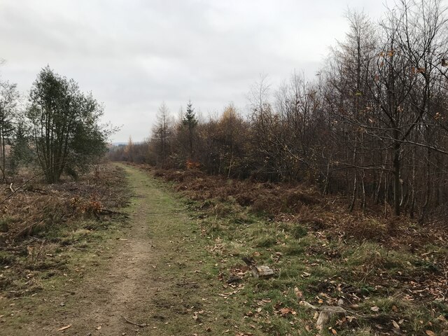
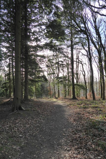
The woodland predominantly consists of a mix of broadleaf trees, including oak, beech, and ash, which create a diverse and visually appealing landscape. The dense canopy provides ample shade and shelter for various flora and fauna species, contributing to the area's ecological importance.

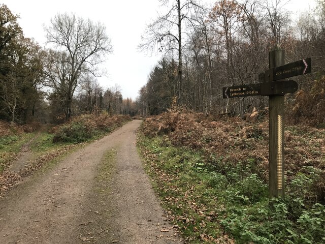
Hangerberry Inclosure offers numerous walking trails and paths, allowing visitors to explore the serene surroundings and immerse themselves in nature. The well-maintained trails cater to different levels of difficulty, making it accessible to people of all ages and abilities. Along the routes, visitors can observe a variety of wildlife, such as deer, squirrels, and numerous bird species.

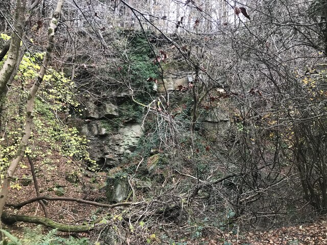
In addition to its natural beauty, Hangerberry Inclosure also holds historical significance. The wood has remnants of ancient iron mines, which were once a vital industry in the region. These mining artifacts serve as a reminder of the area's industrial heritage and add a sense of intrigue to the landscape.

Overall, Hangerberry Inclosure offers a tranquil and picturesque environment for individuals seeking a peaceful retreat or an opportunity to connect with nature. Its combination of diverse woodland, wildlife, and historical remnants make it a valuable asset to Gloucestershire's natural and cultural heritage.

If you have any feedback on the listing, please let us know in the comments section below.

Hangerberry Inclosure Images

Images are sourced within 2km of 51.829658/-2.5846941 or Grid Reference SO5914. Thanks to Geograph Open Source API. All images are credited.

Forest ride
Forest ride
Old railway junction
Mirystock Bridge
Mirystock Bridge
Old chapel and recreation ground
Old railway
Old railway
Old quarry
Old quarry
Sallowvallets track
Sallowvallets track
Sharp turn in the forest track
Old Boundary Marker Estate Boundary Marker east of a forest track and just north of the A4136 near Mirystock House. Lydbrook parish. inscribed Bourts Inclosure and 1842 this perhaps records the enclosure of part of the Forest of Dean.

Milestone Society National ID: GL_LYDBR01em
Old Boundary Marker
Estate Boundary Marker east of a forest track and just north of the A4136 near Mirystock House. Lydbrook parish. inscribed Bourts Inclosure and 1842 this perhaps records the enclosure of part of the Forest of Dean. Milestone Society National ID: GL_LYDBR01em
Forest track Forest track in Serridge Enclosure in the Forect of Dean.
Forest track
Forest track in Serridge Enclosure in the Forect of Dean.
Autumnal forest track Autumnal forest track in Serridge Enclosure.
Autumnal forest track
Autumnal forest track in Serridge Enclosure.
Sign of beaver activity Sign of beaver activity by Greathough Brook in the Forest of Dean.
Sign of beaver activity
Sign of beaver activity by Greathough Brook in the Forest of Dean.
Footbridge and stream Footbridge and stream on a former railway trackbed.
Footbridge and stream
Footbridge and stream on a former railway trackbed.
Memorial to the Waterloo Colliery Disaster Memorial to the Waterloo Colliery Disaster of 30 June 1949 <a href="https://www.geograph.org.uk/photo/7339405">SO6114 : Detail of the Waterloo Colliery Disaster Memorial</a>, on that day the pit was flooded when a breach was made into the water-filled workings of East Slad Colliery. Despite flooding, 177 men escaped by means of the cage up the shaft. There were a further 5 missing men who were eventually contacted and rescued via the old Pluds' Colliery shaft, fortunately this had recently been re-opened for ventilation purposes. The colliery finally closed on 23 December 1959.  Officially this was the Arthur and Edward Colliery. <a href="https://www.geograph.org.uk/photo/7339411">SO6114 : Inscription on Colliery Memorial</a>
Memorial to the Waterloo Colliery Disaster
Memorial to the Waterloo Colliery Disaster of 30 June 1949 SO6114 : Detail of the Waterloo Colliery Disaster Memorial, on that day the pit was flooded when a breach was made into the water-filled workings of East Slad Colliery. Despite flooding, 177 men escaped by means of the cage up the shaft. There were a further 5 missing men who were eventually contacted and rescued via the old Pluds' Colliery shaft, fortunately this had recently been re-opened for ventilation purposes. The colliery finally closed on 23 December 1959. Officially this was the Arthur and Edward Colliery. SO6114 : Inscription on Colliery Memorial
Detail of the Waterloo Colliery Disaster Memorial Memorial to the Waterloo Colliery Disaster of 30 June 1949 <a href="https://www.geograph.org.uk/photo/7339404">SO6114 : Memorial to the Waterloo Colliery Disaster</a>, on that day the pit was flooded when a breach was made into the water-filled workings of East Slad Colliery. Despite flooding, 177 men escaped by means of the cage up the shaft. There were a further 5 missing men who were eventually contacted and rescued via the old Pluds' Colliery shaft, fortunately this had recently been re-opened for ventilation purposes. The colliery finally closed on 23 December 1959.  Officially this was the Arthur and Edward Colliery. <a href="https://www.geograph.org.uk/photo/7339411">SO6114 : Inscription on Colliery Memorial</a>
Detail of the Waterloo Colliery Disaster Memorial
Memorial to the Waterloo Colliery Disaster of 30 June 1949 SO6114 : Memorial to the Waterloo Colliery Disaster, on that day the pit was flooded when a breach was made into the water-filled workings of East Slad Colliery. Despite flooding, 177 men escaped by means of the cage up the shaft. There were a further 5 missing men who were eventually contacted and rescued via the old Pluds' Colliery shaft, fortunately this had recently been re-opened for ventilation purposes. The colliery finally closed on 23 December 1959. Officially this was the Arthur and Edward Colliery. SO6114 : Inscription on Colliery Memorial
Inscription on Colliery Memorial Inscription on the memorial marking the Waterloo Colliery Disaster of 30 June 1949.
Inscription on Colliery Memorial
Inscription on the memorial marking the Waterloo Colliery Disaster of 30 June 1949.
Sheep at Joy's Green Three Texel ewes in a field at Joy's Green near Upper Lydbrook.
Sheep at Joy's Green
Three Texel ewes in a field at Joy's Green near Upper Lydbrook.
Forest path Forest path near Joy's Green in Upper Lydbrook.
Forest path
Forest path near Joy's Green in Upper Lydbrook.
Show me another place!

Hangerberry Inclosure is located at Grid Ref: SO5914 (Lat: 51.829658, Lng: -2.5846941)

Administrative County: Gloucestershire

District: Forest of Dean

Police Authority: Gloucestershire

What 3 Words

///growth.broke.with. Near Lydbrook, Gloucestershire

Related Wikis

Eastbach Court

Eastbach Court is a historic Grade II listed mansion in English Bicknor, Gloucestershire, England. == History == The house was built on a former messuage...

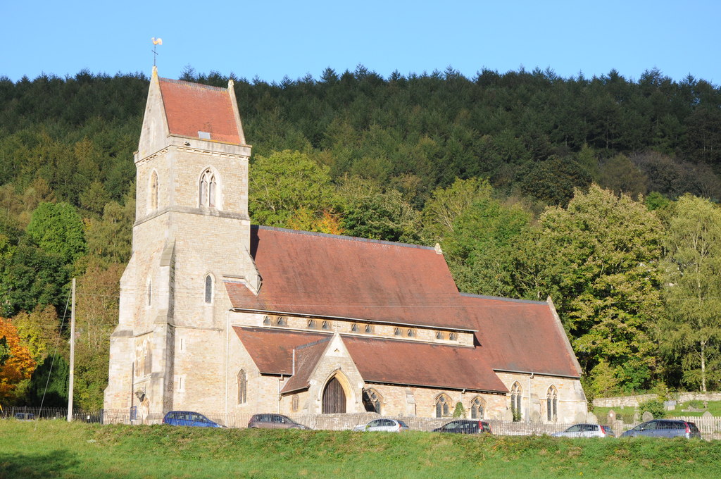
Holy Jesus Church, Lydbrook

Holy Jesus Church at Lydbrook is a Church of England parish church in the English county of Gloucestershire. == Structure == The greater part of the church...

Upper Lydbrook railway station

Upper Lydbrook railway station served the civil parish of Lydbrook, Gloucestershire, England, from 1875 to 1929 on the Severn and Wye Railway. == History... ==

Brooks Head Grove

Brooks Head Grove (grid reference SO586145) is an 11.9-hectare (29-acre) biological Site of Special Scientific Interest in Gloucestershire, notified in...
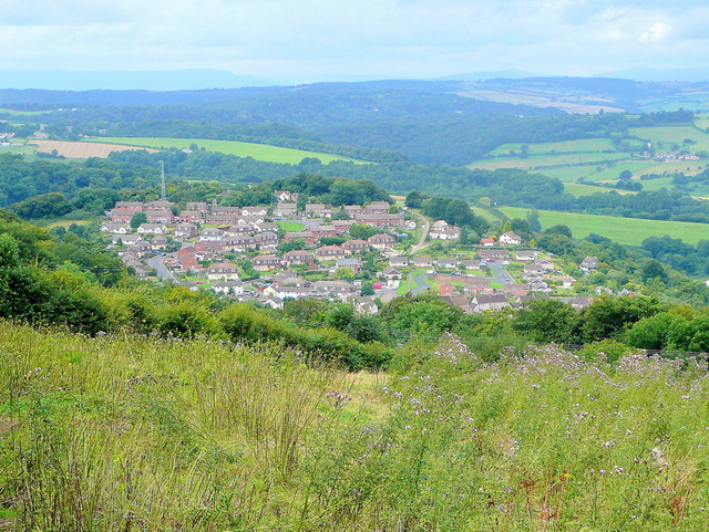
Lydbrook

Lydbrook is a civil parish in the Forest of Dean, a local government district in the English county of Gloucestershire and is located in the Wye Valley...

Sarah Siddons' House

Sarah Siddons' House, also called the Old House, is a cottage in the village of Lydbrook, Gloucestershire, England. A Grade II* listed building, the cottage...

Edge End, Gloucestershire

Edge End is a small hamlet in west Gloucestershire, England. == Location and amenities == Edge End is about 1.5 miles NW of Coleford and about 1 mile north...

Joys Green, Gloucestershire

Joy's Green is a village in the Forest of Dean in West Gloucestershire, England. The village is in the civil parish of the neighbouring village of Lydbrook...

Nearby Amenities

Located within 500m of 51.829658,-2.5846941
Bus Stop
Council Villas
Naptan AtcoCode: 1600GL5381
Naptan Bearing: W
Naptan CommonName: Council Villas
Naptan Indicator: Opp
Naptan NaptanCode: gloagdwt
Naptan Street: A4136
Naptan Verified: no
Source: naptan_import
Lat/Long: 51.8263029/-2.5799546
Bus Stop
Council Villas
Naptan AtcoCode: 1600GLF597
Naptan Bearing: N
Naptan CommonName: Council Villas
Naptan NaptanCode: gloagdwm
Naptan Street: Worrall Hill Rd
Naptan Verified: no
Source: naptan_import
Lat/Long: 51.827219/-2.580155
Bus Stop
Council Villas
Naptan AtcoCode: 1600GLF598
Naptan Bearing: S
Naptan CommonName: Council Villas
Naptan NaptanCode: gloagdwp
Naptan Street: Worrall Hill Rd
Naptan Verified: no
Source: naptan_import
Lat/Long: 51.8273184/-2.5800547
Bus Stop
Hatton Close
Naptan AtcoCode: 1600GLF849
Naptan Bearing: NE
Naptan CommonName: Hatton Close
Naptan Indicator: Opp
Naptan NaptanCode: glogjwpd
Naptan Street: Valley Rd
Naptan Verified: no
Source: naptan_import
Lat/Long: 51.8298887/-2.5784769
Bus Stop
Ridge Place
Bus: yes
Naptan AtcoCode: 1600GL5384
Naptan Bearing: W
Naptan CommonName: Ridge Place
Naptan Indicator: in
Naptan NaptanCode: gloagjdw
Naptan Street: Ridge Place
Naptan Verified: no
Public Transport: platform
Lat/Long: 51.8285901/-2.5782098
Power: pole
Lat/Long: 51.8329801/-2.5802391
Power: pole
Lat/Long: 51.8328259/-2.5821703
Power: pole
Lat/Long: 51.8332682/-2.5853198
Power: pole
Lat/Long: 51.8333249/-2.5825163
Power: pole
Lat/Long: 51.8328558/-2.5801238
Power: pole
Lat/Long: 51.8324016/-2.5860969
Power: pole
Lat/Long: 51.8315792/-2.5868351
Power: pole
Lat/Long: 51.8338037/-2.5846465
Power: pole
Lat/Long: 51.833172/-2.5805835
The data included in this document is from www.openstreetmap.org. The data is made available under ODbL.

Have you been to Hangerberry Inclosure?

Leave your review of Hangerberry Inclosure below (or comments, questions and feedback).