Arbourthorne

Settlement in Yorkshire

England

Arbourthorne

Sheaf View, Sheaf Bank, Sheffield  The Sheaf View is a pub in Heeley, on a steep slope overlooking the River Sheaf. In the distance can be seen the Madina Masjid mosque on Wolseley Road and, on the horizon to its right, the steeple of Highfield Trinity Methodist Church.
Sheaf View, Sheaf Bank, Sheffield Credit: A J Paxton

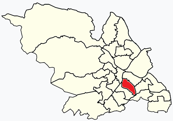
Arbourthorne is a residential area located in Sheffield, South Yorkshire, England. It is situated approximately three miles southeast of the city center and is surrounded by other neighborhoods such as Manor, Gleadless, and Norfolk Park. Arbourthorne is part of the larger Arbourthorne ward, which also includes the districts of Gleadless Valley and parts of Manor Top.

Historically, Arbourthorne was mostly rural land until the early 20th century when it experienced significant urbanization. Today, it is a densely populated area with a mix of housing types, including post-war council estates, terraced houses, and some newer developments. The neighborhood has a strong sense of community, with several local amenities and services catering to the needs of its residents.

Arbourthorne offers good transportation links, with several bus routes connecting it to the city center and other parts of Sheffield. The nearby Sheffield Parkway provides easy access to the M1 motorway, making it convenient for commuters. The area is also home to several primary and secondary schools, providing education for local children.

The neighborhood is known for its green spaces, including Arbourthorne Community Park, which offers recreational facilities such as a playground and sports pitches. Additionally, the area benefits from being close to the beautiful green spaces of Norfolk Heritage Park and Graves Park.

Overall, Arbourthorne is a vibrant and diverse community that provides its residents with a range of amenities, good transport links, and access to nearby parks and green spaces.

If you have any feedback on the listing, please let us know in the comments section below.
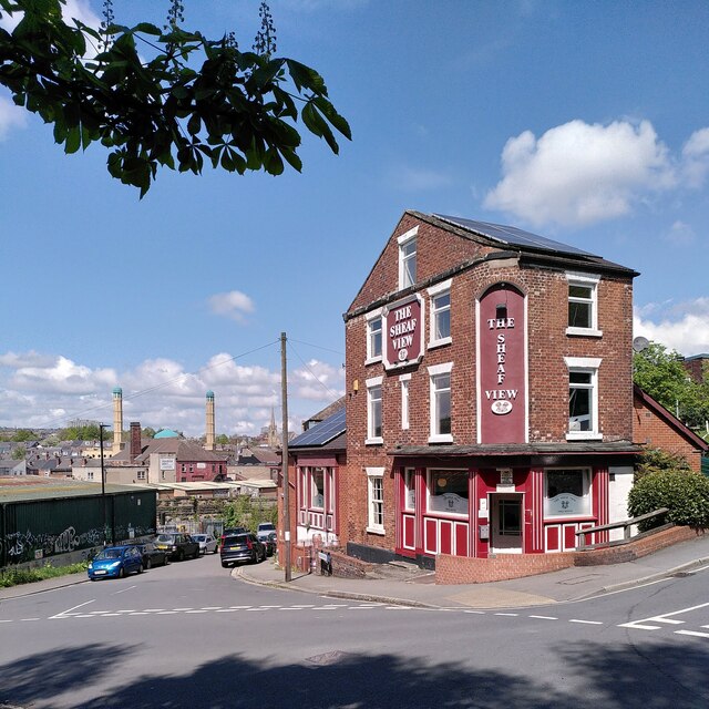
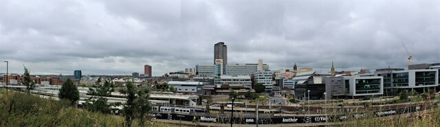
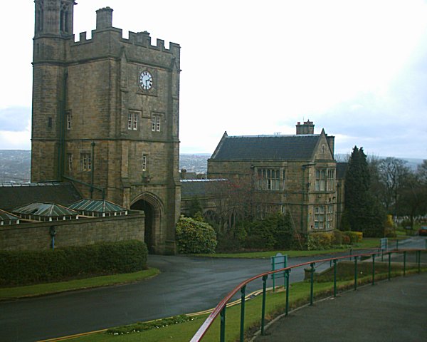
Arbourthorne Images

Images are sourced within 2km of 53.367126/-1.443159 or Grid Reference SK3785. Thanks to Geograph Open Source API. All images are credited.

Sheaf View, Sheaf Bank, Sheffield  The Sheaf View is a pub in Heeley, on a steep slope overlooking the River Sheaf. In the distance can be seen the Madina Masjid mosque on Wolseley Road and, on the horizon to its right, the steeple of Highfield Trinity Methodist Church.
Sheaf View, Sheaf Bank, Sheffield
The Sheaf View is a pub in Heeley, on a steep slope overlooking the River Sheaf. In the distance can be seen the Madina Masjid mosque on Wolseley Road and, on the horizon to its right, the steeple of Highfield Trinity Methodist Church.
Sheffield Chinese Christian Church, Ann Road, Heeley This church opened in 1897 as a Primitive Methodist chapel; for more information, see the My Primitive Methodists site <span class="nowrap"><a title="https://www.myprimitivemethodists.org.uk/content/chapels/yorkshire/sa-sha/sheffield_anns_road_primitive_methodist_chapel" rel="nofollow ugc noopener" href="https://www.myprimitivemethodists.org.uk/content/chapels/yorkshire/sa-sha/sheffield_anns_road_primitive_methodist_chapel">Link</a><img style="margin-left:2px;" alt="External link" title="External link - shift click to open in new window" src="https://s1.geograph.org.uk/img/external.png" width="10" height="10"/></span>. It is now used by a Chinese evangelical church, with services in English and in the Mandarin and Cantonese forms of Chinese; see the church website <span class="nowrap"><a title="https://www.shefccc.org.uk/who-we-are/" rel="nofollow ugc noopener" href="https://www.shefccc.org.uk/who-we-are/">Link</a><img style="margin-left:2px;" alt="External link" title="External link - shift click to open in new window" src="https://s1.geograph.org.uk/img/external.png" width="10" height="10"/></span> . The church is seen here from across Gleadless Road.
Sheffield Chinese Christian Church, Ann Road, Heeley
This church opened in 1897 as a Primitive Methodist chapel; for more information, see the My Primitive Methodists site LinkExternal link. It is now used by a Chinese evangelical church, with services in English and in the Mandarin and Cantonese forms of Chinese; see the church website LinkExternal link . The church is seen here from across Gleadless Road.
Heeley community mural, Gleadless Road, Sheffield  This is a more traditional community mural to which many hands have contributed, rather than the more professional street art that became common after around 2010.
Heeley community mural, Gleadless Road, Sheffield
This is a more traditional community mural to which many hands have contributed, rather than the more professional street art that became common after around 2010.
Bears of Sheffield: #32 Plants & Bees #32 of 61 big bear sculptures, this one was decorated by Jat Cover and is located on Paternoster Row.

Jay’s  Plants & Bees Bear design is based on spring time, around the time when he was actually making the Bear. Near to his studio there was a house where part of the garden was being converted into an allotment, and so he was simply responding to what was around him at the time.
Bears of Sheffield: #32 Plants & Bees
#32 of 61 big bear sculptures, this one was decorated by Jat Cover and is located on Paternoster Row. Jay’s Plants & Bees Bear design is based on spring time, around the time when he was actually making the Bear. Near to his studio there was a house where part of the garden was being converted into an allotment, and so he was simply responding to what was around him at the time.
Bears of Sheffield: #33 Colours by Charlie 2 #33 of 61 big bear sculptures, this one was decorated by Marcus Method and is located in Sheaf Square in front of Sheffield Railway Station.

Marcus’s Bear is inspired by the bright and colourful imagination that children have. Marcus’s own nephew has been treated by Sheffield Children’s Hospital before which inspired him to gather various children’s opinions on the project. Gathering all his paints, he asked his nephew to pick his favourite colours and this formulated the basis of the colour palette, Marcus then applied these in a fun way which allow visitors to see something new each time they look at the Bear.
Bears of Sheffield: #33 Colours by Charlie 2
#33 of 61 big bear sculptures, this one was decorated by Marcus Method and is located in Sheaf Square in front of Sheffield Railway Station. Marcus’s Bear is inspired by the bright and colourful imagination that children have. Marcus’s own nephew has been treated by Sheffield Children’s Hospital before which inspired him to gather various children’s opinions on the project. Gathering all his paints, he asked his nephew to pick his favourite colours and this formulated the basis of the colour palette, Marcus then applied these in a fun way which allow visitors to see something new each time they look at the Bear.
Bears of Sheffield: #12 Peace Bear with Chilli Pepper #12 of 61 big bear sculptures, this one was decorated by Sarah Staton and is located outside Electric Works on Sheaf Street.

Sarah's Bear uses the dove as a symbol of peace in our divisive times and the Chilli Peppers signify the welcome that Sheffield gives to newcomers and the enormous contribution that migrants make, which quite often begins with food culture.
Bears of Sheffield: #12 Peace Bear with Chilli Pepper
#12 of 61 big bear sculptures, this one was decorated by Sarah Staton and is located outside Electric Works on Sheaf Street. Sarah's Bear uses the dove as a symbol of peace in our divisive times and the Chilli Peppers signify the welcome that Sheffield gives to newcomers and the enormous contribution that migrants make, which quite often begins with food culture.
'Colours' Bear looking at its next meal? One of the 61 Bears of Sheffield, Colours appears to be eyeing up the nearby salmon <a href="https://www.geograph.org.uk/photo/6670105">SK3586 : 'Salmon of Steel'</a> for its next meal.
'Colours' Bear looking at its next meal?
One of the 61 Bears of Sheffield, Colours appears to be eyeing up the nearby salmon SK3586 : 'Salmon of Steel' for its next meal.
Sheffield City Centre from Park Hill
East Midlands Railway Class 158 DMU at Sheffield Train from Liverpool about to leave at 11.40 for Norwich
East Midlands Railway Class 158 DMU at Sheffield
Train from Liverpool about to leave at 11.40 for Norwich
Sheffield Midland station
Gleadless Road, looking towards Heeley, Sheffield View of Gleadless Road at the corner with Abney Road and looking west towards Heeley.
Gleadless Road, looking towards Heeley, Sheffield
View of Gleadless Road at the corner with Abney Road and looking west towards Heeley.
River Sheaf below Pond Hill Where the river briefly emerges from a tunnel beneath Sheffield railway station (ahead) before going into another tunnel behind the camera to go below the roads at Park Square roundabout to join the River Don.
River Sheaf below Pond Hill
Where the river briefly emerges from a tunnel beneath Sheffield railway station (ahead) before going into another tunnel behind the camera to go below the roads at Park Square roundabout to join the River Don.
Underneath the arches The Megatron! Walking one of three massive parallel storm water channels taking the River Sheaf and Porter Brook below Sheffield railway station. The station was opened in 1871. Passengers today are oblivious to the river below.

The river reappears briefly in front of the Ponds Forge International Sports Centre before diving underground again in higher tunnels below the Park Square roundabout before reaching the River Don. Amazing to see all the stone and brickwork supporting the station and roads, all built to reclaim the area that was previously - Ponds.
Underneath the arches
The Megatron! Walking one of three massive parallel storm water channels taking the River Sheaf and Porter Brook below Sheffield railway station. The station was opened in 1871. Passengers today are oblivious to the river below. The river reappears briefly in front of the Ponds Forge International Sports Centre before diving underground again in higher tunnels below the Park Square roundabout before reaching the River Don. Amazing to see all the stone and brickwork supporting the station and roads, all built to reclaim the area that was previously - Ponds.
Trap door, Sheffield railway station From below where the Porter Brook joins the River Sheaf, between platforms 2C and 5A. This is to be opened up by the River Sheaf and Porter Brook Trust enabling light to penetrate below.
Trap door, Sheffield railway station
From below where the Porter Brook joins the River Sheaf, between platforms 2C and 5A. This is to be opened up by the River Sheaf and Porter Brook Trust enabling light to penetrate below.
DMUs waiting at Platforms 1 & 2 at Sheffield Station
Sheffield Hallam University Sheffield Hallam University as seen from the top floor of the Yorkshire Art Space building on Sidney Street.
Sheffield Hallam University
Sheffield Hallam University as seen from the top floor of the Yorkshire Art Space building on Sidney Street.
Nelson Mandela Walk Opened by the Lord Mayor of Sheffield in 1986 (according to a nearby plaque).  A name characteristic of Labour councils in the 1980s as support for the anti-apartheid movement was growing in political circles around the world.
Nelson Mandela Walk
Opened by the Lord Mayor of Sheffield in 1986 (according to a nearby plaque). A name characteristic of Labour councils in the 1980s as support for the anti-apartheid movement was growing in political circles around the world.
Park Hill Flats, Sheffield Park Hill Flats in Sheffield dominates the City Centre. Work started in 1957 and the complex was built in many phases into the 1960's. Today the complex is Grade II listed having undergone much renovation.
Park Hill Flats, Sheffield
Park Hill Flats in Sheffield dominates the City Centre. Work started in 1957 and the complex was built in many phases into the 1960's. Today the complex is Grade II listed having undergone much renovation.
Show me another place!

Arbourthorne is located at Grid Ref: SK3785 (Lat: 53.367126, Lng: -1.443159)

Division: West Riding

Unitary Authority: Sheffield

Police Authority: South Yorkshire

What 3 Words

///edges.useful.plots. Near Sheffield, South Yorkshire

Nearby Locations

Arbourthorne Deep Pit

Related Wikis

City Road Cemetery

The City Road Cemetery is a cemetery in the City of Sheffield, England that opened in May 1881 and was originally Intake Road Cemetery. Covering 100 acres...

Norfolk Heritage Park

Norfolk Heritage Park (grid reference SK365859) (commonly referred to as 'Norfolk Park') is a 28-hectare (69-acre) public park in Sheffield, South Yorkshire...

Arbourthorne

Park & Arbourthorne ward—which includes the districts of Arbourthorne, Gleadless, and Norfolk Park—is one of the 28 electoral wards in City of Sheffield...

Sheffield Manor Lodge

Sheffield Manor Lodge, also known as Sheffield Manor or locally as Manor Castle, is a lodge built about 1516 in what then was a large deer park southeast...

Nearby Amenities

Located within 500m of 53.367126,-1.443159
Turning Circle
Lat/Long: 53.3628146/-1.4423537
Crossing
Crossing: unmarked
Crossing Island: yes
Tactile Paving: yes
Lat/Long: 53.3635436/-1.4470104
Spring Lane
Network: Supertram
Operator: Stagecoach
Public Transport: stop_position
Railway: tram_stop
Tram: yes
Lat/Long: 53.3663058/-1.438774
Bus Stop
City Road/Dovercourt Road
Bench: no
Bus: yes
Naptan AtcoCode: 370020072
Naptan Bearing: SE
Naptan CommonName: City Road/Dovercourt Road
Naptan Indicator: 20072
Naptan Landmark: Opposite 398 City Road
Naptan PlusbusZoneRef: ROTHCEN
Naptan Street: City Road
Naptan Verified: no
Public Transport: platform
Shelter: no
Source: naptan_import
Lat/Long: 53.3710005/-1.4427767
Bus Stop
City Road/Cemetery
Bench: no
Bin: yes
Bus: yes
Lit: yes
Naptan AtcoCode: 370020073
Naptan Bearing: SE
Naptan CommonName: City Road/Cemetery
Naptan Indicator: 20073
Naptan Landmark: Opposite 436 City Road/Cemeter
Naptan PlusbusZoneRef: ROTHCEN
Naptan Street: City Road
Naptan Verified: no
Public Transport: platform
Shelter: no
Source: naptan_import
Tactile Paving: yes
Lat/Long: 53.3701519/-1.4420062
Bus Stop
City Road/Cemetery
Bench: no
Bin: no
Bus: yes
Lit: yes
Naptan AtcoCode: 370020074
Naptan Bearing: NW
Naptan CommonName: City Road/Cemetery
Naptan Indicator: 20074
Naptan Landmark: OPPOSITE CEMETERY
Naptan PlusbusZoneRef: ROTHCEN
Naptan Street: City Road
Naptan Verified: no
Public Transport: platform
Shelter: no
Source: naptan_import
Tactile Paving: yes
Lat/Long: 53.370036/-1.4422031
Bus Stop
Park Grange Road/St Aidans Road
Alt Name: Park Grange Road/St Aidans Road
Bench: yes
Bus: yes
Lit: no
Naptan AltCommonName: Park Grange Road/St Aidans Road
Naptan AtcoCode: 370022565
Naptan Bearing: N
Naptan CommonName: Park Grange Road/St Aidans Road
Naptan Indicator: 22565
Naptan Landmark: 22565
Naptan PlusbusZoneRef: ROTHCEN
Naptan Street: Park Grange Road
Naptan Verified: no
Public Transport: platform
Shelter: yes
Source: naptan_import
Tactile Paving: no
Lat/Long: 53.3654152/-1.4440368
Bus Stop
Park Grange Road/St Aidans Road
Alt Name: Park Grange Road/St Aidans Road
Bus: yes
Naptan AltCommonName: Park Grange Road/St Aidans Road
Naptan AtcoCode: 370022566
Naptan Bearing: N
Naptan CommonName: Park Grange Road/St Aidans Road
Naptan Indicator: 22566
Naptan Landmark: ROUNDABOUT
Naptan PlusbusZoneRef: ROTHCEN
Naptan Street: Park Grange Road
Naptan Verified: no
Public Transport: platform
Source: naptan_import
Lat/Long: 53.3663969/-1.4405975
Bus Stop
St Aidans Road/St Aidans Drive
Alt Name: St Aidans Road/St Aidans Drive
Bus: yes
Naptan AltCommonName: St Aidans Road/St Aidans Drive
Naptan AtcoCode: 370022568
Naptan Bearing: SE
Naptan CommonName: St Aidans Road/St Aidans Drive
Naptan Indicator: 22568
Naptan Landmark: 22568
Naptan PlusbusZoneRef: ROTHCEN
Naptan Street: St Aidans Road
Naptan Verified: no
Public Transport: platform
Source: naptan_import
Lat/Long: 53.3681498/-1.4425133
Bus Stop
St Aidans Road/Guildford Avenue
Bus: yes
Naptan AtcoCode: 370022763
Naptan Bearing: SE
Naptan CommonName: St Aidans Road/Guildford Avenue
Naptan Indicator: 22763
Naptan Landmark: Opposite Captive Queen Pub
Naptan PlusbusZoneRef: ROTHCEN
Naptan Street: St Aidans Road
Naptan Verified: no
Public Transport: platform
Source: naptan_import
Lat/Long: 53.3690397/-1.4444555
Bus Stop
Park Grange Road/Beldon Road
Alt Name: Park Grange Road/Beldon Road
Bench: yes
Bin: no
Bus: yes
Lit: no
Naptan AltCommonName: Park Grange Road/Beldon Road
Naptan AtcoCode: 370023197
Naptan Bearing: N
Naptan CommonName: Park Grange Road/Beldon Road
Naptan Indicator: 23197
Naptan Landmark: THE FELLBRIGG
Naptan PlusbusZoneRef: ROTHCEN
Naptan Street: Park Grange Road
Naptan Verified: no
Public Transport: platform
Shelter: yes
Source: naptan_import
Tactile Paving: no
Lat/Long: 53.3638699/-1.4461308
Bus Stop
Park Grange Road/Guildford View
Bench: yes
Bus: yes
Lit: no
Naptan AtcoCode: 370023207
Naptan Bearing: N
Naptan CommonName: Park Grange Road/Guildford View
Naptan Indicator: 23207
Naptan Landmark: OUTSIDE GUILDFORD FLATS 1-251
Naptan PlusbusZoneRef: ROTHCEN
Naptan Street: Park Grange Road
Naptan Verified: no
Public Transport: platform
Shelter: yes
Source: naptan_import
Tactile Paving: no
Lat/Long: 53.3646971/-1.4442566
Bus Stop
Park Grange Road/Spring Lane
Bus: yes
Naptan AtcoCode: 370023208
Naptan Bearing: N
Naptan CommonName: Park Grange Road/Spring Lane
Naptan Indicator: 23208
Naptan Landmark: NORFOLK SCHOOL
Naptan PlusbusZoneRef: ROTHCEN
Naptan Street: Park Grange Road
Naptan Verified: no
Public Transport: platform
Source: naptan_import
Lat/Long: 53.3661813/-1.4406304
Bus Stop
City Road/Park Grange Road
Bus: yes
Naptan AtcoCode: 370023218
Naptan Bearing: SE
Naptan CommonName: City Road/Park Grange Road
Naptan Indicator: 23218
Naptan Landmark: THE TRAVELLERS REST PUB
Naptan PlusbusZoneRef: ROTHCEN
Naptan Street: City Road
Naptan Verified: no
Public Transport: platform
Source: naptan_import
Lat/Long: 53.366164/-1.4369487
Bus Stop
City Road/Park Grange Road
Bench: yes
Bin: yes
Bus: yes
Lit: yes
Naptan AtcoCode: 370023219
Naptan Bearing: NW
Naptan CommonName: City Road/Park Grange Road
Naptan Indicator: 23219
Naptan Landmark: PETROL FILLING STATION
Naptan PlusbusZoneRef: ROTHCEN
Naptan Street: City Road
Naptan Verified: no
Public Transport: platform
Shelter: yes
Source: naptan_import
Tactile Paving: yes
Lat/Long: 53.3670453/-1.4389359
Bus Stop
City Road/City Road Cemetery
Alt Name: City Road/City Road Cemetery
Bench: yes
Bin: yes
Bus: yes
Naptan AltCommonName: City Road/City Road Cemetery
Naptan AtcoCode: 370023220
Naptan Bearing: SE
Naptan CommonName: City Road/City Road Cemetery
Naptan Indicator: 23220
Naptan Landmark: Cemetery
Naptan PlusbusZoneRef: ROTHCEN
Naptan Street: City Road
Naptan Verified: no
Public Transport: platform
Shelter: yes
Source: naptan_import
Lat/Long: 53.3685988/-1.4405086
Bus Stop
City Road/City Road Cemetery
Alt Name: City Road/City Road Cemetery
Bench: yes
Bin: yes
Bus: yes
Lit: yes
Naptan AltCommonName: City Road/City Road Cemetery
Naptan AtcoCode: 370023221
Naptan Bearing: N
Naptan CommonName: City Road/City Road Cemetery
Naptan Indicator: 23221
Naptan Landmark: Cemetery Gates Opposite
Naptan PlusbusZoneRef: ROTHCEN
Naptan Street: City Road
Naptan Verified: no
Public Transport: platform
Shelter: yes
Source: naptan_import
Tactile Paving: yes
Lat/Long: 53.3690244/-1.4411793
Bicycle Parking
Bicycle Parking: stands
Capacity: 10
Covered: no
Lat/Long: 53.3680154/-1.4475895
Fuel
Compressed Air: yes
Source: survey
Lat/Long: 53.367474/-1.4398401
Select & Save
Addr City: Sheffield
Addr Housenumber: 525
Addr Postcode: S2 1GF
Addr Street: City Road
Brand: Select & Save
Fhrs Id: 436837
Shop: convenience
Website: https://selectandsave.co.uk/
Lat/Long: 53.3664725/-1.4372671
Turning Circle
Source: Bing
Lat/Long: 53.3660679/-1.4415022
Turning Circle
Source: Bing
Lat/Long: 53.3653436/-1.4498326
Crossing
Crossing: unmarked
Crossing Island: yes
Tactile Paving: yes
Lat/Long: 53.3652465/-1.4440994
Crossing
Crossing: unmarked
Lat/Long: 53.3668702/-1.4413659
Crossing
Button Operated: yes
Crossing: traffic_signals
Crossing Island: no
Tactile Paving: yes
Traffic Signals Sound: yes
Traffic Signals Vibration: yes
Lat/Long: 53.3703701/-1.4423633
Crossing
Crossing: unmarked
Crossing Island: no
Tactile Paving: yes
Lat/Long: 53.364554/-1.444995
Traffic Calming: table
Lat/Long: 53.3634258/-1.4463967
Crossing
Crossing: unmarked
Crossing Island: yes
Tactile Paving: yes
Lat/Long: 53.3637094/-1.4463705
Crossing: informal
Lat/Long: 53.3635193/-1.4464652
Crossing
Crossing: unmarked
Crossing Island: no
Tactile Paving: yes
Lat/Long: 53.3649547/-1.4441618
Crossing
Crossing: unmarked
Crossing Island: yes
Tactile Paving: yes
Lat/Long: 53.3665182/-1.44169
Crossing
Crossing: unmarked
Crossing Island: no
Kerb: lowered
Tactile Paving: no
Lat/Long: 53.3666532/-1.4451895
Traffic Calming: table
Lat/Long: 53.3632766/-1.4397958
Traffic Calming: table
Lat/Long: 53.3632914/-1.440369
Traffic Calming: table
Lat/Long: 53.3636615/-1.4387623
Traffic Calming: table
Lat/Long: 53.3640052/-1.4380708
Traffic Calming: table
Lat/Long: 53.3640712/-1.4411408
Traffic Calming: table
Lat/Long: 53.364461/-1.4372627
Traffic Calming: table
Lat/Long: 53.3646975/-1.4417504
Traffic Calming: table
Lat/Long: 53.3652363/-1.4415351
Traffic Calming: table
Lat/Long: 53.3655531/-1.440602
Traffic Calming: table
Lat/Long: 53.3638574/-1.4395559
Traffic Calming: table
Lat/Long: 53.364426/-1.440103
Traffic Calming: table
Lat/Long: 53.365059/-1.4407207
Traffic Signals
Crossing: no
Traffic Signals Direction: forward
Lat/Long: 53.3665434/-1.4381072
Turning Circle
Source: Bing
Lat/Long: 53.3700819/-1.4432634
Cafe
Centre in the Park
Addr City: Sheffield
Addr Housename: Centre in the Park
Addr Place: Norfolk Heritage Park
Addr Postcode: S2 2PL
Addr Street: Guildford Avenue
Opening Hours: Mo-Su 10:00-16:00
Operator: Norfolk Park Catering Ltd.
Phone: +44114 2860405
Source Website: https://www.norfolk-park.com/centre.html/
Lat/Long: 53.3681939/-1.4477313
Post Box
Collection Times: Mo-Fr 09:00; Sa 07:00
Post Box Type: pillar
Ref: S2 557
Royal Cypher: EIIR
Royal Cypher Wikidata: Q33102113
Lat/Long: 53.3686474/-1.4408571
Post Box
Collection Times: Mo-Fr 09:00, Sa 07:00
Post Box Type: pillar
Ref: S2 962
Royal Cypher: EIIR
Royal Cypher Wikidata: Q33102113
Lat/Long: 53.3648769/-1.4458725
Access: yes
Leisure: playground
Lat/Long: 53.3663146/-1.4362465
Crossing: unmarked
Crossing Island: yes
Kerb: lowered
Railway: tram_crossing
Supervised: no
Tactile Paving: yes
Lat/Long: 53.3661163/-1.4402194
Railway: tram_level_crossing
Lat/Long: 53.3663149/-1.4407176
Railway: tram_level_crossing
Lat/Long: 53.3636213/-1.4465363
Railway: tram_crossing
Lat/Long: 53.363684/-1.4463456
Railway: tram_crossing
Lat/Long: 53.3664906/-1.4416871
Traffic Signals
Crossing: no
Traffic Signals Direction: backward
Lat/Long: 53.3661424/-1.4401364
Railway: tram_level_crossing
Lat/Long: 53.3664598/-1.4376288
Railway: tram_level_crossing
Lat/Long: 53.3665789/-1.4378688
Railway: tram_level_crossing
Lat/Long: 53.3665354/-1.4382376
Crossing: unmarked
Crossing Island: yes
Kerb: lowered
Railway: tram_crossing
Supervised: no
Tactile Paving: yes
Lat/Long: 53.3661896/-1.4401571
Railway: tram_level_crossing
Lat/Long: 53.3664832/-1.441152
Railway: tram_crossing
Lat/Long: 53.3652554/-1.4441375
Railway: tram_level_crossing
Lat/Long: 53.3644989/-1.4448886
Railway: tram_crossing
Lat/Long: 53.363738/-1.4464008
Crossing
Crossing: unmarked
Crossing Island: no
Tactile Paving: no
Lat/Long: 53.3664802/-1.4375959
Railway: tram_crossing
Lat/Long: 53.3665195/-1.4377135
Crossing
Crossing: unmarked
Crossing Island: yes
Tactile Paving: yes
Lat/Long: 53.3664983/-1.4377447
Railway: tram_crossing
Lat/Long: 53.3664762/-1.4377861
Railway: tram_crossing
Lat/Long: 53.366511/-1.4380599
Railway: tram_crossing
Lat/Long: 53.366582/-1.4380828
Crossing
Crossing: unmarked
Crossing Island: yes
Tactile Paving: yes
Lat/Long: 53.3666715/-1.4380108
Crossing
Crossing: unmarked
Crossing Island: no
Tactile Paving: yes
Lat/Long: 53.3666289/-1.4381552
Railway: tram_crossing
Lat/Long: 53.3664259/-1.4384969
Crossing
Crossing: unmarked
Crossing Island: yes
Tactile Paving: yes
Lat/Long: 53.3664071/-1.4384782
Railway: tram_crossing
Lat/Long: 53.3663824/-1.4384569
Railway: tram_crossing
Lat/Long: 53.3661285/-1.4390694
Crossing
Crossing: unmarked
Crossing Island: yes
Tactile Paving: yes
Lat/Long: 53.366149/-1.4390905
Railway: tram_crossing
Lat/Long: 53.3661758/-1.4391154
Traffic Signals
Crossing: no
Traffic Signals Direction: forward
Lat/Long: 53.366366/-1.4408726
Railway: tram_crossing
Lat/Long: 53.3661065/-1.4394228
Crossing
Bicycle: yes
Crossing: unmarked
Crossing Island: yes
Tactile Paving: yes
Lat/Long: 53.3660663/-1.4394221
Railway: tram_crossing
Lat/Long: 53.3660341/-1.4394183
Railway: tram_crossing
Lat/Long: 53.3664191/-1.440903
Crossing
Crossing: unmarked
Crossing Island: yes
Tactile Paving: yes
Lat/Long: 53.3663841/-1.4409352
Railway: tram_crossing
Lat/Long: 53.36635/-1.4409665
Railway: tram_crossing
Lat/Long: 53.3652382/-1.4440634
Railway: tram_crossing
Lat/Long: 53.3663991/-1.4425803
Crossing
Crossing: unmarked
Crossing Island: yes
Tactile Paving: yes
Lat/Long: 53.3663727/-1.4425541
Railway: tram_crossing
Lat/Long: 53.3663489/-1.4425324
Railway: tram_crossing
Lat/Long: 53.3665505/-1.4416894
Crossing
Crossing: unmarked
Lat/Long: 53.366554/-1.4411376
Railway: tram_crossing
Lat/Long: 53.3635706/-1.44703
Railway: tram_crossing
Lat/Long: 53.3635077/-1.4469843
Crossing
Crossing: unmarked
Crossing Island: no
Tactile Paving: yes
Lat/Long: 53.3636095/-1.4474228
Barrier: kerb
Kerb: lowered
Tactile Paving: yes
Lat/Long: 53.3635943/-1.4474621
Spring Lane
Network: Supertram
Operator: Stagecoach
Public Transport: stop_position
Railway: tram_stop
Tram: yes
Lat/Long: 53.3662636/-1.4387379
Crossing
Crossing: unmarked
Lat/Long: 53.3666062/-1.4417245
Railway: tram_level_crossing
Lat/Long: 53.3665473/-1.4415526
Crossing
Crossing: unmarked
Lat/Long: 53.3665904/-1.4415679
Crossing
Crossing: unmarked
Lat/Long: 53.3668757/-1.4412035
Railway: tram_level_crossing
Lat/Long: 53.3660334/-1.4396054
Railway: tram_level_crossing
Lat/Long: 53.3649858/-1.4442629
Railway: tram_level_crossing
Lat/Long: 53.3635089/-1.4473324
Historic: memorial
Memorial: war_memorial
Wikidata: Q26539575
Lat/Long: 53.3697093/-1.4388321
Kitchens & Fitting
Addr City: Sheffield
Addr Housenumber: 484
Addr Postcode: S2 1GD
Addr Street: City Road
Email: info@kitchensandfitting.co.uk
Phone: +44 114 2392475
Shop: kitchen
Website: https://www.sheffield-kitchens.co.uk/
Lat/Long: 53.3690863/-1.4414687
K's Memorials
Addr City: Sheffield
Addr Housenumber: 484
Addr Postcode: S2 1GD
Addr Street: City Road
Email: craige1970@googlemail.com
Phone: +44 114 253 0352
Shop: funeral_directors
Website: https://www.ksmemorials.co.uk/
Lat/Long: 53.3691852/-1.4415646
City Road Garage
Email: enquiries@cityroadgarage.co.uk
Phone: +44 114 253 0050
Shop: car
Website: https://www.cityroadgarage.co.uk/
Lat/Long: 53.3693628/-1.4417624
Atm
Lat/Long: 53.3663713/-1.4373127
Bench
Backrest: no
Lat/Long: 53.3691958/-1.4498106
Crossing
Button Operated: yes
Crossing: traffic_signals
Crossing Island: no
Kerb: flush
Tactile Paving: yes
Lat/Long: 53.3688295/-1.4408734
Traffic Signals
Crossing: no
Traffic Signals Direction: forward
Lat/Long: 53.3688607/-1.4409021
Traffic Signals
Crossing: no
Traffic Signals Direction: backward
Lat/Long: 53.3687951/-1.4408417
Traffic Signals
Crossing: no
Traffic Signals Direction: forward
Lat/Long: 53.3704025/-1.4423927
Traffic Signals
Crossing: no
Traffic Signals Direction: backward
Lat/Long: 53.3703318/-1.4423284
Traffic Signals
Crossing: no
Traffic Signals Direction: forward
Lat/Long: 53.3666997/-1.4380556
Traffic Signals
Crossing: no
Traffic Signals Direction: backward
Lat/Long: 53.3664669/-1.4376922
Grit Bin
Operator: Sheffield City Council
Operator Type: government
Operator Wikidata: Q7492609
Seasonal: no
Lat/Long: 53.3659897/-1.4396921
Grit Bin
Operator: Sheffield City Council
Operator Type: government
Operator Wikidata: Q7492609
Seasonal: no
Lat/Long: 53.3686881/-1.4420162
Grit Bin
Operator: Sheffield City Council
Operator Type: government
Operator Wikidata: Q7492609
Seasonal: no
Lat/Long: 53.3659093/-1.4417219
Grit Bin
Access: yes
Colour: Yellow
Material: plastic
Operator: Sheffield City Council
Operator Type: government
Operator Wikidata: Q7492609
Seasonal: no
Lat/Long: 53.3670011/-1.4452032
Grit Bin
Operator: Sheffield City Council
Operator Type: government
Operator Wikidata: Q7492609
Seasonal: no
Lat/Long: 53.3680056/-1.4421454
Grit Bin
Operator: Sheffield City Council
Operator Type: government
Operator Wikidata: Q7492609
Seasonal: no
Lat/Long: 53.3649406/-1.4440939
Grit Bin
Operator: Sheffield City Council
Operator Type: government
Operator Wikidata: Q7492609
Seasonal: no
Lat/Long: 53.3648859/-1.4458829
Grit Bin
Operator: Sheffield City Council
Operator Type: government
Operator Wikidata: Q7492609
Seasonal: no
Lat/Long: 53.3637254/-1.447626
Addr City: Sheffield
Addr Housenumber: 30
Addr Street: Strouts Way
Lat/Long: 53.3657832/-1.4375148
Addr City: Sheffield
Addr Housenumber: 58
Addr Street: Strouts Way
Lat/Long: 53.3661149/-1.438414
Addr City: Sheffield
Addr Housenumber: 2
Addr Street: Rawson Close
Lat/Long: 53.3655788/-1.4385077
Addr City: Sheffield
Addr Housenumber: 9
Addr Street: Rawson Close
Lat/Long: 53.365287/-1.4383099
Addr City: Sheffield
Addr Housenumber: 10
Addr Street: Gilmour Avenue
Lat/Long: 53.365099/-1.4374714
Addr City: Sheffield
Addr Housenumber: 21
Addr Street: Rawson Close
Lat/Long: 53.3653262/-1.4393619
Addr City: Sheffield
Addr Housenumber: 11
Addr Street: Rawson Close
Lat/Long: 53.3652814/-1.4385719
Addr City: Sheffield
Addr Housenumber: 25
Addr Street: Strouts Way
Lat/Long: 53.3657401/-1.4392699
Addr City: Sheffield
Addr Housenumber: 1
Addr Street: Rawson Close
Lat/Long: 53.3654716/-1.4381813
Addr City: Sheffield
Addr Housenumber: 27
Addr Street: Rawson Close
Lat/Long: 53.3655453/-1.4399303
Addr City: Sheffield
Addr Housenumber: 28
Addr Street: Strouts Way
Lat/Long: 53.3656895/-1.4372602
Addr City: Sheffield
Addr Housenumber: 33
Addr Street: Gilmour Avenue
Lat/Long: 53.3652379/-1.4377465
Addr City: Sheffield
Addr Housenumber: 13
Addr Street: Strouts Way
Lat/Long: 53.3655128/-1.4381529
Addr City: Sheffield
Addr Housenumber: 23
Addr Street: Rawson Close
Lat/Long: 53.3653733/-1.4398606
Addr City: Sheffield
Addr Housenumber: 2
Addr Street: Gilmour Avenue
Lat/Long: 53.3647537/-1.4374166
Addr City: Sheffield
Addr Housenumber: 15
Addr Street: Strouts Way
Lat/Long: 53.3656267/-1.4384918
Addr City: Sheffield
Addr Housenumber: 11
Addr Street: Strouts Way
Lat/Long: 53.3652842/-1.4377092
Addr City: Sheffield
Addr Housenumber: 18
Addr Street: Rawson Close
Lat/Long: 53.3656621/-1.4395717
Addr City: Sheffield
Addr Housenumber: 27
Addr Street: Gilmour Avenue
Lat/Long: 53.3647428/-1.438711
Addr City: Sheffield
Addr Housenumber: 1
Addr Street: Gilmour Avenue
Lat/Long: 53.3646145/-1.437717
Addr City: Sheffield
Addr Housenumber: 6
Addr Street: Strouts Way
Lat/Long: 53.3650176/-1.4365533
Addr City: Sheffield
Addr Housenumber: 29
Addr Street: Gilmour Avenue
Lat/Long: 53.3650897/-1.4378839
Addr City: Sheffield
Addr Housenumber: 1
Addr Street: Strouts Way
Lat/Long: 53.3648546/-1.4367835
Addr City: Sheffield
Addr Housenumber: 9
Addr Street: Strouts Way
Lat/Long: 53.3651349/-1.4374074
Railway: tram_crossing
Lat/Long: 53.3638963/-1.4457667
Crossing
Lat/Long: 53.3662577/-1.4372375
Railway: tram_level_crossing
Lat/Long: 53.3662288/-1.4372894
Railway: tram_level_crossing
Lat/Long: 53.3660309/-1.436993
Barrier: motorcycle_barrier
Lat/Long: 53.36668/-1.437143
The data included in this document is from www.openstreetmap.org. The data is made available under ODbL.

Have you been to Arbourthorne?

Leave your review of Arbourthorne below (or comments, questions and feedback).