Arborfield Garrison

Settlement in Berkshire

England

Arborfield Garrison

Roundabout on Reading Road, Arborfield Cross
Roundabout on Reading Road, Arborfield Cross Credit: David Howard

Arborfield Garrison is a former military base situated in the county of Berkshire, England. Located about 4 miles southeast of the town of Wokingham, the garrison occupies an area of approximately 2,700 acres. Historically, it served as a training ground for the British Army, housing soldiers from various regiments and providing them with essential facilities and resources.

Originally established in the early 1900s, Arborfield Garrison underwent significant development over the years to accommodate the evolving needs of the military. It played a crucial role during both World Wars, serving as a training base and providing support for troops. In recent years, the garrison has primarily been home to the Royal Electrical and Mechanical Engineers (REME), providing training and support for the maintenance and repair of military vehicles and equipment.

In addition to its military functions, Arborfield Garrison has also been an integral part of the local community. It has provided employment opportunities for residents of the surrounding areas and contributed to the local economy. The garrison's facilities include housing for military personnel and their families, sports and recreational facilities, medical services, and educational institutions.

In 2016, plans were announced for the redevelopment of Arborfield Garrison into a new residential area, including the construction of over 3,500 homes. This redevelopment project aims to transform the former military base into a thriving community, while also preserving elements of its historical significance.

If you have any feedback on the listing, please let us know in the comments section below.

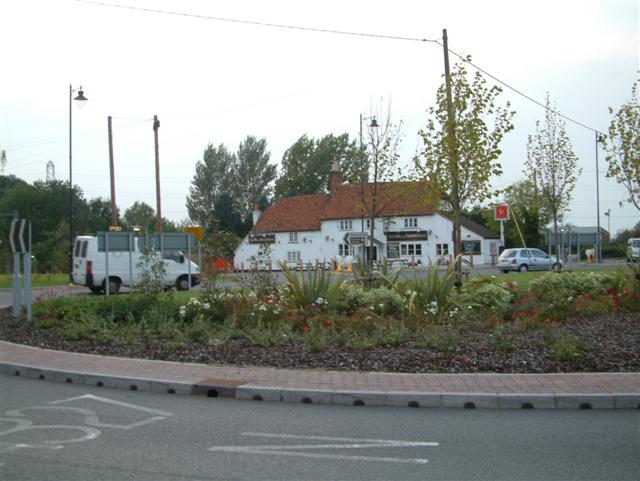
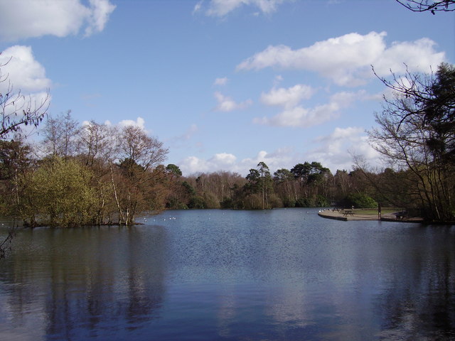
Arborfield Garrison Images

Images are sourced within 2km of 51.386406/-0.89550863 or Grid Reference SU7665. Thanks to Geograph Open Source API. All images are credited.

Roundabout on Reading Road, Arborfield Cross
Arborfield Stores Londis stands for London Independent Supermarkets in case anyone wanted to know
Arborfield Stores
Londis stands for London Independent Supermarkets in case anyone wanted to know
Reading Road, Arborfield Cross
Poperinghe Way, Arborfield
Verge on Poperinghe Way, Arborfield
Poperinghe Way, Arborfield
Whitehall Drive at the junction of Baird Road
Barkham Road at the junction of Barkham Street Looking towards The Bull at Barkham pub
Barkham Road at the junction of Barkham Street
Looking towards The Bull at Barkham pub
The entrance to Home Farm on Sheerlands Road
Green by Whitehall Road, Arborfield Garrison
School Road at the junction of Langley Common Road
Pylon by Church Road, Farley Hill
Church Road, Farley Hill
Benchmark on St James's Church Ordnance Survey cut mark benchmark described on the Bench Mark Database at <span class="nowrap"><a title="http://www.bench-marks.org.uk/bm27568" rel="nofollow ugc noopener" href="http://www.bench-marks.org.uk/bm27568">Link</a><img style="margin-left:2px;" alt="External link" title="External link - shift click to open in new window" src="https://s1.geograph.org.uk/img/external.png" width="10" height="10"/></span>
Benchmark on St James's Church
Ordnance Survey cut mark benchmark described on the Bench Mark Database at LinkExternal link
St James's Church There is an OS benchmark <a href="https://www.geograph.org.uk/photo/5192199">SU7866 : Benchmark on St James's Church</a> on the inside face of the buttress on the near right hand corner of the church.
St James's Church
There is an OS benchmark SU7866 : Benchmark on St James's Church on the inside face of the buttress on the near right hand corner of the church.
The Bull public house There is an OS benchmark <a href="https://www.geograph.org.uk/photo/4398586">SU7766 : Benchmark on The Bull</a> on the road face of the building at its far corner
The Bull public house
There is an OS benchmark SU7766 : Benchmark on The Bull on the road face of the building at its far corner
Barkham Square buildings hidden behind bushes
Barkham Rectory
Barkham Rectory
Show me another place!

Arborfield Garrison is located at Grid Ref: SU7665 (Lat: 51.386406, Lng: -0.89550863)

Unitary Authority: Wokingham

Police Authority: Thames Valley

What 3 Words

///grinning.pizza.denim. Near Barkham, Berkshire

Nearby Locations

Arborfield Garrison

Related Wikis

Arborfield Green

Arborfield Green is a new village approximately 1 mile (1.6 km) south east of the village of Arborfield Cross in the English county of Berkshire, previously...

Arborfield Cross

Arborfield Cross is a village in the civil parish of Arborfield and Newland in the Borough of Wokingham in the English county of Berkshire. == Location... ==

Longmoor Bog

Longmoor Bog is a 14-hectare (35-acre) biological Site of Special Scientific Interest north of Finchampstead in Berkshire. An area of 11.8 hectares (29...

California Country Park

California Country Park is a 100-acre (40 ha) country park covering Long Moor at California in the north of the civil parish of Finchampstead in the English...

Shepperlands Farm

Shepperlands Farm is a 10-hectare (25-acre) nature reserve north-west of Finchampstead in Berkshire. It is managed by the Berkshire, Buckinghamshire and...

California, Berkshire

California is a village in the north of the civil parish of Finchampstead in the English county of Berkshire. It is situated approximately 1.9 mi (3.1...

Farley Castle

Farley Castle is an early 19th-century modern house situated at Farley Hill, Swallowfield, Berkshire.The Gothic-styled, two-storey house in red brick with...

Arborfield

Arborfield is a village and former civil parish, now in the parish of Arborfield and Newland, in the Borough of Wokingham, on the A327 road in Berkshire...

Nearby Amenities

Located within 500m of 51.386406,-0.89550863
Crossing
Bicycle: yes
Crossing: unmarked
Crossing Island: no
Kerb: lowered
Tactile Paving: yes
Lat/Long: 51.3877136/-0.8979596
Bus Stop
Sheerlands Road
Bench: yes
Naptan AtcoCode: 035077340001
Naptan NaptanCode: wokamap
Operator: Reading Buses
Public Transport: platform
Shelter: yes
Lat/Long: 51.3838047/-0.8998242
Post Box
Mapillary: 494431561626880
Post Box Type: pillar
Survey Date: 2021-06-20
Lat/Long: 51.3857256/-0.8967342
Note: Not visible on mapillary images
Removed Amenity: post_box
Lat/Long: 51.3837169/-0.899735
Bus Stop
Biggs Lane
Bench: yes
Bin: yes
Check Date Shelter: 2024-01-01
Lit: yes
Shelter: yes
Tactile Paving: no
Lat/Long: 51.3866825/-0.8960868
Historic: memorial
Lat/Long: 51.384079/-0.8982636
Crossing
Bicycle: yes
Crossing: unmarked
Kerb: lowered
Lat/Long: 51.3856936/-0.8923351
Barrier: stile
Lat/Long: 51.3895336/-0.9006406
Crossing
Crossing: unmarked
Kerb: lowered
Sloped Curb: yes
Lat/Long: 51.3874258/-0.8978528
Crossing
Crossing: uncontrolled
Crossing Island: yes
Kerb: lowered
Sloped Curb: yes
Lat/Long: 51.3862677/-0.8956756
Barrier: bollard
Lat/Long: 51.3852657/-0.8926291
Arborfield Green
Old Name: Arborfield Garrison
Place: village
Source: signs
Lat/Long: 51.3849011/-0.8943728
Crossing
Crossing: unmarked
Kerb: lowered
Sloped Curb: yes
Lat/Long: 51.3892844/-0.8999216
Crossing
Bicycle: yes
Crossing: uncontrolled
Crossing Island: yes
Kerb: lowered
Sloped Curb: yes
Source: survey
Lat/Long: 51.3893943/-0.8998809
Crossing
Bicycle: yes
Crossing: uncontrolled
Crossing Island: yes
Kerb: lowered
Sloped Curb: yes
Source: survey
Lat/Long: 51.3894247/-0.8997569
Crossing
Crossing: unmarked
Kerb: lowered
Sloped Curb: yes
Lat/Long: 51.3873926/-0.8975089
Bus Stop
Naptan AtcoCode: 035077300001
Naptan NaptanCode: wokamad
Lat/Long: 51.3880861/-0.8988027
Bus Stop
Hill Road
Bench: yes
Naptan AtcoCode: 035077300002
Naptan NaptanCode: wokamag
Lat/Long: 51.3886657/-0.8996128
Barrier: kerb
Lat/Long: 51.3881391/-0.8988621
Crossing
Button Operated: yes
Crossing: traffic_signals
Crossing Island: no
Crossing Ref: toucan
Kerb: lowered
Tactile Paving: yes
Traffic Signals Sound: yes
Lat/Long: 51.3866065/-0.8958681
Crossing
Crossing: uncontrolled
Crossing Island: yes
Kerb: lowered
Sloped Curb: yes
Tactile Paving: yes
Lat/Long: 51.3862442/-0.8956382
Crossing
Crossing: unmarked
Kerb: lowered
Lat/Long: 51.3838326/-0.8987662
Crossing
Bicycle: yes
Crossing: unmarked
Lat/Long: 51.3887491/-0.8976621
Barrier: kerb
Lat/Long: 51.3857285/-0.8966984
Crossing
Bicycle: yes
Crossing: unmarked
Lat/Long: 51.389356/-0.8976875
Crossing
Bicycle: yes
Crossing: unmarked
Kerb: lowered
Lat/Long: 51.3832118/-0.8986512
Crossing
Bicycle: yes
Crossing: uncontrolled
Kerb: lowered
Tactile Paving: yes
Lat/Long: 51.3865932/-0.8952497
School
Farley Hill Primary School
Lat/Long: 51.3889965/-0.8970431
Direction: 185
Generator Method: photovoltaic
Generator Output Electricity: yes
Generator Solar Modules: 18
Generator Source: solar
Generator Type: solar_photovoltaic_panel
Location: roof
Power: generator
Lat/Long: 51.3884168/-0.8999187
Direction: 200
Generator Method: photovoltaic
Generator Output Electricity: yes
Generator Solar Modules: 12
Generator Source: solar
Generator Type: solar_photovoltaic_panel
Location: roof
Power: generator
Lat/Long: 51.385755/-0.8888435
Direction: 290
Generator Method: photovoltaic
Generator Output Electricity: yes
Generator Solar Modules: 28
Generator Source: solar
Generator Type: solar_photovoltaic_panel
Location: roof
Power: generator
Lat/Long: 51.385909/-0.8887916
Direction: 110
Generator Method: photovoltaic
Generator Output Electricity: yes
Generator Solar Modules: 28
Generator Source: solar
Generator Type: solar_photovoltaic_panel
Location: roof
Power: generator
Lat/Long: 51.3859058/-0.8887728
Direction: 220
Generator Method: photovoltaic
Generator Output Electricity: yes
Generator Solar Modules: 8
Generator Source: solar
Generator Type: solar_photovoltaic_panel
Location: roof
Power: generator
Lat/Long: 51.3855235/-0.8887882
Direction: 250
Generator Method: photovoltaic
Generator Output Electricity: yes
Generator Solar Modules: 8
Generator Source: solar
Generator Type: solar_photovoltaic_panel
Location: roof
Power: generator
Lat/Long: 51.3856189/-0.8889011
Direction: 200
Generator Method: photovoltaic
Generator Output Electricity: yes
Generator Solar Modules: 5
Generator Source: solar
Generator Type: solar_photovoltaic_panel
Location: roof
Power: generator
Lat/Long: 51.3860038/-0.8885108
Crossing
Bicycle: yes
Crossing: uncontrolled
Kerb: lowered
Tactile Paving: yes
Lat/Long: 51.3869898/-0.8949218
Barrier: kerb
Kerb: raised
Tactile Paving: yes
Lat/Long: 51.3869564/-0.8949459
Bench
Lat/Long: 51.3865412/-0.8978642
Bus Stop
Bus: yes
Public Transport: platform
Shelter: no
Lat/Long: 51.382801/-0.8983897
Bus Stop
Bus: yes
Public Transport: platform
Shelter: no
Lat/Long: 51.3834039/-0.8984261
Barrier: kerb
Kerb: lowered
Tactile Paving: no
Lat/Long: 51.3839288/-0.8981558
Barrier: kerb
Kerb: raised
Tactile Paving: no
Lat/Long: 51.3839293/-0.8980967
Bench
Backrest: yes
Material: wood
Lat/Long: 51.3839465/-0.897887
Bench
Lat/Long: 51.3838793/-0.895886
Bus Stop
Bus: yes
Public Transport: platform
Shelter: no
Lat/Long: 51.3871744/-0.8929618
Bus Stop
Bus: yes
Public Transport: platform
Shelter: no
Lat/Long: 51.3871245/-0.8933603
Bus Stop
Bus: yes
Public Transport: platform
Lat/Long: 51.3869861/-0.8895891
Bus Stop
Bus: yes
Public Transport: platform
Lat/Long: 51.3874855/-0.8886422
Barrier: kerb
Kerb: lowered
Tactile Paving: no
Lat/Long: 51.3839998/-0.8985155
Building: yes
Source: Maxar Premium
Lat/Long: 51.3843252/-0.898168
Addr City: Reading
Addr Housenumber: 25
Addr Postcode: RG2 9LY
Addr Street: Buttenshaw Avenue
Building: house
Source: Maxar Premium Imagery, OSM note 3253429
Lat/Long: 51.3855068/-0.8968224
Addr City: Reading
Addr Housenumber: 25
Addr Postcode: RG2 9LX
Addr Street: Buttenshaw Close
Building: house
Source: Maxar Premium Imagery, OSM note 3253429
Lat/Long: 51.3842097/-0.8916553
Barrier: bollard
Source: Bing
Lat/Long: 51.3866194/-0.9004178
Barrier: bollard
Source: Bing
Lat/Long: 51.3867527/-0.9003712
Bench
Backrest: yes
Material: wood
Lat/Long: 51.3838975/-0.8972931
The data included in this document is from www.openstreetmap.org. The data is made available under ODbL.

Have you been to Arborfield Garrison?

Leave your review of Arborfield Garrison below (or comments, questions and feedback).