Milkwall Inclosure

Wood, Forest in Gloucestershire Forest of Dean

England

Milkwall Inclosure

Old Railway Track from Coleford to Parkend Photo taken from the same position as <a href="https://www.geograph.org.uk/photo/85548">SO6008 : Train from Coleford to Parkend</a>, but 44 years later. The line closed in 1967 and few traces remain. The trackbed is now a walkway and cycleway.
Old Railway Track from Coleford to Parkend Credit: Andrew Goodenough

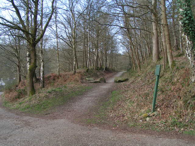
Milkwall Inclosure is a designated area of woodland located in Gloucestershire, England. It is situated within the larger Forest of Dean, a renowned ancient royal hunting forest. The inclosure covers an area of approximately 200 hectares and is predominantly composed of mixed deciduous trees.

The woodland is characterized by its diverse range of tree species, including oak, beech, ash, and birch. These trees provide a rich habitat for a variety of wildlife, such as birds, mammals, and insects. The forest floor is covered in a carpet of ferns, mosses, and wildflowers, creating a vibrant and ever-changing landscape.

Milkwall Inclosure offers a tranquil and peaceful environment for visitors to enjoy nature and explore the forest. There are several walking trails that wind through the woods, allowing visitors to immerse themselves in the beauty of the natural surroundings. These trails are well-maintained and provide access to different parts of the inclosure, offering a variety of experiences for hikers of all levels.

The woodland is also popular among birdwatchers and nature enthusiasts, as it is home to a diverse range of bird species, including woodpeckers, nuthatches, and tawny owls. The forest's secluded and undisturbed nature provides an ideal habitat for these birds to thrive.

Overall, Milkwall Inclosure in Gloucestershire offers a scenic and idyllic setting for individuals seeking a peaceful retreat into nature. With its diverse range of flora and fauna, it is a haven for wildlife enthusiasts and nature lovers alike.

If you have any feedback on the listing, please let us know in the comments section below.

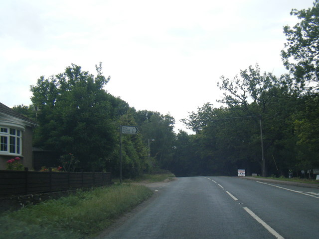
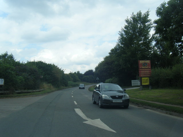
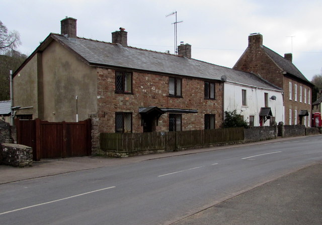
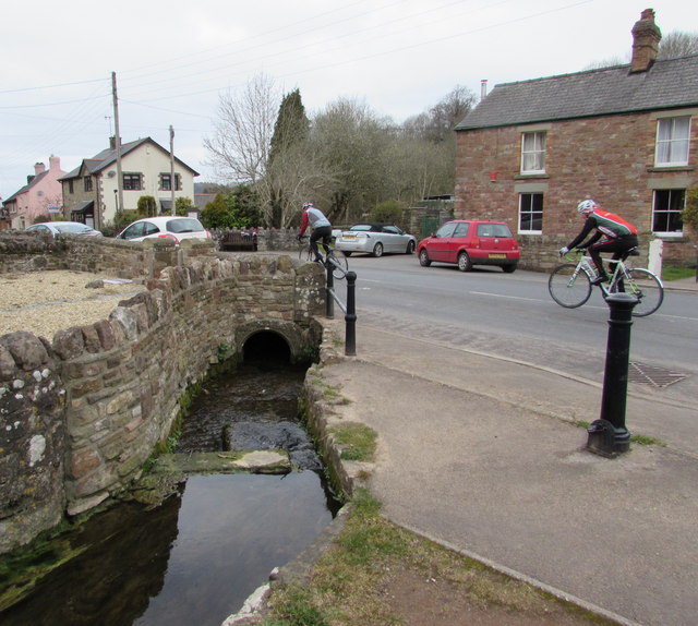
Milkwall Inclosure Images

Images are sourced within 2km of 51.776054/-2.6004225 or Grid Reference SO5808. Thanks to Geograph Open Source API. All images are credited.

Old Railway Track from Coleford to Parkend Photo taken from the same position as <a href="https://www.geograph.org.uk/photo/85548">SO6008 : Train from Coleford to Parkend</a>, but 44 years later. The line closed in 1967 and few traces remain. The trackbed is now a walkway and cycleway.
Old Railway Track from Coleford to Parkend
Photo taken from the same position as SO6008 : Train from Coleford to Parkend, but 44 years later. The line closed in 1967 and few traces remain. The trackbed is now a walkway and cycleway.
Forestry commission Track This track going over Cleave Hill,is at the top end of the RSPB Nagshead Nature Reserve.
Forestry commission Track
This track going over Cleave Hill,is at the top end of the RSPB Nagshead Nature Reserve.
Forest Track This track is going over Nagshead Hill,within the Nagshead Plantation.
Forest Track
This track is going over Nagshead Hill,within the Nagshead Plantation.
Road to Coleford Looking west, with the southern gridline for this square just to the left of the road.
The over-exposed sign points the way along the Gloucestershire Way LDF.
Road to Coleford
Looking west, with the southern gridline for this square just to the left of the road. The over-exposed sign points the way along the Gloucestershire Way LDF.
The Folly A collection of buildings by the Parkend to Coleford road which now houses the Mary Rose Young Pottery and Gallery.
The Gloucestershire Way LDF passes to the left.
The Folly
A collection of buildings by the Parkend to Coleford road which now houses the Mary Rose Young Pottery and Gallery. The Gloucestershire Way LDF passes to the left.
A ludicrous prohibition Yes, I agree, making tracks through the forest in the Nagshead Reserve is not on! But what on earth is wrong with using the road in the background?
A ludicrous prohibition
Yes, I agree, making tracks through the forest in the Nagshead Reserve is not on! But what on earth is wrong with using the road in the background?
Clearing, Nagshead Plantation Within the RSPB reserve, an open area with a natural looking boundary between forest and clearing. Edges of woodland are usually very rich in wildlife.
Clearing, Nagshead Plantation
Within the RSPB reserve, an open area with a natural looking boundary between forest and clearing. Edges of woodland are usually very rich in wildlife.
Track junction, Nagshead Plantation Heading downhill towards the information centre. A substantial logging road is crossed here.
Track junction, Nagshead Plantation
Heading downhill towards the information centre. A substantial logging road is crossed here.
Path, Nagshead Plantation An area of old oaks with holly understorey. No commercial conifers in this part of the reserve. I expected wood warblers and pied flycatchers and was not disappointed. 
The bluebells has yet to flower, Dean bluebells always appear to be a bit later than some other places.
Path, Nagshead Plantation
An area of old oaks with holly understorey. No commercial conifers in this part of the reserve. I expected wood warblers and pied flycatchers and was not disappointed. The bluebells has yet to flower, Dean bluebells always appear to be a bit later than some other places.
Birdwatchers, Nagshead A path in old oak wood. The folk with the telescope were amongst singing wood warblers.
Birdwatchers, Nagshead
A path in old oak wood. The folk with the telescope were amongst singing wood warblers.
The remains of the Titanic Steelworks The Titanic steelworks were so named because Robert Mushet the owner was experimenting with Titanium at that time.  Robert Mushet was working on solving the problems with the Bessemer steel making process.
The remains of the Titanic Steelworks
The Titanic steelworks were so named because Robert Mushet the owner was experimenting with Titanium at that time. Robert Mushet was working on solving the problems with the Bessemer steel making process.
Signed long loop path, RSPB Nagshead There is a short and a  long loop to the north of the car park.
Signed long loop path, RSPB Nagshead
There is a short and a long loop to the north of the car park.
B4228/Shophouse Road junction
B4228 at Sling village boundary
B4228 at Oakwood Road junction
B4228 at Perrygrove
B4228 at Perrygrove
Towards the centre of Clearwell The red phonebox on the right is opposite this <a title="https://www.geograph.org.uk/photo/4400603" href="https://www.geograph.org.uk/photo/4400603">Link</a> medieval cross.
Towards the centre of Clearwell
The red phonebox on the right is opposite this Link medieval cross.
Cycling through Clearwell Two Sunday cyclists head away from the centre of the village.
Cycling through Clearwell
Two Sunday cyclists head away from the centre of the village.
Show me another place!

Milkwall Inclosure is located at Grid Ref: SO5808 (Lat: 51.776054, Lng: -2.6004225)

Administrative County: Gloucestershire

District: Forest of Dean

Police Authority: Gloucestershire

What 3 Words

///cowboys.trend.ruffling. Near Coleford, Gloucestershire

Related Wikis

Milkwall

Milkwall is a village in the Forest of Dean in Gloucestershire, England. It lies between the village of Sling to the south, and the town of Coleford to...
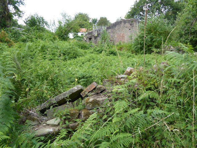
Darkhill Ironworks

Darkhill Ironworks, and the neighbouring Titanic Steelworks, are internationally important industrial remains associated with the development of the iron...

Milkwall railway station

Milkwall railway station is a disused station on the former Severn and Wye Railway. It served the village of Milkwall, Gloucestershire, England. The station...

Gorsty Knoll

Gorsty Knoll is a small hamlet, located in the Forest of Dean, Gloucestershire, England. The internationally important remains of Darkhill Ironworks and...

Old Bow and Old Ham Mines

Old Bow And Old Ham Mines (grid reference SO579088) is a 40.3-hectare (100-acre) biological Site of Special Scientific Interest in Gloucestershire, notified...

Ellwood, Gloucestershire

Ellwood is a hamlet in the Forest of Dean district in Gloucestershire, England. It lies around 3 kilometres (1.9 mi) south-east of Coleford. The hamlet...

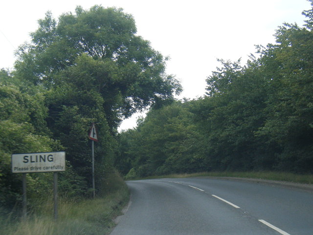
Sling, Gloucestershire

Sling is a village in Gloucestershire, England. The village is located between Clearwell and Bream. It is just south of the village of Milkwall. ��2�...

Perrygrove railway station

Perrygrove railway station is the home of the 15 in (381 mm) gauge Perrygrove Railway. The railway was opened in 1996 and is a heritage railway. There...

Nearby Amenities

Located within 500m of 51.776054,-2.6004225
Ellwood Cross
Lat/Long: 51.7734912/-2.5987171
Bus Stop
Ellwood Cross
Naptan AtcoCode: 1600GL1821
Naptan Bearing: NW
Naptan CommonName: Ellwood Cross
Naptan NaptanCode: gloagadp
Naptan Street: Ellwood Rd
Naptan Verified: no
Source: naptan_import
Lat/Long: 51.7737055/-2.599267
Bus Stop
Ellwood Cross
Naptan AtcoCode: 1600GL1822
Naptan Bearing: SE
Naptan CommonName: Ellwood Cross
Naptan NaptanCode: gloagadw
Naptan Street: Ellwood Rd
Naptan Verified: no
Source: naptan_import
Lat/Long: 51.7737246/-2.5990353
Bus Stop
St James Caravan Park
Naptan AtcoCode: 1600GLF295
Naptan Bearing: N
Naptan CommonName: St James Caravan Park
Naptan NaptanCode: gloadwpm
Naptan Street: Ellwood Rd
Naptan Verified: no
Source: naptan_import
Lat/Long: 51.7756946/-2.6023951
Bus Stop
St James Caravan Park
Naptan AtcoCode: 1600GLF296
Naptan Bearing: S
Naptan CommonName: St James Caravan Park
Naptan Indicator: Opp
Naptan NaptanCode: gloadwpt
Naptan Street: Ellwood Rd
Naptan Verified: no
Source: naptan_import
Lat/Long: 51.7757131/-2.6022794
Bus Stop
Ellwood Cross
Naptan AtcoCode: 1600GLF717
Naptan Bearing: SW
Naptan CommonName: Ellwood Cross
Naptan NaptanCode: gloagagt
Naptan Street: Dark Hill
Naptan Verified: no
Source: naptan_import
Lat/Long: 51.7735111/-2.5985832
Bus Stop
Ellwood Cross
Naptan AtcoCode: 1600GLF718
Naptan Bearing: NE
Naptan CommonName: Ellwood Cross
Naptan NaptanCode: gloagagm
Naptan Street: Dark Hill
Naptan Verified: no
Source: naptan_import
Lat/Long: 51.7735825/-2.5987001
Bus Stop
KWT Coaches Garage
Naptan AtcoCode: 1600GLF784
Naptan Bearing: SW
Naptan CommonName: KWT Coaches Garage
Naptan NaptanCode: gloadwpj
Naptan Street: Off Station Rd
Naptan Verified: no
Source: naptan_import
Lat/Long: 51.7801341/-2.6028311
Telephone
Booth: K6
Covered: booth
Man Made: telephone_box
Source: Bing
Lat/Long: 51.7726445/-2.597091
Post Box
Post Box Type: lamp
Royal Cypher: EIIR
Royal Cypher Wikidata: Q33102113
Lat/Long: 51.7726655/-2.5971303
Ellwood Green
Place: hamlet
Source: OS_OpenData_StreetView
Lat/Long: 51.7722216/-2.599402
Milkwall
Place: village
Source: OS_OpenData_StreetView
Wikidata: Q6858130
Wikipedia: en:Milkwall
Lat/Long: 51.7791977/-2.6046363
Dark Hill
Historic: ruins
Tourism: attraction
Wikidata: Q15212898
Wikipedia: en:Darkhill Ironworks
Lat/Long: 51.7764389/-2.5955603
Cycleway: asl
Lat/Long: 51.7749527/-2.6058126
Power: pole
Lat/Long: 51.7748133/-2.5971146
Power: pole
Lat/Long: 51.7741586/-2.5960685
Power: pole
Lat/Long: 51.7737669/-2.5954302
Power: pole
Lat/Long: 51.7735703/-2.5944096
The data included in this document is from www.openstreetmap.org. The data is made available under ODbL.

Have you been to Milkwall Inclosure?

Leave your review of Milkwall Inclosure below (or comments, questions and feedback).