Cliff Wood

Wood, Forest in Somerset Mendip

England

Cliff Wood

Ham Lane Starting a descent into the Sheppey valley as the snow holds off for a short while. On the left is Darshill Wood.
Ham Lane Credit: Derek Harper

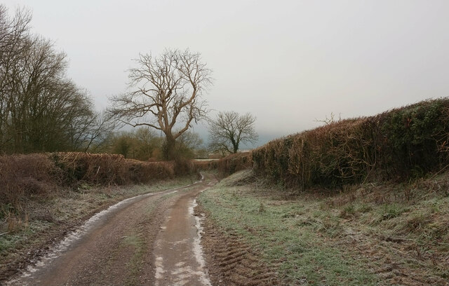
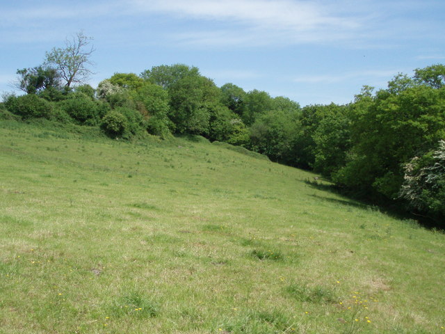
Cliff Wood is a small village located in Somerset, England. It is situated within the larger district of Mendip, near the town of Frome. The village is known for its picturesque setting, nestled within a dense forest and surrounded by rolling hills.

The woodlands in Cliff Wood are abundant with a variety of trees, including oak, beech, and ash. These trees provide a lush and verdant backdrop to the village, making it popular among nature enthusiasts and hikers. The forest is also home to a diverse range of wildlife, including deer, foxes, and various bird species.

The village itself consists of a small cluster of houses, many of which have traditional thatched roofs, adding to the charm and character of the area. There is a local pub, The Woodland Inn, which serves as a gathering place for residents and visitors alike. The pub offers a selection of locally brewed ales and hearty pub food.

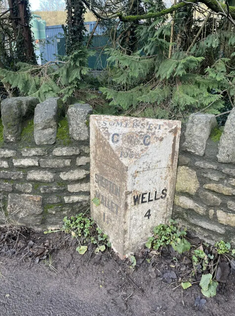
Cliff Wood is well-connected to nearby towns and cities, with good transport links via the A361 road. Its location in the heart of Somerset also provides easy access to popular tourist destinations such as the city of Bath and the historic site of Stonehenge.

Overall, Cliff Wood offers a tranquil and idyllic setting for those seeking a rural escape. Its natural beauty and peaceful atmosphere make it a sought-after location for both residents and tourists looking to immerse themselves in the beauty of the English countryside.

If you have any feedback on the listing, please let us know in the comments section below.

Cliff Wood Images

Images are sourced within 2km of 51.196112/-2.5973583 or Grid Reference ST5844. Thanks to Geograph Open Source API. All images are credited.

Ham Lane Starting a descent into the Sheppey valley as the snow holds off for a short while. On the left is Darshill Wood.
Ham Lane
Starting a descent into the Sheppey valley as the snow holds off for a short while. On the left is Darshill Wood.
Old Milepost by the A371, Wells Road, Shepton Mallet Cast iron post by the A371, in parish of SHEPTON MALLET (MENDIP District), West of Darshill, near sewage works, set in wall, on North side of road. Somerset CC iron casting, erected by the County Council in the 20th century. 

Inscription reads:-
: SHEPTON / MALLET / 1¼ : : SOMERSET / C {badge} C / 1909 : : WELLS / 4 :

Somerset HER.
HER number: 18410 <span class="nowrap"><a title="https://www.heritagegateway.org.uk/Gateway/Results_Single.aspx?uid=18410&resourceID=100" rel="nofollow ugc noopener" href="https://www.heritagegateway.org.uk/Gateway/Results_Single.aspx?uid=18410&resourceID=100">Link</a><img style="margin-left:2px;" alt="External link" title="External link - shift click to open in new window" src="https://s1.geograph.org.uk/img/external.png" width="10" height="10"/></span>

Milestone Society National ID: SO_SMWL01
Old Milepost by the A371, Wells Road, Shepton Mallet
Cast iron post by the A371, in parish of SHEPTON MALLET (MENDIP District), West of Darshill, near sewage works, set in wall, on North side of road. Somerset CC iron casting, erected by the County Council in the 20th century. Inscription reads:- : SHEPTON / MALLET / 1¼ : : SOMERSET / C {badge} C / 1909 : : WELLS / 4 : Somerset HER. HER number: 18410 LinkExternal link Milestone Society National ID: SO_SMWL01
Nancy Camel's Hole, Darshill Wood This cave was once reputed to have been occupied by a drunken stocking-knitter called Nancy Camel. Nancy wrote herself into legend when sometime in the late 17th century or early 18th century, it is reputed that she made a pact with the Devil, and was carried off screaming to Hell during a storm that nearly destroyed the parish church.
Nancy Camel's Hole, Darshill Wood
This cave was once reputed to have been occupied by a drunken stocking-knitter called Nancy Camel. Nancy wrote herself into legend when sometime in the late 17th century or early 18th century, it is reputed that she made a pact with the Devil, and was carried off screaming to Hell during a storm that nearly destroyed the parish church.
Field on the north west side of Ham wood
Shepton Mallet, milepost Recently repainted milepost on A371 next to sewage works; erected 1909 by Somerset County Council. The legend on the right face reads "WELLS / 4".
Shepton Mallet, milepost
Recently repainted milepost on A371 next to sewage works; erected 1909 by Somerset County Council. The legend on the right face reads "WELLS / 4".
View south-west from Ham Lane Glastonbury Tor is prominent. The near buildings belong to Ham Western Farm.
View south-west from Ham Lane
Glastonbury Tor is prominent. The near buildings belong to Ham Western Farm.
Ham Lane Heading towards Croscombe.
Ham Lane
Heading towards Croscombe.
A371 Wells Road
A371 Wells Road
Old Milepost by the A371, Wells Road, Shepton Mallet Cast iron post by the A371, in parish of SHEPTON MALLET (MENDIP District), West of Darshill, near sewage works, set in wall, on North side of road. Somerset CC iron casting, erected by the County Council in the 20th century. 

Inscription reads:-
: SHEPTON / MALLET / 1¼ : : SOMERSET / C {badge} C / 1909 : : WELLS / 4 :

Somerset HER.
HER number: 18410 <span class="nowrap"><a title="https://www.heritagegateway.org.uk/Gateway/Results_Single.aspx?uid=18410&resourceID=100" rel="nofollow ugc noopener" href="https://www.heritagegateway.org.uk/Gateway/Results_Single.aspx?uid=18410&resourceID=100">Link</a><img style="margin-left:2px;" alt="External link" title="External link - shift click to open in new window" src="https://s1.geograph.org.uk/img/external.png" width="10" height="10"/></span>

Milestone Society National ID: SO_SMWL01
Old Milepost by the A371, Wells Road, Shepton Mallet
Cast iron post by the A371, in parish of SHEPTON MALLET (MENDIP District), West of Darshill, near sewage works, set in wall, on North side of road. Somerset CC iron casting, erected by the County Council in the 20th century. Inscription reads:- : SHEPTON / MALLET / 1¼ : : SOMERSET / C {badge} C / 1909 : : WELLS / 4 : Somerset HER. HER number: 18410 LinkExternal link Milestone Society National ID: SO_SMWL01
Croscombe: Higher Mill The structure dates from about 1800 and is Grade II Listed. Commercial milling ceased in 1952, the year in which a BBC film was made of its operation
Croscombe: Higher Mill
The structure dates from about 1800 and is Grade II Listed. Commercial milling ceased in 1952, the year in which a BBC film was made of its operation
Type 29 Pillbox Sharcombe park WW2 Pill box near Dulcote, on "defence line green". This is on the edge of Dinder Wood, which is on a ridge facing south. Thank goodness it and many like it were never needed.
Type 29 Pillbox Sharcombe park
WW2 Pill box near Dulcote, on "defence line green". This is on the edge of Dinder Wood, which is on a ridge facing south. Thank goodness it and many like it were never needed.
Dulcote fountain Built 150 years go on a triangle of land where a toll house once stood, the fountain was created from the overflow of natural springs which have an average flow of 100,000 gallons a day.  The water is hard (calcium carbonate), and the fountain has increased in size over the years as minerals build up the rock surface.
Dulcote fountain
Built 150 years go on a triangle of land where a toll house once stood, the fountain was created from the overflow of natural springs which have an average flow of 100,000 gallons a day. The water is hard (calcium carbonate), and the fountain has increased in size over the years as minerals build up the rock surface.
Dulcote Grotto This man-made grotto with spring water running through it was created about 150 years ago and is on the north wall of the Dulcote triangle near the fountain.
Dulcote Grotto
This man-made grotto with spring water running through it was created about 150 years ago and is on the north wall of the Dulcote triangle near the fountain.
Pill Box at Furzy Sleight This was part of WWII defences against a possible German invasion. It is part of 'Stop-line Green' which ran from Burnham-on-Sea, across the Somerset Levels, through Wells and then on to Freshford, south of Bath.
Pill Box at Furzy Sleight
This was part of WWII defences against a possible German invasion. It is part of 'Stop-line Green' which ran from Burnham-on-Sea, across the Somerset Levels, through Wells and then on to Freshford, south of Bath.
Pill box at Furzy Sleight In spite of being built very quickly, many pill boxes have survived 50 years of neglect.  They had solid flat walls and thick concrete walls covered by external brick shuttering.  This Type 29 pill box formed part of the Green Line defences for WWII.
Pill box at Furzy Sleight
In spite of being built very quickly, many pill boxes have survived 50 years of neglect. They had solid flat walls and thick concrete walls covered by external brick shuttering. This Type 29 pill box formed part of the Green Line defences for WWII.
Limestone gate post An old, unused limestone gatepost at the northern entrance to Sharcombe Park. The rusted hook to hang the original gate on can be seen at the front.  It is attached to the stone with a lump of lead.
Limestone gate post
An old, unused limestone gatepost at the northern entrance to Sharcombe Park. The rusted hook to hang the original gate on can be seen at the front. It is attached to the stone with a lump of lead.
Stile A slab of limestone forms the barrier to climb over and smaller pieces of limestone are built up on either side to aid people crossing.
Stile
A slab of limestone forms the barrier to climb over and smaller pieces of limestone are built up on either side to aid people crossing.
Recently mown field Mown grass drying in the May sun, waiting to be collected for silage. Thrupe lane lies just beyond the barn and hedge at the bottom of the field.
Recently mown field
Mown grass drying in the May sun, waiting to be collected for silage. Thrupe lane lies just beyond the barn and hedge at the bottom of the field.
Show me another place!

Cliff Wood is located at Grid Ref: ST5844 (Lat: 51.196112, Lng: -2.5973583)

Administrative County: Somerset

District: Mendip

Police Authority: Avon and Somerset

What 3 Words

///treat.boast.nags. Near Shepton Mallet, Somerset

Related Wikis

Dinder

Dinder (which means "the house in the valley") is a small village and former civil parish, now in the parish of St Cuthbert Out, in the Somerset district...

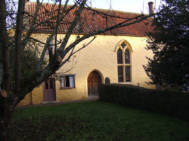
The Old Rectory, Croscombe

The Old Rectory in the village of Croscombe within the English county of Somerset was built in the 17th century and rebuilt in the 18th. It is a Grade...

Dinder House

Dinder House, is a Somerset estate with a small country house Grade II Regency listed building in the village of Dinder, in the civil parish of St Cuthbert...

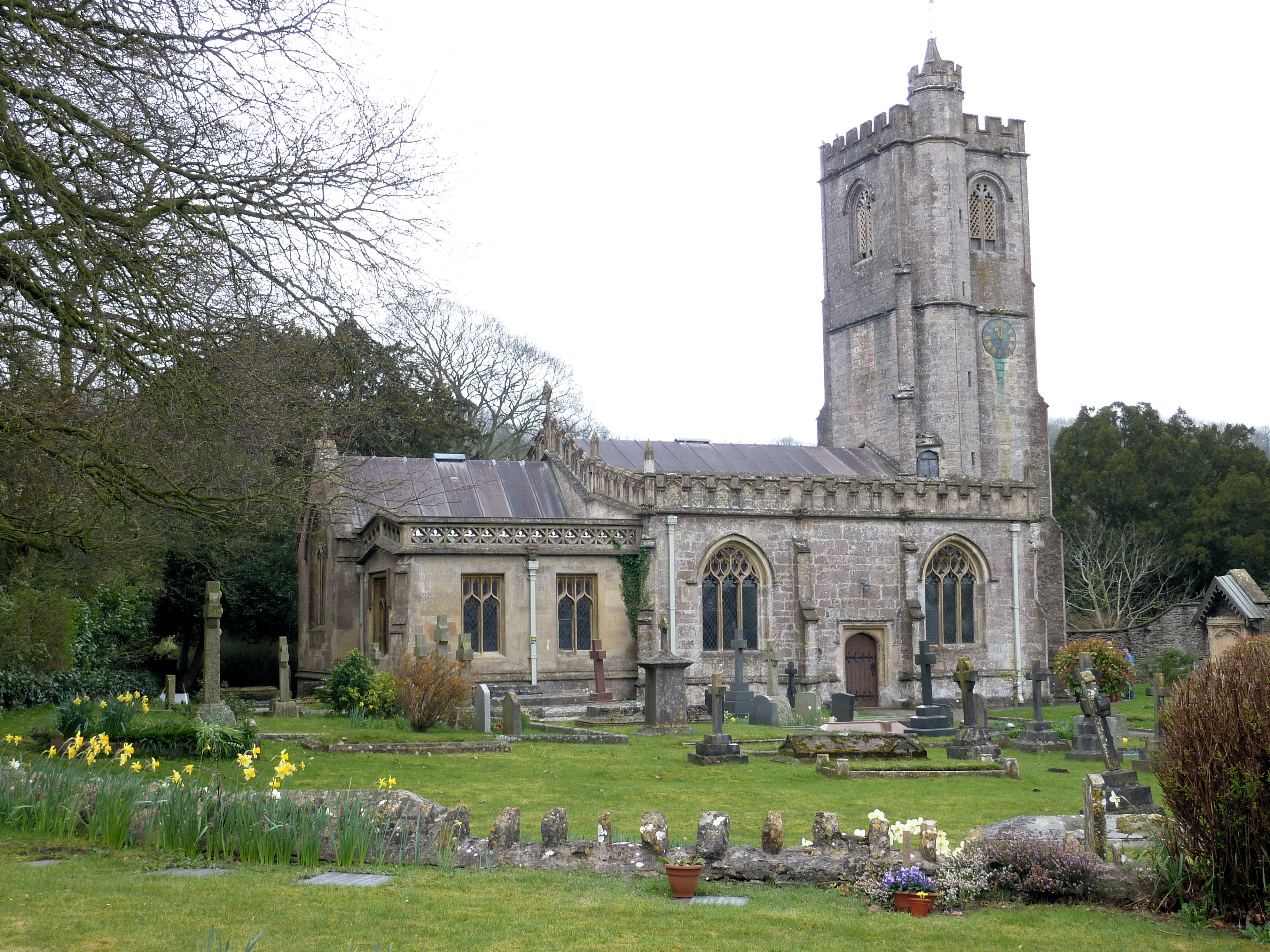
Church of St Michael, Dinder

The Anglican Church of St Michael in Dinder, Somerset, England has Norman origins and was built in the 14th century before being rebuilt in the 15th. It...

The Old Manor, Croscombe

The Old Manor in Croscombe, Somerset, England, was built around 1460–89 as a rectorial manor house for Hugh Sugar, the Treasurer of Wells Cathedral. It...

Croscombe

Croscombe is a village and civil parish 2 miles (3 km) west of Shepton Mallet and 4 miles (6 km) from Wells, in the Mendip district of Somerset, England...

Friar's Oven

Friar's Oven (grid reference ST592431) is a 4.0 hectare biological Site of Special Scientific Interest in Somerset, notified in 1989. == Sources == English...

Dulcote Quarry

Dulcote Quarry is a disused limestone quarry at Dulcote, near Wells on the Mendip Hills, Somerset, England. The quarry measures around 600 metres (2,000...

Nearby Amenities

Located within 500m of 51.196112,-2.5973583
Hillview Cottage
Place: isolated_dwelling
Lat/Long: 51.1946097/-2.592999
Power: pole
Lat/Long: 51.1942599/-2.6024032
Power: pole
Lat/Long: 51.1951285/-2.6016305
Power: pole
Lat/Long: 51.1954507/-2.6013448
Power: pole
Lat/Long: 51.196003/-2.6008598
Power: pole
Lat/Long: 51.1990894/-2.5979548
Power: pole
Lat/Long: 51.2000773/-2.5970813
Power: pole
Lat/Long: 51.2004595/-2.596037
The data included in this document is from www.openstreetmap.org. The data is made available under ODbL.

Have you been to Cliff Wood?

Leave your review of Cliff Wood below (or comments, questions and feedback).