Big Wood

Wood, Forest in Lancashire Chorley

England

Big Wood

Charnock Richard Crematorium Memorial garden
Charnock Richard Crematorium Memorial garden Credit: David Dixon

Big Wood, Lancashire, also known as Wood Forest, is a picturesque woodland area located in the county of Lancashire, England. Spanning over 100 acres, this enchanting forest is a haven for nature enthusiasts and those seeking tranquility amidst the bustling city life.

Situated on the outskirts of the town of Burnley, Big Wood offers a diverse range of habitats, including ancient woodland, open fields, and a small lake. The forest is home to a wide variety of flora and fauna, making it a perfect destination for wildlife spotting and birdwatching. Visitors can expect to see species such as foxes, badgers, deer, and a rich assortment of birdlife.

The woodland itself is a combination of both deciduous and coniferous trees, creating a vibrant tapestry of colors throughout the seasons. In spring, the forest floor is carpeted with bluebells and wildflowers, while autumn brings a stunning display of golden hues as the leaves change color.

Big Wood offers several well-marked trails that meander through the forest, catering to both casual strollers and avid hikers. These paths provide opportunities for leisurely walks, jogging, and cycling, allowing visitors to explore the natural beauty at their own pace.

The forest is also equipped with picnic areas and benches, making it an ideal spot for family outings and gatherings. Additionally, educational programs and guided tours are occasionally organized to promote environmental awareness and understanding of the local ecosystem.

In conclusion, Big Wood, Lancashire, is a cherished natural gem that offers a serene escape from the urban landscape. With its diverse wildlife, stunning landscapes, and recreational opportunities, this woodland paradise is a must-visit destination for nature lovers and outdoor enthusiasts.

If you have any feedback on the listing, please let us know in the comments section below.
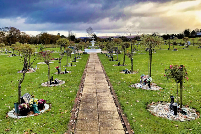
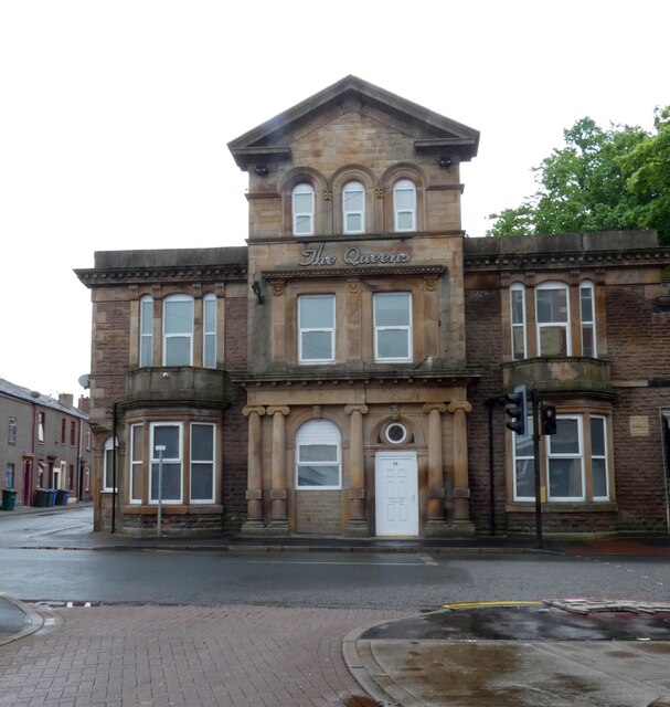
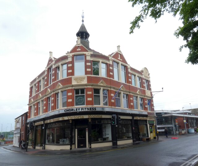
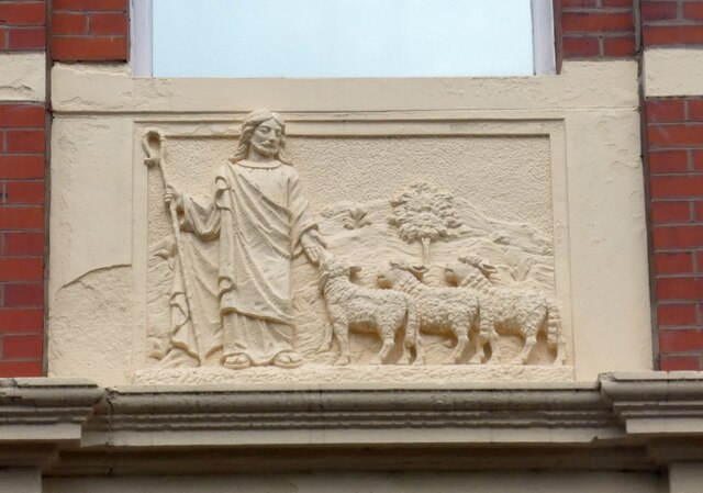
Big Wood Images

Images are sourced within 2km of 53.650799/-2.6521864 or Grid Reference SD5617. Thanks to Geograph Open Source API. All images are credited.

Charnock Richard Crematorium Memorial garden
Memorial Garden, Charnock Richard Crematorium
The Queens 
The Queen's Hotel on Church Street dates back to the 1860s. It closed in 2009 and was falling into disrepair until it was restored and converted to residential use in 2015. See <span class="nowrap"><a title="http://chorleyinnsandtaverns.blogspot.com/p/queens-hotel.html" rel="nofollow ugc noopener" href="http://chorleyinnsandtaverns.blogspot.com/p/queens-hotel.html">Link</a><img style="margin-left:2px;" alt="External link" title="External link - shift click to open in new window" src="https://s1.geograph.org.uk/img/external.png" width="10" height="10"/></span> for more details.
The Queens
The Queen's Hotel on Church Street dates back to the 1860s. It closed in 2009 and was falling into disrepair until it was restored and converted to residential use in 2015. See LinkExternal link for more details.
Shepherd's Victoria Hall The Ancient Order of Shepherds Friendly Society was formed in 1826 and was quite prominent in Chorley in the late 1800s and early 1900s.

The hall is presently occupied Chorley Fitness Centre and a micro-brewery 

On the right is the bus station.

<a href="https://www.geograph.org.uk/photo/7185639">SD5817 : Shepherd's Victoria Hall: Architectural detail (1)</a>.
<a href="https://www.geograph.org.uk/photo/7185644">SD5817 : Shepherd's Victoria Hall: Architectural detail (2)</a>.
Shepherd's Victoria Hall
The Ancient Order of Shepherds Friendly Society was formed in 1826 and was quite prominent in Chorley in the late 1800s and early 1900s. The hall is presently occupied Chorley Fitness Centre and a micro-brewery On the right is the bus station. SD5817 : Shepherd's Victoria Hall: Architectural detail (1). SD5817 : Shepherd's Victoria Hall: Architectural detail (2).
Shepherd's Victoria Hall: Architectural detail (1) 
Detail on Shepherd's Victoria Hall <a href="https://www.geograph.org.uk/photo/7185596">SD5817 : Shepherd's Victoria Hall</a>.
Shepherd's Victoria Hall: Architectural detail (1)
Detail on Shepherd's Victoria Hall SD5817 : Shepherd's Victoria Hall.
Shepherd's Victoria Hall: Architectural detail (2) 
Detail on Shepherd's Victoria Hall <a href="https://www.geograph.org.uk/photo/7185596">SD5817 : Shepherd's Victoria Hall</a>.
Shepherd's Victoria Hall: Architectural detail (2)
Detail on Shepherd's Victoria Hall SD5817 : Shepherd's Victoria Hall.
Chorley Bus Station
Chorley Bus Station
Chorley Railway Station 
As viewed from the bus station across Shepherd's Way (A6).
Chorley Railway Station
As viewed from the bus station across Shepherd's Way (A6).
Astley Hall The render had just been removed from the brickwork
Astley Hall
The render had just been removed from the brickwork
The Courtyard Formed by the stable block to Astley Hall and Astley Farm
The Courtyard
Formed by the stable block to Astley Hall and Astley Farm
Steely Lane Level Crossing, Chorley – 1971 This crossing has disappeared completely, together with the signal box, the only evidence being some asphalt visible in the foreground of this view <a title="https://www.geograph.org.uk/photo/2786575" href="https://www.geograph.org.uk/photo/2786575">Link</a> . The pedestrian subway on the right does survive.
Steely Lane Level Crossing, Chorley – 1971
This crossing has disappeared completely, together with the signal box, the only evidence being some asphalt visible in the foreground of this view Link . The pedestrian subway on the right does survive.
The Malt 'n' Hops, Chorley This building on Friday Street dates from the 1870s and looks as though it might always have been a pub. In fact, it was for very many years a grocer's shop and subsequently found a variety of uses before being converted to a pub in 1989. Today it is renowned for the quality and range of real ales on offer, winning CAMRA's Central Lancashire pub of the year title in 2017.
The Malt 'n' Hops, Chorley
This building on Friday Street dates from the 1870s and looks as though it might always have been a pub. In fact, it was for very many years a grocer's shop and subsequently found a variety of uses before being converted to a pub in 1989. Today it is renowned for the quality and range of real ales on offer, winning CAMRA's Central Lancashire pub of the year title in 2017.
The Bob Inn, Chorley Occupying what is effectively a stall in Chorley's covered market, this is a particularly small micropub. As it forms part of the market it is closed on Sundays.
The Bob Inn, Chorley
Occupying what is effectively a stall in Chorley's covered market, this is a particularly small micropub. As it forms part of the market it is closed on Sundays.
Ben's Tap & Bottleshop, Chorley This is one of several micropubs in the centre of Chorley and is almost opposite the Bob Inn. It is the brewery tap for Ben's microbrewery and opened in March 2022.
Ben's Tap & Bottleshop, Chorley
This is one of several micropubs in the centre of Chorley and is almost opposite the Bob Inn. It is the brewery tap for Ben's microbrewery and opened in March 2022.
Chapel Street, Chorley Chapel Street connects Chorley town centre with the bus and rail stations; the stretch here is pedestrianised. On the left is a charity shop supporting Cancer Research UK.
Chapel Street, Chorley
Chapel Street connects Chorley town centre with the bus and rail stations; the stretch here is pedestrianised. On the left is a charity shop supporting Cancer Research UK.
Chapel Street, Chorley This stretch of Chapel Street runs immediately to the north of St George's Church. Grosvenor Partners on the left is a wealth management and financial planning firm. The larger building on the corner is Shepherd's Hall that originally belonged to the Shepherd's Guild but now houses a gym and a micropub.
Chapel Street, Chorley
This stretch of Chapel Street runs immediately to the north of St George's Church. Grosvenor Partners on the left is a wealth management and financial planning firm. The larger building on the corner is Shepherd's Hall that originally belonged to the Shepherd's Guild but now houses a gym and a micropub.
St George's Church, Chorley - tower St George's Church was designed by Thomas Rickman, an architect with a particular interest in the Gothic Revival, and built between 1822 and 1825. It was a 'commissioner's church', funded by a grant made available under the Church Building Acts of 1818 and 1824 and administered by the Church Building Commission. The object was to provide churches in the fast-growing urban areas of the industrial revolution and Chorley, a Lancashire mill town, would have been a prime candidate. The building is now grade II* listed. The clock is showing the correct time.
St George's Church, Chorley - tower
St George's Church was designed by Thomas Rickman, an architect with a particular interest in the Gothic Revival, and built between 1822 and 1825. It was a 'commissioner's church', funded by a grant made available under the Church Building Acts of 1818 and 1824 and administered by the Church Building Commission. The object was to provide churches in the fast-growing urban areas of the industrial revolution and Chorley, a Lancashire mill town, would have been a prime candidate. The building is now grade II* listed. The clock is showing the correct time.
The Ale Station, Chorley Taking its name from the nearby rail and bus stations, The Ale Station has adopted the British Transport Commission style of sign over its door. This is one of several micropubs in the immediate vicinity.
The Ale Station, Chorley
Taking its name from the nearby rail and bus stations, The Ale Station has adopted the British Transport Commission style of sign over its door. This is one of several micropubs in the immediate vicinity.
Show me another place!

Big Wood is located at Grid Ref: SD5617 (Lat: 53.650799, Lng: -2.6521864)

Administrative County: Lancashire

District: Chorley

Police Authority: Lancashire

What 3 Words

///sand.scars.shares. Near Chorley, Lancashire

Related Wikis

River Chor

The River Chor is a largely culverted stream in the Lancashire town of Chorley. Its name was back-formed from "Chorley". The source of the river is in...

Lancashire College

Lancashire Adult Learning is an adult education college located in Lancashire, England . Courses offered by the college are aimed primarily at adult learners...

Parklands High School, Chorley

Parklands High School is a coeducational secondary school with academy status located in Chorley, Lancashire, England. The school has been judged "good...

Chorley Rural District

Chorley Rural District was a rural district in the administrative county of Lancashire, England from 1894 to 1974. The district was created by the Local...

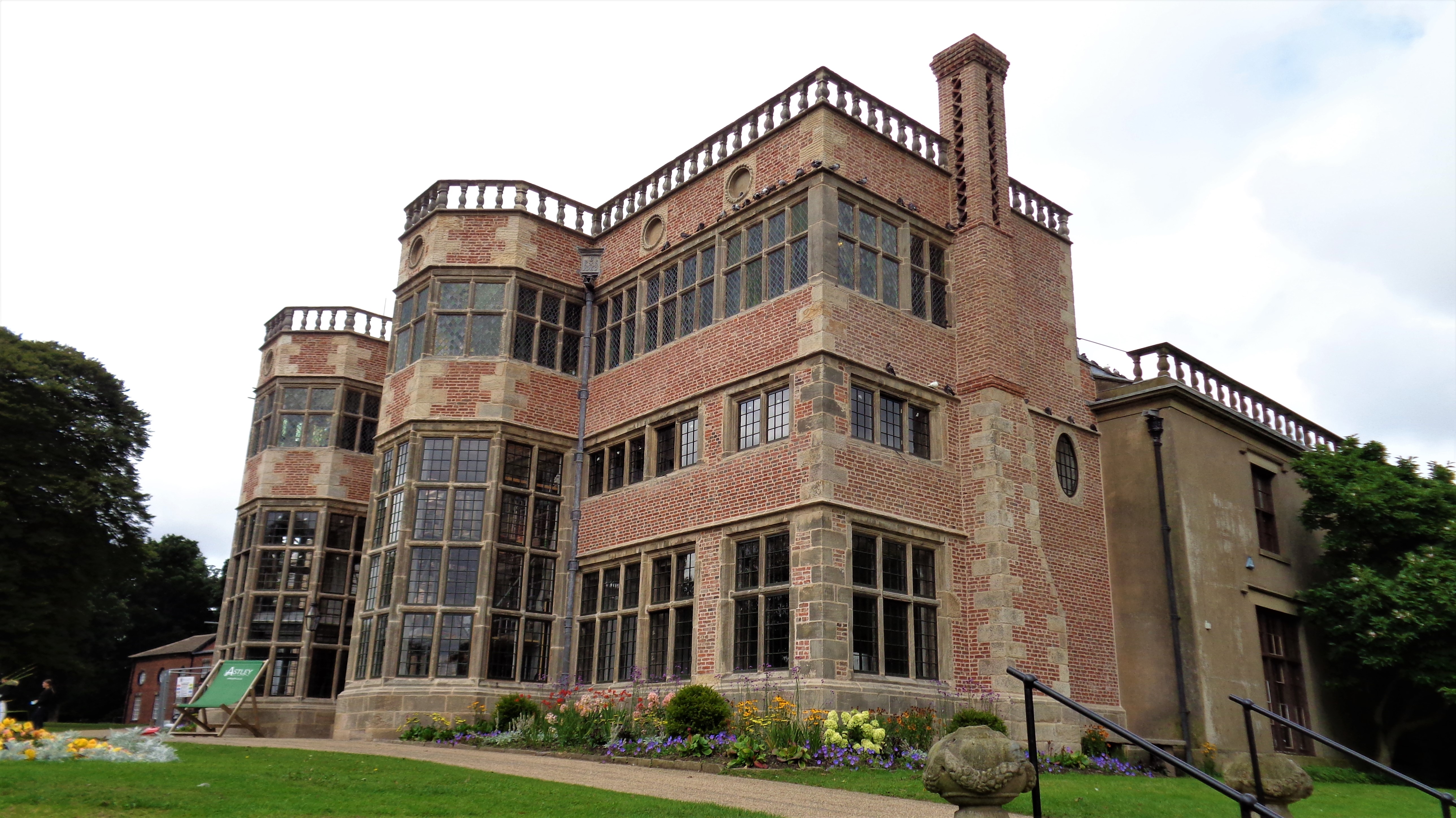
Astley Hall, Chorley

Astley Hall is a country house in Chorley, Lancashire, England. The building is now owned by the town and is known as Astley Hall Museum and Art Gallery...

Southlands High School

Southlands High School is a coeducational secondary school in Chorley, Lancashire, United Kingdom. It has approximately 1,000 students per annum. ��2...

Pestalozzi International Village

Pestalozzi International Foundation (formerly called Pestalozzi Children's Village Trust and then Pestalozzi International Village Trust) is an educational...
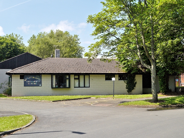
Astley Village

Astley Village is a civil parish in the Borough of Chorley in Lancashire, England, covering a suburb of Chorley. According to the 2011 census, its population...

Nearby Amenities

Located within 500m of 53.650799,-2.6521864
Source: Yahoo imagery
Lat/Long: 53.6496828/-2.6460291
Source: Yahoo imagery
Lat/Long: 53.6498514/-2.6463485
Source: Yahoo imagery
Lat/Long: 53.6501199/-2.6468657
Source: Yahoo imagery
Lat/Long: 53.650264/-2.6472526
Source: Yahoo imagery
Lat/Long: 53.6503991/-2.6477503
Source: Yahoo imagery
Lat/Long: 53.6504485/-2.6480503
Source: Yahoo imagery
Lat/Long: 53.6504873/-2.6486616
Source: Yahoo imagery
Lat/Long: 53.6504888/-2.6493628
Source: Yahoo imagery
Lat/Long: 53.6504795/-2.6497269
Source: Yahoo imagery
Lat/Long: 53.6504614/-2.6507173
Source: Yahoo imagery
Lat/Long: 53.6500212/-2.6492652
Source: Yahoo imagery
Lat/Long: 53.6498777/-2.6485502
Source: Yahoo imagery
Lat/Long: 53.6497114/-2.6476446
Source: Yahoo imagery
Lat/Long: 53.6495887/-2.6468639
Turning Circle
Source: Yahoo imagery
Lat/Long: 53.6490763/-2.6468188
Turning Circle
Source: Yahoo imagery
Lat/Long: 53.648867/-2.6479166
Source: Yahoo imagery
Lat/Long: 53.649493/-2.6477545
Turning Circle
Source: Yahoo imagery
Lat/Long: 53.6490471/-2.6488654
Source: Yahoo imagery
Lat/Long: 53.650596/-2.6476139
Source: Yahoo imagery
Lat/Long: 53.6509378/-2.6473095
Source: Yahoo imagery
Lat/Long: 53.6512638/-2.6469228
Source: Yahoo imagery
Lat/Long: 53.6514129/-2.6465942
Source: Yahoo imagery
Lat/Long: 53.6514652/-2.6463885
Source: Yahoo imagery
Lat/Long: 53.6514638/-2.6459476
Source: Yahoo imagery
Lat/Long: 53.651409/-2.6453563
Passing Place
Source: Yahoo imagery
Lat/Long: 53.6517339/-2.6473734
Source: Yahoo imagery
Lat/Long: 53.6513892/-2.6471725
Source: Yahoo imagery
Lat/Long: 53.6507547/-2.646733
Turning Circle
Source: Yahoo imagery
Lat/Long: 53.6507254/-2.6464877
Source: Yahoo imagery
Lat/Long: 53.6502093/-2.6455842
Source: Yahoo imagery
Lat/Long: 53.6499572/-2.6456289
Source: Yahoo imagery
Lat/Long: 53.6484815/-2.6470168
Source: Yahoo imagery
Lat/Long: 53.6483521/-2.6466384
Source: Yahoo imagery
Lat/Long: 53.6483434/-2.6462672
Turning Circle
Source: Yahoo imagery
Lat/Long: 53.648978/-2.6460152
Source: Yahoo imagery
Lat/Long: 53.6486867/-2.6455299
Source: Yahoo imagery
Lat/Long: 53.6524733/-2.6504157
Source: Yahoo imagery
Lat/Long: 53.6525758/-2.6502416
Source: Yahoo imagery
Lat/Long: 53.6526035/-2.6499907
Source: Yahoo imagery
Lat/Long: 53.6525022/-2.6496182
Source: Yahoo imagery
Lat/Long: 53.652213/-2.6492615
Turning Circle
Source: Yahoo imagery
Lat/Long: 53.6516829/-2.6490453
Source: Yahoo imagery
Lat/Long: 53.6521639/-2.6535943
Source: Yahoo imagery
Lat/Long: 53.6521737/-2.6533793
Source: Yahoo imagery
Lat/Long: 53.6519244/-2.653256
Source: Yahoo imagery
Lat/Long: 53.6521383/-2.6536541
Source: Yahoo imagery
Lat/Long: 53.6518799/-2.6535871
Source: Yahoo imagery
Lat/Long: 53.6520133/-2.6513252
Source: Yahoo imagery
Lat/Long: 53.6541431/-2.6527561
Source: Yahoo imagery
Lat/Long: 53.653706/-2.6502321
Source: Yahoo imagery
Lat/Long: 53.6536277/-2.6499581
Source: Yahoo imagery
Lat/Long: 53.6535373/-2.6494936
Source: Yahoo imagery
Lat/Long: 53.6542306/-2.6489297
Source: Yahoo imagery
Lat/Long: 53.6532892/-2.6481091
Source: Yahoo imagery
Lat/Long: 53.6527958/-2.6493708
Source: Yahoo imagery
Lat/Long: 53.6528675/-2.6506874
Source: Yahoo imagery
Lat/Long: 53.6527292/-2.6513349
Source: Yahoo imagery
Lat/Long: 53.6513801/-2.6510895
Source: Yahoo imagery
Lat/Long: 53.6502173/-2.6508975
Source: Yahoo imagery
Lat/Long: 53.6493057/-2.652007
Source: Yahoo imagery
Lat/Long: 53.648932/-2.6522507
Source: Yahoo imagery
Lat/Long: 53.6489669/-2.6491914
Source: Yahoo imagery
Lat/Long: 53.6488573/-2.6481324
Source: Yahoo imagery
Lat/Long: 53.648404/-2.6473675
Source: Yahoo imagery
Lat/Long: 53.6482097/-2.6461993
Source: Yahoo imagery
Lat/Long: 53.6477713/-2.6472499
Source: Yahoo imagery
Lat/Long: 53.6480702/-2.6480735
Source: Yahoo imagery
Lat/Long: 53.6480602/-2.6485946
Source: Yahoo imagery
Lat/Long: 53.6480948/-2.649538
Source: Yahoo imagery
Lat/Long: 53.6478659/-2.6509143
Source: Yahoo imagery
Lat/Long: 53.6476816/-2.6519397
Source: Yahoo imagery
Lat/Long: 53.6479456/-2.6543519
Source: Yahoo imagery
Lat/Long: 53.6494381/-2.6536614
Source: Yahoo imagery
Lat/Long: 53.6500946/-2.6533757
Source: Yahoo imagery
Lat/Long: 53.6509415/-2.6531147
Source: Yahoo imagery
Lat/Long: 53.6522249/-2.6530703
Source: Yahoo imagery
Lat/Long: 53.6528565/-2.6532456
Source: Yahoo imagery
Lat/Long: 53.6530567/-2.6527718
Source: Yahoo imagery
Lat/Long: 53.6541576/-2.653066
Turning Circle
Source: Yahoo imagery
Lat/Long: 53.6492178/-2.6519287
Source: Yahoo imagery
Lat/Long: 53.6492104/-2.6507816
Source: Yahoo imagery
Lat/Long: 53.6511527/-2.6509395
Source: Yahoo imagery
Lat/Long: 53.6493455/-2.6538644
Turning Circle
Lat/Long: 53.6490346/-2.6498043
Turning Circle
Lat/Long: 53.6478465/-2.6493489
Turning Circle
Lat/Long: 53.6471193/-2.6497389
Turning Circle
Lat/Long: 53.647582/-2.649255
Turning Circle
Lat/Long: 53.6477435/-2.6483467
Turning Circle
Lat/Long: 53.6473184/-2.6477701
Turning Circle
Lat/Long: 53.6469002/-2.6526324
Turning Circle
Lat/Long: 53.6475101/-2.6513283
College
Edge Hill University (Woodlands Campus)
Operator: Edge Hill University
Lat/Long: 53.6543119/-2.6502056
Bus Stop
Walgarth Drive
Naptan AtcoCode: 2500LAA15868
Public Transport: platform
Lat/Long: 53.650911/-2.6473929
Bus Stop
Walgarth Drive
Bus: yes
Naptan AtcoCode: 250011137
Naptan CommonName: Walgarth Drive
Naptan Indicator: adj
Naptan NaptanCode: lanadwjw
Naptan Verified: no
Public Transport: platform
Lat/Long: 53.6506195/-2.6474936
Post Box
Brand: Royal Mail
Brand Wikidata: Q638098
Brand Wikipedia: en:Royal Mail
Collection Times: Mo-Fr 17:45; Sa 11:30
Operator: Royal Mail
Operator Wikidata: Q638098
Post Box Design: type_g
Post Box Type: pillar
Ref: PR7 135
Royal Cypher: EIIR
Royal Cypher Wikidata: Q33102113
Source: survey;Mapillary
Lat/Long: 53.654334/-2.6541598
Bus Stop
Ackhurst Road
Bus: yes
Naptan AtcoCode: 2500LAA15852
Naptan CommonName: Ackhurst Road
Naptan Indicator: opp
Naptan NaptanCode: lanjtjmp
Naptan Verified: no
Public Transport: platform
Lat/Long: 53.6512986/-2.6531927
Post Box
Collection Times: Mo-Fr 17:30; Sa 11:30
Operator: Royal Mail
Post Box Type: lamp
Ref: PR7 25
Lat/Long: 53.6505175/-2.6498572
Source: Yahoo imagery
Lat/Long: 53.6519111/-2.6536598
Charging Station
EV Charging Point
Note: 1 50kW DC Fast Charger 2 32A Podpoint fast chargers
Operator: Podpoint
Lat/Long: 53.6549323/-2.6536038
Crossing
Crossing: uncontrolled
Kerb: lowered
Tactile Paving: no
Lat/Long: 53.6543052/-2.6540447
Bus Stop
Ackhurst Road
Bus: yes
Naptan AtcoCode: 2500LAA15845
Naptan CommonName: Ackhurst Road
Naptan Indicator: by
Naptan NaptanCode: lanjtjgp
Naptan Verified: no
Public Transport: platform
Lat/Long: 53.6530843/-2.6537347
Crossing
Crossing: uncontrolled
Kerb: lowered
Tactile Paving: no
Lat/Long: 53.6517671/-2.6534556
Crossing
Crossing: uncontrolled
Kerb: lowered
Tactile Paving: no
Lat/Long: 53.6519918/-2.6530685
Crossing
Crossing: uncontrolled
Kerb: lowered
Tactile Paving: no
Lat/Long: 53.6520626/-2.6530397
Crossing
Crossing: uncontrolled
Kerb: lowered
Tactile Paving: no
Lat/Long: 53.6520341/-2.6538925
Crossing
Crossing: uncontrolled
Kerb: lowered
Tactile Paving: no
Lat/Long: 53.6517761/-2.6533153
Crossing
Crossing: uncontrolled
Kerb: lowered
Tactile Paving: no
Lat/Long: 53.6522776/-2.6536023
Crossing
Crossing: uncontrolled
Kerb: lowered
Tactile Paving: no
Lat/Long: 53.652284/-2.6534745
Crossing
Crossing: uncontrolled
Kerb: lowered
Tactile Paving: no
Lat/Long: 53.6519348/-2.6538611
Turning Circle
Lat/Long: 53.6541099/-2.6513475
Post Box
Brand: Royal Mail
Brand Wikidata: Q638098
Brand Wikipedia: en:Royal Mail
Collection Times: Mo-Fr 17:45
Mapillary: 326908712105801
Operator: Royal Mail
Operator Wikidata: Q638098
Post Box Type: meter
Ref: PR7 136
Source: survey
Lat/Long: 53.6543105/-2.6541861
Bus Stop
Gillibrand, Burgh Wood Way
Naptan AtcoCode: 2500LAA16187
Naptan NaptanCode: lanwpwt
Public Transport: platform
Lat/Long: 53.6467302/-2.652128
Bus Stop
Burghwood Way
Bus: yes
Naptan AtcoCode: 2500LAA15851
Naptan CommonName: Burghwood Way
Naptan Indicator: opp
Naptan NaptanCode: lanjtjmj
Naptan Verified: no
Public Transport: platform
Lat/Long: 53.6467505/-2.6548318
Direction: SW
Generator Method: photovoltaic
Generator Output Electricity: yes
Generator Solar Modules: 8
Generator Source: solar
Generator Type: solar_photovoltaic_panel
Location: roof
Power: generator
Lat/Long: 53.6490578/-2.6504047
Direction: SW
Generator Method: photovoltaic
Generator Output Electricity: yes
Generator Solar Modules: 8
Generator Source: solar
Generator Type: solar_photovoltaic_panel
Location: roof
Power: generator
Lat/Long: 53.6490904/-2.6505817
Direction: S
Generator Method: photovoltaic
Generator Output Electricity: yes
Generator Solar Modules: 8
Generator Source: solar
Generator Type: solar_photovoltaic_panel
Location: roof
Power: generator
Lat/Long: 53.6490474/-2.6515433
Turning Circle
Lat/Long: 53.6482827/-2.6516305
Direction: SW
Generator Method: photovoltaic
Generator Output Electricity: yes
Generator Solar Modules: 8
Generator Source: solar
Generator Type: solar_photovoltaic_panel
Location: roof
Power: generator
Lat/Long: 53.6523414/-2.6491307
Direction: E
Generator Method: photovoltaic
Generator Output Electricity: yes
Generator Solar Modules: 8
Generator Source: solar
Generator Type: solar_photovoltaic_panel
Location: roof
Power: generator
Lat/Long: 53.6492986/-2.6499487
Direction: S
Generator Method: photovoltaic
Generator Output Electricity: yes
Generator Solar Modules: 8
Generator Source: solar
Generator Type: solar_photovoltaic_panel
Location: roof
Power: generator
Lat/Long: 53.6503193/-2.6495384
Direction: S
Generator Method: photovoltaic
Generator Output Electricity: yes
Generator Solar Modules: 8
Generator Source: solar
Generator Type: solar_photovoltaic_panel
Location: roof
Power: generator
Lat/Long: 53.6522484/-2.6497422
Direction: S
Generator Method: photovoltaic
Generator Output Electricity: yes
Generator Solar Modules: 8
Generator Source: solar
Generator Type: solar_photovoltaic_panel
Location: roof
Power: generator
Lat/Long: 53.6524289/-2.6499742
Direction: SW
Generator Method: photovoltaic
Generator Output Electricity: yes
Generator Solar Modules: 8
Generator Source: solar
Generator Type: solar_photovoltaic_panel
Location: roof
Power: generator
Lat/Long: 53.6526633/-2.6496966
Direction: S
Generator Method: photovoltaic
Generator Output Electricity: yes
Generator Solar Modules: 18
Generator Source: solar
Generator Type: solar_photovoltaic_panel
Location: roof
Power: generator
Lat/Long: 53.6526307/-2.6511852
Direction: S
Generator Method: photovoltaic
Generator Output Electricity: yes
Generator Solar Modules: 20
Generator Source: solar
Generator Type: solar_photovoltaic_panel
Location: roof
Power: generator
Lat/Long: 53.6521046/-2.6509988
Direction: S
Generator Method: photovoltaic
Generator Output Electricity: yes
Generator Solar Modules: 8
Generator Source: solar
Generator Type: solar_photovoltaic_panel
Location: roof
Power: generator
Lat/Long: 53.6514655/-2.6506944
Direction: S
Generator Method: photovoltaic
Generator Output Electricity: yes
Generator Solar Modules: 8
Generator Source: solar
Generator Type: solar_photovoltaic_panel
Location: roof
Power: generator
Lat/Long: 53.651045/-2.6505858
Direction: S
Generator Method: photovoltaic
Generator Output Electricity: yes
Generator Solar Modules: 8
Generator Source: solar
Generator Type: solar_photovoltaic_panel
Location: roof
Power: generator
Lat/Long: 53.6506007/-2.6505013
Direction: W
Generator Method: photovoltaic
Generator Output Electricity: yes
Generator Solar Modules: 8
Generator Source: solar
Generator Type: solar_photovoltaic_panel
Location: roof
Power: generator
Lat/Long: 53.649305/-2.6500238
Direction: S
Generator Method: photovoltaic
Generator Output Electricity: yes
Generator Solar Modules: 10
Generator Source: solar
Generator Type: solar_photovoltaic_panel
Location: roof
Power: generator
Lat/Long: 53.6501277/-2.6474892
Direction: S
Generator Method: photovoltaic
Generator Output Electricity: yes
Generator Solar Modules: 10
Generator Source: solar
Generator Type: solar_photovoltaic_panel
Location: roof
Power: generator
Lat/Long: 53.6499886/-2.6470265
Direction: S
Generator Method: photovoltaic
Generator Output Electricity: yes
Generator Solar Modules: 10
Generator Source: solar
Generator Type: solar_photovoltaic_panel
Location: roof
Power: generator
Lat/Long: 53.6500101/-2.6470949
Direction: S
Generator Method: photovoltaic
Generator Output Electricity: yes
Generator Solar Modules: 10
Generator Source: solar
Generator Type: solar_photovoltaic_panel
Location: roof
Power: generator
Lat/Long: 53.6500657/-2.6472572
Direction: S
Generator Method: photovoltaic
Generator Output Electricity: yes
Generator Solar Modules: 10
Generator Source: solar
Generator Type: solar_photovoltaic_panel
Location: roof
Power: generator
Lat/Long: 53.6506146/-2.6484326
Direction: S
Generator Method: photovoltaic
Generator Output Electricity: yes
Generator Solar Modules: 10
Generator Source: solar
Generator Type: solar_photovoltaic_panel
Location: roof
Power: generator
Lat/Long: 53.6506229/-2.6483059
Direction: S
Generator Method: photovoltaic
Generator Output Electricity: yes
Generator Solar Modules: 10
Generator Source: solar
Generator Type: solar_photovoltaic_panel
Location: roof
Power: generator
Lat/Long: 53.6506066/-2.6478754
Turning Circle
Lat/Long: 53.6522813/-2.6570792
Direction: SW
Generator Method: photovoltaic
Generator Output Electricity: yes
Generator Solar Modules: 14
Generator Source: solar
Generator Type: solar_photovoltaic_panel
Location: roof
Power: generator
Lat/Long: 53.650894/-2.6467194
Direction: SE
Generator Method: photovoltaic
Generator Output Electricity: yes
Generator Solar Modules: 16
Generator Source: solar
Generator Type: solar_photovoltaic_panel
Location: roof
Power: generator
Lat/Long: 53.6511762/-2.6466818
Direction: SE
Generator Method: photovoltaic
Generator Output Electricity: yes
Generator Solar Modules: 16
Generator Source: solar
Generator Type: solar_photovoltaic_panel
Location: roof
Power: generator
Lat/Long: 53.6510466/-2.6468709
Direction: SE
Generator Method: photovoltaic
Generator Output Electricity: yes
Generator Solar Modules: 16
Generator Source: solar
Generator Type: solar_photovoltaic_panel
Location: roof
Power: generator
Lat/Long: 53.6509846/-2.6469594
Direction: SE
Generator Method: photovoltaic
Generator Output Electricity: yes
Generator Solar Modules: 15
Generator Source: solar
Generator Type: solar_photovoltaic_panel
Location: roof
Power: generator
Lat/Long: 53.651603/-2.6459737
Direction: SE
Generator Method: photovoltaic
Generator Output Electricity: yes
Generator Solar Modules: 16
Generator Source: solar
Generator Type: solar_photovoltaic_panel
Location: roof
Power: generator
Lat/Long: 53.6515958/-2.6464163
Direction: W
Generator Method: photovoltaic
Generator Output Electricity: yes
Generator Solar Modules: 16
Generator Source: solar
Generator Type: solar_photovoltaic_panel
Location: roof
Power: generator
Lat/Long: 53.6479274/-2.6486874
Direction: SE
Generator Method: photovoltaic
Generator Output Electricity: yes
Generator Solar Modules: 16
Generator Source: solar
Generator Type: solar_photovoltaic_panel
Location: roof
Power: generator
Lat/Long: 53.6534659/-2.6555405
Source: Yahoo imagery
Lat/Long: 53.6537728/-2.6501919
Source: Yahoo imagery
Lat/Long: 53.6538121/-2.6497409
Source: Yahoo imagery
Lat/Long: 53.6541335/-2.6491476
Total Deep Clean
Addr City: Chorley
Addr Housenumber: 68
Addr Postcode: PR7 1NW
Addr Street: Foxhole Road
Office: company
Lat/Long: 53.6548316/-2.6550999
Heating Controls
Addr City: Chorley
Addr Housenumber: 70-72
Addr Postcode: PR7 1NW
Addr Street: Foxhole Road
Office: company
Lat/Long: 53.6547267/-2.655167
Copper Works Wood
Natural: wood
Lat/Long: 53.6484854/-2.6504811
The data included in this document is from www.openstreetmap.org. The data is made available under ODbL.

Have you been to Big Wood?

Leave your review of Big Wood below (or comments, questions and feedback).