Mittons Rough
Wood, Forest in Shropshire
England
Mittons Rough

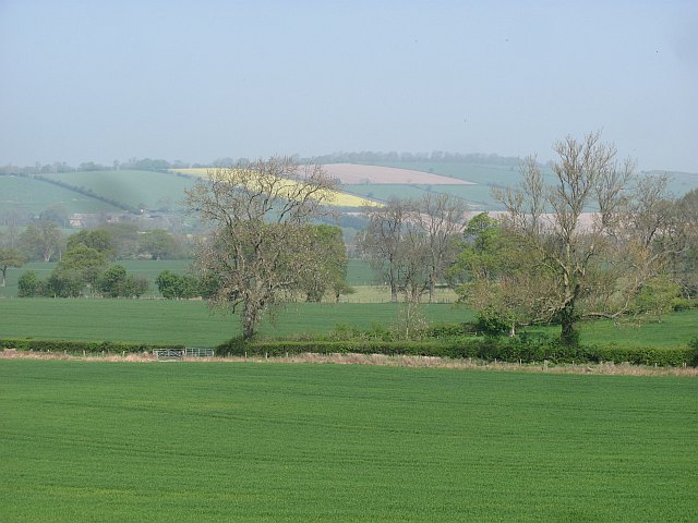
Mittons Rough is a serene woodland located in the county of Shropshire, England. Nestled within the heart of the countryside, this enchanting forest covers an area of approximately 100 acres. It is situated near the village of Mittons, hence the name, and offers visitors a tranquil escape from the bustling city life.
The woodland is predominantly composed of ancient oak and beech trees, which tower majestically over the forest floor. These old-growth trees provide a dense canopy, casting dappled sunlight and creating a magical atmosphere. The forest floor is adorned with a rich carpet of mosses, ferns, and wildflowers, adding to the natural beauty of the area.
Mittons Rough is home to a diverse range of wildlife, making it a haven for nature enthusiasts. Visitors may catch a glimpse of elusive creatures such as deer, foxes, and badgers as they wander through the undergrowth. The forest also attracts a variety of bird species, including woodpeckers, owls, and warblers, making it a perfect spot for birdwatching.
The woodland offers a network of well-maintained footpaths and trails, allowing visitors to explore its hidden treasures. These paths meander through the forest, leading to picturesque viewpoints and secluded clearings. Walking through Mittons Rough provides a sense of tranquility and serenity, with the only sounds being the rustle of leaves underfoot and the occasional birdsong.
Mittons Rough is a popular destination for both locals and tourists alike, offering a peaceful retreat for those seeking solace in nature. Its natural beauty, diverse wildlife, and well-marked trails make it a must-visit location for anyone exploring the stunning Shropshire countryside.
If you have any feedback on the listing, please let us know in the comments section below.
Mittons Rough Images
Images are sourced within 2km of 52.492479/-2.635013 or Grid Reference SO5688. Thanks to Geograph Open Source API. All images are credited.


Mittons Rough is located at Grid Ref: SO5688 (Lat: 52.492479, Lng: -2.635013)
Unitary Authority: Shropshire
Police Authority: West Mercia
What 3 Words
///dawn.modest.growl. Near Cardington, Shropshire
Nearby Locations
Related Wikis

Holdgate
Holdgate (or Stanton Holdgate or Castle Holdgate) is a small village and former civil parish, now in the parish of Abdon and Heath, in the Shropshire district...
Holy Trinity Church, Holdgate
Holy Trinity Church is in the village of Holdgate, Shropshire, England. It is an active Anglican parish church in the deanery of Ludlow, the archdeaconry...

Tugford
Tugford is a village and former civil parish, now in the parish of Abdon and Heath, in the Shropshire district, in the ceremonial county of Shropshire...

Abdon, Shropshire
Abdon is an upland village and former civil parish, now in the parish of Abdon and Heath, in Shropshire, England. In 2011 the parish had a population of...

Stanton Long
Stanton Long is a small village and civil parish situated in the district of Corve Dale, Shropshire, England. It is one of three parishes in the local...

Brown Clee Hill
Brown Clee Hill is the highest hill in the rural English county of Shropshire, at 540 metres (1,770 ft) above sea level. It is one of the Clee Hills,...
Heath, Shropshire
Heath is a hamlet and former civil parish, now in the parish of Abdon and Heath, in the Clee Hills area of Shropshire, England. The settlement and wider...
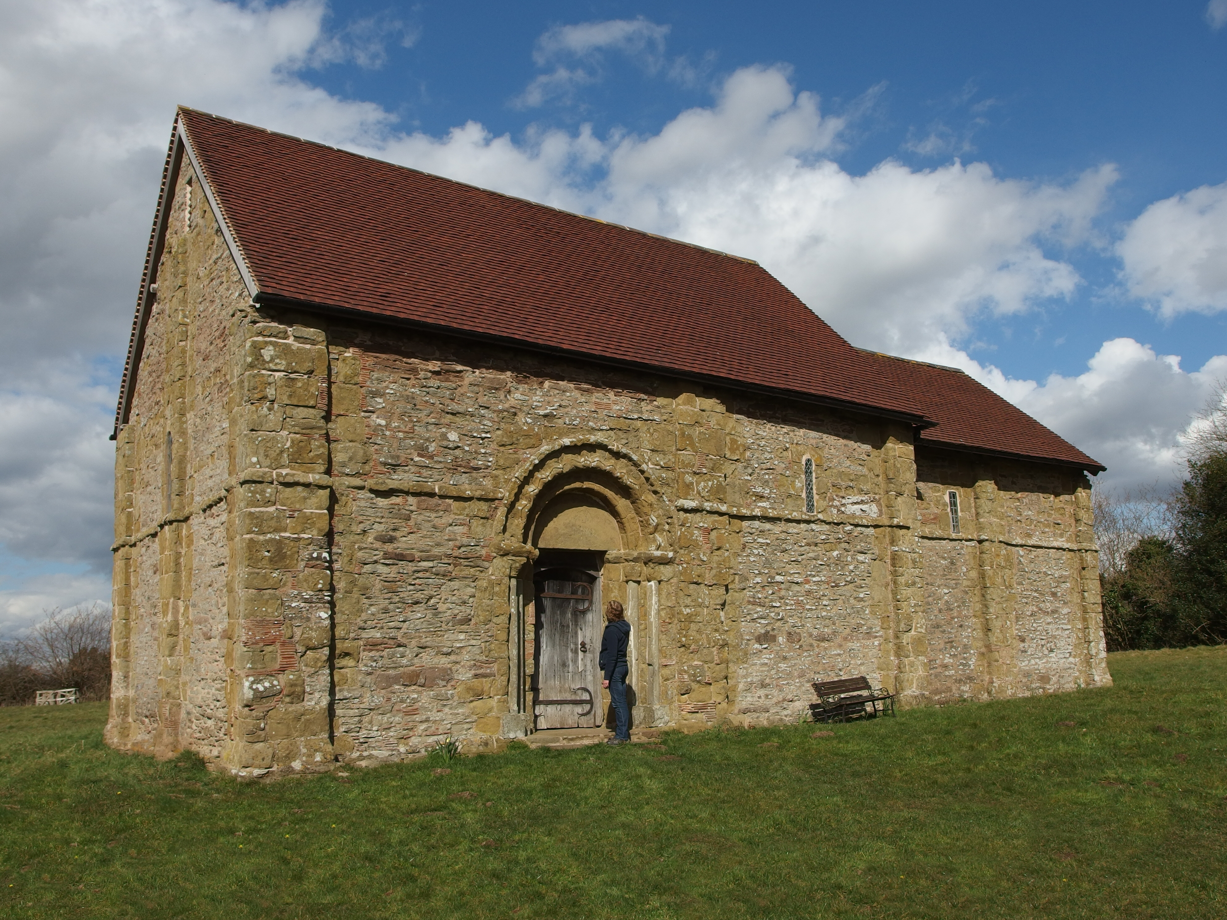
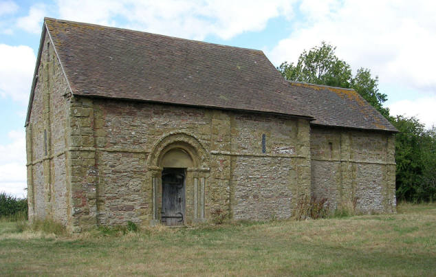
Heath Chapel
Heath Chapel is located in an isolated position in a field in the former civil parish of Heath, Shropshire, England. It is an Anglican chapel in the deanery...
Have you been to Mittons Rough?
Leave your review of Mittons Rough below (or comments, questions and feedback).