Walcombe Wood
Wood, Forest in Somerset Mendip
England
Walcombe Wood
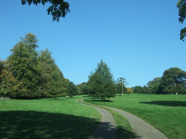
Walcombe Wood is a picturesque forest located in the county of Somerset, England. Covering an area of approximately 100 acres, this woodland is nestled within the enchanting landscape of the Mendip Hills. The wood can be accessed via a well-maintained footpath that winds through rolling hills and lush meadows, offering visitors a scenic journey before reaching the heart of the forest.
Once inside Walcombe Wood, visitors are greeted by a diverse array of native trees, including oak, beech, and ash. These towering giants create a dense canopy, casting dappled sunlight onto the forest floor below. The woodland is also home to a rich variety of flora, with bluebells, wild garlic, and ferns carpeting the ground during the spring and summer months.
The forest is not only a haven for nature enthusiasts but also a sanctuary for wildlife. Birdsong fills the air as numerous species, such as woodpeckers, robins, and thrushes, make their homes amidst the branches. Squirrels can be spotted scurrying along the tree trunks, while the occasional deer may grace lucky visitors with a fleeting glimpse.
For those seeking tranquility and solitude, Walcombe Wood offers a serene retreat. The peaceful atmosphere, coupled with the absence of urban sounds, creates an ideal setting for relaxation and contemplation. The wood also provides a quiet spot for picnics and nature walks, with several well-marked trails allowing visitors to explore its hidden corners.
In conclusion, Walcombe Wood is a captivating forest in Somerset that offers a sensory journey through its verdant landscape. With its diverse flora and fauna, as well as its peaceful ambiance, this woodland is a true gem for nature lovers and a must-visit destination for anyone seeking a connection with the natural world.
If you have any feedback on the listing, please let us know in the comments section below.
Walcombe Wood Images
Images are sourced within 2km of 51.228862/-2.6346317 or Grid Reference ST5547. Thanks to Geograph Open Source API. All images are credited.


Walcombe Wood is located at Grid Ref: ST5547 (Lat: 51.228862, Lng: -2.6346317)
Administrative County: Somerset
District: Mendip
Police Authority: Avon and Somerset
What 3 Words
///straws.enter.converter. Near Mendip, Somerset
Nearby Locations
Related Wikis

Pen Hill
Pen Hill forms part of the Mendip Hills plateau in Somerset, England. The hill is located in St Cuthbert Out civil parish in Mendip district. The name...
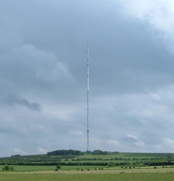
Mendip transmitting station
The Mendip transmitting station is a broadcasting and telecommunications facility on the summit of Pen Hill, part of the Mendip Hills range in Somerset...
Milton Lodge
Milton Lodge is a house and garden overlooking the city of Wells in the English county of Somerset. The terraced garden, which was laid out in the early...

Church of St Thomas, Wells
The Church of St Thomas in Wells, Somerset, England, was built in the 1850s. It is a Grade II* listed building. == History == The church was built during...

Wells Cathedral School
Wells Cathedral School is a co-educational independent day and boarding school located in Wells, Somerset, England. The school is one of the five specialist...
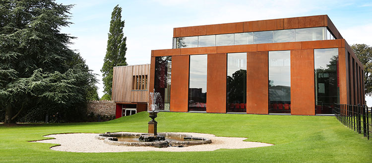
Cedars Hall
Cedars Hall is Wells Cathedral School's performing arts venue located in Wells, Somerset, England. Opened in autumn 2016, it provides the capacity for...
Drove Cottage Henge
Drove Cottage Henge (sometimes called Hunter's Lodge Henge) is a scheduled monument in the Priddy parish of Somerset, England. It is located 370 metres...
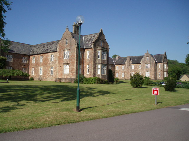
Mendip Hospital
Mendip Hospital opened in 1848 as the Somerset and Bath Pauper Lunatic Asylum at Horrington, near Wells, in the English county of Somerset. As a county...
Nearby Amenities
Located within 500m of 51.228862,-2.6346317Have you been to Walcombe Wood?
Leave your review of Walcombe Wood below (or comments, questions and feedback).