Compton

Settlement in Devon

England

Compton

Old Boundary Marker on Old Laira Road, Plymouth Municipal Boundary Marker facing east against the front garden wall of No.369 Old Laira Road, Plymouth, close to the junction with Manor Lane. Inscribed J.T. BOND / 1896 for John Thomas Bond, mayor.

Milestone Society National ID: DV_PCBS48pb
Old Boundary Marker on Old Laira Road, Plymouth Credit: T Jenkinson

Compton is a charming village located in the county of Devon, in southwestern England. Situated about 10 miles northeast of the city of Plymouth, Compton is nestled within the picturesque Dartmoor National Park, surrounded by rolling hills and lush green countryside. The village has a population of approximately 500 residents.

Compton boasts a rich history, with evidence of human habitation dating back to the Bronze Age. The village is dotted with centuries-old stone cottages, displaying the traditional architecture of the region. Compton is known for its quaint charm and tranquil atmosphere, making it a popular destination for tourists seeking a peaceful retreat.

The heart of the village is dominated by the village green, a beautifully maintained open space where residents and visitors can relax and enjoy the serene surroundings. Compton also features a lovely parish church, St. Andrew's Church, which dates back to the Norman era and offers a glimpse into the village's historical roots.

For those who enjoy outdoor activities, Compton provides ample opportunities for exploration and adventure. Dartmoor National Park offers stunning landscapes, with walking trails and cycling routes that wind through the rugged terrain. The nearby River Plym provides fishing and kayaking opportunities, while the surrounding moorland is perfect for birdwatching and wildlife spotting.

Compton may be a small village, but it offers a warm and welcoming community spirit, with a village hall that hosts various social events throughout the year. The village also benefits from a local pub, The Compton Inn, where residents and visitors can enjoy a traditional pub atmosphere and sample delicious local fare.

In summary, Compton, Devon, is a picturesque village steeped in history and natural beauty. Its idyllic location within Dartmoor National Park, along with its charming architecture and friendly community, make it a delightful place to visit or call home.

If you have any feedback on the listing, please let us know in the comments section below.
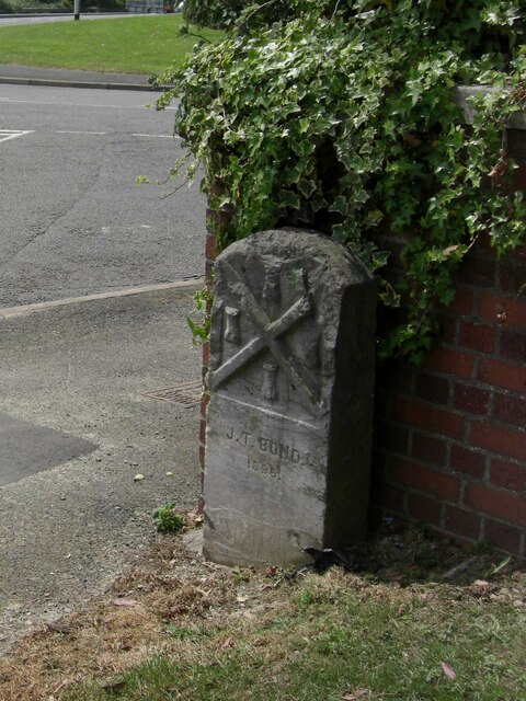
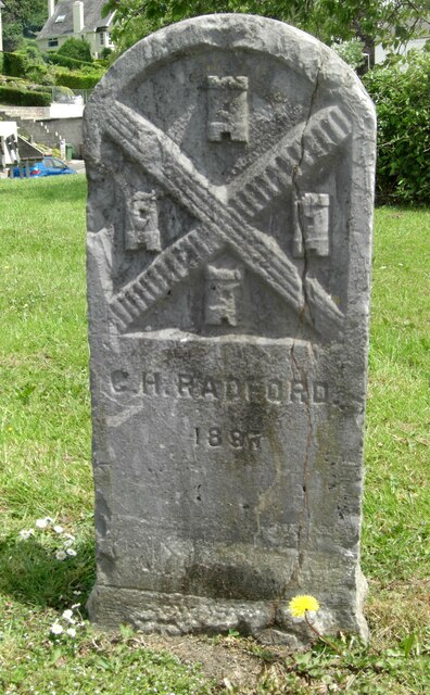
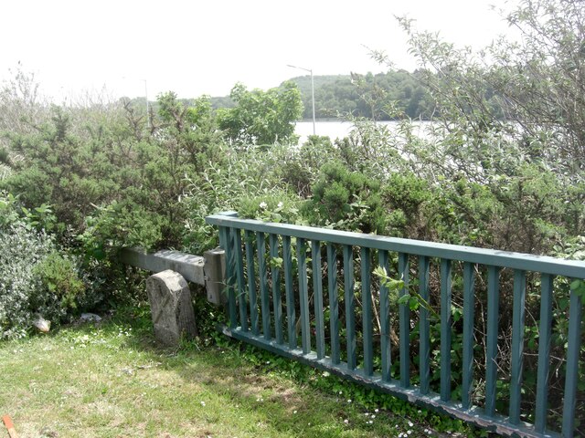
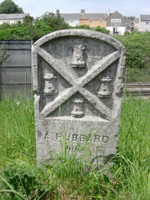
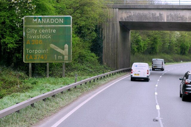
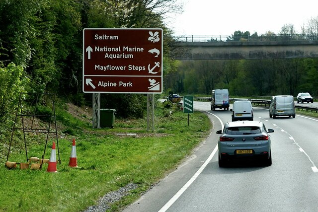
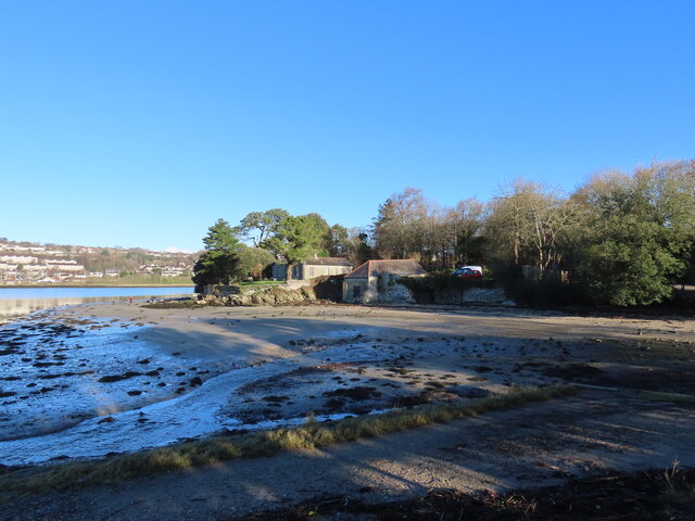
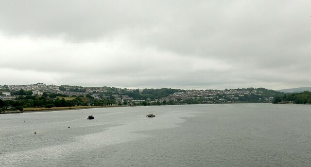
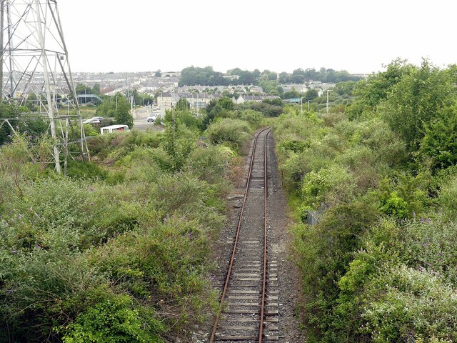
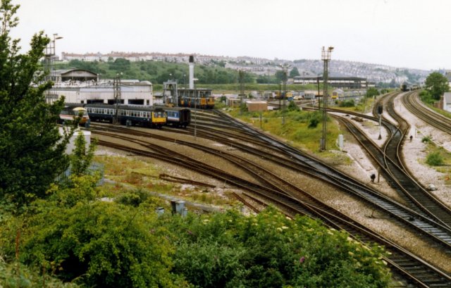
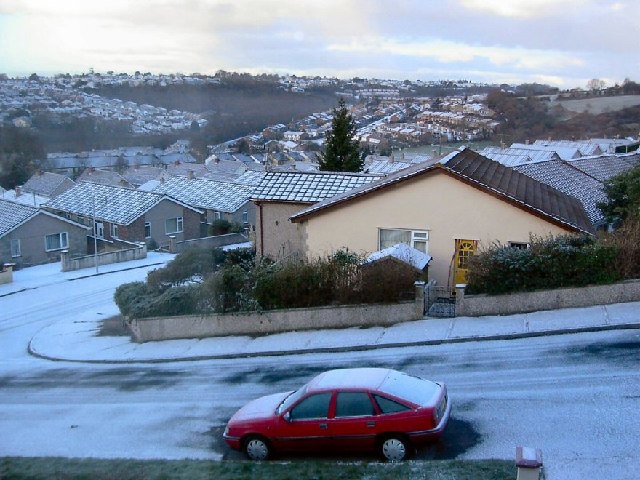
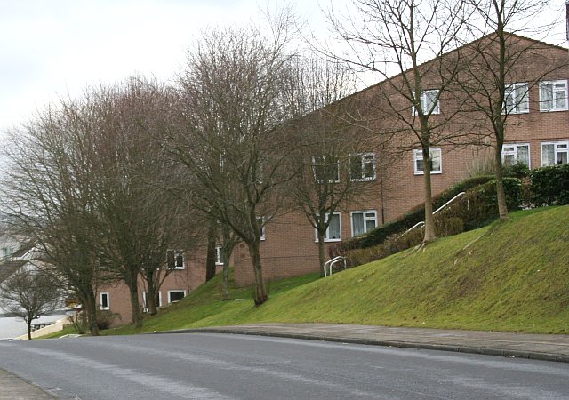
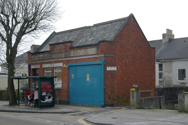
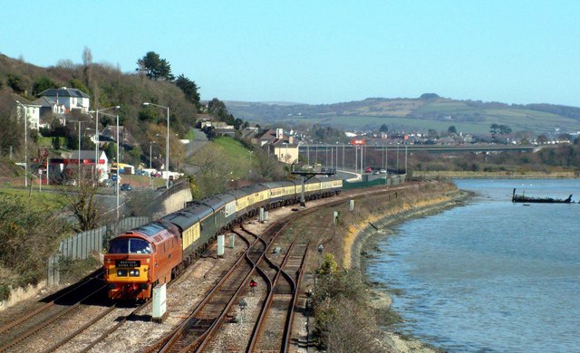
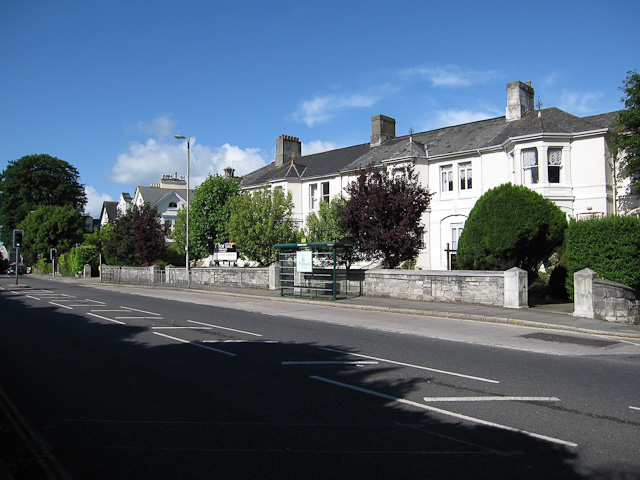
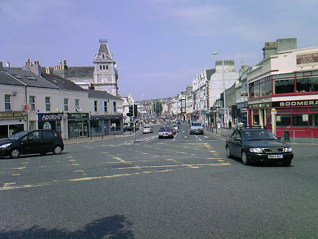
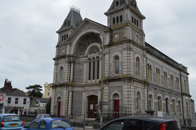
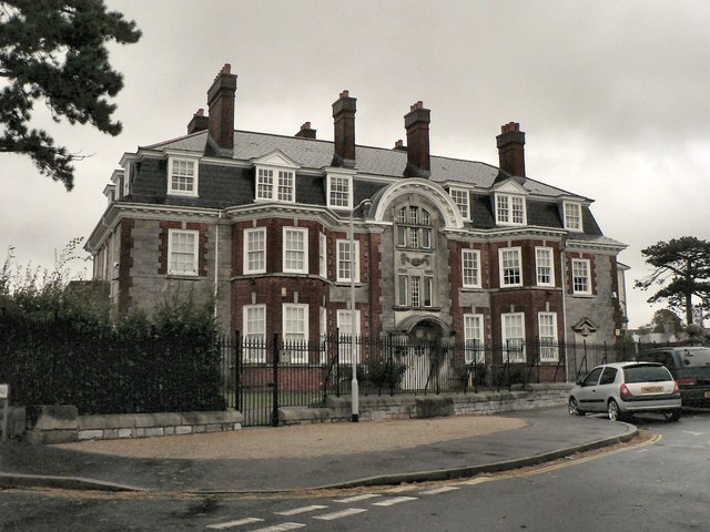
Compton Images

Images are sourced within 2km of 50.384452/-4.1253317 or Grid Reference SX4956. Thanks to Geograph Open Source API. All images are credited.

Old Boundary Marker on Old Laira Road, Plymouth Municipal Boundary Marker facing east against the front garden wall of No.369 Old Laira Road, Plymouth, close to the junction with Manor Lane. Inscribed J.T. BOND / 1896 for John Thomas Bond, mayor.

Milestone Society National ID: DV_PCBS48pb
Old Boundary Marker on Old Laira Road, Plymouth
Municipal Boundary Marker facing east against the front garden wall of No.369 Old Laira Road, Plymouth, close to the junction with Manor Lane. Inscribed J.T. BOND / 1896 for John Thomas Bond, mayor. Milestone Society National ID: DV_PCBS48pb
Old Boundary Marker on Old Laira Road, Plymouth Municipal Boundary Marker on the east side of the junction of the B3214 Old Laira Road and the A374 Embankment Road, Plymouth. Inscribed C.H. RADFORD / 1897 for Charles H Radford, mayor.

Milestone Society National ID: DV_PCBS49pb
Old Boundary Marker on Old Laira Road, Plymouth
Municipal Boundary Marker on the east side of the junction of the B3214 Old Laira Road and the A374 Embankment Road, Plymouth. Inscribed C.H. RADFORD / 1897 for Charles H Radford, mayor. Milestone Society National ID: DV_PCBS49pb
Old Boundary Marker on Embankment Road, Plymouth Municipal Boundary Marker in front of a crash barrier where it meets metal railings on the southeast side of the A374 Embankment Road opposite the junction with Old Laira Road, Plymouth. Inscribed J.T. BOND / (1896) for John Thomas Bond, mayor.

Milestone Society National ID: DV_PCBS50pb
Old Boundary Marker on Embankment Road, Plymouth
Municipal Boundary Marker in front of a crash barrier where it meets metal railings on the southeast side of the A374 Embankment Road opposite the junction with Old Laira Road, Plymouth. Inscribed J.T. BOND / (1896) for John Thomas Bond, mayor. Milestone Society National ID: DV_PCBS50pb
Old Boundary Marker on Lanhydrock Road, Plymouth Municipal Boundary Marker behind a wire mesh fence in Embankment Road allotments, on the north side of Lanhydrock Road, Plymouth. Inscribed A. HUBBARD / 1869 for Alexander Hubbard, mayor.

Milestone Society National ID: DV_PCBS51pb
Old Boundary Marker on Lanhydrock Road, Plymouth
Municipal Boundary Marker behind a wire mesh fence in Embankment Road allotments, on the north side of Lanhydrock Road, Plymouth. Inscribed A. HUBBARD / 1869 for Alexander Hubbard, mayor. Milestone Society National ID: DV_PCBS51pb
Devon Expressway near Plymouth The A38 is a major A-class trunk route. When first designated in 1922, it ran from Derby to Plymouth but it was later extended at both ends so that it now runs for 292 miles from Mansfield in Nottinghamshire to Bodmin in Cornwall.

Prior to the opening of the M5 motorway in the 1960s and 1970s, the A38 formed the main "holiday route" from the Midlands to Somerset, Devon and Cornwall and the south-western section was notorious at holiday times for the congestion. Nowadays, for most of the southern section, the A38 is a fairly quiet road shadowing the M5 extremely closely; often running alongside the motorway as a single carriageway road. The section between Exeter and Plymouth is, however, a busy dual carriageway which serves as the southern extension of the M5 and is known as “the Devon Expressway”.

More information at <span class="nowrap"><a title="http://en.wikipedia.org/wiki/A38_road" rel="nofollow ugc noopener" href="http://en.wikipedia.org/wiki/A38_road">Link</a><img style="margin-left:2px;" alt="External link" title="External link - shift click to open in new window" src="https://s1.geograph.org.uk/img/external.png" width="10" height="10"/></span>  (Wikipedia) and <span class="nowrap"><a title="http://www.sabre-roads.org.uk/wiki/index.php?title=A38" rel="nofollow ugc noopener" href="http://www.sabre-roads.org.uk/wiki/index.php?title=A38">Link</a><img style="margin-left:2px;" alt="External link" title="External link - shift click to open in new window" src="https://s1.geograph.org.uk/img/external.png" width="10" height="10"/></span>  (SABRE).
Devon Expressway near Plymouth
The A38 is a major A-class trunk route. When first designated in 1922, it ran from Derby to Plymouth but it was later extended at both ends so that it now runs for 292 miles from Mansfield in Nottinghamshire to Bodmin in Cornwall. Prior to the opening of the M5 motorway in the 1960s and 1970s, the A38 formed the main "holiday route" from the Midlands to Somerset, Devon and Cornwall and the south-western section was notorious at holiday times for the congestion. Nowadays, for most of the southern section, the A38 is a fairly quiet road shadowing the M5 extremely closely; often running alongside the motorway as a single carriageway road. The section between Exeter and Plymouth is, however, a busy dual carriageway which serves as the southern extension of the M5 and is known as “the Devon Expressway”. More information at LinkExternal link (Wikipedia) and LinkExternal link (SABRE).
Eastbound A38 near Plymouth The A38 is a major A-class trunk route. When first designated in 1922, it ran from Derby to Plymouth but it was later extended at both ends so that it now runs for 292 miles from Mansfield in Nottinghamshire to Bodmin in Cornwall.

Prior to the opening of the M5 motorway in the 1960s and 1970s, the A38 formed the main "holiday route" from the Midlands to Somerset, Devon and Cornwall and the south-western section was notorious at holiday times for the congestion. Nowadays, for most of the southern section, the A38 is a fairly quiet road shadowing the M5 extremely closely; often running alongside the motorway as a single carriageway road. The section between Exeter and Plymouth is, however, a busy dual carriageway which serves as the southern extension of the M5 and is known as “the Devon Expressway”.

More information at <span class="nowrap"><a title="http://en.wikipedia.org/wiki/A38_road" rel="nofollow ugc noopener" href="http://en.wikipedia.org/wiki/A38_road">Link</a><img style="margin-left:2px;" alt="External link" title="External link - shift click to open in new window" src="https://s1.geograph.org.uk/img/external.png" width="10" height="10"/></span>  (Wikipedia) and <span class="nowrap"><a title="http://www.sabre-roads.org.uk/wiki/index.php?title=A38" rel="nofollow ugc noopener" href="http://www.sabre-roads.org.uk/wiki/index.php?title=A38">Link</a><img style="margin-left:2px;" alt="External link" title="External link - shift click to open in new window" src="https://s1.geograph.org.uk/img/external.png" width="10" height="10"/></span>  (SABRE).
Eastbound A38 near Plymouth
The A38 is a major A-class trunk route. When first designated in 1922, it ran from Derby to Plymouth but it was later extended at both ends so that it now runs for 292 miles from Mansfield in Nottinghamshire to Bodmin in Cornwall. Prior to the opening of the M5 motorway in the 1960s and 1970s, the A38 formed the main "holiday route" from the Midlands to Somerset, Devon and Cornwall and the south-western section was notorious at holiday times for the congestion. Nowadays, for most of the southern section, the A38 is a fairly quiet road shadowing the M5 extremely closely; often running alongside the motorway as a single carriageway road. The section between Exeter and Plymouth is, however, a busy dual carriageway which serves as the southern extension of the M5 and is known as “the Devon Expressway”. More information at LinkExternal link (Wikipedia) and LinkExternal link (SABRE).
Saltram Point
Saltram Point
River Plym estuary Looking upstream from Laira Railway Bridge.
River Plym estuary
Looking upstream from Laira Railway Bridge.
Disused railway The branch to the Cattewater quays. Historically this was the Plymouth and Dartmoor Tramway, the first railway to be built in the area, the Laira section opening in 1825. It was horse drawn and built to a gauge of 4ft 6in. It continued as such until some time in the late 19th century when the Cattewater wharves section was incorporated into the London and South Western Railway.
Disused railway
The branch to the Cattewater quays. Historically this was the Plymouth and Dartmoor Tramway, the first railway to be built in the area, the Laira section opening in 1825. It was horse drawn and built to a gauge of 4ft 6in. It continued as such until some time in the late 19th century when the Cattewater wharves section was incorporated into the London and South Western Railway.
Laira Depot The line to the right is the West of England Main Line.  The one curving to the left is the Sutton Harbour branch.
Laira Depot
The line to the right is the West of England Main Line. The one curving to the left is the Sutton Harbour branch.
Bearsdown Close Bearsdown Close, Eggbuckland looking west over Eggbuckland
Bearsdown Close
Bearsdown Close, Eggbuckland looking west over Eggbuckland
New Housing on a Northern Slope Many of the northern slopes of Plymouth's valleys have been left to woodland but there is now an increasing amount of new housing being built on these slopes.
New Housing on a Northern Slope
Many of the northern slopes of Plymouth's valleys have been left to woodland but there is now an increasing amount of new housing being built on these slopes.
Laira old Police and Fire Station Laira old Police and Fire Station, Old Laira Road, Plymouth, Devon. After use as a fire station, it was converted to a library.
Laira old Police and Fire Station
Laira old Police and Fire Station, Old Laira Road, Plymouth, Devon. After use as a fire station, it was converted to a library.
Laira  Depot Plymouth. Taken from the now long gone footbridge that lead off Embankment Road to the depot. This was the public open day on Saturday 23 September 1972.
Laira Depot Plymouth.
Taken from the now long gone footbridge that lead off Embankment Road to the depot. This was the public open day on Saturday 23 September 1972.
Laira by the river Plym The preserved western number 1015 passes its old home depot at Laira by the river Plym. The remains of the boat have been there a few years now. Behind the train one can see the A38 road at Marsh Mills. The cars whiz by like mad now it's a very busy road along the Embankment despite a speed restriction. Mind how you go.
Laira by the river Plym
The preserved western number 1015 passes its old home depot at Laira by the river Plym. The remains of the boat have been there a few years now. Behind the train one can see the A38 road at Marsh Mills. The cars whiz by like mad now it's a very busy road along the Embankment despite a speed restriction. Mind how you go.
Embankment Road tracks, Plymouth Lanhydrock Road adjoins The Embankment, the main link road to the city that runs beside the River Plym  after crossing a small bridge over the railway tracks serving the main depot at Laira. At one time, pre-Beeching, the track would have continued to the freight depot at Friary Station. This section of line now serves as access to rolling stock wash bays, one of which can be seen in this view.
Embankment Road tracks, Plymouth
Lanhydrock Road adjoins The Embankment, the main link road to the city that runs beside the River Plym after crossing a small bridge over the railway tracks serving the main depot at Laira. At one time, pre-Beeching, the track would have continued to the freight depot at Friary Station. This section of line now serves as access to rolling stock wash bays, one of which can be seen in this view.
Laira rail depot Part of the rail depot,on the outskirts of Plymouth.
Laira rail depot
Part of the rail depot,on the outskirts of Plymouth.
Laira Farm bridge This Railway bridge is close to the Laira rail depot.
Laira Farm bridge
This Railway bridge is close to the Laira rail depot.
Show me another place!

Compton is located at Grid Ref: SX4956 (Lat: 50.384452, Lng: -4.1253317)

Unitary Authority: Plymouth

Police Authority: Devon and Cornwall

What 3 Words

///abode.deck.leap. Near Plymouth, Devon

Related Wikis

BBC Radio Devon

BBC Radio Devon is the BBC's local radio station serving the county of Devon. It broadcasts on FM, DAB, digital TV and via BBC Sounds from studios in the...

Mannamead

Mannamead is a suburb of Plymouth in the county of Devon, England. It was an affluent Victorian and early Edwardian suburb with wide avenues such as Seymour...

Compton, Plymouth

Compton or Compton Gifford is a suburb of Plymouth in England. Once a small village, it was developed in the 1930s and now lies between the suburbs of...

Mutley Plain

Mutley Plain is a street in Plymouth, Devon, England. Although Mutley Plain is the main street of the dense suburb called Mutley, the term is often applied...

Mutley Baptist Church

Mutley Baptist Church is an evangelical Baptist church and congregation in Mutley Plain, Plymouth, Devon, situated in a large Grade II building, designed...

Freedom Fields Hospital

Freedom Fields Hospital was an acute hospital in Plymouth that closed in 1998. The site formerly occupied by the hospital has now been largely redeveloped...

Michael Foot memorial

A memorial to Michael Foot is situated in Freedom Fields Park in Plymouth, Devon. Foot was born in Plymouth, and served as Member of Parliament for Plymouth...

Plymouth College

Plymouth College is a co-educational private school in Plymouth, Devon. == History == The school was established in 1877. In 1896 Plymouth College bought...

Nearby Amenities

Located within 500m of 50.384452,-4.1253317
Traffic Signals
Lat/Long: 50.3818331/-4.1248137
Traffic Signals
Traffic Signals: signal
Lat/Long: 50.3867122/-4.1311818
Barrier: bollard
Bicycle: yes
Bollard: fixed
Foot: yes
Motor Vehicle: no
Lat/Long: 50.3860832/-4.1318524
Mannamead
Place: suburb
Wikidata: Q6750733
Lat/Long: 50.3870499/-4.1265385
Lipson Vale
Place: suburb
Lat/Long: 50.3827554/-4.1219191
Generator Method: photovoltaic
Generator Output Electricity: yes
Generator Source: solar
Generator Type: solar_photovoltaic_panel
Location: roof
Power: generator
Lat/Long: 50.3862765/-4.1250122
Generator Method: photovoltaic
Generator Output Electricity: yes
Generator Source: solar
Generator Type: solar_photovoltaic_panel
Location: roof
Power: generator
Lat/Long: 50.3867569/-4.1246287
Generator Method: photovoltaic
Generator Output Electricity: yes
Generator Source: solar
Generator Type: solar_photovoltaic_panel
Location: roof
Power: generator
Lat/Long: 50.3867721/-4.1245575
Generator Method: photovoltaic
Generator Output Electricity: yes
Generator Source: solar
Generator Type: solar_photovoltaic_panel
Location: roof
Power: generator
Lat/Long: 50.3872581/-4.1244462
Generator Method: photovoltaic
Generator Output Electricity: yes
Generator Source: solar
Generator Type: solar_photovoltaic_panel
Location: roof
Power: generator
Lat/Long: 50.3873043/-4.1207662
Generator Method: photovoltaic
Generator Output Electricity: yes
Generator Source: solar
Generator Type: solar_photovoltaic_panel
Location: roof
Power: generator
Lat/Long: 50.386639/-4.120954
Generator Method: photovoltaic
Generator Output Electricity: yes
Generator Source: solar
Generator Type: solar_photovoltaic_panel
Location: roof
Power: generator
Lat/Long: 50.3862662/-4.1215307
Generator Method: photovoltaic
Generator Output Electricity: yes
Generator Source: solar
Generator Type: solar_photovoltaic_panel
Location: roof
Power: generator
Lat/Long: 50.3862919/-4.1228762
Generator Method: photovoltaic
Generator Output Electricity: yes
Generator Source: solar
Generator Type: solar_photovoltaic_panel
Location: roof
Power: generator
Lat/Long: 50.3862927/-4.1228216
Generator Method: photovoltaic
Generator Output Electricity: yes
Generator Source: solar
Generator Type: solar_photovoltaic_panel
Location: roof
Power: generator
Lat/Long: 50.385028/-4.1223651
Generator Method: photovoltaic
Generator Output Electricity: yes
Generator Source: solar
Generator Type: solar_photovoltaic_panel
Location: roof
Power: generator
Lat/Long: 50.3850202/-4.1222902
Generator Method: photovoltaic
Generator Output Electricity: yes
Generator Source: solar
Generator Type: solar_photovoltaic_panel
Location: roof
Power: generator
Lat/Long: 50.3848645/-4.1223733
Generator Method: photovoltaic
Generator Output Electricity: yes
Generator Source: solar
Generator Type: solar_photovoltaic_panel
Location: roof
Power: generator
Lat/Long: 50.3848382/-4.1223224
Generator Method: photovoltaic
Generator Output Electricity: yes
Generator Source: solar
Generator Type: solar_photovoltaic_panel
Location: roof
Power: generator
Lat/Long: 50.3842362/-4.1224909
Generator Method: photovoltaic
Generator Output Electricity: yes
Generator Source: solar
Generator Type: solar_photovoltaic_panel
Location: roof
Power: generator
Lat/Long: 50.3842533/-4.1225499
Generator Method: photovoltaic
Generator Output Electricity: yes
Generator Source: solar
Generator Type: solar_photovoltaic_panel
Location: roof
Power: generator
Lat/Long: 50.3837693/-4.1235209
Generator Method: photovoltaic
Generator Output Electricity: yes
Generator Source: solar
Generator Type: solar_photovoltaic_panel
Location: roof
Power: generator
Lat/Long: 50.3832476/-4.120844
Generator Method: photovoltaic
Generator Output Electricity: yes
Generator Source: solar
Generator Type: solar_photovoltaic_panel
Location: roof
Power: generator
Lat/Long: 50.3831638/-4.1215548
Generator Method: photovoltaic
Generator Output Electricity: yes
Generator Source: solar
Generator Type: solar_photovoltaic_panel
Location: roof
Power: generator
Lat/Long: 50.3834494/-4.1219866
Generator Method: photovoltaic
Generator Output Electricity: yes
Generator Source: solar
Generator Type: solar_photovoltaic_panel
Location: roof
Power: generator
Lat/Long: 50.3834631/-4.1220698
Generator Method: photovoltaic
Generator Output Electricity: yes
Generator Source: solar
Generator Type: solar_photovoltaic_panel
Location: roof
Power: generator
Lat/Long: 50.3831176/-4.122397
Generator Method: photovoltaic
Generator Output Electricity: yes
Generator Source: solar
Generator Type: solar_photovoltaic_panel
Location: roof
Power: generator
Lat/Long: 50.3830954/-4.1224614
Generator Method: photovoltaic
Generator Output Electricity: yes
Generator Source: solar
Generator Type: solar_photovoltaic_panel
Location: roof
Power: generator
Lat/Long: 50.3833126/-4.1229227
Generator Method: photovoltaic
Generator Output Electricity: yes
Generator Source: solar
Generator Type: solar_photovoltaic_panel
Location: roof
Power: generator
Lat/Long: 50.3827448/-4.1233251
Generator Method: photovoltaic
Generator Output Electricity: yes
Generator Source: solar
Generator Type: solar_photovoltaic_panel
Location: roof
Power: generator
Lat/Long: 50.3803346/-4.1236846
Direction: S
Generator Method: photovoltaic
Generator Output Electricity: yes
Generator Solar Modules: 16
Generator Source: solar
Generator Type: solar_photovoltaic_panel
Location: roof
Power: generator
Lat/Long: 50.3821465/-4.1279568
Direction: S
Generator Method: photovoltaic
Generator Output Electricity: yes
Generator Solar Modules: 16
Generator Source: solar
Generator Type: solar_photovoltaic_panel
Location: roof
Power: generator
Lat/Long: 50.3821435/-4.1280676
Direction: S
Generator Method: photovoltaic
Generator Output Electricity: yes
Generator Solar Modules: 16
Generator Source: solar
Generator Type: solar_photovoltaic_panel
Location: roof
Power: generator
Lat/Long: 50.3821413/-4.1281783
Direction: S
Generator Method: photovoltaic
Generator Output Electricity: yes
Generator Solar Modules: 16
Generator Source: solar
Generator Type: solar_photovoltaic_panel
Location: roof
Power: generator
Lat/Long: 50.3821366/-4.1278624
Direction: S
Generator Method: photovoltaic
Generator Output Electricity: yes
Generator Solar Modules: 14
Generator Source: solar
Generator Type: solar_photovoltaic_panel
Location: roof
Power: generator
Lat/Long: 50.3816685/-4.1277096
Direction: S
Generator Method: photovoltaic
Generator Output Electricity: yes
Generator Solar Modules: 16
Generator Source: solar
Generator Type: solar_photovoltaic_panel
Location: roof
Power: generator
Lat/Long: 50.3821424/-4.1276391
Direction: 185
Generator Method: photovoltaic
Generator Output Electricity: yes
Generator Solar Modules: 16
Generator Source: solar
Generator Type: solar_photovoltaic_panel
Location: roof
Power: generator
Lat/Long: 50.3828519/-4.1259857
Direction: S
Generator Method: photovoltaic
Generator Output Electricity: yes
Generator Solar Modules: 16
Generator Source: solar
Generator Type: solar_photovoltaic_panel
Location: roof
Power: generator
Lat/Long: 50.3821384/-4.1275392
Direction: S
Generator Method: photovoltaic
Generator Output Electricity: yes
Generator Solar Modules: 16
Generator Source: solar
Generator Type: solar_photovoltaic_panel
Location: roof
Power: generator
Lat/Long: 50.382143/-4.1277498
Direction: S
Generator Method: photovoltaic
Generator Output Electricity: yes
Generator Solar Modules: 16
Generator Source: solar
Generator Type: solar_photovoltaic_panel
Location: roof
Power: generator
Lat/Long: 50.382136/-4.1282936
Direction: 100
Generator Method: photovoltaic
Generator Output Electricity: yes
Generator Solar Modules: 8
Generator Source: solar
Generator Type: solar_photovoltaic_panel
Location: roof
Power: generator
Lat/Long: 50.3883684/-4.1259606
Direction: 190
Generator Method: photovoltaic
Generator Output Electricity: yes
Generator Solar Modules: 10
Generator Source: solar
Generator Type: solar_photovoltaic_panel
Location: roof
Power: generator
Lat/Long: 50.3876083/-4.1263331
Direction: 185
Generator Method: photovoltaic
Generator Output Electricity: yes
Generator Solar Modules: 10
Generator Source: solar
Generator Type: solar_photovoltaic_panel
Location: roof
Power: generator
Lat/Long: 50.3881189/-4.1277176
Direction: 280
Generator Method: photovoltaic
Generator Output Electricity: yes
Generator Solar Modules: 8
Generator Source: solar
Generator Type: solar_photovoltaic_panel
Location: roof
Power: generator
Lat/Long: 50.3883744/-4.1260009
Direction: 185
Generator Method: photovoltaic
Generator Output Electricity: yes
Generator Solar Modules: 3
Generator Source: solar
Generator Type: solar_photovoltaic_panel
Location: roof
Power: generator
Lat/Long: 50.3872092/-4.1268685
Direction: 185
Generator Method: photovoltaic
Generator Output Electricity: yes
Generator Solar Modules: 7
Generator Source: solar
Generator Type: solar_photovoltaic_panel
Location: roof
Power: generator
Lat/Long: 50.3872341/-4.1268261
Direction: S
Generator Method: photovoltaic
Generator Output Electricity: yes
Generator Solar Modules: 12
Generator Source: solar
Generator Type: solar_photovoltaic_panel
Location: roof
Power: generator
Lat/Long: 50.3886557/-4.123441
Direction: S
Generator Method: photovoltaic
Generator Output Electricity: yes
Generator Solar Modules: 12
Generator Source: solar
Generator Type: solar_photovoltaic_panel
Location: roof
Power: generator
Lat/Long: 50.388644/-4.1237984
Direction: 175
Generator Method: photovoltaic
Generator Output Electricity: yes
Generator Solar Modules: 7
Generator Source: solar
Generator Type: solar_photovoltaic_panel
Location: roof
Power: generator
Lat/Long: 50.3875784/-4.123627
Direction: S
Generator Method: photovoltaic
Generator Output Electricity: yes
Generator Solar Modules: 9
Generator Source: solar
Generator Type: solar_photovoltaic_panel
Location: roof
Power: generator
Lat/Long: 50.3886623/-4.1242755
Direction: 145
Generator Method: photovoltaic
Generator Output Electricity: yes
Generator Solar Modules: 14
Generator Source: solar
Generator Type: solar_photovoltaic_panel
Location: roof
Power: generator
Lat/Long: 50.3815769/-4.1295905
Generator Method: photovoltaic
Generator Output Electricity: yes
Generator Source: solar
Generator Type: solar_photovoltaic_panel
Power: generator
Lat/Long: 50.3833762/-4.1258885
Generator Method: photovoltaic
Generator Output Electricity: yes
Generator Source: solar
Generator Type: solar_photovoltaic_panel
Power: generator
Lat/Long: 50.3837878/-4.1221604
Generator Method: photovoltaic
Generator Output Electricity: yes
Generator Source: solar
Generator Type: solar_photovoltaic_panel
Power: generator
Lat/Long: 50.3837998/-4.122088
Generator Method: photovoltaic
Generator Output Electricity: yes
Generator Source: solar
Generator Type: solar_photovoltaic_panel
Power: generator
Lat/Long: 50.3868727/-4.122214
Generator Method: photovoltaic
Generator Output Electricity: yes
Generator Source: solar
Generator Type: solar_photovoltaic_panel
Power: generator
Lat/Long: 50.3868144/-4.122273
Generator Method: photovoltaic
Generator Output Electricity: yes
Generator Source: solar
Generator Type: solar_photovoltaic_panel
Power: generator
Lat/Long: 50.3868429/-4.1222953
Generator Method: photovoltaic
Generator Output Electricity: yes
Generator Source: solar
Generator Type: solar_photovoltaic_panel
Power: generator
Lat/Long: 50.3876894/-4.1294822
Bus Stop
Mannamead Avenue
Bench: yes
Bin: no
Bus: yes
Departures Board: timetable
Lit: yes
Naptan AtcoCode: 1180PLB11890
Naptan Bearing: SW
Naptan CommonName: Seymour Road
Naptan Indicator: SW-bound
Naptan NaptanCode: plygpam
Naptan PlusbusZoneRef: PLYMTH
Naptan Verified: no
Public Transport: platform
Shelter: yes
Tactile Paving: no
Lat/Long: 50.3862644/-4.1314209
Barrier: bollard
Bollard: fixed
Foot: yes
Lat/Long: 50.3817389/-4.1264694
Advertising: billboard
Lit: yes
Lat/Long: 50.3821982/-4.1201873
Advertising: billboard
Lit: yes
Lat/Long: 50.382201/-4.1200787
Advertising: billboard
Lit: yes
Lat/Long: 50.3822137/-4.1199751
Bus Stop
Lipson Vale
Bench: no
Bin: no
Bus: yes
Departures Board: timetable
Lit: yes
Mapillary: 448274550347689
Naptan AtcoCode: 1180PLB11701
Naptan Bearing: E
Naptan CommonName: Lipson Vale
Naptan Indicator: E-bound
Naptan NaptanCode: plyjajd
Naptan PlusbusZoneRef: PLYMTH
Naptan Street: Lipson Vale
Public Transport: platform
Shelter: no
Survey Date: 2021-12-26
Tactile Paving: yes
Lat/Long: 50.3821224/-4.1204116
Bus Stop
Lipson Vale Park
Bench: yes
Bin: yes
Bus: yes
Lit: yes
Naptan AtcoCode: 1180PLB11702
Naptan Bearing: W
Naptan CommonName: Lipson Vale
Naptan Indicator: W-bound
Naptan NaptanCode: plyjajg
Naptan PlusbusZoneRef: PLYMTH
Naptan Street: Lipson Vale
Naptan Verified: no
Public Transport: platform
Shelter: yes
Tactile Paving: yes
Lat/Long: 50.38198/-4.1203458
Advertising: billboard
Lit: yes
Lat/Long: 50.3825485/-4.1189588
Bus Stop
Crozier Road
Bench: no
Bin: no
Bus: yes
Lit: yes
Naptan AtcoCode: 1180PLB11697
Naptan Bearing: E
Naptan CommonName: Crozier Road
Naptan Indicator: E-bound
Naptan NaptanCode: plygpwg
Naptan PlusbusZoneRef: PLYMTH
Naptan Street: Alexandra Road
Naptan Verified: no
Public Transport: platform
Shelter: no
Tactile Paving: no
Lat/Long: 50.3818631/-4.1284406
Bus Stop
Ashford Hill
Bench: no
Bin: no
Bus: yes
Lit: yes
Mapillary: 1152782885469715
Naptan AtcoCode: 1180PLB11699
Naptan Bearing: E
Naptan CommonName: Ashford Hill
Naptan Indicator: E-bound
Naptan NaptanCode: plygtpg
Naptan PlusbusZoneRef: PLYMTH
Naptan Street: Alexandra Road
Public Transport: platform
Shelter: no
Survey Date: 2021-12-26
Tactile Paving: no
Lat/Long: 50.3818681/-4.1259244
Bus Stop
Ashford Hill
Bench: yes
Bin: no
Bus: yes
Lit: yes
Mapillary: 360616905754066
Naptan AtcoCode: 1180PLB11700
Naptan Bearing: W
Naptan CommonName: Ashford Hill
Naptan Indicator: W-bound
Naptan NaptanCode: plygwdt
Naptan PlusbusZoneRef: PLYMTH
Naptan Street: Alexandra Road
Public Transport: platform
Shelter: yes
Survey Date: 2022-03-06
Tactile Paving: no
Lat/Long: 50.3817143/-4.1239785
Bus Stop
West Hill Road
Bench: no
Bin: no
Bus: yes
Lit: yes
Naptan AtcoCode: 1180PLB11698
Naptan Bearing: W
Naptan CommonName: West Hill Road
Naptan Indicator: W-bound
Naptan NaptanCode: plygtda
Naptan PlusbusZoneRef: PLYMTH
Naptan Street: Alexandra Road
Naptan Verified: no
Public Transport: platform
Shelter: no
Tactile Paving: no
Lat/Long: 50.3817733/-4.1268087
Recycling
Recycling Type: centre
Lat/Long: 50.3819774/-4.1199524
Crossing
Crossing: traffic_signals
Crossing Island: no
Tactile Paving: yes
Lat/Long: 50.3818421/-4.1213241
Man Made: mast
Lat/Long: 50.3860272/-4.1269213
Post Box
Collection Times: Mo-Fr 09:00; Sa 07:00
Mapillary: 623129128931223
Post Box Type: lamp
Ref: PL3 31D
Royal Cypher: EIIR
Royal Cypher Wikidata: Q33102113
Lat/Long: 50.3839714/-4.1218648
Post Box
Collection Times: Mo-Fr 09:00; Sa 07:00
Mapillary: 1373097506487060
Post Box Type: pillar
Ref: PL3 73D
Royal Cypher: GR
Royal Cypher Wikidata: Q33102273
Lat/Long: 50.385562/-4.1277334
Bus Stop
Beechcroft Road
Bench: no
Bin: no
Bus: yes
Lit: yes
Naptan AtcoCode: 1180PLB11627
Naptan Bearing: E
Naptan CommonName: Beechcroft Road
Naptan Indicator: E-bound
Naptan NaptanCode: plygwjt
Naptan PlusbusZoneRef: PLYMTH
Naptan Street: Lower Compton Road
Public Transport: platform
Shelter: no
Survey Date: 2022-02-28
Tactile Paving: no
Lat/Long: 50.3888555/-4.1239072
Street Lamp
Survey Date: 2022-02-28
Lat/Long: 50.3882523/-4.1286472
Street Lamp
Survey Date: 2022-02-28
Lat/Long: 50.3883269/-4.1281627
Street Lamp
Survey Date: 2022-02-28
Lat/Long: 50.3886478/-4.1263785
Fire Hydrant
Emergency: fire_hydrant
Fire Hydrant Type: underground
Survey Date: 2022-02-28
Lat/Long: 50.3887836/-4.126522
Street Lamp
Survey Date: 2022-02-28
Lat/Long: 50.3887376/-4.1249813
Fire Hydrant
Emergency: fire_hydrant
Fire Hydrant Diameter: 100
Fire Hydrant Position: sidewalk
Fire Hydrant Type: underground
Survey Date: 2022-02-28
Lat/Long: 50.3887742/-4.1267354
Street Lamp
Survey Date: 2022-02-28
Lat/Long: 50.3888179/-4.1261493
Street Lamp
Survey Date: 2022-02-28
Lat/Long: 50.388763/-4.124429
Street Lamp
Survey Date: 2022-02-28
Lat/Long: 50.3882428/-4.1276904
Fire Hydrant
Emergency: fire_hydrant
Fire Hydrant Position: sidewalk
Fire Hydrant Type: underground
Survey Date: 2022-02-28
Lat/Long: 50.3883268/-4.1275345
Street Lamp
Survey Date: 2022-02-28
Lat/Long: 50.3882601/-4.127213
Street Lamp
Survey Date: 2022-02-28
Lat/Long: 50.3887782/-4.1267188
Bus Stop
Overton Gardens
Bench: no
Bin: no
Bus: yes
Departures Board: timetable
Lit: yes
Mapillary: 530336188407676
Naptan AtcoCode: 1180PLB11625
Naptan Bearing: NE
Naptan CommonName: Overton Gardens
Naptan Indicator: NE-bound
Naptan NaptanCode: plygtjm
Naptan PlusbusZoneRef: PLYMTH
Naptan Street: Compton Park Road
Public Transport: platform
Shelter: no
Survey Date: 2022-03-06
Tactile Paving: no
Lat/Long: 50.388542/-4.1268556
Bus Stop
Fosbrooke Court
Bench: no
Bin: no
Bus: yes
Naptan AtcoCode: 1180PLB11626
Naptan Bearing: NW
Naptan CommonName: Fosbrooke Court
Naptan Indicator: NW-bound
Naptan NaptanCode: plygtpw
Naptan PlusbusZoneRef: PLYMTH
Naptan Street: Lower Compton Road
Public Transport: platform
Shelter: no
Survey Date: 2022-02-28
Tactile Paving: no
Lat/Long: 50.3886986/-4.1257836
Street Lamp
Survey Date: 2022-02-28
Lat/Long: 50.3887154/-4.1256057
Post Box
Collection Times: Mo-Fr 09:00, Sa 07:00
Post Box Type: wall
Ref: PL3 193D
Royal Cypher: GVIR
Royal Cypher Wikidata: Q33102169
Survey Date: 2022-02-28
Lat/Long: 50.3886986/-4.1250861
Fire Hydrant
Emergency: fire_hydrant
Fire Hydrant Diameter: 100
Fire Hydrant Position: sidewalk
Fire Hydrant Type: underground
Survey Date: 2022-02-28
Lat/Long: 50.3883259/-4.128664
Street Lamp
Ref: 8
Survey Date: 2022-02-28
Lat/Long: 50.3884774/-4.1269362
Fire Hydrant
Emergency: fire_hydrant
Fire Hydrant Diameter: 90
Fire Hydrant Position: lane
Fire Hydrant Type: underground
Survey Date: 2022-03-06
Lat/Long: 50.3816604/-4.1245069
Man Made: street_cabinet
Survey Date: 2022-03-16
Lat/Long: 50.3866918/-4.1310151
Street Lamp
Survey Date: 2022-03-16
Lat/Long: 50.38539/-4.1266092
Fire Hydrant
Emergency: fire_hydrant
Fire Hydrant Type: underground
Survey Date: 2022-03-16
Lat/Long: 50.3853671/-4.1264173
Fire Hydrant
Emergency: fire_hydrant
Fire Hydrant Type: underground
Survey Date: 2022-03-16
Lat/Long: 50.3865728/-4.1247564
Street Lamp
Ref: 6
Survey Date: 2022-03-16
Lat/Long: 50.3865741/-4.1247244
Fire Hydrant
Emergency: fire_hydrant
Fire Hydrant Type: underground
Survey Date: 2022-03-16
Lat/Long: 50.3874126/-4.1230753
Fire Hydrant
Emergency: fire_hydrant
Fire Hydrant Type: underground
Survey Date: 2022-03-16
Lat/Long: 50.3833022/-4.1300596
Street Lamp
Ref: 3
Survey Date: 2022-03-16
Lat/Long: 50.3835642/-4.1296804
Street Lamp
Survey Date: 2022-03-16
Lat/Long: 50.3845849/-4.1313731
Street Lamp
Ref: 14
Survey Date: 2022-03-16
Lat/Long: 50.3869468/-4.1311102
Fire Hydrant
Emergency: fire_hydrant
Fire Hydrant Diameter: 6"
Fire Hydrant Position: sidewalk
Fire Hydrant Type: underground
Survey Date: 2022-03-16
Lat/Long: 50.3866216/-4.1310006
Street Lamp
Survey Date: 2022-03-16
Lat/Long: 50.3866643/-4.1311615
Street Lamp
Survey Date: 2022-03-16
Lat/Long: 50.387151/-4.1307999
Street Lamp
Survey Date: 2022-03-16
Lat/Long: 50.3864018/-4.1303419
Fire Hydrant
Emergency: fire_hydrant
Fire Hydrant Type: underground
Survey Date: 2022-03-16
Lat/Long: 50.3861974/-4.1297581
Street Lamp
Survey Date: 2022-03-16
Lat/Long: 50.3862593/-4.129708
Fire Hydrant
Emergency: fire_hydrant
Fire Hydrant Type: underground
Survey Date: 2022-03-16
Lat/Long: 50.3858316/-4.128648
Street Lamp
Survey Date: 2022-03-16
Lat/Long: 50.3858773/-4.1284797
Street Lamp
Survey Date: 2022-03-16
Lat/Long: 50.3855325/-4.1273039
Street Lamp
Ref: 1
Survey Date: 2022-03-16
Lat/Long: 50.3855733/-4.1254384
Street Lamp
Survey Date: 2022-03-16
Lat/Long: 50.3866681/-4.1309436
Street Lamp
Survey Date: 2022-03-16
Lat/Long: 50.3856598/-4.1279982
Fire Hydrant
Emergency: fire_hydrant
Fire Hydrant Type: underground
Survey Date: 2022-03-16
Lat/Long: 50.3855739/-4.1272619
Street Lamp
Survey Date: 2022-03-16
Lat/Long: 50.3856738/-4.1272277
Man Made: utility_pole
Survey Date: 2022-03-16
Lat/Long: 50.3852927/-4.1256401
Fire Hydrant
Emergency: fire_hydrant
Fire Hydrant Type: underground
Survey Date: 2022-03-16
Lat/Long: 50.3853994/-4.1255263
Fire Hydrant
Emergency: fire_hydrant
Fire Hydrant Type: underground
Survey Date: 2022-03-16
Lat/Long: 50.3866751/-4.1235673
Street Lamp
Ref: 8
Survey Date: 2022-03-16
Lat/Long: 50.3866355/-4.1233347
Man Made: utility_pole
Survey Date: 2022-03-16
Lat/Long: 50.3868348/-4.1232873
Street Lamp
Survey Date: 2022-03-16
Lat/Long: 50.3868981/-4.1233406
Street Lamp
Survey Date: 2022-03-16
Lat/Long: 50.3872387/-4.1231578
Street Lamp
Survey Date: 2022-03-16
Lat/Long: 50.387495/-4.1231233
Street Lamp
Ref: 54
Survey Date: 2022-03-16
Lat/Long: 50.3875761/-4.122239
Street Lamp
Ref: 15
Survey Date: 2022-03-16
Lat/Long: 50.3875739/-4.1218521
Man Made: utility_pole
Survey Date: 2022-03-16
Lat/Long: 50.3847761/-4.122112
Street Lamp
Ref: 25
Survey Date: 2022-03-16
Lat/Long: 50.3845207/-4.1222502
Street Lamp
Ref: 26
Survey Date: 2022-03-16
Lat/Long: 50.3841847/-4.1222528
Street Lamp
Ref: 9
Survey Date: 2022-03-16
Lat/Long: 50.3836778/-4.1212366
Fire Hydrant
Emergency: fire_hydrant
Fire Hydrant Type: underground
Survey Date: 2022-03-16
Lat/Long: 50.3833482/-4.1217474
Street Lamp
Survey Date: 2022-03-16
Lat/Long: 50.3833903/-4.1228632
Fire Hydrant
Emergency: fire_hydrant
Survey Date: 2022-03-16
Lat/Long: 50.383393/-4.1229145
Street Lamp
Survey Date: 2022-03-16
Lat/Long: 50.3837752/-4.1238213
Fire Hydrant
Emergency: fire_hydrant
Fire Hydrant Type: underground
Survey Date: 2022-03-16
Lat/Long: 50.3836162/-4.1265205
Fire Hydrant
Emergency: fire_hydrant
Fire Hydrant Type: underground
Survey Date: 2022-03-16
Lat/Long: 50.3837197/-4.1275892
Street Lamp
Survey Date: 2022-03-16
Lat/Long: 50.3837381/-4.1296968
Street Lamp
Survey Date: 2022-03-16
Lat/Long: 50.3842696/-4.1301271
Fire Hydrant
Emergency: fire_hydrant
Fire Hydrant Type: underground
Survey Date: 2022-03-16
Lat/Long: 50.3842824/-4.1302391
Street Lamp
Ref: 1
Survey Date: 2022-03-16
Lat/Long: 50.3845488/-4.1304807
Street Lamp
Survey Date: 2022-03-16
Lat/Long: 50.384646/-4.1322414
Street Lamp
Ref: 9
Survey Date: 2022-03-16
Lat/Long: 50.3854048/-4.1259747
Street Lamp
Ref: 10
Survey Date: 2022-03-16
Lat/Long: 50.385355/-4.1255201
Street Lamp
Ref: 2
Survey Date: 2022-03-16
Lat/Long: 50.3858917/-4.1252628
Fire Hydrant
Emergency: fire_hydrant
Fire Hydrant Type: underground
Survey Date: 2022-03-16
Lat/Long: 50.3861863/-4.1253311
Street Lamp
Ref: 4
Survey Date: 2022-03-16
Lat/Long: 50.3864946/-4.1252
Post Box
Collection Times: Mo-Fr 09:00; Sa 07:00
Post Box Type: wall
Ref: PL3 224D
Royal Cypher: GR
Royal Cypher Wikidata: Q33102273
Survey Date: 2022-03-16
Lat/Long: 50.3866959/-4.1235381
Man Made: street_cabinet
Survey Date: 2022-03-16
Lat/Long: 50.3870161/-4.1232993
Bus Stop
Culme Avenue
Bench: no
Bus: yes
Naptan AtcoCode: 1180PLB11688
Naptan Bearing: NE
Naptan CommonName: Culme Avenue
Naptan Indicator: NE-bound
Naptan NaptanCode: plygwjw
Naptan PlusbusZoneRef: PLYMTH
Naptan Street: Compton Avenue
Public Transport: platform
Shelter: no
Survey Date: 2022-03-16
Lat/Long: 50.387523/-4.1229401
Fire Hydrant
Emergency: fire_hydrant
Fire Hydrant Type: underground
Survey Date: 2022-03-16
Lat/Long: 50.3875827/-4.122295
Street Lamp
Survey Date: 2022-03-16
Lat/Long: 50.3872108/-4.1215447
Fire Hydrant
Emergency: fire_hydrant
Fire Hydrant Type: underground
Survey Date: 2022-03-16
Lat/Long: 50.3857079/-4.1218507
Man Made: utility_pole
Survey Date: 2022-03-16
Lat/Long: 50.3856092/-4.1220019
Street Lamp
Ref: 24
Survey Date: 2022-03-16
Lat/Long: 50.3848495/-4.1220811
Street Lamp
Survey Date: 2022-03-16
Lat/Long: 50.3838655/-4.1217237
Fire Hydrant
Emergency: fire_hydrant
Fire Hydrant Type: underground
Survey Date: 2022-03-16
Lat/Long: 50.383808/-4.1211087
Man Made: utility_pole
Survey Date: 2022-03-16
Lat/Long: 50.3862497/-4.1253089
Man Made: street_cabinet
Survey Date: 2022-03-16
Lat/Long: 50.3869908/-4.1233034
Fire Hydrant
Emergency: fire_hydrant
Fire Hydrant Type: underground
Survey Date: 2022-03-16
Lat/Long: 50.3864788/-4.1216198
Street Lamp
Survey Date: 2022-03-16
Lat/Long: 50.3840299/-4.1215015
Street Lamp
Survey Date: 2022-03-16
Lat/Long: 50.3833998/-4.1214543
Street Lamp
Survey Date: 2022-03-16
Lat/Long: 50.3866647/-4.1237244
Man Made: street_cabinet
Survey Date: 2022-03-16
Lat/Long: 50.3874512/-4.1228553
Man Made: utility_pole
Survey Date: 2022-03-16
Lat/Long: 50.3874531/-4.1227651
Street Lamp
Survey Date: 2022-03-16
Lat/Long: 50.3875146/-4.1226859
Street Lamp
Survey Date: 2022-03-16
Lat/Long: 50.3874928/-4.121413
Man Made: street_cabinet
Survey Date: 2022-03-16
Lat/Long: 50.387069/-4.1232921
Man Made: utility_pole
Survey Date: 2022-03-16
Lat/Long: 50.3875283/-4.1219313
Street Lamp
Survey Date: 2022-03-16
Lat/Long: 50.3868848/-4.1214966
Street Lamp
Survey Date: 2022-03-16
Lat/Long: 50.3865239/-4.1217128
Street Lamp
Survey Date: 2022-03-16
Lat/Long: 50.3861854/-4.121713
Street Lamp
Survey Date: 2022-03-16
Lat/Long: 50.3858317/-4.1218699
Street Lamp
Survey Date: 2022-03-16
Lat/Long: 50.3854947/-4.1219026
Street Lamp
Ref: 23
Survey Date: 2022-03-16
Lat/Long: 50.3851438/-4.122151
Fire Hydrant
Emergency: fire_hydrant
Fire Hydrant Type: underground
Survey Date: 2022-03-16
Lat/Long: 50.3849293/-4.1220402
Grit Bin
Survey Date: 2022-03-16
Lat/Long: 50.3840182/-4.1222303
Street Lamp
Ref: 20
Survey Date: 2022-03-16
Lat/Long: 50.3839567/-4.1223021
Fire Hydrant
Emergency: fire_hydrant
Fire Hydrant Type: underground
Survey Date: 2022-03-16
Lat/Long: 50.38395/-4.1223296
Man Made: utility_pole
Survey Date: 2022-03-16
Lat/Long: 50.3839331/-4.1222632
Man Made: utility_pole
Survey Date: 2022-03-16
Lat/Long: 50.3838606/-4.1216639
Fire Hydrant
Emergency: fire_hydrant
Fire Hydrant Type: underground
Survey Date: 2022-03-16
Lat/Long: 50.3872697/-4.1214148
Man Made: street_cabinet
Survey Date: 2022-03-16
Lat/Long: 50.383956/-4.1219548
Street Lamp
Ref: 22
Survey Date: 2022-03-16
Lat/Long: 50.3838827/-4.1211923
Street Lamp
Survey Date: 2022-03-16
Lat/Long: 50.3833925/-4.1223495
Street Lamp
Ref: 3
Survey Date: 2022-03-16
Lat/Long: 50.3835529/-4.1233805
Man Made: utility_pole
Survey Date: 2022-03-16
Lat/Long: 50.3837339/-4.1243337
Street Lamp
Ref: 2
Survey Date: 2022-03-16
Lat/Long: 50.3835175/-4.1244556
Man Made: street_cabinet
Survey Date: 2022-03-16
Lat/Long: 50.3834597/-4.1247669
Street Lamp
Ref: 10
Survey Date: 2022-03-16
Lat/Long: 50.3833893/-4.1249449
Fire Hydrant
Emergency: fire_hydrant
Fire Hydrant Type: underground
Survey Date: 2022-03-16
Lat/Long: 50.3837962/-4.1238595
Street Lamp
Ref: 3
Survey Date: 2022-03-16
Lat/Long: 50.3838902/-4.1242661
Street Lamp
Ref: 2
Survey Date: 2022-03-16
Lat/Long: 50.3833615/-4.1245174
Grit Bin
Survey Date: 2022-03-16
Lat/Long: 50.383537/-4.1255737
Man Made: street_cabinet
Survey Date: 2022-03-16
Lat/Long: 50.3835358/-4.1257694
Grit Bin
Survey Date: 2022-03-16
Lat/Long: 50.3839434/-4.1281839
Fire Hydrant
Emergency: fire_hydrant
Fire Hydrant Type: underground
Survey Date: 2022-03-16
Lat/Long: 50.3834381/-4.124671
Street Lamp
Survey Date: 2022-03-16
Lat/Long: 50.3836652/-4.1273847
Street Lamp
Survey Date: 2022-03-16
Lat/Long: 50.3836143/-4.1288472
Post Box
Collection Times: Mo-Fr 09:00, Sa 07:00
Post Box Type: pillar
Ref: PL4 76D
Royal Cypher: VR
Royal Cypher Wikidata: Q33102356
Survey Date: 2022-03-16
Lat/Long: 50.3834524/-4.1250044
Fire Hydrant
Emergency: fire_hydrant
Fire Hydrant Type: underground
Survey Date: 2022-03-16
Lat/Long: 50.3835188/-4.1283446
Fire Hydrant
Emergency: fire_hydrant
Fire Hydrant Type: underground
Survey Date: 2022-03-16
Lat/Long: 50.3835349/-4.1256609
Street Lamp
Survey Date: 2022-03-16
Lat/Long: 50.3835638/-4.1283329
Fire Hydrant
Emergency: fire_hydrant
Fire Hydrant Type: underground
Survey Date: 2022-03-16
Lat/Long: 50.3835412/-4.1289153
Fire Hydrant
Emergency: fire_hydrant
Fire Hydrant Diameter: 100
Fire Hydrant Position: sidewalk
Fire Hydrant Type: underground
Survey Date: 2022-03-16
Lat/Long: 50.3828684/-4.1299073
Street Lamp
Survey Date: 2022-03-16
Lat/Long: 50.3835224/-4.1257449
Fire Hydrant
Emergency: fire_hydrant
Fire Hydrant Type: underground
Survey Date: 2022-03-16
Lat/Long: 50.3836509/-4.1296669
Street Lamp
Survey Date: 2022-03-16
Lat/Long: 50.3832658/-4.1297209
Fire Hydrant
Emergency: fire_hydrant
Fire Hydrant Diameter: 4"
Fire Hydrant Position: sidewalk
Fire Hydrant Type: underground
Survey Date: 2022-03-16
Lat/Long: 50.3827757/-4.1299573
Post Box
Collection Times: Mo-Fr 09:00; Sa 07:00
Post Box Type: wall
Ref: PL4 75D
Royal Cypher: GVIR
Royal Cypher Wikidata: Q33102169
Survey Date: 2022-03-16
Lat/Long: 50.3827572/-4.1301445
Fire Hydrant
Emergency: fire_hydrant
Fire Hydrant Type: underground
Survey Date: 2022-03-16
Lat/Long: 50.3834872/-4.1298078
Fire Hydrant
Emergency: fire_hydrant
Fire Hydrant Type: underground
Survey Date: 2022-03-16
Lat/Long: 50.384665/-4.1314819
Fire Hydrant
Emergency: fire_hydrant
Fire Hydrant Diameter: 225
Fire Hydrant Position: sidewalk
Fire Hydrant Type: underground
Survey Date: 2022-03-21
Lat/Long: 50.3805331/-4.1225211
Fire Hydrant
Emergency: fire_hydrant
Fire Hydrant Diameter: 225
Fire Hydrant Position: sidewalk
Fire Hydrant Type: underground
Survey Date: 2022-03-21
Lat/Long: 50.3817742/-4.1249429
Fire Hydrant
Emergency: fire_hydrant
Fire Hydrant Type: underground
Survey Date: 2022-03-21
Lat/Long: 50.3817901/-4.1296467
Waste Basket
Ref: 434
Survey Date: 2022-03-21
Lat/Long: 50.3859198/-4.1188415
Fire Hydrant
Emergency: fire_hydrant
Fire Hydrant Type: underground
Survey Date: 2022-03-21
Lat/Long: 50.3844989/-4.1186048
Street Lamp
Ref: 3
Survey Date: 2022-03-21
Lat/Long: 50.3836974/-4.1184426
Street Lamp
Survey Date: 2022-03-21
Lat/Long: 50.3843878/-4.1185833
Fire Hydrant
Emergency: fire_hydrant
Fire Hydrant Type: underground
Survey Date: 2022-03-21
Lat/Long: 50.3836387/-4.1184433
Waste Basket
Survey Date: 2022-03-21
Lat/Long: 50.384887/-4.1186208
Street Lamp
Ref: 4
Survey Date: 2022-03-21
Lat/Long: 50.3840472/-4.1184906
Post Box
Collection Times: Mo-Fr 09:00; Sa 07:00
Mapillary: 353398136998400
Post Box Type: lamp
Ref: PL4 77D
Royal Cypher: EIIR
Royal Cypher Wikidata: Q33102113
Source Position: Mapillary 2022-08-21
Survey Date: 2022-08-05
Lat/Long: 50.3819537/-4.1206284
Waste Basket
Survey Date: 2022-03-21
Lat/Long: 50.3820456/-4.1202262
Fire Hydrant
Emergency: fire_hydrant
Fire Hydrant Diameter: 6"
Fire Hydrant Position: sidewalk
Fire Hydrant Type: underground
Survey Date: 2022-03-21
Lat/Long: 50.3818527/-4.1273559
Post Box
Collection Times: Mo-Fr 09:00; Sa 07:00
Post Box Type: wall
Ref: PL4 72D
Royal Cypher: EIIR
Royal Cypher Wikidata: Q33102113
Survey Date: 2022-03-21
Lat/Long: 50.3818071/-4.127379
Fire Hydrant
Emergency: fire_hydrant
Fire Hydrant Diameter: 125
Fire Hydrant Type: underground
Survey Date: 2022-03-21
Lat/Long: 50.381862/-4.128496
Fire Hydrant
Emergency: fire_hydrant
Fire Hydrant Type: underground
Survey Date: 2022-03-21
Lat/Long: 50.3809949/-4.1223727
Fire Hydrant
Emergency: fire_hydrant
Fire Hydrant Diameter: 225
Fire Hydrant Position: sidewalk
Fire Hydrant Type: underground
Survey Date: 2022-03-21
Lat/Long: 50.3816602/-4.1221727
Fire Hydrant
Emergency: fire_hydrant
Fire Hydrant Diameter: 150
Fire Hydrant Position: sidewalk
Fire Hydrant Type: underground
Survey Date: 2022-03-21
Lat/Long: 50.3817579/-4.1242788
Fire Hydrant
Emergency: fire_hydrant
Fire Hydrant Diameter: 100
Fire Hydrant Position: sidewalk
Fire Hydrant Type: underground
Survey Date: 2023-02-17
Lat/Long: 50.3817254/-4.1243951
Fire Hydrant
Emergency: fire_hydrant
Fire Hydrant Diameter: 4"
Fire Hydrant Position: sidewalk
Fire Hydrant Type: underground
Survey Date: 2022-03-21
Lat/Long: 50.381791/-4.1262436
Fire Hydrant
Emergency: fire_hydrant
Fire Hydrant Type: underground
Survey Date: 2022-03-21
Lat/Long: 50.3814253/-4.1225164
Fire Hydrant
Emergency: fire_hydrant
Fire Hydrant Diameter: 4"
Fire Hydrant Position: sidewalk
Fire Hydrant Type: underground
Survey Date: 2022-03-21
Lat/Long: 50.3817731/-4.1214147
Fire Hydrant
Emergency: fire_hydrant
Fire Hydrant Type: underground
Survey Date: 2022-10-18
Lat/Long: 50.3813317/-4.1234663
Bus Stop
Dormy Avenue
Bench: no
Bin: no
Bus: yes
Lit: yes
Naptan AtcoCode: 1180PLA88904
Naptan Bearing: NE
Naptan CommonName: Dormy Avenue
Naptan Indicator: NE-bound
Naptan NaptanCode: plypjdj
Naptan PlusbusZoneRef: PLYMTH
Naptan Street: Dormy Avenue
Naptan Verified: no
Public Transport: platform
Shelter: no
Survey Date: 2023-03-02
Tactile Paving: no
Lat/Long: 50.3879529/-4.1291613
Fire Hydrant
Emergency: fire_hydrant
Fire Hydrant Diameter: 110
Fire Hydrant Position: lane
Fire Hydrant Type: underground
Survey Date: 2023-03-02
Lat/Long: 50.3872797/-4.1293248
Fire Hydrant
Emergency: fire_hydrant
Fire Hydrant Diameter: 100
Fire Hydrant Position: lane
Fire Hydrant Type: underground
Survey Date: 2023-03-02
Lat/Long: 50.3869127/-4.1301682
Fire Hydrant
Emergency: fire_hydrant
Fire Hydrant Diameter: 100
Fire Hydrant Position: sidewalk
Fire Hydrant Type: underground
Survey Date: 2023-03-02
Lat/Long: 50.3877427/-4.1291193
Fire Hydrant
Emergency: fire_hydrant
Survey Date: 2023-08-31
Lat/Long: 50.3808892/-4.1279573
Fire Hydrant
Emergency: fire_hydrant
Survey Date: 2023-08-31
Lat/Long: 50.3814612/-4.127369
Grit Bin
Survey Date: 2023-08-31
Lat/Long: 50.3817792/-4.1264117
Fire Hydrant
Emergency: fire_hydrant
Survey Date: 2023-08-31
Lat/Long: 50.3821854/-4.1240426
Fire Hydrant
Emergency: fire_hydrant
Survey Date: 2023-08-31
Lat/Long: 50.382096/-4.1228955
Fire Hydrant
Emergency: fire_hydrant
Survey Date: 2023-08-31
Lat/Long: 50.3820491/-4.1218029
Bicycle Rental
Bicycle Rental: docking_station
Brand: Beryl
Brand Wikidata: Q106575365
Capacity: 5
Fee: yes
Network: Beryl Plymouth
Operator: Beryl
Operator Type: business
Operator Wikidata: Q106575369
Lat/Long: 50.3812947/-4.1205039
Addr Housenumber: 3
Addr Street: Ashford Close
Lat/Long: 50.3829184/-4.1218671
Addr Housenumber: 9
Addr Street: Compton Park Road
Lat/Long: 50.3883491/-4.1288096
Addr Housenumber: 18
Addr Street: Compton Park Road
Lat/Long: 50.3882232/-4.1275022
Addr Housenumber: 20
Addr Street: Compton Park Road
Lat/Long: 50.388219/-4.1273248
Addr Housenumber: 2
Addr Street: Ashford Close
Lat/Long: 50.3829601/-4.1219159
Addr Housenumber: 5
Addr Street: Ashford Close
Lat/Long: 50.3828221/-4.1216462
Addr Housenumber: 29
Addr Street: Compton Park Road
Lat/Long: 50.3885055/-4.1269791
Addr Housenumber: 6
Addr Street: Compton Park Road
Lat/Long: 50.388253/-4.1289315
Addr Housenumber: 30
Addr Street: Compton Park Road
Lat/Long: 50.3885154/-4.1266151
Addr Housenumber: 15
Addr Street: Compton Park Road
Lat/Long: 50.3883469/-4.1282138
Addr Housenumber: 4
Addr Street: Ashford Close
Lat/Long: 50.3828671/-4.1217371
Addr Housenumber: 19
Addr Street: Compton Park Road
Lat/Long: 50.3883521/-4.1277533
Addr Housenumber: 1
Addr Street: Ashford Close
Lat/Long: 50.3829865/-4.1220053
Waste Basket
Survey Date: 2024-01-20
Lat/Long: 50.3828849/-4.120327
Bench
Survey Date: 2024-01-20
Lat/Long: 50.3828995/-4.1202296
Telephone
Booth: KX100
Survey Date: 2024-01-20
Lat/Long: 50.3831947/-4.1286413
Addr Housenumber: 14
Addr Street: Compton Park Road
Lat/Long: 50.3881944/-4.1278532
Addr Housenumber: 12
Addr Street: Compton Park Road
Lat/Long: 50.3881916/-4.1281363
Addr Housenumber: 21
Addr Street: Compton Park Road
Lat/Long: 50.3883628/-4.127588
Addr Housenumber: 28
Addr Street: Compton Park Road
Lat/Long: 50.3884293/-4.1267982
Addr Housenumber: 7
Addr Street: Ashford Close
Lat/Long: 50.3827827/-4.1215651
Addr Housenumber: 23
Addr Street: Compton Park Road
Lat/Long: 50.3883579/-4.1274254
Addr Housenumber: 8
Addr Street: Ashford Close
Lat/Long: 50.3827517/-4.1214984
Addr Housenumber: 10
Addr Street: Compton Park Road
Lat/Long: 50.3882247/-4.1283494
Addr Housenumber: 27
Addr Street: Compton Park Road
Lat/Long: 50.3884438/-4.1271094
Addr Housenumber: 40
Addr Street: Lower Compton Road
Lat/Long: 50.3887672/-4.1272286
Addr Housenumber: 6
Addr Street: Ashford Close
Lat/Long: 50.382799/-4.1216211
Addr Housenumber: 8
Addr Street: Compton Park Road
Lat/Long: 50.3882245/-4.1286219
Addr Housenumber: 13
Addr Street: Compton Park Road
Lat/Long: 50.3883556/-4.1283689
Addr Housenumber: 11
Addr Street: Compton Park Road
Lat/Long: 50.3883557/-4.1286703
Addr Housenumber: 12
Addr Street: Ashford Close
Lat/Long: 50.3828793/-4.1212717
Grit Bin
Survey Date: 2024-03-15
Lat/Long: 50.3863648/-4.1316995
Bus Stop
Bench: no
Shelter: no
Survey Date: 2024-04-11
Lat/Long: 50.3887672/-4.1234381
The data included in this document is from www.openstreetmap.org. The data is made available under ODbL.

Have you been to Compton?

Leave your review of Compton below (or comments, questions and feedback).