Higher Compton

Settlement in Devon

England

Higher Compton

Old Boundary Marker on Old Laira Road, Plymouth Municipal Boundary Marker facing east against the front garden wall of No.369 Old Laira Road, Plymouth, close to the junction with Manor Lane. Inscribed J.T. BOND / 1896 for John Thomas Bond, mayor.

Milestone Society National ID: DV_PCBS48pb
Old Boundary Marker on Old Laira Road, Plymouth Credit: T Jenkinson

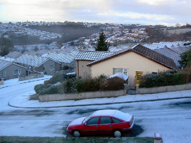
Higher Compton is a small village located in the county of Devon, England. Situated approximately 4 miles northwest of the city of Plymouth, it is a rural community surrounded by picturesque countryside and farmland. The village is part of the larger civil parish of Compton Gifford.

Historically, Higher Compton was an agricultural settlement, with farming being the main economic activity. Today, the village still retains its rural charm, with many traditional cottages and farmhouses dotting the landscape. The village is predominantly residential, with a close-knit community of approximately 500 residents.

Although small in size, Higher Compton offers a range of amenities for its residents. These include a primary school, a village hall, and a local pub, providing a sense of community and meeting places for social gatherings. Additionally, the village benefits from its proximity to the city of Plymouth, where residents can access a wider range of services and facilities.

The surrounding area offers plenty of opportunities for outdoor activities, with various walking and cycling routes available through the beautiful Devonshire countryside. The nearby Dartmoor National Park is also easily accessible, offering stunning landscapes, hiking trails, and opportunities for wildlife spotting.

Overall, Higher Compton is a peaceful and idyllic village, providing a tranquil haven for those seeking a rural lifestyle while still being within close proximity to urban amenities.

If you have any feedback on the listing, please let us know in the comments section below.

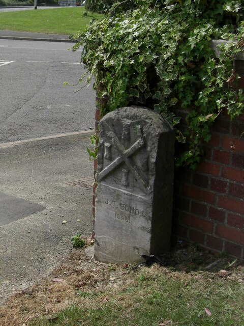
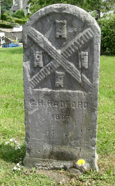
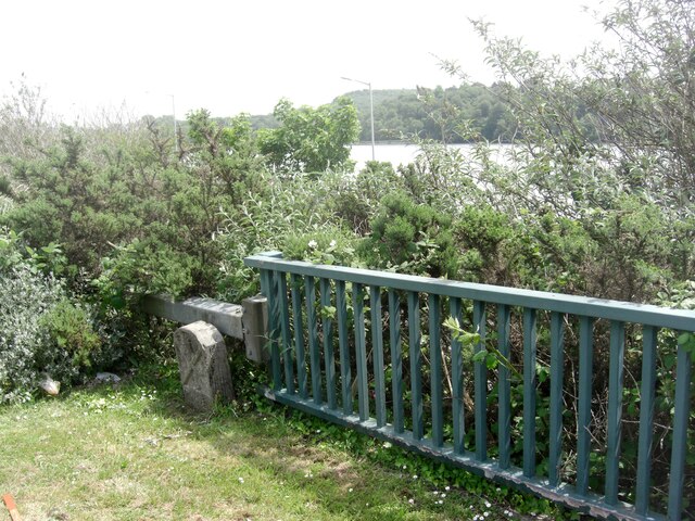
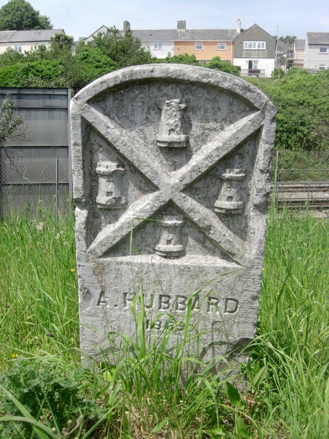
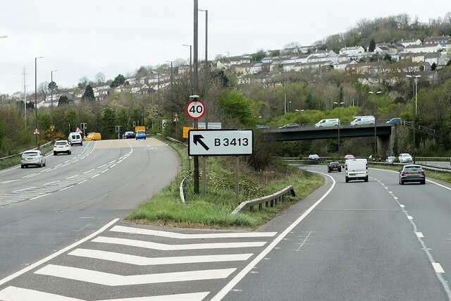
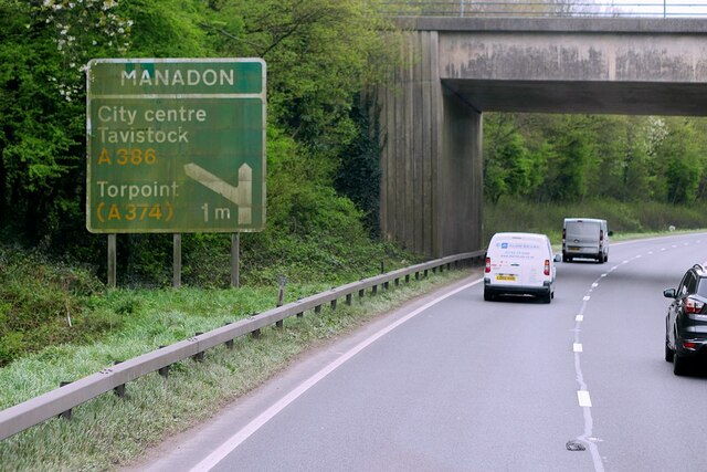
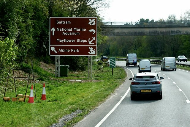
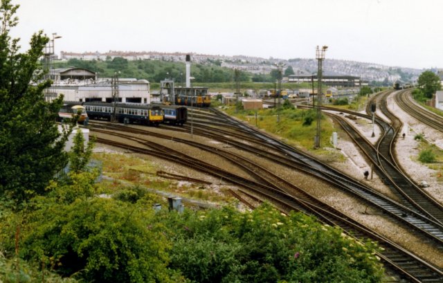
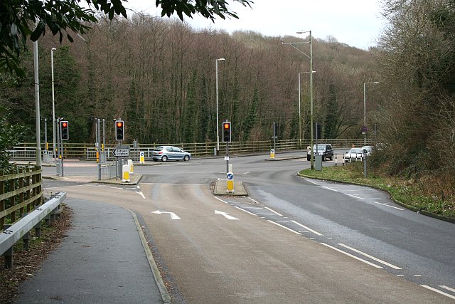
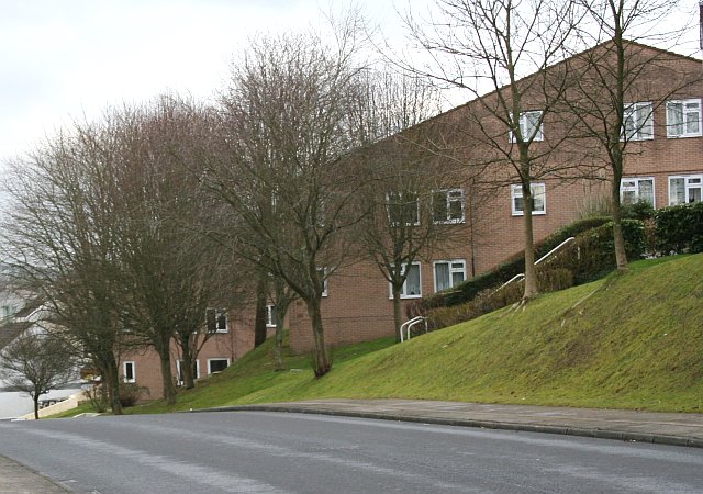
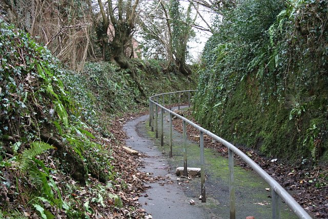
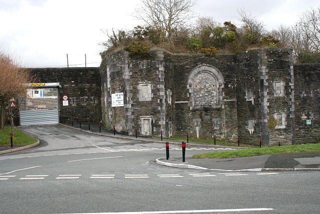
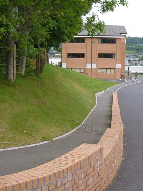
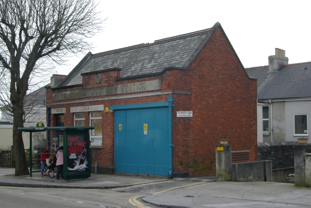
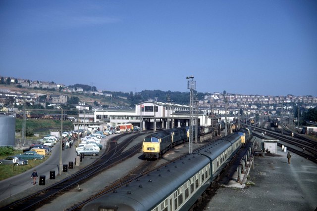
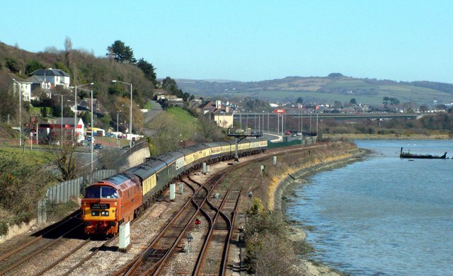
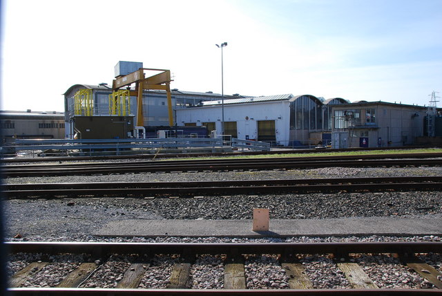
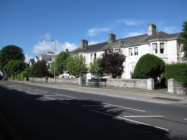
Higher Compton Images

Images are sourced within 2km of 50.392633/-4.1215893 or Grid Reference SX4956. Thanks to Geograph Open Source API. All images are credited.

Old Boundary Marker on Old Laira Road, Plymouth Municipal Boundary Marker facing east against the front garden wall of No.369 Old Laira Road, Plymouth, close to the junction with Manor Lane. Inscribed J.T. BOND / 1896 for John Thomas Bond, mayor.

Milestone Society National ID: DV_PCBS48pb
Old Boundary Marker on Old Laira Road, Plymouth
Municipal Boundary Marker facing east against the front garden wall of No.369 Old Laira Road, Plymouth, close to the junction with Manor Lane. Inscribed J.T. BOND / 1896 for John Thomas Bond, mayor. Milestone Society National ID: DV_PCBS48pb
Old Boundary Marker on Old Laira Road, Plymouth Municipal Boundary Marker on the east side of the junction of the B3214 Old Laira Road and the A374 Embankment Road, Plymouth. Inscribed C.H. RADFORD / 1897 for Charles H Radford, mayor.

Milestone Society National ID: DV_PCBS49pb
Old Boundary Marker on Old Laira Road, Plymouth
Municipal Boundary Marker on the east side of the junction of the B3214 Old Laira Road and the A374 Embankment Road, Plymouth. Inscribed C.H. RADFORD / 1897 for Charles H Radford, mayor. Milestone Society National ID: DV_PCBS49pb
Old Boundary Marker on Embankment Road, Plymouth Municipal Boundary Marker in front of a crash barrier where it meets metal railings on the southeast side of the A374 Embankment Road opposite the junction with Old Laira Road, Plymouth. Inscribed J.T. BOND / (1896) for John Thomas Bond, mayor.

Milestone Society National ID: DV_PCBS50pb
Old Boundary Marker on Embankment Road, Plymouth
Municipal Boundary Marker in front of a crash barrier where it meets metal railings on the southeast side of the A374 Embankment Road opposite the junction with Old Laira Road, Plymouth. Inscribed J.T. BOND / (1896) for John Thomas Bond, mayor. Milestone Society National ID: DV_PCBS50pb
Old Boundary Marker on Lanhydrock Road, Plymouth Municipal Boundary Marker behind a wire mesh fence in Embankment Road allotments, on the north side of Lanhydrock Road, Plymouth. Inscribed A. HUBBARD / 1869 for Alexander Hubbard, mayor.

Milestone Society National ID: DV_PCBS51pb
Old Boundary Marker on Lanhydrock Road, Plymouth
Municipal Boundary Marker behind a wire mesh fence in Embankment Road allotments, on the north side of Lanhydrock Road, Plymouth. Inscribed A. HUBBARD / 1869 for Alexander Hubbard, mayor. Milestone Society National ID: DV_PCBS51pb
A38 at Forder Valley Interchange The A38 is a major A-class trunk route. When first designated in 1922, it ran from Derby to Plymouth but it was later extended at both ends so that it now runs for 292 miles from Mansfield in Nottinghamshire to Bodmin in Cornwall.

Prior to the opening of the M5 motorway in the 1960s and 1970s, the A38 formed the main "holiday route" from the Midlands to Somerset, Devon and Cornwall and the south-western section was notorious at holiday times for the congestion. Nowadays, for most of the southern section, the A38 is a fairly quiet road shadowing the M5 extremely closely; often running alongside the motorway as a single carriageway road. The section between Exeter and Plymouth is, however, a busy dual carriageway which serves as the southern extension of the M5 and is known as “the Devon Expressway”.

More information at <span class="nowrap"><a title="http://en.wikipedia.org/wiki/A38_road" rel="nofollow ugc noopener" href="http://en.wikipedia.org/wiki/A38_road">Link</a><img style="margin-left:2px;" alt="External link" title="External link - shift click to open in new window" src="https://s1.geograph.org.uk/img/external.png" width="10" height="10"/></span>  (Wikipedia) and <span class="nowrap"><a title="http://www.sabre-roads.org.uk/wiki/index.php?title=A38" rel="nofollow ugc noopener" href="http://www.sabre-roads.org.uk/wiki/index.php?title=A38">Link</a><img style="margin-left:2px;" alt="External link" title="External link - shift click to open in new window" src="https://s1.geograph.org.uk/img/external.png" width="10" height="10"/></span>  (SABRE).
A38 at Forder Valley Interchange
The A38 is a major A-class trunk route. When first designated in 1922, it ran from Derby to Plymouth but it was later extended at both ends so that it now runs for 292 miles from Mansfield in Nottinghamshire to Bodmin in Cornwall. Prior to the opening of the M5 motorway in the 1960s and 1970s, the A38 formed the main "holiday route" from the Midlands to Somerset, Devon and Cornwall and the south-western section was notorious at holiday times for the congestion. Nowadays, for most of the southern section, the A38 is a fairly quiet road shadowing the M5 extremely closely; often running alongside the motorway as a single carriageway road. The section between Exeter and Plymouth is, however, a busy dual carriageway which serves as the southern extension of the M5 and is known as “the Devon Expressway”. More information at LinkExternal link (Wikipedia) and LinkExternal link (SABRE).
Devon Expressway near Plymouth The A38 is a major A-class trunk route. When first designated in 1922, it ran from Derby to Plymouth but it was later extended at both ends so that it now runs for 292 miles from Mansfield in Nottinghamshire to Bodmin in Cornwall.

Prior to the opening of the M5 motorway in the 1960s and 1970s, the A38 formed the main "holiday route" from the Midlands to Somerset, Devon and Cornwall and the south-western section was notorious at holiday times for the congestion. Nowadays, for most of the southern section, the A38 is a fairly quiet road shadowing the M5 extremely closely; often running alongside the motorway as a single carriageway road. The section between Exeter and Plymouth is, however, a busy dual carriageway which serves as the southern extension of the M5 and is known as “the Devon Expressway”.

More information at <span class="nowrap"><a title="http://en.wikipedia.org/wiki/A38_road" rel="nofollow ugc noopener" href="http://en.wikipedia.org/wiki/A38_road">Link</a><img style="margin-left:2px;" alt="External link" title="External link - shift click to open in new window" src="https://s1.geograph.org.uk/img/external.png" width="10" height="10"/></span>  (Wikipedia) and <span class="nowrap"><a title="http://www.sabre-roads.org.uk/wiki/index.php?title=A38" rel="nofollow ugc noopener" href="http://www.sabre-roads.org.uk/wiki/index.php?title=A38">Link</a><img style="margin-left:2px;" alt="External link" title="External link - shift click to open in new window" src="https://s1.geograph.org.uk/img/external.png" width="10" height="10"/></span>  (SABRE).
Devon Expressway near Plymouth
The A38 is a major A-class trunk route. When first designated in 1922, it ran from Derby to Plymouth but it was later extended at both ends so that it now runs for 292 miles from Mansfield in Nottinghamshire to Bodmin in Cornwall. Prior to the opening of the M5 motorway in the 1960s and 1970s, the A38 formed the main "holiday route" from the Midlands to Somerset, Devon and Cornwall and the south-western section was notorious at holiday times for the congestion. Nowadays, for most of the southern section, the A38 is a fairly quiet road shadowing the M5 extremely closely; often running alongside the motorway as a single carriageway road. The section between Exeter and Plymouth is, however, a busy dual carriageway which serves as the southern extension of the M5 and is known as “the Devon Expressway”. More information at LinkExternal link (Wikipedia) and LinkExternal link (SABRE).
Eastbound A38 near Plymouth The A38 is a major A-class trunk route. When first designated in 1922, it ran from Derby to Plymouth but it was later extended at both ends so that it now runs for 292 miles from Mansfield in Nottinghamshire to Bodmin in Cornwall.

Prior to the opening of the M5 motorway in the 1960s and 1970s, the A38 formed the main "holiday route" from the Midlands to Somerset, Devon and Cornwall and the south-western section was notorious at holiday times for the congestion. Nowadays, for most of the southern section, the A38 is a fairly quiet road shadowing the M5 extremely closely; often running alongside the motorway as a single carriageway road. The section between Exeter and Plymouth is, however, a busy dual carriageway which serves as the southern extension of the M5 and is known as “the Devon Expressway”.

More information at <span class="nowrap"><a title="http://en.wikipedia.org/wiki/A38_road" rel="nofollow ugc noopener" href="http://en.wikipedia.org/wiki/A38_road">Link</a><img style="margin-left:2px;" alt="External link" title="External link - shift click to open in new window" src="https://s1.geograph.org.uk/img/external.png" width="10" height="10"/></span>  (Wikipedia) and <span class="nowrap"><a title="http://www.sabre-roads.org.uk/wiki/index.php?title=A38" rel="nofollow ugc noopener" href="http://www.sabre-roads.org.uk/wiki/index.php?title=A38">Link</a><img style="margin-left:2px;" alt="External link" title="External link - shift click to open in new window" src="https://s1.geograph.org.uk/img/external.png" width="10" height="10"/></span>  (SABRE).
Eastbound A38 near Plymouth
The A38 is a major A-class trunk route. When first designated in 1922, it ran from Derby to Plymouth but it was later extended at both ends so that it now runs for 292 miles from Mansfield in Nottinghamshire to Bodmin in Cornwall. Prior to the opening of the M5 motorway in the 1960s and 1970s, the A38 formed the main "holiday route" from the Midlands to Somerset, Devon and Cornwall and the south-western section was notorious at holiday times for the congestion. Nowadays, for most of the southern section, the A38 is a fairly quiet road shadowing the M5 extremely closely; often running alongside the motorway as a single carriageway road. The section between Exeter and Plymouth is, however, a busy dual carriageway which serves as the southern extension of the M5 and is known as “the Devon Expressway”. More information at LinkExternal link (Wikipedia) and LinkExternal link (SABRE).
Laira Depot The line to the right is the West of England Main Line.  The one curving to the left is the Sutton Harbour branch.
Laira Depot
The line to the right is the West of England Main Line. The one curving to the left is the Sutton Harbour branch.
Bearsdown Close Bearsdown Close, Eggbuckland looking west over Eggbuckland
Bearsdown Close
Bearsdown Close, Eggbuckland looking west over Eggbuckland
Road Junction in the Valley This road used to be the main route through Plymouth into Cornwall until the Parkway was built.  It is quiet on a Sunday afternoon but will be a different story in the Monday morning rush hour.
Road Junction in the Valley
This road used to be the main route through Plymouth into Cornwall until the Parkway was built. It is quiet on a Sunday afternoon but will be a different story in the Monday morning rush hour.
New Housing on a Northern Slope Many of the northern slopes of Plymouth's valleys have been left to woodland but there is now an increasing amount of new housing being built on these slopes.
New Housing on a Northern Slope
Many of the northern slopes of Plymouth's valleys have been left to woodland but there is now an increasing amount of new housing being built on these slopes.
Steep Lane, Eggbuckland This is one of the narrow country roads left over from when this part of suburban Plymouth was still countryside.  It no longer takes traffic and has a handrail down the centre to help people navigate its steep gradient.
Steep Lane, Eggbuckland
This is one of the narrow country roads left over from when this part of suburban Plymouth was still countryside. It no longer takes traffic and has a handrail down the centre to help people navigate its steep gradient.
Austin Fort, Eggbuckland This is just a part of this large Palmerston Fort. It is one of several such fortifications built around Plymouth in the 19th Century.  It is now used as a local council depot.
Austin Fort, Eggbuckland
This is just a part of this large Palmerston Fort. It is one of several such fortifications built around Plymouth in the 19th Century. It is now used as a local council depot.
Envoy House, Longbridge A new office building beside the Marsh Mills Retail Park outside Plymouth, seen from the entry road off Longbridge Road.
Envoy House, Longbridge
A new office building beside the Marsh Mills Retail Park outside Plymouth, seen from the entry road off Longbridge Road.
Laira old Police and Fire Station Laira old Police and Fire Station, Old Laira Road, Plymouth, Devon. After use as a fire station, it was converted to a library.
Laira old Police and Fire Station
Laira old Police and Fire Station, Old Laira Road, Plymouth, Devon. After use as a fire station, it was converted to a library.
Laira  Depot Plymouth. Taken from the now long gone footbridge that lead off Embankment Road to the depot. This was the public open day on Saturday 23 September 1972.
Laira Depot Plymouth.
Taken from the now long gone footbridge that lead off Embankment Road to the depot. This was the public open day on Saturday 23 September 1972.
Laira by the river Plym The preserved western number 1015 passes its old home depot at Laira by the river Plym. The remains of the boat have been there a few years now. Behind the train one can see the A38 road at Marsh Mills. The cars whiz by like mad now it's a very busy road along the Embankment despite a speed restriction. Mind how you go.
Laira by the river Plym
The preserved western number 1015 passes its old home depot at Laira by the river Plym. The remains of the boat have been there a few years now. Behind the train one can see the A38 road at Marsh Mills. The cars whiz by like mad now it's a very busy road along the Embankment despite a speed restriction. Mind how you go.
Laira rail depot Part of the rail depot,on the outskirts of Plymouth.
Laira rail depot
Part of the rail depot,on the outskirts of Plymouth.
Show me another place!

Higher Compton is located at Grid Ref: SX4956 (Lat: 50.392633, Lng: -4.1215893)

Unitary Authority: Plymouth

Police Authority: Devon and Cornwall

What 3 Words

///bounty.alert.stone. Near Plymouth, Devon

Related Wikis

Hartley, Plymouth

Hartley is a suburb of Plymouth in the county of Devon, England. It is built on higher ground offering views south towards the sea, east into the South...

Compton, Plymouth

Compton or Compton Gifford is a suburb of Plymouth in England. Once a small village, it was developed in the 1930s and now lies between the suburbs of...

Eggbuckland Community College

Eggbuckland Community College is a coeducational secondary school and sixth form with academy status, located in the Eggbuckland area of Plymouth, Devon...

BBC Radio Devon

BBC Radio Devon is the BBC's local radio station serving the county of Devon. It broadcasts on FM, DAB, digital TV and via BBC Sounds from studios in the...

Fort Efford

Fort Efford is a former 19th-century Fort, built as a result of the Royal Commission on National Defence of 1859. It was built to defend the landward approaches...

Efford

Efford (anciently Eppeford, Elforde, etc.) is an historic manor formerly in the parish of Eggbuckland, Devon, England. Today it has been absorbed by large...

Eggbuckland

Eggbuckland is a suburb of the city of Plymouth in the county of Devon, England. Before the Second World War Eggbuckland was a small village a few miles...

Mannamead

Mannamead is a suburb of Plymouth in the county of Devon, England. It was an affluent Victorian and early Edwardian suburb with wide avenues such as Seymour...

Nearby Amenities

Located within 500m of 50.392633,-4.1215893
Mini Roundabout
Direction: clockwise
Lat/Long: 50.3921306/-4.1182897
Mini Roundabout
Direction: clockwise
Lat/Long: 50.3925126/-4.1234972
Mini Roundabout
Direction: clockwise
Lat/Long: 50.3927823/-4.1272095
Turning Circle
Lat/Long: 50.3944959/-4.1264247
Turning Circle
Lat/Long: 50.3950086/-4.1163202
Turning Circle
Lat/Long: 50.392138/-4.1159056
Turning Circle
Lat/Long: 50.39096/-4.1212371
Turning Circle
Lat/Long: 50.3903366/-4.1214755
Lower Compton
Place: suburb
Lat/Long: 50.3887997/-4.120526
Higher Compton
Place: suburb
Lat/Long: 50.3924386/-4.1173503
Crossing
Crossing: marked
Crossing Island: yes
Crossing Ref: zebra
Kerb: flush
Tactile Paving: yes
Traffic Calming: table
Lat/Long: 50.3922398/-4.1189524
Access: no
Barrier: bollard
Bicycle: yes
Bollard: fixed
Foot: yes
Lat/Long: 50.3897107/-4.1205425
Parking
Rest Area
Parking: layby
Lat/Long: 50.395888/-4.1214806
Phone
Emergency: phone
Lat/Long: 50.3959085/-4.121738
Generator Method: photovoltaic
Generator Output Electricity: yes
Generator Source: solar
Generator Type: solar_photovoltaic_panel
Location: roof
Power: generator
Lat/Long: 50.3918924/-4.116818
Generator Method: photovoltaic
Generator Output Electricity: yes
Generator Source: solar
Generator Type: solar_photovoltaic_panel
Location: roof
Power: generator
Lat/Long: 50.3918531/-4.1166329
Generator Method: photovoltaic
Generator Output Electricity: yes
Generator Source: solar
Generator Type: solar_photovoltaic_panel
Location: roof
Power: generator
Lat/Long: 50.3911623/-4.1170782
Generator Method: photovoltaic
Generator Output Electricity: yes
Generator Source: solar
Generator Type: solar_photovoltaic_panel
Location: roof
Power: generator
Lat/Long: 50.3914342/-4.1168341
Generator Method: photovoltaic
Generator Output Electricity: yes
Generator Source: solar
Generator Type: solar_photovoltaic_panel
Location: roof
Power: generator
Lat/Long: 50.3901568/-4.1157532
Generator Method: photovoltaic
Generator Output Electricity: yes
Generator Source: solar
Generator Type: solar_photovoltaic_panel
Location: roof
Power: generator
Lat/Long: 50.3901961/-4.1159597
Generator Method: photovoltaic
Generator Output Electricity: yes
Generator Source: solar
Generator Type: solar_photovoltaic_panel
Location: roof
Power: generator
Lat/Long: 50.3907177/-4.1171774
Generator Method: photovoltaic
Generator Output Electricity: yes
Generator Source: solar
Generator Type: solar_photovoltaic_panel
Location: roof
Power: generator
Lat/Long: 50.3906424/-4.1163889
Generator Method: photovoltaic
Generator Output Electricity: yes
Generator Source: solar
Generator Type: solar_photovoltaic_panel
Location: roof
Power: generator
Lat/Long: 50.3906356/-4.1163111
Generator Method: photovoltaic
Generator Output Electricity: yes
Generator Source: solar
Generator Type: solar_photovoltaic_panel
Location: roof
Power: generator
Lat/Long: 50.3905415/-4.1161743
Generator Method: photovoltaic
Generator Output Electricity: yes
Generator Source: solar
Generator Type: solar_photovoltaic_panel
Location: roof
Power: generator
Lat/Long: 50.3905347/-4.1161045
Generator Method: photovoltaic
Generator Output Electricity: yes
Generator Source: solar
Generator Type: solar_photovoltaic_panel
Location: roof
Power: generator
Lat/Long: 50.3904902/-4.1156593
Generator Method: photovoltaic
Generator Output Electricity: yes
Generator Source: solar
Generator Type: solar_photovoltaic_panel
Location: roof
Power: generator
Lat/Long: 50.3904954/-4.1154394
Generator Method: photovoltaic
Generator Output Electricity: yes
Generator Source: solar
Generator Type: solar_photovoltaic_panel
Location: roof
Power: generator
Lat/Long: 50.3909451/-4.1153348
Generator Method: photovoltaic
Generator Output Electricity: yes
Generator Source: solar
Generator Type: solar_photovoltaic_panel
Location: roof
Power: generator
Lat/Long: 50.3909742/-4.1162708
Generator Method: photovoltaic
Generator Output Electricity: yes
Generator Source: solar
Generator Type: solar_photovoltaic_panel
Location: roof
Power: generator
Lat/Long: 50.3908835/-4.1160187
Generator Method: photovoltaic
Generator Output Electricity: yes
Generator Source: solar
Generator Type: solar_photovoltaic_panel
Location: roof
Power: generator
Lat/Long: 50.3909588/-4.1162011
Generator Method: photovoltaic
Generator Output Electricity: yes
Generator Source: solar
Generator Type: solar_photovoltaic_panel
Location: roof
Power: generator
Lat/Long: 50.3937768/-4.1170353
Generator Method: photovoltaic
Generator Output Electricity: yes
Generator Source: solar
Generator Type: solar_photovoltaic_panel
Location: roof
Power: generator
Lat/Long: 50.3938179/-4.1170004
Generator Method: photovoltaic
Generator Output Electricity: yes
Generator Source: solar
Generator Type: solar_photovoltaic_panel
Location: roof
Power: generator
Lat/Long: 50.3954696/-4.1185856
Generator Method: photovoltaic
Generator Output Electricity: yes
Generator Source: solar
Generator Type: solar_photovoltaic_panel
Location: roof
Power: generator
Lat/Long: 50.3955072/-4.1185185
Generator Method: photovoltaic
Generator Output Electricity: yes
Generator Source: solar
Generator Type: solar_photovoltaic_panel
Location: roof
Power: generator
Lat/Long: 50.3954987/-4.1179016
Generator Method: photovoltaic
Generator Output Electricity: yes
Generator Source: solar
Generator Type: solar_photovoltaic_panel
Location: roof
Power: generator
Lat/Long: 50.3933237/-4.1166624
Generator Method: photovoltaic
Generator Output Electricity: yes
Generator Source: solar
Generator Type: solar_photovoltaic_panel
Location: roof
Power: generator
Lat/Long: 50.3969025/-4.1195914
Generator Method: photovoltaic
Generator Output Electricity: yes
Generator Source: solar
Generator Type: solar_photovoltaic_panel
Location: roof
Power: generator
Lat/Long: 50.3966631/-4.1187331
Maxspeed: 20 mph
Traffic Sign: maxspeed
Lat/Long: 50.3930842/-4.128314
Traffic Calming: cushion
Lat/Long: 50.3922963/-4.1193452
Direction: S
Generator Method: photovoltaic
Generator Output Electricity: yes
Generator Solar Modules: 24
Generator Source: solar
Generator Type: solar_photovoltaic_panel
Location: roof
Power: generator
Lat/Long: 50.3932205/-4.1242713
Direction: S
Generator Method: photovoltaic
Generator Output Electricity: yes
Generator Solar Modules: 12
Generator Source: solar
Generator Type: solar_photovoltaic_panel
Location: roof
Power: generator
Lat/Long: 50.393247/-4.1248061
Direction: S
Generator Method: photovoltaic
Generator Output Electricity: yes
Generator Solar Modules: 12
Generator Source: solar
Generator Type: solar_photovoltaic_panel
Location: roof
Power: generator
Lat/Long: 50.3933057/-4.1248663
Direction: 175
Generator Method: photovoltaic
Generator Output Electricity: yes
Generator Solar Modules: 26
Generator Source: solar
Generator Type: solar_photovoltaic_panel
Location: roof
Power: generator
Lat/Long: 50.3933773/-4.1255458
Direction: 190
Generator Method: photovoltaic
Generator Output Electricity: yes
Generator Solar Modules: 16
Generator Source: solar
Generator Type: solar_photovoltaic_panel
Location: roof
Power: generator
Lat/Long: 50.3957559/-4.1254586
Direction: S
Generator Method: photovoltaic
Generator Output Electricity: yes
Generator Solar Modules: 8
Generator Source: solar
Generator Type: solar_photovoltaic_panel
Location: roof
Power: generator
Lat/Long: 50.3914061/-4.1282234
Direction: S
Generator Method: photovoltaic
Generator Output Electricity: yes
Generator Solar Modules: 16
Generator Source: solar
Generator Type: solar_photovoltaic_panel
Location: roof
Power: generator
Lat/Long: 50.3934417/-4.1241215
Direction: S
Generator Method: photovoltaic
Generator Output Electricity: yes
Generator Solar Modules: 5
Generator Source: solar
Generator Type: solar_photovoltaic_panel
Location: roof
Power: generator
Lat/Long: 50.3933841/-4.1242212
Direction: 275
Generator Method: photovoltaic
Generator Output Electricity: yes
Generator Solar Modules: 9
Generator Source: solar
Generator Type: solar_photovoltaic_panel
Location: roof
Power: generator
Lat/Long: 50.393288/-4.1217702
Direction: S
Generator Method: photovoltaic
Generator Output Electricity: yes
Generator Solar Modules: 29
Generator Source: solar
Generator Type: solar_photovoltaic_panel
Location: roof
Power: generator
Lat/Long: 50.3932405/-4.1245442
Direction: S
Generator Method: photovoltaic
Generator Output Electricity: yes
Generator Solar Modules: 4
Generator Source: solar
Generator Type: solar_photovoltaic_panel
Location: roof
Power: generator
Lat/Long: 50.3933851/-4.1241436
Direction: 170
Generator Method: photovoltaic
Generator Output Electricity: yes
Generator Solar Modules: 16
Generator Source: solar
Generator Type: solar_photovoltaic_panel
Location: roof
Power: generator
Lat/Long: 50.3938352/-4.1223475
Direction: 175
Generator Method: photovoltaic
Generator Output Electricity: yes
Generator Solar Modules: 52
Generator Source: solar
Generator Type: solar_photovoltaic_panel
Location: roof
Power: generator
Lat/Long: 50.393372/-4.1256139
Direction: 170
Generator Method: photovoltaic
Generator Output Electricity: yes
Generator Solar Modules: 16
Generator Source: solar
Generator Type: solar_photovoltaic_panel
Location: roof
Power: generator
Lat/Long: 50.3921875/-4.1263145
Direction: 215
Generator Method: photovoltaic
Generator Output Electricity: yes
Generator Solar Modules: 21
Generator Source: solar
Generator Type: solar_photovoltaic_panel
Location: roof
Power: generator
Lat/Long: 50.3962459/-4.1256639
Traffic Calming: cushion
Lat/Long: 50.3923179/-4.1200736
Direction: 195
Generator Method: photovoltaic
Generator Output Electricity: yes
Generator Solar Modules: 14
Generator Source: solar
Generator Type: solar_photovoltaic_panel
Location: roof
Power: generator
Lat/Long: 50.3959219/-4.1249258
Direction: 95
Generator Method: photovoltaic
Generator Output Electricity: yes
Generator Solar Modules: 7
Generator Source: solar
Generator Type: solar_photovoltaic_panel
Location: roof
Power: generator
Lat/Long: 50.3932871/-4.1216903
Direction: 215
Generator Method: photovoltaic
Generator Output Electricity: yes
Generator Solar Modules: 6
Generator Source: solar
Generator Type: solar_photovoltaic_panel
Location: roof
Power: generator
Lat/Long: 50.3951567/-4.1267769
Direction: 175
Generator Method: photovoltaic
Generator Output Electricity: yes
Generator Solar Modules: 34
Generator Source: solar
Generator Type: solar_photovoltaic_panel
Location: roof
Power: generator
Lat/Long: 50.3933421/-4.1254768
Direction: S
Generator Method: photovoltaic
Generator Output Electricity: yes
Generator Solar Modules: 18
Generator Source: solar
Generator Type: solar_photovoltaic_panel
Location: roof
Power: generator
Lat/Long: 50.393303/-4.1245895
Direction: 175
Generator Method: photovoltaic
Generator Output Electricity: yes
Generator Solar Modules: 68
Generator Source: solar
Generator Type: solar_photovoltaic_panel
Location: roof
Power: generator
Lat/Long: 50.3933421/-4.1254084
Direction: 190
Generator Method: photovoltaic
Generator Output Electricity: yes
Generator Solar Modules: 10
Generator Source: solar
Generator Type: solar_photovoltaic_panel
Location: roof
Power: generator
Lat/Long: 50.3898544/-4.1264937
Direction: 190
Generator Method: photovoltaic
Generator Output Electricity: yes
Generator Solar Modules: 12
Generator Source: solar
Generator Type: solar_photovoltaic_panel
Location: roof
Power: generator
Lat/Long: 50.3898713/-4.1253768
Direction: 145
Generator Method: photovoltaic
Generator Output Electricity: yes
Generator Solar Modules: 10
Generator Source: solar
Generator Type: solar_photovoltaic_panel
Location: roof
Power: generator
Lat/Long: 50.3896501/-4.1235255
Direction: 190
Generator Method: photovoltaic
Generator Output Electricity: yes
Generator Solar Modules: 9
Generator Source: solar
Generator Type: solar_photovoltaic_panel
Location: roof
Power: generator
Lat/Long: 50.3918126/-4.1154983
Direction: SSE
Generator Method: photovoltaic
Generator Output Electricity: yes
Generator Solar Modules: 16
Generator Source: solar
Generator Type: solar_photovoltaic_panel
Location: ground
Power: generator
Lat/Long: 50.3898395/-4.1227411
Direction: 175
Generator Method: photovoltaic
Generator Output Electricity: yes
Generator Solar Modules: 8
Generator Source: solar
Generator Type: solar_photovoltaic_panel
Location: roof
Power: generator
Lat/Long: 50.3902434/-4.1229678
Direction: SE
Generator Method: photovoltaic
Generator Output Electricity: yes
Generator Solar Modules: 6
Generator Source: solar
Generator Type: solar_photovoltaic_panel
Location: roof
Power: generator
Lat/Long: 50.3895967/-4.1267065
Direction: S
Generator Method: photovoltaic
Generator Output Electricity: yes
Generator Solar Modules: 12
Generator Source: solar
Generator Type: solar_photovoltaic_panel
Location: roof
Power: generator
Lat/Long: 50.3886557/-4.123441
Direction: S
Generator Method: photovoltaic
Generator Output Electricity: yes
Generator Solar Modules: 12
Generator Source: solar
Generator Type: solar_photovoltaic_panel
Location: roof
Power: generator
Lat/Long: 50.388644/-4.1237984
Direction: S
Generator Method: photovoltaic
Generator Output Electricity: yes
Generator Solar Modules: 9
Generator Source: solar
Generator Type: solar_photovoltaic_panel
Location: roof
Power: generator
Lat/Long: 50.3886623/-4.1242755
Direction: NE
Generator Method: photovoltaic
Generator Output Electricity: yes
Generator Solar Modules: 6
Generator Source: solar
Generator Type: solar_photovoltaic_panel
Location: roof
Power: generator
Lat/Long: 50.3896463/-4.1266985
Bus Stop
Pearn Home
Bench: yes
Bin: no
Bus: yes
Lit: yes
Naptan AtcoCode: 1180PLB11621
Naptan Bearing: NE
Naptan CommonName: Pearn Convalescent Home
Naptan Indicator: NE-bound
Naptan NaptanCode: plygtgm
Naptan PlusbusZoneRef: PLYMTH
Naptan Street: Eggbuckland Road
Naptan Verified: no
Public Transport: platform
Shelter: yes
Tactile Paving: no
Lat/Long: 50.3910937/-4.1272707
Bus Stop
Pearn Home
Bench: no
Bin: no
Bus: yes
Departures Board: timetable
Lit: yes
Mapillary: 643917110323636
Naptan AtcoCode: 1180PLB11620
Naptan Bearing: SW
Naptan CommonName: Pearn Convalescent Home
Naptan Indicator: SW-bound
Naptan NaptanCode: plygtjp
Naptan PlusbusZoneRef: PLYMTH
Public Transport: platform
Shelter: yes
Survey Date: 2021-11-01
Tactile Paving: no
Lat/Long: 50.3912333/-4.1267758
Bus Stop
Eastfield Crescent
Bench: no
Bin: no
Bus: yes
Departures Board: timetable
Lit: yes
Mapillary: 1542079929481493
Naptan AtcoCode: 1180PLB11616
Naptan Bearing: E
Naptan CommonName: Eastfield Crescent
Naptan Indicator: E-bound
Naptan NaptanCode: plyjadw
Naptan PlusbusZoneRef: PLYMTH
Public Transport: platform
Shelter: no
Survey Date: 2022-03-13
Tactile Paving: no
Lat/Long: 50.3926352/-4.1212968
Bus Stop
Cranmere road
Bench: yes
Bin: no
Bus: yes
Lit: no
Naptan AtcoCode: 1180PLB11617
Naptan Bearing: W
Naptan CommonName: Cranmere Road
Naptan Indicator: W-bound
Naptan NaptanCode: plyjagd
Naptan PlusbusZoneRef: PLYMTH
Naptan Street: Eggbuckland Road
Naptan Verified: no
Public Transport: platform
Shelter: yes
Tactile Paving: no
Lat/Long: 50.3925244/-4.1211868
Bus Stop
Bluebird
Bus: yes
Naptan AtcoCode: 1180PLB11615
Naptan Bearing: E
Naptan CommonName: Bluebird Inn
Naptan Indicator: E-bound
Naptan NaptanCode: plyjapm
Naptan PlusbusZoneRef: PLYMTH
Naptan Street: Eggbuckland Road
Naptan Verified: no
Public Transport: platform
Shelter: yes
Lat/Long: 50.3923581/-4.1194527
Bus Stop
Bluebird Inn
Bench: yes
Bin: no
Bus: yes
Lit: yes
Naptan AtcoCode: 1180PLB11614
Naptan Bearing: NW
Naptan CommonName: Bluebird Inn
Naptan Indicator: NW-bound
Naptan NaptanCode: plyjawj
Naptan PlusbusZoneRef: PLYMTH
Naptan Street: Eggbuckland Road
Naptan Verified: no
Public Transport: platform
Shelter: yes
Tactile Paving: no
Lat/Long: 50.3920786/-4.1185321
Bus Stop
Bluebird Inn
Bench: yes
Bin: no
Bus: yes
Lit: yes
Naptan AtcoCode: 1180PLB11633
Naptan Bearing: SE
Naptan CommonName: Bluebird Inn
Naptan Indicator: SE-bound
Naptan NaptanCode: plyjdja
Naptan PlusbusZoneRef: PLYMTH
Naptan Street: Efford Road
Naptan Verified: no
Public Transport: platform
Shelter: yes
Tactile Paving: no
Lat/Long: 50.3919469/-4.1177214
Bus Stop
Efford Crescent
Bench: no
Bin: no
Bus: yes
Departures Board: no
Lit: no
Mapillary: 425211995638322
Naptan AtcoCode: 1180PLB11634
Naptan Bearing: NW
Naptan CommonName: Efford Crescent
Naptan Indicator: NW-bound
Naptan NaptanCode: plyjdgt
Naptan PlusbusZoneRef: PLYMTH
Public Transport: platform
Shelter: no
Survey Date: 2021-10-21
Tactile Paving: no
Lat/Long: 50.3917912/-4.1175182
Post Box
Collection Times: Mo-Fr 17:00; Sa 11:45
Post Box Type: pillar
Ref: PL3 190
Royal Cypher: GVIR
Royal Cypher Wikidata: Q33102169
Lat/Long: 50.3919443/-4.1183671
Bus Stop
Mannamead Tennis Club
Bench: yes
Bin: no
Bus: yes
Departures Board: timetable
Image: https://storage13.openstreetcam.org/files/photo/2021/11/2/lth/3888377_79e88b392e3a0492141f275e15e68f3a.jpg
Lit: yes
Naptan AtcoCode: 1180PLB11618
Naptan Bearing: SW
Naptan CommonName: Higher Compton Tennis Club
Naptan Indicator: SW-bound
Naptan NaptanCode: plygwjp
Naptan PlusbusZoneRef: PLYMTH
Naptan Street: Eggbuckland Road
Public Transport: platform
Shelter: yes
Survey Date: 2021-11-02
Tactile Paving: no
Lat/Long: 50.3922206/-4.1242019
Bus Stop
Collins Park
Bench: yes
Bin: no
Bus: yes
Lit: yes
Naptan AtcoCode: 1180PLB11619
Naptan Bearing: E
Naptan CommonName: Collins Park
Naptan Indicator: E-bound
Naptan NaptanCode: plygwjd
Naptan PlusbusZoneRef: PLYMTH
Naptan Street: Eggbuckland Road
Naptan Verified: no
Public Transport: platform
Shelter: no
Tactile Paving: no
Lat/Long: 50.3922792/-4.124393
Bus Stop
Speedwell Feedwell
Bench: yes
Bin: no
Bus: yes
Lit: yes
Naptan AtcoCode: 1180PLB11583
Naptan Bearing: E
Naptan CommonName: Speedwell Feedwell
Naptan Indicator: E-bound
Naptan NaptanCode: plyjagp
Naptan PlusbusZoneRef: PLYMTH
Naptan Street: Culver Way
Naptan Verified: no
Public Transport: platform
Shelter: yes
Tactile Paving: no
Lat/Long: 50.3965808/-4.1217604
Bus Stop
Culver Way
Bench: yes
Bin: no
Bus: yes
Lit: yes
Naptan AtcoCode: 1180PLB11584
Naptan Bearing: W
Naptan CommonName: Culver Way
Naptan Indicator: W-bound
Naptan NaptanCode: plyjapg
Naptan PlusbusZoneRef: PLYMTH
Naptan Street: Culver Way
Naptan Verified: no
Public Transport: platform
Shelter: yes
Tactile Paving: yes
Lat/Long: 50.3963623/-4.1201401
Post Box
Collection Times: Mo-Fr 09:00, Sa 07:00
Ref: PL6 322D
Royal Cypher: EIIR
Royal Cypher Wikidata: Q33102113
Lat/Long: 50.3965386/-4.1214607
Barrier: bollard
Bicycle: yes
Bollard: fixed
Foot: yes
Lat/Long: 50.3916113/-4.1161874
Bench
Backrest: yes
Lat/Long: 50.3918866/-4.1173524
Bench
Backrest: yes
Lat/Long: 50.3927465/-4.1283689
Bench
Backrest: yes
Lat/Long: 50.3925486/-4.1280113
Bench
Lat/Long: 50.392318/-4.1285169
Waste Basket
Lat/Long: 50.3919969/-4.1270679
Bench
Backrest: yes
Lat/Long: 50.3923782/-4.1284254
Bench
Backrest: yes
Lat/Long: 50.3925201/-4.1281768
Bus Stop
Windsor Road
Bench: no
Bin: no
Bus: yes
Lit: yes
Naptan AtcoCode: 1180PLB11612
Naptan Bearing: E
Naptan CommonName: Windsor Road
Naptan Indicator: E-bound
Naptan NaptanCode: plyjgda
Naptan PlusbusZoneRef: PLYMTH
Naptan Street: Eggbuckland Road
Naptan Verified: no
Public Transport: platform
Shelter: no
Tactile Paving: no
Lat/Long: 50.3930184/-4.1148282
Communication Mobile Phone: yes
Man Made: mast
Survey Date: 2022-02-09
Tower Type: communication
Lat/Long: 50.390955/-4.1270141
Fire Hydrant
Emergency: fire_hydrant
Fire Hydrant Diameter: 4"
Fire Hydrant Position: sidewalk
Fire Hydrant Type: underground
Survey Date: 2022-02-09
Lat/Long: 50.3923195/-4.1238093
Street Lamp
Survey Date: 2022-02-09
Lat/Long: 50.3925023/-4.123021
Waste Basket
Survey Date: 2022-02-09
Lat/Long: 50.3967596/-4.1222165
Waste Basket
Survey Date: 2022-02-09
Lat/Long: 50.39218/-4.1183375
Street Lamp
Survey Date: 2022-02-09
Lat/Long: 50.392483/-4.1234107
Fire Hydrant
Emergency: fire_hydrant
Fire Hydrant Type: underground
Survey Date: 2022-02-09
Lat/Long: 50.3927102/-4.1221652
Fire Hydrant
Emergency: fire_hydrant
Fire Hydrant Type: underground
Survey Date: 2022-02-09
Lat/Long: 50.3940457/-4.1187709
Waste Basket
Ref: 401
Survey Date: 2022-02-09
Lat/Long: 50.3919368/-4.1183776
Grit Bin
Survey Date: 2022-02-09
Lat/Long: 50.3953645/-4.1189193
Fire Hydrant
Emergency: fire_hydrant
Fire Hydrant Diameter: 150
Fire Hydrant Position: sidewalk
Fire Hydrant Type: underground
Survey Date: 2022-02-09
Lat/Long: 50.3966962/-4.1222879
Street Lamp
Ref: 3
Survey Date: 2022-02-22
Lat/Long: 50.3963958/-4.125214
Street Lamp
Survey Date: 2022-02-22
Lat/Long: 50.3968202/-4.1220546
Street Lamp
Survey Date: 2022-02-22
Lat/Long: 50.396538/-4.1212476
Fire Hydrant
Emergency: fire_hydrant
Fire Hydrant Type: underground
Survey Date: 2022-02-22
Lat/Long: 50.3964756/-4.1198593
Street Lamp
Ref: 2
Survey Date: 2022-02-22
Lat/Long: 50.39645/-4.1248618
Street Lamp
Ref: 24
Survey Date: 2022-02-22
Lat/Long: 50.3969765/-4.1234012
Street Lamp
Ref: 25
Survey Date: 2022-03-02
Lat/Long: 50.3968213/-4.1231363
Street Lamp
Survey Date: 2022-02-22
Lat/Long: 50.3965625/-4.1222364
Street Lamp
Ref: 30
Survey Date: 2022-02-22
Lat/Long: 50.3964373/-4.1207937
Street Lamp
Survey Date: 2022-02-22
Lat/Long: 50.3964805/-4.1203137
Street Lamp
Ref: 26
Survey Date: 2022-02-22
Lat/Long: 50.3967599/-4.1227549
Street Lamp
Ref: 34
Survey Date: 2022-03-10
Lat/Long: 50.3964691/-4.1187213
Street Lamp
Survey Date: 2022-02-22
Lat/Long: 50.3963912/-4.1199579
Street Lamp
Ref: 33
Survey Date: 2022-02-22
Lat/Long: 50.396527/-4.1192453
Street Lamp
Ref: 35
Survey Date: 2022-02-22
Lat/Long: 50.396572/-4.1183429
Bus Stop
Beechcroft Road
Bench: no
Bin: no
Bus: yes
Lit: yes
Naptan AtcoCode: 1180PLB11627
Naptan Bearing: E
Naptan CommonName: Beechcroft Road
Naptan Indicator: E-bound
Naptan NaptanCode: plygwjt
Naptan PlusbusZoneRef: PLYMTH
Naptan Street: Lower Compton Road
Public Transport: platform
Shelter: no
Survey Date: 2022-02-28
Tactile Paving: no
Lat/Long: 50.3888555/-4.1239072
Street Lamp
Survey Date: 2022-02-28
Lat/Long: 50.3898436/-4.120635
Street Lamp
Survey Date: 2022-02-28
Lat/Long: 50.3899272/-4.1200949
Post Box
Collection Times: Mo-Fr 09:00, Sa 07:00
Post Box Type: lamp
Ref: PL3 192D
Royal Cypher: EIIR
Royal Cypher Wikidata: Q33102113
Survey Date: 2022-02-28
Lat/Long: 50.3900572/-4.1198754
Street Lamp
Ref: 21
Survey Date: 2022-02-28
Lat/Long: 50.3900746/-4.1220787
Fire Hydrant
Emergency: fire_hydrant
Fire Hydrant Diameter: 4"
Fire Hydrant Position: lane
Fire Hydrant Type: underground
Survey Date: 2022-02-28
Lat/Long: 50.390593/-4.1230892
Post Box
Collection Times: Mo-Fr 09:00, Sa 07:00
Post Box Type: wall
Ref: PL3 191D
Royal Cypher: GR
Royal Cypher Wikidata: Q33102273
Survey Date: 2022-02-28
Lat/Long: 50.3906846/-4.1232386
Fire Hydrant
Emergency: fire_hydrant
Fire Hydrant Type: underground
Survey Date: 2022-02-28
Lat/Long: 50.3906067/-4.124251
Street Lamp
Survey Date: 2022-02-28
Lat/Long: 50.390549/-4.1251917
Fire Hydrant
Emergency: fire_hydrant
Fire Hydrant Position: sidewalk
Fire Hydrant Type: underground
Survey Date: 2022-02-28
Lat/Long: 50.3907551/-4.1270728
Street Lamp
Survey Date: 2022-02-28
Lat/Long: 50.3887376/-4.1249813
Fire Hydrant
Emergency: fire_hydrant
Fire Hydrant Type: underground
Survey Date: 2022-02-28
Lat/Long: 50.388969/-4.1241616
Street Lamp
Survey Date: 2022-02-28
Lat/Long: 50.3889069/-4.124075
Street Lamp
Survey Date: 2022-02-28
Lat/Long: 50.3893272/-4.1233624
Street Lamp
Survey Date: 2022-02-28
Lat/Long: 50.3896625/-4.1215928
Street Lamp
Survey Date: 2022-02-28
Lat/Long: 50.3896863/-4.1211588
Fire Hydrant
Emergency: fire_hydrant
Fire Hydrant Type: underground
Survey Date: 2022-02-28
Lat/Long: 50.3900175/-4.1199976
Street Lamp
Survey Date: 2022-02-28
Lat/Long: 50.388763/-4.124429
Fire Hydrant
Emergency: fire_hydrant
Fire Hydrant Type: underground
Survey Date: 2022-02-28
Lat/Long: 50.389376/-4.1231057
Street Lamp
Survey Date: 2022-02-28
Lat/Long: 50.3895572/-4.1228757
Street Lamp
Survey Date: 2022-02-28
Lat/Long: 50.3895898/-4.1223688
Street Lamp
Survey Date: 2022-02-28
Lat/Long: 50.3900381/-4.1216617
Street Lamp
Survey Date: 2022-02-28
Lat/Long: 50.3906674/-4.1237938
Street Lamp
Survey Date: 2022-02-28
Lat/Long: 50.3906144/-4.1244389
Fire Hydrant
Emergency: fire_hydrant
Fire Hydrant Type: underground
Survey Date: 2022-02-28
Lat/Long: 50.3905982/-4.1254386
Fire Hydrant
Emergency: fire_hydrant
Fire Hydrant Diameter: 110
Fire Hydrant Position: lane
Fire Hydrant Type: underground
Survey Date: 2022-02-28
Lat/Long: 50.3906266/-4.1262336
Street Lamp
Survey Date: 2022-02-28
Lat/Long: 50.3909366/-4.1270177
Street Lamp
Survey Date: 2022-02-28
Lat/Long: 50.3889838/-4.1238318
Street Lamp
Ref: 3
Survey Date: 2022-02-28
Lat/Long: 50.3891399/-4.1235241
Street Lamp
Ref: 22
Survey Date: 2022-02-28
Lat/Long: 50.3900871/-4.1222926
Street Lamp
Survey Date: 2022-02-28
Lat/Long: 50.3903475/-4.1228325
Street Lamp
Survey Date: 2022-02-28
Lat/Long: 50.3906542/-4.1257441
Street Lamp
Survey Date: 2022-02-28
Lat/Long: 50.3906673/-4.1263828
Fire Hydrant
Emergency: fire_hydrant
Fire Hydrant Position: sidewalk
Fire Hydrant Type: underground
Survey Date: 2022-02-28
Lat/Long: 50.3910657/-4.1272874
Street Lamp
Survey Date: 2022-02-28
Lat/Long: 50.3911084/-4.1272291
Fire Hydrant
Emergency: fire_hydrant
Fire Hydrant Diameter: 110
Fire Hydrant Position: sidewalk
Fire Hydrant Type: underground
Survey Date: 2022-02-28
Lat/Long: 50.3914279/-4.1270107
Post Box
Collection Times: Mo-Fr 09:00, Sa 07:00
Post Box Type: wall
Ref: PL3 188D
Royal Cypher: GR
Royal Cypher Wikidata: Q33102273
Survey Date: 2022-02-28
Lat/Long: 50.3927926/-4.1265723
Street Lamp
Survey Date: 2022-02-28
Lat/Long: 50.3916938/-4.1270228
Street Lamp
Survey Date: 2022-02-28
Lat/Long: 50.3919108/-4.1269914
Street Lamp
Survey Date: 2022-02-28
Lat/Long: 50.3926244/-4.1265875
Street Lamp
Survey Date: 2022-02-28
Lat/Long: 50.3928791/-4.1265773
Street Lamp
Survey Date: 2022-02-28
Lat/Long: 50.3929249/-4.1276976
Fire Hydrant
Emergency: fire_hydrant
Fire Hydrant Diameter Signed: no
Fire Hydrant Position: sidewalk
Fire Hydrant Type: underground
Survey Date: 2022-02-28
Lat/Long: 50.3917559/-4.1269923
Street Lamp
Survey Date: 2022-02-28
Lat/Long: 50.3920434/-4.1265978
Street Lamp
Survey Date: 2022-02-28
Lat/Long: 50.3930537/-4.1279545
Street Lamp
Survey Date: 2022-02-28
Lat/Long: 50.3930351/-4.1281573
Street Lamp
Survey Date: 2022-02-28
Lat/Long: 50.3931438/-4.1283334
Street Lamp
Ref: 41
Survey Date: 2022-03-10
Lat/Long: 50.3925851/-4.1172391
Street Lamp
Survey Date: 2022-03-10
Lat/Long: 50.3953899/-4.11886
Man Made: utility_pole
Survey Date: 2022-03-10
Lat/Long: 50.3950841/-4.1179733
Grit Bin
Survey Date: 2022-03-10
Lat/Long: 50.3940806/-4.1179
Fire Hydrant
Emergency: fire_hydrant
Fire Hydrant Type: underground
Survey Date: 2022-03-10
Lat/Long: 50.3934429/-4.1176701
Man Made: street_cabinet
Survey Date: 2022-03-10
Lat/Long: 50.3925677/-4.1175113
Man Made: utility_pole
Survey Date: 2022-03-10
Lat/Long: 50.3926051/-4.1171862
Man Made: street_cabinet
Survey Date: 2022-03-10
Lat/Long: 50.3929981/-4.1150482
Street Lamp
Ref: 1
Survey Date: 2022-03-10
Lat/Long: 50.3933621/-4.1152374
Street Lamp
Ref: 2
Survey Date: 2022-03-10
Lat/Long: 50.393697/-4.1151461
Man Made: utility_pole
Survey Date: 2022-03-10
Lat/Long: 50.3937625/-4.1151338
Grit Bin
Survey Date: 2022-03-10
Lat/Long: 50.3938036/-4.1152305
Post Box
Collection Times: Mo-Fr 09:00; Sa 07:00
Post Box Type: wall
Ref: PL3 189D
Royal Cypher: EVIIR
Royal Cypher Wikidata: Q33102324
Survey Date: 2022-03-10
Lat/Long: 50.393901/-4.1151177
Grit Bin
Survey Date: 2022-03-10
Lat/Long: 50.3929303/-4.1150538
Street Lamp
Ref: 6
Survey Date: 2022-03-10
Lat/Long: 50.3944024/-4.1178767
Man Made: utility_pole
Survey Date: 2022-03-10
Lat/Long: 50.3940835/-4.1178183
Man Made: street_cabinet
Survey Date: 2022-03-10
Lat/Long: 50.3928656/-4.1162356
Street Lamp
Ref: 10A
Survey Date: 2022-03-10
Lat/Long: 50.3957226/-4.1189574
Information: guidepost
Survey Date: 2022-03-10
Tourism: information
Lat/Long: 50.3964278/-4.1190639
Fire Hydrant
Emergency: fire_hydrant
Fire Hydrant Type: underground
Survey Date: 2022-03-10
Lat/Long: 50.3953214/-4.1187091
Man Made: street_cabinet
Survey Date: 2022-03-10
Lat/Long: 50.3953329/-4.118223
Street Lamp
Survey Date: 2022-03-10
Lat/Long: 50.3954152/-4.1182194
Grit Bin
Survey Date: 2022-03-10
Lat/Long: 50.3953226/-4.1181726
Street Lamp
Ref: 8
Survey Date: 2022-03-10
Lat/Long: 50.3951394/-4.1179989
Fire Hydrant
Emergency: fire_hydrant
Fire Hydrant Type: underground
Survey Date: 2022-03-10
Lat/Long: 50.3949895/-4.1179613
Street Lamp
Ref: 7
Survey Date: 2022-03-10
Lat/Long: 50.394755/-4.1180168
Man Made: utility_pole
Survey Date: 2022-03-10
Lat/Long: 50.3939572/-4.1177265
Street Lamp
Survey Date: 2022-03-10
Lat/Long: 50.3937637/-4.1177412
Man Made: utility_pole
Survey Date: 2022-03-10
Lat/Long: 50.3934804/-4.1178247
Street Lamp
Survey Date: 2022-03-10
Lat/Long: 50.393092/-4.1176279
Man Made: utility_pole
Survey Date: 2022-03-10
Lat/Long: 50.3930523/-4.1177415
Street Lamp
Survey Date: 2022-03-10
Lat/Long: 50.3927579/-4.1176974
Man Made: street_cabinet
Survey Date: 2022-03-10
Lat/Long: 50.3924756/-4.1176717
Man Made: utility_pole
Survey Date: 2022-03-10
Lat/Long: 50.3925281/-4.1176593
Street Lamp
Survey Date: 2022-03-10
Lat/Long: 50.3924037/-4.1176126
Man Made: utility_pole
Survey Date: 2022-03-10
Lat/Long: 50.392605/-4.1168595
Street Lamp
Survey Date: 2022-03-10
Lat/Long: 50.3926199/-4.1167881
Fire Hydrant
Emergency: fire_hydrant
Fire Hydrant Diameter: 4"
Fire Hydrant Position: sidewalk
Fire Hydrant Type: underground
Survey Date: 2022-03-10
Lat/Long: 50.3927171/-4.1168138
Bus Stop
Bloomball Close
Bench: no
Bin: no
Bus: yes
Lit: yes
Naptan AtcoCode: 1180PLB11613
Naptan Bearing: E
Naptan CommonName: Bloomball Close
Naptan Indicator: E-bound
Naptan NaptanCode: plyjdmw
Naptan PlusbusZoneRef: PLYMTH
Naptan Street: Eggbuckland Road
Public Transport: platform
Shelter: no
Survey Date: 2022-03-10
Tactile Paving: no
Lat/Long: 50.3927838/-4.1165737
Street Lamp
Ref: 44
Survey Date: 2022-03-10
Lat/Long: 50.392804/-4.1160034
Man Made: utility_pole
Survey Date: 2022-03-10
Lat/Long: 50.3928684/-4.1157727
Street Lamp
Survey Date: 2022-03-10
Lat/Long: 50.3929293/-4.115124
Man Made: utility_pole
Survey Date: 2022-03-10
Lat/Long: 50.3935279/-4.1151302
Man Made: street_cabinet
Survey Date: 2022-03-10
Lat/Long: 50.3937362/-4.1152388
Fire Hydrant
Emergency: fire_hydrant
Fire Hydrant Type: underground
Survey Date: 2022-03-10
Lat/Long: 50.3936513/-4.1152848
Man Made: utility_pole
Survey Date: 2022-03-10
Lat/Long: 50.3942911/-4.1179444
Street Lamp
Survey Date: 2022-03-10
Lat/Long: 50.3940605/-4.1179002
Man Made: utility_pole
Survey Date: 2022-03-10
Lat/Long: 50.3950415/-4.1180652
Man Made: street_cabinet
Survey Date: 2022-03-10
Lat/Long: 50.3941019/-4.1178939
Street Lamp
Survey Date: 2022-03-10
Lat/Long: 50.3934176/-4.1177913
Street Lamp
Survey Date: 2022-03-10
Lat/Long: 50.3929813/-4.1155948
Street Lamp
Survey Date: 2022-03-10
Lat/Long: 50.3927978/-4.1164372
Fire Hydrant
Emergency: fire_hydrant
Fire Hydrant Diameter: 4"
Fire Hydrant Position: sidewalk
Fire Hydrant Type: underground
Survey Date: 2022-03-10
Lat/Long: 50.3929815/-4.1156677
Street Lamp
Survey Date: 2022-03-11
Lat/Long: 50.3909959/-4.1151513
Street Lamp
Ref: 10
Survey Date: 2022-03-11
Lat/Long: 50.3911978/-4.1151907
Man Made: street_cabinet
Survey Date: 2022-03-11
Lat/Long: 50.3910226/-4.115167
Bus Stop
Dartmeet Avenue
Bench: yes
Bin: no
Bus: yes
Lit: yes
Naptan AtcoCode: 1180PLB11635
Naptan Bearing: NW
Naptan CommonName: Dartmeet Avenue
Naptan Indicator: NW-bound
Naptan NaptanCode: plyjdwj
Naptan PlusbusZoneRef: PLYMTH
Naptan Street: Efford Road
Public Transport: platform
Shelter: yes
Survey Date: 2022-03-11
Tactile Paving: yes
Lat/Long: 50.3912538/-4.1154317
Man Made: utility_pole
Survey Date: 2022-03-11
Lat/Long: 50.3912859/-4.1150731
Fire Hydrant
Emergency: fire_hydrant
Fire Hydrant Diameter: 100
Fire Hydrant Position: sidewalk
Fire Hydrant Type: underground
Survey Date: 2022-03-11
Lat/Long: 50.391163/-4.1152576
Bus Stop
Dartmeet Avenue
Bench: yes
Bin: no
Bus: yes
Naptan AtcoCode: 1180PLB11636
Naptan Bearing: SE
Naptan CommonName: Dartmeet Avenue
Naptan Indicator: SE-bound
Naptan NaptanCode: plyjgad
Naptan PlusbusZoneRef: PLYMTH
Naptan Street: Efford Road
Public Transport: platform
Shelter: yes
Survey Date: 2022-03-11
Tactile Paving: no
Lat/Long: 50.3912717/-4.1150749
Street Lamp
Ref: 5
Survey Date: 2022-03-11
Lat/Long: 50.3912975/-4.1153026
Man Made: street_cabinet
Survey Date: 2022-03-11
Lat/Long: 50.3912917/-4.1150398
Bus Stop
Compton Vale
Bench: yes
Bus: yes
Naptan AtcoCode: 1180PLB11630
Naptan Bearing: W
Naptan CommonName: Compton Vale
Naptan Indicator: W-bound
Naptan NaptanCode: plyjamj
Naptan PlusbusZoneRef: PLYMTH
Naptan Street: Blandford Road
Public Transport: platform
Shelter: yes
Survey Date: 2022-03-21
Lat/Long: 50.3887105/-4.1196289
Bus Stop
Byland Road
Bench: no
Bin: no
Bus: yes
Lit: yes
Naptan AtcoCode: 1180PLB11629
Naptan Bearing: SE
Naptan CommonName: Byland Road
Naptan Indicator: SE-bound
Naptan NaptanCode: plyjajw
Naptan PlusbusZoneRef: PLYMTH
Naptan Street: Blandford Road
Public Transport: platform
Shelter: no
Survey Date: 2022-03-21
Tactile Paving: no
Lat/Long: 50.3888732/-4.1201064
Street Lamp
Survey Date: 2022-03-21
Lat/Long: 50.3885101/-4.1198771
Street Lamp
Ref: 1
Survey Date: 2022-03-28
Lat/Long: 50.3970082/-4.1207277
Street Lamp
Ref: 5
Survey Date: 2022-03-28
Lat/Long: 50.3967789/-4.1193933
Man Made: street_cabinet
Survey Date: 2022-03-28
Lat/Long: 50.3970359/-4.1208941
Street Lamp
Survey Date: 2022-03-28
Lat/Long: 50.3967585/-4.1203641
Man Made: street_cabinet
Survey Date: 2022-03-28
Lat/Long: 50.3967606/-4.1201602
Man Made: street_cabinet
Survey Date: 2022-03-28
Lat/Long: 50.3967609/-4.1200083
Street Lamp
Ref: 4
Survey Date: 2022-03-28
Lat/Long: 50.3967905/-4.1198313
Street Lamp
Survey Date: 2022-05-25
Lat/Long: 50.3917272/-4.117196
Man Made: street_cabinet
Survey Date: 2022-05-25
Lat/Long: 50.3919125/-4.1180716
Street Lamp
Survey Date: 2022-05-25
Lat/Long: 50.3921938/-4.1188782
Fire Hydrant
Emergency: fire_hydrant
Fire Hydrant Type: underground
Survey Date: 2022-05-25
Lat/Long: 50.392614/-4.1206451
Man Made: utility_pole
Material: wood
Survey Date: 2022-05-25
Lat/Long: 50.3925047/-4.1206917
Street Lamp
Survey Date: 2022-05-25
Lat/Long: 50.3925909/-4.1209771
Street Lamp
Ref: 2
Survey Date: 2022-05-25
Lat/Long: 50.3931494/-4.1214887
Street Lamp
Ref: 6
Survey Date: 2022-05-25
Lat/Long: 50.3940585/-4.1221869
Street Lamp
Ref: 1
Survey Date: 2022-05-25
Lat/Long: 50.3941933/-4.1249697
Street Lamp
Survey Date: 2022-05-25
Lat/Long: 50.3941574/-4.1253061
Man Made: street_cabinet
Survey Date: 2022-05-25
Lat/Long: 50.3943419/-4.1252362
Fire Hydrant
Emergency: fire_hydrant
Fire Hydrant Type: underground
Survey Date: 2022-05-25
Lat/Long: 50.3948639/-4.1264036
Street Lamp
Survey Date: 2022-05-25
Lat/Long: 50.3953228/-4.1267716
Grit Bin
Survey Date: 2022-05-25
Lat/Long: 50.3954184/-4.1267875
Street Lamp
Ref: 17
Survey Date: 2022-05-25
Lat/Long: 50.39561/-4.1268276
Man Made: street_cabinet
Survey Date: 2022-05-25
Lat/Long: 50.3926627/-4.1214492
Man Made: utility_pole
Survey Date: 2022-05-25
Lat/Long: 50.3939766/-4.1218453
Fire Hydrant
Emergency: fire_hydrant
Fire Hydrant Type: underground
Survey Date: 2022-05-25
Lat/Long: 50.39423/-4.1252051
Street Lamp
Survey Date: 2022-05-25
Lat/Long: 50.3944672/-4.1253446
Street Lamp
Survey Date: 2022-05-25
Lat/Long: 50.3950909/-4.1263097
Fire Hydrant
Emergency: fire_hydrant
Fire Hydrant Diameter: 90
Fire Hydrant Position: sidewalk
Fire Hydrant Type: underground
Survey Date: 2022-05-25
Lat/Long: 50.3914063/-4.115429
Street Lamp
Survey Date: 2022-05-25
Lat/Long: 50.3919785/-4.1178653
Fire Hydrant
Emergency: fire_hydrant
Fire Hydrant Diameter: 180
Fire Hydrant Position: sidewalk
Fire Hydrant Type: underground
Survey Date: 2022-05-25
Lat/Long: 50.3919486/-4.11806
Street Lamp
Survey Date: 2022-05-25
Lat/Long: 50.3918484/-4.1181589
Fire Hydrant
Emergency: fire_hydrant
Fire Hydrant Position: sidewalk
Fire Hydrant Type: underground
Survey Date: 2022-05-25
Lat/Long: 50.3921743/-4.118733
Street Lamp
Survey Date: 2022-05-25
Lat/Long: 50.3922609/-4.1193337
Street Lamp
Survey Date: 2022-05-25
Lat/Long: 50.3923577/-4.1202054
Street Lamp
Ref: 1
Survey Date: 2022-05-25
Lat/Long: 50.3928178/-4.1216257
Fire Hydrant
Emergency: fire_hydrant
Fire Hydrant Type: underground
Survey Date: 2022-05-25
Lat/Long: 50.3935832/-4.1215878
Man Made: utility_pole
Survey Date: 2022-05-25
Lat/Long: 50.3936174/-4.1215053
Fire Hydrant
Emergency: fire_hydrant
Fire Hydrant Type: underground
Survey Date: 2022-05-25
Lat/Long: 50.3944182/-4.1263285
Fire Hydrant
Emergency: fire_hydrant
Fire Hydrant Diameter: 100
Fire Hydrant Position: sidewalk
Fire Hydrant Type: underground
Survey Date: 2022-05-25
Lat/Long: 50.3917426/-4.1172444
Fire Hydrant
Emergency: fire_hydrant
Fire Hydrant Position: sidewalk
Fire Hydrant Type: underground
Survey Date: 2022-05-25
Lat/Long: 50.3919333/-4.1179922
Fire Hydrant
Emergency: fire_hydrant
Fire Hydrant Type: underground
Survey Date: 2022-05-25
Lat/Long: 50.3927086/-4.1215301
Man Made: street_cabinet
Survey Date: 2022-05-25
Lat/Long: 50.394523/-4.1254143
Fire Hydrant
Emergency: fire_hydrant
Fire Hydrant Position: green
Fire Hydrant Type: underground
Survey Date: 2022-05-25
Lat/Long: 50.3917369/-4.1166763
Fire Hydrant
Emergency: fire_hydrant
Fire Hydrant Diameter: 100
Fire Hydrant Position: sidewalk
Fire Hydrant Type: underground
Survey Date: 2022-05-25
Lat/Long: 50.3922763/-4.120136
Street Lamp
Ref: 4
Survey Date: 2022-05-25
Lat/Long: 50.393753/-4.1215336
Fire Hydrant
Emergency: fire_hydrant
Fire Hydrant Type: underground
Survey Date: 2022-05-25
Lat/Long: 50.3940296/-4.1222262
Street Lamp
Survey Date: 2022-05-25
Lat/Long: 50.394185/-4.1245152
Man Made: street_cabinet
Survey Date: 2022-05-25
Lat/Long: 50.3953886/-4.1269315
Street Lamp
Ref: 3
Survey Date: 2022-05-25
Lat/Long: 50.3934537/-4.121583
Street Lamp
Ref: 6
Survey Date: 2022-05-25
Lat/Long: 50.3945911/-4.1264499
Street Lamp
Ref: 5
Survey Date: 2022-05-25
Lat/Long: 50.3939979/-4.1217001
Fast Food
Wong's Chinese
Cuisine: chinese
Takeaway: only
Lat/Long: 50.3896976/-4.1208142
Bench
Backrest: no
Survey Date: 2022-10-10
Lat/Long: 50.3927469/-4.1252586
Fire Hydrant
Emergency: fire_hydrant
Fire Hydrant Diameter: 4"
Fire Hydrant Position: sidewalk
Fire Hydrant Type: underground
Survey Date: 2022-10-10
Lat/Long: 50.3927361/-4.1250523
Waste Basket
Survey Date: 2022-10-10
Lat/Long: 50.3927707/-4.1250937
Grit Bin
Survey Date: 2022-10-10
Lat/Long: 50.3926555/-4.1219414
Atm
Survey Date: 2022-10-10
Lat/Long: 50.3923172/-4.1183611
Bicycle Rental
Bicycle Rental: docking_station
Brand: Beryl
Brand Wikidata: Q106575365
Capacity: 7
Fee: yes
Network: Beryl Plymouth
Operator: Beryl
Operator Type: business
Operator Wikidata: Q106575369
Lat/Long: 50.3920633/-4.1183207
Bicycle Rental
Bicycle Rental: docking_station
Brand: Beryl
Brand Wikidata: Q106575365
Capacity: 6
Fee: yes
Network: Beryl
Network Wikidata: Q106575365
Operator: Beryl
Operator Type: business
Operator Wikidata: Q106575369
Lat/Long: 50.390887/-4.1272811
Addr Housenumber: 36
Addr Street: Widey View
Lat/Long: 50.3938154/-4.12685
Addr Housenumber: 12
Addr Street: Reservoir Road
Lat/Long: 50.3926404/-4.1271108
Addr Housenumber: 5
Addr Street: Widey View
Lat/Long: 50.3931398/-4.1267231
Addr Housenumber: 27
Addr Street: Higher Compton Road
Lat/Long: 50.3931539/-4.1283324
Addr Housenumber: 3
Addr Street: Widey View
Lat/Long: 50.3930769/-4.1266993
Fire Hydrant
Emergency: fire_hydrant
Fire Hydrant Position: sidewalk
Fire Hydrant Type: underground
Survey Date: 2023-09-29
Lat/Long: 50.391452/-4.1161137
Defibrillator
Emergency: defibrillator
Indoor: no
Survey Date: 2023-09-29
Lat/Long: 50.39289/-4.1253453
Fire Hydrant
Emergency: fire_hydrant
Fire Hydrant Position: sidewalk
Fire Hydrant Type: underground
Survey Date: 2023-09-29
Lat/Long: 50.3937163/-4.126778
Fire Hydrant
Emergency: fire_hydrant
Fire Hydrant Position: lane
Fire Hydrant Type: underground
Survey Date: 2023-09-29
Lat/Long: 50.3946432/-4.1277271
Fire Hydrant
Emergency: fire_hydrant
Fire Hydrant Position: sidewalk
Fire Hydrant Type: underground
Survey Date: 2023-09-29
Lat/Long: 50.3922686/-4.127059
Addr Housenumber: 28
Addr Street: Widey View
Lat/Long: 50.3935667/-4.1266659
Addr Housenumber: 39
Addr Street: Higher Compton Road
Lat/Long: 50.392983/-4.1274087
Addr Housenumber: 2
Addr Street: Reservoir Road
Lat/Long: 50.3921737/-4.1269773
Addr Housenumber: 58
Addr Street: Higher Compton Road
Lat/Long: 50.3925651/-4.1261941
Addr Housenumber: 48
Addr Street: Widey View
Lat/Long: 50.3941852/-4.1272244
Addr Housenumber: 1
Addr Street: Widey View
Lat/Long: 50.3930388/-4.1266868
Addr Housenumber: 25
Addr Street: Higher Compton Road
Lat/Long: 50.3931592/-4.1284209
Addr Housenumber: 35
Addr Street: Widey View
Lat/Long: 50.3939389/-4.1271716
Addr Housenumber: 35
Addr Street: Higher Compton Road
Lat/Long: 50.3930392/-4.1276185
Addr Housenumber: 7
Addr Street: Widey View
Lat/Long: 50.3931785/-4.1267357
Addr Housenumber: 50
Addr Street: Widey View
Lat/Long: 50.3942499/-4.1272726
Addr Housenumber: 54
Addr Street: Widey View
Lat/Long: 50.3944463/-4.1274301
Addr Housenumber: 11
Addr Street: Reservoir Road
Lat/Long: 50.3926006/-4.1271022
Addr Housenumber: 1
Addr Street: Reservoir Road
Lat/Long: 50.3921143/-4.1269478
Addr Housenumber: 140
Addr Street: Eggbuckland Road
Lat/Long: 50.3921497/-4.120978
Addr Housenumber: 55
Addr Street: Widey View
Lat/Long: 50.3945043/-4.1277003
Addr Housenumber: 34
Addr Street: Widey View
Lat/Long: 50.3937038/-4.1267603
Addr Housenumber: 63
Addr Street: Higher Compton Road
Lat/Long: 50.3926635/-4.1261268
Addr Housenumber: 31
Addr Street: Higher Compton Road
Lat/Long: 50.3930944/-4.1277733
Addr Housenumber: 13
Addr Street: Reservoir Road
Lat/Long: 50.3926716/-4.127136
Addr Housenumber: 38
Addr Street: Widey View
Lat/Long: 50.3938619/-4.1268951
Addr Housenumber: 7
Addr Street: Reservoir Road
Lat/Long: 50.3924321/-4.127078
Addr Housenumber: 27A
Addr Street: Higher Compton Road
Lat/Long: 50.3931413/-4.1281264
Addr Housenumber: 30
Addr Street: Widey View
Lat/Long: 50.3936126/-4.1267199
Addr Housenumber: 37
Addr Street: Higher Compton Road
Lat/Long: 50.3930193/-4.1275026
Addr Housenumber: 2
Addr Street: Widey View
Lat/Long: 50.3929525/-4.1265005
Addr Housenumber: 32
Addr Street: Widey View
Lat/Long: 50.3936522/-4.1267301
Addr Housenumber: 3
Addr Street: Reservoir Road
Lat/Long: 50.3922236/-4.1270053
Waste Basket
Survey Date: 2023-11-08
Lat/Long: 50.3922526/-4.1238077
Addr Housenumber: 5
Addr Street: Gleneagle Road
Lat/Long: 50.3904431/-4.1272907
Addr Housenumber: 15
Addr Street: Efford Road
Lat/Long: 50.3917875/-4.1169093
Addr Housenumber: 9
Addr Street: Gleneagle Road
Lat/Long: 50.3901149/-4.1273347
Addr Housenumber: 3
Addr Street: Gleneagle Road
Lat/Long: 50.3905508/-4.1272801
Addr Housenumber: 77
Addr Street: Eggbuckland Road
Lat/Long: 50.3921525/-4.1249867
Addr Housenumber: 71
Addr Street: Eggbuckland Road
Lat/Long: 50.391999/-4.125486
Addr Housenumber: 17
Addr Street: Gleneagle Road
Lat/Long: 50.3901418/-4.1271655
Addr Housenumber: 61
Addr Street: Eggbuckland Road
Lat/Long: 50.3918512/-4.1259086
Addr Housenumber: 18
Addr Street: Gleneagle Road
Lat/Long: 50.3902299/-4.1271552
Addr Housenumber: 67
Addr Street: Eggbuckland Road
Lat/Long: 50.3919567/-4.1256311
Addr Housenumber: 1
Addr Street: Gleneagle Road
Lat/Long: 50.3906462/-4.1272747
Addr Housenumber: 7
Addr Street: Gleneagle Road
Lat/Long: 50.3902899/-4.1273176
Addr Housenumber: 10
Addr Street: Gleneagle Road
Lat/Long: 50.3900699/-4.1273438
Addr Housenumber: 2
Addr Street: Gleneagle Road
Lat/Long: 50.3906031/-4.1272776
Addr Housenumber: 17
Addr Street: Efford Road
Lat/Long: 50.3917119/-4.1166172
Fire Hydrant
Emergency: fire_hydrant
Survey Date: 2024-01-20
Waste: dog_excrement
Lat/Long: 50.3897878/-4.1270246
Fire Hydrant
Emergency: fire_hydrant
Survey Date: 2024-01-20
Lat/Long: 50.3900203/-4.1273072
Defibrillator
Defibrillator Location: On outside of Tennis Club building accessible via gate on Eggbuckland Road (near Hartley Court)
Emergency: defibrillator
Indoor: no
Survey Date: 2024-01-20
Lat/Long: 50.391918/-4.1247724
Addr Housenumber: 115
Addr Street: Eggbuckland Road
Lat/Long: 50.3926561/-4.1225859
Addr Housenumber: 35
Addr Street: Efford Road
Lat/Long: 50.3914203/-4.1155921
Addr Housenumber: 4
Addr Street: Gleneagle Road
Lat/Long: 50.390498/-4.1272986
Addr Housenumber: 6
Addr Street: Gleneagle Road
Lat/Long: 50.3903813/-4.1272821
Addr Housenumber: 75
Addr Street: Eggbuckland Road
Lat/Long: 50.3921077/-4.1251388
Addr Housenumber: 117
Addr Street: Eggbuckland Road
Lat/Long: 50.3926571/-4.1225022
Addr Housenumber: 59
Addr Street: Eggbuckland Road
Lat/Long: 50.3917772/-4.1260572
Addr Housenumber: 63
Addr Street: Eggbuckland Road
Lat/Long: 50.3918834/-4.1258067
Addr Housenumber: 1
Addr Street: Cranmere Road
Lat/Long: 50.3924966/-4.1217089
Addr Housenumber: 69
Addr Street: Eggbuckland Road
Lat/Long: 50.3919766/-4.125559
Addr Housenumber: 119
Addr Street: Eggbuckland Road
Lat/Long: 50.3926749/-4.1223347
Addr Housenumber: 65
Addr Street: Eggbuckland Road
Lat/Long: 50.3919279/-4.1257102
Addr Housenumber: 73
Addr Street: Eggbuckland Road
Lat/Long: 50.3920717/-4.1252598
Addr Housenumber: 121
Addr Street: Eggbuckland Road
Lat/Long: 50.3926835/-4.122148
Bus Stop
Bench: no
Shelter: no
Survey Date: 2024-04-11
Lat/Long: 50.3887672/-4.1234381
Addr Housenumber: 37
Addr Street: Blandford Road
Lat/Long: 50.3889769/-4.1217301
Addr Housenumber: 9
Addr Street: Blandford Road
Lat/Long: 50.3888855/-4.1228871
Addr Housenumber: 15
Addr Street: Blandford Road
Lat/Long: 50.3889049/-4.1226467
Addr Housenumber: 51
Addr Street: Blandford Road
Lat/Long: 50.3889585/-4.1211721
Addr Housenumber: 57
Addr Street: Blandford Road
Lat/Long: 50.388946/-4.1208956
Addr Housenumber: 31
Addr Street: Blandford Road
Lat/Long: 50.3889656/-4.1219627
Addr Housenumber: 47
Addr Street: Blandford Road
Lat/Long: 50.3889634/-4.1213186
Addr Housenumber: 7
Addr Street: Blandford Road
Lat/Long: 50.388883/-4.1229332
Addr Housenumber: 11
Addr Street: Blandford Road
Lat/Long: 50.3889073/-4.1227931
Addr Housenumber: 21
Addr Street: Blandford Road
Lat/Long: 50.3889296/-4.1223603
Addr Housenumber: 39
Addr Street: Blandford Road
Lat/Long: 50.388972/-4.1216663
Addr Housenumber: 63
Addr Street: Blandford Road
Lat/Long: 50.3889317/-4.1206282
Addr Housenumber: 13
Addr Street: Blandford Road
Lat/Long: 50.3889092/-4.122735
Addr Housenumber: 61
Addr Street: Blandford Road
Lat/Long: 50.388932/-4.1206977
Addr Housenumber: 35
Addr Street: Blandford Road
Lat/Long: 50.3889642/-4.1218171
Addr Housenumber: 33
Addr Street: Blandford Road
Lat/Long: 50.3889655/-4.1218847
Addr Housenumber: 45
Addr Street: Blandford Road
Lat/Long: 50.3889657/-4.121399
Addr Housenumber: 27
Addr Street: Blandford Road
Lat/Long: 50.3889634/-4.1221624
Addr Housenumber: 2
Addr Street: Byland Road
Lat/Long: 50.3889305/-4.1202297
Addr Housenumber: 29
Addr Street: Blandford Road
Lat/Long: 50.3889628/-4.1220901
Addr Housenumber: 43
Addr Street: Blandford Road
Lat/Long: 50.3889676/-4.121505
Addr Housenumber: 6
Addr Street: Byland Road
Lat/Long: 50.3890065/-4.1202739
Addr Housenumber: 17
Addr Street: Blandford Road
Lat/Long: 50.388913/-4.1225886
Addr Housenumber: 3
Addr Street: Blandford Road
Lat/Long: 50.3888854/-4.1230636
Addr Housenumber: 23
Addr Street: Blandford Road
Lat/Long: 50.3889351/-4.1222924
Addr Housenumber: 19
Addr Street: Blandford Road
Lat/Long: 50.3889208/-4.1224852
Addr Housenumber: 53
Addr Street: Blandford Road
Lat/Long: 50.3889526/-4.1210744
Addr Housenumber: 65
Addr Street: Blandford Road
Lat/Long: 50.3889376/-4.1205547
Addr Housenumber: 25
Addr Street: Blandford Road
Lat/Long: 50.3889449/-4.1222162
Addr Housenumber: 5
Addr Street: Blandford Road
Lat/Long: 50.3888842/-4.1230046
Addr Housenumber: 49
Addr Street: Blandford Road
Lat/Long: 50.3889658/-4.1212453
Addr Housenumber: 59
Addr Street: Blandford Road
Lat/Long: 50.3889418/-4.1208052
Addr Housenumber: 41
Addr Street: Blandford Road
Lat/Long: 50.3889736/-4.1216042
Addr Housenumber: 4
Addr Street: Byland Road
Lat/Long: 50.3889718/-4.1202482
Addr Housenumber: 55
Addr Street: Blandford Road
Lat/Long: 50.3889524/-4.1210176
The data included in this document is from www.openstreetmap.org. The data is made available under ODbL.

Have you been to Higher Compton?

Leave your review of Higher Compton below (or comments, questions and feedback).