Compton, Lower

Settlement in Devon

England

Compton, Lower

Old Boundary Marker on Old Laira Road, Plymouth Municipal Boundary Marker facing east against the front garden wall of No.369 Old Laira Road, Plymouth, close to the junction with Manor Lane. Inscribed J.T. BOND / 1896 for John Thomas Bond, mayor.

Milestone Society National ID: DV_PCBS48pb
Old Boundary Marker on Old Laira Road, Plymouth Credit: T Jenkinson

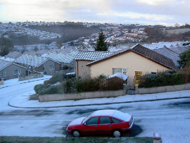
Compton, Lower, Devon is a quaint village located in the South West of England. Situated in the county of Devon, it is nestled in the picturesque countryside and offers a peaceful and idyllic setting for residents and visitors alike.

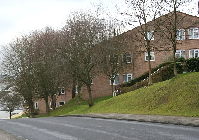
With a population of around 500 residents, Compton, Lower maintains a close-knit community feel. The village boasts a charming mix of traditional thatched cottages and more modern houses, blending the old with the new. The surrounding landscape is characterized by rolling hills, lush green fields, and meandering streams, providing a stunning backdrop to the village.

Compton, Lower is known for its rich history, dating back to the medieval period. Several historic landmarks can be found within the village, including the St. Mary's Church, which dates back to the 13th century, and the Compton Castle, a fortified manor house built in the 14th century.

Despite its small size, the village offers a range of amenities to cater to the needs of its residents. These include a village pub, a local convenience store, a primary school, and a village hall where various community events and activities take place.

For those seeking outdoor activities, Compton, Lower is surrounded by beautiful countryside, providing ample opportunities for walking, hiking, and cycling. The nearby Dartmoor National Park offers even more adventurous pursuits, such as rock climbing and horse riding.

Overall, Compton, Lower, Devon is a charming village that offers a peaceful and scenic escape from the hustle and bustle of city life, making it an ideal place to live or visit for those seeking a tranquil rural experience.

If you have any feedback on the listing, please let us know in the comments section below.

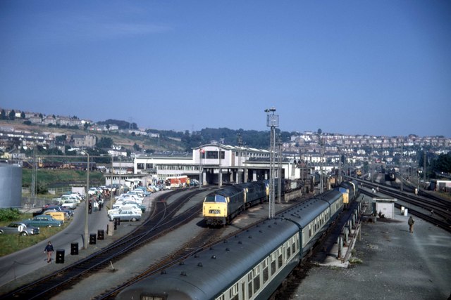
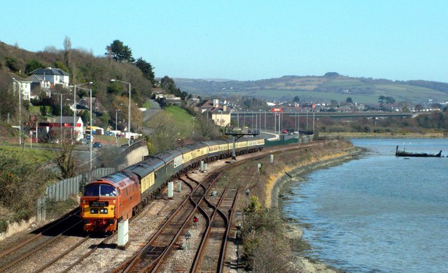
Compton, Lower Images

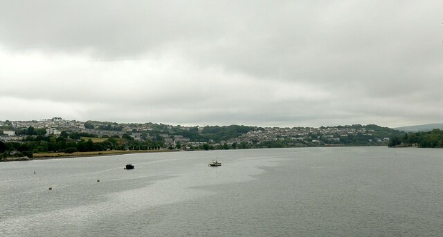
Images are sourced within 2km of 50.386116/-4.119142 or Grid Reference SX4956. Thanks to Geograph Open Source API. All images are credited.

Old Boundary Marker on Old Laira Road, Plymouth Municipal Boundary Marker facing east against the front garden wall of No.369 Old Laira Road, Plymouth, close to the junction with Manor Lane. Inscribed J.T. BOND / 1896 for John Thomas Bond, mayor.

Milestone Society National ID: DV_PCBS48pb
Old Boundary Marker on Old Laira Road, Plymouth
Municipal Boundary Marker facing east against the front garden wall of No.369 Old Laira Road, Plymouth, close to the junction with Manor Lane. Inscribed J.T. BOND / 1896 for John Thomas Bond, mayor. Milestone Society National ID: DV_PCBS48pb
Old Boundary Marker on Old Laira Road, Plymouth Municipal Boundary Marker on the east side of the junction of the B3214 Old Laira Road and the A374 Embankment Road, Plymouth. Inscribed C.H. RADFORD / 1897 for Charles H Radford, mayor.

Milestone Society National ID: DV_PCBS49pb
Old Boundary Marker on Old Laira Road, Plymouth
Municipal Boundary Marker on the east side of the junction of the B3214 Old Laira Road and the A374 Embankment Road, Plymouth. Inscribed C.H. RADFORD / 1897 for Charles H Radford, mayor. Milestone Society National ID: DV_PCBS49pb
Old Boundary Marker on Embankment Road, Plymouth Municipal Boundary Marker in front of a crash barrier where it meets metal railings on the southeast side of the A374 Embankment Road opposite the junction with Old Laira Road, Plymouth. Inscribed J.T. BOND / (1896) for John Thomas Bond, mayor.

Milestone Society National ID: DV_PCBS50pb
Old Boundary Marker on Embankment Road, Plymouth
Municipal Boundary Marker in front of a crash barrier where it meets metal railings on the southeast side of the A374 Embankment Road opposite the junction with Old Laira Road, Plymouth. Inscribed J.T. BOND / (1896) for John Thomas Bond, mayor. Milestone Society National ID: DV_PCBS50pb
Old Boundary Marker on Lanhydrock Road, Plymouth Municipal Boundary Marker behind a wire mesh fence in Embankment Road allotments, on the north side of Lanhydrock Road, Plymouth. Inscribed A. HUBBARD / 1869 for Alexander Hubbard, mayor.

Milestone Society National ID: DV_PCBS51pb
Old Boundary Marker on Lanhydrock Road, Plymouth
Municipal Boundary Marker behind a wire mesh fence in Embankment Road allotments, on the north side of Lanhydrock Road, Plymouth. Inscribed A. HUBBARD / 1869 for Alexander Hubbard, mayor. Milestone Society National ID: DV_PCBS51pb
A38 at Forder Valley Interchange The A38 is a major A-class trunk route. When first designated in 1922, it ran from Derby to Plymouth but it was later extended at both ends so that it now runs for 292 miles from Mansfield in Nottinghamshire to Bodmin in Cornwall.

Prior to the opening of the M5 motorway in the 1960s and 1970s, the A38 formed the main "holiday route" from the Midlands to Somerset, Devon and Cornwall and the south-western section was notorious at holiday times for the congestion. Nowadays, for most of the southern section, the A38 is a fairly quiet road shadowing the M5 extremely closely; often running alongside the motorway as a single carriageway road. The section between Exeter and Plymouth is, however, a busy dual carriageway which serves as the southern extension of the M5 and is known as “the Devon Expressway”.

More information at <span class="nowrap"><a title="http://en.wikipedia.org/wiki/A38_road" rel="nofollow ugc noopener" href="http://en.wikipedia.org/wiki/A38_road">Link</a><img style="margin-left:2px;" alt="External link" title="External link - shift click to open in new window" src="https://s1.geograph.org.uk/img/external.png" width="10" height="10"/></span>  (Wikipedia) and <span class="nowrap"><a title="http://www.sabre-roads.org.uk/wiki/index.php?title=A38" rel="nofollow ugc noopener" href="http://www.sabre-roads.org.uk/wiki/index.php?title=A38">Link</a><img style="margin-left:2px;" alt="External link" title="External link - shift click to open in new window" src="https://s1.geograph.org.uk/img/external.png" width="10" height="10"/></span>  (SABRE).
A38 at Forder Valley Interchange
The A38 is a major A-class trunk route. When first designated in 1922, it ran from Derby to Plymouth but it was later extended at both ends so that it now runs for 292 miles from Mansfield in Nottinghamshire to Bodmin in Cornwall. Prior to the opening of the M5 motorway in the 1960s and 1970s, the A38 formed the main "holiday route" from the Midlands to Somerset, Devon and Cornwall and the south-western section was notorious at holiday times for the congestion. Nowadays, for most of the southern section, the A38 is a fairly quiet road shadowing the M5 extremely closely; often running alongside the motorway as a single carriageway road. The section between Exeter and Plymouth is, however, a busy dual carriageway which serves as the southern extension of the M5 and is known as “the Devon Expressway”. More information at LinkExternal link (Wikipedia) and LinkExternal link (SABRE).
Devon Expressway near Plymouth The A38 is a major A-class trunk route. When first designated in 1922, it ran from Derby to Plymouth but it was later extended at both ends so that it now runs for 292 miles from Mansfield in Nottinghamshire to Bodmin in Cornwall.

Prior to the opening of the M5 motorway in the 1960s and 1970s, the A38 formed the main "holiday route" from the Midlands to Somerset, Devon and Cornwall and the south-western section was notorious at holiday times for the congestion. Nowadays, for most of the southern section, the A38 is a fairly quiet road shadowing the M5 extremely closely; often running alongside the motorway as a single carriageway road. The section between Exeter and Plymouth is, however, a busy dual carriageway which serves as the southern extension of the M5 and is known as “the Devon Expressway”.

More information at <span class="nowrap"><a title="http://en.wikipedia.org/wiki/A38_road" rel="nofollow ugc noopener" href="http://en.wikipedia.org/wiki/A38_road">Link</a><img style="margin-left:2px;" alt="External link" title="External link - shift click to open in new window" src="https://s1.geograph.org.uk/img/external.png" width="10" height="10"/></span>  (Wikipedia) and <span class="nowrap"><a title="http://www.sabre-roads.org.uk/wiki/index.php?title=A38" rel="nofollow ugc noopener" href="http://www.sabre-roads.org.uk/wiki/index.php?title=A38">Link</a><img style="margin-left:2px;" alt="External link" title="External link - shift click to open in new window" src="https://s1.geograph.org.uk/img/external.png" width="10" height="10"/></span>  (SABRE).
Devon Expressway near Plymouth
The A38 is a major A-class trunk route. When first designated in 1922, it ran from Derby to Plymouth but it was later extended at both ends so that it now runs for 292 miles from Mansfield in Nottinghamshire to Bodmin in Cornwall. Prior to the opening of the M5 motorway in the 1960s and 1970s, the A38 formed the main "holiday route" from the Midlands to Somerset, Devon and Cornwall and the south-western section was notorious at holiday times for the congestion. Nowadays, for most of the southern section, the A38 is a fairly quiet road shadowing the M5 extremely closely; often running alongside the motorway as a single carriageway road. The section between Exeter and Plymouth is, however, a busy dual carriageway which serves as the southern extension of the M5 and is known as “the Devon Expressway”. More information at LinkExternal link (Wikipedia) and LinkExternal link (SABRE).
Eastbound A38 near Plymouth The A38 is a major A-class trunk route. When first designated in 1922, it ran from Derby to Plymouth but it was later extended at both ends so that it now runs for 292 miles from Mansfield in Nottinghamshire to Bodmin in Cornwall.

Prior to the opening of the M5 motorway in the 1960s and 1970s, the A38 formed the main "holiday route" from the Midlands to Somerset, Devon and Cornwall and the south-western section was notorious at holiday times for the congestion. Nowadays, for most of the southern section, the A38 is a fairly quiet road shadowing the M5 extremely closely; often running alongside the motorway as a single carriageway road. The section between Exeter and Plymouth is, however, a busy dual carriageway which serves as the southern extension of the M5 and is known as “the Devon Expressway”.

More information at <span class="nowrap"><a title="http://en.wikipedia.org/wiki/A38_road" rel="nofollow ugc noopener" href="http://en.wikipedia.org/wiki/A38_road">Link</a><img style="margin-left:2px;" alt="External link" title="External link - shift click to open in new window" src="https://s1.geograph.org.uk/img/external.png" width="10" height="10"/></span>  (Wikipedia) and <span class="nowrap"><a title="http://www.sabre-roads.org.uk/wiki/index.php?title=A38" rel="nofollow ugc noopener" href="http://www.sabre-roads.org.uk/wiki/index.php?title=A38">Link</a><img style="margin-left:2px;" alt="External link" title="External link - shift click to open in new window" src="https://s1.geograph.org.uk/img/external.png" width="10" height="10"/></span>  (SABRE).
Eastbound A38 near Plymouth
The A38 is a major A-class trunk route. When first designated in 1922, it ran from Derby to Plymouth but it was later extended at both ends so that it now runs for 292 miles from Mansfield in Nottinghamshire to Bodmin in Cornwall. Prior to the opening of the M5 motorway in the 1960s and 1970s, the A38 formed the main "holiday route" from the Midlands to Somerset, Devon and Cornwall and the south-western section was notorious at holiday times for the congestion. Nowadays, for most of the southern section, the A38 is a fairly quiet road shadowing the M5 extremely closely; often running alongside the motorway as a single carriageway road. The section between Exeter and Plymouth is, however, a busy dual carriageway which serves as the southern extension of the M5 and is known as “the Devon Expressway”. More information at LinkExternal link (Wikipedia) and LinkExternal link (SABRE).
Saltram Point
Saltram Point
River Plym estuary Looking upstream from Laira Railway Bridge.
River Plym estuary
Looking upstream from Laira Railway Bridge.
An odd plaque on the refurbished Laira Bridge Railway enthusiasts will recognise this as a traditional railway milepost representing a distance of zero miles and three (III) quarters from the start of the branch, at a junction just outside the former Plymouth Friary Station.
An odd plaque on the refurbished Laira Bridge
Railway enthusiasts will recognise this as a traditional railway milepost representing a distance of zero miles and three (III) quarters from the start of the branch, at a junction just outside the former Plymouth Friary Station.
Disused railway The branch to the Cattewater quays. Historically this was the Plymouth and Dartmoor Tramway, the first railway to be built in the area, the Laira section opening in 1825. It was horse drawn and built to a gauge of 4ft 6in. It continued as such until some time in the late 19th century when the Cattewater wharves section was incorporated into the London and South Western Railway.
Disused railway
The branch to the Cattewater quays. Historically this was the Plymouth and Dartmoor Tramway, the first railway to be built in the area, the Laira section opening in 1825. It was horse drawn and built to a gauge of 4ft 6in. It continued as such until some time in the late 19th century when the Cattewater wharves section was incorporated into the London and South Western Railway.
Laira Depot The line to the right is the West of England Main Line.  The one curving to the left is the Sutton Harbour branch.
Laira Depot
The line to the right is the West of England Main Line. The one curving to the left is the Sutton Harbour branch.
Bearsdown Close Bearsdown Close, Eggbuckland looking west over Eggbuckland
Bearsdown Close
Bearsdown Close, Eggbuckland looking west over Eggbuckland
New Housing on a Northern Slope Many of the northern slopes of Plymouth's valleys have been left to woodland but there is now an increasing amount of new housing being built on these slopes.
New Housing on a Northern Slope
Many of the northern slopes of Plymouth's valleys have been left to woodland but there is now an increasing amount of new housing being built on these slopes.
Austin Fort, Eggbuckland This is just a part of this large Palmerston Fort. It is one of several such fortifications built around Plymouth in the 19th Century.  It is now used as a local council depot.
Austin Fort, Eggbuckland
This is just a part of this large Palmerston Fort. It is one of several such fortifications built around Plymouth in the 19th Century. It is now used as a local council depot.
Laira old Police and Fire Station Laira old Police and Fire Station, Old Laira Road, Plymouth, Devon. After use as a fire station, it was converted to a library.
Laira old Police and Fire Station
Laira old Police and Fire Station, Old Laira Road, Plymouth, Devon. After use as a fire station, it was converted to a library.
Laira  Depot Plymouth. Taken from the now long gone footbridge that lead off Embankment Road to the depot. This was the public open day on Saturday 23 September 1972.
Laira Depot Plymouth.
Taken from the now long gone footbridge that lead off Embankment Road to the depot. This was the public open day on Saturday 23 September 1972.
Laira by the river Plym The preserved western number 1015 passes its old home depot at Laira by the river Plym. The remains of the boat have been there a few years now. Behind the train one can see the A38 road at Marsh Mills. The cars whiz by like mad now it's a very busy road along the Embankment despite a speed restriction. Mind how you go.
Laira by the river Plym
The preserved western number 1015 passes its old home depot at Laira by the river Plym. The remains of the boat have been there a few years now. Behind the train one can see the A38 road at Marsh Mills. The cars whiz by like mad now it's a very busy road along the Embankment despite a speed restriction. Mind how you go.
Show me another place!

Compton, Lower is located at Grid Ref: SX4956 (Lat: 50.386116, Lng: -4.119142)

Unitary Authority: Plymouth

Police Authority: Devon and Cornwall

What 3 Words

///echo.wants.reduce. Near Plymouth, Devon

Related Wikis

Compton, Plymouth

Compton or Compton Gifford is a suburb of Plymouth in England. Once a small village, it was developed in the 1930s and now lies between the suburbs of...

BBC Radio Devon

BBC Radio Devon is the BBC's local radio station serving the county of Devon. It broadcasts on FM, DAB, digital TV and via BBC Sounds from studios in the...

Fort Efford

Fort Efford is a former 19th-century Fort, built as a result of the Royal Commission on National Defence of 1859. It was built to defend the landward approaches...

Efford

Efford (anciently Eppeford, Elforde, etc.) is an historic manor formerly in the parish of Eggbuckland, Devon, England. Today it has been absorbed by large...

Nearby Amenities

Located within 500m of 50.386116,-4.119142
Turning Circle
Lat/Long: 50.3903366/-4.1214755
Lower Compton
Place: suburb
Lat/Long: 50.3887997/-4.120526
Lipson Vale
Place: suburb
Lat/Long: 50.3827554/-4.1219191
Turning Circle
Lat/Long: 50.3874498/-4.1151024
Access: no
Barrier: bollard
Bicycle: yes
Bollard: fixed
Foot: yes
Lat/Long: 50.3897107/-4.1205425
Bus Stop
Old Laira Road
Bench: yes
Bin: no
Bus: yes
Lit: yes
Naptan AtcoCode: 1180PLB11703
Naptan Bearing: W
Naptan CommonName: Old Laira Road
Naptan Indicator: W-bound
Naptan NaptanCode: plyjdjw
Naptan PlusbusZoneRef: PLYMTH
Naptan Street: Old Laira Road
Naptan Verified: no
Public Transport: platform
Shelter: yes
Tactile Paving: no
Lat/Long: 50.3829472/-4.1170167
Bus Stop
Efford Lane
Bench: no
Bin: no
Bus: yes
Departures Board: timetable
Lit: yes
Mapillary: 2749377245371523
Naptan AtcoCode: 1180PCX38435
Naptan Bearing: E
Naptan CommonName: Efford Lane
Naptan Indicator: E-bound
Naptan NaptanCode: plyjdpa
Naptan PlusbusZoneRef: PLYMTH
Public Transport: platform
Shelter: no
Survey Date: 2021-12-26
Tactile Paving: no
Lat/Long: 50.3831695/-4.1159508
Generator Method: photovoltaic
Generator Output Electricity: yes
Generator Source: solar
Generator Type: solar_photovoltaic_panel
Location: roof
Power: generator
Lat/Long: 50.3840241/-4.1168851
Generator Method: photovoltaic
Generator Output Electricity: yes
Generator Source: solar
Generator Type: solar_photovoltaic_panel
Location: roof
Power: generator
Lat/Long: 50.3840532/-4.1168475
Generator Method: photovoltaic
Generator Output Electricity: yes
Generator Source: solar
Generator Type: solar_photovoltaic_panel
Location: roof
Power: generator
Lat/Long: 50.3852948/-4.1127813
Generator Method: photovoltaic
Generator Output Electricity: yes
Generator Source: solar
Generator Type: solar_photovoltaic_panel
Location: roof
Power: generator
Lat/Long: 50.3845115/-4.1150987
Generator Method: photovoltaic
Generator Output Electricity: yes
Generator Source: solar
Generator Type: solar_photovoltaic_panel
Location: roof
Power: generator
Lat/Long: 50.3883697/-4.1171774
Generator Method: photovoltaic
Generator Output Electricity: yes
Generator Source: solar
Generator Type: solar_photovoltaic_panel
Location: roof
Power: generator
Lat/Long: 50.388356/-4.1172713
Generator Method: photovoltaic
Generator Output Electricity: yes
Generator Source: solar
Generator Type: solar_photovoltaic_panel
Location: roof
Power: generator
Lat/Long: 50.3880687/-4.1179338
Generator Method: photovoltaic
Generator Output Electricity: yes
Generator Source: solar
Generator Type: solar_photovoltaic_panel
Location: roof
Power: generator
Lat/Long: 50.3880602/-4.1180143
Generator Method: photovoltaic
Generator Output Electricity: yes
Generator Source: solar
Generator Type: solar_photovoltaic_panel
Location: roof
Power: generator
Lat/Long: 50.3877848/-4.1179714
Generator Method: photovoltaic
Generator Output Electricity: yes
Generator Source: solar
Generator Type: solar_photovoltaic_panel
Location: roof
Power: generator
Lat/Long: 50.3877883/-4.1178989
Generator Method: photovoltaic
Generator Output Electricity: yes
Generator Source: solar
Generator Type: solar_photovoltaic_panel
Location: roof
Power: generator
Lat/Long: 50.386533/-4.116936
Generator Method: photovoltaic
Generator Output Electricity: yes
Generator Source: solar
Generator Type: solar_photovoltaic_panel
Location: roof
Power: generator
Lat/Long: 50.3864646/-4.1169307
Generator Method: photovoltaic
Generator Output Electricity: yes
Generator Source: solar
Generator Type: solar_photovoltaic_panel
Location: roof
Power: generator
Lat/Long: 50.3862833/-4.1168851
Generator Method: photovoltaic
Generator Output Electricity: yes
Generator Source: solar
Generator Type: solar_photovoltaic_panel
Location: roof
Power: generator
Lat/Long: 50.3862115/-4.1168636
Generator Method: photovoltaic
Generator Output Electricity: yes
Generator Source: solar
Generator Type: solar_photovoltaic_panel
Location: roof
Power: generator
Lat/Long: 50.386008/-4.11681
Generator Method: photovoltaic
Generator Output Electricity: yes
Generator Source: solar
Generator Type: solar_photovoltaic_panel
Location: roof
Power: generator
Lat/Long: 50.3868562/-4.1163567
Generator Method: photovoltaic
Generator Output Electricity: yes
Generator Source: solar
Generator Type: solar_photovoltaic_panel
Location: roof
Power: generator
Lat/Long: 50.3867946/-4.1163636
Generator Method: photovoltaic
Generator Output Electricity: yes
Generator Source: solar
Generator Type: solar_photovoltaic_panel
Location: roof
Power: generator
Lat/Long: 50.3871897/-4.1158927
Generator Method: photovoltaic
Generator Output Electricity: yes
Generator Source: solar
Generator Type: solar_photovoltaic_panel
Location: roof
Power: generator
Lat/Long: 50.3872718/-4.11589
Generator Method: photovoltaic
Generator Output Electricity: yes
Generator Source: solar
Generator Type: solar_photovoltaic_panel
Location: roof
Power: generator
Lat/Long: 50.3870467/-4.116354
Generator Method: photovoltaic
Generator Output Electricity: yes
Generator Source: solar
Generator Type: solar_photovoltaic_panel
Location: roof
Power: generator
Lat/Long: 50.3871281/-4.1163459
Generator Method: photovoltaic
Generator Output Electricity: yes
Generator Source: solar
Generator Type: solar_photovoltaic_panel
Location: roof
Power: generator
Lat/Long: 50.3873009/-4.1163325
Generator Method: photovoltaic
Generator Output Electricity: yes
Generator Source: solar
Generator Type: solar_photovoltaic_panel
Location: roof
Power: generator
Lat/Long: 50.3873949/-4.1163191
Generator Method: photovoltaic
Generator Output Electricity: yes
Generator Source: solar
Generator Type: solar_photovoltaic_panel
Location: roof
Power: generator
Lat/Long: 50.387648/-4.1158471
Generator Method: photovoltaic
Generator Output Electricity: yes
Generator Source: solar
Generator Type: solar_photovoltaic_panel
Location: roof
Power: generator
Lat/Long: 50.3888332/-4.1142136
Generator Method: photovoltaic
Generator Output Electricity: yes
Generator Source: solar
Generator Type: solar_photovoltaic_panel
Location: roof
Power: generator
Lat/Long: 50.3877489/-4.113079
Generator Method: photovoltaic
Generator Output Electricity: yes
Generator Source: solar
Generator Type: solar_photovoltaic_panel
Location: roof
Power: generator
Lat/Long: 50.3877575/-4.1138622
Generator Method: photovoltaic
Generator Output Electricity: yes
Generator Source: solar
Generator Type: solar_photovoltaic_panel
Location: roof
Power: generator
Lat/Long: 50.3871555/-4.1143155
Generator Method: photovoltaic
Generator Output Electricity: yes
Generator Source: solar
Generator Type: solar_photovoltaic_panel
Location: roof
Power: generator
Lat/Long: 50.3868323/-4.1138676
Generator Method: photovoltaic
Generator Output Electricity: yes
Generator Source: solar
Generator Type: solar_photovoltaic_panel
Location: roof
Power: generator
Lat/Long: 50.3867536/-4.1143155
Generator Method: photovoltaic
Generator Output Electricity: yes
Generator Source: solar
Generator Type: solar_photovoltaic_panel
Location: roof
Power: generator
Lat/Long: 50.3866818/-4.1143155
Generator Method: photovoltaic
Generator Output Electricity: yes
Generator Source: solar
Generator Type: solar_photovoltaic_panel
Location: roof
Power: generator
Lat/Long: 50.3866031/-4.1148976
Generator Method: photovoltaic
Generator Output Electricity: yes
Generator Source: solar
Generator Type: solar_photovoltaic_panel
Location: roof
Power: generator
Lat/Long: 50.3868272/-4.1153213
Generator Method: photovoltaic
Generator Output Electricity: yes
Generator Source: solar
Generator Type: solar_photovoltaic_panel
Location: roof
Power: generator
Lat/Long: 50.3866373/-4.1153052
Generator Method: photovoltaic
Generator Output Electricity: yes
Generator Source: solar
Generator Type: solar_photovoltaic_panel
Location: roof
Power: generator
Lat/Long: 50.386256/-4.1159248
Generator Method: photovoltaic
Generator Output Electricity: yes
Generator Source: solar
Generator Type: solar_photovoltaic_panel
Location: roof
Power: generator
Lat/Long: 50.3861636/-4.1155064
Generator Method: photovoltaic
Generator Output Electricity: yes
Generator Source: solar
Generator Type: solar_photovoltaic_panel
Location: roof
Power: generator
Lat/Long: 50.3858677/-4.1157907
Generator Method: photovoltaic
Generator Output Electricity: yes
Generator Source: solar
Generator Type: solar_photovoltaic_panel
Location: roof
Power: generator
Lat/Long: 50.385406/-4.1155681
Generator Method: photovoltaic
Generator Output Electricity: yes
Generator Source: solar
Generator Type: solar_photovoltaic_panel
Location: roof
Power: generator
Lat/Long: 50.3859037/-4.1154018
Generator Method: photovoltaic
Generator Output Electricity: yes
Generator Source: solar
Generator Type: solar_photovoltaic_panel
Location: roof
Power: generator
Lat/Long: 50.3859019/-4.1153187
Generator Method: photovoltaic
Generator Output Electricity: yes
Generator Source: solar
Generator Type: solar_photovoltaic_panel
Location: roof
Power: generator
Lat/Long: 50.3857001/-4.1151416
Generator Method: photovoltaic
Generator Output Electricity: yes
Generator Source: solar
Generator Type: solar_photovoltaic_panel
Location: roof
Power: generator
Lat/Long: 50.385707/-4.1150585
Generator Method: photovoltaic
Generator Output Electricity: yes
Generator Source: solar
Generator Type: solar_photovoltaic_panel
Location: roof
Power: generator
Lat/Long: 50.3862816/-4.1122368
Generator Method: photovoltaic
Generator Output Electricity: yes
Generator Source: solar
Generator Type: solar_photovoltaic_panel
Location: roof
Power: generator
Lat/Long: 50.386309/-4.1121885
Generator Method: photovoltaic
Generator Output Electricity: yes
Generator Source: solar
Generator Type: solar_photovoltaic_panel
Location: roof
Power: generator
Lat/Long: 50.3873676/-4.1123655
Generator Method: photovoltaic
Generator Output Electricity: yes
Generator Source: solar
Generator Type: solar_photovoltaic_panel
Location: roof
Power: generator
Lat/Long: 50.3884655/-4.1133821
Generator Method: photovoltaic
Generator Output Electricity: yes
Generator Source: solar
Generator Type: solar_photovoltaic_panel
Location: roof
Power: generator
Lat/Long: 50.3862765/-4.1250122
Generator Method: photovoltaic
Generator Output Electricity: yes
Generator Source: solar
Generator Type: solar_photovoltaic_panel
Location: roof
Power: generator
Lat/Long: 50.3867569/-4.1246287
Generator Method: photovoltaic
Generator Output Electricity: yes
Generator Source: solar
Generator Type: solar_photovoltaic_panel
Location: roof
Power: generator
Lat/Long: 50.3867721/-4.1245575
Generator Method: photovoltaic
Generator Output Electricity: yes
Generator Source: solar
Generator Type: solar_photovoltaic_panel
Location: roof
Power: generator
Lat/Long: 50.3872581/-4.1244462
Generator Method: photovoltaic
Generator Output Electricity: yes
Generator Source: solar
Generator Type: solar_photovoltaic_panel
Location: roof
Power: generator
Lat/Long: 50.3873043/-4.1207662
Generator Method: photovoltaic
Generator Output Electricity: yes
Generator Source: solar
Generator Type: solar_photovoltaic_panel
Location: roof
Power: generator
Lat/Long: 50.386639/-4.120954
Generator Method: photovoltaic
Generator Output Electricity: yes
Generator Source: solar
Generator Type: solar_photovoltaic_panel
Location: roof
Power: generator
Lat/Long: 50.3862662/-4.1215307
Generator Method: photovoltaic
Generator Output Electricity: yes
Generator Source: solar
Generator Type: solar_photovoltaic_panel
Location: roof
Power: generator
Lat/Long: 50.3862919/-4.1228762
Generator Method: photovoltaic
Generator Output Electricity: yes
Generator Source: solar
Generator Type: solar_photovoltaic_panel
Location: roof
Power: generator
Lat/Long: 50.3862927/-4.1228216
Generator Method: photovoltaic
Generator Output Electricity: yes
Generator Source: solar
Generator Type: solar_photovoltaic_panel
Location: roof
Power: generator
Lat/Long: 50.385028/-4.1223651
Generator Method: photovoltaic
Generator Output Electricity: yes
Generator Source: solar
Generator Type: solar_photovoltaic_panel
Location: roof
Power: generator
Lat/Long: 50.3850202/-4.1222902
Generator Method: photovoltaic
Generator Output Electricity: yes
Generator Source: solar
Generator Type: solar_photovoltaic_panel
Location: roof
Power: generator
Lat/Long: 50.3848645/-4.1223733
Generator Method: photovoltaic
Generator Output Electricity: yes
Generator Source: solar
Generator Type: solar_photovoltaic_panel
Location: roof
Power: generator
Lat/Long: 50.3848382/-4.1223224
Generator Method: photovoltaic
Generator Output Electricity: yes
Generator Source: solar
Generator Type: solar_photovoltaic_panel
Location: roof
Power: generator
Lat/Long: 50.3842362/-4.1224909
Generator Method: photovoltaic
Generator Output Electricity: yes
Generator Source: solar
Generator Type: solar_photovoltaic_panel
Location: roof
Power: generator
Lat/Long: 50.3842533/-4.1225499
Generator Method: photovoltaic
Generator Output Electricity: yes
Generator Source: solar
Generator Type: solar_photovoltaic_panel
Location: roof
Power: generator
Lat/Long: 50.3837693/-4.1235209
Generator Method: photovoltaic
Generator Output Electricity: yes
Generator Source: solar
Generator Type: solar_photovoltaic_panel
Location: roof
Power: generator
Lat/Long: 50.3832476/-4.120844
Generator Method: photovoltaic
Generator Output Electricity: yes
Generator Source: solar
Generator Type: solar_photovoltaic_panel
Location: roof
Power: generator
Lat/Long: 50.3831638/-4.1215548
Generator Method: photovoltaic
Generator Output Electricity: yes
Generator Source: solar
Generator Type: solar_photovoltaic_panel
Location: roof
Power: generator
Lat/Long: 50.3834494/-4.1219866
Generator Method: photovoltaic
Generator Output Electricity: yes
Generator Source: solar
Generator Type: solar_photovoltaic_panel
Location: roof
Power: generator
Lat/Long: 50.3834631/-4.1220698
Generator Method: photovoltaic
Generator Output Electricity: yes
Generator Source: solar
Generator Type: solar_photovoltaic_panel
Location: roof
Power: generator
Lat/Long: 50.3831176/-4.122397
Generator Method: photovoltaic
Generator Output Electricity: yes
Generator Source: solar
Generator Type: solar_photovoltaic_panel
Location: roof
Power: generator
Lat/Long: 50.3830954/-4.1224614
Generator Method: photovoltaic
Generator Output Electricity: yes
Generator Source: solar
Generator Type: solar_photovoltaic_panel
Location: roof
Power: generator
Lat/Long: 50.3833126/-4.1229227
Generator Method: photovoltaic
Generator Output Electricity: yes
Generator Source: solar
Generator Type: solar_photovoltaic_panel
Location: roof
Power: generator
Lat/Long: 50.3827448/-4.1233251
Direction: SSE
Generator Method: photovoltaic
Generator Output Electricity: yes
Generator Solar Modules: 16
Generator Source: solar
Generator Type: solar_photovoltaic_panel
Location: ground
Power: generator
Lat/Long: 50.3898395/-4.1227411
Direction: S
Generator Method: photovoltaic
Generator Output Electricity: yes
Generator Solar Modules: 12
Generator Source: solar
Generator Type: solar_photovoltaic_panel
Location: roof
Power: generator
Lat/Long: 50.3886557/-4.123441
Direction: S
Generator Method: photovoltaic
Generator Output Electricity: yes
Generator Solar Modules: 12
Generator Source: solar
Generator Type: solar_photovoltaic_panel
Location: roof
Power: generator
Lat/Long: 50.388644/-4.1237984
Direction: 175
Generator Method: photovoltaic
Generator Output Electricity: yes
Generator Solar Modules: 7
Generator Source: solar
Generator Type: solar_photovoltaic_panel
Location: roof
Power: generator
Lat/Long: 50.3875784/-4.123627
Direction: S
Generator Method: photovoltaic
Generator Output Electricity: yes
Generator Solar Modules: 9
Generator Source: solar
Generator Type: solar_photovoltaic_panel
Location: roof
Power: generator
Lat/Long: 50.3886623/-4.1242755
Generator Method: photovoltaic
Generator Output Electricity: yes
Generator Source: solar
Generator Type: solar_photovoltaic_panel
Power: generator
Lat/Long: 50.3869347/-4.1169393
Generator Method: photovoltaic
Generator Output Electricity: yes
Generator Source: solar
Generator Type: solar_photovoltaic_panel
Power: generator
Lat/Long: 50.3869638/-4.1169768
Generator Method: photovoltaic
Generator Output Electricity: yes
Generator Source: solar
Generator Type: solar_photovoltaic_panel
Power: generator
Lat/Long: 50.3837878/-4.1221604
Generator Method: photovoltaic
Generator Output Electricity: yes
Generator Source: solar
Generator Type: solar_photovoltaic_panel
Power: generator
Lat/Long: 50.3837998/-4.122088
Generator Method: photovoltaic
Generator Output Electricity: yes
Generator Source: solar
Generator Type: solar_photovoltaic_panel
Power: generator
Lat/Long: 50.3868727/-4.122214
Generator Method: photovoltaic
Generator Output Electricity: yes
Generator Source: solar
Generator Type: solar_photovoltaic_panel
Power: generator
Lat/Long: 50.3868144/-4.122273
Generator Method: photovoltaic
Generator Output Electricity: yes
Generator Source: solar
Generator Type: solar_photovoltaic_panel
Power: generator
Lat/Long: 50.3868429/-4.1222953
Advertising: billboard
Lit: yes
Lat/Long: 50.3821982/-4.1201873
Advertising: billboard
Lit: yes
Lat/Long: 50.382201/-4.1200787
Advertising: billboard
Lit: yes
Lat/Long: 50.3822137/-4.1199751
Bus Stop
Lipson Vale
Bench: no
Bin: no
Bus: yes
Departures Board: timetable
Lit: yes
Mapillary: 448274550347689
Naptan AtcoCode: 1180PLB11701
Naptan Bearing: E
Naptan CommonName: Lipson Vale
Naptan Indicator: E-bound
Naptan NaptanCode: plyjajd
Naptan PlusbusZoneRef: PLYMTH
Naptan Street: Lipson Vale
Public Transport: platform
Shelter: no
Survey Date: 2021-12-26
Tactile Paving: yes
Lat/Long: 50.3821224/-4.1204116
Bus Stop
Lipson Vale Park
Bench: yes
Bin: yes
Bus: yes
Lit: yes
Naptan AtcoCode: 1180PLB11702
Naptan Bearing: W
Naptan CommonName: Lipson Vale
Naptan Indicator: W-bound
Naptan NaptanCode: plyjajg
Naptan PlusbusZoneRef: PLYMTH
Naptan Street: Lipson Vale
Naptan Verified: no
Public Transport: platform
Shelter: yes
Tactile Paving: yes
Lat/Long: 50.38198/-4.1203458
Advertising: billboard
Lit: yes
Lat/Long: 50.3825485/-4.1189588
Bus Stop
Efford Lane Bottom
Bench: no
Bin: no
Bus: yes
Departures Board: timetable
Lit: yes
Mapillary: 944770656398766
Naptan AtcoCode: 1180PLB11667
Naptan Bearing: NE
Naptan CommonName: Efford Lane Bottom
Naptan Indicator: NE-bound
Naptan NaptanCode: plyjdmt
Naptan PlusbusZoneRef: PLYMTH
Naptan Street: Efford Lane
Public Transport: platform
Shelter: no
Survey Date: 2022-03-06
Tactile Paving: no
Lat/Long: 50.3833961/-4.1163635
Bus Stop
Derwent Avenue
Bench: yes
Bin: no
Bus: yes
Departures Board: timetable
Lit: yes
Naptan AtcoCode: 1180PLB11671
Naptan Bearing: SW
Naptan CommonName: Derwent Avenue
Naptan Indicator: SW-bound
Naptan NaptanCode: plyjgwm
Naptan PlusbusZoneRef: PLYMTH
Naptan Street: Efford Lane
Naptan Verified: no
Public Transport: platform
Shelter: yes
Tactile Paving: no
Lat/Long: 50.3857607/-4.112388
Bus Stop
Western Drive
Bench: no
Bin: no
Bus: yes
Departures Board: timetable
Lit: yes
Naptan AtcoCode: 1180PCX38449
Naptan Bearing: SW
Naptan CommonName: Western Drive
Naptan Indicator: SW-bound
Naptan NaptanCode: plyjgag
Naptan PlusbusZoneRef: PLYMTH
Naptan Street: Efford Lane
Naptan Verified: no
Public Transport: platform
Shelter: no
Tactile Paving: no
Lat/Long: 50.3842007/-4.1147609
Bus Stop
Western Drive
Bus: yes
Naptan AtcoCode: 1180PLB11669
Naptan Bearing: NE
Naptan CommonName: Western Drive
Naptan Indicator: NE-bound
Naptan NaptanCode: plyjdwd
Naptan PlusbusZoneRef: PLYMTH
Naptan Street: Efford Lane
Naptan Verified: no
Public Transport: platform
Lat/Long: 50.3839148/-4.1154362
Bus Stop
Elwick Gardens
Bench: no
Bin: no
Bus: yes
Departures Board: timetable
Lit: yes
Mapillary: 1146827292814061
Naptan AtcoCode: 1180PLB11670
Naptan Bearing: NE
Naptan CommonName: Elwick Gardens
Naptan Indicator: NE-bound
Naptan NaptanCode: plyjgjw
Naptan PlusbusZoneRef: PLYMTH
Naptan Street: Efford Lane
Public Transport: platform
Shelter: no
Survey Date: 2022-03-06
Tactile Paving: no
Lat/Long: 50.3856234/-4.1127795
Recycling
Recycling Type: centre
Lat/Long: 50.3819774/-4.1199524
Crossing
Crossing: traffic_signals
Crossing Island: no
Tactile Paving: yes
Lat/Long: 50.3818421/-4.1213241
Post Box
Collection Times: Mo-Fr 09:00; Sa 07:00
Mapillary: 623129128931223
Post Box Type: lamp
Ref: PL3 31D
Royal Cypher: EIIR
Royal Cypher Wikidata: Q33102113
Lat/Long: 50.3839714/-4.1218648
Bus Stop
Beechcroft Road
Bench: no
Bin: no
Bus: yes
Lit: yes
Naptan AtcoCode: 1180PLB11627
Naptan Bearing: E
Naptan CommonName: Beechcroft Road
Naptan Indicator: E-bound
Naptan NaptanCode: plygwjt
Naptan PlusbusZoneRef: PLYMTH
Naptan Street: Lower Compton Road
Public Transport: platform
Shelter: no
Survey Date: 2022-02-28
Tactile Paving: no
Lat/Long: 50.3888555/-4.1239072
Street Lamp
Survey Date: 2022-02-28
Lat/Long: 50.3898436/-4.120635
Street Lamp
Survey Date: 2022-02-28
Lat/Long: 50.3899272/-4.1200949
Post Box
Collection Times: Mo-Fr 09:00, Sa 07:00
Post Box Type: lamp
Ref: PL3 192D
Royal Cypher: EIIR
Royal Cypher Wikidata: Q33102113
Survey Date: 2022-02-28
Lat/Long: 50.3900572/-4.1198754
Street Lamp
Ref: 21
Survey Date: 2022-02-28
Lat/Long: 50.3900746/-4.1220787
Fire Hydrant
Emergency: fire_hydrant
Fire Hydrant Type: underground
Survey Date: 2022-02-28
Lat/Long: 50.388969/-4.1241616
Street Lamp
Survey Date: 2022-02-28
Lat/Long: 50.3889069/-4.124075
Street Lamp
Survey Date: 2022-02-28
Lat/Long: 50.3893272/-4.1233624
Street Lamp
Survey Date: 2022-02-28
Lat/Long: 50.3896625/-4.1215928
Street Lamp
Survey Date: 2022-02-28
Lat/Long: 50.3896863/-4.1211588
Fire Hydrant
Emergency: fire_hydrant
Fire Hydrant Type: underground
Survey Date: 2022-02-28
Lat/Long: 50.3900175/-4.1199976
Street Lamp
Survey Date: 2022-02-28
Lat/Long: 50.388763/-4.124429
Fire Hydrant
Emergency: fire_hydrant
Fire Hydrant Type: underground
Survey Date: 2022-02-28
Lat/Long: 50.389376/-4.1231057
Street Lamp
Survey Date: 2022-02-28
Lat/Long: 50.3895572/-4.1228757
Street Lamp
Survey Date: 2022-02-28
Lat/Long: 50.3895898/-4.1223688
Street Lamp
Survey Date: 2022-02-28
Lat/Long: 50.3900381/-4.1216617
Street Lamp
Survey Date: 2022-02-28
Lat/Long: 50.3889838/-4.1238318
Street Lamp
Ref: 3
Survey Date: 2022-02-28
Lat/Long: 50.3891399/-4.1235241
Street Lamp
Ref: 22
Survey Date: 2022-02-28
Lat/Long: 50.3900871/-4.1222926
Bus Stop
Higher Efford Road
Bench: yes
Bin: no
Bus: yes
Lit: yes
Naptan AtcoCode: 1180PLB11686
Naptan Bearing: W
Naptan CommonName: Higher Efford Road
Naptan Indicator: W-bound
Naptan NaptanCode: plyjgpt
Naptan PlusbusZoneRef: PLYMTH
Naptan Street: Blandford Road
Public Transport: platform
Shelter: yes
Survey Date: 2022-03-11
Tactile Paving: no
Lat/Long: 50.3886074/-4.1134943
Street Lamp
Survey Date: 2022-03-11
Lat/Long: 50.3886044/-4.1136251
Street Lamp
Survey Date: 2022-03-11
Lat/Long: 50.3886763/-4.1140761
Man Made: street_cabinet
Survey Date: 2022-03-11
Lat/Long: 50.3887012/-4.1147806
Street Lamp
Survey Date: 2022-03-11
Lat/Long: 50.3887005/-4.114898
Post Box
Collection Times: Mo-Fr 09:00; Sa 07:00
Post Box Type: lamp
Ref: PL3 33D
Royal Cypher: EIIR
Royal Cypher Wikidata: Q33102113
Survey Date: 2022-03-11
Lat/Long: 50.3887155/-4.1172604
Street Lamp
Survey Date: 2022-03-11
Lat/Long: 50.3886092/-4.1144412
Street Lamp
Survey Date: 2022-03-11
Lat/Long: 50.3886081/-4.1152316
Bus Stop
Spire Court
Bench: no
Bin: no
Bus: yes
Naptan AtcoCode: 1180PLB11632
Naptan Bearing: E
Naptan CommonName: Spire Court
Naptan Indicator: E-bound
Naptan NaptanCode: plyjdmg
Naptan PlusbusZoneRef: PLYMTH
Naptan Street: Blandford Road
Public Transport: platform
Shelter: no
Survey Date: 2022-03-11
Tactile Paving: no
Lat/Long: 50.3886591/-4.1174637
Street Lamp
Survey Date: 2022-03-11
Lat/Long: 50.3886898/-4.1155771
Street Lamp
Survey Date: 2022-03-11
Lat/Long: 50.3886067/-4.1160138
Street Lamp
Survey Date: 2022-03-11
Lat/Long: 50.3886826/-4.1165111
Man Made: utility_pole
Survey Date: 2022-03-11
Lat/Long: 50.3887166/-4.116054
Street Lamp
Survey Date: 2022-03-11
Lat/Long: 50.3885869/-4.1168892
Street Lamp
Survey Date: 2022-03-11
Lat/Long: 50.3888236/-4.1173972
Street Lamp
Survey Date: 2022-03-11
Lat/Long: 50.3885674/-4.1173331
Bench
Backrest: yes
Survey Date: 2022-03-11
Lat/Long: 50.3886321/-4.117524
Waste Basket
Survey Date: 2022-03-11
Lat/Long: 50.3886546/-4.1176113
Man Made: street_cabinet
Survey Date: 2022-03-11
Lat/Long: 50.3884406/-4.1178229
Bus Stop
Carlton Close
Bench: no
Bus: yes
Naptan AtcoCode: 1180PLB11631
Naptan Bearing: W
Naptan CommonName: Carlton Close
Naptan Indicator: W-bound
Naptan NaptanCode: plyjdgm
Naptan PlusbusZoneRef: PLYMTH
Naptan Street: Blandford Road
Public Transport: platform
Shelter: no
Survey Date: 2022-03-11
Lat/Long: 50.3884699/-4.1177686
Communication Mobile Phone: yes
Man Made: mast
Survey Date: 2022-03-11
Tower Type: communication
Lat/Long: 50.3884696/-4.117867
Man Made: street_cabinet
Survey Date: 2022-03-11
Lat/Long: 50.3884439/-4.1177742
Man Made: street_cabinet
Survey Date: 2022-03-11
Lat/Long: 50.3884569/-4.1177476
Man Made: street_cabinet
Survey Date: 2022-03-11
Lat/Long: 50.3884796/-4.1176828
Man Made: street_cabinet
Survey Date: 2022-03-11
Lat/Long: 50.3885081/-4.1176442
Man Made: street_cabinet
Survey Date: 2022-03-11
Lat/Long: 50.3884868/-4.1176021
Man Made: utility_pole
Material: wood
Survey Date: 2022-03-11
Lat/Long: 50.388539/-4.1172989
Fire Hydrant
Emergency: fire_hydrant
Fire Hydrant Type: underground
Survey Date: 2022-03-11
Lat/Long: 50.3885574/-4.117315
Fire Hydrant
Emergency: fire_hydrant
Fire Hydrant Type: underground
Survey Date: 2022-03-11
Lat/Long: 50.388601/-4.1159528
Street Lamp
Ref: 1
Survey Date: 2022-03-11
Lat/Long: 50.3889031/-4.1146642
Street Lamp
Survey Date: 2022-03-11
Lat/Long: 50.3892203/-4.1146292
Street Lamp
Survey Date: 2022-03-11
Lat/Long: 50.3896924/-4.1148818
Fire Hydrant
Emergency: fire_hydrant
Fire Hydrant Type: underground
Survey Date: 2022-03-11
Lat/Long: 50.389349/-4.1147998
Street Lamp
Survey Date: 2022-03-11
Lat/Long: 50.3893907/-4.1147879
Man Made: street_cabinet
Survey Date: 2022-03-11
Lat/Long: 50.3894455/-4.1146709
Fire Hydrant
Emergency: fire_hydrant
Fire Hydrant Type: underground
Survey Date: 2022-03-16
Lat/Long: 50.3865728/-4.1247564
Street Lamp
Ref: 6
Survey Date: 2022-03-16
Lat/Long: 50.3865741/-4.1247244
Fire Hydrant
Emergency: fire_hydrant
Fire Hydrant Type: underground
Survey Date: 2022-03-16
Lat/Long: 50.3874126/-4.1230753
Street Lamp
Ref: 1
Survey Date: 2022-03-16
Lat/Long: 50.3855733/-4.1254384
Man Made: utility_pole
Survey Date: 2022-03-16
Lat/Long: 50.3852927/-4.1256401
Fire Hydrant
Emergency: fire_hydrant
Fire Hydrant Type: underground
Survey Date: 2022-03-16
Lat/Long: 50.3853994/-4.1255263
Fire Hydrant
Emergency: fire_hydrant
Fire Hydrant Type: underground
Survey Date: 2022-03-16
Lat/Long: 50.3866751/-4.1235673
Street Lamp
Ref: 8
Survey Date: 2022-03-16
Lat/Long: 50.3866355/-4.1233347
Man Made: utility_pole
Survey Date: 2022-03-16
Lat/Long: 50.3868348/-4.1232873
Street Lamp
Survey Date: 2022-03-16
Lat/Long: 50.3868981/-4.1233406
Street Lamp
Survey Date: 2022-03-16
Lat/Long: 50.3872387/-4.1231578
Street Lamp
Survey Date: 2022-03-16
Lat/Long: 50.387495/-4.1231233
Street Lamp
Ref: 54
Survey Date: 2022-03-16
Lat/Long: 50.3875761/-4.122239
Street Lamp
Ref: 15
Survey Date: 2022-03-16
Lat/Long: 50.3875739/-4.1218521
Man Made: utility_pole
Survey Date: 2022-03-16
Lat/Long: 50.3847761/-4.122112
Street Lamp
Ref: 25
Survey Date: 2022-03-16
Lat/Long: 50.3845207/-4.1222502
Street Lamp
Ref: 26
Survey Date: 2022-03-16
Lat/Long: 50.3841847/-4.1222528
Street Lamp
Ref: 9
Survey Date: 2022-03-16
Lat/Long: 50.3836778/-4.1212366
Fire Hydrant
Emergency: fire_hydrant
Fire Hydrant Type: underground
Survey Date: 2022-03-16
Lat/Long: 50.3833482/-4.1217474
Street Lamp
Survey Date: 2022-03-16
Lat/Long: 50.3833903/-4.1228632
Fire Hydrant
Emergency: fire_hydrant
Survey Date: 2022-03-16
Lat/Long: 50.383393/-4.1229145
Street Lamp
Survey Date: 2022-03-16
Lat/Long: 50.3837752/-4.1238213
Street Lamp
Ref: 9
Survey Date: 2022-03-16
Lat/Long: 50.3854048/-4.1259747
Street Lamp
Ref: 10
Survey Date: 2022-03-16
Lat/Long: 50.385355/-4.1255201
Street Lamp
Ref: 2
Survey Date: 2022-03-16
Lat/Long: 50.3858917/-4.1252628
Fire Hydrant
Emergency: fire_hydrant
Fire Hydrant Type: underground
Survey Date: 2022-03-16
Lat/Long: 50.3861863/-4.1253311
Street Lamp
Ref: 4
Survey Date: 2022-03-16
Lat/Long: 50.3864946/-4.1252
Post Box
Collection Times: Mo-Fr 09:00; Sa 07:00
Post Box Type: wall
Ref: PL3 224D
Royal Cypher: GR
Royal Cypher Wikidata: Q33102273
Survey Date: 2022-03-16
Lat/Long: 50.3866959/-4.1235381
Man Made: street_cabinet
Survey Date: 2022-03-16
Lat/Long: 50.3870161/-4.1232993
Bus Stop
Culme Avenue
Bench: no
Bus: yes
Naptan AtcoCode: 1180PLB11688
Naptan Bearing: NE
Naptan CommonName: Culme Avenue
Naptan Indicator: NE-bound
Naptan NaptanCode: plygwjw
Naptan PlusbusZoneRef: PLYMTH
Naptan Street: Compton Avenue
Public Transport: platform
Shelter: no
Survey Date: 2022-03-16
Lat/Long: 50.387523/-4.1229401
Fire Hydrant
Emergency: fire_hydrant
Fire Hydrant Type: underground
Survey Date: 2022-03-16
Lat/Long: 50.3875827/-4.122295
Street Lamp
Survey Date: 2022-03-16
Lat/Long: 50.3872108/-4.1215447
Fire Hydrant
Emergency: fire_hydrant
Fire Hydrant Type: underground
Survey Date: 2022-03-16
Lat/Long: 50.3857079/-4.1218507
Man Made: utility_pole
Survey Date: 2022-03-16
Lat/Long: 50.3856092/-4.1220019
Street Lamp
Ref: 24
Survey Date: 2022-03-16
Lat/Long: 50.3848495/-4.1220811
Street Lamp
Survey Date: 2022-03-16
Lat/Long: 50.3838655/-4.1217237
Fire Hydrant
Emergency: fire_hydrant
Fire Hydrant Type: underground
Survey Date: 2022-03-16
Lat/Long: 50.383808/-4.1211087
Man Made: utility_pole
Survey Date: 2022-03-16
Lat/Long: 50.3862497/-4.1253089
Man Made: street_cabinet
Survey Date: 2022-03-16
Lat/Long: 50.3869908/-4.1233034
Fire Hydrant
Emergency: fire_hydrant
Fire Hydrant Type: underground
Survey Date: 2022-03-16
Lat/Long: 50.3864788/-4.1216198
Street Lamp
Survey Date: 2022-03-16
Lat/Long: 50.3840299/-4.1215015
Street Lamp
Survey Date: 2022-03-16
Lat/Long: 50.3833998/-4.1214543
Street Lamp
Survey Date: 2022-03-16
Lat/Long: 50.3866647/-4.1237244
Man Made: street_cabinet
Survey Date: 2022-03-16
Lat/Long: 50.3874512/-4.1228553
Man Made: utility_pole
Survey Date: 2022-03-16
Lat/Long: 50.3874531/-4.1227651
Street Lamp
Survey Date: 2022-03-16
Lat/Long: 50.3875146/-4.1226859
Street Lamp
Survey Date: 2022-03-16
Lat/Long: 50.3874928/-4.121413
Man Made: street_cabinet
Survey Date: 2022-03-16
Lat/Long: 50.387069/-4.1232921
Man Made: utility_pole
Survey Date: 2022-03-16
Lat/Long: 50.3875283/-4.1219313
Street Lamp
Survey Date: 2022-03-16
Lat/Long: 50.3868848/-4.1214966
Street Lamp
Survey Date: 2022-03-16
Lat/Long: 50.3865239/-4.1217128
Street Lamp
Survey Date: 2022-03-16
Lat/Long: 50.3861854/-4.121713
Street Lamp
Survey Date: 2022-03-16
Lat/Long: 50.3858317/-4.1218699
Street Lamp
Survey Date: 2022-03-16
Lat/Long: 50.3854947/-4.1219026
Street Lamp
Ref: 23
Survey Date: 2022-03-16
Lat/Long: 50.3851438/-4.122151
Fire Hydrant
Emergency: fire_hydrant
Fire Hydrant Type: underground
Survey Date: 2022-03-16
Lat/Long: 50.3849293/-4.1220402
Grit Bin
Survey Date: 2022-03-16
Lat/Long: 50.3840182/-4.1222303
Street Lamp
Ref: 20
Survey Date: 2022-03-16
Lat/Long: 50.3839567/-4.1223021
Fire Hydrant
Emergency: fire_hydrant
Fire Hydrant Type: underground
Survey Date: 2022-03-16
Lat/Long: 50.38395/-4.1223296
Man Made: utility_pole
Survey Date: 2022-03-16
Lat/Long: 50.3839331/-4.1222632
Man Made: utility_pole
Survey Date: 2022-03-16
Lat/Long: 50.3838606/-4.1216639
Fire Hydrant
Emergency: fire_hydrant
Fire Hydrant Type: underground
Survey Date: 2022-03-16
Lat/Long: 50.3872697/-4.1214148
Man Made: street_cabinet
Survey Date: 2022-03-16
Lat/Long: 50.383956/-4.1219548
Street Lamp
Ref: 22
Survey Date: 2022-03-16
Lat/Long: 50.3838827/-4.1211923
Street Lamp
Survey Date: 2022-03-16
Lat/Long: 50.3833925/-4.1223495
Street Lamp
Ref: 3
Survey Date: 2022-03-16
Lat/Long: 50.3835529/-4.1233805
Man Made: utility_pole
Survey Date: 2022-03-16
Lat/Long: 50.3837339/-4.1243337
Street Lamp
Ref: 2
Survey Date: 2022-03-16
Lat/Long: 50.3835175/-4.1244556
Man Made: street_cabinet
Survey Date: 2022-03-16
Lat/Long: 50.3834597/-4.1247669
Fire Hydrant
Emergency: fire_hydrant
Fire Hydrant Type: underground
Survey Date: 2022-03-16
Lat/Long: 50.3837962/-4.1238595
Street Lamp
Ref: 3
Survey Date: 2022-03-16
Lat/Long: 50.3838902/-4.1242661
Street Lamp
Ref: 2
Survey Date: 2022-03-16
Lat/Long: 50.3833615/-4.1245174
Fire Hydrant
Emergency: fire_hydrant
Fire Hydrant Type: underground
Survey Date: 2022-03-16
Lat/Long: 50.3834381/-4.124671
Communication Mobile Phone: yes
Man Made: mast
Survey Date: 2022-03-21
Tower Type: communication
Lat/Long: 50.3825401/-4.1186579
Post Box
Collection Times: Mo-Fr 09:00; Sa 07:00
Post Box Type: wall
Ref: PL4 266D
Royal Cypher: GVIR
Royal Cypher Wikidata: Q33102169
Survey Date: 2022-03-21
Lat/Long: 50.3820582/-4.117175
Bus Stop
Compton Vale
Bench: yes
Bus: yes
Naptan AtcoCode: 1180PLB11630
Naptan Bearing: W
Naptan CommonName: Compton Vale
Naptan Indicator: W-bound
Naptan NaptanCode: plyjamj
Naptan PlusbusZoneRef: PLYMTH
Naptan Street: Blandford Road
Public Transport: platform
Shelter: yes
Survey Date: 2022-03-21
Lat/Long: 50.3887105/-4.1196289
Street Lamp
Survey Date: 2022-03-21
Lat/Long: 50.3881643/-4.119678
Street Lamp
Survey Date: 2022-03-21
Lat/Long: 50.387905/-4.1193433
Waste Basket
Ref: 434
Survey Date: 2022-03-21
Lat/Long: 50.3859198/-4.1188415
Fire Hydrant
Emergency: fire_hydrant
Fire Hydrant Type: underground
Survey Date: 2022-03-21
Lat/Long: 50.3844989/-4.1186048
Street Lamp
Survey Date: 2022-03-21
Lat/Long: 50.3830271/-4.1167146
Street Lamp
Survey Date: 2022-03-21
Lat/Long: 50.3831344/-4.1147321
Street Lamp
Ref: 11
Survey Date: 2022-03-21
Lat/Long: 50.3832194/-4.1142444
Fire Hydrant
Emergency: fire_hydrant
Fire Hydrant Type: underground
Survey Date: 2022-03-21
Lat/Long: 50.3878576/-4.1192967
Street Lamp
Ref: 5
Survey Date: 2022-03-21
Lat/Long: 50.3872995/-4.1187675
Street Lamp
Survey Date: 2022-03-21
Lat/Long: 50.3867094/-4.1187766
Street Lamp
Ref: 3
Survey Date: 2022-03-21
Lat/Long: 50.3836974/-4.1184426
Communication Mobile Phone: yes
Man Made: mast
Survey Date: 2022-03-21
Tower Type: communication
Lat/Long: 50.382766/-4.1186283
Street Lamp
Ref: 9
Survey Date: 2022-03-21
Lat/Long: 50.3831885/-4.1152749
Post Box
Collection Times: Mo-Fr 09:00; Sa 07:00
Post Box Type: wall
Ref: PL3 209D
Royal Cypher: EIIR
Royal Cypher Wikidata: Q33102113
Survey Date: 2022-03-21
Lat/Long: 50.3832036/-4.1150212
Bus Stop
Byland Road
Bench: no
Bin: no
Bus: yes
Lit: yes
Naptan AtcoCode: 1180PLB11629
Naptan Bearing: SE
Naptan CommonName: Byland Road
Naptan Indicator: SE-bound
Naptan NaptanCode: plyjajw
Naptan PlusbusZoneRef: PLYMTH
Naptan Street: Blandford Road
Public Transport: platform
Shelter: no
Survey Date: 2022-03-21
Tactile Paving: no
Lat/Long: 50.3888732/-4.1201064
Street Lamp
Survey Date: 2022-03-21
Lat/Long: 50.3885101/-4.1198771
Street Lamp
Survey Date: 2022-03-21
Lat/Long: 50.3843878/-4.1185833
Street Lamp
Ref: 1
Survey Date: 2022-03-21
Lat/Long: 50.3830331/-4.1186342
Street Lamp
Ref: 4
Survey Date: 2022-03-21
Lat/Long: 50.3875819/-4.1191661
Street Lamp
Ref: 6
Survey Date: 2022-03-21
Lat/Long: 50.3869888/-4.1187347
Fire Hydrant
Emergency: fire_hydrant
Fire Hydrant Type: underground
Survey Date: 2022-03-21
Lat/Long: 50.3836387/-4.1184433
Street Lamp
Survey Date: 2022-03-21
Lat/Long: 50.3829296/-4.1177373
Fire Hydrant
Emergency: fire_hydrant
Fire Hydrant Type: underground
Survey Date: 2022-03-21
Lat/Long: 50.3866277/-4.1187661
Waste Basket
Survey Date: 2022-03-21
Lat/Long: 50.384887/-4.1186208
Street Lamp
Ref: 2
Survey Date: 2022-03-21
Lat/Long: 50.3833461/-4.1184793
Street Lamp
Ref: 3
Survey Date: 2022-03-21
Lat/Long: 50.382983/-4.1181742
Fire Hydrant
Emergency: fire_hydrant
Fire Hydrant Type: underground
Survey Date: 2022-03-21
Lat/Long: 50.382971/-4.1170151
Street Lamp
Survey Date: 2022-03-21
Lat/Long: 50.383109/-4.1157554
Fire Hydrant
Emergency: fire_hydrant
Fire Hydrant Diameter: 150
Fire Hydrant Position: lane
Fire Hydrant Type: underground
Survey Date: 2022-03-21
Lat/Long: 50.3832862/-4.1164142
Street Lamp
Ref: 4
Survey Date: 2022-03-21
Lat/Long: 50.3840472/-4.1184906
Street Lamp
Survey Date: 2022-03-21
Lat/Long: 50.3846874/-4.1125424
Man Made: utility_pole
Survey Date: 2022-03-21
Lat/Long: 50.3849689/-4.1127561
Street Lamp
Ref: 22
Survey Date: 2022-03-21
Lat/Long: 50.3850131/-4.1129353
Fire Hydrant
Emergency: fire_hydrant
Fire Hydrant Diameter: 100
Fire Hydrant Position: sidewalk
Fire Hydrant Type: underground
Survey Date: 2022-03-21
Lat/Long: 50.3848629/-4.1137146
Street Lamp
Survey Date: 2022-03-21
Lat/Long: 50.3835775/-4.1158948
Fire Hydrant
Emergency: fire_hydrant
Fire Hydrant Diameter: 90
Fire Hydrant Position: lane
Fire Hydrant Type: underground
Survey Date: 2022-03-21
Lat/Long: 50.3832323/-4.1165181
Street Lamp
Ref: 2
Survey Date: 2022-03-21
Lat/Long: 50.3844776/-4.11264
Grit Bin
Survey Date: 2022-03-21
Lat/Long: 50.3846606/-4.1125517
Street Lamp
Ref: 3A
Survey Date: 2022-03-21
Lat/Long: 50.3848334/-4.1127716
Post Box
Collection Times: Mo-Fr 09:00; Sa 07:00
Post Box Type: pillar
Ref: PL3 234D
Royal Cypher: GR
Royal Cypher Wikidata: Q33102273
Survey Date: 2022-03-21
Lat/Long: 50.3847888/-4.1137103
Street Lamp
Survey Date: 2022-03-21
Lat/Long: 50.3822334/-4.1190665
Fire Hydrant
Emergency: fire_hydrant
Fire Hydrant Type: underground
Survey Date: 2022-03-21
Lat/Long: 50.3820372/-4.1182786
Post Box
Brand: Royal Mail
Brand Wikidata: Q638098
Collection Times: Mo-Fr 09:00; Sa 07:00
Mapillary: 353398136998400
Operator: Royal Mail
Operator Wikidata: Q638098
Post Box Mounting: pier
Post Box Type: lamp
Ref: PL4 77D
Royal Cypher: EIIR
Royal Cypher Wikidata: Q33102113
Source Position: Mapillary 2022-08-21
Survey Date: 2022-08-05
Lat/Long: 50.3819537/-4.1206284
Waste Basket
Survey Date: 2022-03-21
Lat/Long: 50.3820456/-4.1202262
Fire Hydrant
Emergency: fire_hydrant
Fire Hydrant Position: sidewalk
Fire Hydrant Type: underground
Survey Date: 2022-03-21
Lat/Long: 50.3852177/-4.113174
Fire Hydrant
Emergency: fire_hydrant
Fire Hydrant Diameter: 4"
Fire Hydrant Position: sidewalk
Fire Hydrant Type: underground
Survey Date: 2022-03-21
Lat/Long: 50.3851912/-4.1132029
Street Lamp
Survey Date: 2022-03-21
Lat/Long: 50.3833817/-4.116344
Fire Hydrant
Emergency: fire_hydrant
Fire Hydrant Diameter: 100
Fire Hydrant Position: sidewalk
Fire Hydrant Type: underground
Survey Date: 2022-03-21
Lat/Long: 50.3832255/-4.1166253
Fire Hydrant
Emergency: fire_hydrant
Fire Hydrant Diameter: 75
Fire Hydrant Position: lane
Fire Hydrant Type: underground
Survey Date: 2022-03-21
Lat/Long: 50.3841917/-4.1148968
Street Lamp
Survey Date: 2022-03-21
Lat/Long: 50.3830503/-4.1171445
Waste Basket
Survey Date: 2022-03-21
Lat/Long: 50.3828655/-4.1184961
Street Lamp
Survey Date: 2022-03-21
Lat/Long: 50.3820461/-4.1192203
Fast Food
Wong's Chinese
Cuisine: chinese
Takeaway: only
Lat/Long: 50.3896976/-4.1208142
Fire Hydrant
Emergency: fire_hydrant
Survey Date: 2023-08-31
Lat/Long: 50.3820491/-4.1218029
Fire Hydrant
Emergency: fire_hydrant
Fire Hydrant Type: underground
Survey Date: 2023-08-31
Lat/Long: 50.3837448/-4.11575
Fire Hydrant
Emergency: fire_hydrant
Survey Date: 2023-08-31
Lat/Long: 50.3843849/-4.114652
Fire Hydrant
Emergency: fire_hydrant
Fire Hydrant Type: underground
Survey Date: 2023-08-31
Lat/Long: 50.3858959/-4.1121683
Addr Housenumber: 17
Addr Street: Channel Park Avenue
Lat/Long: 50.3879439/-4.1139263
Addr Housenumber: 12
Addr Street: Channel Park Avenue
Lat/Long: 50.387773/-4.1141528
Addr Housenumber: 2
Addr Street: Kirton Place
Lat/Long: 50.3862853/-4.114504
Addr Housenumber: 3
Addr Street: Ashford Close
Lat/Long: 50.3829184/-4.1218671
Addr Housenumber: 67
Addr Street: Higher Efford Road
Lat/Long: 50.3861796/-4.1137667
Addr Housenumber: 52
Addr Street: Higher Efford Road
Lat/Long: 50.3859358/-4.1137171
Addr Housenumber: 65
Addr Street: Higher Efford Road
Lat/Long: 50.3862398/-4.1138927
Addr Housenumber: 2
Addr Street: Ashford Close
Lat/Long: 50.3829601/-4.1219159
Addr Housenumber: 5
Addr Street: Ashford Close
Lat/Long: 50.3828221/-4.1216462
Addr Housenumber: 18
Addr Street: Higher Efford Road
Lat/Long: 50.3872818/-4.1142527
Addr Housenumber: 55
Addr Street: Higher Efford Road
Lat/Long: 50.386677/-4.1139919
Addr Housenumber: 50
Addr Street: Higher Efford Road
Lat/Long: 50.3860189/-4.1138168
Addr Housenumber: 7
Addr Street: Kirton Place
Lat/Long: 50.3861507/-4.1146115
Addr Housenumber: 20
Addr Street: Higher Efford Road
Lat/Long: 50.3872099/-4.1142571
Addr Housenumber: 53
Addr Street: Higher Efford Road
Lat/Long: 50.386746/-4.1139872
Addr Housenumber: 1
Addr Street: Kirton Place
Lat/Long: 50.3861797/-4.1142296
Addr Housenumber: 32
Addr Street: Higher Efford Road
Lat/Long: 50.3868323/-4.1142273
Addr Housenumber: 3
Addr Street: Kirton Place
Lat/Long: 50.3861586/-4.1143823
Addr Housenumber: 40
Addr Street: Higher Efford Road
Lat/Long: 50.3865237/-4.1142173
Addr Housenumber: 4
Addr Street: Ashford Close
Lat/Long: 50.3828671/-4.1217371
Addr Housenumber: 2
Addr Street: Ward Place
Lat/Long: 50.3874995/-4.1143443
Addr Housenumber: 28
Addr Street: Higher Efford Road
Lat/Long: 50.3869736/-4.1142164
Addr Housenumber: 48
Addr Street: Higher Efford Road
Lat/Long: 50.3861079/-4.1139744
Addr Housenumber: 1
Addr Street: Ashford Close
Lat/Long: 50.3829865/-4.1220053
Fire Hydrant
Emergency: fire_hydrant
Survey Date: 2024-01-20
Lat/Long: 50.3860028/-4.1136798
Waste Basket
Survey Date: 2024-01-20
Lat/Long: 50.3828849/-4.120327
Bench
Survey Date: 2024-01-20
Lat/Long: 50.3828995/-4.1202296
Addr Housenumber: 14
Addr Street: Channel Park Avenue
Lat/Long: 50.3877363/-4.1141699
Addr Housenumber: 63
Addr Street: Higher Efford Road
Lat/Long: 50.386321/-4.1139532
Addr Housenumber: 19
Addr Street: Channel Park Avenue
Lat/Long: 50.3878172/-4.1139631
Addr Housenumber: 7
Addr Street: Ashford Close
Lat/Long: 50.3827827/-4.1215651
Addr Housenumber: 150
Addr Street: Channel Park Avenue
Lat/Long: 50.387945/-4.1143755
Addr Housenumber: 27
Addr Street: Channel Park Avenue
Lat/Long: 50.3876383/-4.1139701
Addr Housenumber: 8
Addr Street: Ashford Close
Lat/Long: 50.3827517/-4.1214984
Addr Housenumber: 1
Addr Street: Ward Place
Lat/Long: 50.3873927/-4.1143186
Addr Housenumber: 6
Addr Street: Ashford Close
Lat/Long: 50.382799/-4.1216211
Addr Housenumber: 38
Addr Street: Higher Efford Road
Lat/Long: 50.3866375/-4.114259
Addr Housenumber: 41
Addr Street: Higher Efford Road
Lat/Long: 50.3870791/-4.1139903
Addr Housenumber: 15
Addr Street: Channel Park Avenue
Lat/Long: 50.3880154/-4.1139366
Addr Housenumber: 33
Addr Street: Higher Efford Road
Lat/Long: 50.3873523/-4.114013
Addr Housenumber: 26
Addr Street: Higher Efford Road
Lat/Long: 50.3870275/-4.1142053
Addr Housenumber: 47
Addr Street: Higher Efford Road
Lat/Long: 50.3869174/-4.1139849
Addr Housenumber: 4
Addr Street: Kirton Place
Lat/Long: 50.3862905/-4.1145784
Addr Housenumber: 5
Addr Street: Kirton Place
Lat/Long: 50.3861591/-4.1145178
Addr Housenumber: 10
Addr Street: Channel Park Avenue
Lat/Long: 50.387875/-4.1141932
Addr Housenumber: 61
Addr Street: Higher Efford Road
Lat/Long: 50.3864434/-4.114035
Addr Housenumber: 46
Addr Street: Higher Efford Road
Lat/Long: 50.3861311/-4.1140314
Addr Housenumber: 12
Addr Street: Ashford Close
Lat/Long: 50.3828793/-4.1212717
Communication Television: yes
Man Made: mast
Tower Construction: freestanding
Tower Type: communication
Lat/Long: 50.3881248/-4.117425
Bus Stop
Bench: no
Shelter: no
Survey Date: 2024-04-11
Lat/Long: 50.3887672/-4.1234381
Addr Housenumber: 37
Addr Street: Blandford Road
Lat/Long: 50.3889769/-4.1217301
Addr Housenumber: 9
Addr Street: Blandford Road
Lat/Long: 50.3888855/-4.1228871
Addr Housenumber: 15
Addr Street: Blandford Road
Lat/Long: 50.3889049/-4.1226467
Addr Housenumber: 51
Addr Street: Blandford Road
Lat/Long: 50.3889585/-4.1211721
Addr Housenumber: 57
Addr Street: Blandford Road
Lat/Long: 50.388946/-4.1208956
Addr Housenumber: 31
Addr Street: Blandford Road
Lat/Long: 50.3889656/-4.1219627
Addr Housenumber: 47
Addr Street: Blandford Road
Lat/Long: 50.3889634/-4.1213186
Addr Housenumber: 7
Addr Street: Blandford Road
Lat/Long: 50.388883/-4.1229332
Addr Housenumber: 11
Addr Street: Blandford Road
Lat/Long: 50.3889073/-4.1227931
Addr Housenumber: 21
Addr Street: Blandford Road
Lat/Long: 50.3889296/-4.1223603
Addr Housenumber: 39
Addr Street: Blandford Road
Lat/Long: 50.388972/-4.1216663
Addr Housenumber: 63
Addr Street: Blandford Road
Lat/Long: 50.3889317/-4.1206282
Addr Housenumber: 13
Addr Street: Blandford Road
Lat/Long: 50.3889092/-4.122735
Addr Housenumber: 61
Addr Street: Blandford Road
Lat/Long: 50.388932/-4.1206977
Addr Housenumber: 35
Addr Street: Blandford Road
Lat/Long: 50.3889642/-4.1218171
Addr Housenumber: 33
Addr Street: Blandford Road
Lat/Long: 50.3889655/-4.1218847
Addr Housenumber: 45
Addr Street: Blandford Road
Lat/Long: 50.3889657/-4.121399
Addr Housenumber: 27
Addr Street: Blandford Road
Lat/Long: 50.3889634/-4.1221624
Addr Housenumber: 2
Addr Street: Byland Road
Lat/Long: 50.3889305/-4.1202297
Addr Housenumber: 29
Addr Street: Blandford Road
Lat/Long: 50.3889628/-4.1220901
Addr Housenumber: 43
Addr Street: Blandford Road
Lat/Long: 50.3889676/-4.121505
Addr Housenumber: 6
Addr Street: Byland Road
Lat/Long: 50.3890065/-4.1202739
Addr Housenumber: 17
Addr Street: Blandford Road
Lat/Long: 50.388913/-4.1225886
Addr Housenumber: 3
Addr Street: Blandford Road
Lat/Long: 50.3888854/-4.1230636
Addr Housenumber: 23
Addr Street: Blandford Road
Lat/Long: 50.3889351/-4.1222924
Addr Housenumber: 19
Addr Street: Blandford Road
Lat/Long: 50.3889208/-4.1224852
Addr Housenumber: 53
Addr Street: Blandford Road
Lat/Long: 50.3889526/-4.1210744
Addr Housenumber: 65
Addr Street: Blandford Road
Lat/Long: 50.3889376/-4.1205547
Addr Housenumber: 25
Addr Street: Blandford Road
Lat/Long: 50.3889449/-4.1222162
Addr Housenumber: 5
Addr Street: Blandford Road
Lat/Long: 50.3888842/-4.1230046
Addr Housenumber: 49
Addr Street: Blandford Road
Lat/Long: 50.3889658/-4.1212453
Addr Housenumber: 59
Addr Street: Blandford Road
Lat/Long: 50.3889418/-4.1208052
Addr Housenumber: 41
Addr Street: Blandford Road
Lat/Long: 50.3889736/-4.1216042
Addr Housenumber: 4
Addr Street: Byland Road
Lat/Long: 50.3889718/-4.1202482
Addr Housenumber: 55
Addr Street: Blandford Road
Lat/Long: 50.3889524/-4.1210176
The data included in this document is from www.openstreetmap.org. The data is made available under ODbL.

Have you been to Compton, Lower?

Leave your review of Compton, Lower below (or comments, questions and feedback).