Brickfield Wood

Wood, Forest in Lancashire South Ribble

England

Brickfield Wood

Runshaw Lane
Runshaw Lane Credit: David Dixon

Brickfield Wood, located in Lancashire, is a picturesque woodland area covering approximately 20 acres. This woodland, also known as Brickfield Plantation, is situated near the village of Samlesbury and is surrounded by rolling countryside. It is a popular spot for nature enthusiasts and offers a tranquil escape from the hustle and bustle of nearby urban areas.

The wood is predominantly made up of native deciduous trees, such as oak, birch, and beech, which provide a rich and diverse habitat for a variety of wildlife. Visitors to Brickfield Wood can expect to encounter a range of bird species, including woodpeckers, owls, and thrushes, as well as squirrels and other small mammals.

There are several footpaths and trails that wind through the wood, allowing visitors to explore its natural beauty at their leisure. These paths are suitable for walkers of all abilities and provide opportunities for peaceful strolls or more challenging hikes. Along the way, there are numerous benches and picnic areas where visitors can rest and take in the tranquil surroundings.

In addition to its natural beauty, Brickfield Wood also has historical significance. It was once part of the Samlesbury Hall Estate, a historic manor house located nearby. The wood is now managed by the Woodland Trust, a conservation charity that ensures its preservation and encourages the public to enjoy its natural wonders.

Brickfield Wood is a hidden gem in Lancashire, offering a peaceful and enchanting experience for those who venture into its leafy depths.

If you have any feedback on the listing, please let us know in the comments section below.

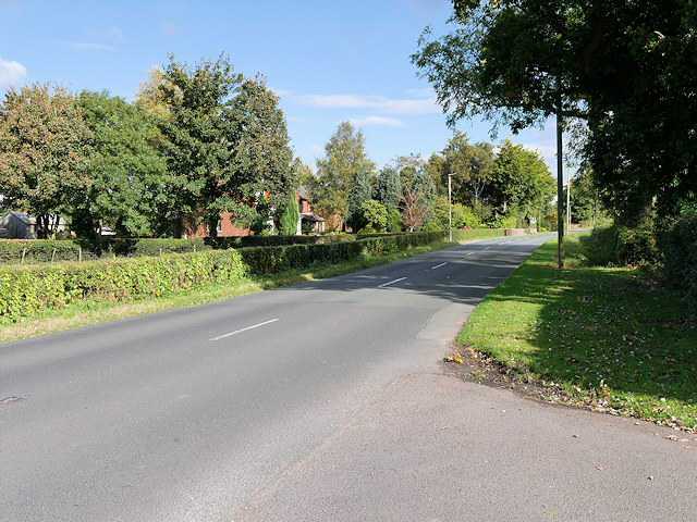
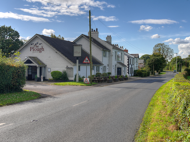
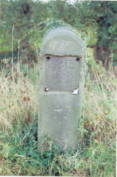
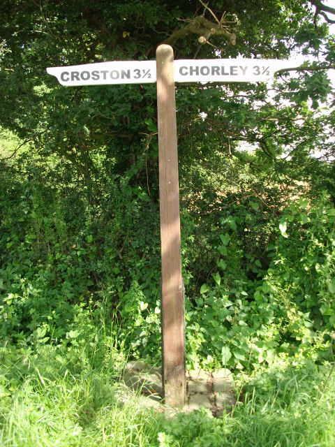
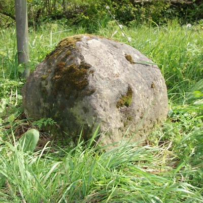
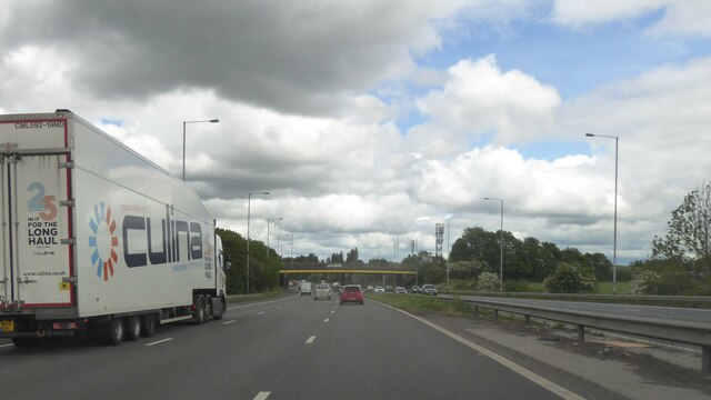
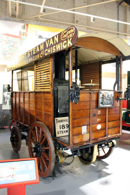
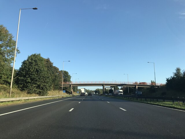
Brickfield Wood Images

Images are sourced within 2km of 53.685418/-2.7068526 or Grid Reference SD5321. Thanks to Geograph Open Source API. All images are credited.

Runshaw Lane
Runshaw Lane
The Plough at Euxton Country pub/restaurant near Euxton.
The Plough at Euxton
Country pub/restaurant near Euxton.
Old Milestone by the B5253, Leyland Lane, Leyland Parish Stone post (plate lost) by the B5253, in parish of LEYLAND (SOUTH RIBBLE District), Leyland Lane, South of Brookfold Farm, on East side of road. Preston iron plate, erected by the Penwortham & Wrightington turnpike trust in the 19th century. 

Inscription once read:-
(TO)
(PRESTON)
(7)
(MILES) 
Carved benchmark on front under plate.  

Milestone Society National ID: LA_PSWG07.
Old Milestone by the B5253, Leyland Lane, Leyland Parish
Stone post (plate lost) by the B5253, in parish of LEYLAND (SOUTH RIBBLE District), Leyland Lane, South of Brookfold Farm, on East side of road. Preston iron plate, erected by the Penwortham & Wrightington turnpike trust in the 19th century. Inscription once read:- (TO) (PRESTON) (7) (MILES) Carved benchmark on front under plate. Milestone Society National ID: LA_PSWG07.
Old Direction Sign - Signpost by Runshaw Lane, Croston Parish No finial - 2 arms; Lancashire wood by the UC road, in parish of Croston (Chorley District), Runshaw Lane, junction with Flag Lane.

Surveyed

Milestone Society National ID: LA_SD5319.
Old Direction Sign - Signpost by Runshaw Lane, Croston Parish
No finial - 2 arms; Lancashire wood by the UC road, in parish of Croston (Chorley District), Runshaw Lane, junction with Flag Lane. Surveyed Milestone Society National ID: LA_SD5319.
Old Boundary Marker by the B5253, Hollins Brook Bridge, Leyland Lane Parish Boundary Marker by the B5253, in parish of Eccleston (Chorley District), Leyland Lane, Hollins Brook Bridge, East side of road.

Carved bench mark and pivot on top.

Surveyed

Milestone Society National ID: LA_PSWG07pb
Old Boundary Marker by the B5253, Hollins Brook Bridge, Leyland Lane
Parish Boundary Marker by the B5253, in parish of Eccleston (Chorley District), Leyland Lane, Hollins Brook Bridge, East side of road. Carved bench mark and pivot on top. Surveyed Milestone Society National ID: LA_PSWG07pb
Bridge over M6 at Leyland
1896 Thornycroft steam van, The British Commercial Vehicle Museum, King Street, Leyland Increase in the speed limit to 14 mph in 1896 promoted the increase in steam driven vehicles. This front wheel drive rear steer van was built by John Isaac Thornycroft of Chiswick and first took to the road on 2 Jan. 1897. In Newport, Mr William Duncan tried to climb aboard his newly delivered van whilst it was moving and slipped. Run over by his own vehicle this was the first motor vehicle accident in Wales resulting in the amputation of one of William's feet. One of the earliest steam road vehicles it was powered by a coke fired steamboat engine by Simpson Strickland and Co. Dartmouth.
1896 Thornycroft steam van, The British Commercial Vehicle Museum, King Street, Leyland
Increase in the speed limit to 14 mph in 1896 promoted the increase in steam driven vehicles. This front wheel drive rear steer van was built by John Isaac Thornycroft of Chiswick and first took to the road on 2 Jan. 1897. In Newport, Mr William Duncan tried to climb aboard his newly delivered van whilst it was moving and slipped. Run over by his own vehicle this was the first motor vehicle accident in Wales resulting in the amputation of one of William's feet. One of the earliest steam road vehicles it was powered by a coke fired steamboat engine by Simpson Strickland and Co. Dartmouth.
Footbridge - northbound M6
B5248 - northbound M6
Leyland Railway Station
British Commercial Vehicle Museum, Leyland The car park and entrance to this most excellent museum. It has had a face-lift since Roger Cornfoot was there in 2015 - <a href="https://www.geograph.org.uk/photo/4529223">SD5422 : The British Commercial Vehicle Museum, Leyland</a>
British Commercial Vehicle Museum, Leyland
The car park and entrance to this most excellent museum. It has had a face-lift since Roger Cornfoot was there in 2015 - SD5422 : The British Commercial Vehicle Museum, Leyland
19th Century horse-drawn bus Originally from the Edinburgh and District Tramways Company Limited, now at the Leyland Commercial Vehicles Museum. For a rear view see <a href="https://www.geograph.org.uk/photo/7006065">SD5422 : 19th Century horse-drawn bus</a>
19th Century horse-drawn bus
Originally from the Edinburgh and District Tramways Company Limited, now at the Leyland Commercial Vehicles Museum. For a rear view see SD5422 : 19th Century horse-drawn bus
19th Century horse-drawn bus Originally from the Edinburgh and District Tramways Company Limited, now at the Leyland Commercial Vehicles Museum. For a side view see <a href="https://www.geograph.org.uk/photo/7006059">SD5422 : 19th Century horse-drawn bus</a>

FARE 
BUS & CAR 3d 
BUS 1d

For the younger amongst us 3d = 1.25p, and 1d = 0.416p
19th Century horse-drawn bus
Originally from the Edinburgh and District Tramways Company Limited, now at the Leyland Commercial Vehicles Museum. For a side view see SD5422 : 19th Century horse-drawn bus FARE BUS & CAR 3d BUS 1d For the younger amongst us 3d = 1.25p, and 1d = 0.416p
The Edinburgh & District Tramways Company Limited The company's logo on the horse tram at the British Commercial Vehicle Museum <a href="https://www.geograph.org.uk/photo/7006059">SD5422 : 19th Century horse-drawn bus</a>. It operated from 1893 to 1919 <span class="nowrap"><a title="https://en.wikipedia.org/wiki/Edinburgh_and_District_Tramways" rel="nofollow ugc noopener" href="https://en.wikipedia.org/wiki/Edinburgh_and_District_Tramways">Link</a><img style="margin-left:2px;" alt="External link" title="External link - shift click to open in new window" src="https://s1.geograph.org.uk/img/external.png" width="10" height="10"/></span>.
The Edinburgh & District Tramways Company Limited
The company's logo on the horse tram at the British Commercial Vehicle Museum SD5422 : 19th Century horse-drawn bus. It operated from 1893 to 1919 LinkExternal link.
Television Detector Van A 1979 Dodge Space Van that served as a TV licence detector van, in the British Commercial Vehicle Museum. The vehicle on the left is a 1927 Model T Ford van - see <a href="https://www.geograph.org.uk/photo/7006155">SD5422 : Ford 'Model T'</a> for details.
Television Detector Van
A 1979 Dodge Space Van that served as a TV licence detector van, in the British Commercial Vehicle Museum. The vehicle on the left is a 1927 Model T Ford van - see SD5422 : Ford 'Model T' for details.
Ford 'Model T' Details of the Ford van at the British Commercial Vehicle Museum <a href="https://www.geograph.org.uk/photo/7006143">SD5422 : Television Detector Van</a>.
Ford 'Model T'
Details of the Ford van at the British Commercial Vehicle Museum SD5422 : Television Detector Van.
Post Office Radio Service Van A 1949 Leyland Morris 'Y' Type van in the British Commercial Vehicle Museum. For details see <a href="https://www.geograph.org.uk/photo/7006164">SD5422 : Leyland Morris 'Y' Type van - details</a>. This one has a trailer attached.
Post Office Radio Service Van
A 1949 Leyland Morris 'Y' Type van in the British Commercial Vehicle Museum. For details see SD5422 : Leyland Morris 'Y' Type van - details. This one has a trailer attached.
Leyland Morris 'Y' Type van - details Details of the van at <a href="https://www.geograph.org.uk/photo/7006161">SD5422 : Post Office Radio Service Van</a>.
Leyland Morris 'Y' Type van - details
Show me another place!

Brickfield Wood is located at Grid Ref: SD5321 (Lat: 53.685418, Lng: -2.7068526)

Administrative County: Lancashire

District: South Ribble

Police Authority: Lancashire

What 3 Words

///frame.rises.march. Near Leyland, Lancashire

Related Wikis

St Mary's Catholic High School, Leyland

St Mary's Catholic High School is a coeducational secondary school located in Leyland in the English county of Lancashire.It is a voluntary aided school...

Worden Park

Worden Park is a large area of parkland situated on the outskirts of Leyland, a town in the borough of South Ribble, Lancashire, England. It is less than...

Occleshaw House

Occleshaw House, also known by its address as 2 Worden Lane, is a Grade II listed building in Leyland, Lancashire. The building has been described as the...

Leyland, Lancashire

Leyland ( LAY-lənd) is a town in South Ribble, Lancashire, England, 6 miles (10 km) south of Preston. The population was 35,578 at the 2011 Census.The...

Nearby Amenities

Located within 500m of 53.685418,-2.7068526
Mini Roundabout
Direction: clockwise
Lat/Long: 53.6882932/-2.71098
Turning Circle
Lat/Long: 53.6842166/-2.713459
Turning Circle
Lat/Long: 53.6849516/-2.7090908
Turning Circle
Lat/Long: 53.689183/-2.7053276
Bus Stop
Queensway
Bus: yes
Naptan AtcoCode: 25001102
Naptan Bearing: W
Naptan CommonName: Queensway
Naptan Indicator: by
Naptan NaptanCode: lanadtpa
Public Transport: platform
Shelter: yes
Lat/Long: 53.6884615/-2.7121884
Turning Circle
Lat/Long: 53.683235/-2.7105075
Turning Circle
Lat/Long: 53.683116/-2.7092567
Turning Circle
Lat/Long: 53.6831632/-2.7115977
Morrisons Daily
Addr City: Leyland
Addr Country: GB
Addr Housenumber: 69
Addr Postcode: PR25 1BX
Addr Street: Royal Avenue
Brand: Morrisons Daily
Brand Wikidata: Q99752411
Fhrs Id: 467735
Old Name: Wade Hall Convenience Store
Operator: McColl's
Operator Wikidata: Q16997477
Shop: convenience
Website: https://my.morrisons.com/storefinder/61273/morrisons-daily-leyland-royal-avenue
Lat/Long: 53.6846589/-2.7115395
Childcare
Wade Hall Child Centre
Addr City: Leyland
Addr Street: Royal Avenue
Lat/Long: 53.6843391/-2.7116134
Post Box
Ref: PR25 390
Lat/Long: 53.6838237/-2.7115422
Turning Circle
Lat/Long: 53.6830999/-2.7110464
Wade Hall
Place: neighbourhood
Source: local knowledge;OS Opendata
Lat/Long: 53.6849332/-2.711928
Cafe
The Folly Coffee House & Deli
Addr City: Leyland
Addr Housename: Worden Hall
Addr Place: Worden Park
Addr Postcode: PR25 1DJ
Fhrs Id: 924927
Lat/Long: 53.6823935/-2.7018641
Leyland Stained Glass
Addr City: Leyland
Addr Postcode: PR25 1DJ
Addr Street: Worden Hall
Craft: glaziery
Lat/Long: 53.6824078/-2.7026729
WS Contemporary Fine Art
Craft: artist
Tourism: gallery
Lat/Long: 53.6824809/-2.7026206
Peter Doyle
Addr City: Leyland
Addr Postcode: PR25 1DJ
Addr Street: Worden Hall
Addr Unit: Unit 5
Craft: bookbinder
Email: info@book-restoration.co.uk
Phone: +44 1772 623827
Website: http://www.book-restoration.co.uk/about_us.htm
Lat/Long: 53.6825294/-2.7025697
Rumpus in the Park
Addr City: Leyland
Addr Postcode: PR25 1DJ
Addr Street: Worden Hall
Addr Unit: Studio 3 & 4
Shop: interior_decoration
Lat/Long: 53.6825794/-2.702449
Bartleyart
Craft: artist
Mapillary: 135901815195684
Tourism: gallery
Lat/Long: 53.6825381/-2.7023055
Red Frog Photography
Addr City: Leyland
Addr Housename: Gardener's Cottage
Addr Postcode: PR25 1DJ
Addr Street: Worden Hall
Craft: photographer
Lat/Long: 53.6829877/-2.7024919
Theatre
Marsden Room Theatre
Operator: South Ribble Borough Council
Lat/Long: 53.6824166/-2.7020332
Toilets
Access: yes
Changing Table: yes
Toilets Disposal: flush
Unisex: yes
Wheelchair: yes
Lat/Long: 53.6859378/-2.6998696
Crossing
Crossing: uncontrolled
Crossing Ref: zebra
Lat/Long: 53.6877556/-2.7054545
Bus Stop
Sports & Social Club
Bus: yes
Naptan AtcoCode: 2500DCL3303
Naptan Bearing: W
Naptan CommonName: Sports & Social Club
Naptan Indicator: o/s
Naptan NaptanCode: landjata
Public Transport: platform
Lat/Long: 53.6880204/-2.7016417
Bus Stop
Royal Avenue
Bus: yes
Naptan AtcoCode: 250015531
Naptan Bearing: W
Naptan CommonName: Royal Avenue
Naptan Indicator: by
Naptan NaptanCode: lanapmwd
Public Transport: platform
Lat/Long: 53.6877132/-2.7049679
Bus Stop
Forestway
Bus: yes
Naptan AtcoCode: 2500DCL3302
Naptan Bearing: E
Naptan CommonName: Forestway
Naptan Indicator: by
Naptan NaptanCode: landjapw
Public Transport: platform
Lat/Long: 53.6878247/-2.704349
Bus Stop
St Marys School
Bus: yes
Naptan AtcoCode: 2500LAA00484
Naptan Bearing: NE
Naptan CommonName: St Marys School
Naptan Indicator: by
Naptan NaptanCode: langwgtp
Public Transport: platform
Lat/Long: 53.685631/-2.7090214
Bus Stop
Queensway Shops
Bus: yes
Naptan AtcoCode: 2500LA00039
Naptan Bearing: N
Naptan CommonName: Queensway Shops
Naptan Indicator: opp
Naptan NaptanCode: langmwjm
Public Transport: platform
Lat/Long: 53.6844609/-2.7123177
Bus Stop
Queensway Shops
Bus: yes
Naptan AtcoCode: 2500LA00038
Naptan Bearing: S
Naptan CommonName: Queensway Shops
Naptan Indicator: by
Naptan NaptanCode: langmwjg
Public Transport: platform
Lat/Long: 53.684381/-2.7121498
Turning Circle
Lat/Long: 53.6834896/-2.711724
Direction: W
Generator Method: photovoltaic
Generator Output Electricity: yes
Generator Solar Modules: 16
Generator Source: solar
Generator Type: solar_photovoltaic_panel
Location: roof
Power: generator
Lat/Long: 53.6830266/-2.7077705
Direction: W
Generator Method: photovoltaic
Generator Output Electricity: yes
Generator Solar Modules: 16
Generator Source: solar
Generator Type: solar_photovoltaic_panel
Location: roof
Power: generator
Lat/Long: 53.6834062/-2.7079555
Direction: W
Generator Method: photovoltaic
Generator Output Electricity: yes
Generator Solar Modules: 16
Generator Source: solar
Generator Type: solar_photovoltaic_panel
Location: roof
Power: generator
Lat/Long: 53.6833586/-2.7079609
Direction: S
Generator Method: photovoltaic
Generator Output Electricity: yes
Generator Solar Modules: 16
Generator Source: solar
Generator Type: solar_photovoltaic_panel
Location: roof
Power: generator
Lat/Long: 53.683608/-2.7072394
Direction: SE
Generator Method: photovoltaic
Generator Output Electricity: yes
Generator Solar Modules: 16
Generator Source: solar
Generator Type: solar_photovoltaic_panel
Location: roof
Power: generator
Lat/Long: 53.684183/-2.7097379
Direction: SE
Generator Method: photovoltaic
Generator Output Electricity: yes
Generator Solar Modules: 16
Generator Source: solar
Generator Type: solar_photovoltaic_panel
Location: roof
Power: generator
Lat/Long: 53.6841552/-2.7098773
Direction: SE
Generator Method: photovoltaic
Generator Output Electricity: yes
Generator Solar Modules: 16
Generator Source: solar
Generator Type: solar_photovoltaic_panel
Location: roof
Power: generator
Lat/Long: 53.6843339/-2.7103722
Direction: SE
Generator Method: photovoltaic
Generator Output Electricity: yes
Generator Solar Modules: 16
Generator Source: solar
Generator Type: solar_photovoltaic_panel
Location: roof
Power: generator
Lat/Long: 53.6843856/-2.7101456
Direction: SE
Generator Method: photovoltaic
Generator Output Electricity: yes
Generator Solar Modules: 16
Generator Source: solar
Generator Type: solar_photovoltaic_panel
Location: roof
Power: generator
Lat/Long: 53.6844094/-2.710045
Direction: SW
Generator Method: photovoltaic
Generator Output Electricity: yes
Generator Solar Modules: 16
Generator Source: solar
Generator Type: solar_photovoltaic_panel
Location: roof
Power: generator
Lat/Long: 53.6836699/-2.7094817
The data included in this document is from www.openstreetmap.org. The data is made available under ODbL.

Have you been to Brickfield Wood?

Leave your review of Brickfield Wood below (or comments, questions and feedback).