Ban-y-gor Wood

Wood, Forest in Gloucestershire Forest of Dean

England

Ban-y-gor Wood

Poppies on a Coleford Road bus shelter, Tutshill, Gloucestershire In November 2023.
Poppies on a Coleford Road bus shelter, Tutshill, Gloucestershire Credit: Jaggery

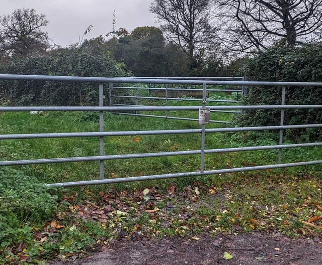
Ban-y-gor Wood is a picturesque woodland located in Gloucestershire, England. Stretching over an area of approximately 100 acres, this forest offers a tranquil and enchanting escape from the hustle and bustle of urban life. The wood is nestled in the heart of the beautiful Cotswolds, an Area of Outstanding Natural Beauty.

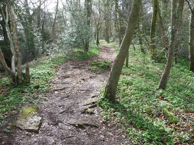
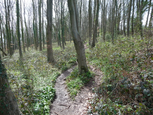
The wood is predominantly made up of native broadleaf trees such as oak, beech, and ash, which create a dense canopy that provides shade and shelter for a diverse range of flora and fauna. The forest floor is adorned with a carpet of bluebells during the spring months, adding a vibrant burst of color to the landscape.

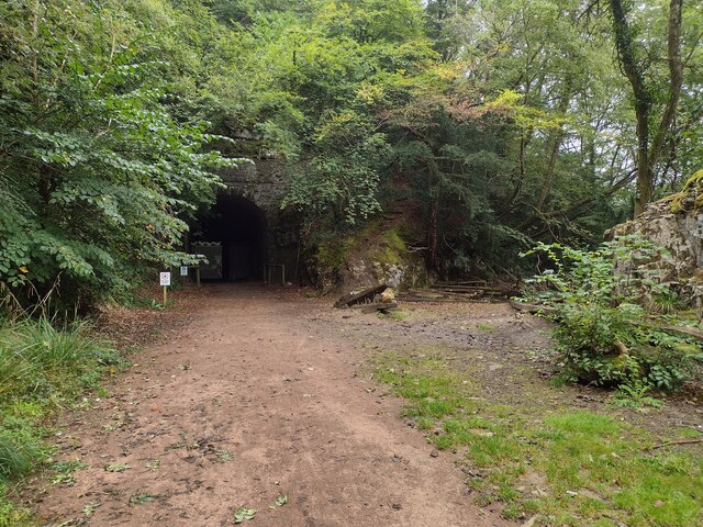
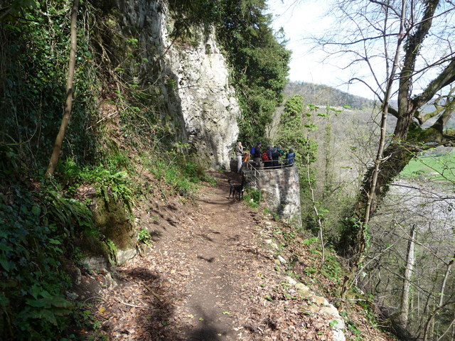
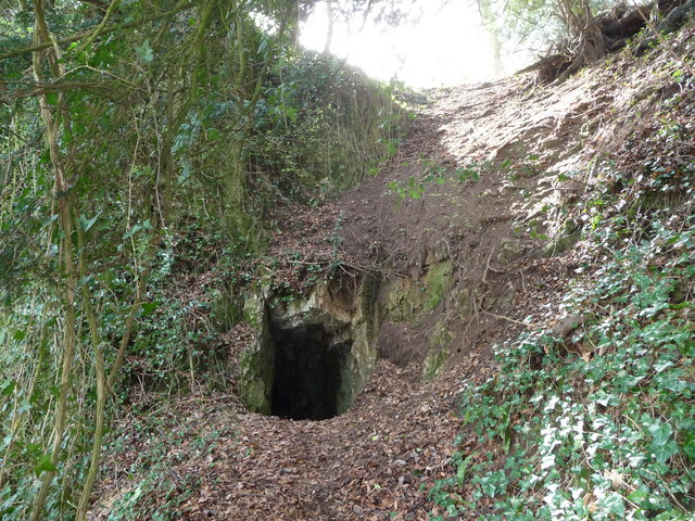
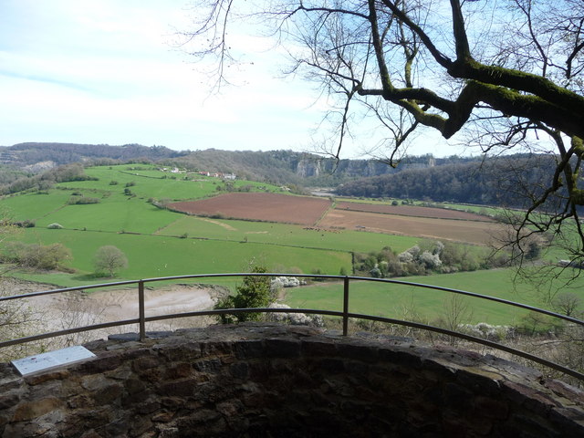
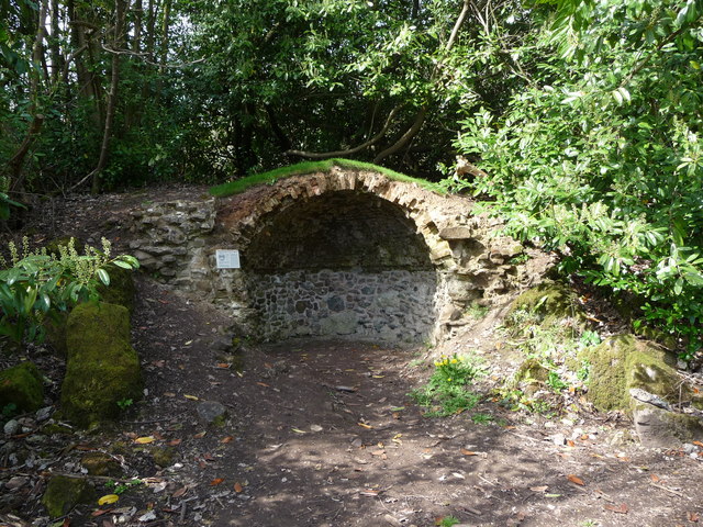
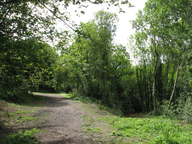
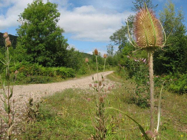
Numerous well-marked trails meander through Ban-y-gor Wood, allowing visitors to explore its natural wonders at their own pace. These paths wind through ancient woodland, revealing hidden glades, babbling brooks, and charming wildlife habitats. Nature enthusiasts will be delighted to encounter a variety of bird species, including woodpeckers, owls, and thrushes, as well as small mammals like squirrels and hedgehogs.

Ban-y-gor Wood is a haven for outdoor enthusiasts, offering opportunities for walking, jogging, and wildlife spotting. It is also a popular destination for families, with designated picnic areas and a small adventure playground for children to enjoy. The wood is well-maintained, with regular conservation efforts ensuring the preservation of its natural beauty and biodiversity.

Overall, Ban-y-gor Wood is a captivating woodland retreat, inviting visitors to immerse themselves in the tranquility and natural splendor of Gloucestershire's countryside.

If you have any feedback on the listing, please let us know in the comments section below.

Ban-y-gor Wood Images

Images are sourced within 2km of 51.668936/-2.6759746 or Grid Reference ST5396. Thanks to Geograph Open Source API. All images are credited.

Poppies on a Coleford Road bus shelter, Tutshill, Gloucestershire In November 2023.
Poppies on a Coleford Road bus shelter, Tutshill, Gloucestershire
In November 2023.
Wide field gate, Tutshill, Gloucestershire Alongside the B4228 Coleford Road.
Wide field gate, Tutshill, Gloucestershire
Alongside the B4228 Coleford Road.
Dead leaves, Tutshill, Gloucestershire On the pavement near Tutshill C of E Primary School in November 2023.
Dead leaves, Tutshill, Gloucestershire
On the pavement near Tutshill C of E Primary School in November 2023.
Keep the zig zags clear, Tutshill, Gloucestershire Banner on Tutshill Church of England Primary School perimeter 
railings  viewed from the B4228 Coleford Road in November 2023.
Keep the zig zags clear, Tutshill, Gloucestershire
Banner on Tutshill Church of England Primary School perimeter railings viewed from the B4228 Coleford Road in November 2023.
Entrance to Tidenham Tunnel The northern entrance to Tidenham Tunnel
Entrance to Tidenham Tunnel
The northern entrance to Tidenham Tunnel
The Wye Valley Walk in Black Cliff Wood in April After the hillfort summit the walk levels out and you walk through woodland on a twisting path that almost seems to good to be true.
The Wye Valley Walk in Black Cliff Wood in April
After the hillfort summit the walk levels out and you walk through woodland on a twisting path that almost seems to good to be true.
Part of the Wye Valley Walk in Wyndcliff wood If there is one criticism of the WVW in this section it is that you don't get to see much of the River Wye, but, you do get to see varied woodlands, and an  appreciation of the valley's history, geology, ecology and industrial heritage.
Part of the Wye Valley Walk in Wyndcliff wood
If there is one criticism of the WVW in this section it is that you don't get to see much of the River Wye, but, you do get to see varied woodlands, and an appreciation of the valley's history, geology, ecology and industrial heritage.
The Eagle's Nest viewpoint on the Wynd Cliff The information board fitted by the Forestry Commission tells of how this viewpoint got its name and what can be viewed. A beautiful spot that I never tire of revisiting.
The Eagle's Nest viewpoint on the Wynd Cliff
The information board fitted by the Forestry Commission tells of how this viewpoint got its name and what can be viewed. A beautiful spot that I never tire of revisiting.
The Lancaut peninsula from the Eagle's Nest The huge curve in the Wye is a well-known view with Chepstow and the Severn Bridges beyond.
The Lancaut peninsula from the Eagle's Nest
The huge curve in the Wye is a well-known view with Chepstow and the Severn Bridges beyond.
The Eagle's Nest An excellent spot for a rest, a brew and some lunch.
The Eagle's Nest
An excellent spot for a rest, a brew and some lunch.
A group of walkers at the Giant's Cave in the Wye Valley This group of retired walkers were enjoying the viewing platform just outside the Giant's Cave as I approached and was spotted by their little dog. They were a mix of local and not so local fellers who were enjoying their firm friendships, relaxed banter, outdoor exercise and the good weather. Not a bad way to spend some of your retirement.
A group of walkers at the Giant's Cave in the Wye Valley
This group of retired walkers were enjoying the viewing platform just outside the Giant's Cave as I approached and was spotted by their little dog. They were a mix of local and not so local fellers who were enjoying their firm friendships, relaxed banter, outdoor exercise and the good weather. Not a bad way to spend some of your retirement.
The northern entrance to the Giant's Cave on the Wye Valley Walk Yes, you are expected to enter or exit through this aperture. It's easier and more fun than it looks. One of many interesting features on this section of the WVW.
The northern entrance to the Giant's Cave on the Wye Valley Walk
Yes, you are expected to enter or exit through this aperture. It's easier and more fun than it looks. One of many interesting features on this section of the WVW.
View from the Giant's Cave viewing platform The view across the graceful curve of the River Wye onto the Lancaut peninsula and above that up to Wintour's Leap and the great cliffs near Woodcroft.
View from the Giant's Cave viewing platform
The view across the graceful curve of the River Wye onto the Lancaut peninsula and above that up to Wintour's Leap and the great cliffs near Woodcroft.
The Grotto in Piercefield Woods This feature, along with several others on a similar 'Romantic' theme, was installed in Piercefield Park and woods and comprised part of a tour through this area between around 1760 and maybe the 1820's. Gentry came from various parts of the country and toured the Wye Valley inspecting folly's, caves, walks, viewpoints and landscapes and often recording their opinions and thoughts in journals and publications. Originally this grotto was of course larger, more complete and lined inside with 'glittering crystalline minerals, glass fragments and iron and copper slag'. This would have created an elaborate decorated effect intended to mimic naturally occurring outcrops. I'm glad to see the Piercefield Walks features receiving some improvement.
The Grotto in Piercefield Woods
This feature, along with several others on a similar 'Romantic' theme, was installed in Piercefield Park and woods and comprised part of a tour through this area between around 1760 and maybe the 1820's. Gentry came from various parts of the country and toured the Wye Valley inspecting folly's, caves, walks, viewpoints and landscapes and often recording their opinions and thoughts in journals and publications. Originally this grotto was of course larger, more complete and lined inside with 'glittering crystalline minerals, glass fragments and iron and copper slag'. This would have created an elaborate decorated effect intended to mimic naturally occurring outcrops. I'm glad to see the Piercefield Walks features receiving some improvement.
General view, Chepstow Racecourse
Cliff by the River Wye
Path along course of Wye Valley Railway near Tintern The railway line carried on straight ahead at this point, through the trees. Walkers now have a choice and can drop down right, or go up to the left.
Path along course of Wye Valley Railway near Tintern
The railway line carried on straight ahead at this point, through the trees. Walkers now have a choice and can drop down right, or go up to the left.
Path junction in woods near River Wye
Show me another place!

Ban-y-gor Wood is located at Grid Ref: ST5396 (Lat: 51.668936, Lng: -2.6759746)

Administrative County: Gloucestershire

District: Forest of Dean

Police Authority: Gloucestershire

What 3 Words

///lawyer.became.thrones. Near Tintern, Monmouthshire

Related Wikis

Lancaut

Lancaut (Welsh: Llan Cewydd) is a deserted village and former civil parish, now in the parish of Tidenham, in the Forest of Dean district, in Gloucestershire...
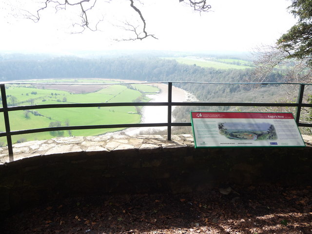
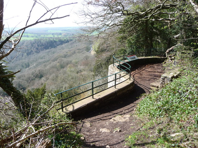
Wintour's Leap

Wintour's Leap is a noted rock climbing location and viewpoint. It is located near the village of Woodcroft in Gloucestershire, on the English side of...
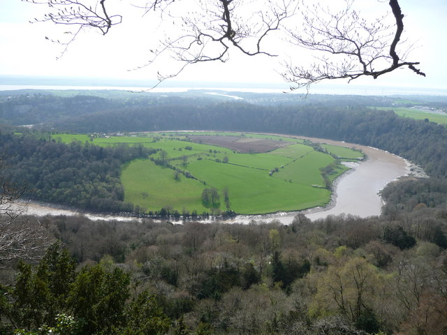
Wyndcliff

The Wyndcliff or Wynd Cliff (historically sometimes spelt Wyndcliffe) is a steep limestone cliff rising above the western bank of the River Wye in Monmouthshire...

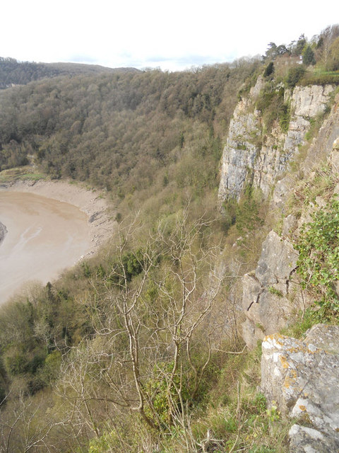
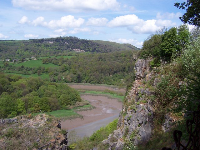
Lower Wye Gorge SSSI

Lower Wye Gorge (grid reference ST548983, ST537967) is a 65-hectare (160-acre) biological and geological Site of Special Scientific Interest in Gloucestershire...
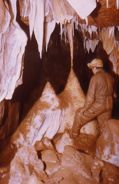
Otter Hole

Otter Hole is perhaps one of the best decorated caves in Britain. Located on the Wales–England border just north of Chepstow, the cave runs from the banks...

Woodcroft, Gloucestershire

Woodcroft is a small village in the Forest of Dean district of Gloucestershire, England. It is located on the eastern bank of the River Wye, opposite...

Green Gathering

The Green Gathering, formerly known as the Big Green Gathering is a festival with an environmental and social justice focus, including workshops and talks...

Piercefield House

Piercefield House is a largely ruined neo-classical country house near St Arvans, Monmouthshire, Wales, about 1.5 miles (2.4 km) north of the centre of...

Related Videos

Chepstow Castle #shorts

Chepstow Castle: https://youtu.be/8PxbJC8oSbk To donate and support our channel: ...

Offa's Dyke Day 1 Chepstow to Monmouth

May 31, 2021 with Peter O'Connor walking Chepstow to Monmouth Music: Illuminate You Musician: Weary Eyes URL: ...

Devils pulpit’s | An Adventurers Place To Visit In Scotland. #travel #ukvloger

Did you know that not too far from Glasgow and Edinburgh in Scotland is a beautiful moss covered, 100ft deep gorge, through ...

Nearby Amenities

Located within 500m of 51.668936,-2.6759746
Source: PGS
Lat/Long: 51.6693469/-2.6829184
Source: PGS
Lat/Long: 51.6696344/-2.682265
Source: PGS
Lat/Long: 51.6698188/-2.6816269
Source: PGS
Lat/Long: 51.6700971/-2.680101
Source: PGS
Lat/Long: 51.6701964/-2.6790316
Source: PGS
Lat/Long: 51.6702535/-2.6777272
Source: PGS
Lat/Long: 51.6702157/-2.6767579
Source: PGS
Lat/Long: 51.670183/-2.6759444
Source: PGS
Lat/Long: 51.6700619/-2.6748983
Source: PGS
Lat/Long: 51.6699379/-2.6736615
Source: PGS
Lat/Long: 51.6700008/-2.6733737
Source: PGS
Lat/Long: 51.6701088/-2.6729175
Source: PGS
Lat/Long: 51.6700209/-2.6714935
Source: PGS
Lat/Long: 51.6695969/-2.6714981
Source: PGS
Lat/Long: 51.6694971/-2.6710877
Source: PGS
Lat/Long: 51.6695941/-2.6695122
Source: PGS
Lat/Long: 51.6686685/-2.6691856
Source: PGS
Lat/Long: 51.6686232/-2.6702142
Source: PGS
Lat/Long: 51.6686368/-2.6707383
Source: PGS
Lat/Long: 51.668546/-2.671696
Source: PGS
Lat/Long: 51.668808/-2.673755
Source: PGS
Lat/Long: 51.669069/-2.675401
Source: PGS
Lat/Long: 51.6692549/-2.6766627
Source: PGS
Lat/Long: 51.6692887/-2.6775164
Source: PGS
Lat/Long: 51.668829/-2.681585
Source: PGS
Lat/Long: 51.6687419/-2.6821287
Source: PGS
Lat/Long: 51.6685446/-2.6825823
Source: PGS
Lat/Long: 51.6683889/-2.6829447
Source: PGS
Lat/Long: 51.6692149/-2.6791853
Lancaut
Is In: Gloucestershire, UK
Place: hamlet
Source: Bing + survey
Wikidata: Q11752768
Lat/Long: 51.6657079/-2.6759693
Bench
Tourism: viewpoint
Lat/Long: 51.6658893/-2.6715701
Barrier: cattle_grid
Lat/Long: 51.6671947/-2.6728871
old lime kiln
Historic: ruins
Lat/Long: 51.6667595/-2.6696801
Source: PGS
Lat/Long: 51.6691922/-2.6799454
Fixme: Path continues. Needs survey.
Lat/Long: 51.6675089/-2.6716355
The data included in this document is from www.openstreetmap.org. The data is made available under ODbL.

Have you been to Ban-y-gor Wood?

Leave your review of Ban-y-gor Wood below (or comments, questions and feedback).