Church Wood

Wood, Forest in Lancashire South Ribble

England

Church Wood

Industrial Units on Fylde Road View from Fylde Road Viaduct
Industrial Units on Fylde Road Credit: Raymond Knapman

Church Wood is a picturesque woodland located in the county of Lancashire, England. Covering an area of approximately 50 acres, it is a popular destination for nature lovers, hikers, and those seeking tranquility in a natural setting. The wood is situated near the village of Church, just a few miles from the larger town of Accrington.

The woodland is characterized by a diverse range of tree species, including oak, birch, beech, and ash, which create a vibrant and colorful canopy during the autumn months. The forest floor is covered in a thick carpet of moss and ferns, adding to the enchanting atmosphere of the wood. Numerous pathways wind through the trees, providing visitors with ample opportunities to explore and discover the hidden treasures within.

Church Wood is home to a variety of wildlife, making it a haven for birdwatchers and animal enthusiasts. Visitors may spot a wide array of bird species, such as woodpeckers, thrushes, and owls, as well as small mammals like squirrels and rabbits. The wood is also known for its rich insect life, with butterflies and dragonflies fluttering among the flowers and foliage.

The wood has a long history and is believed to have existed since at least medieval times. It was once part of a larger hunting ground and is still crisscrossed with remnants of ancient paths and boundaries. Today, it is managed by a local conservation group, which ensures its preservation and provides information to visitors about the wood's natural heritage.

Overall, Church Wood offers a peaceful and idyllic retreat for nature enthusiasts, providing a glimpse into Lancashire's rich natural heritage.

If you have any feedback on the listing, please let us know in the comments section below.
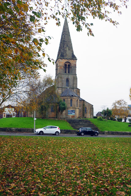
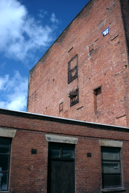
Church Wood Images

Images are sourced within 2km of 53.753242/-2.7236576 or Grid Reference SD5228. Thanks to Geograph Open Source API. All images are credited.

Industrial Units on Fylde Road View from Fylde Road Viaduct
Industrial Units on Fylde Road
View from Fylde Road Viaduct
Milestone Marker 56-01 F (between bridges 11-10), Lancaster Canal Milestone located by the side of the Lancaster Canal
This milestone is 1 miles from the centre of Preston and 56 miles from Kendal

Inscription reads:- 

Preston / 1 :: Garstang / 16 
Milestone Society National ID: LAN-01R
Milestone Marker 56-01 F (between bridges 11-10), Lancaster Canal
Milestone located by the side of the Lancaster Canal This milestone is 1 miles from the centre of Preston and 56 miles from Kendal Inscription reads:- Preston / 1 :: Garstang / 16 Milestone Society National ID: LAN-01R
St Thomas' Church, Preston This grade II listed church was designed by John Latham and built between 1837 and 1839. It was declared redundant by the Church of England in 1983 and is used by City Church Preston, part of a Pentecostal denomination.
St Thomas' Church, Preston
This grade II listed church was designed by John Latham and built between 1837 and 1839. It was declared redundant by the Church of England in 1983 and is used by City Church Preston, part of a Pentecostal denomination.
The back streets of Preston! From the front, this is a typical row of terraced houses. From the back, however, the southern end of the Lancaster Canal provides a totally unexpected view.

The Canal once ran right into the middle of Preston, terminating at Fishergate - the 1940's map clearly shows this. With the modern developments in the city, the canal now ends here.
The back streets of Preston!
From the front, this is a typical row of terraced houses. From the back, however, the southern end of the Lancaster Canal provides a totally unexpected view. The Canal once ran right into the middle of Preston, terminating at Fishergate - the 1940's map clearly shows this. With the modern developments in the city, the canal now ends here.
Tulketh Mill,  Ashton, Preston Taken from the canal bridge on Woodplumpton Road. Tulketh Mill is now a mail-order catalogue distribution and call centre.
Tulketh Mill, Ashton, Preston
Taken from the canal bridge on Woodplumpton Road. Tulketh Mill is now a mail-order catalogue distribution and call centre.
Drinking Water Fountain, Haslam Park, Ashton This fountain was gifted to the park in 1911 - it's no longer in use as a drinking fountain.  Haslam Park covers this square and SD5131. (See <a href="https://www.geograph.org.uk/gridref/SD5131">SD5131</a> for a 21st century sculpture).
Drinking Water Fountain, Haslam Park, Ashton
This fountain was gifted to the park in 1911 - it's no longer in use as a drinking fountain. Haslam Park covers this square and SD5131. (See SD5131 for a 21st century sculpture).
The Watering Trough - Fylde Road
Salvation Army Worship Hall - Harrington Street
Former Windmill off Moor Lane
Windmill Entrances - off Moor Lane
The Queen Vic - Moor Lane
St Thomas' Church - St Thomas' Place
St Thomas' Hall - St Thomas' Place
New flats near Harrington Street
Preston Hanover Street Mill Dated 1796 built by Horrocks as a cotton spinning mill
Preston Hanover Street Mill
Dated 1796 built by Horrocks as a cotton spinning mill
Preston - Great Bank Street The first building is dated 1914 and further up the street is Arkwright Mill of 1854 a cotton spinning mill.
Preston - Great Bank Street
The first building is dated 1914 and further up the street is Arkwright Mill of 1854 a cotton spinning mill.
Preston Aqueduct Street Mill The engine house has been demolished but note the brackets for the vertical drive shaft. The mill dates from 1846
Preston Aqueduct Street Mill
The engine house has been demolished but note the brackets for the vertical drive shaft. The mill dates from 1846
Preston Aqueduct Mill The mill dates from 1846. Note the wheel and roller over the lintel of the low building
Preston Aqueduct Mill
The mill dates from 1846. Note the wheel and roller over the lintel of the low building
Show me another place!

Church Wood is located at Grid Ref: SD5228 (Lat: 53.753242, Lng: -2.7236576)

Administrative County: Lancashire

District: South Ribble

Police Authority: Lancashire

What 3 Words

///wounds.winter.mint. Near Preston, Lancashire

Related Wikis

St Mary's Church, Penwortham

St Mary's Church is in Church Avenue, Penwortham, Lancashire, England. It is an active Anglican parish church in the deanery of Leyland, the archdeaconry...

Penwortham Castle

Penwortham Castle was built on the south bank of the River Ribble, at Penwortham to the west of Preston, Lancashire, England, at grid reference SD524291...

Ribble Power Station

Ribble Power Station was a coal-fired electricity generating station on the River Ribble in Penwortham near Preston, Lancashire, England. The station was...

Preston Fishergate Hill railway station

Preston Fishergate Hill was a railway station at the bottom of Fishergate Hill in Preston. It formed the northeastern terminus of the West Lancashire...

Penwortham Girls' High School

Penwortham Girls' High School is a secondary school located in Penwortham in the English county of Lancashire.Established in 1954 as Penwortham Girls'...

Penwortham Priory

Penwortham Priory was first a Benedictine priory and, after the Dissolution of the Monasteries, a country house in the village of Penwortham, near Preston...

Penwortham Old Bridge

Penwortham Old Bridge is a toll-free, five-span bridge over the River Ribble at Preston, Lancashire, England. A Grade II listed structure and a Scheduled...

West Cliff, Preston

West Cliff is a cricket ground in Preston, Lancashire. The first recorded match on the ground was in 1870, when Preston played a United North of England...

Nearby Amenities

Located within 500m of 53.753242,-2.7236576
Source: PGS
Lat/Long: 53.7568674/-2.7199292
Created By: almien_coastlines
Source: PGS
Lat/Long: 53.756596/-2.7191354
Source: PGS
Lat/Long: 53.756162/-2.718335
Source: PGS
Lat/Long: 53.7555502/-2.7177508
Source: PGS
Lat/Long: 53.7548168/-2.7174348
Source: PGS
Lat/Long: 53.7542096/-2.717231
Source: PGS
Lat/Long: 53.7535422/-2.7170528
Source: PGS
Lat/Long: 53.7522133/-2.7166023
Source: PGS
Lat/Long: 53.75178/-2.716533
Created By: almien_coastlines
Source: PGS
Lat/Long: 53.751543/-2.717702
Source: PGS
Lat/Long: 53.7526787/-2.7180627
Source: PGS
Lat/Long: 53.7538613/-2.7183499
Source: PGS
Lat/Long: 53.7541218/-2.7183746
Source: PGS
Lat/Long: 53.7545697/-2.7186123
Source: PGS
Lat/Long: 53.7549092/-2.7188697
Source: PGS
Lat/Long: 53.7553512/-2.7192955
Source: PGS
Lat/Long: 53.7556351/-2.7197213
Source: PGS
Lat/Long: 53.7558663/-2.7201124
Source: PGS
Lat/Long: 53.7560537/-2.7205233
Source: PGS
Lat/Long: 53.7562322/-2.7209689
Source: PGS
Lat/Long: 53.7563991/-2.7215926
Source: PGS
Lat/Long: 53.7566449/-2.7226175
Created By: almien_coastlines
Source: PGS
Lat/Long: 53.7567959/-2.7234177
Created By: almien_coastlines
Source: PGS
Lat/Long: 53.7569629/-2.7240313
Created By: almien_coastlines
Source: PGS
Lat/Long: 53.757067/-2.724797
Created By: almien_coastlines
Source: PGS
Lat/Long: 53.757327/-2.726524
Traffic Signals
Traffic Signals: signal
Lat/Long: 53.7496402/-2.7216684
Barrier: bollard
Bicycle: yes
Foot: yes
Motor Vehicle: no
Lat/Long: 53.7521351/-2.7232782
Traffic Signals
Traffic Signals: signal
Lat/Long: 53.7492676/-2.7215089
Traffic Signals
Traffic Signals: signal
Lat/Long: 53.7495366/-2.7212421
Give Way
Lat/Long: 53.7511746/-2.7258256
Traffic Signals
Traffic Signals: signal
Lat/Long: 53.7523255/-2.7217431
Speed Camera
Lat/Long: 53.7510468/-2.7255138
Railway: buffer_stop
Lat/Long: 53.7556415/-2.7174464
Railway: switch
Lat/Long: 53.7575812/-2.7220322
Bicycle: dismount
Crossing Bell: yes
Crossing Light: yes
Foot: yes
Mapillary: 1636953329828145
Railway: crossing
Lat/Long: 53.7556623/-2.7173044
Cycleway: asl
Lat/Long: 53.7500821/-2.7284828
Addr City: Preston
Addr Housenumber: 1&2
Addr Postcode: PR1 8DX
Addr Street: Broadgate
Old Name: Ribbleside
Lat/Long: 53.7537039/-2.7161083
Traffic Signals
Traffic Signals: signal
Lat/Long: 53.7521378/-2.7222553
Barrier: bollard
Bicycle: yes
Foot: yes
Motor Vehicle: no
Lat/Long: 53.7515292/-2.7178442
Barrier: bollard
Bicycle: yes
Foot: yes
Motor Vehicle: no
Lat/Long: 53.7531997/-2.7182841
Collection Times: Mo-Fr 09:00; Sa 07:00
Disused Amenity: post_box
Operator: Royal Mail
Post Box Type: pillar
Ref: PR1 44
Lat/Long: 53.7504063/-2.7276577
Barrier: bollard
Bicycle: yes
Foot: yes
Motor Vehicle: no
Lat/Long: 53.7532847/-2.7227523
Bus Stop
Liverpool Road o/s Library
Bench: yes
Bus: yes
Departures Board: timetable
Lit: yes
Naptan AtcoCode: 25001136
Naptan NaptanCode: lanagdag
Operator: Lancashire County Council
Public Transport: platform
Ref: lanagdag
Shelter: yes
Tactile Paving: yes
Website: https://www.lancashire.gov.uk/roads-parking-and-travel/public-transport/bus-timetables/bus-timetable-stop/?stopref=25001136
Wheelchair: yes
Lat/Long: 53.7499462/-2.7286734
Historic: memorial
Memorial: war_memorial
Lat/Long: 53.7517743/-2.7243273
Bench
Lat/Long: 53.7512206/-2.7257124
Bench
Lat/Long: 53.7507704/-2.7260823
Traffic Signals
Traffic Signals: signal
Lat/Long: 53.7522791/-2.7223963
Traffic Signals
Traffic Signals: signal
Lat/Long: 53.7521982/-2.7221292
Traffic Signals
Traffic Signals: signal
Lat/Long: 53.7523844/-2.7219686
Crossing
Bicycle: yes
Crossing: traffic_signals
Foot: yes
Segregated: no
Lat/Long: 53.7522989/-2.7217614
Crossing
Bicycle: yes
Crossing: traffic_signals
Foot: yes
Segregated: no
Lat/Long: 53.752268/-2.7219889
Crossing
Bicycle: yes
Crossing: traffic_signals
Foot: yes
Segregated: no
Lat/Long: 53.7522302/-2.7221539
Crossing
Bicycle: yes
Crossing: traffic_signals
Foot: yes
Segregated: no
Lat/Long: 53.7521502/-2.7223112
Crossing
Bicycle: yes
Crossing: traffic_signals
Foot: yes
Segregated: no
Lat/Long: 53.7522638/-2.722309
Crossing
Bicycle: yes
Crossing: traffic_signals
Foot: yes
Segregated: no
Lat/Long: 53.7522994/-2.7223329
Crossing
Crossing: uncontrolled
Crossing Ref: zebra
Lat/Long: 53.7523506/-2.7223895
Give Way
Direction: forward
Lat/Long: 53.7523246/-2.7224118
Give Way
Direction: backward
Lat/Long: 53.7523634/-2.7223557
Give Way
Direction: backward
Lat/Long: 53.7535641/-2.7186128
Give Way
Direction: forward
Lat/Long: 53.7536439/-2.7186514
Bar
Gin Jar Ale
Lat/Long: 53.7501613/-2.7291448
Bus Stop
Liverpool Road by Flyover
Bus: yes
Departures Board: no
Naptan AtcoCode: 2500DCL3222
Naptan Bearing: SW
Naptan CommonName: Flyover
Naptan Indicator: by
Naptan NaptanCode: landgwda
Operator: Lancashire County Council
Public Transport: platform
Ref: landgwda
Shelter: no
Website: https://www.lancashire.gov.uk/roads-parking-and-travel/public-transport/bus-timetables/bus-timetable-stop/?stopref=2500DCL3222
Lat/Long: 53.7517237/-2.7237377
Cafe
Bread & Butter
Addr City: Penwortham
Addr Housenumber: 10
Addr Street: Liverpool Road
Contact Facebook: https://www.facebook.com/BreadandbutterFTLOF/
Email: breadandbutterbookings@gmail.com
Outdoor Seating: yes
Phone: +441772745457
Website: https://www.sugarvine.com/restaurant/bread-butter-preston/
Lat/Long: 53.7501695/-2.7289652
David Thomas Hairdressing
Shop: hairdresser
Lat/Long: 53.7501676/-2.7290701
Neil Buckley Funerals
Addr City: Preston
Addr Housenumber: 6
Addr Postcode: PR1 0AD
Addr Street: Liverpool Road
Addr Suburb: Penwortham
Opening Hours: 24/7
Operator: Longton Hutton & Penwortham Funeral Service Ltd
Phone: +441772747400
Shop: funeral_directors
Website: https://nealbuckleyfunerals.co.uk/
Lat/Long: 53.7502492/-2.728503
Restaurant
Pane e Vino
Addr City: Preston
Addr Housenumber: 7
Addr Postcode: PR1 0AR
Addr Street: Priory Lane
Addr Suburb: Penwortham
Cuisine: italian
Email: panevinoitalianrestaurant@gmail.com
Outdoor Seating: no
Phone: +447513973190
Takeaway: yes
Website: https://www.facebook.com/PeVrU
Lat/Long: 53.7508457/-2.7296649
Arts Centre
Lat/Long: 53.7501056/-2.7276101
Macmillans Gifts
Addr City: Preston
Addr Housenumber: 11-13
Addr Postcode: PR1 0AR
Addr Street: Priory Lane
Addr Suburb: Penwortham
Payment Cash: yes
Payment Credit Cards: yes
Payment Debit Cards: yes
Shop: gift
Website: https://macmillansgifts.co.uk
Lat/Long: 53.7509051/-2.7296637
Cafe
No. 15 Café House
Addr City: Preston
Addr Housenumber: 15
Addr Postcode: PR1 0AR
Addr Street: Priory Lane
Addr Suburb: Penwortham
Cuisine: coffee_shop
Outdoor Seating: no
Website: https://macmillansgifts.co.uk/no15-cafe-house/
Lat/Long: 53.7509495/-2.729669
The Prestige Barber Shop
Shop: hairdresser
Website: https://www.theprestigebarbershop.co.uk
Lat/Long: 53.7503773/-2.7294825
Waste Basket
Lat/Long: 53.7569695/-2.7258375
Bench
Backrest: yes
Lat/Long: 53.7562497/-2.7218198
Bench
Backrest: yes
Lat/Long: 53.7566302/-2.7236262
Waste Basket
Lat/Long: 53.75592/-2.72089
Waste Basket
Lat/Long: 53.7565486/-2.727785
Bench
Backrest: yes
Lat/Long: 53.7564537/-2.7227941
Waste Basket
Lat/Long: 53.7541931/-2.7188014
Bench
Backrest: yes
Lat/Long: 53.7540126/-2.7186984
Bench
Backrest: yes
Lat/Long: 53.7550313/-2.7194402
Waste Basket
Lat/Long: 53.7517877/-2.7240837
Bench
Lat/Long: 53.7517157/-2.724324
Bench
Lat/Long: 53.7517722/-2.7241329
Location: outdoor
Operator: Electricity North West
Operator Wikidata: Q5357804
Power: transformer
Transformer: distribution
Voltage Primary: 33 kVA
Voltage Secondary: 11 kVA
Lat/Long: 53.7565459/-2.7247808
Location: outdoor
Operator: Electricity North West
Operator Wikidata: Q5357804
Power: transformer
Transformer: distribution
Voltage Primary: 33 kVA
Voltage Secondary: 11 kVA
Lat/Long: 53.7565174/-2.7246172
Cutting Crew
Addr City: Preston
Addr Housenumber: 5
Addr Street: Priory Lane
Addr Suburb: Penwortham
Phone: +441772745101
Shop: hairdresser
Website: https://sites.google.com/view/cutting-crew-and-co/
Lat/Long: 53.7507432/-2.7296669
Community Centre
Penwortham Over 60’s Club
Addr City: Preston
Addr Country: GB
Addr Postcode: PR1 0AR
Addr Street: Priory Lane
Addr Suburb: Penwortham
Phone: +441772750538
Lat/Long: 53.7508002/-2.7294033
Pharmacy
Penwortham Pharmacy
Addr City: Preston
Addr Housename: St. Fillan's Medical Centre
Addr Housenumber: 2
Addr Postcode: PR1 0AD
Addr Street: Liverpool Road
Addr Suburb: Penwortham
Dispensing: yes
Drive Through: no
Healthcare: pharmacy
Opening Hours: Mo-Su 08:00-20:00
Phone: +441772746566
Lat/Long: 53.7511217/-2.7265437
M.E. French & Co
Addr City: Preston
Addr Housenumber: 8
Addr Postcode: PR1 0AD
Addr Street: Liverpool Road
Addr Suburb: Penwortham
Office: insurance
Phone: +441772752055
Lat/Long: 53.7502272/-2.7287431
19/6
Addr City: Preston
Addr Housenumber: 17
Addr Postcode: PR1 0AR
Addr Street: Priory Lane
Addr Suburb: Penwortham
Alt Name: Nineteen and Six Ltd.
Office: accountant
Phone: +441772751135
Website: https://www.nineteenandsix.co.uk
Lat/Long: 53.7510215/-2.7296749
Colour Me Beautiful
Addr City: Preston
Addr Housenumber: 9
Addr Postcode: PR1 0AR
Addr Street: Priory Lane
Addr Suburb: Penwortham
Phone: +441772750052
Shop: beauty
Website: https://colourmebeautifuldirect.co.uk
Lat/Long: 53.7508019/-2.7296605
Power: substation
Lat/Long: 53.7511091/-2.7255525
Paul James Kelly Photography
Addr City: Preston
Addr Housenumber: 19
Addr Postcode: PR1 0AR
Addr Street: Priory Lane
Addr Suburb: Penwortham
Craft: photographer
Level: 0
Phone: +441772740040
Website: https://www.pauljameskelly.com/
Lat/Long: 53.7510869/-2.7296814
Beccies Beauty
Addr City: Preston
Addr Housenumber: 19
Addr Postcode: PR1 0AR
Addr Street: Priory Lane
Addr Suburb: Penwortham
Level: 1
Shop: beauty
Lat/Long: 53.7510811/-2.7296819
Crossing Bell: yes
Crossing Light: yes
Foot: yes
Mapillary: 1636953329828145
Railway: crossing
Lat/Long: 53.7555492/-2.7171785
Bus Stop
Liverpool Road opp Library
Bench: yes
Bus: yes
Departures Board: timetable
Lit: yes
Naptan AtcoCode: 25001140
Naptan NaptanCode: lanagdjm
Operator: Lancashire County Council
Public Transport: platform
Ref: lanagdjm
Shelter: yes
Tactile Paving: yes
Website: https://www.lancashire.gov.uk/roads-parking-and-travel/public-transport/bus-timetables/bus-timetable-stop/?stopref=25001140
Wheelchair: yes
Lat/Long: 53.7503928/-2.7274579
Crossing
Crossing: uncontrolled
Crossing Ref: zebra
Lat/Long: 53.7503868/-2.7275778
Crossing
Bicycle: yes
Button Operated: yes
Crossing: traffic_signals
Crossing Island: yes
Crossing Ref: toucan
Kerb: flush
Supervised: no
Tactile Paving: yes
Lat/Long: 53.7501918/-2.7280067
Crossing
Crossing: uncontrolled
Crossing Ref: zebra
Lat/Long: 53.7502366/-2.7280426
Traffic Signals
Traffic Signals: signal
Lat/Long: 53.7497527/-2.7216801
Traffic Signals
Traffic Signals: signal
Lat/Long: 53.7495275/-2.7210605
Crossing
Crossing: unmarked
Lat/Long: 53.750245/-2.7199038
Crossing
Crossing: unmarked
Lat/Long: 53.7502846/-2.7200812
Crossing
Crossing: unmarked
Lat/Long: 53.7503283/-2.7204031
Give Way
Lat/Long: 53.7522049/-2.7218841
Traffic Signals
Traffic Signals: signal
Lat/Long: 53.7491715/-2.721578
Give Way
Lat/Long: 53.7512532/-2.7259478
Crossing
Crossing: unmarked
Kerb: lowered
Tactile Paving: yes
Lat/Long: 53.7508753/-2.7260996
Crossing
Crossing: unmarked
Kerb: lowered
Tactile Paving: yes
Lat/Long: 53.7509451/-2.7261883
Crossing
Crossing: uncontrolled
Crossing Island: yes
Crossing Ref: zebra
Kerb: lowered
Tactile Paving: yes
Lat/Long: 53.7512322/-2.725914
Give Way
Lat/Long: 53.7496561/-2.7282196
Give Way
Direction: backward
Lat/Long: 53.7525051/-2.7292509
Stop
Direction: forward
Lat/Long: 53.7524451/-2.7292722
Crossing
Bicycle: yes
Button Operated: yes
Crossing: traffic_signals
Crossing Island: yes
Crossing Ref: toucan
Kerb: flush
Supervised: no
Tactile Paving: yes
Lat/Long: 53.7501226/-2.727954
Cycleway: asl
Lat/Long: 53.750172/-2.7277966
Traffic Signals
Traffic Signals: signal
Lat/Long: 53.7502054/-2.7276933
Traffic Signals
Traffic Signals: signal
Lat/Long: 53.7500673/-2.7285729
Traffic Signals
Traffic Signals: signal
Traffic Signals Direction: forward
Lat/Long: 53.749881/-2.7282139
Crossing
Crossing: unmarked
Lat/Long: 53.7509187/-2.7261547
Crossing
Crossing: uncontrolled
Lat/Long: 53.7541641/-2.716449
Traffic Signals
Traffic Signals: signal
Lat/Long: 53.7540549/-2.7162371
Traffic Signals
Traffic Signals: signal
Lat/Long: 53.7541528/-2.7164885
Traffic Signals
Traffic Signals: signal
Lat/Long: 53.7544568/-2.7163379
Crossing
Crossing: uncontrolled
Lat/Long: 53.7540776/-2.7162337
Crossing
Crossing: uncontrolled
Lat/Long: 53.7544212/-2.7163152
Crossing
Crossing: uncontrolled
Lat/Long: 53.7541742/-2.7164108
Crossing
Crossing: uncontrolled
Crossing Markings: yes
Lat/Long: 53.7540975/-2.7163577
Crossing
Crossing: traffic_signals
Lat/Long: 53.7541853/-2.7163681
Crossing
Crossing: traffic_signals
Lat/Long: 53.7541138/-2.7162282
Crossing
Crossing: uncontrolled
Crossing Markings: yes
Lat/Long: 53.7543146/-2.716534
Crossing
Lat/Long: 53.7543187/-2.7166362
Crossing
Lat/Long: 53.7543606/-2.7166232
Crossing
Lat/Long: 53.7546198/-2.7165838
The data included in this document is from www.openstreetmap.org. The data is made available under ODbL.

Have you been to Church Wood?

Leave your review of Church Wood below (or comments, questions and feedback).