Crow Wood

Wood, Forest in Lancashire South Ribble

England

Crow Wood

Ribble Viaduct
Ribble Viaduct Credit: N Chadwick

Crow Wood is a picturesque woodland located in the county of Lancashire, England. Covering an area of approximately 50 acres, it is an enchanting haven for nature enthusiasts and those seeking tranquility amidst the bustling urban landscape. The wood is situated near the village of Crow Wood, which lies on the outskirts of the town of Burnley.

The woodland boasts a rich biodiversity, with a variety of trees such as oak, birch, and beech dominating the landscape. These towering trees provide a dense canopy, creating a cool and shaded environment, particularly during the summer months. The forest floor is adorned with a tapestry of wildflowers, adding bursts of color to the woodland scenery.

A network of well-maintained footpaths winds its way through Crow Wood, allowing visitors to explore its hidden treasures. Birdwatchers will be delighted by the presence of numerous species, including woodpeckers, thrushes, and owls, which can be spotted throughout the year. The wood is also home to a diverse array of small mammals, such as foxes, rabbits, and squirrels, making it an ideal spot for wildlife enthusiasts.

Additionally, Crow Wood offers recreational opportunities for visitors, with picnic areas and benches scattered throughout the woodland. Families and friends can enjoy a leisurely stroll, indulge in a picnic amidst the natural beauty, or simply find a quiet spot to relax and soak in the peaceful atmosphere.

In conclusion, Crow Wood in Lancashire is a captivating forest that provides a sanctuary for both wildlife and humans alike. With its lush vegetation, diverse wildlife, and peaceful ambiance, it is a destination that promises a truly enchanting experience for all who venture into its embrace.

If you have any feedback on the listing, please let us know in the comments section below.

Crow Wood Images

Images are sourced within 2km of 53.755111/-2.7251458 or Grid Reference SD5228. Thanks to Geograph Open Source API. All images are credited.

Ribble Viaduct
Ribble Viaduct
South of Preston Station
Preston Station
Preston Station
A6 North Road, Preston
Industrial Units on Fylde Road View from Fylde Road Viaduct
Industrial Units on Fylde Road
View from Fylde Road Viaduct
Milestone Marker 56-01 F (between bridges 11-10), Lancaster Canal Milestone located by the side of the Lancaster Canal
This milestone is 1 miles from the centre of Preston and 56 miles from Kendal

Inscription reads:- 

Preston / 1 :: Garstang / 16 
Milestone Society National ID: LAN-01R
Milestone Marker 56-01 F (between bridges 11-10), Lancaster Canal
Milestone located by the side of the Lancaster Canal This milestone is 1 miles from the centre of Preston and 56 miles from Kendal Inscription reads:- Preston / 1 :: Garstang / 16 Milestone Society National ID: LAN-01R
St Thomas' Church, Preston This grade II listed church was designed by John Latham and built between 1837 and 1839. It was declared redundant by the Church of England in 1983 and is used by City Church Preston, part of a Pentecostal denomination.
St Thomas' Church, Preston
This grade II listed church was designed by John Latham and built between 1837 and 1839. It was declared redundant by the Church of England in 1983 and is used by City Church Preston, part of a Pentecostal denomination.
The Princess Alice, Preston The Princess Alice on Cambridge Walk is a traditional Victorian back-street pub that has survived despite all the redevelopment around it.
The Princess Alice, Preston
The Princess Alice on Cambridge Walk is a traditional Victorian back-street pub that has survived despite all the redevelopment around it.
The back streets of Preston! From the front, this is a typical row of terraced houses. From the back, however, the southern end of the Lancaster Canal provides a totally unexpected view.

The Canal once ran right into the middle of Preston, terminating at Fishergate - the 1940's map clearly shows this. With the modern developments in the city, the canal now ends here.
The back streets of Preston!
From the front, this is a typical row of terraced houses. From the back, however, the southern end of the Lancaster Canal provides a totally unexpected view. The Canal once ran right into the middle of Preston, terminating at Fishergate - the 1940's map clearly shows this. With the modern developments in the city, the canal now ends here.
Tulketh Mill,  Ashton, Preston Taken from the canal bridge on Woodplumpton Road. Tulketh Mill is now a mail-order catalogue distribution and call centre.
Tulketh Mill, Ashton, Preston
Taken from the canal bridge on Woodplumpton Road. Tulketh Mill is now a mail-order catalogue distribution and call centre.
Drinking Water Fountain, Haslam Park, Ashton This fountain was gifted to the park in 1911 - it's no longer in use as a drinking fountain.  Haslam Park covers this square and SD5131. (See <a href="https://www.geograph.org.uk/gridref/SD5131">SD5131</a> for a 21st century sculpture).
Drinking Water Fountain, Haslam Park, Ashton
This fountain was gifted to the park in 1911 - it's no longer in use as a drinking fountain. Haslam Park covers this square and SD5131. (See SD5131 for a 21st century sculpture).
North Road, Preston
North Road, Preston
The Watering Trough - Fylde Road
Salvation Army Worship Hall - Harrington Street
Former Windmill off Moor Lane
Windmill Entrances - off Moor Lane
The Queen Vic - Moor Lane
St Thomas' Church - St Thomas' Place
Show me another place!

Crow Wood is located at Grid Ref: SD5228 (Lat: 53.755111, Lng: -2.7251458)

Administrative County: Lancashire

District: South Ribble

Police Authority: Lancashire

What 3 Words

///plus.gift.short. Near Preston, Lancashire

Related Wikis

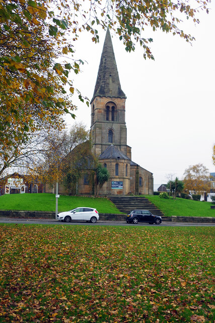
St Mary's Church, Penwortham

St Mary's Church is in Church Avenue, Penwortham, Lancashire, England. It is an active Anglican parish church in the deanery of Leyland, the archdeaconry...

Penwortham Castle

Penwortham Castle was built on the south bank of the River Ribble, at Penwortham to the west of Preston, Lancashire, England, at grid reference SD524291...

Ribble Power Station

Ribble Power Station was a coal-fired electricity generating station on the River Ribble in Penwortham near Preston, Lancashire, England. The station was...

Preston Fishergate Hill railway station

Preston Fishergate Hill was a railway station at the bottom of Fishergate Hill in Preston. It formed the northeastern terminus of the West Lancashire...

Penwortham Priory

Penwortham Priory was first a Benedictine priory and, after the Dissolution of the Monasteries, a country house in the village of Penwortham, near Preston...

Penwortham Girls' High School

Penwortham Girls' High School is a secondary school located in Penwortham in the English county of Lancashire.Established in 1954 as Penwortham Girls'...

St Mark's Church, Preston

St Mark's Church is a redundant Anglican parish church in St Mark's Road, Preston, Lancashire, England. It is recorded in the National Heritage List for...

Preston Dock

Preston Dock (also known as Preston Docklands) was a former maritime dock located on the northern bank of the River Ribble approximately 2.5 km (1.6 mi...

Nearby Amenities

Located within 500m of 53.755111,-2.7251458
Source: PGS
Lat/Long: 53.7568674/-2.7199292
Created By: almien_coastlines
Source: PGS
Lat/Long: 53.756596/-2.7191354
Source: PGS
Lat/Long: 53.756162/-2.718335
Source: PGS
Lat/Long: 53.7555502/-2.7177508
Source: PGS
Lat/Long: 53.7538613/-2.7183499
Source: PGS
Lat/Long: 53.7541218/-2.7183746
Source: PGS
Lat/Long: 53.7545697/-2.7186123
Source: PGS
Lat/Long: 53.7549092/-2.7188697
Source: PGS
Lat/Long: 53.7553512/-2.7192955
Source: PGS
Lat/Long: 53.7556351/-2.7197213
Source: PGS
Lat/Long: 53.7558663/-2.7201124
Source: PGS
Lat/Long: 53.7560537/-2.7205233
Source: PGS
Lat/Long: 53.7562322/-2.7209689
Source: PGS
Lat/Long: 53.7563991/-2.7215926
Source: PGS
Lat/Long: 53.7566449/-2.7226175
Created By: almien_coastlines
Source: PGS
Lat/Long: 53.7567959/-2.7234177
Created By: almien_coastlines
Source: PGS
Lat/Long: 53.7569629/-2.7240313
Created By: almien_coastlines
Source: PGS
Lat/Long: 53.757067/-2.724797
Created By: almien_coastlines
Source: PGS
Lat/Long: 53.757327/-2.726524
Created By: almien_coastlines
Source: PGS
Lat/Long: 53.757587/-2.728251
Source: PGS
Lat/Long: 53.7576459/-2.729197
Source: PGS
Lat/Long: 53.7577162/-2.7302763
Bus Stop
The Pavilions
Bus: yes
Naptan AtcoCode: 2500LA00147
Naptan NaptanCode: langpdpg
Public Transport: platform
Shelter: yes
Lat/Long: 53.7584728/-2.7251549
Bus Stop
Bus: yes
Naptan AtcoCode: 2500LA00401
Naptan NaptanCode: langptwt
Public Transport: platform
Lat/Long: 53.7584292/-2.7253967
Barrier: bollard
Bicycle: yes
Foot: yes
Motor Vehicle: no
Lat/Long: 53.7521351/-2.7232782
Crossing
Crossing: unmarked
Crossing Markings: no
Lat/Long: 53.7582143/-2.7205441
Give Way
Lat/Long: 53.7511746/-2.7258256
Traffic Signals
Traffic Signals: signal
Lat/Long: 53.7523255/-2.7217431
Speed Camera
Lat/Long: 53.7510468/-2.7255138
Crossing
Bicycle: yes
Crossing: traffic_signals
Tactile Paving: yes
Lat/Long: 53.7568196/-2.7183083
Railway: switch
Lat/Long: 53.7565485/-2.7182579
Railway: switch
Lat/Long: 53.7575812/-2.7220322
Railway: switch
Lat/Long: 53.7577194/-2.7225231
Railway: switch
Lat/Long: 53.7585298/-2.728097
Railway: switch
Lat/Long: 53.758593/-2.7285326
Disused Railway: halt
Note: Used as station in 1992 Guild
Lat/Long: 53.7585031/-2.7274268
Crossing
Bicycle: yes
Crossing: traffic_signals
Tactile Paving: yes
Lat/Long: 53.7569066/-2.7183156
Traffic Signals
Lat/Long: 53.7570471/-2.7184562
Crossing
Bicycle: yes
Crossing: traffic_signals
Tactile Paving: yes
Lat/Long: 53.7570731/-2.7184222
Traffic Signals
Traffic Signals: signal
Lat/Long: 53.7567974/-2.7182308
Traffic Signals
Traffic Signals: signal
Lat/Long: 53.756987/-2.7183886
Traffic Signals
Traffic Signals: signal
Lat/Long: 53.7521378/-2.7222553
Barrier: bollard
Bicycle: yes
Foot: yes
Motor Vehicle: no
Lat/Long: 53.7531997/-2.7182841
Give Way
Direction: forward
Lat/Long: 53.7588758/-2.7268004
Barrier: bollard
Bicycle: yes
Foot: yes
Motor Vehicle: no
Lat/Long: 53.7532847/-2.7227523
Historic: memorial
Memorial: war_memorial
Lat/Long: 53.7517743/-2.7243273
Bench
Lat/Long: 53.7512206/-2.7257124
Bench
Lat/Long: 53.7507704/-2.7260823
Traffic Signals
Traffic Signals: signal
Lat/Long: 53.7522791/-2.7223963
Traffic Signals
Traffic Signals: signal
Lat/Long: 53.7521982/-2.7221292
Traffic Signals
Traffic Signals: signal
Lat/Long: 53.7523844/-2.7219686
Crossing
Bicycle: yes
Crossing: traffic_signals
Foot: yes
Segregated: no
Lat/Long: 53.7522989/-2.7217614
Crossing
Bicycle: yes
Crossing: traffic_signals
Foot: yes
Segregated: no
Lat/Long: 53.752268/-2.7219889
Crossing
Bicycle: yes
Crossing: traffic_signals
Foot: yes
Segregated: no
Lat/Long: 53.7522302/-2.7221539
Crossing
Bicycle: yes
Crossing: traffic_signals
Foot: yes
Segregated: no
Lat/Long: 53.7521502/-2.7223112
Crossing
Bicycle: yes
Crossing: traffic_signals
Foot: yes
Segregated: no
Lat/Long: 53.7522638/-2.722309
Crossing
Bicycle: yes
Crossing: traffic_signals
Foot: yes
Segregated: no
Lat/Long: 53.7522994/-2.7223329
Crossing
Crossing: uncontrolled
Crossing Ref: zebra
Lat/Long: 53.7523506/-2.7223895
Give Way
Direction: forward
Lat/Long: 53.7523246/-2.7224118
Give Way
Direction: backward
Lat/Long: 53.7523634/-2.7223557
Give Way
Direction: backward
Lat/Long: 53.7535641/-2.7186128
Give Way
Direction: forward
Lat/Long: 53.7536439/-2.7186514
Bus Stop
Liverpool Road by Flyover
Bus: yes
Departures Board: no
Naptan AtcoCode: 2500DCL3222
Naptan Bearing: SW
Naptan CommonName: Flyover
Naptan Indicator: by
Naptan NaptanCode: landgwda
Operator: Lancashire County Council
Public Transport: platform
Ref: landgwda
Shelter: no
Website: https://www.lancashire.gov.uk/roads-parking-and-travel/public-transport/bus-timetables/bus-timetable-stop/?stopref=2500DCL3222
Lat/Long: 53.7517237/-2.7237377
Post Box
Lat/Long: 53.7539954/-2.7316173
Waste Basket
Lat/Long: 53.7569695/-2.7258375
Bench
Backrest: yes
Lat/Long: 53.7562497/-2.7218198
Bench
Backrest: yes
Lat/Long: 53.7566302/-2.7236262
Waste Basket
Lat/Long: 53.75592/-2.72089
Waste Basket
Lat/Long: 53.7565486/-2.727785
Bench
Backrest: yes
Lat/Long: 53.7564537/-2.7227941
Waste Basket
Lat/Long: 53.7541931/-2.7188014
Bench
Backrest: yes
Lat/Long: 53.7540126/-2.7186984
Bench
Backrest: yes
Lat/Long: 53.7550313/-2.7194402
Waste Basket
Lat/Long: 53.7517877/-2.7240837
Bench
Lat/Long: 53.7517157/-2.724324
Bench
Lat/Long: 53.7517722/-2.7241329
Waste Basket
Lat/Long: 53.7551964/-2.7307006
Bench
Backrest: yes
Lat/Long: 53.7574215/-2.7289512
Bench
Backrest: yes
Lat/Long: 53.7575628/-2.7300959
Waste Basket
Lat/Long: 53.7574246/-2.7297021
Location: outdoor
Operator: Electricity North West
Operator Wikidata: Q5357804
Power: transformer
Transformer: distribution
Voltage Primary: 33 kVA
Voltage Secondary: 11 kVA
Lat/Long: 53.7565459/-2.7247808
Location: outdoor
Operator: Electricity North West
Operator Wikidata: Q5357804
Power: transformer
Transformer: distribution
Voltage Primary: 33 kVA
Voltage Secondary: 11 kVA
Lat/Long: 53.7565174/-2.7246172
Bench
Backrest: yes
Lat/Long: 53.757562/-2.7300107
Bench
Backrest: yes
Lat/Long: 53.7574211/-2.7288526
Ribble Generating Station
Board Type: history
Direction: 180
Information: board
Tourism: information
Lat/Long: 53.7573453/-2.7273572
Pharmacy
Penwortham Pharmacy
Addr City: Preston
Addr Housename: St. Fillan's Medical Centre
Addr Housenumber: 2
Addr Postcode: PR1 0AD
Addr Street: Liverpool Road
Addr Suburb: Penwortham
Dispensing: yes
Drive Through: no
Healthcare: pharmacy
Opening Hours: Mo-Su 08:00-20:00
Phone: +441772746566
Lat/Long: 53.7511217/-2.7265437
Power: substation
Lat/Long: 53.7511091/-2.7255525
Give Way
Lat/Long: 53.7522049/-2.7218841
Give Way
Lat/Long: 53.7512532/-2.7259478
Crossing
Crossing: unmarked
Kerb: lowered
Tactile Paving: yes
Lat/Long: 53.7508753/-2.7260996
Crossing
Crossing: unmarked
Kerb: lowered
Tactile Paving: yes
Lat/Long: 53.7509451/-2.7261883
Crossing
Crossing: uncontrolled
Crossing Island: yes
Crossing Ref: zebra
Kerb: lowered
Tactile Paving: yes
Lat/Long: 53.7512322/-2.725914
Give Way
Direction: backward
Lat/Long: 53.7525051/-2.7292509
Stop
Direction: forward
Lat/Long: 53.7524451/-2.7292722
Barrier: bollard
Bicycle: yes
Foot: yes
Horse: yes
Motor Vehicle: no
Lat/Long: 53.7583794/-2.7204125
Crossing
Crossing: unmarked
Lat/Long: 53.7509187/-2.7261547
Crossing
Crossing: traffic_signals
Tactile Paving: yes
Lat/Long: 53.7569997/-2.7183215
Direction: SE
Generator Method: photovoltaic
Generator Output Electricity: yes
Generator Solar Modules: 60
Generator Source: solar
Generator Type: solar_photovoltaic_panel
Location: roof
Power: generator
Lat/Long: 53.759298/-2.7228753
Direction: SW
Generator Method: photovoltaic
Generator Output Electricity: yes
Generator Solar Modules: 30
Generator Source: solar
Generator Type: solar_photovoltaic_panel
Location: roof
Power: generator
Lat/Long: 53.7593472/-2.7226232
Direction: SW
Generator Method: photovoltaic
Generator Output Electricity: yes
Generator Solar Modules: 30
Generator Source: solar
Generator Type: solar_photovoltaic_panel
Location: roof
Power: generator
Lat/Long: 53.7590538/-2.7230604
Direction: SE
Generator Method: photovoltaic
Generator Output Electricity: yes
Generator Solar Modules: 16
Generator Source: solar
Generator Type: solar_photovoltaic_panel
Location: roof
Power: generator
Lat/Long: 53.7590443/-2.7229545
Entrance: yes
Lat/Long: 53.7586451/-2.723715
Entrance: yes
Lat/Long: 53.7588972/-2.7250399
The data included in this document is from www.openstreetmap.org. The data is made available under ODbL.

Have you been to Crow Wood?

Leave your review of Crow Wood below (or comments, questions and feedback).