Ebbor Wood
Wood, Forest in Somerset Mendip
England
Ebbor Wood

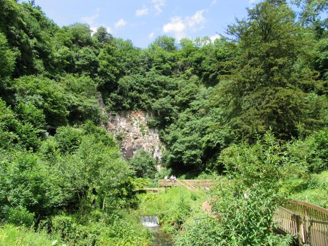
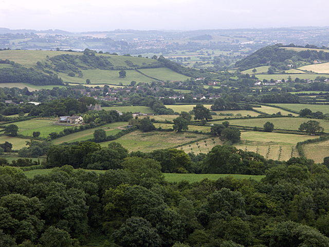
Ebbor Wood is a stunning woodland located in Somerset, England. With an approximate area of 200 acres, it is nestled within the Mendip Hills, which is an Area of Outstanding Natural Beauty. The woodland is situated near the village of Wookey Hole and is easily accessible from the nearby town of Wells.
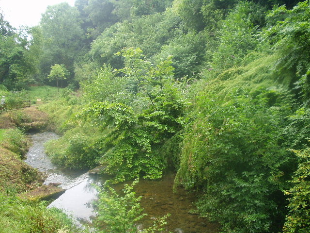
Ebbor Wood is known for its diverse range of trees, including oak, beech, ash, and birch, creating a rich tapestry of colors throughout the year. The woodland floor is covered with a variety of vibrant wildflowers, such as bluebells, primroses, and wood anemones, adding to its natural beauty.
The wood is crisscrossed by a network of footpaths and trails, making it a popular destination for walking and hiking enthusiasts. These paths lead visitors through enchanting wooded areas, across babbling streams, and up to breathtaking viewpoints, offering panoramic vistas of the surrounding countryside.
Ebbor Wood is also a haven for wildlife. The diverse habitat supports a wide range of bird species, including woodpeckers, nuthatches, and tawny owls. Additionally, deer, badgers, and foxes can often be spotted roaming through the woodland.
For those interested in history, Ebbor Wood has archaeological significance. There are remnants of ancient settlements, including Iron Age hillforts and Roman lead mines, which provide insight into the area's past.
Overall, Ebbor Wood is a tranquil and picturesque woodland, offering visitors a chance to immerse themselves in the natural beauty of Somerset's countryside while enjoying its rich history and diverse wildlife.
If you have any feedback on the listing, please let us know in the comments section below.
Ebbor Wood Images
Images are sourced within 2km of 51.234012/-2.6846473 or Grid Reference ST5248. Thanks to Geograph Open Source API. All images are credited.


Ebbor Wood is located at Grid Ref: ST5248 (Lat: 51.234012, Lng: -2.6846473)
Administrative County: Somerset
District: Mendip
Police Authority: Avon and Somerset
What 3 Words
///mule.revised.professed. Near Wells, Somerset
Nearby Locations
Related Wikis
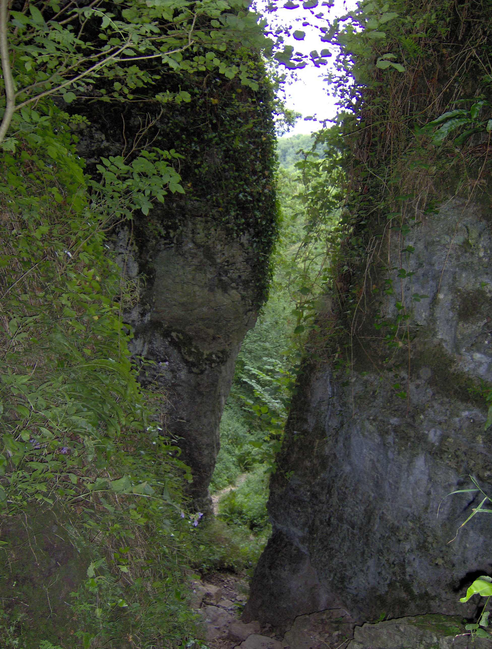
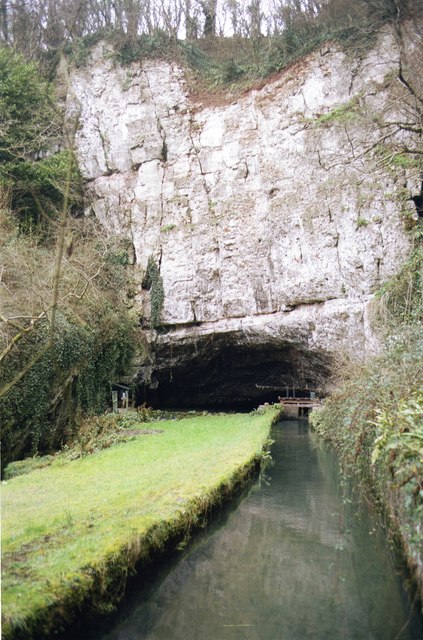
Ebbor Gorge
Ebbor Gorge is a limestone gorge in Somerset, England, designated and notified in 1952 as a 63.5-hectare (157-acre) biological Site of Special Scientific...

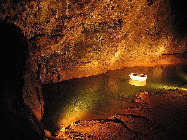
Wookey Hole Caves
Wookey Hole Caves () are a series of limestone caverns, a show cave and tourist attraction in the village of Wookey Hole on the southern edge of the Mendip...

St Paul's Church, Easton
St Paul's Church is a Church of England church in Easton, Somerset, England. The church, which was designed by Richard Carver and built in 1843, has been...

Wookey Hole
Wookey Hole is a village in Somerset, England. It is the location of the Wookey Hole show caves. == Location == Wookey Hole is located in the civil parish...
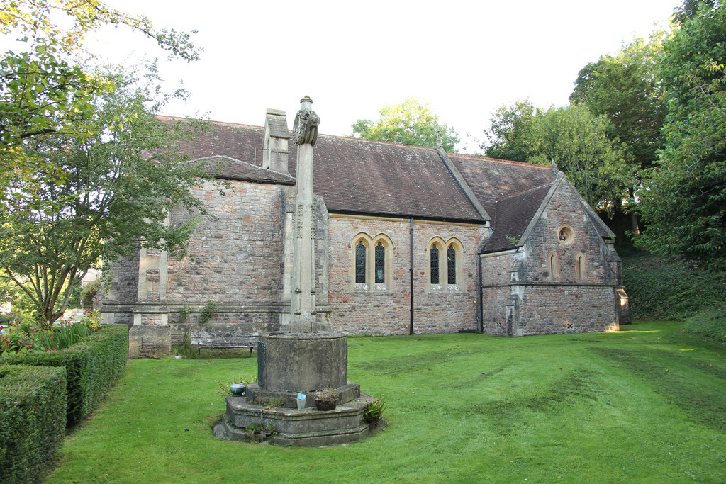
Church of St Mary Magdalene, Wookey Hole
The Church of St Mary Magdalene is a Church of England church in Wookey Hole, Somerset, England, dedicated to Jesus' companion Mary Magdalene. The church...

Sandpit Hole and Bishop's Lot
Sandpit Hole and Bishop's Lot (grid reference ST531498) is a 1.8 hectare geological Site of Special Scientific Interest near Ebbor Gorge in Somerset, notified...

Westbury-sub-Mendip
Westbury-sub-Mendip is a village and civil parish in Somerset, England. The village is on the southern slopes of the Mendip Hills, 4 miles (6.4 km) from...
St Cuthberts Mill
St Cuthberts Mill is a British paper manufacturing company in Wells, Somerset, that specialises in mould made artists papers. The range includes traditional...
Nearby Amenities
Located within 500m of 51.234012,-2.6846473Have you been to Ebbor Wood?
Leave your review of Ebbor Wood below (or comments, questions and feedback).