Hope Wood
Wood, Forest in Somerset Mendip
England
Hope Wood

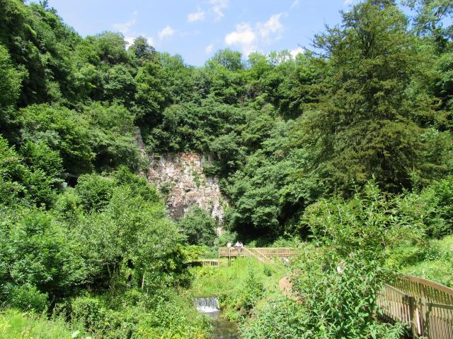
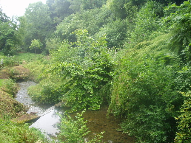
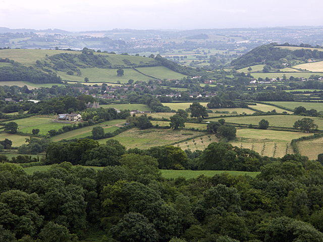
Hope Wood is a picturesque and enchanting forest located in Somerset, England. Covering an area of approximately 500 acres, it is a haven for nature lovers and outdoor enthusiasts alike. The wood is nestled in the heart of the Somerset Levels, offering visitors a tranquil and peaceful escape from the hustle and bustle of everyday life.
The woodland is primarily composed of ancient oak and ash trees, creating a dense canopy that provides shade and shelter for a diverse range of flora and fauna. The forest floor is carpeted with an array of wildflowers, ferns, and mosses, creating a vibrant and colorful landscape throughout the seasons.
Hope Wood is also home to a variety of wildlife, including deer, foxes, badgers, and numerous species of birds. It is a popular spot for birdwatching, with sightings of buzzards, woodpeckers, and owls being common.
In addition to its natural beauty, the wood also boasts several walking trails and footpaths, allowing visitors to explore its hidden corners and discover its hidden gems. These paths meander through the forest, offering breathtaking views of the surrounding countryside and the opportunity to spot rare plant species and elusive wildlife.
Whether you are seeking a peaceful retreat, a chance to reconnect with nature, or simply an escape from the pressures of modern life, Hope Wood in Somerset is a destination that will captivate and inspire.
If you have any feedback on the listing, please let us know in the comments section below.
Hope Wood Images
Images are sourced within 2km of 51.234285/-2.6886906 or Grid Reference ST5248. Thanks to Geograph Open Source API. All images are credited.


Hope Wood is located at Grid Ref: ST5248 (Lat: 51.234285, Lng: -2.6886906)
Administrative County: Somerset
District: Mendip
Police Authority: Avon and Somerset
What 3 Words
///shuttled.basket.salon. Near Wells, Somerset
Nearby Locations
Related Wikis
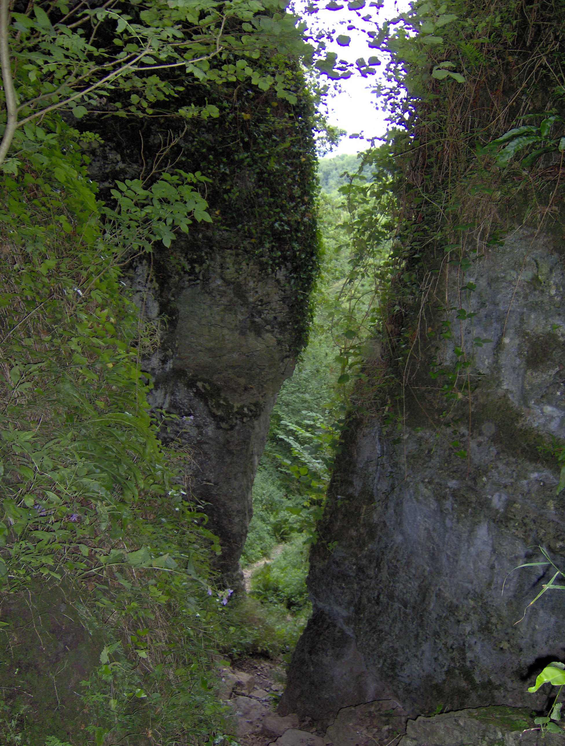
Ebbor Gorge
Ebbor Gorge is a limestone gorge in Somerset, England, designated and notified in 1952 as a 63.5-hectare (157-acre) biological Site of Special Scientific...

St Paul's Church, Easton
St Paul's Church is a Church of England church in Easton, Somerset, England. The church, which was designed by Richard Carver and built in 1843, has been...

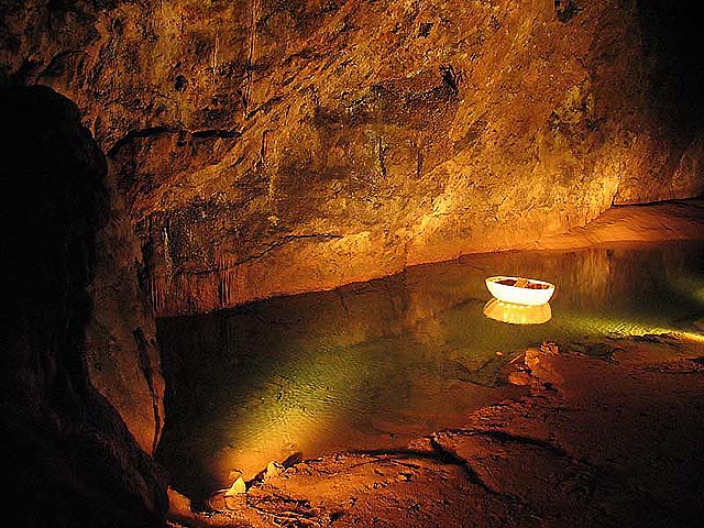
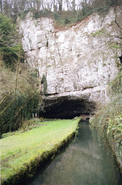
Wookey Hole Caves
Wookey Hole Caves () are a series of limestone caverns, a show cave and tourist attraction in the village of Wookey Hole on the southern edge of the Mendip...

Wookey Hole
Wookey Hole is a village in Somerset, England. It is the location of the Wookey Hole show caves. == Location == Wookey Hole is located in the civil parish...
Nearby Amenities
Located within 500m of 51.234285,-2.6886906Have you been to Hope Wood?
Leave your review of Hope Wood below (or comments, questions and feedback).