Crook o' Lune Wood
Wood, Forest in Lancashire Lancaster
England
Crook o' Lune Wood

Crook o' Lune Wood is a beautiful woodland located in the county of Lancashire, England. Situated near the village of Caton, it covers an area of approximately 40 hectares. The woodland is named after the meandering River Lune, which gracefully curves around the area, providing a picturesque backdrop.
This ancient woodland is rich in biodiversity, boasting a variety of tree species such as oak, beech, birch, and ash. The lush green canopy provides a haven for numerous bird species, including woodpeckers, owls, and warblers. Wildlife enthusiasts can also spot various mammals, such as squirrels, foxes, and deer, roaming freely in their natural habitat.
The wood offers visitors a tranquil escape from the hustle and bustle of everyday life. It is crisscrossed by well-maintained footpaths, allowing visitors to explore the woodland at their leisure. The paths wind through the trees, revealing stunning vistas of the river and surrounding countryside. There are also several picnic spots dotted throughout the woodland, perfect for enjoying a packed lunch while immersing oneself in the peaceful surroundings.
Crook o' Lune Wood is a popular destination for both locals and tourists alike. It offers a range of recreational activities, including walking, cycling, and horse riding. The wood is also a designated nature reserve, managed by the Lancashire Wildlife Trust, ensuring the preservation of its natural beauty and wildlife.
Overall, Crook o' Lune Wood is a natural gem in Lancashire, offering visitors a chance to connect with nature and experience the tranquility of an ancient woodland.
If you have any feedback on the listing, please let us know in the comments section below.
Crook o' Lune Wood Images
Images are sourced within 2km of 54.073778/-2.7345106 or Grid Reference SD5264. Thanks to Geograph Open Source API. All images are credited.


Crook o' Lune Wood is located at Grid Ref: SD5264 (Lat: 54.073778, Lng: -2.7345106)
Administrative County: Lancashire
District: Lancaster
Police Authority: Lancashire
What 3 Words
///inferior.stones.pigtails. Near Caton, Lancashire
Nearby Locations
Related Wikis
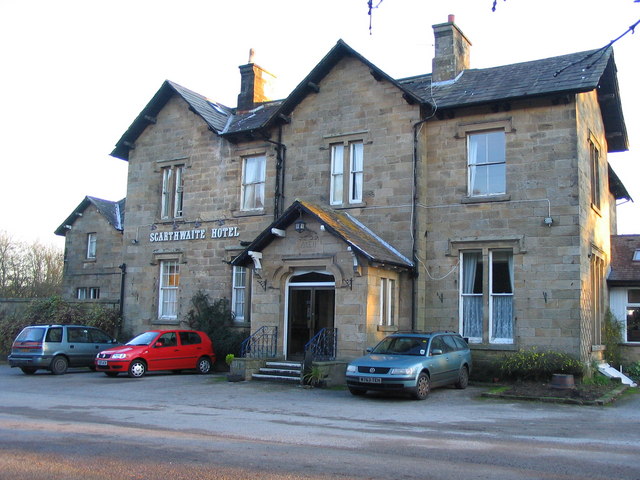
The Scarthwaite Hotel
The Scarthwaite Country House Hotel at Crook O’Lune near Caton in Lancashire is a house of historical significance. It was built in 1858 by Adam Hodgson...

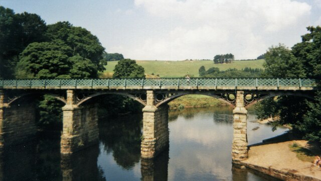
Crook o' Lune
The Crook o' Lune or Crook of Lune, about three miles north-east of Lancaster, Lancashire, is a horseshoe bend of the River Lune, which here meanders through...

North West England
North West England (North West Region) is one of nine official regions of England and consists of the ceremonial counties of Cheshire, Cumbria, Greater...

Caton railway station
Caton railway station served the village of Caton in the City of Lancaster district of Lancashire, England. The station was located near Ball Lane and...
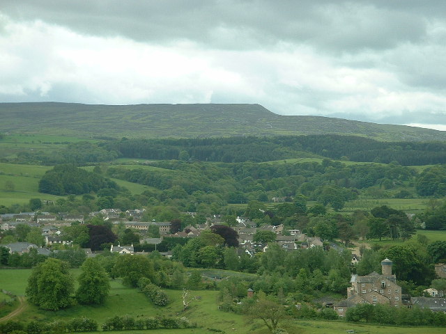
Caton-with-Littledale
The civil parish of Caton-with-Littledale is situated in Lancashire, England, near the River Lune. The parish lies within the Forest of Bowland Area of...

Artle Beck
Artle Beck is a minor river of Lancashire. Rising at the confluence of Udale Beck and Foxdale Beck below Fosdale Bridge and Udale Bridge near Crossgill...
Lancaster University Boat Club
Lancaster University Boat Club (LUBC) is the rowing club of Lancaster University. The club was founded in 1964 with the inception of the university by...
Halton railway station (Lancashire)
Halton railway station served the village of Halton in Lancashire, England. It closed in 1966, but the station building and part of one platform survive...
Nearby Amenities
Located within 500m of 54.073778,-2.7345106Have you been to Crook o' Lune Wood?
Leave your review of Crook o' Lune Wood below (or comments, questions and feedback).