Earnscombe Copse

Wood, Forest in Dorset

England

Earnscombe Copse

Valley above West Milton, from Ant Hill Trail
Valley above West Milton, from Ant Hill Trail Credit: Maurice D Budden

Earnscombe Copse is a picturesque wood located in the county of Dorset, England. Situated in the heart of the countryside, it covers an area of approximately 50 acres and is known for its natural beauty and diverse ecosystem. The copse is nestled within the larger landscape of the Blackmore Vale, surrounded by rolling hills and farmland.

The wood is primarily composed of mature broadleaf trees, including oak, beech, and ash, which create a dense canopy that provides shade and shelter for the various wildlife species that inhabit the area. The forest floor is covered in a rich carpet of ferns, wildflowers, and mosses, adding to the enchanting atmosphere of the copse.

Earnscombe Copse is home to a wide range of flora and fauna, making it a popular spot for nature enthusiasts and birdwatchers. Visitors can expect to encounter an array of bird species, such as woodpeckers, warblers, and owls, as well as small mammals like squirrels and hedgehogs. The copse is also known for its vibrant butterfly population, with species like the orange tip and the silver-washed fritillary fluttering among the trees.

Walking trails wind through the copse, allowing visitors to explore its beauty at their own pace. The peaceful ambiance and stunning scenery make it an ideal location for a leisurely stroll or a picnic amidst nature. The copse is well-maintained, with designated areas for visitors to rest and enjoy the tranquility of the surroundings.

Overall, Earnscombe Copse offers a captivating glimpse into the natural beauty of Dorset, showcasing the diverse flora and fauna that thrive within its boundaries. It is a haven for wildlife and a sanctuary for those seeking solace in the enchanting woodlands.

If you have any feedback on the listing, please let us know in the comments section below.

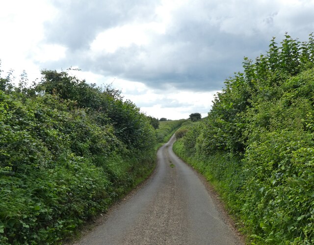
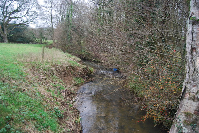
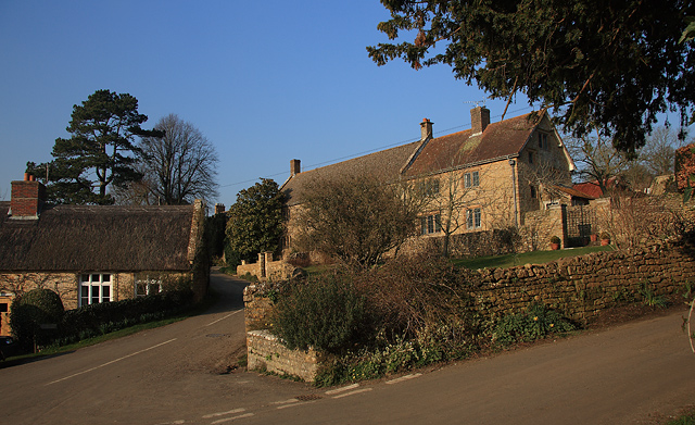
Earnscombe Copse Images

Images are sourced within 2km of 50.760686/-2.7003569 or Grid Reference SY5095. Thanks to Geograph Open Source API. All images are credited.

Valley above West Milton, from Ant Hill Trail
Halfway Copse Seen from the road at the western edge of Uploders. The copse overlooks the meeting of the Asker valley (foreground, with trees along the course of the river) with the Mappercombe valley.
Halfway Copse
Seen from the road at the western edge of Uploders. The copse overlooks the meeting of the Asker valley (foreground, with trees along the course of the river) with the Mappercombe valley.
Ridgeback Lane
Ridgeback Lane
Entrance, Beningfield Wood
Path through Beningfield Wood
Sheep grazing next to Ridgeback Lane
Brookwood Cottage
Brookwood Cottage
Shelter and telephone box, West Milton
Cottages, West Mlton
Church of St Mary the Virgin, Powerstock, Dorset
Church of St Mary the Virgin, Powerstock, Dorset A view across the Church towards the North aisle
Church of St Mary the Virgin, Powerstock, Dorset
A view across the Church towards the North aisle
Church of St Mary the Virgin, Powerstock, Dorset The Nave.
Church of St Mary the Virgin, Powerstock, Dorset
The Nave.
Church of St Mary the Virgin, Powerstock, Dorset A view across the Church towards the South aisle.
Church of St Mary the Virgin, Powerstock, Dorset
A view across the Church towards the South aisle.
Church of St Mary the Virgin, Powerstock, Dorset A view of the Chancel arch, which dates from the early 12th-century.
Church of St Mary the Virgin, Powerstock, Dorset
A view of the Chancel arch, which dates from the early 12th-century.
Church of St Mary the Virgin, Powerstock, Dorset The roof structure.
Church of St Mary the Virgin, Powerstock, Dorset
The roof structure.
Church of St Mary the Virgin, Powerstock, Dorset The Chancel.
Church of St Mary the Virgin, Powerstock, Dorset
The Chancel.
Show me another place!

Earnscombe Copse is located at Grid Ref: SY5095 (Lat: 50.760686, Lng: -2.7003569)

Unitary Authority: Dorset

Police Authority: Dorset

What 3 Words

///talking.cartoons.plotter. Near Bridport, Dorset

Related Wikis

West Milton, Dorset

West Milton is a small village in western Dorset, in South West England, about 3 miles (5 km) northeast of Bridport and 1 mile (1.6 km) west of Powerstock...

Mangerton River

The Mangerton River or Mangerton Brook is a 13.37 km (8.31 mi) long river in Dorset, England that is a tributary of the River Asker. The river rises at...

Powerstock (liberty)

Powerstock Liberty was a liberty comprising part of the parish of Powerstock in Dorset, England. == See also == List of liberties in Dorset == Sources... ==

Powerstock

Powerstock is a village and civil parish in south west Dorset, England, situated in a steep valley on the edge of the Dorset Downs, 5 miles (8 km) north...

Nearby Amenities

Located within 500m of 50.760686,-2.7003569
NETTLECOMBE1
Disused: yes
Man Made: petroleum_well
Ref GB Decc: L97/07-1
Source: DECC
Lat/Long: 50.7573611/-2.7014722
Material: wood
Power: pole
Source: bing
Lat/Long: 50.7579565/-2.6947493
Material: wood
Power: pole
Source: bing
Lat/Long: 50.7588594/-2.6944308
Material: wood
Power: pole
Source: bing
Lat/Long: 50.7597581/-2.6941022
Material: wood
Power: pole
Source: bing
Lat/Long: 50.7606395/-2.6937806
Material: wood
Power: pole
Source: bing
Lat/Long: 50.7615884/-2.6934416
Material: wood
Power: pole
Source: bing
Lat/Long: 50.7635608/-2.6952424
Material: wood
Power: pole
Source: bing
Lat/Long: 50.7636313/-2.6960314
Material: wood
Power: pole
Source: bing
Lat/Long: 50.7637415/-2.6972753
Material: wood
Power: pole
Source: bing
Lat/Long: 50.7639148/-2.6985715
Material: wood
Power: pole
Source: bing
Lat/Long: 50.7642497/-2.7011484
Material: wood
Power: pole
Source: bing
Lat/Long: 50.7643318/-2.704159
Material: wood
Power: pole
Source: bing
Lat/Long: 50.7643368/-2.7024591
The data included in this document is from www.openstreetmap.org. The data is made available under ODbL.

Have you been to Earnscombe Copse?

Leave your review of Earnscombe Copse below (or comments, questions and feedback).