Calves Plot Wood

Wood, Forest in Somerset Mendip

England

Calves Plot Wood

Broad Road near Rodney Stoke A view down Broad Road at the top of the descent into Rodney Stoke.
The view west goes over the Somerset Levels to the Bristol Channel.
Broad Road near Rodney Stoke Credit: Kevin Pearson

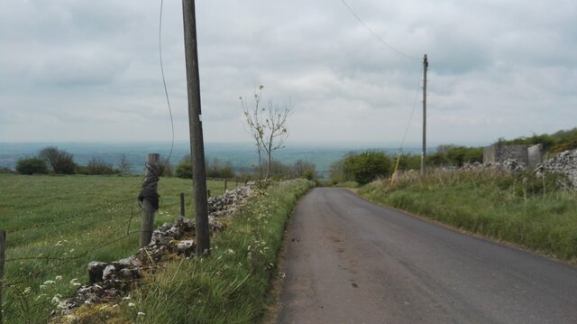
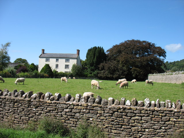
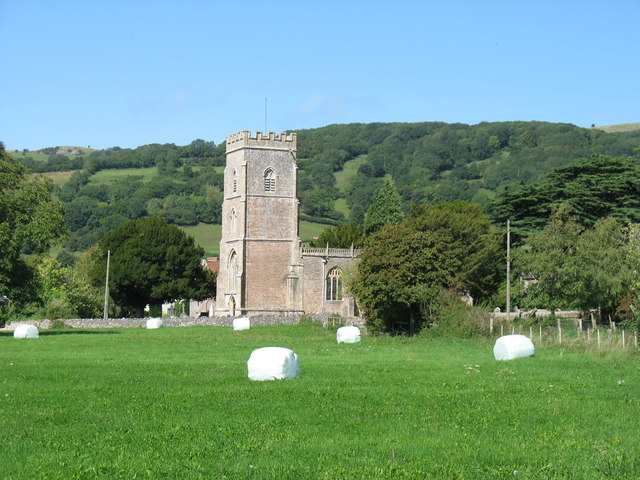
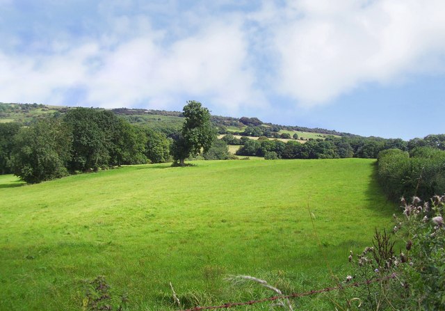
Calves Plot Wood is a picturesque forest located in the county of Somerset, England. Stretching over an area of approximately 100 acres, it is known for its lush greenery, diverse wildlife, and tranquil atmosphere. The wood is situated near the charming village of Wood, providing a serene escape for nature enthusiasts and locals alike.

The woodland is predominantly made up of deciduous trees, including oak, beech, and ash, which create a dense canopy overhead. This creates a shaded and cool environment, perfect for leisurely walks and exploration. The forest floor is covered in a thick carpet of moss and wildflowers, adding to the natural beauty of the area.

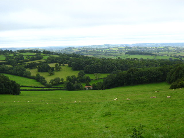
Calves Plot Wood is home to a wide range of wildlife species, making it a haven for nature lovers. Visitors may spot deer, rabbits, squirrels, and a variety of bird species, including woodpeckers and owls. The forest also boasts a small pond, attracting amphibians such as frogs and newts.

The wood offers several well-marked trails, allowing visitors to explore its enchanting beauty at their own pace. These paths take visitors through various sections of the woodland, offering different perspectives of the landscape. There are also designated picnic areas and benches, providing perfect spots to rest and enjoy the tranquility of the surroundings.

Calves Plot Wood is a cherished natural treasure in Somerset, inviting visitors to immerse themselves in the beauty of nature and enjoy a peaceful retreat from the hustle and bustle of everyday life.

If you have any feedback on the listing, please let us know in the comments section below.

Calves Plot Wood Images

Images are sourced within 2km of 51.250292/-2.7211969 or Grid Reference ST4950. Thanks to Geograph Open Source API. All images are credited.

Broad Road near Rodney Stoke A view down Broad Road at the top of the descent into Rodney Stoke.
The view west goes over the Somerset Levels to the Bristol Channel.
Broad Road near Rodney Stoke
A view down Broad Road at the top of the descent into Rodney Stoke. The view west goes over the Somerset Levels to the Bristol Channel.
In Rodney Stoke
In Rodney Stoke
St Leonard's church, Rodney Stoke
St Leonard's church, Rodney Stoke - monument to Sir Edward Rodney This monument has two oval recesses featuring the busts of Sir Edward Rodney (†1657) and his wife (†1659) under a canopy with a raised curtain. They are flanked left and right by two seated angels, a third sits on a cloud below the canopy. It was Sir Edward who gave the church its chancel screen, pulpit, and font cover.
St Leonard's church, Rodney Stoke - monument to Sir Edward Rodney
This monument has two oval recesses featuring the busts of Sir Edward Rodney (†1657) and his wife (†1659) under a canopy with a raised curtain. They are flanked left and right by two seated angels, a third sits on a cloud below the canopy. It was Sir Edward who gave the church its chancel screen, pulpit, and font cover.
St Leonard's church, Rodney Stoke - monument to Anne Lakes This monument in the north chapel is to Anne Lakes (†1630), wife of George Rodney and daughter of Sir Thomas Lakes of Channons in Middlesex. Her effigy in alabaster lies on top of a sarcophagus base below a delicate arch supported by Ionic columns. The arch is decorated inside with stars and clouds.
St Leonard's church, Rodney Stoke - monument to Anne Lakes
This monument in the north chapel is to Anne Lakes (†1630), wife of George Rodney and daughter of Sir Thomas Lakes of Channons in Middlesex. Her effigy in alabaster lies on top of a sarcophagus base below a delicate arch supported by Ionic columns. The arch is decorated inside with stars and clouds.
St Leonard's church, Rodney Stoke - monument to Anne Lakes (2) detail
St Leonard's church, Rodney Stoke - monument to Anne Lakes (3) detail
St Leonard's church, Rodney Stoke - monument to George Rodney The monument to George Rodney (†1651) shows him as the demi-figure in a shroud rising from a coffin set between two earth -bound putti. An angel in the clouds in the open segmental pediment blows a trumpet. The base plinth is decorated with strapwork.
St Leonard's church, Rodney Stoke - monument to George Rodney
The monument to George Rodney (†1651) shows him as the demi-figure in a shroud rising from a coffin set between two earth -bound putti. An angel in the clouds in the open segmental pediment blows a trumpet. The base plinth is decorated with strapwork.
Westbury-Sub Mendip Church Saint Lawrence, with parts dating back to the 12th century.
Westbury-Sub Mendip Church
Saint Lawrence, with parts dating back to the 12th century.
Mendip Edge Scenery On the south west slope of the Mendip Hills near Rodney Stoke.
Mendip Edge Scenery
On the south west slope of the Mendip Hills near Rodney Stoke.
St Leonard's Church In Rodney Stoke founded 1175
St Leonard's Church
In Rodney Stoke founded 1175
Caravan Park On Westclose Hill
Caravan Park
On Westclose Hill
St Lawrence's church, Westbury Originally C12; a little Norman work remains, but the tower was rebuilt in 1887, possibly reusing the former pinnacles <span class="nowrap"><a title="http://webapp1.somerset.gov.uk/her/details.asp?prn=22003" rel="nofollow ugc noopener" href="http://webapp1.somerset.gov.uk/her/details.asp?prn=22003">Link</a><img style="margin-left:2px;" alt="External link" title="External link - shift click to open in new window" src="https://s1.geograph.org.uk/img/external.png" width="10" height="10"/></span> .
St Lawrence's church, Westbury
Originally C12; a little Norman work remains, but the tower was rebuilt in 1887, possibly reusing the former pinnacles LinkExternal link .
Churchyard, Westbury-Sub-Mendip The churchyard on the north side of <a href="https://www.geograph.org.uk/photo/1878790">ST4948 : St Lawrence's church, Westbury</a>. In the background are barns at Court House Farm.
Churchyard, Westbury-Sub-Mendip
The churchyard on the north side of ST4948 : St Lawrence's church, Westbury. In the background are barns at Court House Farm.
St Lawrence's church, Westbury A view of <a href="https://www.geograph.org.uk/photo/1878790">ST4948 : St Lawrence's church, Westbury</a> from the south, showing the two-storey porch with its pierced parapet and empty niche. In a few minutes the sun would have illuminated more of the stonework, but breakfast called.
St Lawrence's church, Westbury
A view of ST4948 : St Lawrence's church, Westbury from the south, showing the two-storey porch with its pierced parapet and empty niche. In a few minutes the sun would have illuminated more of the stonework, but breakfast called.
Hollow Farm The lane is The Hollow, running from the centre of Westbury-Sub-Mendip to meet the A371 turnpike. Hollow Farm lies below Broadway Hill on the right.
Hollow Farm
The lane is The Hollow, running from the centre of Westbury-Sub-Mendip to meet the A371 turnpike. Hollow Farm lies below Broadway Hill on the right.
Towards Stoneleigh from The Hollow Looking across a couple of fields down the hill to the houses at Stoneleigh, which are along the A371 Stoke Road. The partly wooded Lodge Hill rises in the background.
Towards Stoneleigh from The Hollow
Looking across a couple of fields down the hill to the houses at Stoneleigh, which are along the A371 Stoke Road. The partly wooded Lodge Hill rises in the background.
Footpath up Broadway Hill The sign indicates the start of footpath WS 13/59 from The Hollow, but according to the maps it should leave the lane 100 metres further east. Two more footpaths cross the field.
Footpath up Broadway Hill
The sign indicates the start of footpath WS 13/59 from The Hollow, but according to the maps it should leave the lane 100 metres further east. Two more footpaths cross the field.
Show me another place!

Calves Plot Wood is located at Grid Ref: ST4950 (Lat: 51.250292, Lng: -2.7211969)

Administrative County: Somerset

District: Mendip

Police Authority: Avon and Somerset

What 3 Words

///lions.reworked.credited. Near Draycott, Somerset

Related Wikis

Rodney Stoke SSSI

Rodney Stoke (grid reference ST492507) is a 69.6 hectare (172.0 acre) biological Site of Special Scientific Interest, just north of the village of Rodney...

Westbury Camp

Westbury Camp is a univallate Iron Age hill fort in the Mendip Hills in Somerset, England. The hill fort is situated in the parish of Rodney Stoke, approximately...

Rodney Stoke

Rodney Stoke is a small village and civil parish, located at grid reference ST486501, 5 miles north-west of Wells, in the English county of Somerset. The...

Brimble Pit and Cross Swallet Basins

Brimble Pit and Cross Swallet Basins (grid reference ST512505) is a 154.3 hectare (381.3 acre) geological Site of Special Scientific Interest between Wookey...

Westbury-sub-Mendip

Westbury-sub-Mendip is a village and civil parish in Somerset, England. The village is on the southern slopes of the Mendip Hills, 4 miles (6.4 km) from...

Church of St Lawrence, Westbury-sub-Mendip

The Church of St Lawrence in Westbury-sub-Mendip, Somerset, England was built in the 12th century. It is a Grade II* listed building. == History == The...

Lodge Hill railway station

Lodge Hill railway station was a station on the Bristol and Exeter Railway's Cheddar Valley line in Somerset, England from 1870 until 1963. The station...

Draycott Sleights

Draycott Sleights (grid reference ST483518) is a 61.95 hectares (153.1 acres) biological Site of Special Scientific Interest at Draycott in the Mendip...

Nearby Amenities

Located within 500m of 51.250292,-2.7211969
ROC Nuclear fallout shelter (site of)
Historic: archaeological_site
Lat/Long: 51.2541243/-2.7177402
The data included in this document is from www.openstreetmap.org. The data is made available under ODbL.

Have you been to Calves Plot Wood?

Leave your review of Calves Plot Wood below (or comments, questions and feedback).