Big Stoke

Wood, Forest in Somerset Mendip

England

Big Stoke

Broad Road near Rodney Stoke A view down Broad Road at the top of the descent into Rodney Stoke.
The view west goes over the Somerset Levels to the Bristol Channel.
Broad Road near Rodney Stoke Credit: Kevin Pearson

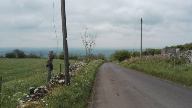
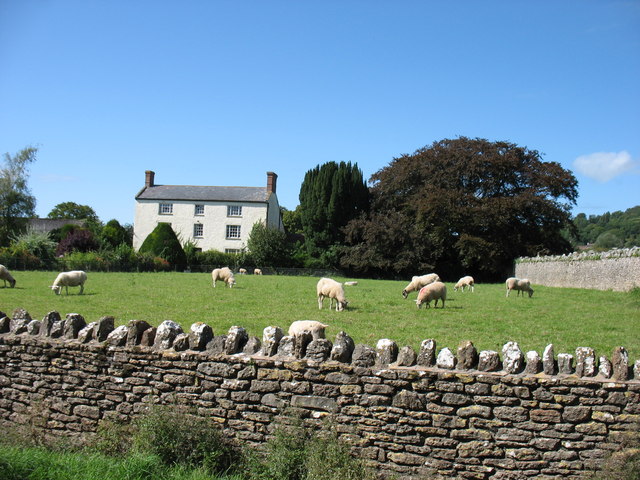
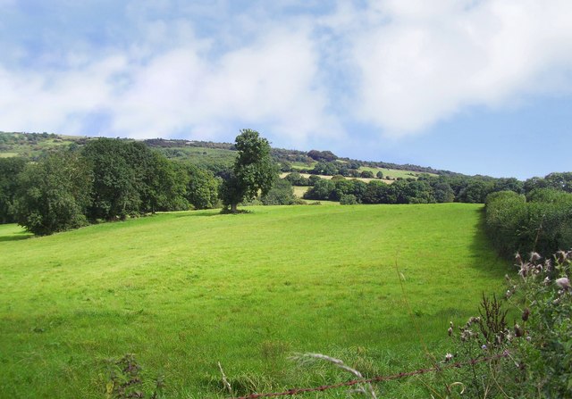
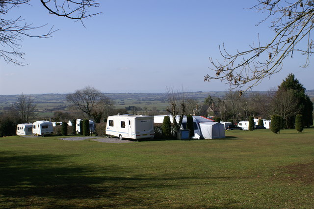
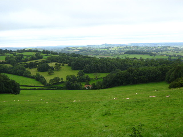
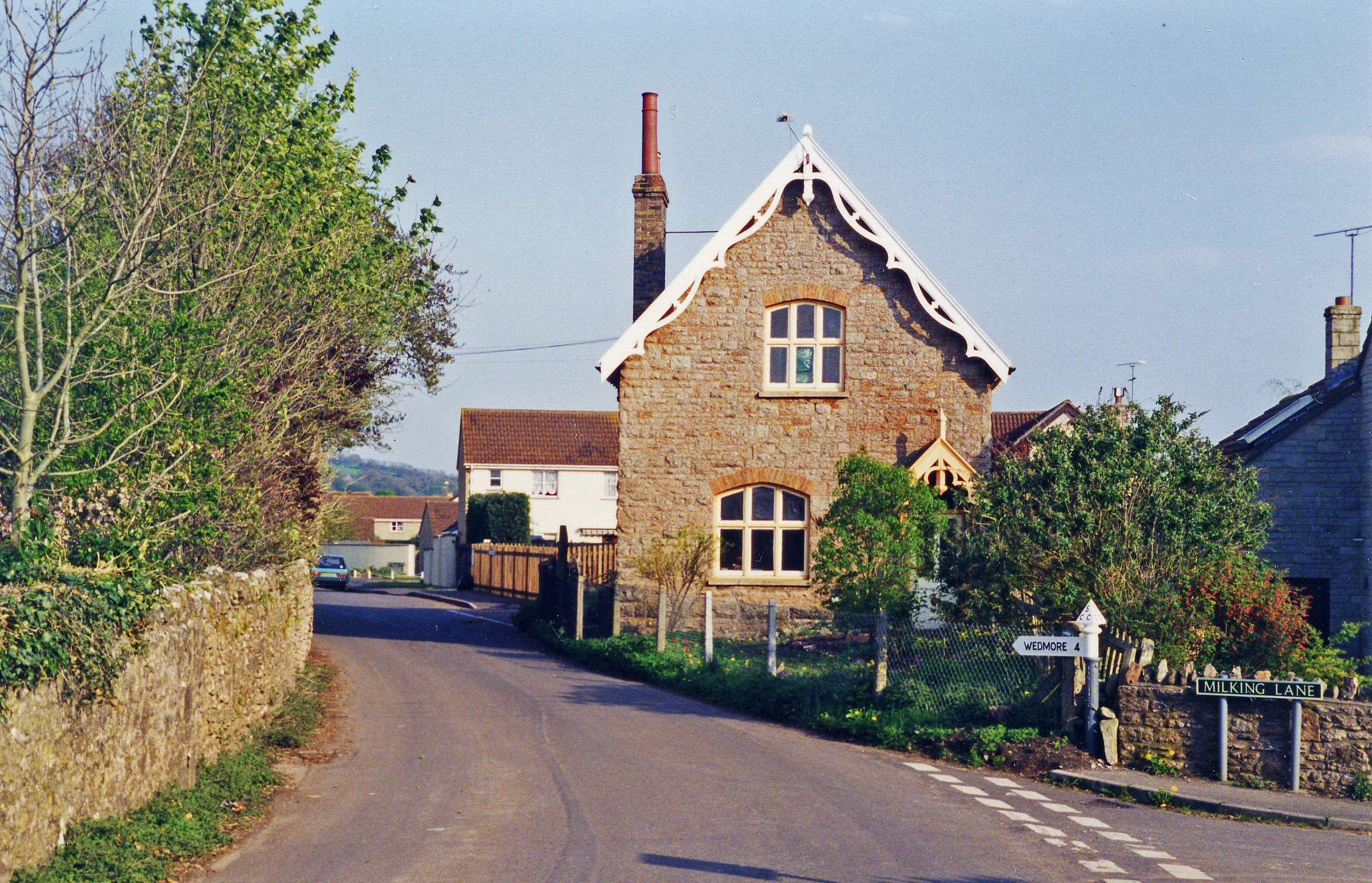
Big Stoke is a picturesque village located in Somerset, England. Situated in the heart of the county, it is a part of the Mendip district and lies within the beautiful landscape of the Mendip Hills. The village is surrounded by lush greenery and is known for its dense woodlands and enchanting forests, making it a popular destination for nature lovers and outdoor enthusiasts.

The woodlands in Big Stoke are home to a diverse range of flora and fauna, providing a habitat for various species of plants, animals, and birds. The forested areas offer a tranquil and serene environment, perfect for hiking, walking, and exploring. Visitors can enjoy the fresh air as they wander through the well-maintained trails, taking in the stunning views and immersing themselves in nature.

Aside from its natural beauty, Big Stoke also boasts a strong sense of community. The village is home to a close-knit population who take pride in their surroundings and actively participate in local events and initiatives. The residents organize regular community gatherings, such as fairs and festivals, which bring people together and foster a friendly and welcoming atmosphere.

In terms of amenities, Big Stoke offers a range of facilities to cater to the needs of its residents. The village has a primary school, a small local shop, and a community center, providing essential services and promoting a sense of convenience for the locals.

Overall, Big Stoke, Somerset (Wood, Forest) is a charming village blessed with natural beauty and a strong community spirit. It offers a peaceful retreat and a chance to reconnect with nature, making it a favorite destination for those seeking solace and tranquility.

If you have any feedback on the listing, please let us know in the comments section below.
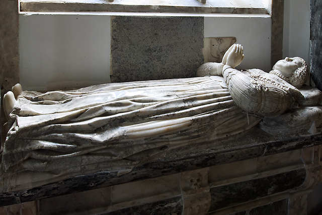
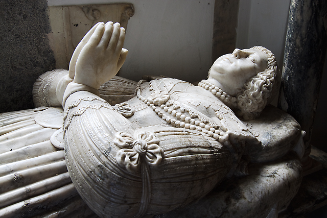
Big Stoke Images

Images are sourced within 2km of 51.253488/-2.7279243 or Grid Reference ST4950. Thanks to Geograph Open Source API. All images are credited.

Broad Road near Rodney Stoke A view down Broad Road at the top of the descent into Rodney Stoke.
The view west goes over the Somerset Levels to the Bristol Channel.
Broad Road near Rodney Stoke
A view down Broad Road at the top of the descent into Rodney Stoke. The view west goes over the Somerset Levels to the Bristol Channel.
In Rodney Stoke
In Rodney Stoke
St Leonard's church, Rodney Stoke
St Leonard's church, Rodney Stoke - monument to Sir Edward Rodney This monument has two oval recesses featuring the busts of Sir Edward Rodney (†1657) and his wife (†1659) under a canopy with a raised curtain. They are flanked left and right by two seated angels, a third sits on a cloud below the canopy. It was Sir Edward who gave the church its chancel screen, pulpit, and font cover.
St Leonard's church, Rodney Stoke - monument to Sir Edward Rodney
This monument has two oval recesses featuring the busts of Sir Edward Rodney (†1657) and his wife (†1659) under a canopy with a raised curtain. They are flanked left and right by two seated angels, a third sits on a cloud below the canopy. It was Sir Edward who gave the church its chancel screen, pulpit, and font cover.
St Leonard's church, Rodney Stoke - monument to Anne Lakes This monument in the north chapel is to Anne Lakes (†1630), wife of George Rodney and daughter of Sir Thomas Lakes of Channons in Middlesex. Her effigy in alabaster lies on top of a sarcophagus base below a delicate arch supported by Ionic columns. The arch is decorated inside with stars and clouds.
St Leonard's church, Rodney Stoke - monument to Anne Lakes
This monument in the north chapel is to Anne Lakes (†1630), wife of George Rodney and daughter of Sir Thomas Lakes of Channons in Middlesex. Her effigy in alabaster lies on top of a sarcophagus base below a delicate arch supported by Ionic columns. The arch is decorated inside with stars and clouds.
St Leonard's church, Rodney Stoke - monument to Anne Lakes (2) detail
St Leonard's church, Rodney Stoke - monument to Anne Lakes (3) detail
St Leonard's church, Rodney Stoke - monument to George Rodney The monument to George Rodney (†1651) shows him as the demi-figure in a shroud rising from a coffin set between two earth -bound putti. An angel in the clouds in the open segmental pediment blows a trumpet. The base plinth is decorated with strapwork.
St Leonard's church, Rodney Stoke - monument to George Rodney
The monument to George Rodney (†1651) shows him as the demi-figure in a shroud rising from a coffin set between two earth -bound putti. An angel in the clouds in the open segmental pediment blows a trumpet. The base plinth is decorated with strapwork.
Mendip Edge Scenery On the south west slope of the Mendip Hills near Rodney Stoke.
Mendip Edge Scenery
On the south west slope of the Mendip Hills near Rodney Stoke.
St Leonard's Church In Rodney Stoke founded 1175
St Leonard's Church
In Rodney Stoke founded 1175
Caravan Park On Westclose Hill
Caravan Park
On Westclose Hill
Hollow Farm The lane is The Hollow, running from the centre of Westbury-Sub-Mendip to meet the A371 turnpike. Hollow Farm lies below Broadway Hill on the right.
Hollow Farm
The lane is The Hollow, running from the centre of Westbury-Sub-Mendip to meet the A371 turnpike. Hollow Farm lies below Broadway Hill on the right.
Towards Stoneleigh from The Hollow Looking across a couple of fields down the hill to the houses at Stoneleigh, which are along the A371 Stoke Road. The partly wooded Lodge Hill rises in the background.
Towards Stoneleigh from The Hollow
Looking across a couple of fields down the hill to the houses at Stoneleigh, which are along the A371 Stoke Road. The partly wooded Lodge Hill rises in the background.
Footpath up Broadway Hill The sign indicates the start of footpath WS 13/59 from The Hollow, but according to the maps it should leave the lane 100 metres further east. Two more footpaths cross the field.
Footpath up Broadway Hill
The sign indicates the start of footpath WS 13/59 from The Hollow, but according to the maps it should leave the lane 100 metres further east. Two more footpaths cross the field.
On Broadway Hill The line of yellow hawkweed roughly shows the line of footpath WS 13/17 down to meet The Hollow at the gate near the farm buildings. This is taken from footpath WS 13/59; the two paths cross just to the right of the camera. The two trees on a more steeply sloping bank suggest the line of a vanished field boundary.
On Broadway Hill
The line of yellow hawkweed roughly shows the line of footpath WS 13/17 down to meet The Hollow at the gate near the farm buildings. This is taken from footpath WS 13/59; the two paths cross just to the right of the camera. The two trees on a more steeply sloping bank suggest the line of a vanished field boundary.
Footpath down Broadway Hill The reverse view of <a href="https://www.geograph.org.uk/photo/1878942">ST4949 : Footpath up Broadway Hill</a>, with footpath WS 13/59 dropping to meet The Hollow. The nearest houses are at Stoneleigh on the A371, with Windmill Hill and Lodge Hill in the background.
Footpath down Broadway Hill
The reverse view of ST4949 : Footpath up Broadway Hill, with footpath WS 13/59 dropping to meet The Hollow. The nearest houses are at Stoneleigh on the A371, with Windmill Hill and Lodge Hill in the background.
On Broadway Hill Looking along the line of footpath WS 13/17 as it drops diagonally across the hillside towards The Hollow; see also <a href="https://www.geograph.org.uk/photo/1879003">ST4949 : On Broadway Hill</a>. The yellow flowers are Hawkweed.
On Broadway Hill
Looking along the line of footpath WS 13/17 as it drops diagonally across the hillside towards The Hollow; see also ST4949 : On Broadway Hill. The yellow flowers are Hawkweed.
Gunge tank, Broadway Hill Taken from close to the same spot as <a href="https://www.geograph.org.uk/photo/1879227">ST4949 : On Broadway Hill</a>, this is reminiscent of the "Poets Cornered" tub of gunk that Peter Cook, Dudley Moore and guest inevitably ended up in, in "Not Only ... But Also". Nevertheless, an important source of liquid for livestock on what is going to be a very hot weekend, and positioned so that animals in adjoining fields can enjoy a chat with their bevvy. Below is The Hollow, leading into Westbury-Sub-Mendip.
Gunge tank, Broadway Hill
Taken from close to the same spot as ST4949 : On Broadway Hill, this is reminiscent of the "Poets Cornered" tub of gunk that Peter Cook, Dudley Moore and guest inevitably ended up in, in "Not Only ... But Also". Nevertheless, an important source of liquid for livestock on what is going to be a very hot weekend, and positioned so that animals in adjoining fields can enjoy a chat with their bevvy. Below is The Hollow, leading into Westbury-Sub-Mendip.
Show me another place!

Big Stoke is located at Grid Ref: ST4950 (Lat: 51.253488, Lng: -2.7279243)

Administrative County: Somerset

District: Mendip

Police Authority: Avon and Somerset

What 3 Words

///sounding.radiates.remembers. Near Draycott, Somerset

Related Wikis

Rodney Stoke SSSI

Rodney Stoke (grid reference ST492507) is a 69.6 hectare (172.0 acre) biological Site of Special Scientific Interest, just north of the village of Rodney...

Westbury Camp

Westbury Camp is a univallate Iron Age hill fort in the Mendip Hills in Somerset, England. The hill fort is situated in the parish of Rodney Stoke, approximately...

Rodney Stoke

Rodney Stoke is a small village and civil parish, located at grid reference ST486501, 5 miles north-west of Wells, in the English county of Somerset. The...

Draycott Sleights

Draycott Sleights (grid reference ST483518) is a 61.95 hectares (153.1 acres) biological Site of Special Scientific Interest at Draycott in the Mendip...

Draycott, Somerset

Draycott is a village in Somerset, England, neighbouring the village of Cheddar on the southern edge of the Mendip Hills Area of Outstanding Natural Beauty...

Draycott railway station

Draycott railway station was a station on the Bristol and Exeter Railway's Cheddar Valley line in Draycott, Somerset. The station was opened with the extension...

Brimble Pit and Cross Swallet Basins

Brimble Pit and Cross Swallet Basins (grid reference ST512505) is a 154.3 hectare (381.3 acre) geological Site of Special Scientific Interest between Wookey...

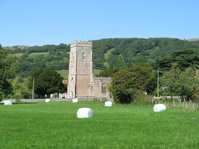
Church of St Lawrence, Westbury-sub-Mendip

The Church of St Lawrence in Westbury-sub-Mendip, Somerset, England was built in the 12th century. It is a Grade II* listed building. == History == The...

Nearby Amenities

Located within 500m of 51.253488,-2.7279243
Rodnye Stoke Natinal Nature Reserve
Information: board
Tourism: information
Lat/Long: 51.2546601/-2.7340655
The data included in this document is from www.openstreetmap.org. The data is made available under ODbL.

Have you been to Big Stoke?

Leave your review of Big Stoke below (or comments, questions and feedback).