Applemore

Settlement in Hampshire New Forest

England

Applemore

A bus for Hythe departing from the Garden City stop, Dibden A 'Blue Star' No.8 service.
A bus for Hythe departing from the Garden City stop, Dibden Credit: John Lucas

Applemore is a small village located in the county of Hampshire, England. Situated on the outskirts of the larger town of Totton, Applemore benefits from a convenient location with easy access to both urban amenities and the natural beauty of the New Forest National Park.

The village is primarily residential and boasts a close-knit community. It is known for its peaceful atmosphere, making it an ideal place for families and retirees seeking a tranquil lifestyle. The housing in Applemore is predominantly traditional in style, with a mix of detached and semi-detached houses, as well as some modern developments. The village also offers a range of amenities, including a primary school, a community center, and several local shops catering to everyday needs.

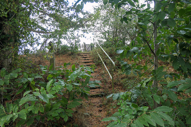
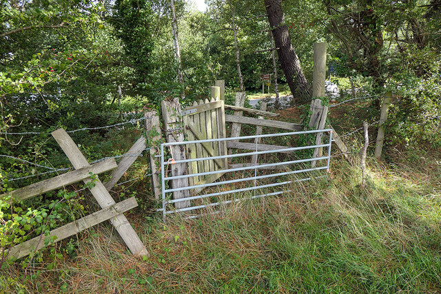
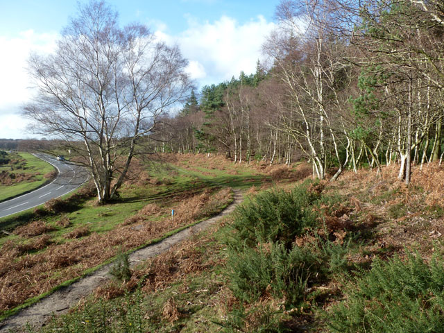
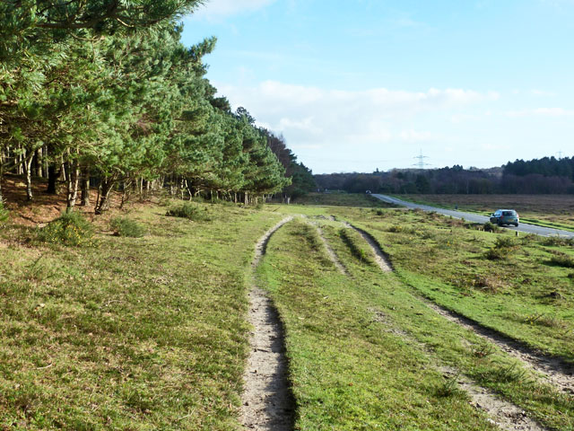
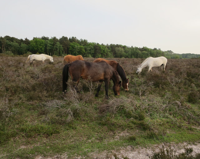
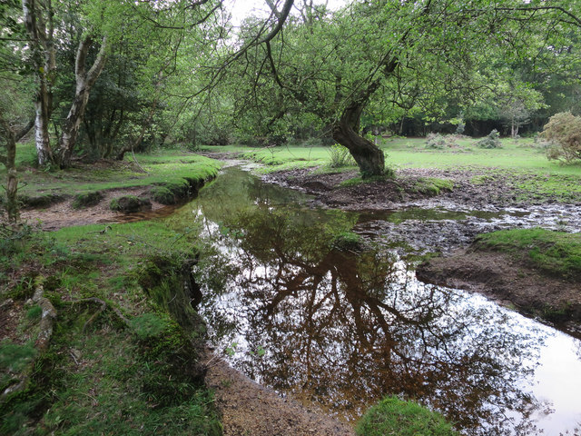
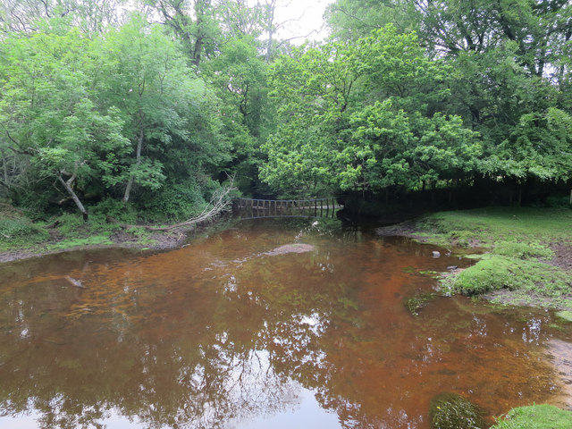
In terms of recreation, Applemore benefits from its proximity to the New Forest, where residents can enjoy scenic walks, cycling, and horse riding. Additionally, the village is well-connected to neighboring towns and cities via a network of roads, making it easy to explore the wider region.

For those seeking cultural or leisure activities, the nearby town of Totton offers a wider range of options, including shopping centers, restaurants, and leisure facilities. Applemore also benefits from good transportation links, with regular bus services connecting the village to Totton and other surrounding areas.

Overall, Applemore provides a peaceful, residential lifestyle with access to both natural beauty and urban conveniences. Its location and community-oriented atmosphere make it an attractive place to live for those seeking a balance between rural and urban living.

If you have any feedback on the listing, please let us know in the comments section below.
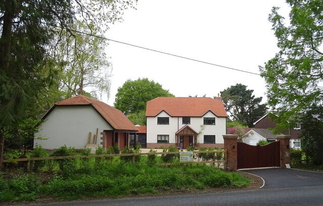
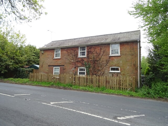
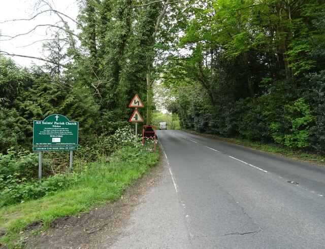
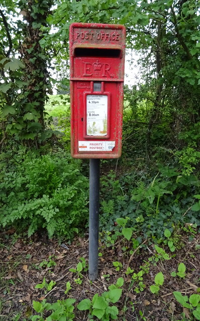
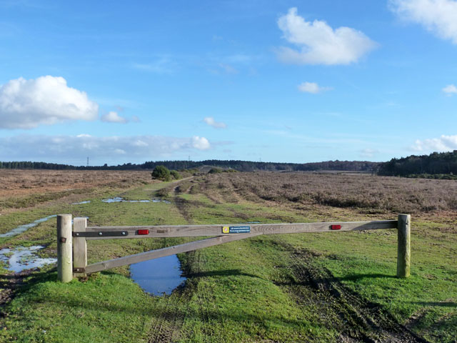
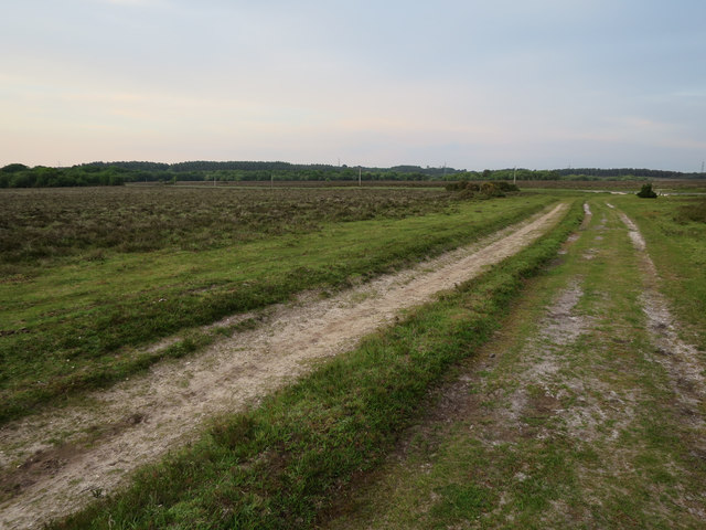
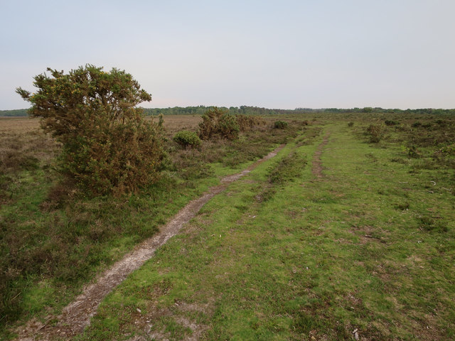
Applemore Images

Images are sourced within 2km of 50.863737/-1.434458 or Grid Reference SU3907. Thanks to Geograph Open Source API. All images are credited.

A bus for Hythe departing from the Garden City stop, Dibden A 'Blue Star' No.8 service.
A bus for Hythe departing from the Garden City stop, Dibden
A 'Blue Star' No.8 service.
A field of harvested sweetcorn A fairly benign looking field, but when attempting to follow a public footpath around the edge, I slipped into a deep furrow and was trapped there in the mud for some 36 hours. A police team and dog eventually found me after establishing my location from the last 'ping' of my phone (which had been rendered useless by water).

After some 16 years of Geographing, I doubt that I shall again be exploring new ground 'off the beaten track', mostly at the exhortations of my family, but the event also shook my own confidence - we shall see if I can overcome that.

It's somewhat ironic that, after wild camping and exploring the wilds of Scotland, The Peaks, Snowdonia etc., it should be in an ordinary field in the county of my birth which has bought my 'wild' Geographing exploration to an end. 

This image was the last that I took before finding myself in my 'predicament'. Thankfully, I was able to rescue the memory cards from my ruined camera gear!
A field of harvested sweetcorn
A fairly benign looking field, but when attempting to follow a public footpath around the edge, I slipped into a deep furrow and was trapped there in the mud for some 36 hours. A police team and dog eventually found me after establishing my location from the last 'ping' of my phone (which had been rendered useless by water). After some 16 years of Geographing, I doubt that I shall again be exploring new ground 'off the beaten track', mostly at the exhortations of my family, but the event also shook my own confidence - we shall see if I can overcome that. It's somewhat ironic that, after wild camping and exploring the wilds of Scotland, The Peaks, Snowdonia etc., it should be in an ordinary field in the county of my birth which has bought my 'wild' Geographing exploration to an end. This image was the last that I took before finding myself in my 'predicament'. Thankfully, I was able to rescue the memory cards from my ruined camera gear!
House on Main Road
House on Main Road
Cottage on Main Road
Main Road towards Dibden
Elizabeth II postbox on Main Road, Dibden Postbox No. SO45 57.
Elizabeth II postbox on Main Road, Dibden
Postbox No. SO45 57.
Bus stop and shelter on Main Road, Dibden Showing position of Postbox No. SO45 57.
Bus stop and shelter on Main Road, Dibden
Showing position of Postbox No. SO45 57.
Steps leading to a footpath which crosses farmland leading to Hangar Corner Leading away from the Marchwood Bypass. Although waymarked, the path is not well maintained and a barrier has been positioned on the other side of the gate in the centre of the view.
Steps leading to a footpath which crosses farmland leading to Hangar Corner
Leading away from the Marchwood Bypass. Although waymarked, the path is not well maintained and a barrier has been positioned on the other side of the gate in the centre of the view.
Barred footpath gateway - public footpath I was able to step over it - just. But it might have been better if I hadn't, given what followed a while later! See <a href="https://www.geograph.org.uk/photo/7305672">SU3908 : A field of harvested sweetcorn</a>. Marchwood bypass is just visible through the foliage.
Barred footpath gateway - public footpath
I was able to step over it - just. But it might have been better if I hadn't, given what followed a while later! See SU3908 : A field of harvested sweetcorn. Marchwood bypass is just visible through the foliage.
Path by Marchwood Inclosure It is certainly used by horses, but whether ridden or free ranging is hard to tell.
Path by Marchwood Inclosure
It is certainly used by horses, but whether ridden or free ranging is hard to tell.
Three strand path Between Marchwood Inclosure on the left and the road to Dibden.
Three strand path
Between Marchwood Inclosure on the left and the road to Dibden.
Forestry track, New Forest Not the usual forestry tack, as the woodland is rather remote, but the sign does say Forestry Commission.
Forestry track, New Forest
Not the usual forestry tack, as the woodland is rather remote, but the sign does say Forestry Commission.
Ponies on Dibden Bottom
Track to Dibden Bottom The area to the left is marked as woodland on the 1:25000 map, but clearly hasn't been for a while.
Track to Dibden Bottom
The area to the left is marked as woodland on the 1:25000 map, but clearly hasn't been for a while.
Track by Beaulieu River Generally the 1:25000 map is much better than the 1:50000 in the New Forest, but in this square there are several discrepancies between the 1:25000 and what is there.
Track by Beaulieu River
Generally the 1:25000 map is much better than the 1:50000 in the New Forest, but in this square there are several discrepancies between the 1:25000 and what is there.
Tributary of Beaulieu River Not the easiest stream to cross.
Tributary of Beaulieu River
Not the easiest stream to cross.
Watergate across Beaulieu River Fenceline crossing the river.
Watergate across Beaulieu River
Fenceline crossing the river.
Show me another place!

Applemore is located at Grid Ref: SU3907 (Lat: 50.863737, Lng: -1.434458)

Administrative County: Hampshire

District: New Forest

Police Authority: Hampshire

What 3 Words

///stacks.hurls.honey. Near Hythe, Hampshire

Related Wikis

Applemore College

Applemore College is a secondary school in Hampshire, England, situated in the village of Dibden Purlieu on the edge of the New Forest. It offers education...
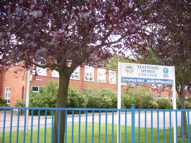
Testwood School

Testwood School (formerly Testwood Sports College) is a secondary school with academy status located in the town of Totton and Eling, England. The school...

Hythe & Dibden F.C.

Hythe & Dibden Football Club is a football club based in Hythe, near Southampton in Hampshire. They are currently members of the Wessex League Premier...

Dibden

Dibden is a small village in Hampshire, England, which dates from the Middle Ages. It is dominated by the nearby settlements of Hythe and Dibden Purlieu...

Noadswood School

Noadswood School is an academy school and specialist Sports College in Dibden Purlieu, Hampshire, England. It provides state funded education for children...

Fawley branch line

The Fawley branch line, also known as the Waterside line is a standard-gauge railway line to Fawley, in the English county of Hampshire. It is on the opposite...

Dibden Purlieu

Dibden Purlieu () is a village situated on the edge of the New Forest in Hampshire, England. The village merges with the nearby town of Hythe. It is in...

Dibden Bay

Dibden Bay is a 229.4-hectare (567-acre) biological Site of Special Scientific Interest (SSSI) between Marchwood and Hythe in Hampshire.Most of this site...

Nearby Amenities

Located within 500m of 50.863737,-1.434458
Parking
Lat/Long: 50.8633/-1.43986
Natural: wetland
Lat/Long: 50.8629/-1.43983
Note: Parallel crossing beind constructed here
Lat/Long: 50.8637811/-1.4308132
Note: proposed choke built here
Lat/Long: 50.8625581/-1.4330807
Barrier: cattle_grid
Lat/Long: 50.8633841/-1.4384125
Colour: grey
Design: barrel
Material: steel
Power: tower
Ref: 4YD 30
Source Ref: interpolation
Structure: lattice
Tower Type: tension
Lat/Long: 50.8619586/-1.434145
Colour: grey
Design: barrel
Line Attachment: suspension
Material: steel
Power: tower
Ref: 4YD 31
Structure: lattice
Lat/Long: 50.86401/-1.4379997
Mini Roundabout
Direction: clockwise
Lat/Long: 50.8641235/-1.43248
Crossing
Bicycle: yes
Crossing: unmarked
Crossing Island: no
Crossing Markings: no
Kerb: flush
Tactile Paving: yes
Lat/Long: 50.8637228/-1.4346519
Crossing
Bicycle: yes
Crossing: unmarked
Crossing Island: no
Crossing Markings: no
Kerb: flush
Tactile Paving: yes
Lat/Long: 50.8636639/-1.4345958
Crossing
Crossing: unmarked
Crossing Island: no
Crossing Markings: no
Kerb: flush
Tactile Paving: yes
Lat/Long: 50.8637648/-1.4351292
Crossing
Crossing: unmarked
Crossing Island: no
Crossing Markings: no
Kerb: flush
Tactile Paving: yes
Lat/Long: 50.8637187/-1.4352796
Bus Stop
Applemore Tesco
Bus: yes
Naptan AtcoCode: 1900HA080287
Naptan Bearing: NW
Naptan CommonName: Applemore Tesco
Naptan Crossing: Opp Rowhill Drive
Naptan Landmark: O/s Tesco
Naptan NaptanCode: hamatjga
Naptan Street: Claypits Lane
Naptan Verified: no
Public Transport: platform
Source: naptan_import
Lat/Long: 50.8644609/-1.4315063
Bus Stop
Applemore Tesco
Alt Name: Tesco Applemore
Bus: yes
Naptan AtcoCode: 1900HA080288
Naptan Bearing: SE
Naptan CommonName: Applemore Tesco
Naptan Crossing: Rowhill Drive
Naptan Landmark: Opp Tesco
Naptan NaptanCode: hamatjgt
Naptan Street: Claypits Lane
Naptan Verified: no
Public Transport: platform
Source: naptan_import
Lat/Long: 50.8643417/-1.4310389
Bus Stop
Cabot Drive
Bus: yes
Naptan AtcoCode: 1900HA080289
Naptan Bearing: SW
Naptan CommonName: Cumberland Way
Naptan Crossing: Cabot Drive
Naptan NaptanCode: hamatjpa
Naptan Street: Claypits Lane
Naptan Verified: no
Public Transport: platform
Source: naptan_import
Lat/Long: 50.864868/-1.4281239
Bus Stop
Cabot Drive
Bus: yes
Naptan AtcoCode: 1900HA080290
Naptan Bearing: NE
Naptan CommonName: Cumberland Way
Naptan Crossing: Cabot Drive
Naptan NaptanCode: hamatjmw
Naptan Street: Claypits Lane
Naptan Verified: no
Public Transport: platform
Source: naptan_import
Lat/Long: 50.8649189/-1.428184
Bus Stop
Applemore Recreation Centre
Bus: yes
Naptan AtcoCode: 1900HA080635
Naptan Bearing: SW
Naptan CommonName: Applemore Recreation Centre
Naptan Crossing: Hythe By-pass
Naptan NaptanCode: hamatjdw
Naptan Street: Claypits Lane
Naptan Verified: no
Public Transport: platform
Source: naptan_import
Lat/Long: 50.8628452/-1.4321228
Applemore
Is In: Dibden
Place: locality
Source Place: https://en.wikipedia.org/wiki/Talk:Applemore
Lat/Long: 50.8634935/-1.434975
Recycling
Lat/Long: 50.8640248/-1.4322174
Post Box
Collection Times: Mo-Fr 16:00; Sa 12:00
Note: Located near exit. Position within store may vary: was moved between visits!
Post Box Design: indoor_pillar
Post Box Type: pillar
Ref: SO45 788
Royal Cypher: EIIR
Royal Cypher Wikidata: Q33102113
Lat/Long: 50.8633795/-1.4326438
Recycling
Lat/Long: 50.8618824/-1.4318922
Atm
Lat/Long: 50.8636037/-1.4328499
Bicycle Parking
Bicycle Parking: stands
Capacity: 6
Covered: yes
Lat/Long: 50.8632289/-1.4326345
Bicycle Parking
Bicycle Parking: stands
Capacity: 14
Covered: no
Lat/Long: 50.8628565/-1.431921
Bicycle Parking
Bicycle Parking: stands
Capacity: 14
Covered: no
Lat/Long: 50.8628937/-1.4318352
Ford: yes
Lat/Long: 50.8611697/-1.4344563
Material: concrete
Pipeline: marker
Substance: gas
Support: pedestal
Lat/Long: 50.8642869/-1.4391621
Material: concrete
Pipeline: marker
Substance: gas
Support: pedestal
Lat/Long: 50.8648256/-1.4405688
Material: concrete
Pipeline: marker
Substance: gas
Support: pedestal
Lat/Long: 50.864622/-1.440217
Diameter: 0'6"
Location: underground
Man Made: manhole
Manhole: water
Material: metal_and_concrete;concrete
Owner: SCWW
Pipeline: valve;marker
Position: 0;0;2'0";180
Substance: water
Support: pedestal
Usage: sluice_valve;wash_out
Lat/Long: 50.8634359/-1.4392616
Material: concrete
Pipeline: marker
Substance: gas
Support: pedestal
Lat/Long: 50.8634745/-1.4380355
Material: concrete
Pipeline: marker
Substance: gas
Support: pedestal
Lat/Long: 50.8633827/-1.4380002
Material: concrete
Pipeline: marker
Substance: gas
Support: pedestal
Lat/Long: 50.8635365/-1.4372055
Material: concrete
Pipeline: marker
Substance: gas
Support: pedestal
Lat/Long: 50.8634524/-1.4370102
Direction: 215
Generator Method: photovoltaic
Generator Output Electricity: yes
Generator Solar Modules: 14
Generator Source: solar
Generator Type: solar_photovoltaic_panel
Location: roof
Power: generator
Lat/Long: 50.8647771/-1.4315855
Direction: 215
Generator Method: photovoltaic
Generator Output Electricity: yes
Generator Solar Modules: 10
Generator Source: solar
Generator Type: solar_photovoltaic_panel
Location: roof
Power: generator
Lat/Long: 50.8657037/-1.4310846
Direction: 215
Generator Method: photovoltaic
Generator Output Electricity: yes
Generator Solar Modules: 10
Generator Source: solar
Generator Type: solar_photovoltaic_panel
Location: roof
Power: generator
Lat/Long: 50.8655016/-1.4314071
Direction: 125
Generator Method: photovoltaic
Generator Output Electricity: yes
Generator Solar Modules: 12
Generator Source: solar
Generator Type: solar_photovoltaic_panel
Location: roof
Power: generator
Lat/Long: 50.8649233/-1.4312619
Post Box
Brand: Royal Mail
Brand Wikidata: Q638098
Collection Times: Mo-Fr 09:00; Sa 07:00
Operator: Royal Mail
Operator Wikidata: Q638098
Post Box Mounting: metal_post
Post Box Type: lamp
Ref: SO45 638D
Royal Cypher: EIIR
Royal Cypher Wikidata: Q33102113
Lat/Long: 50.8663031/-1.4378106
Applemore
Place: hamlet
Lat/Long: 50.8669163/-1.4385048
The data included in this document is from www.openstreetmap.org. The data is made available under ODbL.

Have you been to Applemore?

Leave your review of Applemore below (or comments, questions and feedback).