Marchwood Inclosure

Wood, Forest in Hampshire New Forest

England

Marchwood Inclosure

A bus for Hythe departing from the Garden City stop, Dibden A 'Blue Star' No.8 service.
A bus for Hythe departing from the Garden City stop, Dibden Credit: John Lucas

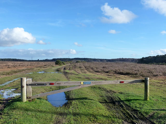
Marchwood Inclosure is a woodland located in the county of Hampshire, England. Spanning an area of approximately 1.5 square kilometers, it is situated near the village of Marchwood, just a few miles southwest of Southampton.

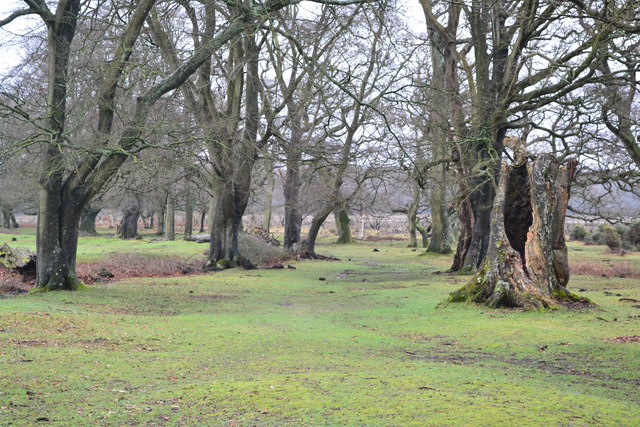
This ancient woodland is primarily composed of mixed broadleaf trees, including oak, beech, and birch, which create a diverse and vibrant ecosystem. The forest floor is covered with a variety of plants, such as bluebells, wood anemones, and wild garlic, which burst into color during the spring months.

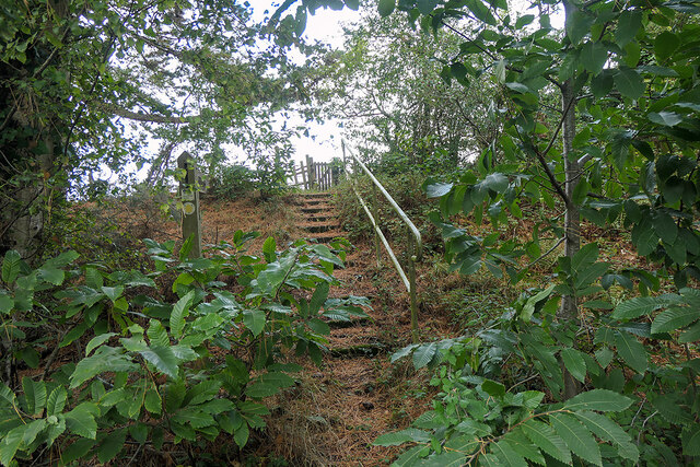
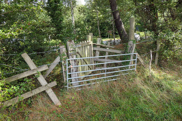
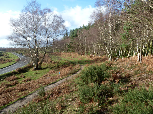
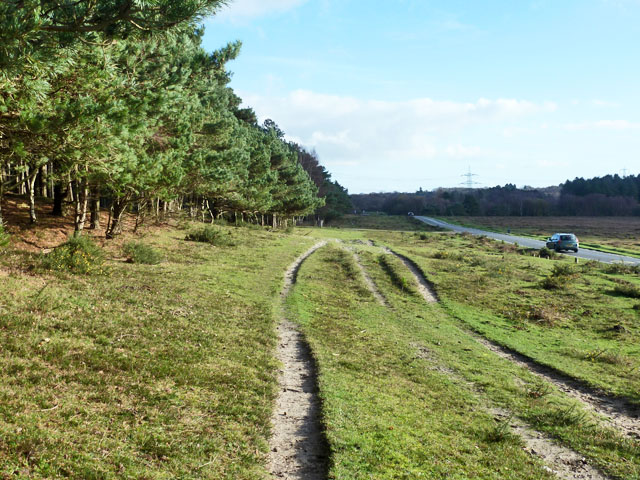
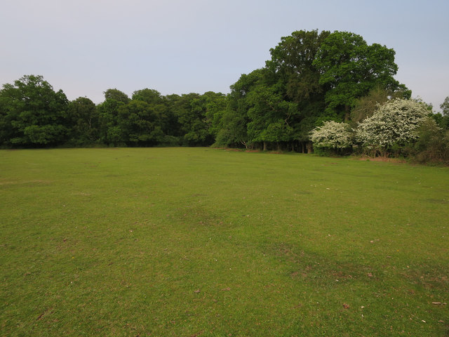
Marchwood Inclosure is a popular destination for nature enthusiasts, walkers, and cyclists. It offers a network of well-maintained footpaths and trails, allowing visitors to explore the woodland at their own pace. The tranquility of the surroundings provides a perfect escape from the hustle and bustle of everyday life.

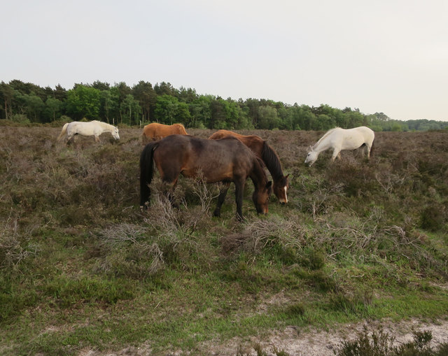
The woodland is also home to a range of wildlife species, including deer, foxes, badgers, and a wide variety of bird species. Birdwatchers can spot woodpeckers, buzzards, and many other avian creatures within the canopy of the trees.

Managed by the Forestry Commission, Marchwood Inclosure is part of the wider New Forest National Park, which encompasses a much larger area of protected woodlands and heathland. The commission is responsible for maintaining the woodland, ensuring its sustainability and preserving its natural beauty for future generations to enjoy.

Overall, Marchwood Inclosure is a remarkable natural treasure, offering a peaceful retreat and a haven for wildlife in the heart of Hampshire.

If you have any feedback on the listing, please let us know in the comments section below.

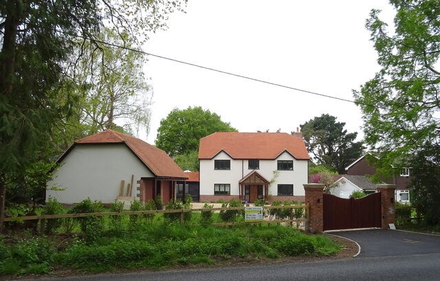
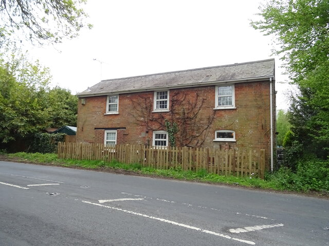
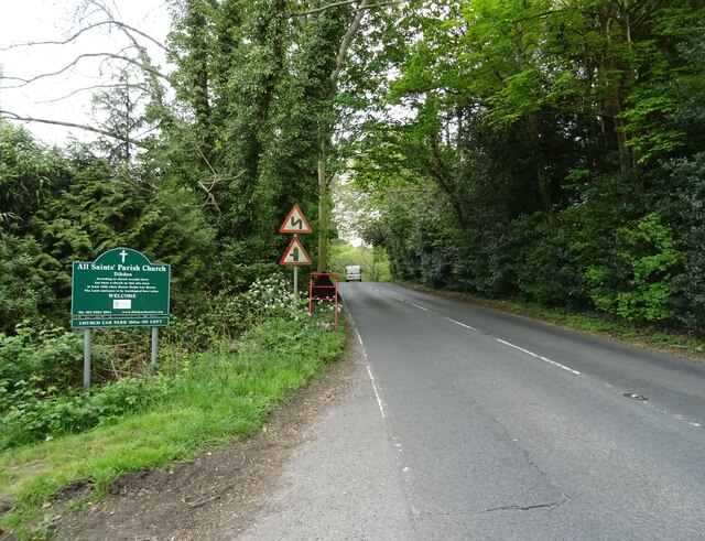
Marchwood Inclosure Images

Images are sourced within 2km of 50.865265/-1.4471343 or Grid Reference SU3907. Thanks to Geograph Open Source API. All images are credited.

A bus for Hythe departing from the Garden City stop, Dibden A 'Blue Star' No.8 service.
A bus for Hythe departing from the Garden City stop, Dibden
A 'Blue Star' No.8 service.
A field of harvested sweetcorn A fairly benign looking field, but when attempting to follow a public footpath around the edge, I slipped into a deep furrow and was trapped there in the mud for some 36 hours. A police team and dog eventually found me after establishing my location from the last 'ping' of my phone (which had been rendered useless by water).

After some 16 years of Geographing, I doubt that I shall again be exploring new ground 'off the beaten track', mostly at the exhortations of my family, but the event also shook my own confidence - we shall see if I can overcome that.

It's somewhat ironic that, after wild camping and exploring the wilds of Scotland, The Peaks, Snowdonia etc., it should be in an ordinary field in the county of my birth which has bought my 'wild' Geographing exploration to an end. 

This image was the last that I took before finding myself in my 'predicament'. Thankfully, I was able to rescue the memory cards from my ruined camera gear!
A field of harvested sweetcorn
A fairly benign looking field, but when attempting to follow a public footpath around the edge, I slipped into a deep furrow and was trapped there in the mud for some 36 hours. A police team and dog eventually found me after establishing my location from the last 'ping' of my phone (which had been rendered useless by water). After some 16 years of Geographing, I doubt that I shall again be exploring new ground 'off the beaten track', mostly at the exhortations of my family, but the event also shook my own confidence - we shall see if I can overcome that. It's somewhat ironic that, after wild camping and exploring the wilds of Scotland, The Peaks, Snowdonia etc., it should be in an ordinary field in the county of my birth which has bought my 'wild' Geographing exploration to an end. This image was the last that I took before finding myself in my 'predicament'. Thankfully, I was able to rescue the memory cards from my ruined camera gear!
Hythe Road
Hythe Road
House on Main Road
House on Main Road
Cottage on Main Road
Main Road towards Dibden
Elizabeth II postbox on Main Road, Dibden Postbox No. SO45 57.
Elizabeth II postbox on Main Road, Dibden
Postbox No. SO45 57.
Bus stop and shelter on Main Road, Dibden Showing position of Postbox No. SO45 57.
Bus stop and shelter on Main Road, Dibden
Showing position of Postbox No. SO45 57.
Steps leading to a footpath which crosses farmland leading to Hangar Corner Leading away from the Marchwood Bypass. Although waymarked, the path is not well maintained and a barrier has been positioned on the other side of the gate in the centre of the view.
Steps leading to a footpath which crosses farmland leading to Hangar Corner
Leading away from the Marchwood Bypass. Although waymarked, the path is not well maintained and a barrier has been positioned on the other side of the gate in the centre of the view.
Barred footpath gateway - public footpath I was able to step over it - just. But it might have been better if I hadn't, given what followed a while later! See <a href="https://www.geograph.org.uk/photo/7305672">SU3908 : A field of harvested sweetcorn</a>. Marchwood bypass is just visible through the foliage.
Barred footpath gateway - public footpath
I was able to step over it - just. But it might have been better if I hadn't, given what followed a while later! See SU3908 : A field of harvested sweetcorn. Marchwood bypass is just visible through the foliage.
Twiggs Lane Straight on the lane becomes Twiggs Lane End, a dead end. The major route bends right to become Arters Lawn.
Twiggs Lane
Straight on the lane becomes Twiggs Lane End, a dead end. The major route bends right to become Arters Lawn.
Path by Marchwood Inclosure It is certainly used by horses, but whether ridden or free ranging is hard to tell.
Path by Marchwood Inclosure
It is certainly used by horses, but whether ridden or free ranging is hard to tell.
Three strand path Between Marchwood Inclosure on the left and the road to Dibden.
Three strand path
Between Marchwood Inclosure on the left and the road to Dibden.
Forestry track, New Forest Not the usual forestry tack, as the woodland is rather remote, but the sign does say Forestry Commission.
Forestry track, New Forest
Not the usual forestry tack, as the woodland is rather remote, but the sign does say Forestry Commission.
Path through the trees near Farrant's Copse
Lawn near Aldermoor Lodge
Ponies on Dibden Bottom
Show me another place!

Marchwood Inclosure is located at Grid Ref: SU3907 (Lat: 50.865265, Lng: -1.4471343)

Administrative County: Hampshire

District: New Forest

Police Authority: Hampshire

What 3 Words

///blitz.ozone.thick. Near Marchwood, Hampshire

Related Wikis

Applemore College

Applemore College is a secondary school in Hampshire, England, situated in the village of Dibden Purlieu on the edge of the New Forest. It offers education...
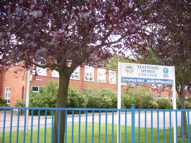
Testwood School

Testwood School (formerly Testwood Sports College) is a secondary school with academy status located in the town of Totton and Eling, England. The school...

Hythe & Dibden F.C.

Hythe & Dibden Football Club is a football club based in Hythe, near Southampton in Hampshire. They are currently members of the Wessex League Premier...

Dibden

Dibden is a small village in Hampshire, England, which dates from the Middle Ages. It is dominated by the nearby settlements of Hythe and Dibden Purlieu...

Noadswood School

Noadswood School is an academy school and specialist Sports College in Dibden Purlieu, Hampshire, England. It provides state funded education for children...

Fawley branch line

The Fawley branch line, also known as the Waterside line is a standard-gauge railway line to Fawley, in the English county of Hampshire. It is on the opposite...

Dibden Bay

Dibden Bay is a 229.4-hectare (567-acre) biological Site of Special Scientific Interest (SSSI) between Marchwood and Hythe in Hampshire.Most of this site...

Marchwood railway station

Marchwood railway station was an intermediate station on the Totton, Hythe and Fawley Light Railway, which was built along the coast of Southampton Water...

Nearby Amenities

Located within 500m of 50.865265,-1.4471343
Colour: grey
Design: barrel
Line Attachment: suspension
Material: steel
Power: tower
Ref: 4YD 32
Structure: lattice
Lat/Long: 50.8659241/-1.4415006
Power: tower
Lat/Long: 50.8676736/-1.4448308
Barrier: cattle_grid
Lat/Long: 50.867336/-1.4533847
Dale Farm House
Tourism: guest_house
Lat/Long: 50.8687682/-1.4451622
Man Made: utility_pole
Material: wood
Ref: 1
Utility: telecom
Lat/Long: 50.8631234/-1.4531823
Man Made: manhole
Manhole: water
Material: metal_and_concrete
Owner: SCWW
Substance: water
Lat/Long: 50.863906/-1.4458384
Diameter: 0'1"
Man Made: manhole
Manhole: water
Material: metal
Pipeline: valve
Usage: air_valve
Lat/Long: 50.8639788/-1.4484913
Diameter: 30 mm
Man Made: manhole
Manhole: water
Material: metal
Pipeline: valve
Usage: air_valve
Lat/Long: 50.8640484/-1.4520241
Diameter: 30 mm
Material: metal
Pipeline: marker
Position: 0;0;1;300
Substance: water
Support: pedestal
Usage: air_valve
Lat/Long: 50.8640478/-1.4520207
Material: concrete
Pipeline: marker
Position: 0;0;0;280
Ref: SCWW
Substance: water
Support: pedestal
Lat/Long: 50.8640647/-1.45059
Diameter: 0'6"
Man Made: manhole
Manhole: water
Material: concrete;metal_and_concrete
Owner: SCWW
Pipeline: marker
Position: 0;0;2'0";180
Substance: water
Support: pedestal
Usage: wash_out
Lat/Long: 50.8639381/-1.4475535
Diameter: 0'1"
Material: metal
Pipeline: marker
Position: 0;0;1'0";180
Substance: water
Support: pedestal
Usage: air_valve
Lat/Long: 50.8639798/-1.4484913
Location Transition: yes
Man Made: utility_pole
Material: wood
Ref: DP 311
Telecom: connection_point
Utility: telecom
Lat/Long: 50.8674251/-1.4532688
Connection Point: tertiary
Location: overground
Material: metal
Owner: BT
Support: pillar
Telecom: connection_point
Lat/Long: 50.86465/-1.4532175
Label: BT
Man Made: manhole
Manhole: telecom
Material: concrete
Lat/Long: 50.867412/-1.4532318
Communication: pole
Connection Point: tertiary
Label: PO
Location: overhead
Location Transition: yes
Man Made: manhole
Manhole: telecom
Material: metal;wood
Ref: DP 312
Telecom: connection_point
Telephone: pole
Lat/Long: 50.8635785/-1.4532351
Location: underground
Owner: Southern Water
Pipeline: valve
Usage: sluice_valve
Lat/Long: 50.8637322/-1.4437227
Diameter: 0'6"
Material: concrete
Pipeline: marker
Position: 0;0;3'0";180
Substance: water
Support: pedestal
Usage: wash_out
Lat/Long: 50.8637385/-1.4437231
Diameter: 0'6"
Man Made: manhole
Manhole: water
Material: metal_and_concrete
Owner: SCWW
Usage: wash_out
Lat/Long: 50.8637273/-1.4437226
Marker: pedestal
Material: concrete
Operator: Esso
Support: pedestal
Utility: oil
Lat/Long: 50.8672061/-1.4534858
Marker: pedestal
Material: concrete
Operator: Esso
Support: pedestal
Utility: oil
Lat/Long: 50.8672016/-1.4533222
Marker: pedestal
Material: concrete
Operator: Esso
Support: pedestal
Utility: oil
Lat/Long: 50.8672458/-1.4533257
Marker: pedestal
Material: concrete
Operator: Esso
Support: pedestal
Utility: oil
Lat/Long: 50.8672525/-1.4535174
Label: BT
Man Made: manhole
Manhole: telecom
Material: concrete
Lat/Long: 50.8671877/-1.4532351
Diameter: 30 mm
Location: underground
Man Made: manhole
Manhole: water
Material: metal
Pipeline: marker;valve
Position: 0;0;2;180
Substance: water
Support: pedestal
Usage: air_valve;sluice_valve
Lat/Long: 50.8636676/-1.4427773
Diameter: 0'6"
Location: underground
Man Made: manhole
Manhole: water
Material: metal_and_concrete;concrete
Owner: Southern Water;SCWW
Pipeline: valve;marker
Position: 0;0;5'0";45
Substance: water
Support: pedestral
Usage: sluice_valve;wash_out
Lat/Long: 50.8648183/-1.4532712
Diameter: 0'3";0'4"
Location: underground
Man Made: manhole
Manhole: water
Material: metal_and_concrete;concrete
Owner: SCWW
Pipeline: valve;marker
Position: 0;0;3'0";55
Substance: water
Support: pedestal
Usage: sluice_valve
Lat/Long: 50.8650326/-1.4536224
Diameter: 0'1"
Man Made: manhole
Manhole: water
Material: metal_and_concrete;concrete
Pipeline: valve;marker
Substance: water
Support: pedestal
Usage: air_valve
Lat/Long: 50.8652265/-1.4538667
Communication: pole
Label: BT
Location Transition: yes
Man Made: manhole
Manhole: telecom
Material: wood;concrete
Telecom: connection_point
Telephone: pole
Lat/Long: 50.8673383/-1.4527161
Man Made: utility_pole
Material: wood
Utility: telecom
Lat/Long: 50.8672759/-1.4520635
Material: concrete
Pipeline: marker
Ref: PO54SU390076TP570
Substance: gas
Support: pedestal
Lat/Long: 50.86692/-1.4467898
Material: concrete
Pipeline: marker
Substance: gas
Support: pedestal
Lat/Long: 50.8667333/-1.4456607
Material: concrete
Pipeline: marker
Substance: gas
Support: pedestal
Lat/Long: 50.8666393/-1.4461897
Material: concrete
Pipeline: marker
Substance: gas
Support: pedestal
Lat/Long: 50.8648256/-1.4405688
Material: concrete
Pipeline: marker
Substance: gas
Support: pedestal
Lat/Long: 50.864622/-1.440217
Give Way
Direction: forward
Lat/Long: 50.863233/-1.4532294
The data included in this document is from www.openstreetmap.org. The data is made available under ODbL.

Have you been to Marchwood Inclosure?

Leave your review of Marchwood Inclosure below (or comments, questions and feedback).