Underlaid Wood

Wood, Forest in Westmorland South Lakeland

England

Underlaid Wood

Farm sheds near Beetham These sheds lie to the south of the River Bela.
Farm sheds near Beetham Credit: Mary and Angus Hogg

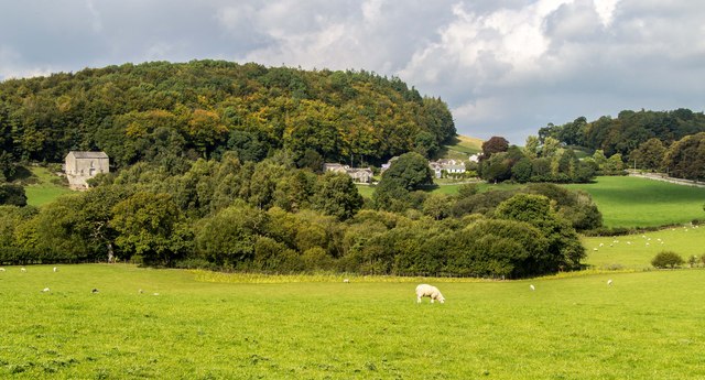
Underlaid Wood, located in the historic county of Westmorland, is a picturesque forest that showcases the natural beauty of the region. Situated in the northwestern part of England, this woodland area spans a significant expanse of land, covering approximately 500 acres. The wood is known for its rich biodiversity and is a haven for various flora and fauna species.

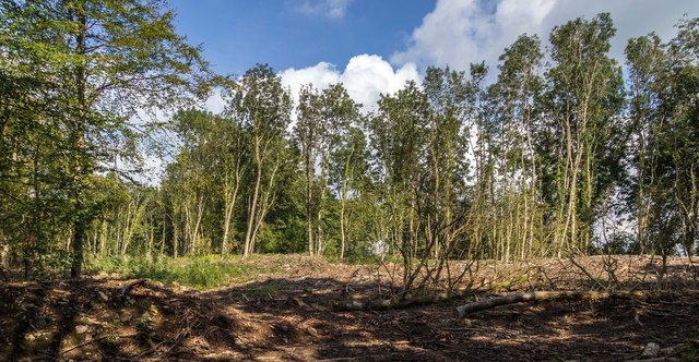
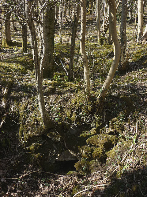
Underlaid Wood is predominantly composed of deciduous trees, including oak, beech, and birch, which create a dense and vibrant canopy. These trees provide ample shade during the summer months, making it an ideal destination for nature enthusiasts and hikers seeking respite from the heat. The forest floor is covered with a lush carpet of ferns, wildflowers, and mosses, adding to the enchanting atmosphere.

The wood is intersected by several hiking trails, ranging from easy strolls to more challenging routes, catering to visitors of all fitness levels. These well-maintained paths guide visitors through the diverse landscape, allowing them to explore the wood's hidden treasures, such as tranquil streams, small waterfalls, and secluded clearings.

Underlaid Wood is also home to a variety of wildlife, including deer, foxes, badgers, and numerous species of birds. Birdwatchers will delight in the opportunity to spot woodpeckers, owls, and various songbirds. The serene ambiance of the wood makes it an ideal location for birdwatching, photography, and nature study.

In addition to its natural beauty, Underlaid Wood offers recreational facilities such as picnic areas, camping spots, and designated areas for wildlife observation. It is a popular destination for family outings, school trips, and nature-based activities organized by local community groups.

Overall, Underlaid Wood, Westmorland, is a captivating forest that showcases the diverse flora and fauna of the region, offering visitors a tranquil escape into nature's embrace.

If you have any feedback on the listing, please let us know in the comments section below.

Underlaid Wood Images

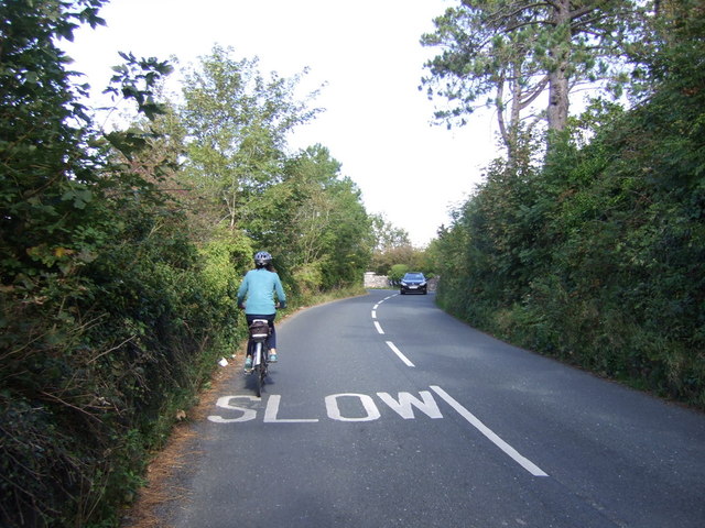
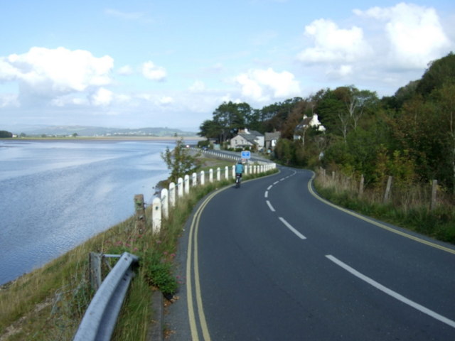
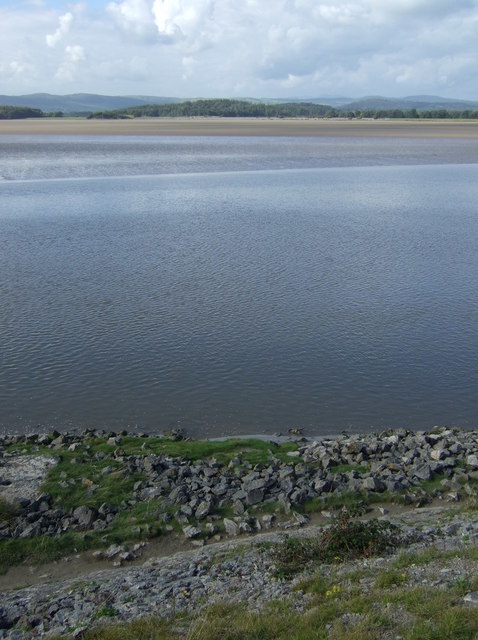
Images are sourced within 2km of 54.204/-2.7940334 or Grid Reference SD4878. Thanks to Geograph Open Source API. All images are credited.

Farm sheds near Beetham These sheds lie to the south of the River Bela.
Farm sheds near Beetham
These sheds lie to the south of the River Bela.
On the A6 The M6 takes most of the traffic away from the old trunk road which makes it less stressful to use.
On the A6
The M6 takes most of the traffic away from the old trunk road which makes it less stressful to use.
A6 The junction of Paradise Lane with the A6.
A6
The junction of Paradise Lane with the A6.
Haverbrack
Haverbrack
Wray Cottages Visible after the felling of trees.
Wray Cottages
Visible after the felling of trees.
Storth Builders Merchants in Storth.
Storth
Builders Merchants in Storth.
The Ship Inn, Sandside
Sign for the Ship Inn, Sandside
Restaurant on Park Road, Sandside
Cycling on Park Road (B5282) Heading north east.
Cycling on Park Road (B5282)
Heading north east.
Dropping down on the coastal road into Sandside Heading north east.
Dropping down on the coastal road into Sandside
Heading north east.
Kent Channel and Milnthorpe Sands
Works entrance off Park Road, Sandside
Limestone outcrop, Haverbrack Bank Like all the hills in the AONB, the bank is composed of carboniferous limestone. Although there are no great pavements or exposures to be seen, it's a pleasant place to wander around on a fine Spring day. Mercifully, the huge Sandside Quarry is not visible from here (screened by the trees on the left). No doubt it will be audible on a working day. Views north over the Kent estuary to the Lakeland fells, Howgills and Dales fells are exceptionally good.
Limestone outcrop, Haverbrack Bank
Like all the hills in the AONB, the bank is composed of carboniferous limestone. Although there are no great pavements or exposures to be seen, it's a pleasant place to wander around on a fine Spring day. Mercifully, the huge Sandside Quarry is not visible from here (screened by the trees on the left). No doubt it will be audible on a working day. Views north over the Kent estuary to the Lakeland fells, Howgills and Dales fells are exceptionally good.
Spring lamb, Spring snow A lamb reclines in warm Spring sunshine whilst overnight snow has briefly whitened the fells of the Yorkshire Dales. Curiously, the higher Lakeland fells were unaffected, possibly due to their closer proximity to the sea.
Spring lamb, Spring snow
A lamb reclines in warm Spring sunshine whilst overnight snow has briefly whitened the fells of the Yorkshire Dales. Curiously, the higher Lakeland fells were unaffected, possibly due to their closer proximity to the sea.
The Deer Shed, Dallam Park The fallow deer that inhabit The Park <a href="https://www.geograph.org.uk/photo/4585838">SD4980 : Fallow deer in The Park, Dallam Tower</a> were nowhere to be seen today.
The Deer Shed, Dallam Park
The fallow deer that inhabit The Park SD4980 : Fallow deer in The Park, Dallam Tower were nowhere to be seen today.
Relaxing in The Park A recently arrived resident of The Park gets some sleep in the warm Spring sunshine. It's obviously hard work running and jumping about all morning.
Relaxing in The Park
A recently arrived resident of The Park gets some sleep in the warm Spring sunshine. It's obviously hard work running and jumping about all morning.
Possible ruined lime kiln, woods west of Haverbrack At first I thought that this hole just west of the footpath might be a natural cave or mine working. A peek inside revealed rough masonry which I took to be the remnants of an old kiln.
Possible ruined lime kiln, woods west of Haverbrack
At first I thought that this hole just west of the footpath might be a natural cave or mine working. A peek inside revealed rough masonry which I took to be the remnants of an old kiln.
Show me another place!

Underlaid Wood is located at Grid Ref: SD4878 (Lat: 54.204, Lng: -2.7940334)

Administrative County: Cumbria

District: South Lakeland

Police Authority: Cumbria

What 3 Words

///negotiators.valve.clocks. Near Arnside, Cumbria

Related Wikis

Hazelslack

Hazelslack is a hamlet in the South Lakeland district, in the English county of Cumbria. It is near the villages of Arnside and Storth. Nearby Hazelslack...

Storth

Storth is a village near Arnside in Cumbria, England, situated near the border with Lancashire. It is in the historic county of Westmorland. The village...

Carr Bank

Carr Bank is a small hamlet near Arnside, Cumbria, England. It is in the civil parish of Beetham in South Lakeland local government district. == References... ==

Slack Head

Slack Head, sometimes written Slackhead, is a hamlet near Beetham, South Lakeland, Cumbria, England. It is in Beetham civil parish. It is a purely residential...

Nearby Amenities

Located within 500m of 54.204,-2.7940334
Ele: 117
Lat/Long: 54.2036021/-2.7873647
Power: pole
Lat/Long: 54.2042955/-2.8011435
Power: pole
Lat/Long: 54.2045935/-2.7997729
Power: pole
Lat/Long: 54.2048869/-2.7983192
Power: pole
Lat/Long: 54.2052007/-2.7968949
Power: pole
Lat/Long: 54.2058125/-2.7939338
Power: pole
Lat/Long: 54.2063145/-2.7931505
Power: pole
Lat/Long: 54.2068181/-2.7923164
Power: pole
Lat/Long: 54.2073232/-2.79156
Power: pole
Lat/Long: 54.2078236/-2.79075
Underlain Wood
Natural: wood
Lat/Long: 54.206965/-2.7954584
Information: board
Tourism: information
Lat/Long: 54.2035861/-2.7874203
Information: board
Tourism: information
Lat/Long: 54.203465/-2.7875258
The data included in this document is from www.openstreetmap.org. The data is made available under ODbL.

Have you been to Underlaid Wood?

Leave your review of Underlaid Wood below (or comments, questions and feedback).