Beetham Fell

Downs, Moorland in Westmorland South Lakeland

England

Beetham Fell

Farm sheds near Beetham These sheds lie to the south of the River Bela.
Farm sheds near Beetham Credit: Mary and Angus Hogg

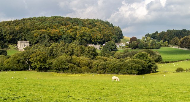
Beetham Fell, located in the historical county of Westmorland in the northwest region of England, is a remarkable landscape that showcases a combination of downs and moorland. Covering an area of approximately 1,500 acres, this stunning natural site is a popular destination for outdoor enthusiasts and nature lovers.

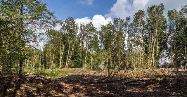
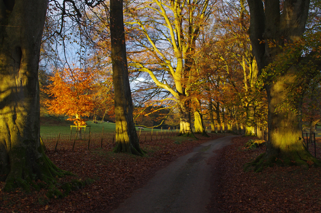
The fell boasts a diverse range of habitats, including limestone pavements, grasslands, heathlands, and woodlands. These habitats provide a rich environment for a variety of plant and animal species to thrive. The limestone pavements, in particular, are a unique feature of Beetham Fell, with their striking crisscross patterns and crevices formed by the erosion of the underlying limestone.

Visitors to Beetham Fell can enjoy panoramic views of the surrounding countryside, with the fells of the Lake District visible in the distance. The area is also home to several walking trails and footpaths, allowing visitors to explore its natural beauty at their own pace.

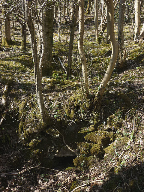
One of the highlights of Beetham Fell is the enchanting Fairy Steps, a narrow limestone cleft that leads to the top of the fell. Legend has it that if one can ascend the steps without touching the sides, they will be granted a wish. This folklore has added an element of mystique and allure to the site, attracting curious visitors from near and far.

Overall, Beetham Fell is a captivating and varied landscape, offering a glimpse into the diverse natural wonders of Westmorland. Its mix of downs, moorland, and limestone pavements make it a truly special place to visit and explore.

If you have any feedback on the listing, please let us know in the comments section below.

Beetham Fell Images

Images are sourced within 2km of 54.202234/-2.7878675 or Grid Reference SD4878. Thanks to Geograph Open Source API. All images are credited.

Farm sheds near Beetham These sheds lie to the south of the River Bela.
Farm sheds near Beetham
These sheds lie to the south of the River Bela.
On the A6 The M6 takes most of the traffic away from the old trunk road which makes it less stressful to use.
On the A6
The M6 takes most of the traffic away from the old trunk road which makes it less stressful to use.
Crossroads at Hale This is where Pye’s Bridge Lane joins the A6 near Beetham.
Crossroads at Hale
This is where Pye’s Bridge Lane joins the A6 near Beetham.
A6 near Hale
A6 near Hale
A6 The junction of Paradise Lane with the A6.
A6
The junction of Paradise Lane with the A6.
Haverbrack
Haverbrack
Wray Cottages Visible after the felling of trees.
Wray Cottages
Visible after the felling of trees.
Limestone outcrop, Haverbrack Bank Like all the hills in the AONB, the bank is composed of carboniferous limestone. Although there are no great pavements or exposures to be seen, it's a pleasant place to wander around on a fine Spring day. Mercifully, the huge Sandside Quarry is not visible from here (screened by the trees on the left). No doubt it will be audible on a working day. Views north over the Kent estuary to the Lakeland fells, Howgills and Dales fells are exceptionally good.
Limestone outcrop, Haverbrack Bank
Like all the hills in the AONB, the bank is composed of carboniferous limestone. Although there are no great pavements or exposures to be seen, it's a pleasant place to wander around on a fine Spring day. Mercifully, the huge Sandside Quarry is not visible from here (screened by the trees on the left). No doubt it will be audible on a working day. Views north over the Kent estuary to the Lakeland fells, Howgills and Dales fells are exceptionally good.
Spring lamb, Spring snow A lamb reclines in warm Spring sunshine whilst overnight snow has briefly whitened the fells of the Yorkshire Dales. Curiously, the higher Lakeland fells were unaffected, possibly due to their closer proximity to the sea.
Spring lamb, Spring snow
A lamb reclines in warm Spring sunshine whilst overnight snow has briefly whitened the fells of the Yorkshire Dales. Curiously, the higher Lakeland fells were unaffected, possibly due to their closer proximity to the sea.
The Deer Shed, Dallam Park The fallow deer that inhabit The Park <a href="https://www.geograph.org.uk/photo/4585838">SD4980 : Fallow deer in The Park, Dallam Tower</a> were nowhere to be seen today.
The Deer Shed, Dallam Park
The fallow deer that inhabit The Park SD4980 : Fallow deer in The Park, Dallam Tower were nowhere to be seen today.
Relaxing in The Park A recently arrived resident of The Park gets some sleep in the warm Spring sunshine. It's obviously hard work running and jumping about all morning.
Relaxing in The Park
A recently arrived resident of The Park gets some sleep in the warm Spring sunshine. It's obviously hard work running and jumping about all morning.
Possible ruined lime kiln, woods west of Haverbrack At first I thought that this hole just west of the footpath might be a natural cave or mine working. A peek inside revealed rough masonry which I took to be the remnants of an old kiln.
Possible ruined lime kiln, woods west of Haverbrack
At first I thought that this hole just west of the footpath might be a natural cave or mine working. A peek inside revealed rough masonry which I took to be the remnants of an old kiln.
Public footpath at Beetham Leading to The Deer Park.
Public footpath at Beetham
Leading to The Deer Park.
Dallam Park View from beneath a mature sycamore on the south side of the park.
Dallam Park
View from beneath a mature sycamore on the south side of the park.
Dallam Park The southern end of the road through the park passes down an avenue of trees. Here, some of the trees are lit by the low late autumn sun.
Dallam Park
The southern end of the road through the park passes down an avenue of trees. Here, some of the trees are lit by the low late autumn sun.
Dallam Park The southern end of the road through the park passes down an avenue of trees. Here, some of the trees are lit by the low late autumn sun.
Dallam Park
The southern end of the road through the park passes down an avenue of trees. Here, some of the trees are lit by the low late autumn sun.
Bracket fungus This is Polyporus squamosus, Shaggy Dryad's Saddle, growing on the dead tree stump on the left in <a href="https://www.geograph.org.uk/photo/5207943">SD4980 : Dallam Park</a>.
Bracket fungus
This is Polyporus squamosus, Shaggy Dryad's Saddle, growing on the dead tree stump on the left in SD4980 : Dallam Park.
Dallam Park Looking across the park. The low late autumn sun is casting shadows of the avenue of trees.
Dallam Park
Looking across the park. The low late autumn sun is casting shadows of the avenue of trees.
Show me another place!

Beetham Fell is located at Grid Ref: SD4878 (Lat: 54.202234, Lng: -2.7878675)

Administrative County: Cumbria

District: South Lakeland

Police Authority: Cumbria

What 3 Words

///makeovers.songbook.darts. Near Arnside, Cumbria

Related Wikis

Storth

Storth is a village near Arnside in Cumbria, England, situated near the border with Lancashire. It is in the historic county of Westmorland. The village...

Slack Head

Slack Head, sometimes written Slackhead, is a hamlet near Beetham, South Lakeland, Cumbria, England. It is in Beetham civil parish. It is a purely residential...

Hazelslack

Hazelslack is a hamlet in the South Lakeland district, in the English county of Cumbria. It is near the villages of Arnside and Storth. Nearby Hazelslack...

Beetham

Beetham is a village and civil parish in the South Lakeland district, in Cumbria, England, situated on the border with Lancashire, 6 miles (10 km) north...

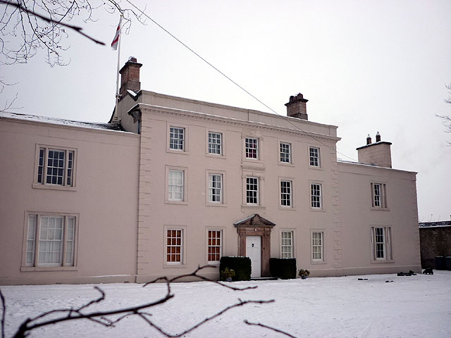
Ashton House, Cumbria

Ashton House is a large country house in Beetham in Cumbria. It is a Grade II* listed building. == History == The house was built in 1678 probably for...

St Michael's Church, Beetham

St Michael's Church is in the village of Beetham, Cumbria, England. It is an active Anglican parish church in the deanery of Kendal, the archdeaconry of...

Carr Bank

Carr Bank is a small hamlet near Arnside, Cumbria, England. It is in the civil parish of Beetham in South Lakeland local government district. == References... ==

Dog Hole Cave

Dog Hole Cave is an archaeologically significant cave near Storth, Cumbria, England. Other names for the cave include Haverbrack Bank Pot, Haverbrack Dog...

Nearby Amenities

Located within 500m of 54.202234,-2.7878675
Ele: 117
Lat/Long: 54.2036021/-2.7873647
Slack Head
Place: hamlet
Wikidata: Q20128089
Lat/Long: 54.201644/-2.7815195
Information: board
Tourism: information
Lat/Long: 54.2035861/-2.7874203
Information: board
Tourism: information
Lat/Long: 54.203465/-2.7875258
The data included in this document is from www.openstreetmap.org. The data is made available under ODbL.

Have you been to Beetham Fell?

Leave your review of Beetham Fell below (or comments, questions and feedback).