Appledore

Settlement in Kent Ashford

England

Appledore

Junction of Moor Lane and Woodchurch Road in Appledore
Junction of Moor Lane and Woodchurch Road in Appledore Credit: Ron Lee

Appledore is a picturesque village located in the county of Kent, in southeast England. Situated on the southern bank of the River Rother, it is part of the Romney Marsh area and lies approximately 9 miles south-west of the historic town of Ashford.

The village of Appledore boasts a rich history, with evidence of human occupation dating back to the Iron Age. It was once an important port, known for its trade connections with Europe and the rest of England. Today, the old port area is still visible, with remnants of its maritime past evident in its charming architecture and cobbled streets.

The village is characterized by its quaint and idyllic setting, surrounded by rolling countryside and picturesque farmland. It is home to a tight-knit community, with a population of around 800 residents. Appledore offers a range of amenities, including a primary school, village hall, church, and several pubs and cafes.

Nature enthusiasts will find Appledore a delight, as it is nestled within the Kent Downs Area of Outstanding Natural Beauty. The surrounding countryside provides ample opportunities for scenic walks, wildlife spotting, and exploring the marshland ecosystem. Additionally, the nearby Royal Military Canal offers further recreational activities, such as boating and fishing.

Appledore is well-connected to other parts of Kent and beyond. The village is served by regular bus services, and the nearby Ashford International Railway Station provides easy access to London and continental Europe.

Overall, Appledore is a charming and historic village, offering a tranquil and scenic escape for residents and visitors alike.

If you have any feedback on the listing, please let us know in the comments section below.
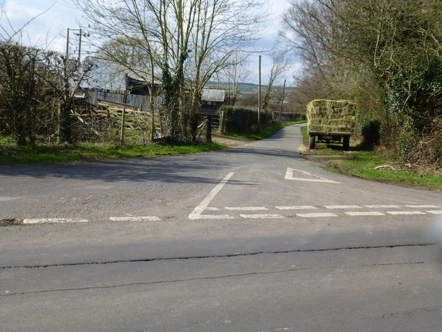
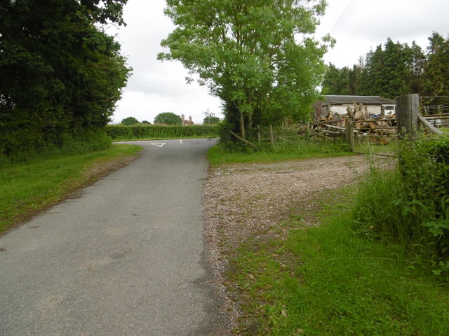
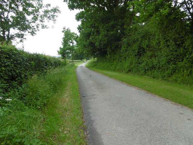
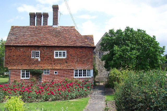
Appledore Images

Images are sourced within 2km of 51.029874/0.789175 or Grid Reference TQ9529. Thanks to Geograph Open Source API. All images are credited.

Junction of Moor Lane and Woodchurch Road in Appledore
Manclark Cottage, Appledore Grade II listed <span class="nowrap"><a title="https://www.historicengland.org.uk/listing/the-list/list-entry/1071027" rel="nofollow ugc noopener" href="https://www.historicengland.org.uk/listing/the-list/list-entry/1071027">Link</a><img style="margin-left:2px;" alt="External link" title="External link - shift click to open in new window" src="https://s1.geograph.org.uk/img/external.png" width="10" height="10"/></span>
Manclark Cottage, Appledore
Grade II listed LinkExternal link
Woodchurch Road crossroads From School Road, Kenardington Road across.

Merrymead house on the corner, Grade II listed <span class="nowrap"><a title="https://www.historicengland.org.uk/listing/the-list/list-entry/1071023" rel="nofollow ugc noopener" href="https://www.historicengland.org.uk/listing/the-list/list-entry/1071023">Link</a><img style="margin-left:2px;" alt="External link" title="External link - shift click to open in new window" src="https://s1.geograph.org.uk/img/external.png" width="10" height="10"/></span>
Woodchurch Road crossroads
From School Road, Kenardington Road across. Merrymead house on the corner, Grade II listed LinkExternal link
Merrymead , Woodchurch Road Grade II listed <span class="nowrap"><a title="https://www.historicengland.org.uk/listing/the-list/list-entry/1071023" rel="nofollow ugc noopener" href="https://www.historicengland.org.uk/listing/the-list/list-entry/1071023">Link</a><img style="margin-left:2px;" alt="External link" title="External link - shift click to open in new window" src="https://s1.geograph.org.uk/img/external.png" width="10" height="10"/></span>
Merrymead , Woodchurch Road
Grade II listed LinkExternal link
Gusbourne Farm
Gusbourne Farm
Gusbourne Farm
Gusbourne Farm
Hornes Place Grade II* listed <span class="nowrap"><a title="https://www.historicengland.org.uk/listing/the-list/list-entry/1362879" rel="nofollow ugc noopener" href="https://www.historicengland.org.uk/listing/the-list/list-entry/1362879">Link</a><img style="margin-left:2px;" alt="External link" title="External link - shift click to open in new window" src="https://s1.geograph.org.uk/img/external.png" width="10" height="10"/></span>
Hornes Place
Grade II* listed LinkExternal link
Hornes Place Oast, Kenardington Road, Appledore Twin square kiln oast house, missing cowls.
Hornes Place Oast, Kenardington Road, Appledore
Twin square kiln oast house, missing cowls.
This Friday House built around 2010/11 in the grounds of Roundabout Friday.
This Friday
House built around 2010/11 in the grounds of Roundabout Friday.
Appledore Heath This is Woodchurch Road approaching the centre of Appledore Heath. At the crossroads ahead School Road is to the right and Kenardington Road is to the left.
Appledore Heath
This is Woodchurch Road approaching the centre of Appledore Heath. At the crossroads ahead School Road is to the right and Kenardington Road is to the left.
Woodchurch Road Woodchurch Road is leaving Appledore Heath here.
Woodchurch Road
Woodchurch Road is leaving Appledore Heath here.
Moor Lane Moor Lane meets Woodchurch Road just ahead.
Moor Lane
Moor Lane meets Woodchurch Road just ahead.
Moor Lane Moor Lane winds across Shirley Moor to eventually meet the B2067 between Woodchurch and Tenterden.
Moor Lane
Moor Lane winds across Shirley Moor to eventually meet the B2067 between Woodchurch and Tenterden.
Hops to the north of Appledore
Sluice on the Royal Military Canal Path
Pillbox alongside the Royal Military Canal
Royal Military Canal Path near Appledore
Royal Military Canal Path towards Higham Farm
Show me another place!

Appledore is located at Grid Ref: TQ9529 (Lat: 51.029874, Lng: 0.789175)

Administrative County: Kent

District: Ashford

Police Authority: Kent

What 3 Words

///yards.headsets.cookery. Near Stone, Kent

Related Wikis

Nearby Amenities

Located within 500m of 51.029874,0.789175
Cafe
Lat/Long: 51.0303985/0.7887086
Post Office
Appledore Post Office
Addr Country: GB
Addr Postcode: TN26 2AF
Brand: Post Office
Brand Wikidata: Q1783168
Contact Website: https://www.postoffice.co.uk/branch-finder/1209256/appledore
Ref Pol Id: 1962
Lat/Long: 51.0314426/0.7887688
Give Way
Direction: backward
Lat/Long: 51.0282632/0.7907705
Give Way
Direction: forward
Lat/Long: 51.0294371/0.7895362
Give Way
Direction: forward
Lat/Long: 51.0284958/0.7903419
Crossing
Lat/Long: 51.0284843/0.7913479
Tourism: camp_site
Lat/Long: 51.0288711/0.7933406
Generator Method: photovoltaic
Generator Output Electricity: yes
Generator Source: solar
Generator Type: solar_photovoltaic_panel
Location: roof
Power: generator
Lat/Long: 51.0278093/0.7928379
Generator Method: photovoltaic
Generator Output Electricity: yes
Generator Source: solar
Generator Type: solar_photovoltaic_panel
Location: roof
Power: generator
Lat/Long: 51.0279949/0.792339
Generator Method: photovoltaic
Generator Output Electricity: yes
Generator Source: solar
Generator Type: solar_photovoltaic_panel
Location: roof
Power: generator
Lat/Long: 51.0331576/0.7876583
Generator Method: photovoltaic
Generator Output Electricity: yes
Generator Source: solar
Generator Type: solar_photovoltaic_panel
Location: roof
Power: generator
Lat/Long: 51.0332673/0.7874048
Defibrillator
Booth: K6
Covered: booth
Defibrillator Location: Inside red phone box, The Street, Appledore
Disused Amenity: telephone
Emergency: defibrillator
Indoor: yes
Man Made: telephone_box
Ref GB The Circuit: 042EB1DC-B852-491B-92B3-AEAC00AD7C9C
Lat/Long: 51.0295916/0.7892508
Bus Stop
The Black Lion
Bus: yes
Flag: no
Naptan AtcoCode: 2400104531
Naptan Bearing: NW
Naptan BusStopType: CUS
Naptan CommonName: The Black Lion
Naptan Indicator: opp
Naptan Landmark: The Black Lion
Naptan NaptanCode: kntjpgaj
Naptan Street: The Street
Naptan Verified: no
Public Transport: platform
Ref: kntjpgaj
Source: NAPTAN
Source Date: 2018-02-19T10:14:00
Lat/Long: 51.0297519/0.7891724
Bus Stop
Recreation Ground
Bus: yes
Flag: no
Naptan AtcoCode: 2400105437
Naptan Bearing: S
Naptan BusStopType: CUS
Naptan CommonName: Recreation Ground
Naptan Indicator: adj
Naptan Landmark: Recreation Ground
Naptan NaptanCode: kntjtapa
Naptan Street: The Street
Public Transport: platform
Ref: kntjtapa
Source: NAPTAN
Source Date: 2018-02-15T11:41:00
Lat/Long: 51.0340521/0.7880042
Bus Stop
The Black Lion
Bus: yes
Flag: no
Naptan AtcoCode: 2400A070260A
Naptan Bearing: SE
Naptan BusStopType: CUS
Naptan CommonName: The Black Lion
Naptan Indicator: adj
Naptan Landmark: The Black Lion
Naptan NaptanCode: kntgdgmt
Naptan Street: The Street
Naptan Verified: no
Public Transport: platform
Ref: kntgdgmt
Source: NAPTAN
Source Date: 2018-02-19T10:15:00
Lat/Long: 51.0296266/0.7895214
Post Box
Operator: Royal Mail
Operator Wikidata: Q638098
Post Box Type: wall
Ref: TN26 269
Royal Cypher: EIIR
Royal Cypher Wikidata: Q33102113
Source: survey
Lat/Long: 51.0314168/0.788577
The data included in this document is from www.openstreetmap.org. The data is made available under ODbL.

Have you been to Appledore?

Leave your review of Appledore below (or comments, questions and feedback).