Hawkeybank Wood

Wood, Forest in Cumberland Eden

England

Hawkeybank Wood

Petterilbank Bridge and ford Why is the deep, rough ford still in use? There's a perfectly good bridge to the side.
Petterilbank Bridge and ford Credit: Andrew Smith

Hawkeybank Wood is a picturesque forest located in Cumberland, England. Covering an area of approximately 100 acres, this wood is a haven of natural beauty and tranquility. The forest is easily accessible and attracts visitors from near and far who seek solace in its peaceful surroundings.

The wood is predominantly composed of deciduous trees, including oak, beech, and birch. These towering trees create a dense canopy, providing shade and shelter for a diverse range of flora and fauna. Wildflowers such as bluebells and primroses carpet the forest floor during spring, creating a vibrant and colorful landscape.

Hawkeybank Wood is also known for its abundant wildlife. The forest is home to various bird species, including woodpeckers, owls, and thrushes, making it a popular destination for birdwatching enthusiasts. Squirrels, foxes, and deer are also commonly spotted within the wood, adding to its natural charm.

The wood is crisscrossed with a network of well-maintained footpaths, allowing visitors to explore its hidden gems. Walking through the forest, visitors can discover tranquil streams, ancient stone walls, and moss-covered rocks. These elements contribute to the magical atmosphere that pervades the wood, transporting visitors to a bygone era.

Overall, Hawkeybank Wood is a captivating destination for nature lovers and those seeking a peaceful retreat. Its diverse ecosystem, picturesque scenery, and abundant wildlife make it a must-visit location for anyone looking to connect with nature and experience the beauty of the Cumberland countryside.

If you have any feedback on the listing, please let us know in the comments section below.

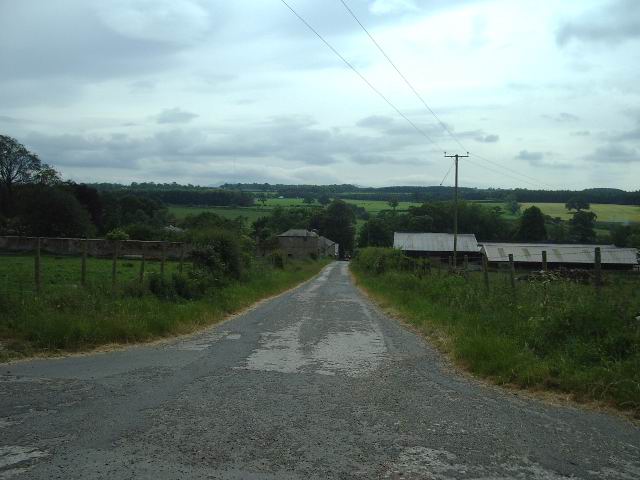
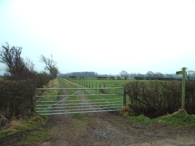
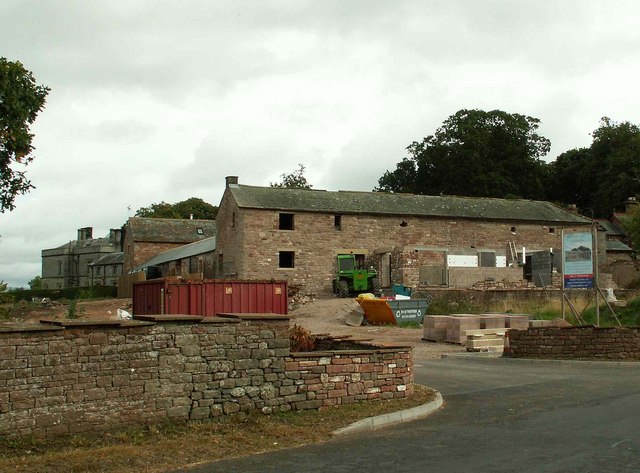
Hawkeybank Wood Images

Images are sourced within 2km of 54.770383/-2.8392387 or Grid Reference NY4642. Thanks to Geograph Open Source API. All images are credited.

Petterilbank Bridge and ford Why is the deep, rough ford still in use? There's a perfectly good bridge to the side.
Petterilbank Bridge and ford
Why is the deep, rough ford still in use? There's a perfectly good bridge to the side.
Ford, Barrow Mill A rough, deep ford through the River Petteril.
Ford, Barrow Mill
A rough, deep ford through the River Petteril.
Road junction The side road off the Calthwaite to Burthwaite road drops down through the trees, under the M6 and then on to High Hesket
Road junction
The side road off the Calthwaite to Burthwaite road drops down through the trees, under the M6 and then on to High Hesket
The Elephant The 1940 map tells us that it was once the Elephant Inn, there is no sign of that today, in fact it has the look of a well to do farmhouse.
The Elephant
The 1940 map tells us that it was once the Elephant Inn, there is no sign of that today, in fact it has the look of a well to do farmhouse.
Entrance to Petteril Grange
M6 Taken from the bridge on the access road to Wood Oaks Mill looking NW
M6
Taken from the bridge on the access road to Wood Oaks Mill looking NW
The Road to Petteril Green
The Road to Troughfoot
Harrington Ling Farm
Milk Churn Stand Milk stand at the entrance to Ling House
Milk Churn Stand
Milk stand at the entrance to Ling House
Ling House
Ling House
Sheep enjoying a portion of mangel (-wurzel)
Footpath to Sceugh Dyke
The Road to Sceugh Mire Farm
Hay Close - farmhouse and tearoom A good example of farm diversification, Hay Close has a maize maze, tearoom and children's play areas. <span class="nowrap"><a title="http://www.hayclose.com" rel="nofollow ugc noopener" href="http://www.hayclose.com">Link</a><img style="margin-left:2px;" alt="External link" title="External link - shift click to open in new window" src="https://s1.geograph.org.uk/img/external.png" width="10" height="10"/></span>
Hay Close - farmhouse and tearoom
A good example of farm diversification, Hay Close has a maize maze, tearoom and children's play areas. LinkExternal link
Hay Close Maize Maze as seen from the road For a much more informative aerial picture, see <a href="https://www.geograph.org.uk/photo/280147">NY4441 : Hay Close Farm Maize Maze</a>.
Hay Close Maize Maze as seen from the road
For a much more informative aerial picture, see NY4441 : Hay Close Farm Maize Maze.
Calthwaite Hall Lodge
Calthwaite - barn conversion in progress The grey building (rear left) is Calthwaite Hall, a Gothic mansion built in the 1830's.
Calthwaite - barn conversion in progress
The grey building (rear left) is Calthwaite Hall, a Gothic mansion built in the 1830's.
Show me another place!

Hawkeybank Wood is located at Grid Ref: NY4642 (Lat: 54.770383, Lng: -2.8392387)

Administrative County: Cumbria

District: Eden

Police Authority: Cumbria

What 3 Words

///chap.starter.smudges. Near Dalston, Cumbria

Related Wikis

Calthwaite

Calthwaite is a small village in rural Cumbria, England, situated between the small market town of Penrith and the larger city of Carlisle. It is within...
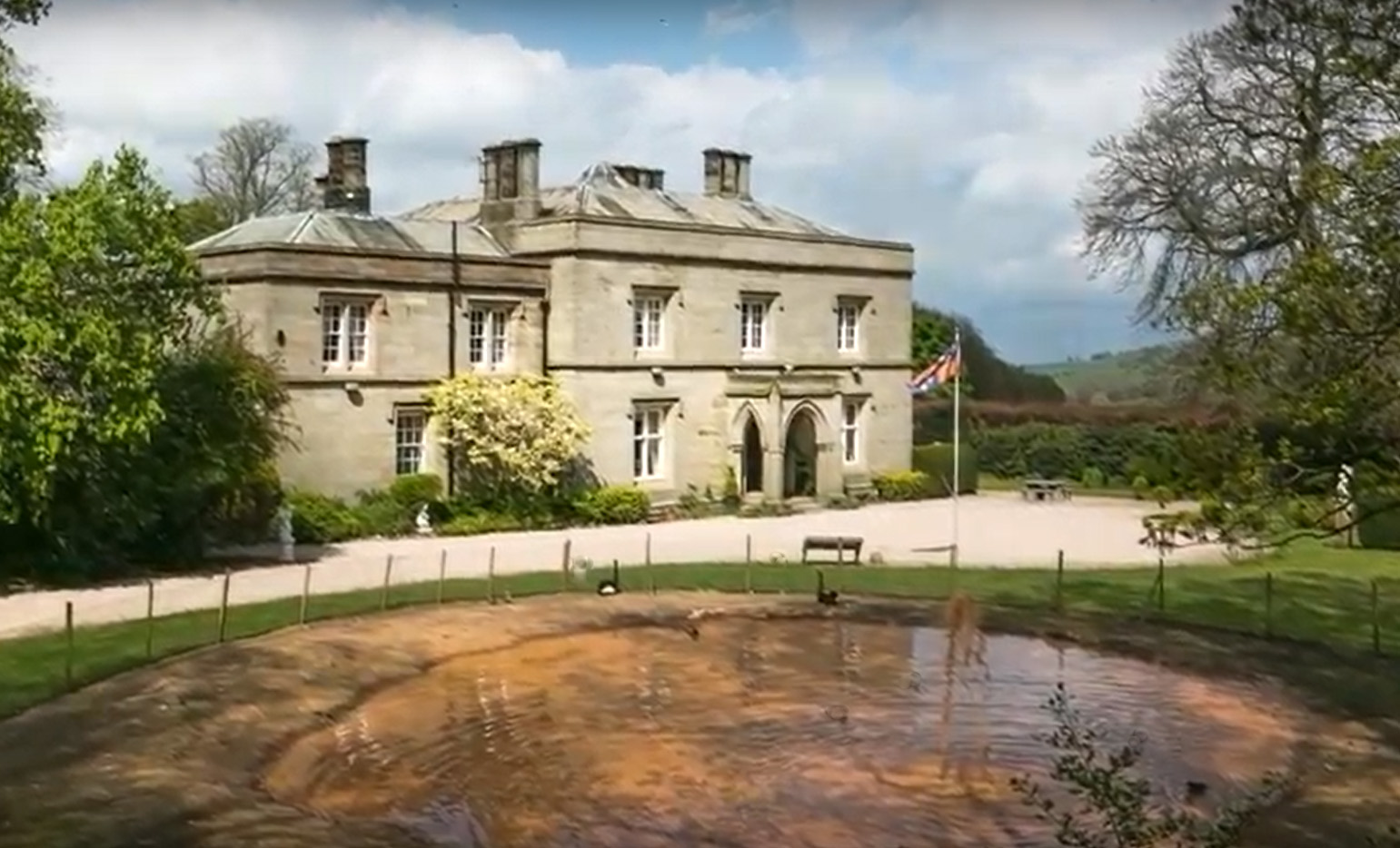
Calthwaite Hall

Calthwaite Hall, near Penrith in Cumbria, England, is a house of historical significance and is Grade II listed on the National Heritage List for England...

Calthwaite railway station

Calthwaite railway station in Hesket parish, was situated on the Lancaster and Carlisle Railway (the West Coast Main Line) between Carlisle and Penrith...

Hesket, Cumbria

Hesket (also Hesket-in-the-Forest) is a large civil parish in the Eden District of Cumbria, England, on the main A6 between Carlisle and Penrith. At the...

Nearby Amenities

Located within 500m of 54.770383,-2.8392387
Created By: Merkaartor 0.12
Lat/Long: 54.767845/-2.8437638
Power: pole
Lat/Long: 54.7742746/-2.8409019
Power: pole
Lat/Long: 54.7736158/-2.8400259
Power: pole
Lat/Long: 54.7729503/-2.8391876
Power: pole
Lat/Long: 54.7724653/-2.8377559
Power: pole
Lat/Long: 54.7720103/-2.8362064
Power: pole
Lat/Long: 54.7714296/-2.8343907
Power: pole
Lat/Long: 54.7710065/-2.8330675
Power: pole
Lat/Long: 54.7705093/-2.8314992
Power: pole
Lat/Long: 54.7721801/-2.8340989
Power: pole
Lat/Long: 54.7730168/-2.8337857
The data included in this document is from www.openstreetmap.org. The data is made available under ODbL.

Have you been to Hawkeybank Wood?

Leave your review of Hawkeybank Wood below (or comments, questions and feedback).