Oakbank Wood

Wood, Forest in Cumberland Eden

England

Oakbank Wood

Petterilbank Bridge and ford Why is the deep, rough ford still in use? There's a perfectly good bridge to the side.
Petterilbank Bridge and ford Credit: Andrew Smith

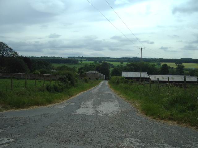
Oakbank Wood is a picturesque forest located in Cumberland, England. Covering an area of approximately 200 acres, this wood is known for its stunning natural beauty and diverse range of flora and fauna. The wood is predominantly made up of oak trees, hence its name, but also features a variety of other tree species such as beech, birch, and ash.

The woodland floor is covered in a thick layer of leaf litter, providing a rich habitat for a wide range of wildlife. Visitors to Oakbank Wood can expect to see an array of woodland creatures including deer, foxes, badgers, and numerous bird species such as woodpeckers and owls. The wood is also home to a variety of insects and small mammals.

Walking trails wind their way through the forest, offering visitors the opportunity to explore this natural wonderland. The atmosphere in Oakbank Wood is peaceful and tranquil, making it an ideal destination for nature enthusiasts and those seeking a break from the hustle and bustle of everyday life.

In addition to its natural beauty, Oakbank Wood also has historical significance. It is believed that the wood has been in existence for hundreds of years and has seen various uses over time, including providing timber for construction and fuel.

Overall, Oakbank Wood is a captivating forest that offers visitors a chance to immerse themselves in nature and experience the serenity of the English countryside. Its lush woodland, diverse wildlife, and rich history make it a must-visit destination for anyone with an appreciation for the great outdoors.

If you have any feedback on the listing, please let us know in the comments section below.

Oakbank Wood Images

Images are sourced within 2km of 54.773498/-2.8254212 or Grid Reference NY4642. Thanks to Geograph Open Source API. All images are credited.

Petterilbank Bridge and ford Why is the deep, rough ford still in use? There's a perfectly good bridge to the side.
Petterilbank Bridge and ford
Why is the deep, rough ford still in use? There's a perfectly good bridge to the side.
Ford, Barrow Mill A rough, deep ford through the River Petteril.
Ford, Barrow Mill
A rough, deep ford through the River Petteril.
A6 junction This minor road on the east side of the A6 goes to Lazonby
A6 junction
This minor road on the east side of the A6 goes to Lazonby
Calthwaite Bridge Road bridge spanning the River Petteril
Calthwaite Bridge
Road bridge spanning the River Petteril
Road junction The side road off the Calthwaite to Burthwaite road drops down through the trees, under the M6 and then on to High Hesket
Road junction
The side road off the Calthwaite to Burthwaite road drops down through the trees, under the M6 and then on to High Hesket
The Elephant The 1940 map tells us that it was once the Elephant Inn, there is no sign of that today, in fact it has the look of a well to do farmhouse.
The Elephant
The 1940 map tells us that it was once the Elephant Inn, there is no sign of that today, in fact it has the look of a well to do farmhouse.
Entrance to Petteril Grange
M6 Taken from the bridge on the access road to Wood Oaks Mill looking NW
M6
Taken from the bridge on the access road to Wood Oaks Mill looking NW
The Road to Petteril Green
The Road to Troughfoot
Gateway Left open for ease during silage making
Gateway
Left open for ease during silage making
Blackrack Bridge There are two Blackrack Bridges over the Blackrack Beck, this is the one on the A6
Blackrack Bridge
There are two Blackrack Bridges over the Blackrack Beck, this is the one on the A6
Shops I would say that this building has been converted from a garage/car showroom because with the coming of the M6, passing trade would have disappeared.
Shops
I would say that this building has been converted from a garage/car showroom because with the coming of the M6, passing trade would have disappeared.
Harrington Ling Farm
Milk Churn Stand Milk stand at the entrance to Ling House
Milk Churn Stand
Milk stand at the entrance to Ling House
Ling House
Ling House
Road junction at Ling Cottages The road to the left goes to Petteril Bank
Road junction at Ling Cottages
The road to the left goes to Petteril Bank
River Petteril  bursting its banks at Troughfoot Farmhouse
River Petteril bursting its banks at Troughfoot Farmhouse
Show me another place!

Oakbank Wood is located at Grid Ref: NY4642 (Lat: 54.773498, Lng: -2.8254212)

Administrative County: Cumbria

District: Eden

Police Authority: Cumbria

What 3 Words

///lessening.uproot.under. Near Wetheral, Cumbria

Related Wikis

Hesket, Cumbria

Hesket (also Hesket-in-the-Forest) is a large civil parish in the Eden District of Cumbria, England, on the main A6 between Carlisle and Penrith. At the...

Calthwaite railway station

Calthwaite railway station in Hesket parish, was situated on the Lancaster and Carlisle Railway (the West Coast Main Line) between Carlisle and Penrith...

High Hesket

High Hesket is a village near the A6 road, in the parish of Hesket, in the Eden district, in the English county of Cumbria. The village was on the A6 road...

Calthwaite Hall

Calthwaite Hall, near Penrith in Cumbria, England, is a house of historical significance and is Grade II listed on the National Heritage List for England...

Nearby Amenities

Located within 500m of 54.773498,-2.8254212
Power: pole
Lat/Long: 54.7755566/-2.8187143
Power: pole
Lat/Long: 54.7760287/-2.8199857
Power: pole
Lat/Long: 54.7770634/-2.8222935
Power: pole
Lat/Long: 54.7700054/-2.8299309
Power: pole
Lat/Long: 54.7775932/-2.8272099
Power: pole
Lat/Long: 54.7766035/-2.8277908
The data included in this document is from www.openstreetmap.org. The data is made available under ODbL.

Have you been to Oakbank Wood?

Leave your review of Oakbank Wood below (or comments, questions and feedback).