Appleby-in-Westmorland

Settlement in Westmorland Eden

England

Appleby-in-Westmorland

Ordnance Survey 1GL Bolt This OS bolt can be found on the east face of St Michael's Church. It marks a point 142.838m above mean sea level.
Ordnance Survey 1GL Bolt Credit: Adrian Dust

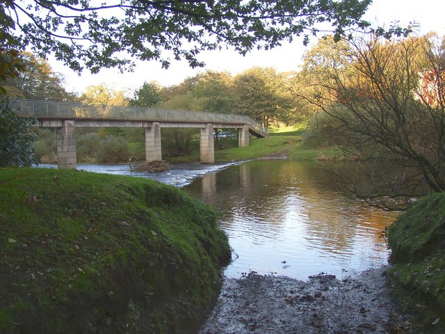
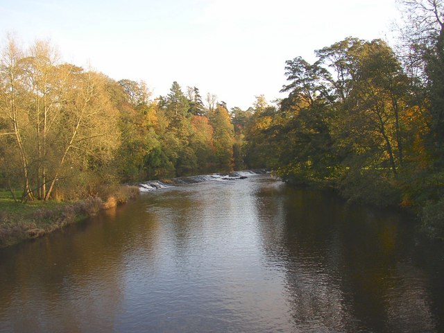
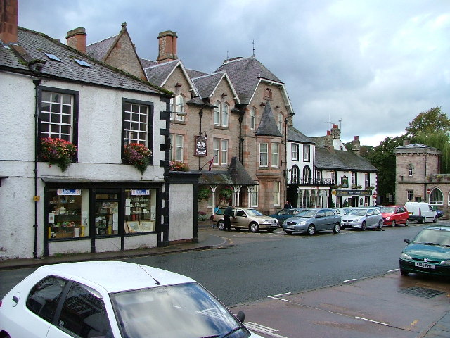
Appleby-in-Westmorland, located in the county of Westmorland in the northwestern region of England, is a small market town with a population of around 3,000 residents. Situated on the banks of the River Eden, it is nestled in the picturesque Eden Valley and is surrounded by stunning countryside.

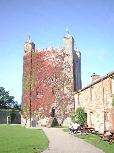
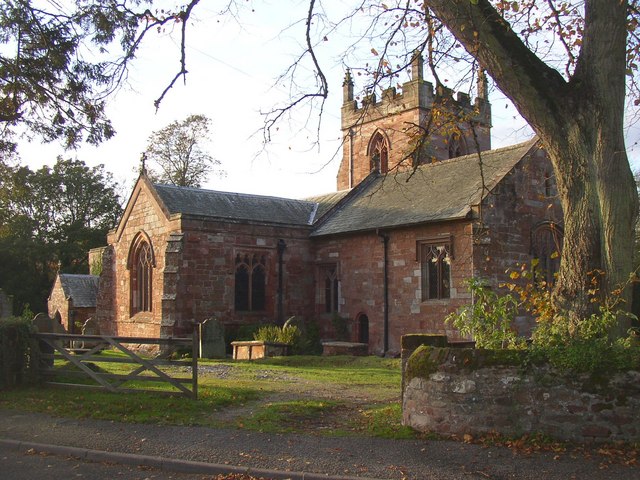
The town's history dates back to the Roman era, with evidence of a Roman fort and a settlement known as "Aballaba" in the vicinity. Over the centuries, Appleby has evolved into a charming town with many historical buildings and landmarks. One such landmark is the 12th-century Appleby Castle, which dominates the skyline and offers glimpses into the town's past.

Appleby-in-Westmorland is renowned for its annual horse fair, one of the largest and oldest in Europe. The fair, which takes place in June, attracts thousands of visitors who come to witness the spectacle of horse trading and traditional gypsy culture. This centuries-old tradition adds a vibrant and lively atmosphere to the town.

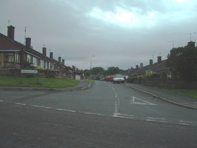
The town center boasts a variety of independent shops, cafes, and restaurants, offering visitors a chance to explore and experience local produce and crafts. The quaint streets and alleys are lined with well-preserved Georgian buildings, adding to the town's charm.

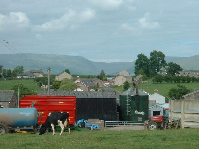
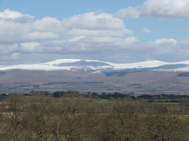
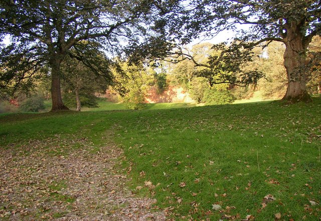
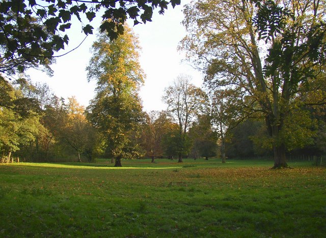
Surrounded by the rolling hills of the Pennines and the Lake District National Park, Appleby-in-Westmorland is a perfect base for outdoor enthusiasts. The town is an ideal starting point for exploring the scenic countryside through numerous walking and cycling trails.

Overall, Appleby-in-Westmorland is a historic market town that offers a glimpse into the rich heritage of Westmorland while providing access to the stunning natural beauty of the surrounding area.

If you have any feedback on the listing, please let us know in the comments section below.

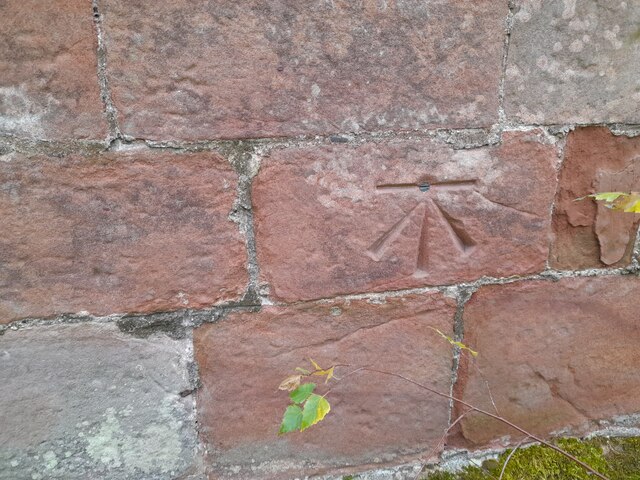
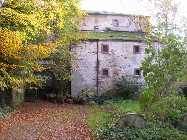
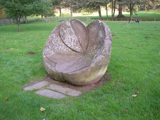
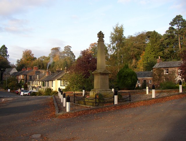
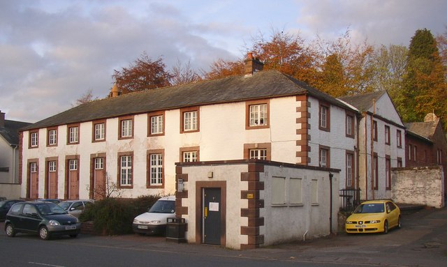
Appleby-in-Westmorland Images

Images are sourced within 2km of 54.577771/-2.491265 or Grid Reference NY6820. Thanks to Geograph Open Source API. All images are credited.

Ordnance Survey 1GL Bolt This OS bolt can be found on the east face of St Michael's Church. It marks a point 142.838m above mean sea level.
Ordnance Survey 1GL Bolt
This OS bolt can be found on the east face of St Michael's Church. It marks a point 142.838m above mean sea level.
Ordnance Survey Cut Mark This OS cut mark can be found on the building NE side of Scattergate. It marks a point 145.460m above mean sea level.
Ordnance Survey Cut Mark
This OS cut mark can be found on the building NE side of Scattergate. It marks a point 145.460m above mean sea level.
Ordnance Survey Cut Mark This OS cut mark can be found on the wall SW side of the road junction. It marks a point 168.155m above mean sea level.
Ordnance Survey Cut Mark
This OS cut mark can be found on the wall SW side of the road junction. It marks a point 168.155m above mean sea level.
Ordnance Survey Cut Mark This OS cut mark can be found on the north face of the railway bridge. It marks a point 158.005m above mean sea level.
Ordnance Survey Cut Mark
This OS cut mark can be found on the north face of the railway bridge. It marks a point 158.005m above mean sea level.
Appleby Castle Caesar's Tower at Appleby Castle built it is thought on the site of a Roman tower.
Appleby Castle
Caesar's Tower at Appleby Castle built it is thought on the site of a Roman tower.
Burrells Village, near Appleby Looking north. The deep incut of High Cup Nick is visible on the horizon
Burrells Village, near Appleby
Looking north. The deep incut of High Cup Nick is visible on the horizon
Pennines from brackenslack
Margarets Way, Appleby-in-Westmorland
Verge, Scattergate, Appleby This is the road to Orton, behind the castle.  Part of the wall around the castle grounds is on the left.
Verge, Scattergate, Appleby
This is the road to Orton, behind the castle. Part of the wall around the castle grounds is on the left.
Bongate Scar, Appleby Not marked as a quarry on the 6" map of 1863, so presumably a natural cliff of red sandstone. The information board by the footbridge reads "The same geological formation that contains oil under the North Sea.  One of the few places in the World where this type of formation is visible." Unfortunately it is in a field with a 'keep out' notice.
Bongate Scar, Appleby
Not marked as a quarry on the 6" map of 1863, so presumably a natural cliff of red sandstone. The information board by the footbridge reads "The same geological formation that contains oil under the North Sea. One of the few places in the World where this type of formation is visible." Unfortunately it is in a field with a 'keep out' notice.
St Michael's Church, Bongate, Appleby The north doorway has a Saxon hogsback gravestone re-used as a lintel.  Bongate was called 'Old Appleby' in medieval times, and is considered to have been the Anglo-saxon settlement that existed before the Normans came.  The south arcade and transept are in the Early Decorated style.  The north tower is an addition of 1885-6.  There are wall-paintings of c.1900 on the west wall and chancel north wall.
St Michael's Church, Bongate, Appleby
The north doorway has a Saxon hogsback gravestone re-used as a lintel. Bongate was called 'Old Appleby' in medieval times, and is considered to have been the Anglo-saxon settlement that existed before the Normans came. The south arcade and transept are in the Early Decorated style. The north tower is an addition of 1885-6. There are wall-paintings of c.1900 on the west wall and chancel north wall.
Riverside field off Castle Bank, Appleby This looks to be parkland belonging to the castle, but also a water meadow that could be flooded when the river level is high.
Riverside field off Castle Bank, Appleby
This looks to be parkland belonging to the castle, but also a water meadow that could be flooded when the river level is high.
Ford and Jubilee Footbridge, Appleby This is a replacement, built in 1971, of the original Jubilee Bridge that was destroyed by a flood in 1968.
Ford and Jubilee Footbridge, Appleby
This is a replacement, built in 1971, of the original Jubilee Bridge that was destroyed by a flood in 1968.
Weir for Bongate Mill, Appleby This crosses the River Eden on a long diagonal, and still looks to be in good condition although the mill closed many years ago.
Weir for Bongate Mill, Appleby
This crosses the River Eden on a long diagonal, and still looks to be in good condition although the mill closed many years ago.
Bongate Mill, Appleby An 18C mill building, Grade II listed. The mill wheel, now removed, was in a big sandstone arch.  It has been a pottery and gallery, but this looks to be closed now.
Bongate Mill, Appleby
An 18C mill building, Grade II listed. The mill wheel, now removed, was in a big sandstone arch. It has been a pottery and gallery, but this looks to be closed now.
Primrose Stone, Appleby One of ten sculptures along the River Eden, commissioned in the late 20C by the East Cumbria Countryside Project. The Primrose Stone is by Joss Smith.
Primrose Stone, Appleby
One of ten sculptures along the River Eden, commissioned in the late 20C by the East Cumbria Countryside Project. The Primrose Stone is by Joss Smith.
Monument, Bongate, Appleby Presumably a War Memorial, but captioned 'Monument' on the 1915 1:2500 map.
Monument, Bongate, Appleby
Presumably a War Memorial, but captioned 'Monument' on the 1915 1:2500 map.
Appleby Castle On top of a hill with views of the Pennines and Eden Valley since Norman times, the privately owned Appleby Castle is possibly only best photographed from this vantage point.
<span class="nowrap"><a title="http://www.visitcumbria.com/pen/appbcas.htm" rel="nofollow ugc noopener" href="http://www.visitcumbria.com/pen/appbcas.htm">Link</a><img style="margin-left:2px;" alt="External link" title="External link - shift click to open in new window" src="https://s1.geograph.org.uk/img/external.png" width="10" height="10"/></span>
Appleby Castle
On top of a hill with views of the Pennines and Eden Valley since Norman times, the privately owned Appleby Castle is possibly only best photographed from this vantage point. LinkExternal link
Show me another place!

Appleby-in-Westmorland is located at Grid Ref: NY6820 (Lat: 54.577771, Lng: -2.491265)

Administrative County: Cumbria

District: Eden

Police Authority: Cumbria

What 3 Words

///cooking.asking.rucksack. Near Appleby-in-Westmorland, Cumbria

Related Wikis

Nearby Amenities

Located within 500m of 54.577771,-2.491265
Appleby-in-Westmorland
Place: town
Source: Survey
Wikidata: Q621540
Wikipedia: en:Appleby-in-Westmorland
Lat/Long: 54.5771885/-2.4893592
Created By: Merkaartor 0.12
Lat/Long: 54.5807159/-2.487997
Post Office
Appleby Post Office
Addr Country: GB
Addr Postcode: CA16 6UZ
Branch: Appleby
Brand: Post Office
Brand Wikidata: Q1783168
Check Date: 2022-05-27
Check Date Opening Hours: 2022-05-27
Contact Website: https://www.postoffice.co.uk/branch-finder/1584103/appleby
Opening Hours: Mo-Fr 08:45-17:30; Sa 08:45-13:00
Ref Pol Id: 3496
Lat/Long: 54.5769508/-2.4910376
St Anne's Hospital
Tourism: attraction
Lat/Long: 54.5760785/-2.4898362
Appleby Tourist Information Centre
Addr City: Appleby-in-Westmorland
Addr Street: Boroughgate
Information: office
Operator: Appleby Town Council
Tourism: information
Lat/Long: 54.577456/-2.4911326
Low Cross
Historic: yes
Tourism: attraction
Lat/Long: 54.5777589/-2.4913775
Parking
Access: yes
Fee: no
Parking: surface
Lat/Long: 54.5776331/-2.4912738
Parking
Access: yes
Created By: Potlatch 0.10b
Fee: no
Parking: street_side
Lat/Long: 54.57716/-2.4909551
Doctors
Description: Appleby Health Centre
Healthcare: doctor
Lat/Long: 54.578966/-2.4941738
Place Of Worship
Kingdom Hall
Denomination: jehovahs_witness
Religion: christian
Lat/Long: 54.5773607/-2.487332
Place Of Worship
Appleby
Denomination: catholic
Religion: christian
Lat/Long: 54.5787664/-2.4877121
Library
Appleby Library
Wikidata: Q54732911
Lat/Long: 54.5779048/-2.492289
Cafe
Corries
Addr Street: Bridge Street
Lat/Long: 54.5780135/-2.4901529
The King's Head
Addr Street: Bridge Street
Building: apartments
Lat/Long: 54.5779357/-2.490396
Cafe
Eden River cafe
Addr City: Appleby-In-Westmorland
Addr Housenumber: 5
Addr Postcode: CA16 6QH
Addr Street: Bridge Street
Fhrs Id: 307313
Source Addr: FHRS Open Data
Lat/Long: 54.5778611/-2.4906621
Cafe
Ashiana
Addr City: Appleby-In-Westmorland
Addr Housenumber: 9
Addr Postcode: CA16 6QH
Addr Street: Bridge Street
Cuisine: indian
Fhrs Id: 307773
Source Addr: FHRS Open Data
Lat/Long: 54.5778011/-2.490968
Pharmacy
Boots
Brand: Boots
Brand Wikidata: Q6123139
Brand Wikipedia: en:Boots UK
Healthcare: pharmacy
Operator: Boots
Website: https://www.boots.com/stores/1401-appleby-wstmorlnd-ca16-6xf
Lat/Long: 54.5775275/-2.4909466
Cafe
Bo Jangles
Lat/Long: 54.5779196/-2.4910429
Restaurant
Spice of Aisa
Addr City: Appleby-in-Westmorland
Addr Street: Bridge Street
Cuisine: asian
Takeaway: yes
Lat/Long: 54.5779787/-2.4907425
Bongate House
Addr City: Appleby-In-Westmorland
Addr Postcode: CA16 6UE
Addr Street: Bongate
Fhrs Id: 307005
Source Addr: FHRS Open Data
Tourism: guest_house
Wikidata: Q26430936
Lat/Long: 54.5761998/-2.4846141
Bus Stop
The Sands
Bench: no
Bin: yes
Bus: yes
Covered: no
Naptan AtcoCode: 090074030099
Naptan Bearing: N
Naptan CommonName: The Sands
Naptan Indicator: opp
Naptan Landmark: Police Station
Naptan NaptanCode: cumawtmt
Naptan Street: The Sands
Public Transport: platform
Shelter: no
Source: naptan_import
Tactile Paving: no
Lat/Long: 54.5784059/-2.4895404
Bus Stop
Coach park by Moot Hall
Bus: yes
Flag: no
Local Ref: AT
Naptan AtcoCode: 090074030101
Naptan Bearing: N
Naptan BusStopType: CUS
Naptan CommonName: Moot Hall Market Square
Naptan Indicator: at
Naptan Landmark: Moot Hall on Market Square
Naptan NaptanCode: cumawtpa
Naptan Street: Boroughgate
Naptan Verified: yes
Public Transport: platform
Shelter: no
Source: naptan_import
Tactile Paving: no
Lat/Long: 54.5772562/-2.491024
Bus Stop
The Sands
Bench: no
Bin: yes
Bus: yes
Naptan AtcoCode: 090074030999
Naptan Bearing: S
Naptan CommonName: Magistrates Court
Naptan Indicator: o/s
Naptan Landmark: Magistrates Court
Naptan NaptanCode: cumawtpm
Naptan Street: The Sands
Naptan Verified: no
Public Transport: platform
Shelter: no
Source: naptan_import
Tactile Paving: no
Lat/Long: 54.5784624/-2.4893162
Bus Stop
Boroughgate
Addr City: Appleby-in-Westmorland
Addr Street: Boroughgate
Bus: yes
Naptan AtcoCode: 090074033334
Naptan Bearing: S
Naptan BusStopType: CUS
Naptan CommonName: Boroughgate
Naptan Indicator: opp
Naptan Landmark: Moot Hall
Naptan NaptanCode: cumawtwp
Naptan Street: Boroughgate
Naptan Verified: no
Public Transport: platform
Source: naptan_import
Lat/Long: 54.5773028/-2.4908945
Bus Stop
Appleby Railway Station
Bus: yes
Local Ref: AT
Naptan AtcoCode: 090074034004
Naptan Bearing: N
Naptan BusStopType: CUS
Naptan CommonName: Appleby Railway Station
Naptan Indicator: at
Naptan Landmark: Railway Station
Naptan NaptanCode: cumdpdwp
Naptan Street: Clifford Street
Naptan Verified: no
Public Transport: platform
Source: naptan_import
Lat/Long: 54.5802001/-2.4868917
Crossing
Check Date Crossing: 2021-07-14
Crossing: zebra
Crossing Island: yes
Tactile Paving: yes
Lat/Long: 54.5784395/-2.4893874
Appleby
Naptan AtcoCode: 9100APBY
Network: National Rail
Network Website: https://www.nationalrail.co.uk/stations/app/
Network Wikidata: Q26334
Old Name: Appleby West
Operator: Northern Rail
Operator Website: https://www.northernrailway.co.uk/stations/appleby
Operator Wikidata: Q85789775
Public Transport: station
Railway: station
Ref Crs: APP
Source: NPE
Train: yes
Wheelchair: limited
Wikidata: Q2169384
Wikipedia: en:Appleby railway station
Lat/Long: 54.58041/-2.486536
Toilets
Broadclose Appleby
Changing Table: yes
Fee: no
Female: yes
Male: yes
Opening Hours: Mo-Su 08:00-18:30
Wheelchair: yes
Lat/Long: 54.5771316/-2.4934886
Toilets
Market Arcade Appleby
Changing Table: yes
Female: yes
Male: yes
Opening Hours: Mo-Su 08:00-21:00
Wheelchair: yes
Lat/Long: 54.5771631/-2.4913909
Power: pole
Lat/Long: 54.5774161/-2.4957955
Railway: switch
Lat/Long: 54.5819243/-2.4893733
Railway: switch
Lat/Long: 54.5813608/-2.4882485
Power: pole
Lat/Long: 54.5781499/-2.4961951
Power: pole
Lat/Long: 54.5800185/-2.4971902
Railway: switch
Lat/Long: 54.5817422/-2.4889552
Railway: switch
Lat/Long: 54.5815852/-2.4885797
Power: pole
Lat/Long: 54.5790562/-2.4966457
Railway: switch
Lat/Long: 54.581411/-2.4884139
Disused Amenity: bank
Old Name: Barclays
Lat/Long: 54.5772715/-2.4907889
Fast Food
Riverside Fish & Chips
Cuisine: fish_and_chips
Lat/Long: 54.5783551/-2.4890937
Disused Amenity: bank
Old Name: HSBC
Lat/Long: 54.577266/-2.4905227
Social Facility
Edenside
Abandoned: yes
Addr Street: Holme Street
Social Facility: group_home
Social Facility For: senior
Lat/Long: 54.5766852/-2.4939048
Addr City: Appleby-in-Westmorland
Addr Street: High Wiend
Disused Shop: yes
Lat/Long: 54.5767983/-2.4917244
A. Stephenson
Addr City: Appleby-In-Westmorland
Addr Housenumber: 23
Addr Postcode: CA16 6XF
Addr Street: Boroughgate
Fhrs Id: 306860
Opening Hours: Mo-Fr 06:00-16:00; Sa 06:00-15:00
Shop: greengrocer
Source Addr: FHRS Open Data
Lat/Long: 54.5770999/-2.4906676
Dents
Shop: newsagent
Lat/Long: 54.5771325/-2.4912094
Tastes of Eden
Addr City: Appleby-In-Westmorland
Addr Housenumber: 1
Addr Postcode: CA16 6QP
Addr Street: Low Wiend
Fhrs Id: 307227
Shop: deli
Source Addr: FHRS Open Data
Lat/Long: 54.5776477/-2.4921098
Pignets - agricultural
Building: garage
Lat/Long: 54.5769293/-2.4923706
Libra
Addr Street: Boroughgate
Shop: clothes
Lat/Long: 54.5773358/-2.4908169
Fuel
Lat/Long: 54.5771372/-2.4924647
Bicycle Parking
Bicycle Parking: stands
Capacity: 6
Check Date Capacity: 2021-07-15
Covered: no
Lat/Long: 54.5768604/-2.4907963
Pub
Crown & Cushion
Addr City: Appleby-In-Westmorland
Addr Housenumber: 2
Addr Postcode: CA16 6XB
Addr Street: Boroughgate
Fhrs Id: 307302
Source Addr: FHRS Open Data
Wikidata: Q26605127
Lat/Long: 54.5777248/-2.4916225
Appleby Bakery
Shop: bakery
Lat/Long: 54.5770594/-2.4911638
Pub
Hare & Hounds
Addr City: Appleby-In-Westmorland
Addr Housenumber: 13
Addr Postcode: CA16 6XF
Addr Street: Boroughgate
Fhrs Id: 307002
Source Addr: FHRS Open Data
Lat/Long: 54.5774605/-2.4908875
Entrance: yes
Lat/Long: 54.5780695/-2.4916074
Eden Community Outdoors
Leisure: park
Note: climbing wall, youth club
Sport: climbing
Lat/Long: 54.5770497/-2.4930688
Cafe
Ruby's
Addr Street: Bridge Street
Lat/Long: 54.5778538/-2.490746
Eco Chic
Addr Street: Bridge Street
Shop: clothes
Lat/Long: 54.577804/-2.4904671
Factor 33
Addr City: Appleby-in-Westmorland
Addr Street: Bridge Street
Opening Hours: Mo-Sa 10:00-16:30; Su 11:00-15:00
Shop: clothes
Lat/Long: 54.578072/-2.4904636
Highlights North
Addr City: Highlights North
Addr Street: Bridge Street
Office: ngo
Lat/Long: 54.5777393/-2.4904142
Appleby Business Services
Addr City: Appleby-in-Westmorland
Addr Street: Bridge Street
Shop: electronics
Lat/Long: 54.5778357/-2.4908234
Cleators
Addr Street: Bridge Street
Shop: electrical
Lat/Long: 54.5777828/-2.4910492
Feel Good Factory
Addr Street: Boroughgate
Shop: food
Lat/Long: 54.5777695/-2.4911093
Arnison Heelis
Office: ngo
Shop: yes
Lat/Long: 54.5776816/-2.4910559
Appleby Flower Basket
Addr Street: Boroughgate
Shop: florist
Lat/Long: 54.5776226/-2.4909803
Addr Housename: Red House
Addr Street: Boroughgate
Building: apartments
Lat/Long: 54.5769842/-2.4906001
Gaynham, King and Mellor
Addr Street: Boroughgate
Office: yes
Lat/Long: 54.5767718/-2.4904763
Cafe
Courtyard Gallery
Addr City: Appleby-In-Westmorland
Addr Housenumber: 32
Addr Postcode: CA16 6XG
Addr Street: Boroughgate
Cuisine: regional
Fhrs Id: 307441
Source Addr: FHRS Open Data
Lat/Long: 54.5763116/-2.4906695
Holberries
Addr Street: Boroughgate
Shop: clothes
Lat/Long: 54.5767969/-2.4908205
Pigneys
Addr Street: High Wiend.
Opening Hours: Mo-Fr 08:30-17:30; Sa 08:30-16:00
Shop: hardware
Lat/Long: 54.576792/-2.4921455
Dentist
Tufton Dental Practice
Addr Street: Chapel Street
Healthcare: dentist
Lat/Long: 54.5773829/-2.4926037
The Salon
Addr City: Appleby-in-Westmorland
Addr Street: Low Wiend
Operator: Karen Noble
Shop: hairdresser
Lat/Long: 54.5776577/-2.4925749
Recycling
Broad Close Recycling
Addr City: Appleby
Addr Street: Chapel Street
Location: overground
Operator: Eden District Council
Recycling Cans: yes
Recycling Clothes: yes
Recycling Glass: yes
Recycling Paper: yes
Recycling Type: container
Lat/Long: 54.5772932/-2.4934989
Scouts Hut
Building: hut
Lat/Long: 54.5789664/-2.4947146
Emerald Laundrette
Shop: laundry
Lat/Long: 54.5776084/-2.4922762
NFU Insurance
Addr City: Appleby-in-Westmorland
Addr Street: Low Wiend
Office: yes
Lat/Long: 54.5778152/-2.4922742
Appleby Age Concert Charity Shop
Addr City: Appleby-in-Westmorland
Addr Street: Low Wiend
Operator: Appleby Age Concern
Shop: yes
Lat/Long: 54.5775941/-2.4923994
Bank
Cumberland Building Society
Addr City: Appleby-in-Westmorland
Addr Street: Bridge Street
Brand: Cumberland Building Society
Brand Wikidata: Q5193845
Brand Wikipedia: en:Cumberland Building Society
Lat/Long: 54.5778902/-2.4911954
Jaybee Knitz
Addr City: Appleby-in-Westmorland
Addr Street: Bridge Street
Disused Shop: yes
Lat/Long: 54.5779445/-2.4909142
Pause for Thought
Addr City: Appleby-in-Westmorland
Addr Street: Bridge Street
Shop: gift
Lat/Long: 54.5779631/-2.490823
Mind
Addr City: Appleby-in-Westmorland
Addr Housename: 3 Market Arcade
Addr Postcode: CA16 6XE
Addr Street: Boroughgate
Brand: Mind
Brand Wikidata: Q3314763
Brand Wikipedia: en:Mind (charity)
Shop: charity
Lat/Long: 54.5771787/-2.4912117
Pets Pantry
Addr City: Appleby-in-Westmorland
Addr Street: Boroughgate
Shop: pet
Lat/Long: 54.5773351/-2.4913165
Tufton Arms
Addr City: Appleby-in-Westmorland
Addr Postcode: CA16 6XA
Addr Street: Boroughgate
Fhrs Id: 306867
Source Addr: FHRS Open Data
Tourism: hotel
Lat/Long: 54.5775558/-2.4914775
Dowding
Addr City: Appleby-in-Westmorland
Addr Housenumber: 12
Addr Postcode: CA16 6XB
Addr Street: Boroughgate
Fhrs Id: 565443
Shop: butcher
Source Addr: FHRS Open Data
Lat/Long: 54.5775207/-2.4914333
Pause for Thought
Addr City: Appleby-in-Westmorland
Addr Street: Boroughgate
Shop: convenience
Lat/Long: 54.5774705/-2.4914033
Sugar and Spice
Addr City: Appleby-in-Westmorland
Addr Housenumber: 16
Addr Postcode: CA16 6XB
Addr Street: Boroughgate
Fhrs Id: 991963
Shop: confectionery
Source Addr: FHRS Open Data
Lat/Long: 54.5774279/-2.491379
Appleby Travel
Addr City: Appleby-in-Westmorland
Addr Street: Boroughgate
Operator: Appleby Travel
Shop: travel_agency
Lat/Long: 54.5773879/-2.4914024
Dentist
The Limes, Shire Hall
Addr City: Appleby-in-Westmorland
Addr Street: The Sands
Healthcare: dentist
Lat/Long: 54.5779183/-2.4885437
Mike Addison
Addr City: Appleby-in-Westmorland
Addr Street: The Sands
Opening Hours: Tu-Sa 09:00-12:30, Tu-Fr 13:30-17:00
Shop: optician
Lat/Long: 54.5778685/-2.4884686
Salon Shari
Addr City: Appleby-in-Westmorland
Addr Street: The Sands
Shop: beauty
Lat/Long: 54.5777799/-2.4883694
Fredrick Potts and Sons, Builders
Craft: builder
Lat/Long: 54.5771469/-2.4875403
Appleby Heritage Centre
Addr City: Appleby in Westmorland
Addr Street: Station Road
Building: college
Lat/Long: 54.5794231/-2.4849547
Bench
Lat/Long: 54.579263/-2.4902172
Waste Basket
Lat/Long: 54.5792237/-2.4901679
Post Box
Operator: Royal Mail
Operator Wikidata: Q638098
Post Box Type: wall
Ref: CA16 76
Royal Cypher: GR
Royal Cypher Wikidata: Q33102273
Lat/Long: 54.5812242/-2.4909446
Post Box
Operator: Royal Mail
Operator Wikidata: Q638098
Post Box Type: wall
Ref: CA16 80
Royal Cypher: GR
Royal Cypher Wikidata: Q33102273
Lat/Long: 54.5809479/-2.4861532
Post Box
Collection Times: Mo-Fr 09:00, Sa 07:00
Ref: CA16 290
Royal Cypher: EIIR
Royal Cypher Wikidata: Q33102113
Lat/Long: 54.5773797/-2.4840838
Post Box
Collection Times: Mo-Fr 17:45, Sa 12:30
Post Box Type: wall
Ref: CA16 158
Royal Cypher: no
Lat/Long: 54.5769907/-2.4910073
Post Box
Operator: Royal Mail
Operator Wikidata: Q638098
Post Box Type: wall
Ref: CA16 77D
Royal Cypher: EIIR
Royal Cypher Wikidata: Q33102113
Lat/Long: 54.5793527/-2.4883877
Appleby
Public Transport: stop_position
Railway: stop
Train: yes
Lat/Long: 54.5803946/-2.4865438
Appleby
Public Transport: stop_position
Railway: stop
Train: yes
Lat/Long: 54.5804184/-2.4864996
Defibrillator
Emergency: defibrillator
Indoor: no
Location: outside Appleby Primary School
Lat/Long: 54.5809885/-2.4859278
Branthwaites
Shop: gift
Lat/Long: 54.577399/-2.490841
Atm
Fee: no
Indoor: yes
Note: is inside Spar
Lat/Long: 54.5776163/-2.4916706
Telephone
Booth: KX100
Covered: booth
Phone: +44 1768 351 403
Lat/Long: 54.577865/-2.4912524
Defibrillator
Addr Postcode: CA16 6XD
Emergency: defibrillator
Indoor: no
Location: in alley below greengrocers on Boroughgate, Appleby
Ref: 2/411
Lat/Long: 54.5772277/-2.4907214
Atm
Check Date: 2021-07-16
Fee: no
Indoor: yes
Note: is inside Dents newsagents
Lat/Long: 54.577108/-2.4912846
Midland Hotel
Addr City: Appleby-in-Westmorland
Addr Housenumber: 25
Addr Postcode: CA16 6TS
Addr Street: Clifford Street
Bar: yes
Camra: yes
Email: info@themidlandhotelappleby.co.uk
Fhrs Id: 307833
Guest House: bed_and_breakfast
Outdoor Seating: yes
Phone: +44 17683 51524
Tourism: hotel
Website: https://www.themidlandhotelappleby.co.uk
Lat/Long: 54.580391/-2.487358
Atm
Brand: Bank of Ireland
Brand Wikidata: Q806689
Check Date: 2021-07-15
Fee: no
Indoor: no
Operator: Bank of Ireland
Operator Wikidata: Q806689
Lat/Long: 54.5769385/-2.4909762
High Wiend (Appleby)
Power: substation
Lat/Long: 54.5767223/-2.491408
Telephone
Booth: KX100
Check Date: 2021-07-16
Covered: booth
Phone: +44 1768 352426
Lat/Long: 54.5802762/-2.486784
Shop: gift
Lat/Long: 54.5778557/-2.4914989
Bench
Source: survey;gps
Lat/Long: 54.5795925/-2.4936685
Appleby Bridge
Information: board
Tourism: information
Lat/Long: 54.5781724/-2.4902634
Bench
Source: survey;gps
Lat/Long: 54.5796267/-2.4918634
Bench
Source: survey;gps
Lat/Long: 54.5787173/-2.494964
Bench
Source: survey;gps
Lat/Long: 54.5785478/-2.4949157
Bench
Source: survey;gps
Lat/Long: 54.5780309/-2.4947092
Bench
Source: survey;gps
Lat/Long: 54.5777706/-2.4946314
Generator Method: photovoltaic
Generator Output Electricity: yes
Generator Source: solar
Generator Type: solar_photovoltaic_panel
Location: roof
Power: generator
Lat/Long: 54.5743066/-2.4946599
Generator Method: photovoltaic
Generator Output Electricity: yes
Generator Source: solar
Generator Type: solar_photovoltaic_panel
Location: roof
Power: generator
Lat/Long: 54.5741185/-2.4930425
Generator Method: photovoltaic
Generator Output Electricity: yes
Generator Source: solar
Generator Type: solar_photovoltaic_panel
Location: roof
Power: generator
Lat/Long: 54.5737904/-2.4922942
Generator Method: photovoltaic
Generator Output Electricity: yes
Generator Source: solar
Generator Type: solar_photovoltaic_panel
Location: roof
Power: generator
Lat/Long: 54.5744636/-2.4935012
Generator Method: photovoltaic
Generator Output Electricity: yes
Generator Source: solar
Generator Type: solar_photovoltaic_panel
Location: roof
Power: generator
Lat/Long: 54.574389/-2.4934663
Generator Method: photovoltaic
Generator Output Electricity: yes
Generator Source: solar
Generator Type: solar_photovoltaic_panel
Location: roof
Power: generator
Lat/Long: 54.5785523/-2.4875547
Generator Method: photovoltaic
Generator Output Electricity: yes
Generator Source: solar
Generator Type: solar_photovoltaic_panel
Location: roof
Power: generator
Lat/Long: 54.5781777/-2.4857791
Generator Method: photovoltaic
Generator Output Electricity: yes
Generator Source: solar
Generator Type: solar_photovoltaic_panel
Location: roof
Power: generator
Lat/Long: 54.5778481/-2.485299
Generator Method: photovoltaic
Generator Output Electricity: yes
Generator Source: solar
Generator Type: solar_photovoltaic_panel
Location: roof
Power: generator
Lat/Long: 54.5786207/-2.4844648
Generator Method: photovoltaic
Generator Output Electricity: yes
Generator Source: solar
Generator Type: solar_photovoltaic_panel
Location: roof
Power: generator
Lat/Long: 54.5800121/-2.4894081
Generator Method: photovoltaic
Generator Output Electricity: yes
Generator Source: solar
Generator Type: solar_photovoltaic_panel
Location: roof
Power: generator
Lat/Long: 54.5800354/-2.4894698
Generator Method: photovoltaic
Generator Output Electricity: yes
Generator Source: solar
Generator Type: solar_photovoltaic_panel
Location: roof
Power: generator
Lat/Long: 54.5799903/-2.4896147
Generator Method: photovoltaic
Generator Output Electricity: yes
Generator Source: solar
Generator Type: solar_photovoltaic_panel
Location: roof
Power: generator
Lat/Long: 54.579098/-2.4935736
Generator Method: photovoltaic
Generator Output Electricity: yes
Generator Source: solar
Generator Type: solar_photovoltaic_panel
Location: roof
Power: generator
Lat/Long: 54.5770817/-2.4928494
Generator Method: photovoltaic
Generator Output Electricity: yes
Generator Source: solar
Generator Type: solar_photovoltaic_panel
Location: roof
Power: generator
Lat/Long: 54.5762531/-2.4930693
Generator Method: photovoltaic
Generator Output Electricity: yes
Generator Source: solar
Generator Type: solar_photovoltaic_panel
Location: roof
Power: generator
Lat/Long: 54.5760028/-2.4930586
Generator Method: photovoltaic
Generator Output Electricity: yes
Generator Source: solar
Generator Type: solar_photovoltaic_panel
Location: roof
Power: generator
Lat/Long: 54.5757742/-2.4926858
Generator Method: photovoltaic
Generator Output Electricity: yes
Generator Source: solar
Generator Type: solar_photovoltaic_panel
Location: roof
Power: generator
Lat/Long: 54.5757851/-2.4926831
Generator Method: photovoltaic
Generator Output Electricity: yes
Generator Source: solar
Generator Type: solar_photovoltaic_panel
Location: roof
Power: generator
Lat/Long: 54.5758084/-2.4906607
Generator Method: photovoltaic
Generator Output Electricity: yes
Generator Source: solar
Generator Type: solar_photovoltaic_panel
Location: roof
Power: generator
Lat/Long: 54.5766594/-2.4898628
Generator Method: photovoltaic
Generator Output Electricity: yes
Generator Source: solar
Generator Type: solar_photovoltaic_panel
Location: roof
Power: generator
Lat/Long: 54.5766376/-2.4899606
Generator Method: photovoltaic
Generator Output Electricity: yes
Generator Source: solar
Generator Type: solar_photovoltaic_panel
Location: roof
Power: generator
Lat/Long: 54.5784591/-2.4864201
Generator Method: photovoltaic
Generator Output Electricity: yes
Generator Source: solar
Generator Type: solar_photovoltaic_panel
Location: roof
Power: generator
Lat/Long: 54.5801329/-2.488765
Generator Method: photovoltaic
Generator Output Electricity: yes
Generator Source: solar
Generator Type: solar_photovoltaic_panel
Location: roof
Power: generator
Lat/Long: 54.5816472/-2.491145
Generator Method: photovoltaic
Generator Output Electricity: yes
Generator Source: solar
Generator Type: solar_photovoltaic_panel
Location: roof
Power: generator
Lat/Long: 54.5817436/-2.4918826
Vending Machine
Payment Card: yes
Payment Others: no
Vending: public_transport_tickets
Lat/Long: 54.5802071/-2.4864734
Toilets
Male: yes
Note: Access via platform
Lat/Long: 54.5804204/-2.4867484
Ticket office
Opening Hours: Mo-Fr 09:00-18:15; Sa 08:00-17:20
Payment Cards: yes
Payment Cash: yes
Shop: ticket
Lat/Long: 54.5803172/-2.486659
Toilets
Female: yes
Note: Access via ticket office
Lat/Long: 54.5803003/-2.4866353
Entrance: main
Lat/Long: 54.5803653/-2.4866086
Railway: railway_crossing
Lat/Long: 54.5815663/-2.4886293
Railway: railway_crossing
Lat/Long: 54.5817534/-2.4888888
Appleby North Junction
Railway: junction
Lat/Long: 54.5820089/-2.4892933
Bench
Backrest: yes
Lat/Long: 54.5804692/-2.48649
Bench
Backrest: yes
Lat/Long: 54.5804327/-2.4864296
Bench
Lat/Long: 54.5804245/-2.4867052
Bench
Backrest: yes
Lat/Long: 54.5801917/-2.4863519
Cumberland Estate Agent
Addr City: Appleby-in-Westmorland
Addr Street: Bridge Street
Office: estate_agent
Lat/Long: 54.5778988/-2.491153
The data included in this document is from www.openstreetmap.org. The data is made available under ODbL.

Have you been to Appleby-in-Westmorland?

Leave your review of Appleby-in-Westmorland below (or comments, questions and feedback).