Crewe Gorse

Wood, Forest in Cheshire

England

Crewe Gorse

Direction Sign – Signpost on the A534 in Farndon parish Located on the southwest side of the crossroads of the A534 Barton Road, the B5130 Sibbersfield Lane and Flennens Brook Road in Farndon parish. 3 missing arms and missing pawn finial. The arms were FARNDON, lost by 2006; A534 / BROXTON, lost by 2009 and A534 / WREXHAM, lost by 2016. See also <a title="https://www.geograph.org.uk/photo/6056663" href="https://www.geograph.org.uk/photo/6056663">Link</a> and <a title="https://www.geograph.org.uk/photo/1129064" href="https://www.geograph.org.uk/photo/1129064">Link</a>.

Milestone Society National ID: CH_SJ4254B
Direction Sign – Signpost on the A534 in Farndon parish Credit: J Haynes

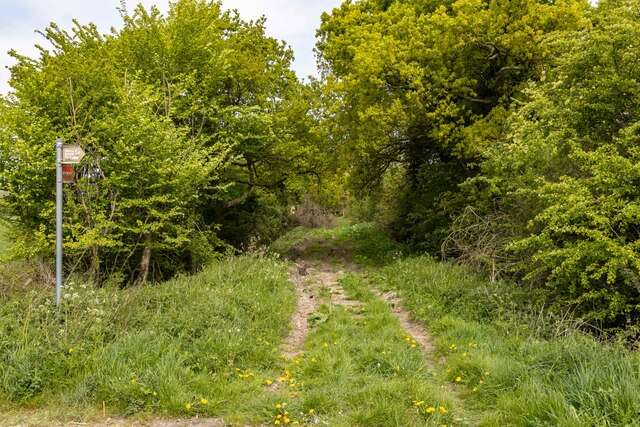
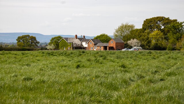
Crewe Gorse is a wood located in the county of Cheshire, England. Covering an area of approximately 100 acres, it is situated near the town of Crewe and is a popular destination for nature enthusiasts and local residents alike.

The wood, also referred to as a forest, is predominantly made up of ancient oak trees, interspersed with beech and birch trees. The dense foliage provides a haven for a variety of wildlife, including deer, foxes, and a wide array of bird species. Birdwatchers flock to Crewe Gorse to catch a glimpse of rare and migratory birds that make the wood their temporary home.

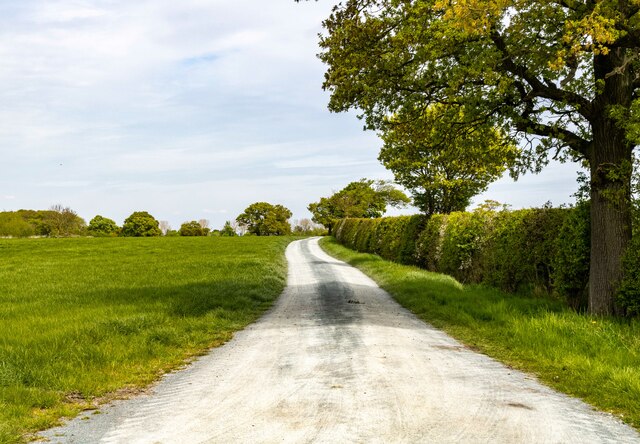
A network of well-marked footpaths wind their way through the wood, allowing visitors to explore its natural beauty. These paths offer opportunities for peaceful walks and picnics, with designated areas for visitors to relax and enjoy the tranquility of the surroundings.

Crewe Gorse is also notable for its historical significance. It is believed to have been a part of the ancient hunting grounds of the Earls of Crewe, dating back several centuries. The wood has been carefully maintained and preserved, ensuring its historical and ecological value is conserved for future generations.

Access to Crewe Gorse is free, with ample parking available nearby. It is open to the public throughout the year, offering an escape from the hustle and bustle of daily life. Whether it's a leisurely stroll, birdwatching, or simply enjoying the serenity of nature, Crewe Gorse provides a charming and picturesque setting for all who visit.

If you have any feedback on the listing, please let us know in the comments section below.

Crewe Gorse Images

Images are sourced within 2km of 53.06656/-2.8643732 or Grid Reference SJ4252. Thanks to Geograph Open Source API. All images are credited.

Direction Sign – Signpost on the A534 in Farndon parish Located on the southwest side of the crossroads of the A534 Barton Road, the B5130 Sibbersfield Lane and Flennens Brook Road in Farndon parish. 3 missing arms and missing pawn finial. The arms were FARNDON, lost by 2006; A534 / BROXTON, lost by 2009 and A534 / WREXHAM, lost by 2016. See also <a title="https://www.geograph.org.uk/photo/6056663" href="https://www.geograph.org.uk/photo/6056663">Link</a> and <a title="https://www.geograph.org.uk/photo/1129064" href="https://www.geograph.org.uk/photo/1129064">Link</a>.

Milestone Society National ID: CH_SJ4254B
Direction Sign – Signpost on the A534 in Farndon parish
Located on the southwest side of the crossroads of the A534 Barton Road, the B5130 Sibbersfield Lane and Flennens Brook Road in Farndon parish. 3 missing arms and missing pawn finial. The arms were FARNDON, lost by 2006; A534 / BROXTON, lost by 2009 and A534 / WREXHAM, lost by 2016. See also Link and Link. Milestone Society National ID: CH_SJ4254B
By Holt Green Quarter of a mile to Farndon, and another country.
By Holt Green
Quarter of a mile to Farndon, and another country.
Byway Byway to Rowley Hill Farm.
Byway
Byway to Rowley Hill Farm.
Meadow View
Meadow View
Wetreins Lane Field access off Wetreins Lane.
Wetreins Lane
Field access off Wetreins Lane.
Barton Road Barton Road, the old A41.
Barton Road
Barton Road, the old A41.
Holt Castle The remains of Holt Castle seen from the south-east. Holt castle has undergone a four year restoration project (funded by Wrexham Heritage Service with financial assistance from the Rural Development Plan for Wales) and re-opened in June 2015.
The restoration involved the removal of vegetation to conserve the remaining masonry and installing new and improved interpretation boards. A new staircase has also been installed to allow access to the castle's courtyard.

*Source: Wrexham.com

Wikipedia <span class="nowrap"><a title="https://en.wikipedia.org/wiki/Holt_Castle" rel="nofollow ugc noopener" href="https://en.wikipedia.org/wiki/Holt_Castle">Link</a><img style="margin-left:2px;" alt="External link" title="External link - shift click to open in new window" src="https://s1.geograph.org.uk/img/external.png" width="10" height="10"/></span>
Holt Castle
The remains of Holt Castle seen from the south-east. Holt castle has undergone a four year restoration project (funded by Wrexham Heritage Service with financial assistance from the Rural Development Plan for Wales) and re-opened in June 2015. The restoration involved the removal of vegetation to conserve the remaining masonry and installing new and improved interpretation boards. A new staircase has also been installed to allow access to the castle's courtyard. *Source: Wrexham.com Wikipedia LinkExternal link
Holt Castle The remains of Holt Castle seen from the north-east showing the new staircase. Holt castle has undergone a four year restoration project (funded by Wrexham Heritage Service with financial assistance from the Rural Development Plan for Wales) and re-opened in June 2015.
The restoration involved the removal of vegetation to conserve the remaining masonry and installing new and improved interpretation boards. A new staircase has also been installed to allow access to the castle's courtyard.

*Source: Wrexham.com

Wikipedia <span class="nowrap"><a title="https://en.wikipedia.org/wiki/Holt_Castle" rel="nofollow ugc noopener" href="https://en.wikipedia.org/wiki/Holt_Castle">Link</a><img style="margin-left:2px;" alt="External link" title="External link - shift click to open in new window" src="https://s1.geograph.org.uk/img/external.png" width="10" height="10"/></span>
Holt Castle
The remains of Holt Castle seen from the north-east showing the new staircase. Holt castle has undergone a four year restoration project (funded by Wrexham Heritage Service with financial assistance from the Rural Development Plan for Wales) and re-opened in June 2015. The restoration involved the removal of vegetation to conserve the remaining masonry and installing new and improved interpretation boards. A new staircase has also been installed to allow access to the castle's courtyard. *Source: Wrexham.com Wikipedia LinkExternal link
Holt Castle The remains of Holt Castle seen from the south-west. Holt castle has undergone a four year restoration project (funded by Wrexham Heritage Service with financial assistance from the Rural Development Plan for Wales) and re-opened in June 2015.
The restoration involved the removal of vegetation to conserve the remaining masonry and installing new and improved interpretation boards. A new staircase has also been installed to allow access to the castle's courtyard.

*Source: Wrexham.com

The same view of Holt Castle before restoration <a href="https://www.geograph.org.uk/photo/3024793">SJ4153 : Holt Castle</a>

Wikipedia <span class="nowrap"><a title="https://en.wikipedia.org/wiki/Holt_Castle" rel="nofollow ugc noopener" href="https://en.wikipedia.org/wiki/Holt_Castle">Link</a><img style="margin-left:2px;" alt="External link" title="External link - shift click to open in new window" src="https://s1.geograph.org.uk/img/external.png" width="10" height="10"/></span>
Holt Castle
The remains of Holt Castle seen from the south-west. Holt castle has undergone a four year restoration project (funded by Wrexham Heritage Service with financial assistance from the Rural Development Plan for Wales) and re-opened in June 2015. The restoration involved the removal of vegetation to conserve the remaining masonry and installing new and improved interpretation boards. A new staircase has also been installed to allow access to the castle's courtyard. *Source: Wrexham.com The same view of Holt Castle before restoration SJ4153 : Holt Castle Wikipedia LinkExternal link
Ordnance Survey Flush Bracket S1198 This can be found on the wall of St Chad's Church in Holt.
For more detail see : <span class="nowrap"><a title="http://www.bench-marks.org.uk/bm2487" rel="nofollow ugc noopener" href="http://www.bench-marks.org.uk/bm2487">Link</a><img style="margin-left:2px;" alt="External link" title="External link - shift click to open in new window" src="https://s1.geograph.org.uk/img/external.png" width="10" height="10"/></span>
Ordnance Survey Flush Bracket S1198
This can be found on the wall of St Chad's Church in Holt. For more detail see : LinkExternal link
The Church of St Chad at Holt Viewed from the south-west.
The Church of St Chad at Holt
Viewed from the south-west.
Remains of Holt Castle near Wrexham
Village cross at Holt near Wrexham
Holt near Wrexham - St Chad's Church (English Civil War damage interior) Musket shot damage on the interior west wall of St Chad's Church.
Holt near Wrexham - St Chad's Church (English Civil War damage interior)
Musket shot damage on the interior west wall of St Chad's Church.
Holt near Wrexham - St Chad's Church (holes cut in north door during English Civil War) There are three holes in the middle of the north door on St Chad's Church which were cut during the English civil War so that muskets could be put through from within.
Holt near Wrexham - St Chad's Church (holes cut in north door during English Civil War)
There are three holes in the middle of the north door on St Chad's Church which were cut during the English civil War so that muskets could be put through from within.
Holt near Wrexham - St Chad's Church
Farndon Boarding Kennels and Cattery At the junction of the B5130 and Barton Road.
Farndon Boarding Kennels and Cattery
At the junction of the B5130 and Barton Road.
Thatched cottage on Barton Road
Show me another place!

Crewe Gorse is located at Grid Ref: SJ4252 (Lat: 53.06656, Lng: -2.8643732)

Unitary Authority: Cheshire West and Chester

Police Authority: Cheshire

What 3 Words

///grandest.flopped.dates. Near Holt, Wrexham

Related Wikis

Crewe-by-Farndon

Crewe-by-Farndon is a settlement and former civil parish, now in the parish of Farndon, in the borough of Cheshire West and Chester and ceremonial county...

Crewe Hill

Crewe Hill is a country house near Crewe by Farndon, to the southeast of the village of Farndon, Cheshire, England. It was enlarged from a farmhouse for...

Maelor Rural District

Maelor was a rural district in the administrative county of Flintshire, Wales, from 1894 to 1974. The area approximated to the hundred of Maelor or English...

Overton Rural District

Overton Rural District was formed by the Local Government Act 1894 which created numerous administrative areas around the country. The district was located...

Caldecott, Cheshire

Caldecott is a former civil parish, now in the parish of Shocklach Oviatt and District, in the Borough of Cheshire West and Chester and ceremonial county...
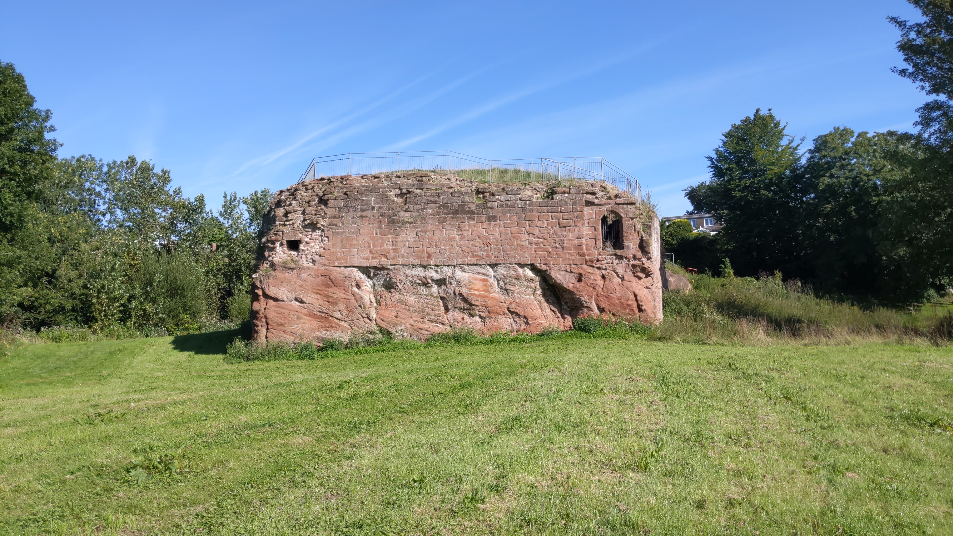
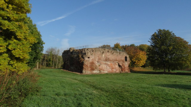
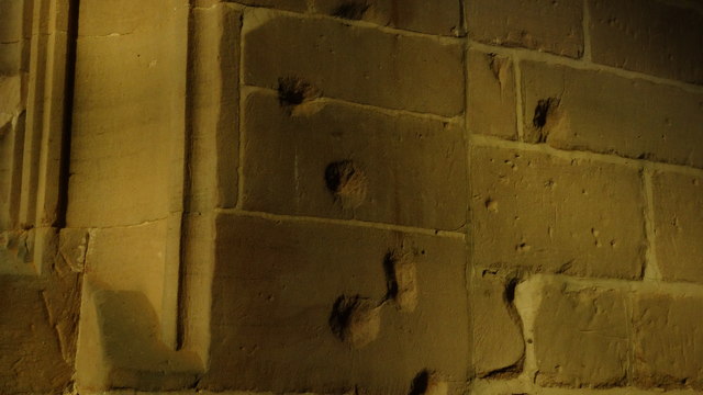
Holt Castle

Holt Castle (Welsh: Castell Holt) was a medieval castle in the village of Holt, Wrexham County Borough, Wales. Work began in the 13th century during the...

Holt, Wrexham

Holt is a medieval village and community in Wrexham County Borough, Wales. It is situated on the border with England and in the historic county of Denbighshire...

St Chad's Church, Holt

St Chad's Church, Holt, is in the village of Holt, Wrexham County Borough, Wales overlooking the River Dee and the Wales–England border. It is an active...

Nearby Amenities

Located within 500m of 53.06656,-2.8643732
The data included in this document is from www.openstreetmap.org. The data is made available under ODbL.

Have you been to Crewe Gorse?

Leave your review of Crewe Gorse below (or comments, questions and feedback).