Caldecott Green

Settlement in Cheshire

England

Caldecott Green

Byway Byway to Rowley Hill Farm.
Byway Credit: Peter McDermott

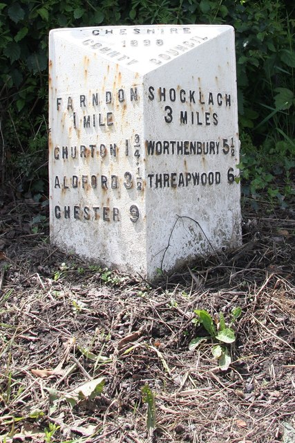
Caldecott Green is a small village located in the county of Cheshire, England. Situated approximately 8 miles south of the town of Nantwich, Caldecott Green is nestled amidst the picturesque Cheshire countryside. The village is part of the larger civil parish of Wybunbury.

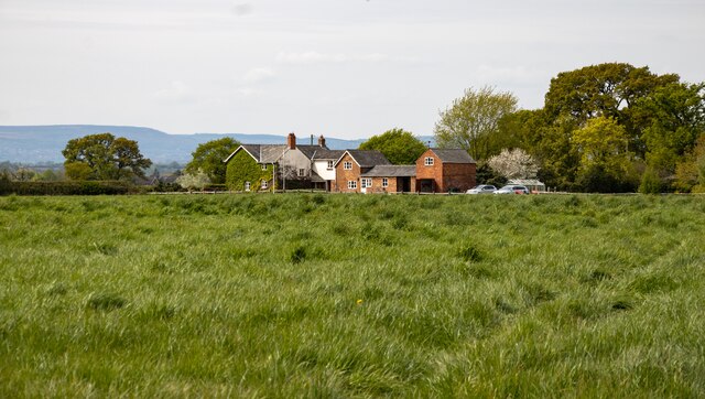
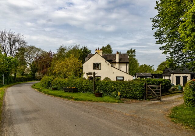
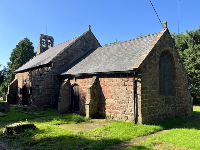
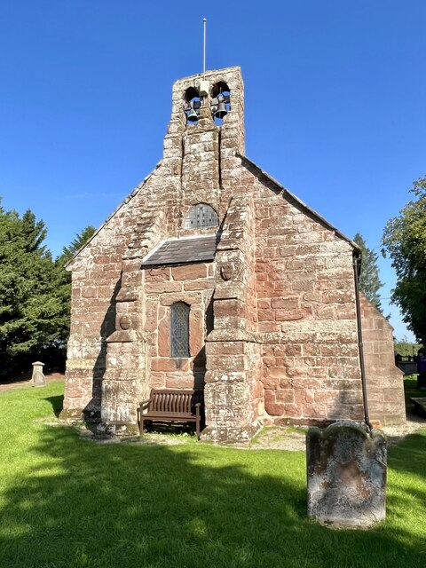
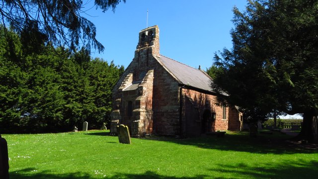
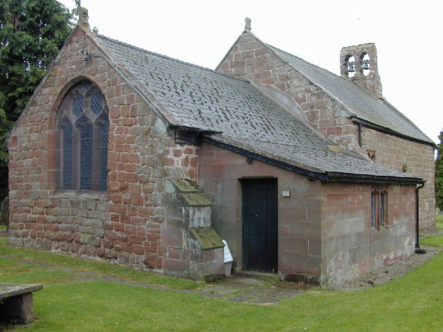
Known for its tranquil and idyllic setting, Caldecott Green offers residents and visitors a peaceful retreat from the hustle and bustle of city life. The village is characterized by its charming cottages and historic buildings, which exude a quintessentially English charm. The local church, St. Chad's, is a notable landmark and dates back to the 14th century.

Despite its small size, Caldecott Green boasts a strong sense of community. The village has a close-knit population, with residents actively involved in various community initiatives and events. The annual village fete, held in the summer, is a highlight for both locals and visitors.

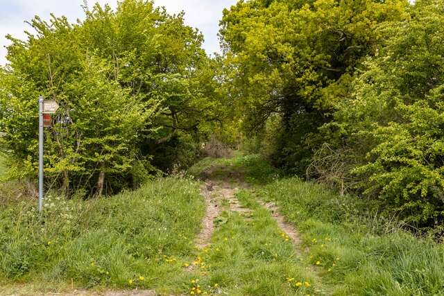
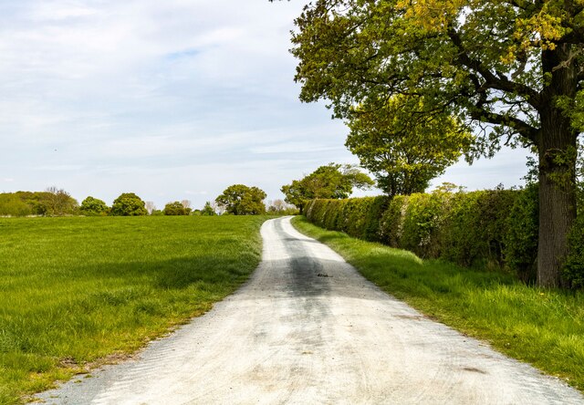
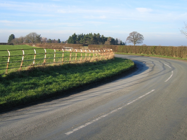
Surrounded by lush green fields and rolling hills, Caldecott Green offers ample opportunities for outdoor pursuits. The area is crisscrossed by footpaths and bridleways, making it popular with walkers, cyclists, and horse riders. Additionally, nearby attractions such as Doddington Hall and Gardens provide opportunities for leisurely strolls and exploration.

While Caldecott Green does not have its own amenities such as shops or schools, the village benefits from its proximity to nearby towns and villages that offer a range of facilities and services. The city of Chester, with its extensive shopping, dining, and cultural opportunities, is within a reasonable driving distance.

In summary, Caldecott Green is a charming and peaceful village in Cheshire, offering a tranquil lifestyle in a picturesque rural setting.

If you have any feedback on the listing, please let us know in the comments section below.

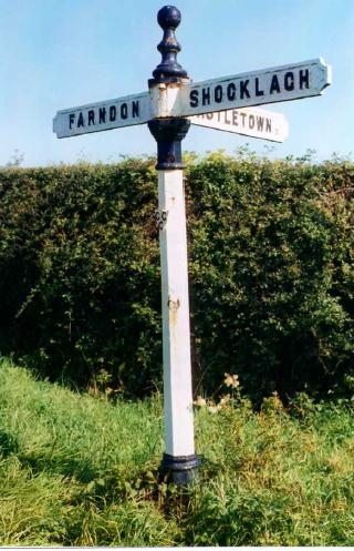
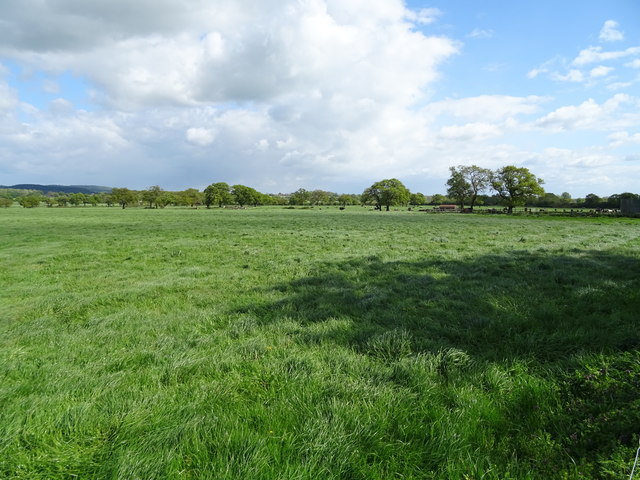
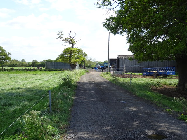
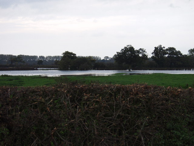
Caldecott Green Images

Images are sourced within 2km of 53.062249/-2.8526027 or Grid Reference SJ4252. Thanks to Geograph Open Source API. All images are credited.

Byway Byway to Rowley Hill Farm.
Byway
Byway to Rowley Hill Farm.
Meadow View
Meadow View
Wetreins Cottage
Wetreins Cottage
Wetreins Lane Field access off Wetreins Lane.
Wetreins Lane
Field access off Wetreins Lane.
St Edith's Church, Shocklach
St Edith's Church, Shocklach: the west end
St Edith's Church, Shocklach
Old Milepost by the former B5130, Crewe-by-Farndon Cast iron post by the UC road (was B5130), in parish of Farndon (Chester District), North of Lodge Farm, on the verge, back to hedge, on West side of road. Cast iron CCC1898, erected by the County Council in the 19th century. 

Inscription reads:-
: FARNDON / 1 MILE / CHURTON 1¾ / ALDFORD 3½ / CHESTER 9 : : CHESHIRE / 1898 / COUNTY COUNCIL : : SHOCKLACH / 3 MILES / WORTHENBURY 5½ / THREAPWOOD 6 :
Maker:-
: W H SMITH & CO / MAKERS / WHITCHURCH :

Milestone Society National ID: CH_CHTP09
Old Milepost by the former B5130, Crewe-by-Farndon
Cast iron post by the UC road (was B5130), in parish of Farndon (Chester District), North of Lodge Farm, on the verge, back to hedge, on West side of road. Cast iron CCC1898, erected by the County Council in the 19th century. Inscription reads:- : FARNDON / 1 MILE / CHURTON 1¾ / ALDFORD 3½ / CHESTER 9 : : CHESHIRE / 1898 / COUNTY COUNCIL : : SHOCKLACH / 3 MILES / WORTHENBURY 5½ / THREAPWOOD 6 : Maker:- : W H SMITH & CO / MAKERS / WHITCHURCH : Milestone Society National ID: CH_CHTP09
Old Milepost by the former B5130 at Caldecott Green Cast iron post by the UC road (was B5130), in parish of Caldecott (Chester District), North of Caldecott Green, on the verge, back to hedge, on West side of road. Cast iron CCC1898, erected by the County Council in the 19th century. 

Inscription reads:-
:FARNDON / 2 MILES / CHURTON 2¾ / ALDFORD 4½ / CHESTER 10 : : CHESHIRE / 1898 / COUNTY COUNCIL : : SHOCKLACH / 2 MILES / WORTHENBURY 4½ / THREAPWOOD 5 :
Maker:-
: W H SMITH & CO / MAKERS / WHITCHURCH :

Milestone Society National ID: CH_CHTP10
Old Milepost by the former B5130 at Caldecott Green
Cast iron post by the UC road (was B5130), in parish of Caldecott (Chester District), North of Caldecott Green, on the verge, back to hedge, on West side of road. Cast iron CCC1898, erected by the County Council in the 19th century. Inscription reads:- :FARNDON / 2 MILES / CHURTON 2¾ / ALDFORD 4½ / CHESTER 10 : : CHESHIRE / 1898 / COUNTY COUNCIL : : SHOCKLACH / 2 MILES / WORTHENBURY 4½ / THREAPWOOD 5 : Maker:- : W H SMITH & CO / MAKERS / WHITCHURCH : Milestone Society National ID: CH_CHTP10
Old Milepost by the former B5130 in Church Shocklach Cast iron post by the UC road (was B5130), in parish of Church Shocklach (Chester District), South of Castletown Rough, on the verge back to hedge, on West side of road. Cast iron CCC1898, erected by the County Council in the 19th century. 

Inscription reads:-
: FARNDON / 3 MILES / CHURTON / 3¾ MILE / ALDFORD 5½ / CHESTER 11 : : CHESHIRE / 1898 / COUNTY COUNCIL : : SHOCKLACH / 1 MILE / WORTHENBURY 3½ / THREAPWOOD 4 : 
Maker:-
: W H SMITH & CO / MAKERS / WHITCHURCH :  

Milestone Society National ID: CH_CHTP11
Old Milepost by the former B5130 in Church Shocklach
Cast iron post by the UC road (was B5130), in parish of Church Shocklach (Chester District), South of Castletown Rough, on the verge back to hedge, on West side of road. Cast iron CCC1898, erected by the County Council in the 19th century. Inscription reads:- : FARNDON / 3 MILES / CHURTON / 3¾ MILE / ALDFORD 5½ / CHESTER 11 : : CHESHIRE / 1898 / COUNTY COUNCIL : : SHOCKLACH / 1 MILE / WORTHENBURY 3½ / THREAPWOOD 4 : Maker:- : W H SMITH & CO / MAKERS / WHITCHURCH : Milestone Society National ID: CH_CHTP11
Welcome to Stretton
Welcome to Stretton
In business since 1858 Crew-by-Farndon Methodist Church.
In business since 1858
Crew-by-Farndon Methodist Church.
Old Direction Sign - Signpost by the Shocklach road, Church Shocklach parish Pawn finial - 3 arms; Cheshire CCC octagonal by the UC road, in parish of Church Shocklach (Chester District), Castletown Lane junction to Chestnuts, Shocklach.

Surveyed

Milestone Society National ID: CH_SJ4350
Old Direction Sign - Signpost by the Shocklach road, Church Shocklach parish
Pawn finial - 3 arms; Cheshire CCC octagonal by the UC road, in parish of Church Shocklach (Chester District), Castletown Lane junction to Chestnuts, Shocklach. Surveyed Milestone Society National ID: CH_SJ4350
Grassland near Rowley Hill Farm Off the Bishop Bennett Way.
Grassland near Rowley Hill Farm
Off the Bishop Bennett Way.
Byway approaching Rowley Hill Farm Looking south on the Bishop Bennett Way.
Byway approaching Rowley Hill Farm
Looking south on the Bishop Bennett Way.
Flood plains doing what they do best We have had a fair bit of rain over the last few days and the Afon Dyfrdwy (River Dee) spills out onto the flood plain. The river has several meanders at this point and within this square the Welsh Border which follows the river takes off across the fields presumably along an old river line.
Flood plains doing what they do best
We have had a fair bit of rain over the last few days and the Afon Dyfrdwy (River Dee) spills out onto the flood plain. The river has several meanders at this point and within this square the Welsh Border which follows the river takes off across the fields presumably along an old river line.
Shocklach Church
Shocklach Church
Stretton Hall A view looking north towards Stretton Hall.
Stretton Hall
A view looking north towards Stretton Hall.
Show me another place!

Caldecott Green is located at Grid Ref: SJ4252 (Lat: 53.062249, Lng: -2.8526027)

Unitary Authority: Cheshire West and Chester

Police Authority: Cheshire

What 3 Words

///factories.deranged.swear. Near Holt, Wrexham

Related Wikis

Caldecott, Cheshire

Caldecott is a former civil parish, now in the parish of Shocklach Oviatt and District, in the Borough of Cheshire West and Chester and ceremonial county...

Crewe-by-Farndon

Crewe-by-Farndon is a settlement and former civil parish, now in the parish of Farndon, in the borough of Cheshire West and Chester and ceremonial county...

Crewe Hill

Crewe Hill is a country house near Crewe by Farndon, to the southeast of the village of Farndon, Cheshire, England. It was enlarged from a farmhouse for...

Castletown, Cheshire

Castletown in the civil parish of Shocklach Oviatt and District, in Cheshire, England is a deserted village located at SJ43885110 whose sole remains are...

Nearby Amenities

Located within 500m of 53.062249,-2.8526027
Barrier: stile
Fixme: Stile is on a junction. Needs to be on correct path
Foot: no
Lat/Long: 53.0612286/-2.854528
Barrier: stile
Lat/Long: 53.0603024/-2.8572228
Barrier: stile
Foot: yes
Lat/Long: 53.0610305/-2.8542875
The data included in this document is from www.openstreetmap.org. The data is made available under ODbL.

Have you been to Caldecott Green?

Leave your review of Caldecott Green below (or comments, questions and feedback).