Black Snib

Wood, Forest in Cumberland Carlisle

England

Black Snib

Hedge-lined minor road near to Bogbush Knowe Looking north-eastward.
Hedge-lined minor road near to Bogbush Knowe Credit: Peter Wood

Black Snib is a charming woodland area located in the historic county of Cumberland, England. Nestled within the picturesque Cumbrian countryside, this forested region covers a vast expanse of approximately 500 acres. The woodland is predominantly composed of native species such as oak, birch, and beech trees, creating a diverse and vibrant ecosystem.

Black Snib is renowned for its natural beauty and tranquil atmosphere. Its dense canopy provides a haven for various wildlife, including deer, foxes, and a wide variety of bird species. The forest floor is adorned with an array of wildflowers, adding splashes of color to the verdant landscape.

The woodland is intersected by a network of well-maintained trails, making it a popular destination for outdoor enthusiasts and nature lovers. These pathways offer opportunities for hiking, cycling, and leisurely walks, allowing visitors to immerse themselves in the serene surroundings. Along the trails, there are several viewpoints that offer breathtaking vistas of the surrounding countryside and the nearby fells.

Black Snib also holds historical significance, with traces of ancient settlements and remnants of mining activities dating back centuries. The area is dotted with old mine shafts and ruins, providing a glimpse into the region's industrial heritage.

Visitors to Black Snib can enjoy a peaceful retreat from the bustling city life, immersing themselves in the natural wonders of the Cumbrian countryside. Whether it's a leisurely stroll or an adventurous hike, this woodland sanctuary offers something for everyone, providing a truly memorable experience for all who visit.

If you have any feedback on the listing, please let us know in the comments section below.
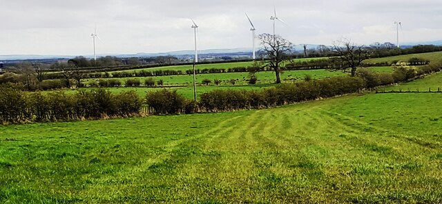
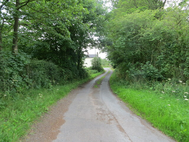
Black Snib Images

Images are sourced within 2km of 55.000847/-2.9054825 or Grid Reference NY4267. Thanks to Geograph Open Source API. All images are credited.

Hedge-lined minor road near to Bogbush Knowe Looking north-eastward.
Hedge-lined minor road near to Bogbush Knowe
Looking north-eastward.
View over fields on SE side of Moor Road towards wind farm
Gate guardian of Norman's timberyard A nice piece of chain-saw art that catches the eye on the A8071 near Longtown; there is a partner on the opposite side of the entrance <a href="https://www.geograph.org.uk/photo/7158659">NY4066 : Gate guardian of Norman's timberyard</a>.
Gate guardian of Norman's timberyard
A nice piece of chain-saw art that catches the eye on the A8071 near Longtown; there is a partner on the opposite side of the entrance NY4066 : Gate guardian of Norman's timberyard.
Gate guardian of Norman's timberyard A nice piece of chain-saw art that catches the eye on the A8071 near Longtown; there is a partner on the opposite side of the entrance <a href="https://www.geograph.org.uk/photo/7158657">NY4066 : Gate guardian of Norman's timberyard</a>.
Gate guardian of Norman's timberyard
A nice piece of chain-saw art that catches the eye on the A8071 near Longtown; there is a partner on the opposite side of the entrance NY4066 : Gate guardian of Norman's timberyard.
Timber yard near Longtown A useful place for anything wood related.
Timber yard near Longtown
A useful place for anything wood related.
Timber yard near Longtown A useful place for anything wood related.
Timber yard near Longtown
A useful place for anything wood related.
Polythene landscape near Longtown The polythene warms the soil, in which maize has been sown. When harvested it will go to an anaerobic digester to produce methane <span class="nowrap"><a title="https://en.wikipedia.org/wiki/Anaerobic_digestion?msclkid=adb03555c6f511ecbf8c925041f224d" rel="nofollow ugc noopener" href="https://en.wikipedia.org/wiki/Anaerobic_digestion?msclkid=adb03555c6f511ecbf8c925041f224d">Link</a><img style="margin-left:2px;" alt="External link" title="External link - shift click to open in new window" src="https://s1.geograph.org.uk/img/external.png" width="10" height="10"/></span> , which can be used as a fuel.
Polythene landscape near Longtown
The polythene warms the soil, in which maize has been sown. When harvested it will go to an anaerobic digester to produce methane LinkExternal link , which can be used as a fuel.
Polythene landscape near Longtown The polythene warms the soil, in which maize has been sown. When harvested it will go to an anaerobic digester to produce methane  <span class="nowrap"><a title="https://en.wikipedia.org/wiki/Anaerobic_digestion?msclkid=adb03555c6f511ecbf8c925041f224d" rel="nofollow ugc noopener" href="https://en.wikipedia.org/wiki/Anaerobic_digestion?msclkid=adb03555c6f511ecbf8c925041f224d">Link</a><img style="margin-left:2px;" alt="External link" title="External link - shift click to open in new window" src="https://s1.geograph.org.uk/img/external.png" width="10" height="10"/></span> , which can be used as a fuel.
Polythene landscape near Longtown
The polythene warms the soil, in which maize has been sown. When harvested it will go to an anaerobic digester to produce methane LinkExternal link , which can be used as a fuel.
Hedge enclosed minor road near Burnt Hill Looking south-westward towards the A6071 road.
Hedge enclosed minor road near Burnt Hill
Looking south-westward towards the A6071 road.
Mown hay field awaiting baling near Kirklinton Looking eastward.
Mown hay field awaiting baling near Kirklinton
Looking eastward.
The Church of St Cuthbert at Kirklinton Viewed from the west.
The Church of St Cuthbert at Kirklinton
Viewed from the west.
Minor road approaching Uppertown Looking south-eastward.
Minor road approaching Uppertown
Looking south-eastward.
Ordnance Survey Cut Mark This mark can be found on the wall of St Cuthbert's Church, Kirklinton.
The recorded details give a height of 39.941 metres above sea level.
For more detail see : <span class="nowrap"><a title="https://www.bench-marks.org.uk/bm106481" rel="nofollow ugc noopener" href="https://www.bench-marks.org.uk/bm106481">Link</a><img style="margin-left:2px;" alt="External link" title="External link - shift click to open in new window" src="https://s1.geograph.org.uk/img/external.png" width="10" height="10"/></span>
Ordnance Survey Cut Mark
This mark can be found on the wall of St Cuthbert's Church, Kirklinton. The recorded details give a height of 39.941 metres above sea level. For more detail see : LinkExternal link
Low Hallburn Farm The farm adjoins the old World War II Longtown airfield.
Low Hallburn Farm
The farm adjoins the old World War II Longtown airfield.
Hallburn Farm The farm occupies the site of the old World War II Longtown airfield where RAF 44 Group Transport OTU were based. The concrete building in the foreground is a relic dating from that time.
Hallburn Farm
The farm occupies the site of the old World War II Longtown airfield where RAF 44 Group Transport OTU were based. The concrete building in the foreground is a relic dating from that time.
Hallburn Farm The farm occupies the site of the old World War II Longtown airfield where RAF 44 Group Transport OTU were based.
Hallburn Farm
The farm occupies the site of the old World War II Longtown airfield where RAF 44 Group Transport OTU were based.
Field near Whingate Farm Drakeknowe Plantation in the background.
Field near Whingate Farm
Drakeknowe Plantation in the background.
Show me another place!

Black Snib is located at Grid Ref: NY4267 (Lat: 55.000847, Lng: -2.9054825)

Administrative County: Cumbria

District: Carlisle

Police Authority: Cumbria

What 3 Words

///gladiator.hotels.vitals. Near Longtown, Cumbria

Nearby Locations

Black Snib Sawmill Wood

Related Wikis

RAF Longtown

Royal Air Force Longtown or more simply RAF Longtown is a former Royal Air Force satellite station located 2 miles (3.2 km) east of Longtown, Cumbria and...

Kirklinton Middle

Kirklinton Middle is a civil parish in City of Carlisle district, Cumbria, England. At the 2011 census it had a population of 384.The parish is bordered...

Kirklinton

Kirklinton is a village in the Carlisle district, in the English county of Cumbria. The population of the civil parish of Kirklinton Middle, taken at the...

Battle of Arfderydd

The Battle of Arfderydd (also known as Arderydd) was fought in medieval Britain in AD 573, according to the Annales Cambriae. The opposing armies are identified...

Have you been to Black Snib?

Leave your review of Black Snib below (or comments, questions and feedback).