Apperley Bridge

Settlement in Yorkshire

England

Apperley Bridge

Post box, Santa Monica Road, Idle, Bradford This post box can be seen in context in <a href="https://www.geograph.org.uk/photo/7002152">SE1737 : The junction of Santa Monica Road and Highfield Road, Idle, Bradford</a>.
Post box, Santa Monica Road, Idle, Bradford Credit: habiloid

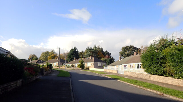
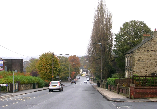
Apperley Bridge is a small suburban village located in the metropolitan borough of Bradford, West Yorkshire, England. Situated approximately 4 miles north-west of Bradford city center, the village is primarily known for its picturesque views and tranquil surroundings.

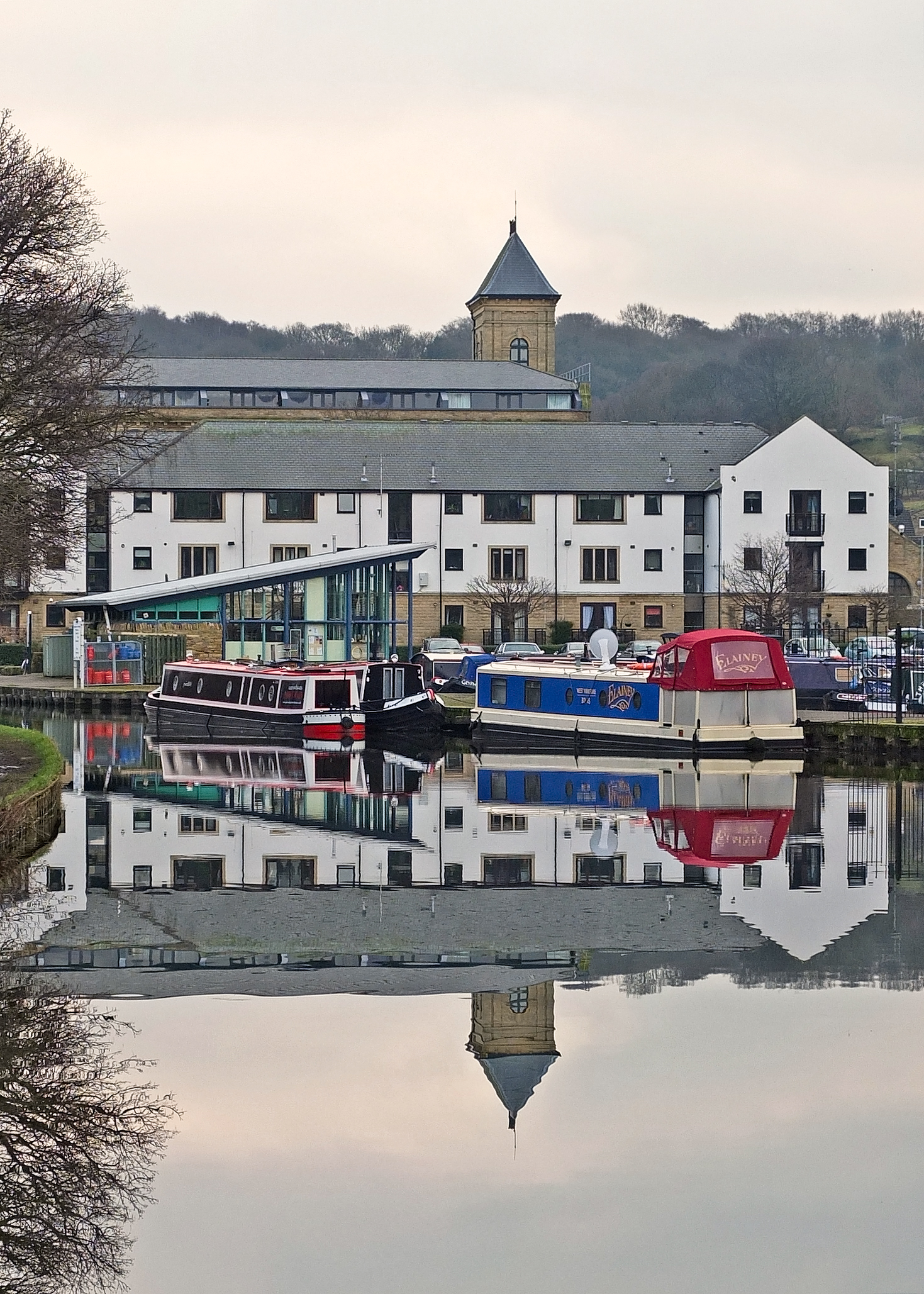
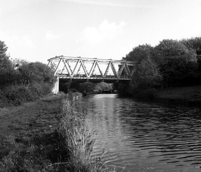
The village is nestled on the southern banks of the River Aire, which flows through the area, creating a serene and peaceful atmosphere. Apperley Bridge is surrounded by beautiful countryside, making it a popular destination for nature lovers and outdoor enthusiasts. The nearby Leeds and Liverpool Canal also adds to the village's charm, offering scenic walks and boat trips.

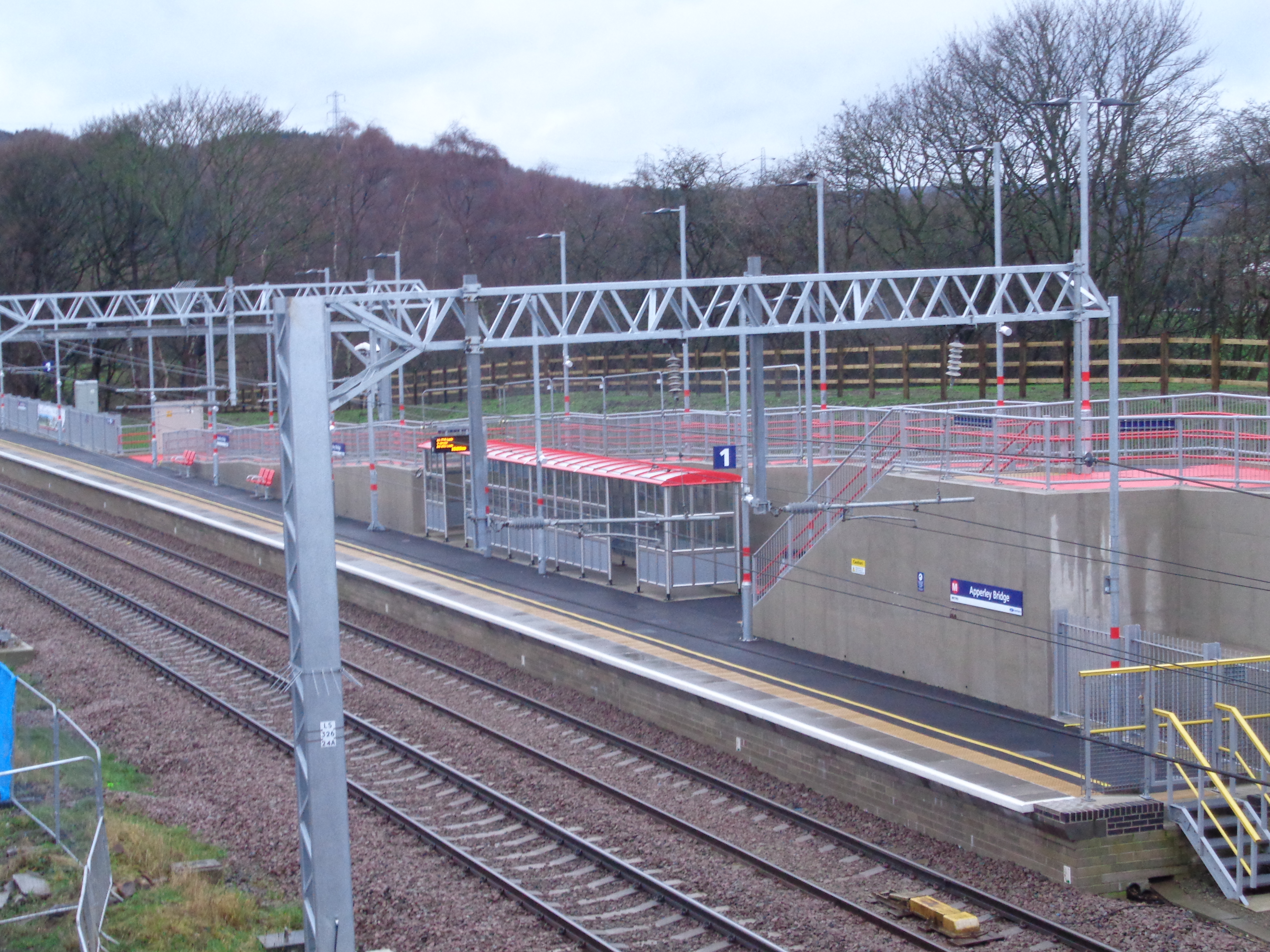
Despite its rural setting, Apperley Bridge benefits from excellent transport links, making it an attractive location for commuters. The village is served by Apperley Bridge railway station, providing regular train services to Leeds, Bradford, and other nearby towns. Additionally, nearby major roads, including the A658 and A657, connect the village to the wider Yorkshire region.

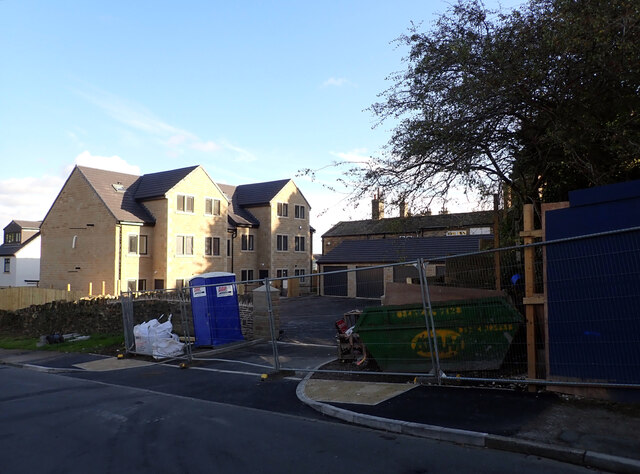
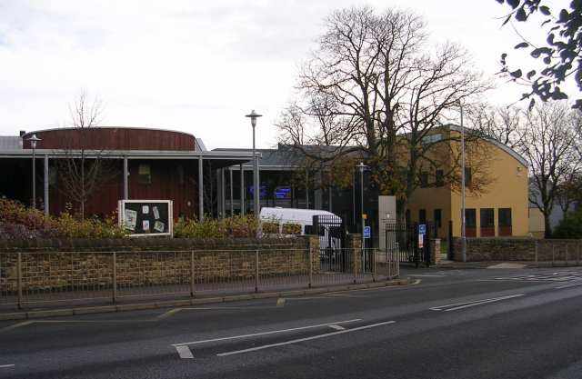
Apperley Bridge has a small but vibrant community, with a range of amenities available to residents and visitors. The village boasts a primary school, a few shops, and a handful of pubs and restaurants. For those seeking a wider range of amenities, the bustling city center of Bradford is just a short distance away.

Overall, Apperley Bridge offers a harmonious blend of rural charm and convenient urban access, making it an appealing place to live or visit for those seeking a peaceful yet well-connected location in Yorkshire.

If you have any feedback on the listing, please let us know in the comments section below.

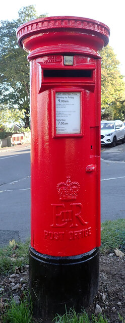
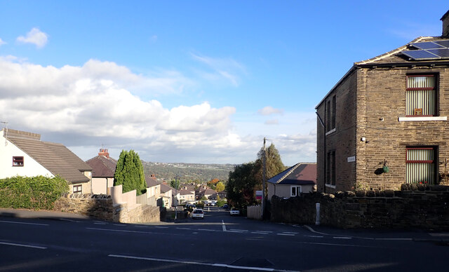
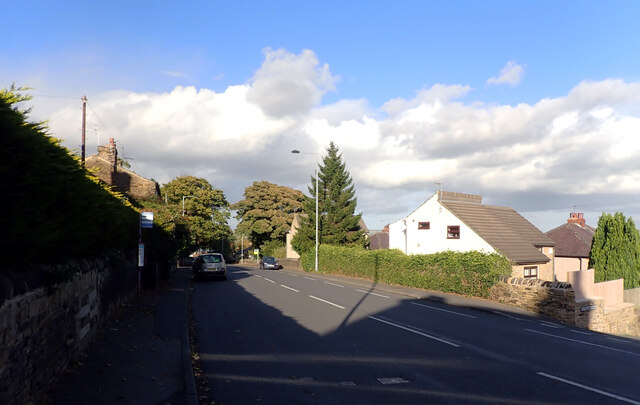
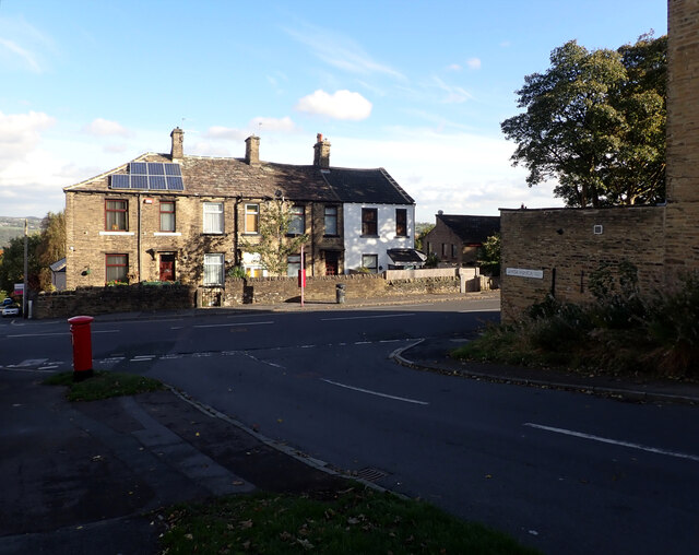
Apperley Bridge Images

Images are sourced within 2km of 53.83673/-1.709569 or Grid Reference SE1937. Thanks to Geograph Open Source API. All images are credited.

Post box, Santa Monica Road, Idle, Bradford This post box can be seen in context in <a href="https://www.geograph.org.uk/photo/7002152">SE1737 : The junction of Santa Monica Road and Highfield Road, Idle, Bradford</a>.
Post box, Santa Monica Road, Idle, Bradford
Ley Fleaks Road seen from Highfield Road, Idle, Bradford
Highfield Road, Idle, Bradford
The junction of Santa Monica Road and Highfield Road, Idle, Bradford A close-up of the post box can be seen in <a href="https://www.geograph.org.uk/photo/7002148">SE1737 : Post box, Santa Monica Road, Idle, Bradford</a>.
The junction of Santa Monica Road and Highfield Road, Idle, Bradford
A close-up of the post box can be seen in SE1737 : Post box, Santa Monica Road, Idle, Bradford.
Santa Monica Road, Idle, Bradford
New housing development, Santa Monica Road, Idle, Bradford
Remembrance box, Harrogate Road, Greengates Painting utility cabinets in abstract or decorative designs has become a fashion in the last few years. This is the first I've seen on the theme of wartime remembrance.  The text on the end reads "Commissioned by Friends of Greengates cenotaph. Bradford Street Art box 1 @bdstreetart".  The last bit looks like a 'Twitter handle' but isn't.  The group does however have a Facebook page showing several designs in the area.  For the cenotaph, see <a href="https://www.geograph.org.uk/photo/2260195">SE1937 : Greengates War Memorial</a>.
Remembrance box, Harrogate Road, Greengates
Painting utility cabinets in abstract or decorative designs has become a fashion in the last few years. This is the first I've seen on the theme of wartime remembrance. The text on the end reads "Commissioned by Friends of Greengates cenotaph. Bradford Street Art box 1 @bdstreetart". The last bit looks like a 'Twitter handle' but isn't. The group does however have a Facebook page showing several designs in the area. For the cenotaph, see SE1937 : Greengates War Memorial.
Roadworks, Harrogate Road, Greengates The junction of New Line (A657) and Harrogate Road (A658) is being remodelled.  Work has been going on for well over a year already and is nowhere near finished, and locals are getting rather annoyed about the delays, as the temporary 4-way traffic lights are increasing the congestion that the works are designed to ease.

The building in the background is the former Seven Stars pub, now a row of shops. It is listed grade II (list entry 1133123) where it is dated to circa 1830-40, "rebuild of earlier inn or former building".
Roadworks, Harrogate Road, Greengates
The junction of New Line (A657) and Harrogate Road (A658) is being remodelled. Work has been going on for well over a year already and is nowhere near finished, and locals are getting rather annoyed about the delays, as the temporary 4-way traffic lights are increasing the congestion that the works are designed to ease. The building in the background is the former Seven Stars pub, now a row of shops. It is listed grade II (list entry 1133123) where it is dated to circa 1830-40, "rebuild of earlier inn or former building".
Roadworks at Greengates junction The junction of New Line (A657) and Harrogate Road (A658) is being remodelled.  Work has been going on for well over a year already and is nowhere near finished, and locals are getting rather annoyed about the delays, as the temporary 4-way traffic lights are increasing the congestion that the works are designed to ease.

This view is looking along the new slip road that will avoid the traffic lights for traffic from Yeadon towards Calverley, but that only forms a small proportion of the throughput of the junction. How much it will actually reduce congestion is a moot point, but presumably traffic modelling has produced a positive cost-benefit ratio.
Roadworks at Greengates junction
The junction of New Line (A657) and Harrogate Road (A658) is being remodelled. Work has been going on for well over a year already and is nowhere near finished, and locals are getting rather annoyed about the delays, as the temporary 4-way traffic lights are increasing the congestion that the works are designed to ease. This view is looking along the new slip road that will avoid the traffic lights for traffic from Yeadon towards Calverley, but that only forms a small proportion of the throughput of the junction. How much it will actually reduce congestion is a moot point, but presumably traffic modelling has produced a positive cost-benefit ratio.
A field near Dobson Locks, Leeds and Liverpool Canal, Apperley Bridge
Dobson Locks, Leeds and Liverpool Canal, Apperley Bridge The Leeds and Liverpool Canal is the longest canal in Northern England at 127 miles long. The first of the trans-Pennine canals it took 46 years to build at a cost of five times the original budget, mainly because of the length and complexity of the route. It passes through 91 locks with a summit level of 487 feet at Foulridge near Nelson and Colne. It was originally conceived in the 18th century to carry woollen goods from Leeds and Bradford and limestone from Skipton but in its 19th century heyday it carried stone, coal and many other goods. The impact of the railways was not as great as with other canals and commercial traffic continued along the main canal until 1964. Regular work stopped in 1972 when the movement of coal to Wigan Power Station ceased. In the latter part of the 20th century the leisure potential of the canal was developed and it is now a popular destination for cruising, fishing, walking and cycling. See <span class="nowrap"><a title="http://www.penninewaterways.co.uk/ll/index.htm" rel="nofollow ugc noopener" href="http://www.penninewaterways.co.uk/ll/index.htm">Link</a><img style="margin-left:2px;" alt="External link" title="External link - shift click to open in new window" src="https://s1.geograph.org.uk/img/external.png" width="10" height="10"/></span> for detailed information.
Dobson Locks, Leeds and Liverpool Canal, Apperley Bridge
The Leeds and Liverpool Canal is the longest canal in Northern England at 127 miles long. The first of the trans-Pennine canals it took 46 years to build at a cost of five times the original budget, mainly because of the length and complexity of the route. It passes through 91 locks with a summit level of 487 feet at Foulridge near Nelson and Colne. It was originally conceived in the 18th century to carry woollen goods from Leeds and Bradford and limestone from Skipton but in its 19th century heyday it carried stone, coal and many other goods. The impact of the railways was not as great as with other canals and commercial traffic continued along the main canal until 1964. Regular work stopped in 1972 when the movement of coal to Wigan Power Station ceased. In the latter part of the 20th century the leisure potential of the canal was developed and it is now a popular destination for cruising, fishing, walking and cycling. See LinkExternal link for detailed information.
The Leeds and Liverpool Canal above Dobson Locks, Apperley Bridge A close up of the blue sign can be seen in <a href="https://www.geograph.org.uk/photo/7172958">SE1838 : "Attention Dogs", the Leeds and Liverpool Canal above Dobson Locks, Apperley Bridge</a>.
The Leeds and Liverpool Canal above Dobson Locks, Apperley Bridge
"Attention Dogs", the Leeds and Liverpool Canal above Dobson Locks, Apperley Bridge This Canal & River trust sign on a building by Dobson Locks reads:
"Canal &
River trust

Attention dog owners
Pick up after your dogs. Thank you.

Attention dogs
Grrrrr, bark, woof."

It can be seen in context in <a href="https://www.geograph.org.uk/photo/7172951">SE1838 : The Leeds and Liverpool Canal above Dobson Locks, Apperley Bridge</a>.
"Attention Dogs", the Leeds and Liverpool Canal above Dobson Locks, Apperley Bridge
This Canal & River trust sign on a building by Dobson Locks reads: "Canal & River trust Attention dog owners Pick up after your dogs. Thank you. Attention dogs Grrrrr, bark, woof." It can be seen in context in SE1838 : The Leeds and Liverpool Canal above Dobson Locks, Apperley Bridge.
Milestone, the Leeds and Liverpool Canal above Dobson Locks, Apperley Bridge This milestone can be seen in context in <a href="https://www.geograph.org.uk/photo/7172968">SE1838 : The Leeds and Liverpool Canal above Dobson Locks, Apperley Bridge</a>. It reads:

"L'POOL
118
MILES

LEEDS
9¼
MILES"
Milestone, the Leeds and Liverpool Canal above Dobson Locks, Apperley Bridge
This milestone can be seen in context in SE1838 : The Leeds and Liverpool Canal above Dobson Locks, Apperley Bridge. It reads: "L'POOL 118 MILES LEEDS 9¼ MILES"
The Leeds and Liverpool Canal above Dobson Locks, Apperley Bridge A close-up of the milestone can be seen in <a href="https://www.geograph.org.uk/photo/7172964">SE1838 : Milestone, the Leeds and Liverpool Canal above Dobson Locks, Apperley Bridge</a>.
The Leeds and Liverpool Canal above Dobson Locks, Apperley Bridge
The Leeds and Liverpool Canal above Dobson Locks, Apperley Bridge The Leeds and Liverpool Canal is the longest canal in Northern England at 127 miles long. The first of the trans-Pennine canals it took 46 years to build at a cost of five times the original budget, mainly because of the length and complexity of the route. It passes through 91 locks with a summit level of 487 feet at Foulridge near Nelson and Colne. It was originally conceived in the 18th century to carry woollen goods from Leeds and Bradford and limestone from Skipton but in its 19th century heyday it carried stone, coal and many other goods. The impact of the railways was not as great as with other canals and commercial traffic continued along the main canal until 1964. Regular work stopped in 1972 when the movement of coal to Wigan Power Station ceased. In the latter part of the 20th century the leisure potential of the canal was developed and it is now a popular destination for cruising, fishing, walking and cycling. See <span class="nowrap"><a title="http://www.penninewaterways.co.uk/ll/index.htm" rel="nofollow ugc noopener" href="http://www.penninewaterways.co.uk/ll/index.htm">Link</a><img style="margin-left:2px;" alt="External link" title="External link - shift click to open in new window" src="https://s1.geograph.org.uk/img/external.png" width="10" height="10"/></span> for detailed information.
The Leeds and Liverpool Canal above Dobson Locks, Apperley Bridge
The Leeds and Liverpool Canal is the longest canal in Northern England at 127 miles long. The first of the trans-Pennine canals it took 46 years to build at a cost of five times the original budget, mainly because of the length and complexity of the route. It passes through 91 locks with a summit level of 487 feet at Foulridge near Nelson and Colne. It was originally conceived in the 18th century to carry woollen goods from Leeds and Bradford and limestone from Skipton but in its 19th century heyday it carried stone, coal and many other goods. The impact of the railways was not as great as with other canals and commercial traffic continued along the main canal until 1964. Regular work stopped in 1972 when the movement of coal to Wigan Power Station ceased. In the latter part of the 20th century the leisure potential of the canal was developed and it is now a popular destination for cruising, fishing, walking and cycling. See LinkExternal link for detailed information.
Show me another place!

Apperley Bridge is located at Grid Ref: SE1937 (Lat: 53.83673, Lng: -1.709569)

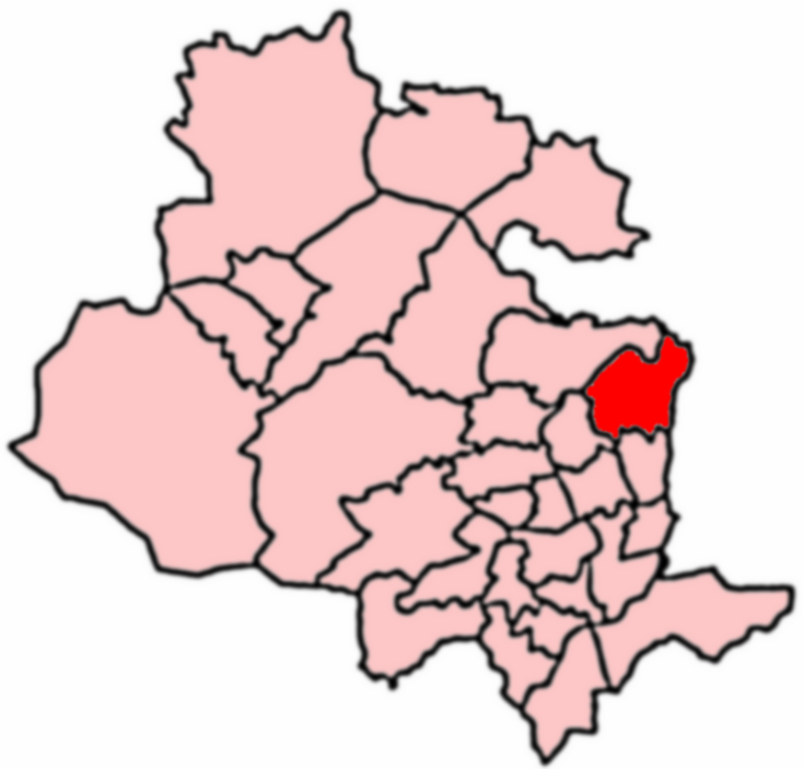
Division: West Riding

Unitary Authority: Bradford

Police Authority: West Yorkshire

What 3 Words

///format.fruit.keys. Near Yeadon, West Yorkshire

Related Wikis

Apperley Bridge

Apperley Bridge is a village in the metropolitan borough of the City of Bradford, in West Yorkshire, England in the Idle and Thackley Ward. Apperley Bridge...

Apperley Bridge railway station

Apperley Bridge station is situated in Bradford on the (Leeds and Bradford, later Midland) line between Leeds and Shipley, West Yorkshire, England. It...

Greengates

Greengates is a small suburban area in the north-east of the city of Bradford, West Yorkshire, in England. The area is bordered by Idle and Thackley to...

Woodhouse Grove School

Woodhouse Grove School ('The Grove') is a private, co-educational, day and boarding school and Sixth Form. it is located to the north of Apperley Bridge...

Esholt Sewage Works Railway

Esholt Sewage Works Railway was a standard gauge works railway constructed in 1910 to serve a sewage works in Esholt, West Yorkshire, England. The works...

Idle and Thackley

Idle and Thackley is a ward within the City of Bradford Metropolitan District Council in the county of West Yorkshire, England, named after the villages...

A657 road

The A657 is an A road in West Yorkshire, England that begins in Bramley and ends in Saltaire near Shipley. The road is approximately 8 miles (13 km) long...

Immanuel College, Bradford

Immanuel College is a mixed Church of England secondary school and sixth form located in the City of Bradford, West Yorkshire, England. It was officially...

Nearby Amenities

Located within 500m of 53.83673,-1.709569
Crossing
Crossing: traffic_signals
Crossing Ref: pegasus
Lat/Long: 53.8365913/-1.7055507
Pub
George and Dragon
Food: yes
Lat/Long: 53.8374936/-1.7066085
Post Box
Collection Times: Mo-Fr 16:30; Sa 10:45
Operator: Royal Mail
Post Box Type: lamp
Ref: BD10 253
Royal Cypher: EIIR
Royal Cypher Wikidata: Q33102113
Source: survey
Lat/Long: 53.8359411/-1.7061118
Cafe
The Bridge Cafe
Addr City: Bradford
Addr Housenumber: 1027
Addr Postcode: BD10 0NB
Addr Street: Harrogate Road
Fhrs Id: 576153
Source Addr: FHRS Open Data
Lat/Long: 53.8359018/-1.7063356
Post Box
Ref: BD10 252
Lat/Long: 53.8339937/-1.709688
Bus Stop
Harrogate Road Tenterfields
Bus: yes
Local Ref: 45018114
Naptan AtcoCode: 450018114
Naptan Bearing: NE
Naptan CommonName: Harrogate Road Tenterfields
Naptan Crossing: Tenterfields
Naptan Indicator: Stop 45018114
Naptan PlusbusZoneRef: LEEDS
Naptan ShortCommonName: Tenterfields
Naptan Street: Harrogate Road
Naptan Verified: no
Public Transport: platform
Source: naptan_import
Lat/Long: 53.8339411/-1.7082417
Bus Stop
Harrogate Road Tenterfields
Bus: yes
Local Ref: 45018115
Naptan AtcoCode: 450018115
Naptan Bearing: SW
Naptan CommonName: Harrogate Road Tenterfields
Naptan Crossing: Tenterfields
Naptan Indicator: Stop 45018115
Naptan PlusbusZoneRef: LEEDS
Naptan ShortCommonName: Tenterfields
Naptan Street: Harrogate Road
Naptan Verified: no
Public Transport: platform
Source: naptan_import
Lat/Long: 53.8339586/-1.7079024
Bus Stop
Harrogate Road Laburnum Place
Bus: yes
Local Ref: 45018116
Naptan AtcoCode: 450018116
Naptan Bearing: NE
Naptan CommonName: Harrogate Road Laburnum Place
Naptan Crossing: Laburnum Place
Naptan Indicator: Stop 45018116
Naptan PlusbusZoneRef: LEEDS
Naptan ShortCommonName: Laburnum Place
Naptan Street: Harrogate Road
Naptan Verified: no
Public Transport: platform
Source: naptan_import
Lat/Long: 53.8353807/-1.7066461
Bus Stop
Harrogate Road Parkin Lane
Bus: yes
Local Ref: 45018117
Naptan AtcoCode: 450018117
Naptan Bearing: SW
Naptan CommonName: Harrogate Road Parkin Lane
Naptan Crossing: Parkin Lane
Naptan Indicator: Stop 45018117
Naptan PlusbusZoneRef: LEEDS
Naptan ShortCommonName: Parkin Lane
Naptan Street: Harrogate Road
Naptan Verified: no
Public Transport: platform
Source: naptan_import
Lat/Long: 53.8365194/-1.7054984
Bus Stop
Harrogate Road Apperley Road
Bus: yes
Local Ref: 45024890
Naptan AtcoCode: 450024890
Naptan Bearing: NE
Naptan CommonName: Harrogate Road Apperley Road
Naptan Crossing: Apperley Road
Naptan Indicator: Stop 45024890
Naptan Landmark: George & Dragon PH
Naptan PlusbusZoneRef: LEEDS
Naptan ShortCommonName: Apperley Road
Naptan Street: Harrogate Road
Naptan Verified: no
Public Transport: platform
Source: naptan_import
Lat/Long: 53.8363225/-1.7058493
Turning Circle
Lat/Long: 53.835445/-1.7044568
Turning Circle
Lat/Long: 53.8361133/-1.703927
Turning Circle
Lat/Long: 53.836732/-1.7068456
Power: pole
Lat/Long: 53.8395257/-1.7147002
Power: pole
Lat/Long: 53.8393532/-1.7141933
Power: pole
Lat/Long: 53.8390066/-1.7131499
Power: pole
Lat/Long: 53.838929/-1.7125759
Traffic Signals
Lat/Long: 53.833461/-1.7086284
Leisure: playground
Lat/Long: 53.8374393/-1.7156243
Turning Circle
Lat/Long: 53.8378993/-1.7165309
Turning Circle
Lat/Long: 53.835062/-1.7163258
Traffic Signals
Lat/Long: 53.8331104/-1.7090404
Bridge Support: small_bridge
Lat/Long: 53.837481/-1.7134177
Crossing
Crossing: unmarked
Lat/Long: 53.8368045/-1.7150072
Crossing
Lat/Long: 53.8364408/-1.7158089
Noexit: yes
Lat/Long: 53.8370504/-1.7059557
Noexit: yes
Lat/Long: 53.8372714/-1.7062961
Access: no
Barrier: stile
Foot: yes
Material: wood
Stile: stepover
Lat/Long: 53.8400647/-1.7125822
Access: no
Barrier: stile
Foot: yes
Material: stone
Stile: squeezer
Lat/Long: 53.8379094/-1.7116938
Access: no
Barrier: stile
Foot: yes
Material: wood
Stile: stepover
Lat/Long: 53.8390003/-1.7121895
Turning Circle
Lat/Long: 53.8360399/-1.7048584
Turning Circle
Lat/Long: 53.8354062/-1.7050634
Access: no
Barrier: stile
Foot: yes
Material: wood
Stile: stepover
Lat/Long: 53.8382333/-1.7116979
Direction: both
Surface: asphalt
Traffic Calming: table
Lat/Long: 53.8403347/-1.7054401
Direction: both
Surface: asphalt
Traffic Calming: table
Lat/Long: 53.8406266/-1.7062992
Bus Stop
Bus: yes
Naptan AtcoCode: 450029878
Naptan NaptanCode: 45029878
Public Transport: platform
Shelter: yes
Lat/Long: 53.8390468/-1.7040433
Waterway: sanitary_dump_station
Lat/Long: 53.8359637/-1.7106759
Shop: boat
Lat/Long: 53.8360088/-1.7107351
Give Way
Direction: forward
Lat/Long: 53.8380369/-1.7037579
Crossing
Crossing: unmarked
Crossing Island: yes
Tactile Paving: yes
Lat/Long: 53.834387/-1.707555
Parking
Access: private
Parking: surface
Lat/Long: 53.8353746/-1.7069532
Crossing
Crossing: unmarked
Crossing Island: yes
Tactile Paving: yes
Lat/Long: 53.837739/-1.7047776
Riverside Ebikes
Shop: bicycle
Lat/Long: 53.8378721/-1.7052737
Information: route_marker
Tourism: information
Lat/Long: 53.8374814/-1.7133396
Information: route_marker
Tourism: information
Lat/Long: 53.8360722/-1.7020811
Information: route_marker
Tourism: information
Lat/Long: 53.8352898/-1.7072198
Description: 1/2 mile type ones
Waterway: milestone
Lat/Long: 53.8355109/-1.7079859
Information: route_marker
Tourism: information
Lat/Long: 53.8375237/-1.7132382
Man Made: monitoring_station
Monitoring Water Level: yes
Website: https://check-for-flooding.service.gov.uk/station/9017
Lat/Long: 53.8376155/-1.706483
The data included in this document is from www.openstreetmap.org. The data is made available under ODbL.

Have you been to Apperley Bridge?

Leave your review of Apperley Bridge below (or comments, questions and feedback).