Bettiscombe Coppice

Wood, Forest in Dorset

England

Bettiscombe Coppice

View towards Pilsdon Barn from Pilsdon Pen This view is looking south from the SE end of Pilsdon Pen, just above Lob Gate where the car-parking layby for the hillfort is. The valley beyond is lost in drizzle, a typical Dorset autumn afternoon. The ubiquitous sheep are grazing the downland to the left of Pilsdon Barn.
View towards Pilsdon Barn from Pilsdon Pen Credit: Jim Champion

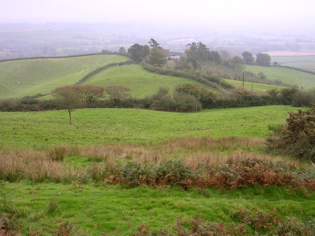
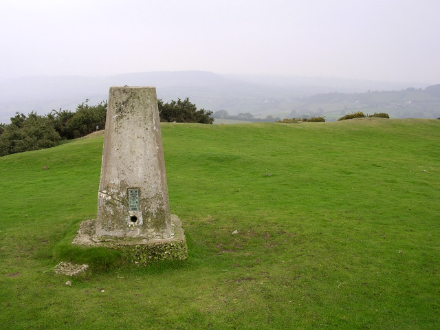
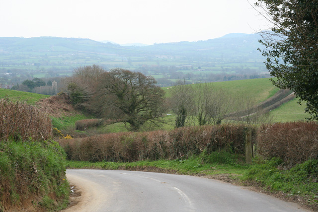
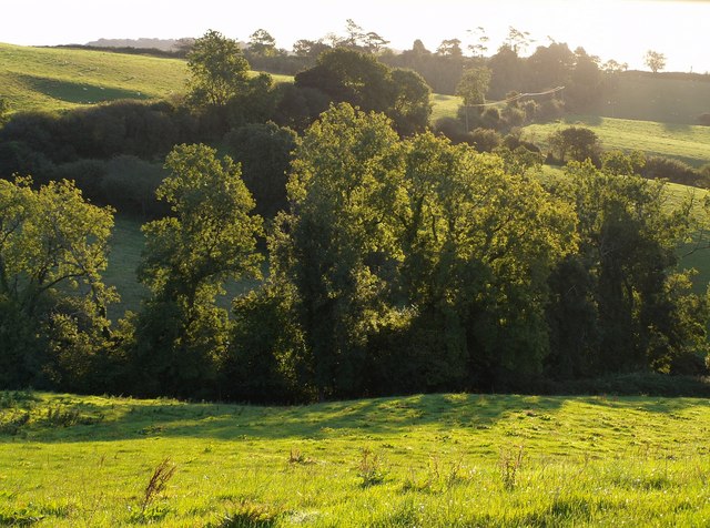
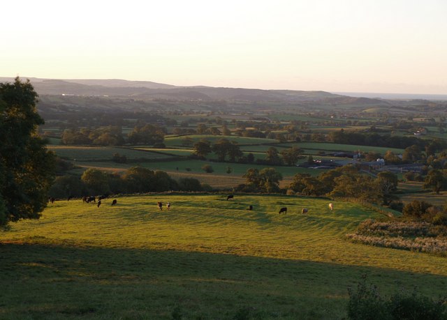
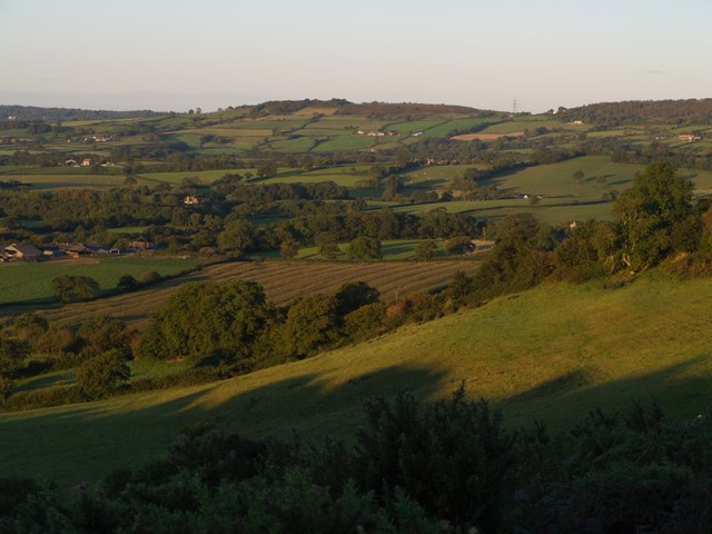
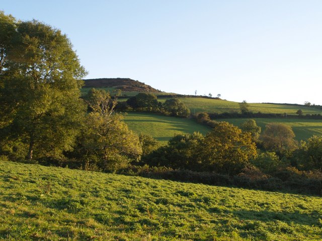
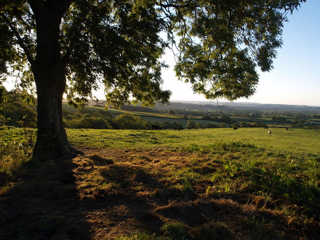
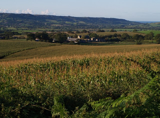
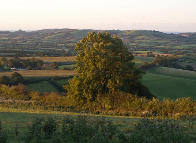
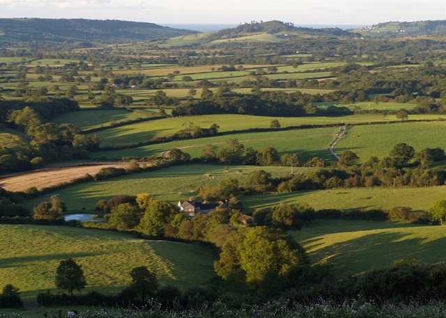
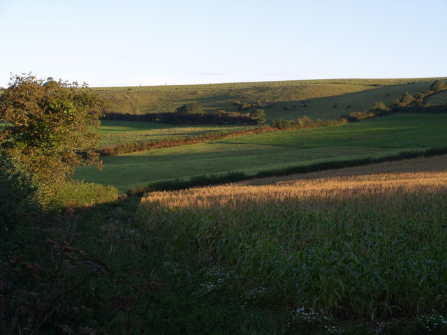
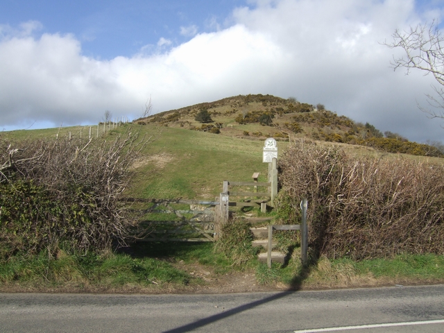
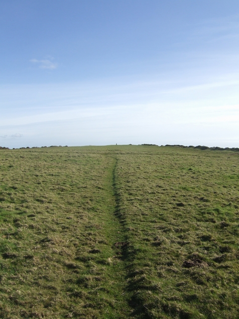
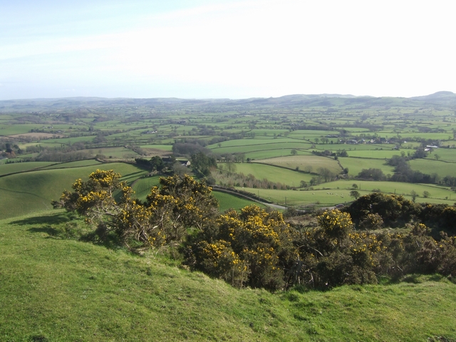
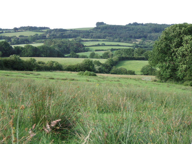
Bettiscombe Coppice is a picturesque woodland area located in the county of Dorset, England. Covering an area of approximately 50 acres, it is situated near the village of Bettiscombe, nestled within the rolling hills of the Marshwood Vale.

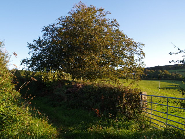
This ancient coppice woodland is home to a diverse range of flora and fauna, making it a haven for nature enthusiasts and wildlife lovers. The woodland primarily consists of oak and hazel trees, along with occasional beech and ash trees. The dense canopy of the trees creates a shaded and tranquil environment, perfect for a leisurely stroll or a peaceful retreat.

The forest floor is covered with a rich carpet of wildflowers, including bluebells, wood anemones, and primroses, which burst into a riot of colors during the springtime. The woodland is also home to a variety of animal species, including deer, foxes, badgers, and numerous bird species. Visitors may be lucky enough to catch a glimpse of these creatures as they go about their daily activities.

Bettiscombe Coppice is not only a natural sanctuary but also holds historical significance. It has been managed as a coppice woodland for hundreds of years, providing a sustainable source of wood for local communities. The traditional practice of coppicing involves cutting trees at the base, promoting new growth and a continuous supply of timber.

Overall, Bettiscombe Coppice offers a serene and enchanting experience for those seeking a connection with nature and a glimpse into the region's history.

If you have any feedback on the listing, please let us know in the comments section below.

Bettiscombe Coppice Images

Images are sourced within 2km of 50.794746/-2.8535487 or Grid Reference SY3999. Thanks to Geograph Open Source API. All images are credited.

View towards Pilsdon Barn from Pilsdon Pen This view is looking south from the SE end of Pilsdon Pen, just above Lob Gate where the car-parking layby for the hillfort is. The valley beyond is lost in drizzle, a typical Dorset autumn afternoon. The ubiquitous sheep are grazing the downland to the left of Pilsdon Barn.
View towards Pilsdon Barn from Pilsdon Pen
This view is looking south from the SE end of Pilsdon Pen, just above Lob Gate where the car-parking layby for the hillfort is. The valley beyond is lost in drizzle, a typical Dorset autumn afternoon. The ubiquitous sheep are grazing the downland to the left of Pilsdon Barn.
Trig point at the summit of Pilsdon Pen This trig point marks the summit of Pilsdon Pen, which at 277m above sea level is traditionally the highest point in the county of Dorset. The crested bank behind the trig point is the inner rampart of the iron-age hillfort on top of the hill. The rampart ditches have a thick growth of gorse.
Trig point at the summit of Pilsdon Pen
This trig point marks the summit of Pilsdon Pen, which at 277m above sea level is traditionally the highest point in the county of Dorset. The crested bank behind the trig point is the inner rampart of the iron-age hillfort on top of the hill. The rampart ditches have a thick growth of gorse.
Thorncombe: Racedown By the entrance to the estate: Looking north west from the B3165 Crewkerne – Marshwood road
Thorncombe: Racedown
By the entrance to the estate: Looking north west from the B3165 Crewkerne – Marshwood road
The B3165 at Marshalsea Looking south west near Tanyard Farm. Here the B3165 provides the boundary between Thorncombe and Bettiscombe parishes
The B3165 at Marshalsea
Looking south west near Tanyard Farm. Here the B3165 provides the boundary between Thorncombe and Bettiscombe parishes
Bettiscombe: by Horse Mill Cross Looking south. Near Birdsmoorgate
Bettiscombe: by Horse Mill Cross
Looking south. Near Birdsmoorgate
Trees near Templeman's Ash The trees catching the morning sunlight are alongside a small tributary of the River Char which drops down from Pilsdon Pen. Taken from the gateway in <a href="https://www.geograph.org.uk/photo/562679">ST4000 : Bridleway to Templeman's Ash</a> on the Wessex Ridgeway Trail a little south of Templeman's Ash.
Trees near Templeman's Ash
The trees catching the morning sunlight are alongside a small tributary of the River Char which drops down from Pilsdon Pen. Taken from the gateway in ST4000 : Bridleway to Templeman's Ash on the Wessex Ridgeway Trail a little south of Templeman's Ash.
First light above Pilsdon Early morning sunlight catching segments of the landscape. The ridge running down the foreground carries the Wessex Ridgeway past the grazing cattle. The farms visible to the right are across a myriad boundary at Pilsdon, in <a href="https://www.geograph.org.uk/gridref/SY4199">SY4199</a>. Beyond is the Marshwood Vale, and past the hills on the far side is the sea.
First light above Pilsdon
Early morning sunlight catching segments of the landscape. The ridge running down the foreground carries the Wessex Ridgeway past the grazing cattle. The farms visible to the right are across a myriad boundary at Pilsdon, in SY4199. Beyond is the Marshwood Vale, and past the hills on the far side is the sea.
Country northeast of Bettiscombe The northern edge of the Marshwood Vale meets the hills - Sliding Hill is to the right. Taken from a similar spot to <a href="https://www.geograph.org.uk/photo/562668">ST4000 : Revelshay Farm</a>, and a few minutes earlier (7:19 am). On the left is Lower House Farm, in <a href="https://www.geograph.org.uk/gridref/SY4099">SY4099</a>. The hill in the distance is Coney's Castle - see <a href="https://www.geograph.org.uk/photo/475785">SY3797 : Northeast from Coney's Castle</a> for a corresponding view in this direction.
Country northeast of Bettiscombe
The northern edge of the Marshwood Vale meets the hills - Sliding Hill is to the right. Taken from a similar spot to ST4000 : Revelshay Farm, and a few minutes earlier (7:19 am). On the left is Lower House Farm, in SY4099. The hill in the distance is Coney's Castle - see SY3797 : Northeast from Coney's Castle for a corresponding view in this direction.
Looking towards Lob Gate Taken from the Wessex Ridgeway as it follows a path from Templeman's Ash to Pilsdon, looking across the southern slopes of Pilsdon Pen. Lob Gate is on the B3164, which runs behind the uppermost hedge where the trees are above the horizon. The intervening valley is of a small tributary of the River Char that flows through Pilsdon.
Looking towards Lob Gate
Taken from the Wessex Ridgeway as it follows a path from Templeman's Ash to Pilsdon, looking across the southern slopes of Pilsdon Pen. Lob Gate is on the B3164, which runs behind the uppermost hedge where the trees are above the horizon. The intervening valley is of a small tributary of the River Char that flows through Pilsdon.
Ash tree by the Wessex Ridgeway This is the tree that appears on the left of <a href="https://www.geograph.org.uk/photo/561156">ST4100 : First light above Pilsdon</a>. The footpath heads out across the field towards Pilsdon.
Ash tree by the Wessex Ridgeway
This is the tree that appears on the left of ST4100 : First light above Pilsdon. The footpath heads out across the field towards Pilsdon.
Farm at Pilsdon A less blurred view of the group of buildings seen in the background of <a href="https://www.geograph.org.uk/photo/561677">ST4100 : Signpost above Pilsdon</a>. This is shown on the 1:25000 map as "Pilsdon Cottages", but larger scale maps identify it as "Gables". The view is across a maize field from the junction of Yard Lane and Pilsdon Lane. Forming the backdrop beyond Marshwood Vale are Stonebarrow Hill and the sea at Charmouth.
Farm at Pilsdon
A less blurred view of the group of buildings seen in the background of ST4100 : Signpost above Pilsdon. This is shown on the 1:25000 map as "Pilsdon Cottages", but larger scale maps identify it as "Gables". The view is across a maize field from the junction of Yard Lane and Pilsdon Lane. Forming the backdrop beyond Marshwood Vale are Stonebarrow Hill and the sea at Charmouth.
Tree above Pilsdon A large tree - an ash, I think - catching the first of the sunlight on the slopes below Templeman's Ash. The buildings on the left are at Pilsdon. The sea can be seen either side of the hills north of Chideock. Taken from roughly the same spot as <a href="https://www.geograph.org.uk/photo/561156">ST4100 : First light above Pilsdon</a>.
Tree above Pilsdon
A large tree - an ash, I think - catching the first of the sunlight on the slopes below Templeman's Ash. The buildings on the left are at Pilsdon. The sea can be seen either side of the hills north of Chideock. Taken from roughly the same spot as ST4100 : First light above Pilsdon.
Revelshay Farm Looking down on the farm from a field close to Farthings Brake Coppice. The field forms a conservation walk adjacent to bridleway W32W22W38/7, which carries the Wessex Ridgeway down from Templeman's Ash into the Marshwood Vale. This forms the backdrop to the picture, with Conegar Hill rising beyond, and the sea visible on either side of it.
Revelshay Farm
Looking down on the farm from a field close to Farthings Brake Coppice. The field forms a conservation walk adjacent to bridleway W32W22W38/7, which carries the Wessex Ridgeway down from Templeman's Ash into the Marshwood Vale. This forms the backdrop to the picture, with Conegar Hill rising beyond, and the sea visible on either side of it.
Bridleway to Templeman's Ash The bridleway which is seen crossing fields in <a href="https://www.geograph.org.uk/photo/561156">ST4100 : First light above Pilsdon</a> is seen here climbing the ridge between hedges. <a href="https://www.geograph.org.uk/photo/559706">ST4100 : Trees near Templeman's Ash</a> was taken from the gateway.
Bridleway to Templeman's Ash
The bridleway which is seen crossing fields in ST4100 : First light above Pilsdon is seen here climbing the ridge between hedges. ST4100 : Trees near Templeman's Ash was taken from the gateway.
Pilsdon Pen from Templeman's Ash Bridleway W23/40 heads alongside this hedge along the foot of Pilsdon Pen, whose distinctive hillfort summit is off to the right in SY4101.
Pilsdon Pen from Templeman's Ash
Bridleway W23/40 heads alongside this hedge along the foot of Pilsdon Pen, whose distinctive hillfort summit is off to the right in SY4101.
Pilsdon Pen The highest iron age hill fort in Dorset.
Pilsdon Pen
The highest iron age hill fort in Dorset.
Inside Pilsdon Pen Looking south towards the Trig Point along the Monarch's Way.
Inside Pilsdon Pen
Looking south towards the Trig Point along the Monarch's Way.
Outer Ring at Pilsdon Pen The highest hill fort in Dorset offers a view to the coastal hills.
Outer Ring at Pilsdon Pen
The highest hill fort in Dorset offers a view to the coastal hills.
Show me another place!

Bettiscombe Coppice is located at Grid Ref: SY3999 (Lat: 50.794746, Lng: -2.8535487)

Unitary Authority: Dorset

Police Authority: Dorset

What 3 Words

///commuting.backlog.laptop. Near Charmouth, Dorset

Related Wikis

Bettiscombe

Bettiscombe is a small village and civil parish in west Dorset, England, situated in the Marshwood Vale four miles (6.4 km) west of Beaminster. Dorset...

Pilsdon

Pilsdon is a hamlet and civil parish in the Dorset unitary authority area of Dorset, England. Dorset County Council's 2013 mid-year estimate of the parish...

St Mary's Church, Marshwood

St Mary's Church is a Church of England church in Marshwood, Dorset, England. The earliest part of the church is the tower, which dates to 1840, while...

Marshwood

Marshwood is a village and civil parish in west Dorset, England, situated on the northern edge of the Marshwood Vale approximately 5.5 miles (8.9 km) northeast...

Pilsdon Pen

Pilsdon Pen is a 277-metre (909 ft) hill in Dorset in South West England, situated at the north end of the Marshwood Vale, approximately 4.5 miles (7.2...

Payne's Down

Payne's Down is a prominent hill, 211 metres (692 ft) high, some 10 kilometres east-northeast of Axminster and 1 kilometre northwest of Birdsmoorgate,...

The Bottle Inn

The Bottle Inn is a 16th-century public house at Marshwood in Dorset, England which hosts the World Nettle Eating Championship. It is Grade II listed....

Marshwood Castle

Marshwood Castle was a motte-and-bailey castle in Marshwood, Dorset, within the Vale of Marshwood. It was built by William de Mandeville following his...

Nearby Amenities

Located within 500m of 50.794746,-2.8535487
Bettiscombe
Place: hamlet
Source: NPE
Lat/Long: 50.7957469/-2.854917
The data included in this document is from www.openstreetmap.org. The data is made available under ODbL.

Have you been to Bettiscombe Coppice?

Leave your review of Bettiscombe Coppice below (or comments, questions and feedback).