Young Oaks

Wood, Forest in Herefordshire

England

Young Oaks

Trig point on Burton Hill The trig point on Burton Hill is not positioned at the highest point as can be seen from this picture. The trig point is 287m above sea level, however the land to the south-west rises to just over 290m.
Trig point on Burton Hill Credit: Philip Halling

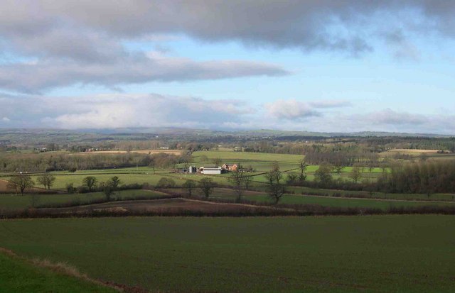
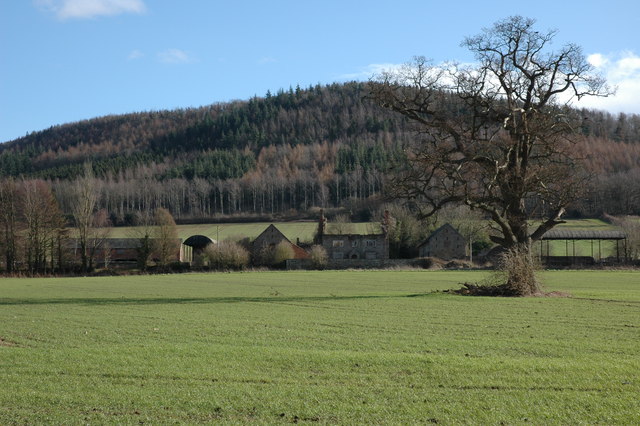
Young Oaks is a small wood located in the county of Herefordshire, England. Situated in the heart of the county, it covers an area of approximately 20 acres. The wood is predominantly made up of oak trees, hence its name, with a few other tree species interspersed throughout.

The forest boasts a diverse ecosystem, providing a habitat for various wildlife species. It is home to a wide range of bird species, including woodpeckers, owls, and songbirds. Small mammals such as squirrels, foxes, and hedgehogs can also be found within the wood. Additionally, the forest floor is rich in flora, with a carpet of bluebells and wildflowers during the spring and summer months.

Young Oaks is a popular destination for nature enthusiasts and hikers alike. It offers a network of well-maintained trails that wind through the wood, providing visitors with the opportunity to explore its natural beauty. The trails are suitable for people of all ages and fitness levels, making it an ideal location for a leisurely stroll or a more vigorous hike.

The wood is managed by the local conservation authority, who ensure the preservation of its natural resources and biodiversity. They also organize educational programs and guided tours to raise awareness about the importance of woodland conservation.

Overall, Young Oaks in Herefordshire is a delightful woodland retreat, offering visitors a chance to immerse themselves in nature and appreciate the tranquility of the forest.

If you have any feedback on the listing, please let us know in the comments section below.

Young Oaks Images

Images are sourced within 2km of 52.139435/-2.8790224 or Grid Reference SO3949. Thanks to Geograph Open Source API. All images are credited.

Trig point on Burton Hill The trig point on Burton Hill is not positioned at the highest point as can be seen from this picture. The trig point is 287m above sea level, however the land to the south-west rises to just over 290m.
Trig point on Burton Hill
The trig point on Burton Hill is not positioned at the highest point as can be seen from this picture. The trig point is 287m above sea level, however the land to the south-west rises to just over 290m.
Footpath through the woodland on Burton Hill This footpath descends to a track which contours the northern slopes of the hill.
Footpath through the woodland on Burton Hill
This footpath descends to a track which contours the northern slopes of the hill.
Devereux Wootton Devereux Wootton is a farm on the B4230. Here it is viewed from the south-east. The high ground on the horizon directly above the farmhouse is Black Mixen which rises to just over 2000ft above sea level and is easily identified by the transmitter on its summit.
Devereux Wootton
Devereux Wootton is a farm on the B4230. Here it is viewed from the south-east. The high ground on the horizon directly above the farmhouse is Black Mixen which rises to just over 2000ft above sea level and is easily identified by the transmitter on its summit.
The B4230 near Shoals Bank Shoals Bank is the house which can be seen above the road on the right.
The B4230 near Shoals Bank
Shoals Bank is the house which can be seen above the road on the right.
Milepost near Devereux Wootton Milepost on the B4230.
Milepost near Devereux Wootton
Milepost on the B4230.
Hyatt Sarnesfield From Shoals Bank
Hyatt Sarnesfield
From Shoals Bank
Sheep on Shoals Bank From the B4230
Sheep on Shoals Bank
From the B4230
Farm driveway to Fenhampton A clamour of rooks can be seen above the field on the right.
Farm driveway to Fenhampton
A clamour of rooks can be seen above the field on the right.
Fields End, near Weobley Viewed from the B4230 the farmhouse at Fields End is just a shell. The wooded hill behind is Burton Hill
Fields End, near Weobley
Viewed from the B4230 the farmhouse at Fields End is just a shell. The wooded hill behind is Burton Hill
Footpath at Fenhampton Suitable footwear required - particularly when crossing the by-products of a dairy farm in the next field
Footpath at Fenhampton
Suitable footwear required - particularly when crossing the by-products of a dairy farm in the next field
Fenhampton farm buildings The rear of Fenhampton farm - not as beautiful as the 17th century front.
Fenhampton farm buildings
The rear of Fenhampton farm - not as beautiful as the 17th century front.
Farm machinery at Fenhampton The machinery of modern farming, set in a more traditional agricultural element - mud. Looking towards Hyatt Sarnesfield.
Farm machinery at Fenhampton
The machinery of modern farming, set in a more traditional agricultural element - mud. Looking towards Hyatt Sarnesfield.
Footpath junction - Fenhampton The lane ends abruptly and offers two very soggy options - both wonderful walks when drier.
Footpath junction - Fenhampton
The lane ends abruptly and offers two very soggy options - both wonderful walks when drier.
Fenhampton, near Weobley Even on a soggy December morning, it looks a picture. Not so pretty at the back (see SO 3850)
Fenhampton, near Weobley
Even on a soggy December morning, it looks a picture. Not so pretty at the back (see SO 3850)
The tenants of Fenhampton farm A traditional Herefordshire farmyard - the gateway less so. Ingenious, nevertheless.
The tenants of Fenhampton farm
A traditional Herefordshire farmyard - the gateway less so. Ingenious, nevertheless.
Fenhampton with sheep 17th century farmhouse near Weobley.
Fenhampton with sheep
17th century farmhouse near Weobley.
The Ley, Weobley The finest house in Weobley. 3/4 of a mile outside of the village at the end of a lane. Exquisite position with an adjacent lake. Dates from 1589.
The Ley, Weobley
The finest house in Weobley. 3/4 of a mile outside of the village at the end of a lane. Exquisite position with an adjacent lake. Dates from 1589.
The lake, The Ley, Weobley The humps and bumps in the field beyond suggest that this may have been the moat of an much earlier house.
The lake, The Ley, Weobley
The humps and bumps in the field beyond suggest that this may have been the moat of an much earlier house.
Show me another place!

Young Oaks is located at Grid Ref: SO3949 (Lat: 52.139435, Lng: -2.8790224)

Unitary Authority: County of Herefordshire

Police Authority: West Mercia

What 3 Words

///exchanges.slips.delusions. Near Weobley, Herefordshire

Nearby Locations

Young Oaks Burton Covert

Related Wikis

Norton Canon

Norton Canon is a village and civil parish in Herefordshire, England, near the A480 road and the B4230 road. The population at the 2011 Census was 242...

Weobley High School

Weobley High School is a mixed secondary school located in Weobley in the English county of Herefordshire.It is a community school administered by Herefordshire...

Weobley Castle, Herefordshire

Weobley Castle was a ringwork and bailey castle in the English county of Herefordshire (grid reference SO40365135). The castle belonged to the De Lacy...

Weobley

Weobley ( WEB-lee) is an ancient settlement and civil parish in Herefordshire, England. Formerly a market town, the market is long defunct and the settlement...

Nearby Amenities

Located within 500m of 52.139435,-2.8790224
The data included in this document is from www.openstreetmap.org. The data is made available under ODbL.

Have you been to Young Oaks?

Leave your review of Young Oaks below (or comments, questions and feedback).