Apley

Settlement in Lincolnshire West Lindsey

England

Apley

Tracks in a muddy field The Bridleway at this point became very muddy and impassable.
Tracks in a muddy field Credit: Julian P Guffogg

Apley is a small village located in the East Midlands region of England, specifically in the county of Lincolnshire. Nestled amidst picturesque countryside, Apley is situated approximately 7 miles north-west of the historic town of Boston.

With a population of just over 200 residents, Apley boasts a close-knit community that embraces its rural charm. The village is characterized by its idyllic surrounding landscape, which comprises rolling hills, lush green fields, and meandering streams. This picturesque setting provides ample opportunities for outdoor activities such as walking, cycling, and fishing, attracting nature enthusiasts and adventurers alike.

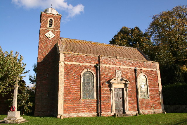
Apley is also home to a number of quaint cottages and traditional farmhouses, showcasing the region's architectural heritage. The village features a small parish church, St. Andrew's, which dates back to the 14th century and serves as a focal point for the community.

Despite its small size, Apley benefits from its proximity to nearby amenities and services. The neighboring town of Boston offers a range of shops, supermarkets, schools, and healthcare facilities, ensuring residents have access to essential resources.

Overall, Apley presents an ideal location for those seeking a peaceful and rural lifestyle. With its charming scenery, tight-knit community, and convenient access to nearby amenities, Apley truly embodies the quintessential English village experience.

If you have any feedback on the listing, please let us know in the comments section below.
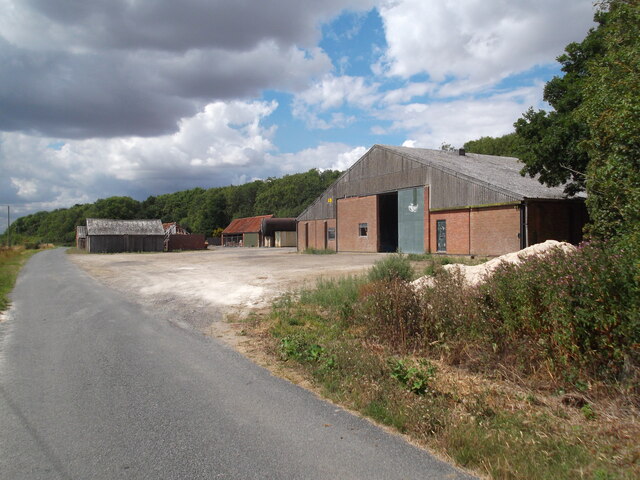
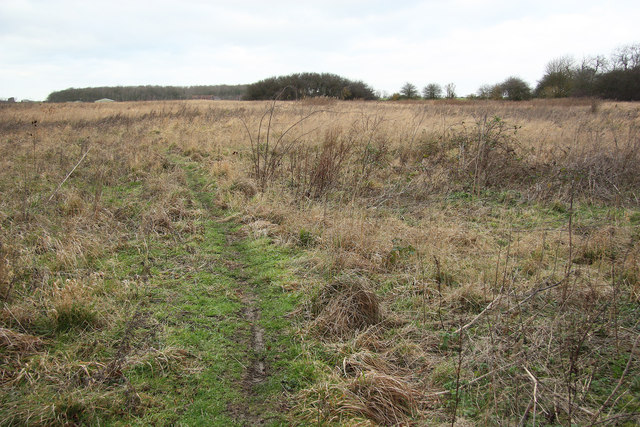
Apley Images

Images are sourced within 2km of 53.261725/-0.337013 or Grid Reference TF1175. Thanks to Geograph Open Source API. All images are credited.

Tracks in a muddy field The Bridleway at this point became very muddy and impassable.
Tracks in a muddy field
The Bridleway at this point became very muddy and impassable.
Public Bridleway across field This well marked Bridleway does not actually follow the line on the map, but the  path cuts straight across the field.
Public Bridleway across field
This well marked Bridleway does not actually follow the line on the map, but the path cuts straight across the field.
The Diminutive Church of Apley, St Andrew's A charming church in well-kept grounds.  See <a title="https://www.geograph.org.uk/photo/6972672" href="https://www.geograph.org.uk/photo/6972672">Link</a> for a view of the east end.
The Diminutive Church of Apley, St Andrew's
A charming church in well-kept grounds. See Link for a view of the east end.
Apley, St Andrew's Church, East End See <a title="https://www.geograph.org.uk/photo/6972668" href="https://www.geograph.org.uk/photo/6972668">Link</a> for a view of the west end of this diminutive church.  Buried by the cement render band is believed to be a cut bench mark, detailed at <span class="nowrap"><a title="https://www.bench-marks.org.uk/bm156009" rel="nofollow ugc noopener" href="https://www.bench-marks.org.uk/bm156009">Link</a><img style="margin-left:2px;" alt="External link" title="External link - shift click to open in new window" src="https://s1.geograph.org.uk/img/external.png" width="10" height="10"/></span>.
Apley, St Andrew's Church, East End
See Link for a view of the west end of this diminutive church. Buried by the cement render band is believed to be a cut bench mark, detailed at LinkExternal link.
Part of site of Benedictine  Nunnery at Stainfield Benedictine Priory of St. Mary at Stainfield was founded in the mid 12th century and dissolved in 1536. It was the only Benedictine nunnery in Lincolnshire. In 1538 it was granted to Sir Robert Tyrwhitt whose descendants constructed a large house, park and formal gardens on the site. The remains of the nunnery, including most of the precinct, the site of the conventual buildings and a group of fishponds, are therefore partly overlain by the remains of a post-Dissolution house with associated buildings, gardens and other landscape features.

See: <span class="nowrap"><a title="https://historicengland.org.uk/listing/the-list/list-entry/1014454" rel="nofollow ugc noopener" href="https://historicengland.org.uk/listing/the-list/list-entry/1014454">Link</a><img style="margin-left:2px;" alt="External link" title="External link - shift click to open in new window" src="https://s1.geograph.org.uk/img/external.png" width="10" height="10"/></span>

A Tyrwhitt was also responsible for ridding the area of the tyranny of the Wild Man - or so the story goes... see <a href="https://www.geograph.org.uk/photo/6974026">TF1173 : Wild Man in Church of St. Andrew, Stainfield</a>.
Part of site of Benedictine Nunnery at Stainfield
Benedictine Priory of St. Mary at Stainfield was founded in the mid 12th century and dissolved in 1536. It was the only Benedictine nunnery in Lincolnshire. In 1538 it was granted to Sir Robert Tyrwhitt whose descendants constructed a large house, park and formal gardens on the site. The remains of the nunnery, including most of the precinct, the site of the conventual buildings and a group of fishponds, are therefore partly overlain by the remains of a post-Dissolution house with associated buildings, gardens and other landscape features. See: LinkExternal link A Tyrwhitt was also responsible for ridding the area of the tyranny of the Wild Man - or so the story goes... see TF1173 : Wild Man in Church of St. Andrew, Stainfield.
Model of Benedictine nun in St. Andrew's Church, Stainfield The Benedictine nunnery of Stainfield was founded in the mid 12th century and dissolved in 1536. In 1538 it was granted to Sir Robert Tyrwhitt whose descendants constructed a large house, park and formal gardens on the site. The remains of the nunnery, including most of the precinct, the site of the conventual buildings and a group of fishponds, are therefore partly overlain by the remains of a post-Dissolution house with associated buildings, gardens and other landscape features.

The Priory of St Mary at Stainfield was the only nunnery of the Benedictine order in the old county of Lincolnshire. There is extensive information about the Priory in the church.

See: <span class="nowrap"><a title="https://historicengland.org.uk/listing/the-list/list-entry/1014454" rel="nofollow ugc noopener" href="https://historicengland.org.uk/listing/the-list/list-entry/1014454">Link</a><img style="margin-left:2px;" alt="External link" title="External link - shift click to open in new window" src="https://s1.geograph.org.uk/img/external.png" width="10" height="10"/></span>
Model of Benedictine nun in St. Andrew's Church, Stainfield
The Benedictine nunnery of Stainfield was founded in the mid 12th century and dissolved in 1536. In 1538 it was granted to Sir Robert Tyrwhitt whose descendants constructed a large house, park and formal gardens on the site. The remains of the nunnery, including most of the precinct, the site of the conventual buildings and a group of fishponds, are therefore partly overlain by the remains of a post-Dissolution house with associated buildings, gardens and other landscape features. The Priory of St Mary at Stainfield was the only nunnery of the Benedictine order in the old county of Lincolnshire. There is extensive information about the Priory in the church. See: LinkExternal link
WW1 Memorial in St. Andrew's Church, Stainfield
Doorway, St. Andrew's Church, Stainfield St Andrews church is dated 1711, a Queen Anne church. Its design has been attributed to Sir Christopher Wren, who is said to have visited Stainfield Hall at about this time. The church lies north south, so that it forms a pleasing view in the parkland. It was built on the site of the only Benedictine priory in Lincolnshire; finds of sculptural and architectural fragments from the 14th century indicate the site of the priory church and buildings. See <span class="nowrap"><a title="https://www.explorechurches.org/church/st-andrew-stainfield" rel="nofollow ugc noopener" href="https://www.explorechurches.org/church/st-andrew-stainfield">Link</a><img style="margin-left:2px;" alt="External link" title="External link - shift click to open in new window" src="https://s1.geograph.org.uk/img/external.png" width="10" height="10"/></span> and <a href="https://www.geograph.org.uk/photo/3509307">TF1173 : St.Andrew's church</a>.
Doorway, St. Andrew's Church, Stainfield
St Andrews church is dated 1711, a Queen Anne church. Its design has been attributed to Sir Christopher Wren, who is said to have visited Stainfield Hall at about this time. The church lies north south, so that it forms a pleasing view in the parkland. It was built on the site of the only Benedictine priory in Lincolnshire; finds of sculptural and architectural fragments from the 14th century indicate the site of the priory church and buildings. See LinkExternal link and TF1173 : St.Andrew's church.
Tyrwhitt coat of arms in St. Andrew's Church, Stainfield Tyrwhitt is apparently another name for lapwing or plover. See <a href="https://www.geograph.org.uk/photo/6974026">TF1173 : Wild Man in Church of St. Andrew, Stainfield</a>.
Tyrwhitt coat of arms in St. Andrew's Church, Stainfield
Tyrwhitt is apparently another name for lapwing or plover. See TF1173 : Wild Man in Church of St. Andrew, Stainfield.
Wild Man in Church of St. Andrew, Stainfield Said to be from the helmet of one of the Tyrwhitts of Stainfield.

One of Lincolnshire's legends tells of a wild man (aka Wood Wose) who lived in the woods near Stainfield. The story appears in Folklore around Horncastle (1915) by Revd James Alpas Penny, who writes that in Stainfield church is the helmet of one of the Tyrwhitts of Stainfield, with the family crest of a wild man with a dagger. He recounts the legend that one Francis Tyrwhitt-Drake was promised all the land in Stainfield if he could kill the wild man who had terrorised the district. The wild man, so the story goes says, was asleep on a bank by a pit, but his presence had disturbed a plover’s nest. The parent birds made such a noise that they attracted the attention of Tyrwhitt-Drake as he rode by. As he lay asleep, Drake ran the wild man through with his sword, though the man got up and chased him before dropping dead. Interestingly the word ‘Tyrwhitt’ is an old English name for a peewit (or lapwing). The Tyrwhitt-Drake coat of arms henceforth featured three peewits to commemorate the great victory.  

A variation of this story, set in the 12th century, identifies the wild man as a Stainfield nobleman who had been away fighting in the Crusades for so long that when he returned he found he had been dispossessed. He went on to live in the woods, where he became so dangerous that Drake-Tyrwhitt was forced to kill him. It has been suggested that the story was put about to explain the relics in St Andrews belonging to the Tyrwhitt family, which included tattered cloth hanging from the wall reputed to be the wild man's clothing, and the dagger, gloves, and helmet said to belong to the man who killed him. In fact, the rags were the tattered remnants of the three banners embroidered by the ladies of the Tyrwhitt family, now in the care of the Archives Office in Lincoln. According to another variation on the legend the wildman was killed by a band of farmers incensed that their livestock was being taken and their families terrorised. The farmers, who went on to be known as "The Hardy Gang", trapped and killed the wildman in a wood between Langton and Stainfield. See <span class="nowrap"><a title="https://en.wikipedia.org/wiki/Stainfield" rel="nofollow ugc noopener" href="https://en.wikipedia.org/wiki/Stainfield">Link</a><img style="margin-left:2px;" alt="External link" title="External link - shift click to open in new window" src="https://s1.geograph.org.uk/img/external.png" width="10" height="10"/></span> and <span class="nowrap"><a title="https://www.facebook.com/UKBigfootResearchGroup/posts/the-stainfield-wildman-lincolnshireone-of-the-most-enduring-tales-of-a-woodwose-/162384935467021/" rel="nofollow ugc noopener" href="https://www.facebook.com/UKBigfootResearchGroup/posts/the-stainfield-wildman-lincolnshireone-of-the-most-enduring-tales-of-a-woodwose-/162384935467021/">Link</a><img style="margin-left:2px;" alt="External link" title="External link - shift click to open in new window" src="https://s1.geograph.org.uk/img/external.png" width="10" height="10"/></span>

A "replica" of the wildman lurks menacingly in the corner of the otherwise charming church, along with a quilt depicting him - see <a href="https://www.geograph.org.uk/photo/5773609">TF1173 : The Wild Man of Stainfield, Stainfield church</a>.
Wild Man in Church of St. Andrew, Stainfield
Said to be from the helmet of one of the Tyrwhitts of Stainfield. One of Lincolnshire's legends tells of a wild man (aka Wood Wose) who lived in the woods near Stainfield. The story appears in Folklore around Horncastle (1915) by Revd James Alpas Penny, who writes that in Stainfield church is the helmet of one of the Tyrwhitts of Stainfield, with the family crest of a wild man with a dagger. He recounts the legend that one Francis Tyrwhitt-Drake was promised all the land in Stainfield if he could kill the wild man who had terrorised the district. The wild man, so the story goes says, was asleep on a bank by a pit, but his presence had disturbed a plover’s nest. The parent birds made such a noise that they attracted the attention of Tyrwhitt-Drake as he rode by. As he lay asleep, Drake ran the wild man through with his sword, though the man got up and chased him before dropping dead. Interestingly the word ‘Tyrwhitt’ is an old English name for a peewit (or lapwing). The Tyrwhitt-Drake coat of arms henceforth featured three peewits to commemorate the great victory. A variation of this story, set in the 12th century, identifies the wild man as a Stainfield nobleman who had been away fighting in the Crusades for so long that when he returned he found he had been dispossessed. He went on to live in the woods, where he became so dangerous that Drake-Tyrwhitt was forced to kill him. It has been suggested that the story was put about to explain the relics in St Andrews belonging to the Tyrwhitt family, which included tattered cloth hanging from the wall reputed to be the wild man's clothing, and the dagger, gloves, and helmet said to belong to the man who killed him. In fact, the rags were the tattered remnants of the three banners embroidered by the ladies of the Tyrwhitt family, now in the care of the Archives Office in Lincoln. According to another variation on the legend the wildman was killed by a band of farmers incensed that their livestock was being taken and their families terrorised. The farmers, who went on to be known as "The Hardy Gang", trapped and killed the wildman in a wood between Langton and Stainfield. See LinkExternal link and LinkExternal link A "replica" of the wildman lurks menacingly in the corner of the otherwise charming church, along with a quilt depicting him - see TF1173 : The Wild Man of Stainfield, Stainfield church.
Site of Medieval settlement of Apley: aerial 2021 See <span class="nowrap"><a title="https://www.heritagegateway.org.uk/Gateway/Results_Single.aspx?uid=MLI50506&resourceID=1006" rel="nofollow ugc noopener" href="https://www.heritagegateway.org.uk/Gateway/Results_Single.aspx?uid=MLI50506&resourceID=1006">Link</a><img style="margin-left:2px;" alt="External link" title="External link - shift click to open in new window" src="https://s1.geograph.org.uk/img/external.png" width="10" height="10"/></span>.

Evidence for former settlement exists both as earthworks and as surface pottery scatters. A main hollow way running east to west is flanked along its north side by rectangular closes. A different pattern of large rectangular ditched closes to the south side resembles earthworks identified as monastic granges, demesne manors or farms within villages elsewhere in the area. These closes are all full of ridge and furrow (except at their northern end which may overlie earlier occupation). The Tithe map of 1849 shows that in addition to the surviving north to south farm track, a further way ran up the east side of the churchyard...

The medieval settlement of Apley was a hamlet established by the late 11th century. After the foundation of Stainfield Priory in the mid 12th century the settlement was granted to the nunnery and managed as a monastic manor or grange. Documentary references to a priest at Apley occur from the early 13th century onwards. The population of the settlement, which remained low throughout the medieval period, declined after the Dissolution when 'Apley Grange' was granted, with the rest of the Stainfield Priory estate, to Sir Robert Tyrwhitt, who enclosed large areas of land for sheep pasture. The medieval church at Apley remained standing until the beginning of the 18th century; the present St Andrew's chapel, which stands on an adjacent site and is not included in the scheduling, was constructed in 1871. The remains of the medieval settlement of Apley and the surviving parts of its open fields are visible as earthworks with associated buried remains and lie in two separate areas of protection.
Site of Medieval settlement of Apley: aerial 2021
See LinkExternal link. Evidence for former settlement exists both as earthworks and as surface pottery scatters. A main hollow way running east to west is flanked along its north side by rectangular closes. A different pattern of large rectangular ditched closes to the south side resembles earthworks identified as monastic granges, demesne manors or farms within villages elsewhere in the area. These closes are all full of ridge and furrow (except at their northern end which may overlie earlier occupation). The Tithe map of 1849 shows that in addition to the surviving north to south farm track, a further way ran up the east side of the churchyard... The medieval settlement of Apley was a hamlet established by the late 11th century. After the foundation of Stainfield Priory in the mid 12th century the settlement was granted to the nunnery and managed as a monastic manor or grange. Documentary references to a priest at Apley occur from the early 13th century onwards. The population of the settlement, which remained low throughout the medieval period, declined after the Dissolution when 'Apley Grange' was granted, with the rest of the Stainfield Priory estate, to Sir Robert Tyrwhitt, who enclosed large areas of land for sheep pasture. The medieval church at Apley remained standing until the beginning of the 18th century; the present St Andrew's chapel, which stands on an adjacent site and is not included in the scheduling, was constructed in 1871. The remains of the medieval settlement of Apley and the surviving parts of its open fields are visible as earthworks with associated buried remains and lie in two separate areas of protection.
Settlement of Apley: aerial 2022 The medieval settlement of Apley was a hamlet established by the late 11th century. After the foundation of Stainfield Priory in the mid 12th century the settlement was granted to the nunnery and managed as a monastic manor or grange. Documentary references to a priest at Apley occur from the early 13th century onwards. The population of the settlement, which remained low throughout the medieval period, declined after the Dissolution when 'Apley Grange' was granted, with the rest of the Stainfield Priory estate, to Sir Robert Tyrwhitt, who enclosed large areas of land for sheep pasture. The medieval church at Apley remained standing until the beginning of the 18th century; the present St Andrew's chapel, which stands on an adjacent site and is not included in the scheduling, was constructed in 1871. The remains of the medieval settlement of Apley and the surviving parts of its open fields are visible as earthworks with associated buried remains and lie in two separate areas of protection.

See <span class="nowrap"><a title="https://www.heritagegateway.org.uk/Gateway/Results_Single.aspx?uid=MLI50506&resourceID=1006" rel="nofollow ugc noopener" href="https://www.heritagegateway.org.uk/Gateway/Results_Single.aspx?uid=MLI50506&resourceID=1006">Link</a><img style="margin-left:2px;" alt="External link" title="External link - shift click to open in new window" src="https://s1.geograph.org.uk/img/external.png" width="10" height="10"/></span>
Settlement of Apley: aerial 2022
The medieval settlement of Apley was a hamlet established by the late 11th century. After the foundation of Stainfield Priory in the mid 12th century the settlement was granted to the nunnery and managed as a monastic manor or grange. Documentary references to a priest at Apley occur from the early 13th century onwards. The population of the settlement, which remained low throughout the medieval period, declined after the Dissolution when 'Apley Grange' was granted, with the rest of the Stainfield Priory estate, to Sir Robert Tyrwhitt, who enclosed large areas of land for sheep pasture. The medieval church at Apley remained standing until the beginning of the 18th century; the present St Andrew's chapel, which stands on an adjacent site and is not included in the scheduling, was constructed in 1871. The remains of the medieval settlement of Apley and the surviving parts of its open fields are visible as earthworks with associated buried remains and lie in two separate areas of protection. See LinkExternal link
Former farm buildings, Stainfield Now converted to dwellings <span class="nowrap"><a title="https://historicengland.org.uk/listing/the-list/list-entry/1147857?section=official-list-entry" rel="nofollow ugc noopener" href="https://historicengland.org.uk/listing/the-list/list-entry/1147857?section=official-list-entry">Link</a><img style="margin-left:2px;" alt="External link" title="External link - shift click to open in new window" src="https://s1.geograph.org.uk/img/external.png" width="10" height="10"/></span>
Former farm buildings, Stainfield
Now converted to dwellings LinkExternal link
Path to the Black Plantation
Path by Thistle Storr Wood
In Bardney Limewoods Nature Reserve
Cream Poke Farm
Cream Poke Farm
Stainfield Beck
Stainfield Beck
Show me another place!

Apley is located at Grid Ref: TF1175 (Lat: 53.261725, Lng: -0.337013)

Division: Parts of Lindsey

Administrative County: Lincolnshire

District: West Lindsey

Police Authority: Lincolnshire

What 3 Words

///waggled.wedding.forkful. Near Wragby, Lincolnshire

Nearby Locations

Apley Apley Willow Rough

Related Wikis

Apley

Apley is a hamlet and civil parish in the West Lindsey district of Lincolnshire, England. It is situated 1 mile (1.6 km) west from the hamlet of Kingthorpe...

Bullington Priory

Bullington Priory was a priory in Bullington, Lincolnshire, England. The priory was a house of the Gilbertine Order and dedicated to Saint Mary. It was...

Kingthorpe

Kingthorpe is a hamlet in the West Lindsey district of Lincolnshire, England. The hamlet is in the civil parish of Apley, and is 10 miles (16 km) east...

Stainfield Priory

Stainfield Priory was a Benedictine nunnery at Stainfield in the North of Lincolnshire, England, between Wragby and Fiskerton. The priory of St Mary at...

Stainfield

Stainfield is a village and civil parish about 10 miles (16 km) east of the city of Lincoln, in the West Lindsey district of Lincolnshire, England. The...

Goltho

Goltho is a hamlet in the West Lindsey district of Lincolnshire, England. The population (including Bullington) was 157 at the 2011 census. It is situated...

Kingthorpe railway station

Kingthorpe railway station was a railway station that served the village of Kingthorpe, Lincolnshire, England between 1874 and 1956, on the Louth to Bardney...

St George's Church, Goltho

St George's Church is a redundant Anglican church in the deserted village of Goltho, Lincolnshire, England. It is recorded in the National Heritage List...

Related Videos

Viking Way walk / hike on New Year’s Eve

Ending 2020, the same way I'll start 2021....fit and healthy, now I've reached 50 years young.

Wragby and Goltho, Lincolnshire, UK

This walk started in Wragby Market Place and headed towards the old windmill.Then the site of a medieval manor and an old ...

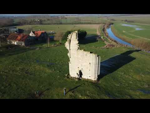
Barlings Abbey By Drone ( DJI Mini 2)

Amazing Drone Footage Of what's Left Of This Abbey.

Barlings Abbey - A Short Video of the Premonstratensian Monastery

Barlings Abbey, Lincolnshire, was a Premonstratensian monastery in England, founded in 1154, as a daughter house of the ...

Nearby Amenities

Located within 500m of 53.261725,-0.337013
Apley
Is In: Lincolnshire, England, UK
Place: hamlet
Source: Bing
Wikidata: Q4779976
Lat/Long: 53.261306/-0.3395759
Westwood View
Naptan AtcoCode: 270000009607
Naptan Bearing: NW
Naptan BusStopType: CUS
Naptan CommonName: Westwood View
Naptan Indicator: opp
Naptan Landmark: Westwood View
Naptan NaptanCode: linjdjtp
Naptan Street: Stainfield Road
Naptan Verified: no
Source: naptan_import
Lat/Long: 53.2614913/-0.3369073
Westwood View
Naptan AtcoCode: 2700LAVJ5115
Naptan Bearing: SE
Naptan BusStopType: CUS
Naptan CommonName: Westwood View
Naptan Indicator: adj
Naptan Landmark: Westwood View
Naptan NaptanCode: lindptjg
Naptan Street: Stainfield Road
Naptan Verified: no
Source: naptan_import
Lat/Long: 53.261526/-0.3368159
Manor Farm
Place: farm
Source: Bing
Lat/Long: 53.2602807/-0.3386068
Power: pole
Lat/Long: 53.2638635/-0.3313362
Power: pole
Lat/Long: 53.2642709/-0.3330182
Power: pole
Lat/Long: 53.265215/-0.3347334
Power: pole
Lat/Long: 53.2658129/-0.3343525
Power: pole
Lat/Long: 53.2640024/-0.3403828
Power: pole
Lat/Long: 53.2642166/-0.3387284
Power: pole
Lat/Long: 53.2644265/-0.3371475
Power: pole
Lat/Long: 53.2646148/-0.3357782
Power: pole
Lat/Long: 53.25814/-0.3342856
Power: pole
Lat/Long: 53.2589388/-0.3346078
Power: pole
Lat/Long: 53.2593093/-0.3321786
Power: pole
Lat/Long: 53.2583124/-0.338616
Power: pole
Lat/Long: 53.2584973/-0.3373723
Power: pole
Lat/Long: 53.2587003/-0.336138
Barrier: stile
Foot: yes
Material: wood
Stile: stepover
Lat/Long: 53.2599367/-0.3391255
Barrier: stile
Foot: yes
Material: wood
Stile: stepover
Lat/Long: 53.2605265/-0.3393853
Post Box
Lat/Long: 53.2613951/-0.339209
Power: pole
Lat/Long: 53.2639047/-0.3411656
Power: pole
Lat/Long: 53.2647272/-0.3349704
Power: pole
Lat/Long: 53.2595357/-0.3306939
Power: pole
Lat/Long: 53.2640083/-0.3417197
Power: pole
Lat/Long: 53.2631033/-0.331277
Power: pole
Lat/Long: 53.2610449/-0.3323096
Power: pole
Lat/Long: 53.2600934/-0.3329292
Power: pole
Lat/Long: 53.2590702/-0.3336368
Bench
Material: wood
Lat/Long: 53.2614897/-0.3391841
The data included in this document is from www.openstreetmap.org. The data is made available under ODbL.

Have you been to Apley?

Leave your review of Apley below (or comments, questions and feedback).