Belle Grange Coppice

Wood, Forest in Lancashire South Lakeland

England

Belle Grange Coppice

Troutbeck Bridge : A591 Heading through Troutbeck Bridge.
Troutbeck Bridge : A591 Credit: Lewis Clarke

Belle Grange Coppice, located in Lancashire, is a beautiful and enchanting woodland area that spans several acres. This coppice, also known as a small wood or forest, is nestled in the heart of the county and offers visitors a serene and peaceful escape from the bustling city life.

The woodland boasts a diverse range of trees, including oak, beech, birch, and ash, creating a rich and varied landscape. The dense canopy above provides shelter and shade, while the forest floor is covered with a lush carpet of mosses, ferns, and wildflowers, adding to the area's natural beauty.

Belle Grange Coppice is a haven for wildlife, attracting a wide array of species. Bird enthusiasts can spot various feathered friends such as woodpeckers, owls, and songbirds, while small mammals like squirrels, rabbits, and hedgehogs scurry among the undergrowth. The flora and fauna of this woodland create a harmonious ecosystem, allowing visitors to witness the wonders of nature up close.

The coppice also offers a network of well-maintained walking paths, allowing visitors to explore the area at their leisure. These trails wind through the forest, offering glimpses of tranquil ponds and babbling brooks along the way. The peaceful ambiance of Belle Grange Coppice makes it an ideal spot for nature walks, picnics, or simply unwinding in the midst of breathtaking surroundings.

Whether you are a nature lover, an avid hiker, or simply seeking solace in the beauty of the outdoors, Belle Grange Coppice in Lancashire is a destination that will not disappoint.

If you have any feedback on the listing, please let us know in the comments section below.

Belle Grange Coppice Images

Images are sourced within 2km of 54.383145/-2.9475987 or Grid Reference SD3899. Thanks to Geograph Open Source API. All images are credited.

Troutbeck Bridge : A591 Heading through Troutbeck Bridge.
Troutbeck Bridge : A591
Heading through Troutbeck Bridge.
Viewpoint at the Rayrigg Road This view point is very popular as a stopping off place for tourists driving through the town of Windermere to get a view over the lake
Viewpoint at the Rayrigg Road
This view point is very popular as a stopping off place for tourists driving through the town of Windermere to get a view over the lake
Jetty at Millerground A glimpse of sun on Windermere on an otherwise murky day. Claife Heights looms out of the gloom across the lake.
Jetty at Millerground
A glimpse of sun on Windermere on an otherwise murky day. Claife Heights looms out of the gloom across the lake.
Wait for the splash The landing stage at Low Millerground, on Windermere.
Wait for the splash
The landing stage at Low Millerground, on Windermere.
Wynlass Beck Between Rayrigg Road and Millerground Landing.
Wynlass Beck
Between Rayrigg Road and Millerground Landing.
Windermere From Millerground Landing.
Windermere
From Millerground Landing.
Ferry Cottage Low Miller Ground Grade II* listed. Dating from 1834.
Ferry Cottage Low Miller Ground
Grade II* listed. Dating from 1834.
Fields near Low Miller Ground Adjacent to Windermere.
Fields near Low Miller Ground
Adjacent to Windermere.
Bridge over Wynlass Beck Near Windermere.
Bridge over Wynlass Beck
Near Windermere.
Footbridge over Wynlass Beck Near Lake Windermere
Footbridge over Wynlass Beck
Near Lake Windermere
Millerground House Above High Millerground.
Millerground House
Above High Millerground.
Cemetery gate house At the entrance to Windermere Cemetery.
Cemetery gate house
At the entrance to Windermere Cemetery.
Viewpoint on the A592, north of Bowness As with other viewpoints in the vicinity of Windermere, this one is becoming obstructed by trees. Though in general I would not favour tree-felling, perhaps an exception should be made in a few spots to open up some splendid vistas again.
Viewpoint on the A592, north of Bowness
As with other viewpoints in the vicinity of Windermere, this one is becoming obstructed by trees. Though in general I would not favour tree-felling, perhaps an exception should be made in a few spots to open up some splendid vistas again.
Queen Adelaide's Hill I hope the sheep appreciate the view.
Queen Adelaide's Hill
I hope the sheep appreciate the view.
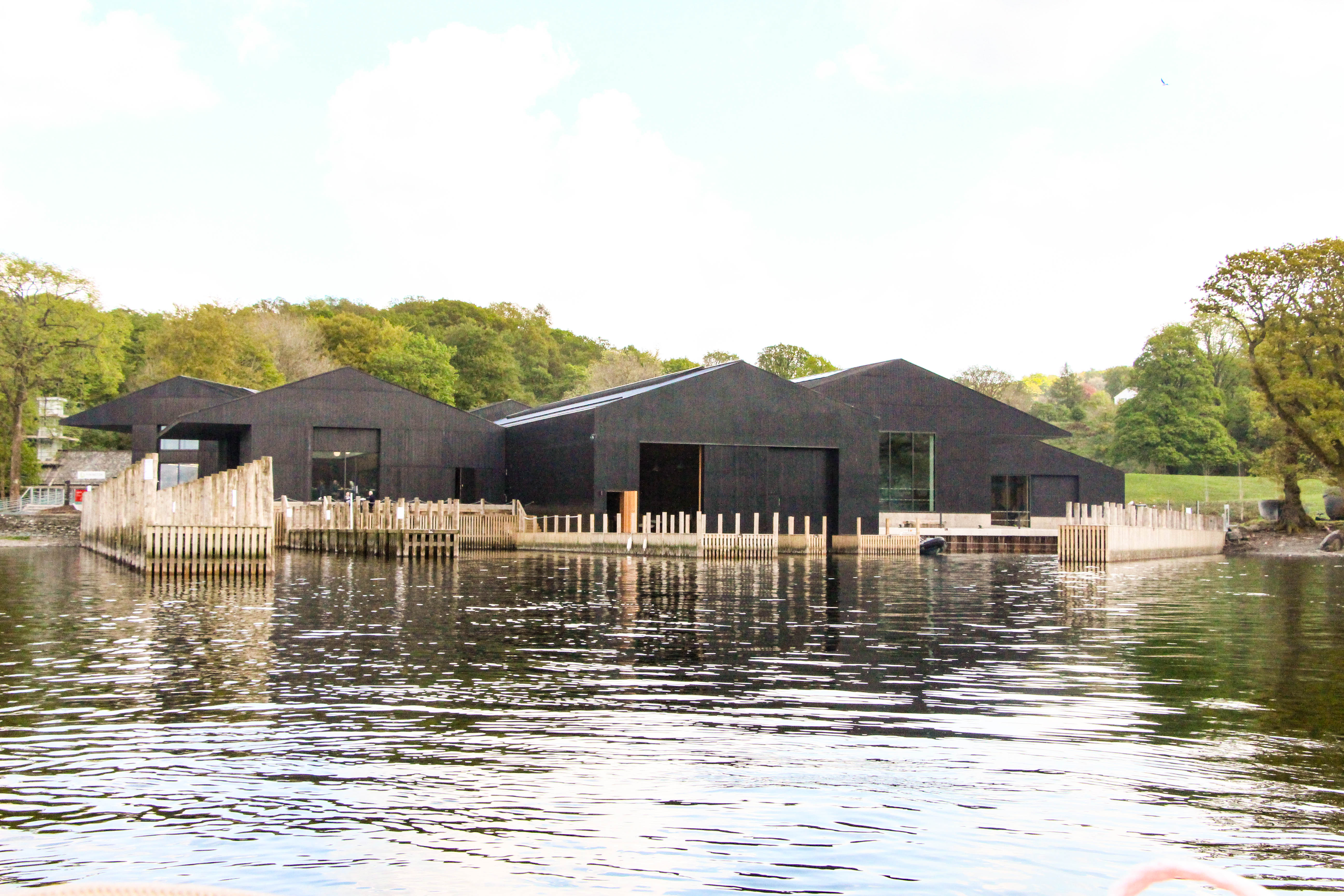
Windermere shore Boat house and jetties at Millerground.
Windermere shore
Boat house and jetties at Millerground.
Boat house at Millerground
Lakeside bungalow and boat house north of Millerground A small boat house and jetties on the east side of Windermere
Lakeside bungalow and boat house north of Millerground
A small boat house and jetties on the east side of Windermere
Cut Mark: A592, Rayrigg Road, Windermere Cemetery Lodge Cut Mark: A592, Rayrigg Road, Windermere Cemetery Lodge - nice cut mark
Cut Mark: A592, Rayrigg Road, Windermere Cemetery Lodge
Cut Mark: A592, Rayrigg Road, Windermere Cemetery Lodge - nice cut mark
Show me another place!

Belle Grange Coppice is located at Grid Ref: SD3899 (Lat: 54.383145, Lng: -2.9475987)

Administrative County: Cumbria

District: South Lakeland

Police Authority: Cumbria

What 3 Words

///charted.divided.sketching. Near Windermere, Cumbria

Related Wikis

Claife

Claife is a civil parish in the South Lakeland district of Cumbria, England. It is situated west of Windermere, and east of Esthwaite Water and the village...

Claife Heights

Claife Heights is an upland area in the Lake District, near to Windermere in Cumbria, England. It has a topographic prominence of 177 metres (581 ft) so...

Latterbarrow

Latterbarrow is a hill in the English Lake District, east of Hawkshead, Cumbria. It is the subject of a chapter of Wainwright's book The Outlying Fells...

The Lakes School

The Lakes School is a coeducational secondary school and sixth form located in Troutbeck Bridge, Windermere, in the English county of Cumbria.It is a comprehensive...

Brockhole

The Brockhole Lake District Visitor Centre, also known as the Brockhole National Park Visitor Centre, is a visitor centre and tourist attraction managed...

Windermere Jetty: Museum of Boats, Steam and Stories

Windermere Jetty: Museum of Boats, Steam and Stories (formerly Windermere Steamboat Museum) is a museum on the eastern shore of Windermere between Bowness...

Troutbeck Bridge

Troutbeck Bridge is a village in the civil parish of Windermere and Bowness, in the Westmorland and Furness district, in the ceremonial county of Cumbria...

RMS Wray Castle

RMS Wray Castle was a training college for Merchant Navy radio officers based at Wray Castle in the Lake District, from 1958 to 1998.At 11:40 p.m., on...

Nearby Amenities

Located within 500m of 54.383145,-2.9475987
Source: Landsat photo
Lat/Long: 54.3795002/-2.9438871
Source: Landsat photo
Lat/Long: 54.3807791/-2.9443335
Source: Landsat photo
Lat/Long: 54.3811754/-2.944114
Source: Landsat photo
Lat/Long: 54.3818718/-2.9435519
Source: Landsat photo
Lat/Long: 54.3822951/-2.9439175
Source: Landsat photo
Lat/Long: 54.3824923/-2.9439139
Source: Landsat photo
Lat/Long: 54.3827172/-2.9443216
Source: Landsat photo
Lat/Long: 54.3830671/-2.9443431
Source: Landsat photo
Lat/Long: 54.3835794/-2.9442787
Source: Landsat photo
Lat/Long: 54.3840918/-2.9448581
Source: Landsat photo
Lat/Long: 54.3846427/-2.9451222
Source: Landsat photo
Lat/Long: 54.3847915/-2.9456306
Source: Landsat photo
Lat/Long: 54.3849466/-2.9461089
Source: Landsat photo
Lat/Long: 54.3858843/-2.9470787
Source: Landsat photo
Lat/Long: 54.3866783/-2.9472613
Source: Landsat photo
Lat/Long: 54.3871656/-2.9474545
Source: Landsat photo
Lat/Long: 54.387553/-2.9483342
Source: Landsat photo
Lat/Long: 54.387578/-2.9488707
Barrier: bollard
Motor Vehicle: no
Lat/Long: 54.3867032/-2.9475116
Barrier: bollard
Lat/Long: 54.381653/-2.9448441
Ferry Terminal
Bark Barn
Ferry: yes
Public Transport: station
Lat/Long: 54.3815972/-2.9432421
Information: board
Tourism: information
Lat/Long: 54.3866899/-2.9475737
Source: Landsat photo
Lat/Long: 54.3854372/-2.9467737
Bench
Backrest: yes
Lat/Long: 54.3869001/-2.9475022
Power: pole
Lat/Long: 54.3867525/-2.9516106
Power: pole
Lat/Long: 54.3860425/-2.9506426
Power: pole
Lat/Long: 54.3855733/-2.9500044
Power: pole
Lat/Long: 54.3849286/-2.9493965
Power: pole
Lat/Long: 54.3844251/-2.9488956
Power: pole
Lat/Long: 54.3839756/-2.9484838
Power: pole
Lat/Long: 54.3837909/-2.9481558
Power: pole
Lat/Long: 54.3829365/-2.947072
Power: pole
Lat/Long: 54.3825752/-2.94658
Power: pole
Lat/Long: 54.3822575/-2.9462306
The data included in this document is from www.openstreetmap.org. The data is made available under ODbL.

Have you been to Belle Grange Coppice?

Leave your review of Belle Grange Coppice below (or comments, questions and feedback).