Arthur Wood

Wood, Forest in Lancashire South Lakeland

England

Arthur Wood

Path on Latterbarrow This is the path from Claife Heights, leading up the south ridge towards the summit of Latterbarrow.
Path on Latterbarrow Credit: Adrian Taylor

Arthur Wood is a small village located in the county of Lancashire, England. It is nestled within the larger area known as Wood, which encompasses several other villages and communities. Situated within the Forest of Bowland, Arthur Wood is surrounded by picturesque countryside and offers a tranquil and scenic environment for its residents.

The village of Arthur Wood is known for its rich history, dating back several centuries. It is believed to have been a settlement since the medieval times, with evidence of human activity found in the area. The village has managed to retain much of its traditional charm, with many historic buildings and landmarks still standing today.

The community in Arthur Wood is tight-knit, with a population of around 500 residents. The village is home to a primary school, a small church, and a local pub that serves as a gathering place for locals and visitors alike. The residents of Arthur Wood take great pride in their village and actively participate in various community events and activities.

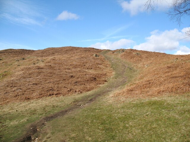
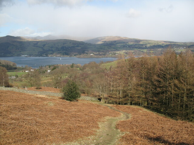
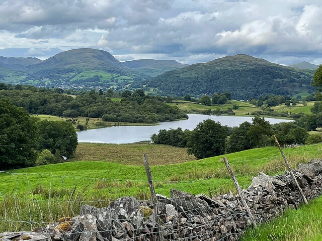
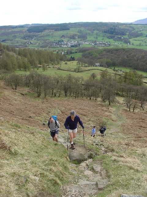
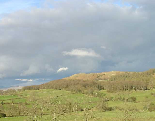
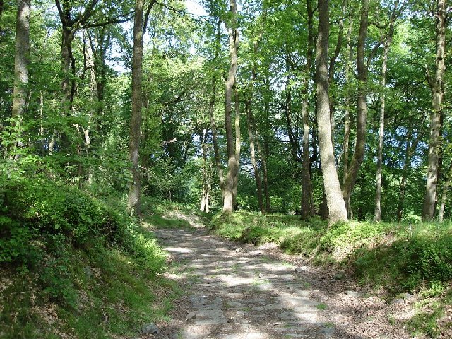
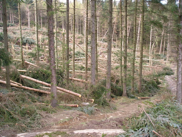
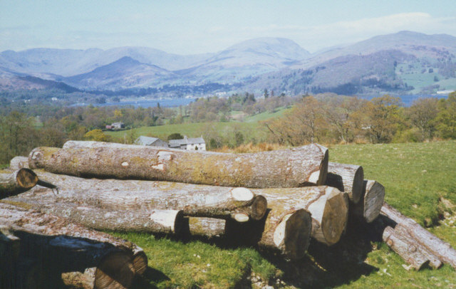
Surrounded by lush greenery and rolling hills, Arthur Wood provides ample opportunities for outdoor enthusiasts. The village is a popular destination for hiking, cycling, and nature walks, with numerous trails and paths to explore. It also offers stunning views of the Forest of Bowland, which is designated as an Area of Outstanding Natural Beauty.

Overall, Arthur Wood is a charming and idyllic village that offers a peaceful retreat for its residents and visitors. With its rich history, beautiful surroundings, and strong sense of community, it is a place that captures the essence of rural Lancashire.

If you have any feedback on the listing, please let us know in the comments section below.

Arthur Wood Images

Images are sourced within 2km of 54.388059/-2.9558274 or Grid Reference SD3899. Thanks to Geograph Open Source API. All images are credited.

Path on Latterbarrow This is the path from Claife Heights, leading up the south ridge towards the summit of Latterbarrow.
Path on Latterbarrow
This is the path from Claife Heights, leading up the south ridge towards the summit of Latterbarrow.
OS Cut Mark - High Wray, Beyond Fields Fm, Outbuilding <span class="nowrap"><a title="https://www.bench-marks.org.uk/bm56690" rel="nofollow ugc noopener" href="https://www.bench-marks.org.uk/bm56690">Link</a><img style="margin-left:2px;" alt="External link" title="External link - shift click to open in new window" src="https://s1.geograph.org.uk/img/external.png" width="10" height="10"/></span>
OS Cut Mark - High Wray, Beyond Fields Fm, Outbuilding
Path above Waterson Intake The path is the public footpath from Latterbarrow to High Wray.
Windermere is in the middle distance and there is a snow shower over the Kentmere Fells.
Path above Waterson Intake
The path is the public footpath from Latterbarrow to High Wray. Windermere is in the middle distance and there is a snow shower over the Kentmere Fells.
Wall and fields above Blelham Tarn
Dinner time! An evening meal for these sheep near Outgate.
Dinner time!
An evening meal for these sheep near Outgate.
Western Slopes of Latterbarrow, Near Hawkshead, Cumbria This grid square is dominated by the small hill of Latterbarrow. The photo shows a group of walkers ascending Latterbarrow from the west.
In the background, the small town of Hawkshead can be seen.
Western Slopes of Latterbarrow, Near Hawkshead, Cumbria
This grid square is dominated by the small hill of Latterbarrow. The photo shows a group of walkers ascending Latterbarrow from the west. In the background, the small town of Hawkshead can be seen.
Latterbarrow. View from Hawkshead Latterbarrow is a local viewpoint for the village of Hawkshead. Accessible by foot after a short walk, the views from the top are excellent in almost 360 degrees. On a good day the Howgills can be seen.
Latterbarrow. View from Hawkshead
Latterbarrow is a local viewpoint for the village of Hawkshead. Accessible by foot after a short walk, the views from the top are excellent in almost 360 degrees. On a good day the Howgills can be seen.
View over Windermere from Red Nab This photograph was taken from the car-park at the end of the unclassified road that leads down to the west shore of Windermere from High Wray.
View over Windermere from Red Nab
This photograph was taken from the car-park at the end of the unclassified road that leads down to the west shore of Windermere from High Wray.
Woodland to the west of Belle Grange
Summit of Latterbarrow
Storm damage
Storm damage
On Lake Windermere On board M.V. Swan en route for Ambleside. Almost opposite Millerground on the east bank
On Lake Windermere
On board M.V. Swan en route for Ambleside. Almost opposite Millerground on the east bank
On Lake Windermere Just passing Meregarth landings on the east bank. On M.V. Swan en route for Bowness.
On Lake Windermere
Just passing Meregarth landings on the east bank. On M.V. Swan en route for Bowness.
log pile near High Wray A pile of logs left just below the woodland above High Wray, view towards the north end of Windermere.
log pile near High Wray
A pile of logs left just below the woodland above High Wray, view towards the north end of Windermere.
Tarn in the Woods Lily Pond Tarn alongside the footpath leading from Colthouse to Claife Heights, between Hawkshead and Windermere in the Lake District (Cumbria).
Tarn in the Woods
Lily Pond Tarn alongside the footpath leading from Colthouse to Claife Heights, between Hawkshead and Windermere in the Lake District (Cumbria).
Forestry - Highs Moss One of the paths through the forest. The paths are often not obvious and it can be difficult to navigate in places.
Forestry - Highs Moss
One of the paths through the forest. The paths are often not obvious and it can be difficult to navigate in places.
New Forestry - Highs Moss Recently felled and replanted forest above Windermere.
New Forestry - Highs Moss
Recently felled and replanted forest above Windermere.
Windermere through a newly planted forest Looking towards Windermere. The white pole in the centre is part of the television and radio transmitter within the next square north.
Windermere through a newly planted forest
Looking towards Windermere. The white pole in the centre is part of the television and radio transmitter within the next square north.
Show me another place!

Arthur Wood is located at Grid Ref: SD3899 (Lat: 54.388059, Lng: -2.9558274)

Administrative County: Cumbria

District: South Lakeland

Police Authority: Cumbria

What 3 Words

///suffer.buggy.lottery. Near Windermere, Cumbria

Related Wikis

Latterbarrow

Latterbarrow is a hill in the English Lake District, east of Hawkshead, Cumbria. It is the subject of a chapter of Wainwright's book The Outlying Fells...

RMS Wray Castle

RMS Wray Castle was a training college for Merchant Navy radio officers based at Wray Castle in the Lake District, from 1958 to 1998.At 11:40 p.m., on...
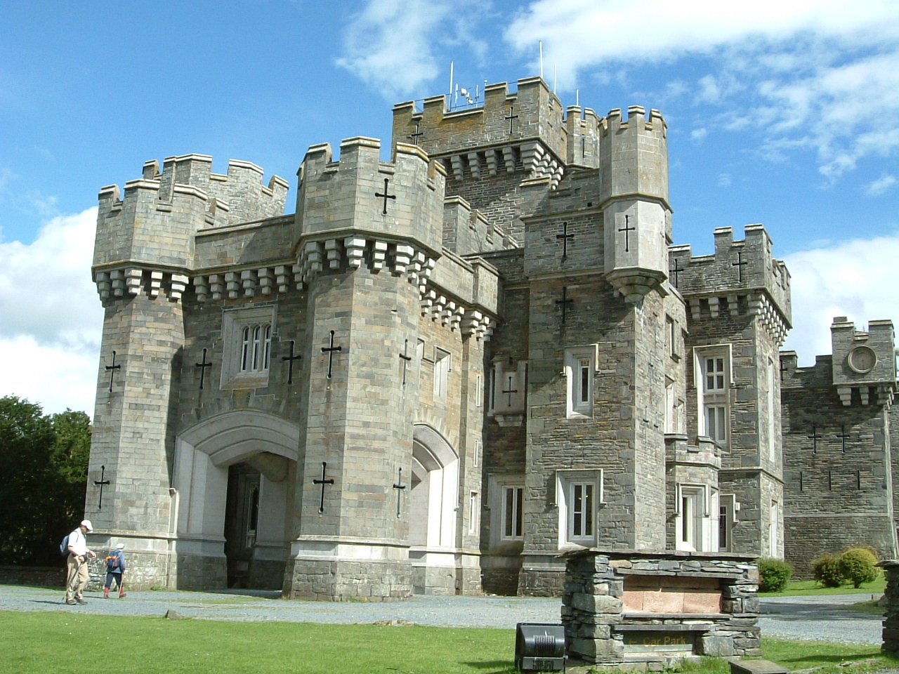
Wray Castle

Wray Castle is a Victorian neo-gothic building at Claife in Cumbria within the boundaries of the historic county of Lancashire. The house and grounds have...

Blelham Tarn

Blelham Tarn is a large valley tarn in the Lake District of England, to the north of the hill Latterbarrow. The settlements of Outgate, Low Wray and High...

Brockhole

The Brockhole Lake District Visitor Centre, also known as the Brockhole National Park Visitor Centre, is a visitor centre and tourist attraction managed...

Claife

Claife is a civil parish in the South Lakeland district of Cumbria, England. It is situated west of Windermere, and east of Esthwaite Water and the village...

Langdale Chase

Langdale Chase, Windermere is a house of historical significance and is listed on the English heritage register. It consists of six acres of landscaped...

The Lakes School

The Lakes School is a coeducational secondary school and sixth form located in Troutbeck Bridge, Windermere, in the English county of Cumbria.It is a comprehensive...

Nearby Amenities

Located within 500m of 54.388059,-2.9558274
Source: Landsat photo
Lat/Long: 54.3921883/-2.9561663
Source: Landsat photo
Lat/Long: 54.387553/-2.9483342
Source: Landsat photo
Lat/Long: 54.387578/-2.9488707
Source: Landsat photo
Lat/Long: 54.3879153/-2.9496002
Source: Landsat photo
Lat/Long: 54.3886025/-2.9503083
Source: Landsat photo
Lat/Long: 54.3890148/-2.9508019
Source: Landsat photo
Lat/Long: 54.3894271/-2.9510808
Source: Landsat photo
Lat/Long: 54.389802/-2.9512525
Source: Landsat photo
Lat/Long: 54.3901143/-2.9515314
Source: Landsat photo
Lat/Long: 54.3904891/-2.9525828
Source: Landsat photo
Lat/Long: 54.3908015/-2.9533553
Source: Landsat photo
Lat/Long: 54.3913387/-2.9546213
Source: Landsat photo
Lat/Long: 54.391776/-2.9550719
Source: Landsat photo
Lat/Long: 54.3919759/-2.9555655
Bench
Lat/Long: 54.3886862/-2.9507687
Balla Wray
Is In Country Code: GB
Is In County: Cumbria
Is In National Park: Lake District National Park
Place: locality
Lat/Long: 54.3908349/-2.9583651
Bench
Lat/Long: 54.3905512/-2.9532188
Beyondfields Fell
Place: locality
Lat/Long: 54.3856113/-2.9589536
Power: pole
Lat/Long: 54.3901281/-2.9619623
Power: pole
Lat/Long: 54.3900129/-2.9611084
Power: pole
Lat/Long: 54.3898748/-2.9601066
Power: pole
Lat/Long: 54.3897378/-2.959668
Power: pole
Lat/Long: 54.3895094/-2.9589728
Power: pole
Lat/Long: 54.3892686/-2.9582277
Power: pole
Lat/Long: 54.3889988/-2.9574059
Power: pole
Lat/Long: 54.3886697/-2.9563577
Power: pole
Lat/Long: 54.388404/-2.9555359
Power: pole
Lat/Long: 54.38783/-2.9541526
Power: pole
Lat/Long: 54.3867525/-2.9516106
Power: pole
Lat/Long: 54.3860425/-2.9506426
Power: pole
Lat/Long: 54.3855733/-2.9500044
The data included in this document is from www.openstreetmap.org. The data is made available under ODbL.

Have you been to Arthur Wood?

Leave your review of Arthur Wood below (or comments, questions and feedback).