Cockleford

Settlement in Gloucestershire Cotswold

England

Cockleford

Manx Loaghtan sheep Manx Loaghtan sheep in a field at Coberley.
Manx Loaghtan sheep Credit: Philip Halling

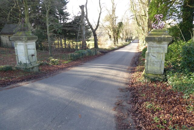
Cockleford is a small village located in the county of Gloucestershire, England. Situated within the picturesque Cotswolds, this rural settlement is surrounded by rolling hills and idyllic countryside, offering residents and visitors a peaceful and tranquil environment.

The village itself is home to a small population, with just over 100 residents. The community is tightly knit, and locals take great pride in maintaining the traditional charm and character of Cockleford. The architecture of the village reflects its rich history, with many buildings dating back to the 17th and 18th centuries.

Cockleford is renowned for its natural beauty and serves as a popular destination for outdoor enthusiasts. The nearby Cotswold Way, a long-distance walking trail, passes through the village, attracting hikers and nature lovers. The surrounding area also offers opportunities for cycling, horse riding, and fishing.

Although small in size, Cockleford is well-served by amenities. The village has a local pub, The Cockleford Inn, which offers a warm and welcoming atmosphere along with delicious food and drink. Additionally, the neighboring town of Cheltenham is just a short drive away, providing residents with access to a wider range of services, shops, and entertainment options.

In summary, Cockleford is a charming village nestled in the beautiful Cotswolds. With its peaceful atmosphere, stunning natural surroundings, and strong sense of community, it is an ideal place for those seeking a tranquil rural lifestyle.

If you have any feedback on the listing, please let us know in the comments section below.
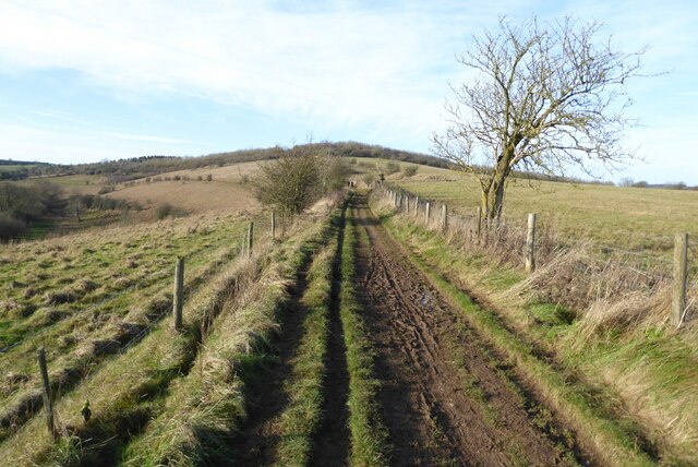
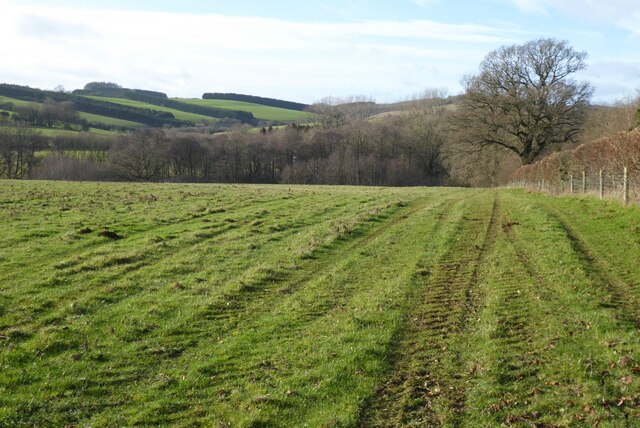
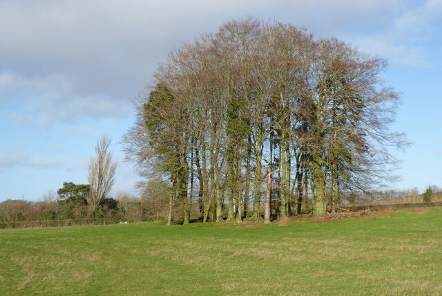
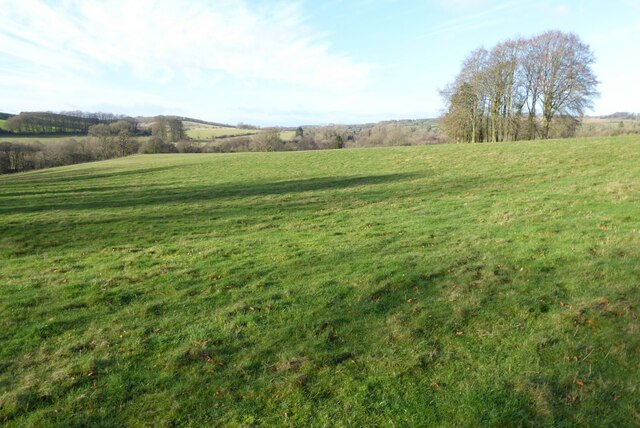
Cockleford Images

Images are sourced within 2km of 51.825377/-2.048141 or Grid Reference SO9614. Thanks to Geograph Open Source API. All images are credited.

Manx Loaghtan sheep Manx Loaghtan sheep in a field at Coberley.
Manx Loaghtan sheep
Manx Loaghtan sheep in a field at Coberley.
Manx Loaghtan sheep Manx Loaghtan sheep in a field at Coberley.
Manx Loaghtan sheep
Manx Loaghtan sheep in a field at Coberley.
Manx Loaghtan sheep Manx Loaghtan sheep in a field at Coberley.
Manx Loaghtan sheep
Manx Loaghtan sheep in a field at Coberley.
Coldwell Bottom View across Coldwell Bottom to the Churn valley beyond, from the Gloucestershire Way.
Coldwell Bottom
View across Coldwell Bottom to the Churn valley beyond, from the Gloucestershire Way.
The Gloucestershire Way The Gloucestershire Way to the west of Coberley and above Coldwell Bottom which is out of view on the left.
The Gloucestershire Way
The Gloucestershire Way to the west of Coberley and above Coldwell Bottom which is out of view on the left.
Coberley church Coberley church is dedicated to St Giles and dates back to the 12th century.  The church is Grade II* listed, see: <span class="nowrap"><a title="https://historicengland.org.uk/listing/the-list/list-entry/1091770?section=official-listing" rel="nofollow ugc noopener" href="https://historicengland.org.uk/listing/the-list/list-entry/1091770?section=official-listing">Link</a><img style="margin-left:2px;" alt="External link" title="External link - shift click to open in new window" src="https://s1.geograph.org.uk/img/external.png" width="10" height="10"/></span>  The wall in the foreground is part of Coberley Court which was demolished in 1790.  The wall is Grade II listed, see: <span class="nowrap"><a title="https://historicengland.org.uk/listing/the-list/list-entry/1091771?section=official-listing" rel="nofollow ugc noopener" href="https://historicengland.org.uk/listing/the-list/list-entry/1091771?section=official-listing">Link</a><img style="margin-left:2px;" alt="External link" title="External link - shift click to open in new window" src="https://s1.geograph.org.uk/img/external.png" width="10" height="10"/></span>
Coberley church
Coberley church is dedicated to St Giles and dates back to the 12th century. The church is Grade II* listed, see: LinkExternal link The wall in the foreground is part of Coberley Court which was demolished in 1790. The wall is Grade II listed, see: LinkExternal link
Base of a cross  The base and lower shaft of a cross in Coberley churchyard.  It possibly dates from Saxom times and is Grade II listed, see: <span class="nowrap"><a title="https://historicengland.org.uk/listing/the-list/list-entry/1340130?section=official-listing" rel="nofollow ugc noopener" href="https://historicengland.org.uk/listing/the-list/list-entry/1340130?section=official-listing">Link</a><img style="margin-left:2px;" alt="External link" title="External link - shift click to open in new window" src="https://s1.geograph.org.uk/img/external.png" width="10" height="10"/></span>
Base of a cross
The base and lower shaft of a cross in Coberley churchyard. It possibly dates from Saxom times and is Grade II listed, see: LinkExternal link
Tomb of Sir Thomas and Lady Berkeley Effigies of Lady Berkeley and her first husband Sir Thomas Berkeley who fought at the battle of Crecy in 1346, her second husband was Sir William Whittington, her son Sir Richard Whittington became Lord Mayor of London and inspiration for the Dick Whittington pantomime character.
Tomb of Sir Thomas and Lady Berkeley
Effigies of Lady Berkeley and her first husband Sir Thomas Berkeley who fought at the battle of Crecy in 1346, her second husband was Sir William Whittington, her son Sir Richard Whittington became Lord Mayor of London and inspiration for the Dick Whittington pantomime character.
Font in Coberley church
Gravestones in Coberley churchyard
Trees reflected in a pool Trees reflected in a pool viewed from the Gloucestershire Way in Coberley.
Trees reflected in a pool
Trees reflected in a pool viewed from the Gloucestershire Way in Coberley.
Farmland Coberley View to the west across farmland between Coberley and Cowley.
Farmland Coberley
View to the west across farmland between Coberley and Cowley.
Clump of trees Clump of trees beside a footpath between Cowley and Coberley.
Clump of trees
Clump of trees beside a footpath between Cowley and Coberley.
Field at Cowley in the Churn valley This field between Cowley and Coberley was the site of a Channel 4 'Time Team' dig.  The programme was entitled "Mysteries of the Mosaic" in which they unearthed mosaics and a Roman villa.  The site is a scheduled monument, see: <span class="nowrap"><a title="https://historicengland.org.uk/listing/the-list/list-entry/1405896" rel="nofollow ugc noopener" href="https://historicengland.org.uk/listing/the-list/list-entry/1405896">Link</a><img style="margin-left:2px;" alt="External link" title="External link - shift click to open in new window" src="https://s1.geograph.org.uk/img/external.png" width="10" height="10"/></span>
Field at Cowley in the Churn valley
This field between Cowley and Coberley was the site of a Channel 4 'Time Team' dig. The programme was entitled "Mysteries of the Mosaic" in which they unearthed mosaics and a Roman villa. The site is a scheduled monument, see: LinkExternal link
Gate pillars on the road to Cowley This pair of gate pillars flank this road at its junction with the A435.  The road leads to Cowley and originally this was a private drive to a manor.  There used to be a lodge to the left but it was demolished in the 1960s.
Gate pillars on the road to Cowley
This pair of gate pillars flank this road at its junction with the A435. The road leads to Cowley and originally this was a private drive to a manor. There used to be a lodge to the left but it was demolished in the 1960s.
Grave of Sir James Horlick, 1st Baronet Grave of Sir James Horlick, 1st Baronet in Cowley churchyard.  He lived in Cowley Manor which is next to the church and now a luxury hotel.  James and his brother William were born in Ruardean in the Forest of Dean and went off to the United States where they developed the Horlicks brand.
Grave of Sir James Horlick, 1st Baronet
Grave of Sir James Horlick, 1st Baronet in Cowley churchyard. He lived in Cowley Manor which is next to the church and now a luxury hotel. James and his brother William were born in Ruardean in the Forest of Dean and went off to the United States where they developed the Horlicks brand.
Cowley church Cowling church is dedicated to St Mary.  The church dates from the 13th century and is Grade II* listed, see: <span class="nowrap"><a title="https://historicengland.org.uk/listing/the-list/list-entry/1340154?section=official-listing" rel="nofollow ugc noopener" href="https://historicengland.org.uk/listing/the-list/list-entry/1340154?section=official-listing">Link</a><img style="margin-left:2px;" alt="External link" title="External link - shift click to open in new window" src="https://s1.geograph.org.uk/img/external.png" width="10" height="10"/></span>
Cowley church
Cowling church is dedicated to St Mary. The church dates from the 13th century and is Grade II* listed, see: LinkExternal link
Cowley church and Cowley Manor Hotel St Mary's church which is situated next to Cowley Manor  Hotel which can be seen in the background.
Cowley church and Cowley Manor Hotel
St Mary's church which is situated next to Cowley Manor Hotel which can be seen in the background.
Show me another place!

Cockleford is located at Grid Ref: SO9614 (Lat: 51.825377, Lng: -2.048141)

Administrative County: Gloucestershire

District: Cotswold

Police Authority: Gloucestershire

What 3 Words

///trifling.sends.skidding. Near Charlton Kings, Gloucestershire

Nearby Locations

Cowley Cockleford

Related Wikis

Cowley, Gloucestershire

Cowley is a village and civil parish in the Cotswold District of Gloucestershire, England. It lies between the A417 and A435 roads between Cheltenham...

Cockleford Marsh

Cockleford Marsh (grid reference SO977133) is a 3.2-hectare (7.9-acre) biological Site of Special Scientific Interest in Gloucestershire, notified in 1991...

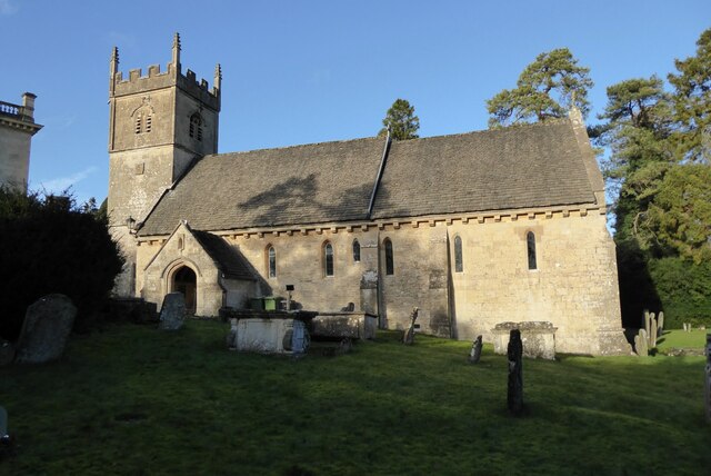
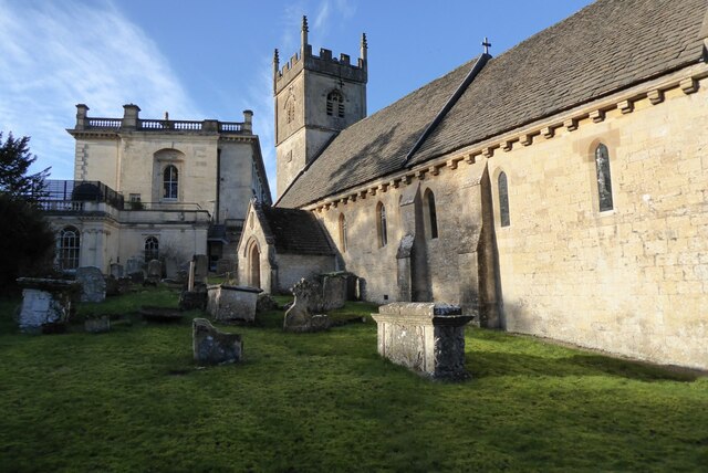
Church of St John the Evangelist, Elkstone

The Anglican Church of St John the Evangelist at Elkstone in the Cotswold District of Gloucestershire, England was built in the 12th century. It is a grade...

Elkstone

Elkstone is a village and civil parish in the English county of Gloucestershire. In the 2001 United Kingdom census, the parish had a population of 203...

Coberley

Coberley is a village and civil parish in the Cotswold District of Gloucestershire in England, 4 miles (6.4 km) south of Cheltenham. It lies at the confluence...

Bushley Muzzard, Brimpsfield

Bushley Muzzard, Brimpsfield (grid reference SO944133) is a 1.13-hectare (2.8-acre) biological Site of Special Scientific Interest in Gloucestershire,...

Church of St Michael, Brimpsfield

The Anglican Church of St Michael at Brimpsfield in the Cotswold District of Gloucestershire, England was built in 12th century. It is a grade I listed...

Brimpsfield Priory

Brimpsfield Priory was a Benedictine monastic foundation in Brimpsfield, Gloucestershire, England, a cell or grange of the Abbey of Saint-Wandrille in...

Nearby Amenities

Located within 500m of 51.825377,-2.048141
Cockleford
Is In: Gloucestershire, England, UK
Place: hamlet
Wikidata: Q118496105
Lat/Long: 51.8258442/-2.0477158
Bus Stop
Cockleford Turn
Bus: yes
Naptan AtcoCode: 1600GLC149
Naptan Bearing: S
Naptan CommonName: Cockleford Turn
Naptan Indicator: Opp
Naptan NaptanCode: glodwdtm
Naptan Street: A435
Naptan Verified: no
Public Transport: platform
Source: naptan_import
Lat/Long: 51.8295487/-2.0465963
Bus Stop
Cockleford Turn
Bus: yes
Naptan AtcoCode: 1600GLC150
Naptan Bearing: N
Naptan CommonName: Cockleford Turn
Naptan NaptanCode: glodwdtg
Naptan Street: A435
Naptan Verified: no
Public Transport: platform
Source: naptan_import
Lat/Long: 51.8294947/-2.0467414
Bus Stop
The Green Dragon
Bus: yes
Naptan AtcoCode: 1600GLS943
Naptan Bearing: SE
Naptan CommonName: The Green Dragon
Naptan NaptanCode: glodwdpd
Naptan Street: Cowley Ln
Naptan Verified: no
Public Transport: platform
Source: naptan_import
Lat/Long: 51.8263565/-2.0473766
Bus Stop
The Green Dragon
Bus: yes
Naptan AtcoCode: 1600GLS944
Naptan Bearing: NW
Naptan CommonName: The Green Dragon
Naptan NaptanCode: glodwdpa
Naptan Street: Cowley Ln
Naptan Verified: no
Public Transport: platform
Source: naptan_import
Lat/Long: 51.8263205/-2.0474055
Power: pole
Lat/Long: 51.8212213/-2.0480409
Power: pole
Lat/Long: 51.8230802/-2.0476386
Power: pole
Lat/Long: 51.823878/-2.0474877
Power: pole
Lat/Long: 51.8221924/-2.0478217
Power: pole
Lat/Long: 51.8246012/-2.0473154
Power: pole
Lat/Long: 51.8238071/-2.0430165
Location Transition: yes
Power: pole
Lat/Long: 51.8236273/-2.0419979
Location Transition: yes
Power: pole
Lat/Long: 51.8239862/-2.0439546
Location Transition: yes
Power: pole
Lat/Long: 51.8244877/-2.0450462
Location Transition: yes
Power: pole
Lat/Long: 51.8252382/-2.0466623
Location Transition: yes
Power: pole
Lat/Long: 51.8248615/-2.0458529
Location Transition: yes
Power: pole
Lat/Long: 51.8254997/-2.0472329
Cockleford Green Dragon
Location Transition: yes
Power: pole
Transformer: distribution
Voltage Primary: 11000
Lat/Long: 51.8259303/-2.0473429
Location Transition: yes
Power: pole
Lat/Long: 51.8263108/-2.0480141
Location Transition: yes
Power: pole
Lat/Long: 51.826678/-2.0486471
Location Transition: yes
Power: pole
Lat/Long: 51.8277261/-2.0508385
Cowley Guide Pavilion
Location Transition: yes
Power: pole
Transformer: distribution
Voltage Primary: 11000
Lat/Long: 51.8270224/-2.04937
Location Transition: yes
Power: pole
Lat/Long: 51.8273796/-2.0501042
Location Transition: yes
Power: pole
Lat/Long: 51.8283452/-2.0523975
Location Transition: yes
Power: pole
Lat/Long: 51.8280808/-2.0515593
The data included in this document is from www.openstreetmap.org. The data is made available under ODbL.

Have you been to Cockleford?

Leave your review of Cockleford below (or comments, questions and feedback).